Delta Plain - Poorly Drained Backswamp
Scenario model
Current ecosystem state
Select a state
Management practices/drivers
Select a transition or restoration pathway
-
Transition T1A
Wind or water Force causing canopy gaps.
More details -
Transition T*-3
Catastrophic event river change in channel location to new run.
More details -
Transition T1B
Clear and established the desired Community
More details -
Transition T1B
Clear and established the desired Community
More details -
Transition T2A
Regeneration of Hardwood species.
More details -
Transition T*-3
Catastrophic event river change in channel location to new run.
More details -
Transition T*-5
Establish desired forage species and manage for grazing.
More details -
Transition T*-6
Plant or natural regeneration of woody species.
More details -
Transition T*-4
Establish and manage crop rotation.
More details -
Transition T*-6
Plant or natural regeneration of woody species.
More details -
Transition T6A
Heavy Brush Management.
More details -
Transition T6B
Manage succession for historic community.
More details -
No transition or restoration pathway between the selected states has been described
Target ecosystem state
Select a state
Description
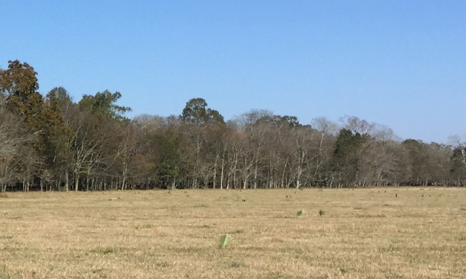
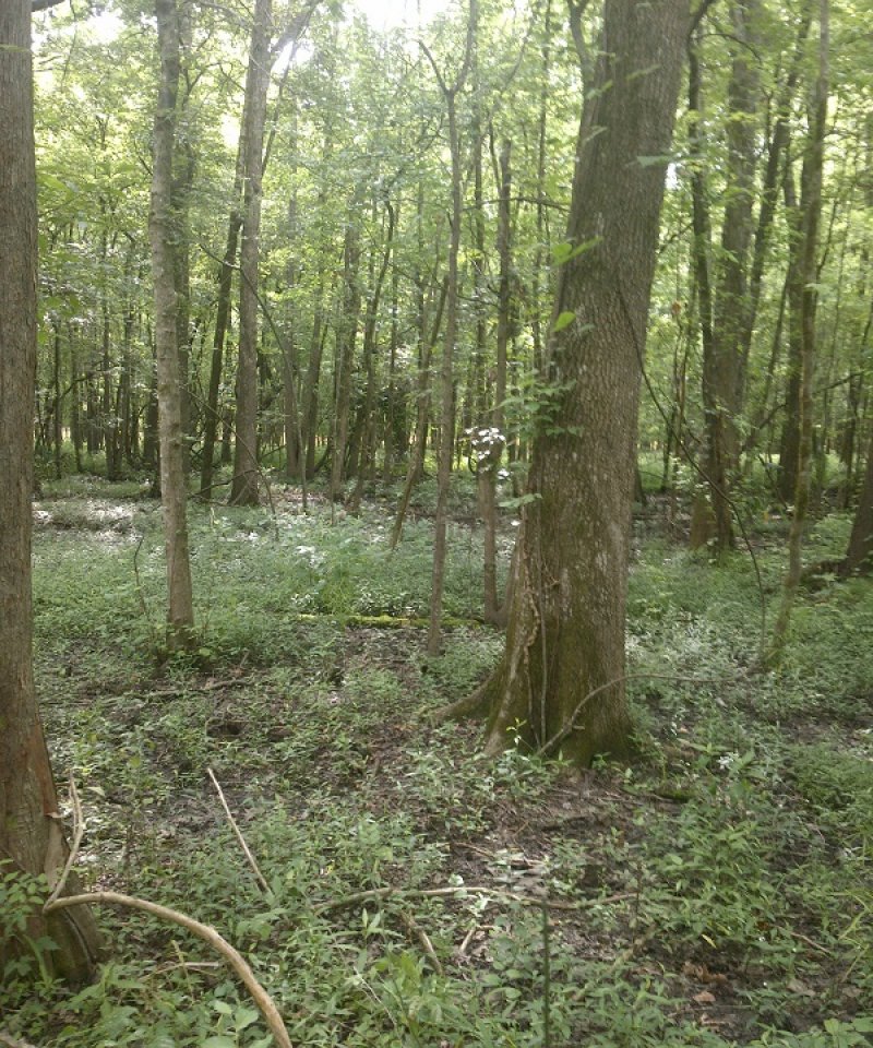
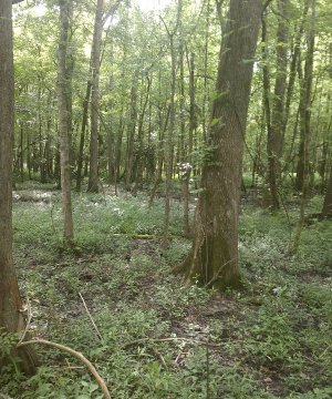
Willow, Water Oaks, Honey Locust, Green Ash, Sweetgum, Baldcypress, Red Maple, Box Elder, Overcup oak, Nuttall Oak, Bitter Pecan, Palmetto, Poison ivy
Submodel
Description
Forest Canopy opening created by potentially several ways that allows the understory community to receive adequate sunlight. This State will have a continuum from sparse herbaceous due to recent opening occurring to regeneration of Woody species with dense herbaceous species to the stage where the woody regeneration overtops the herbaceous and begins to shade them out. This continuum of colonization can be delineated as multiple phases depending on needs, and succession can be set back along the continuum.
Submodel
Description
Catastrophic river change in channel (AVULSION)
When the river changes courses from potentially multiple factors this site will be affected in many ways. This site may become the location of the new channel when the river re-occupies and older course or that of another river. Conversely when the river changes course and abandons previous backswamps the site may loose sediment and water inputs and become drier other than in extreme events. This State has potentially multiple phases as great as all of the other states of the Ecological Sites in the sub region.
Submodel
Description
This site is generally considered not suited for crop production due to flooding and wetness. When the site hydrology has been altered mechanically by the construction of levees, water control structures, and potentially pumps, crop species may be established and the site utilized for production. Maintenance of the hydrologic control must be continued to maintain production and if control is abandoned or lost, site conditions may return to excessively wet conditions which will prevent utilization of the land for crop production. Conditions even with control may only allow production on an irregular basis.
This state represents a crop production field. Annual plantings for forage production would also be included in this phase, which may include cool season annual grasses and legumes and warm season forage species. Vegetable crops are grown on this site and are generally on a small scale. Sugarcane, Corn, and Soybeans are dominant crops and can be planted in fields with adequate management. Wheat may be included in the rotation or as a standalone crop. Other row crop species have been produced on these sites. Often two or more crops will be grown in a multiyear rotation, this breaks pest cycles and some crops produce higher amounts of residue, which is left on the soil to improve soil health. Maintenance of monoculture crop stands also requires the control of unwanted species, which will require Pest Management and Nutrient Management to maintain the needed fertility for production of the desired species. Refer to E-Field Office Technical Guide and the local NRCS Field Office for management assistance.
Submodel
Description
This site is generally considered not suited for grazing due to flooding and wetness. When the site hydrology has been altered mechanically by the construction of ditches, levees, water control structures, and potentially pumps, forage species may be established and the site utilized for grazing. Maintenance of the hydrologic control must be continued to maintain production and if control is abandoned or lost, site conditions may return to excessively wet conditions which will prevent utilization of the land for forage production. Conditions even with control may only allow forage production on an irregular basis. Additionally, adjacent higher elevation areas or protected areas may be needed for the storage of harvested forage or holding of livestock when wet or flooded conditions occur. Some forage operations on this site may experience none to multiple extreme wetness events in a single year that will require preplanning and resources to meet the needs of the livestock.
This state is characterized by a monoculture or a mixture of forage species planted or allowed to establish from naturalized species managed for forage production or as herbaceous ground cover.
This Site fits Pasture & Hayland Groups: 1A and 1B
Deep, poorly drained, bottomland soils with mostly clayey or loamy surface layers, having high or medium natural fertility and are subject to damaging overflows. Flooding is occasional to frequent with very brief to very long duration. It has a range of limitations that could include wetness, trafficability, high water tables, and soils saturation during the growing season.
Most soils need nitrogen fertilization for higher levels of production when grasses are grown alone. It is not practical to apply high rates of fertilizer due to the wetness limitation potential of the site which normally occurs from December through June. To prevent extreme acidity in the subsoil when high rates of acidifying nitrogen is used, the surface soil should not be allowed to become more acid than 5.0 pH and lime should be applied at more frequent intervals.
Adapted Grasses and Legumes
Hybrid bermudagrass, common bermudagrass, dallisgrass, bahiagrass, and johnsongrass are the better adapted warm-season perennials. White clover, vetch, winter peas, and red clover are adapted cool-season legumes. Periodic brush control is needed to prevent the area from reverting to woodland.
Submodel
Mechanism
Catastrophic event river change in channel location to new run.
Mechanism
Clear and established the desired Community
Relevant conservation practices
| Practice | External resources |
|---|---|
|
Clearing and Snagging |
|
|
Land Clearing |
|
|
Land Smoothing |
Transition T1B

Mechanism
Clear and established the desired Community
Relevant conservation practices
| Practice | External resources |
|---|---|
|
Clearing and Snagging |
|
|
Land Clearing |
|
|
Land Smoothing |
Mechanism
Catastrophic event river change in channel location to new run.
Mechanism
Establish desired forage species and manage for grazing.
Relevant conservation practices
| Practice | External resources |
|---|---|
|
Bedding |
|
|
Fence |
|
|
Forage Harvest Management |
|
|
Forage and Biomass Planting |
|
|
Livestock Pipeline |
|
|
Prescribed Grazing |
|
|
Grazing Land Mechanical Treatment |
|
|
Heavy Use Area Protection |
|
|
Nutrient Management |
|
|
Watering Facility |
|
|
Water Well |
Mechanism
Plant or natural regeneration of woody species.
Relevant conservation practices
| Practice | External resources |
|---|---|
|
Tree/Shrub Site Preparation |
|
|
Tree/Shrub Establishment |
|
|
Forest Stand Improvement |
Mechanism
Establish and manage crop rotation.
Relevant conservation practices
| Practice | External resources |
|---|---|
|
Conservation Crop Rotation |
|
|
Grade Stabilization Structure |
|
|
Nutrient Management |
|
|
Integrated Pest Management (IPM) |
Mechanism
Plant or natural regeneration of woody species.
Relevant conservation practices
| Practice | External resources |
|---|---|
|
Tree/Shrub Site Preparation |
|
|
Tree/Shrub Establishment |
|
|
Forest Stand Improvement |
Mechanism
Heavy Brush Management.
Relevant conservation practices
| Practice | External resources |
|---|---|
|
Bedding |
|
|
Fence |
|
|
Forage Harvest Management |
|
|
Forage and Biomass Planting |
|
|
Livestock Pipeline |
|
|
Prescribed Grazing |
|
|
Grazing Land Mechanical Treatment |
|
|
Heavy Use Area Protection |
|
|
Nutrient Management |
|
|
Watering Facility |
|
|
Water Well |
Model keys
Briefcase
Add ecological sites and Major Land Resource Areas to your briefcase by clicking on the briefcase (![]() ) icon wherever it occurs. Drag and drop items to reorder. Cookies are used to store briefcase items between browsing sessions. Because of this, the number of items that can be added to your briefcase is limited, and briefcase items added on one device and browser cannot be accessed from another device or browser. Users who do not wish to place cookies on their devices should not use the briefcase tool. Briefcase cookies serve no other purpose than described here and are deleted whenever browsing history is cleared.
) icon wherever it occurs. Drag and drop items to reorder. Cookies are used to store briefcase items between browsing sessions. Because of this, the number of items that can be added to your briefcase is limited, and briefcase items added on one device and browser cannot be accessed from another device or browser. Users who do not wish to place cookies on their devices should not use the briefcase tool. Briefcase cookies serve no other purpose than described here and are deleted whenever browsing history is cleared.
Ecological sites
Major Land Resource Areas
The Ecosystem Dynamics Interpretive Tool is an information system framework developed by the USDA-ARS Jornada Experimental Range, USDA Natural Resources Conservation Service, and New Mexico State University.