Ecological dynamics
The information in this ecological site description (ESD), including the state-and-transition model (STM), was developed using archeological and historical data, professional experience, and scientific studies. The information is representative of a complex set of plant communities. Not all scenarios or plants are included. Key indicator plants, animals, and ecological processes are described to inform land management decisions.
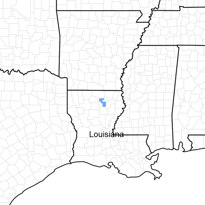
Introduction - The Southern Mississippi River Terrace (MLRA 131D) region is on smooth terraces and floodplains along the Mississippi River and its major tributaries south of its confluence with the Ohio River. The geologic material in the region consists of very thick deposits of sandy to clayey alluvium of Pleistocene to Holocene age. This material was deposited by the rivers with local relief is typically less than 15 feet and elevation ranging from 50 to 250 feet.
Geology - Bedrock in this area consists of Tertiary and Cretaceous sands formed as beach deposits during the retreat of the Cretaceous ocean from the midsection of the United States. Alluvial deposits from flooding and lateral migration of the rivers crossing this area typically lie above the bedrock. These sediments form Pleistocene-age alluvial terraces. Silty alluvium underlies most of the area. Clayey sediments are in old channel scars. The Pleistocene terraces are part of the Prairie Terrace complex. A minor portion of the area is in the Deweyville and Montgomery terrace formation. These terraces have a base of red alluvium capped by one to several feet of brownish alluvium.
Biological Resources - This area as a whole, supports hardwoods and pines. The Grand Prairie originally supported tall prairie grasses interlaced with hardwood timber. Cherrybark oak (Quercus pagoda) and Shumard oak (Quercus shumardii) are widely distributed. Tuliptree (Liriodendron tulipifera), white ash (Fraxinus americana), eastern cottonwood (Populus deltoides), and black walnut (Juglans nigra) are important species on the flood plains. Loblolly pine (Pinus taeda) and shortleaf pine (Pinus echinata) are on a wide variety of sites, mainly the eroded soils on uplands and ridges. Other hardwood species that commonly grow in this area are white oak (Quercus alba), basswood (Tillia sp.), sweetgum (Liquidambar styraciflua), water oak (Quercus nigra), American elm (Ulmus americana), blackgum (Nyssa sylvatica), sycamore (Plantanus occidentalis), sassafras (Sassafras albidum), southern red oak (Quercus falcata), chinkapin oak (Quercus muehlenbergii), American beech (Fagus grandifolia), and hickory (Carya sp.).
Land Use - Land use varies throughout the MLRA consisting of 42 percent cropland, 4 percent grassland, 47 percent forest, 3 percent urban development, 3 percent water, and 1 percent other. Scattered tracts of forests and farms make up nearly all of this area. Rice, soybeans, and wheat are the main crops. In most areas furrow or flood irrigation is used throughout the growing season. Hardwood timber is harvested on some forested wetlands, and most forested areas are managed for wildlife. Bait fish are produced commercially in ponds that are contained by levees. The area is in a major migratory flight path and hunting waterfowl is a popular recreation activity.
Conservation - The major soil resource concerns are management of soil moisture, erosion control, and maintenance of the content of organic matter and productivity of the soils. Depletion of ground water through excessive pumping is a major concern in the Grand Prairie area. Conservation practices on cropland generally include nutrient management, crop residue management, and alternative tillage systems, especially no-till systems that reduce the need for tillage. In many areas land leveling or shaping optimizes the control of surface water. Other major cropland management practices are control of competing vegetation and insects through aerial or ground spraying of herbicides and insecticides and fertility management programs that make use of chemical fertilizers.
State 1
Prairie
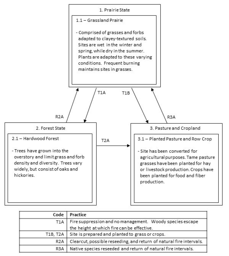
This ecological site is a grassland prairie. Herbaceous vegetation found throughout the site are adapted to the clayey-textured soils. Frequent fire is necessary to keep the sites open and free of woody species.
Community 1.1
Grassland Prairie
The vegetation adapted to the sites include species that can tolerate periodic wetness during the cooler months and very dry conditions during the warmer months. Little bluestem (Schizachyrium scoparium), Indiangrass (Sorghastrum nutans), eastern gamagrass (Tripsacum dactyloides), longleaf woodoats (Chasmanthium sessiliflorum), Cherokee sedge (Carex cherokeensis), and littlehead nutrush (Scleria oligantha) are common to the site. Forbs vary throughout the site.
State 2
Forest
Prolonged absence of fire in the Prairie State will transition into the Forest State. Without natural frequent fire intervals, woody species become established. Within a few years they can grow to a height where fire is ineffective at controlling their growth. They eventually grow to densities where light is restricted to the grasses and forbs, and only shade tolerant species can thrive.
Community 2.1
Hardwood Forest
Overstory trees are wide and ranging throughout the sites. Common trees include: mockernut hickory (Carya tomentosa), blackgum (Nyssa sylvatica), white oak, cherrybark oak, water oak, swamp chestnut oak (Quercus michauxii), and sweetgum. Midstory trees include: flowering dogwood (Cornus florida), hophornbeam (Ostrya virginiana), and winged elm (Ulmus alata). Grass and forb species will reduce in density and diversity as the trees shade the ground. Longleaf woodoats may be one of the few species found in the understory.
State 3
Pasture and Cropland
The Pasture and Cropland State is a result of conversion activities. The landowner has maximized agriculture production by planting a monoculture of introduced grass species or agricultural row crops.
Community 3.1
Planted Pasture and Row Crop
Typical perennial warm-season grasses include Bermudagrass, bahiagrass, dallisgrass, and Johnsongrass. Spring and fall forages may include legumes such as clover. The grasses are grown for livestock production through direct grazing or baling hay for later use. Agricultural row crops are grown for food and fiber production. Typical crops include cotton, soybeans, milo, corn, rice, and sugarcane. Many farmers use herbicides to reduce unwanted plant competition which yields a plant community unrepresentative of State 1 or subsequent vegetative states.
Transition T1A
State 1 to 2
The transition from State 1 to State 2 is a result of time and long periods of no fire. Without fire to suppress seedlings, biomass and diversity is lost from the grass and forb layers.
Transition T1B
State 1 to 3
The transition is due to the land manager maximizing agricultural production. If present, merchantable timber is harvested by clearcut, then the site is prepared and planted to either a tame grass or row crop.
Restoration pathway R2A
State 2 to 1
Restoration of this community to the reference state begins with a timber harvest. Removing trees opens up the canopy, allowing sunlight penetration to the ground. If the land has been forested for many decades, native seeds may be required if a seedbank does not exist. After a successful stand of grass has returned, natural burn intervals are required to keep woody species controlled.
Transition T2A
State 2 to 3
The transition is due to the land manager maximizing agricultural production. Merchantable timber is harvested by clearcut, then the site is prepared and planted to either a tame grass or row crop.
Restoration pathway R3A
State 3 to 1
Restoration of this community to the reference state begins by reseeding native seeds. After a successful stand of grass has returned, natural burn intervals are required to keep woody species controlled.


