Natural Resources
Conservation Service
Ecological site F133BY010TX
Very Deep Sandy Upland
Last updated: 6/16/2025
Accessed: 03/22/2026
General information
Provisional. A provisional ecological site description has undergone quality control and quality assurance review. It contains a working state and transition model and enough information to identify the ecological site.
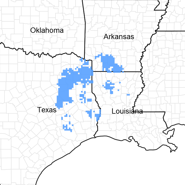
Figure 1. Mapped extent
Areas shown in blue indicate the maximum mapped extent of this ecological site. Other ecological sites likely occur within the highlighted areas. It is also possible for this ecological site to occur outside of highlighted areas if detailed soil survey has not been completed or recently updated.
MLRA notes
Major Land Resource Area (MLRA): 133B–Western Coastal Plain
Major Land Resource Area (MLRA) 133B, Western Coastal Plain is in eastern Texas, western Louisiana, and the southwest corner of Arkansas. The area is dominated by coniferous forest covering 45,450 square miles (29,088,000 acres). The region is a diverse transition zone between the eastern deciduous forests and the central grasslands to the west.
Classification relationships
NatureServe, 2002
- CEGL008566 – West Gulf Coastal Plain Xeric Post Oak Woodland
Soil Survey Staff, 2011
- Woodland Suitability Group 4s3
USDA-Natural Resources Conservation Service, 2006.
-Major Land Resource Area (MLRA) 133B
Van Kley et. Al., 2007
- 231Eg.11.1.10 – Shortleaf Pine-(Longleaf Pine)-Bluejack Oak/Tragia Grossarenic Dry Uplands
Ecological site concept
The Very Deep Sandy Uplands ecological site has deep sandy soils greater than 80 inches with little horizon development. The upland landscape, coupled with properties associated with the depth of the sand, forms its unique plant community. This site is characterized as a woodland site and differs from adjacent sites having several oak species being interspersed. Soils associated with this site are slightly acidic to moderately acidic (3.8-6.0).
Associated sites
| F133BY008TX |
Northern Deep Sandy Upland This ecological site has subtle clay percent increases in the subsurface, and are gently sloping to steep sloping ridges on uplands. Soil depth is 80 inches. Precipitation total (average) 55 to 57 inches. |
|---|---|
| F133BY009TX |
Southern Deep Sandy Upland This ecological site has subtle clay increases in the subsurface and are gently sloping to moderate steep sloping ridges on uplands. Soil depth is 80 inches. Precipitation total (average) 55 to 57 inches. |
| F133BY011TX |
Deep Sandy Terrace This ecological site is on a lower landscape position on nearly level or gently sloping stream terraces. Soil depth is 80 inches. Precipitation total (average) 55 to 57 inches. |
Similar sites
| F133BY009TX |
Southern Deep Sandy Upland Gently sloping to moderately steep sloping ridges on uplands. Drainage class is well drained to somewhat excessively drained. Permeability class is moderately rapid to rapid. Soil depth is 80 inches. Family particle size is loamy, Slope is 1 to 20 percent. |
|---|---|
| F133BY011TX |
Deep Sandy Terrace Gently sloping stream terraces. Drainage class is somewhat excessively drained. Permeability class is moderate to moderately rapid. Soil depth is 80 inches. Family particle size is sandy. Slope is 5 percent. |
| F133BY008TX |
Northern Deep Sandy Upland Gently sloping to steep sloping ridges on uplands. Drainage class is well drained to somewhat excessively drained. Permeability class is moderately rapid to rapid. Soil depth is 80 inches. Family particle size is loamy. Slope 1 to 25 percent. |
Table 1. Dominant plant species
| Tree |
(1) Quercus stellata |
|---|---|
| Shrub |
Not specified |
| Herbaceous |
(1) Aristida purpurascens |
Physiographic features
This ecological site occurs on gently to strongly sloping broad ridges of interfluves of broad ridges on inland dissected coastal plains. Slopes range from 0 to 25 percent, but are typically between 1 and 8 percent. Elevation ranges from 165 to 685 feet. The topography of the area includes summits and side slopes.
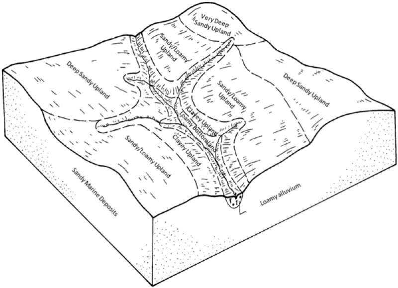
Figure 2. Very Deep Sandy Upland Block Diagram
Table 2. Representative physiographic features
| Landforms |
(1)
Coastal plain
> Interfluve
|
|---|---|
| Runoff class | Negligible to low |
| Elevation | 165 – 685 ft |
| Slope | 1 – 8% |
| Aspect | Aspect is not a significant factor |
Table 3. Representative physiographic features (actual ranges)
| Runoff class | Not specified |
|---|---|
| Elevation | Not specified |
| Slope | 25% |
Climatic features
The climate of the Western Coastal Plain (MLRA 133B) is humid subtropical with hot summers and mild winters. Canadian air masses that move southward across Texas and Louisiana, over the Gulf of Mexico, in winter produce cool, cloudy, and rainy weather with only rare cold waves that usually last one or two days. Precipitation is distributed evenly throughout the year and is most often in the form of slow, gentle rains.
Spring weather can be variable. March is relatively dry while thunderstorm activities increase in April and May. Occasional slow-moving thunderstorms or other weather disturbances may produce excessive amounts of precipitation. Fall has moderate temperatures; experiences an increase of precipitation; and frequently has periods of mild, dry, and sunny weather. Heavy rain may occur early in the fall because of tropical disturbances, which move westward from the gulf. Tropical storms are a threat to the area in the summer and fall but severe storms are rare. Prolonged droughts and snowfall are rare.
The total annual precipitation ranges from 39 inches in the western part of the region to 60 inches in the eastern part of the region. Approximately 50 percent of the rainfall occurs between April and September, during the growing season for most crops. Thunderstorms occur on about 50 days each year and most occur during the summer.
The average relative humidity in mid-afternoon is 60 percent. Humidity is higher through the night, with an average of 90 percent at dawn. The sun shines 70 percent of the time in summer and 50 percent in winter. The prevailing wind is from the south-southeast. Average wind-speed is highest at 11 miles per hour in spring.
Table 4. Representative climatic features
| Frost-free period (average) | 218 days |
|---|---|
| Freeze-free period (average) | 250 days |
| Precipitation total (average) | 52 in |
Figure 3. Monthly precipitation range
Figure 4. Monthly average minimum and maximum temperature
Figure 5. Annual precipitation pattern
Figure 6. Annual average temperature pattern
Climate stations used
-
(1) ATLANTA [USC00410408], Atlanta, TX
-
(2) MARSHALL [USC00415618], Marshall, TX
-
(3) MINEOLA 8 ENE [USC00415956], Mineola, TX
-
(4) NACOGDOCHES [USC00416177], Nacogdoches, TX
-
(5) TYLER [USC00419207], Tyler, TX
-
(6) MAGNOLIA [USC00034548], Magnolia, AR
-
(7) ATHENS [USC00410404], Athens, TX
-
(8) JEFFERSON [USC00414577], Jefferson, TX
-
(9) EL DORADO S AR RGNL AP [USW00093992], El Dorado, AR
Influencing water features
This plant community is influenced by the droughty nature of the very deep sandy soils. The deep sands drain water rapidly, leading to a lack of water, decrease in organic matter, and reduced availability of nutrients typically found in the topsoil. Consequently, the tolerance by plants is affected.
Wetland description
Wetlands are not associated with this site.
Soil features
The soils of the ecological site are deep and characterized by sands throughout the entire upper 80 inches of the profile. The entisols are not well developed in the subsurface layers (B horizons). They are characterized mainly by a change in color, not the typical clay accumulations of most other upland soils throughout the MLRA. The Tonkawa series is a representative soil and consists of very deep, excessively drained, permeable soils that formed in sandy residuum from Southern Coastal Plain marine deposits of the Carizzo Sand, Queen City Sand, and Sparta Sand Formations. The Tonkawa series is classified as a Thermic, coated Typic Quartzipsamment. Besides the Tonkawa series, Darden and Duffern are included in the Very Deep Sandy Upland ecological site.
Table 5. Representative soil features
| Parent material |
(1)
Marine deposits
–
sandstone and shale
|
|---|---|
| Surface texture |
(1) Fine sand |
| Family particle size |
(1) Sandy |
| Drainage class | Excessively drained |
| Permeability class | Rapid to very rapid |
| Soil depth | 80 in |
| Surface fragment cover <=3" | Not specified |
| Surface fragment cover >3" | Not specified |
| Available water capacity (0-40in) |
1.6 – 2.8 in |
| Calcium carbonate equivalent (0-40in) |
Not specified |
| Electrical conductivity (0-40in) |
2 mmhos/cm |
| Sodium adsorption ratio (0-40in) |
Not specified |
| Soil reaction (1:1 water) (0-40in) |
3.5 – 6 |
| Subsurface fragment volume <=3" (Depth not specified) |
2% |
| Subsurface fragment volume >3" (Depth not specified) |
Not specified |
Ecological dynamics
The information in this ecological site description (ESD), including the state-and-transition model (STM), was developed using archeological and historical data, professional experience, and scientific studies. The information is representative of a complex set of plant communities. Not all scenarios or plants are included. Key indicator plants, animals, and ecological processes are described to inform land management decisions.
Southern Arkansas, western Louisiana, and eastern Texas have been deemed the Pineywoods because of the vast expanse of pine trees. The region represents the western edge of the southern coniferous belt. Historically, the area was covered by pines with mixed hardwoods, sparse shrubs, and a diverse understory of grasses and forbs. Fire played a significant role in reducing the woody cover that generally out-competes the herbaceous understory. Fire suppression and land conversion have reduced the amount of historical communities in existence today.
Prior to settlement by the Europeans, the reference state for the Very Deep Sandy Uplands ecological site was a Post Oak/Shortleaf Pine (Quercus stellata/Pinus echinata) Woodland. Remnants of this historic plant community still exist where natural conditions are replicated through conservation management techniques. Evidence of the reference state is found in accounts of early historic explorers to the area, historic forest and biological survey teams, as well as recent (last 30 years) ecological studies. The age of this woodland community varies and has a diverse understory of grasses and forbs.
As human settlement increased throughout the area, so did the increase in logging and grazing by domestic livestock. Logging became so extensive that by the 1930’s most of the region had been cut-over. Replanting trees to historic communities was not common and early foresters began planting loblolly pine (Pinus taeda) for its quick growth. As more people colonized they began suppressing fire, which allowed dense thickets of shrubs to replace the herbaceous understory.
Today much of the remnant forest is gone, replaced by pine plantations and pastures. The areas that were not converted are dominated by loblolly pine and fire intolerant hardwoods due to extensive fire suppression. Currently, U.S. Forest Service land is the best place to view remnant reference communities. Some private individuals have begun restoring communities through selective tree planting and retention of communities that remain. Other restoration efforts include mimicking natural-disturbance regimes through gap-phase regeneration on plantation sites.
Fire was a natural and important disturbance throughout the Western Gulf Plain. Fire occurred naturally from lightning strikes and by Native Americans for game movement. The reference community developed with a fire frequency of 4 to 8 years. Fires usually occurred in early spring, removing senescent vegetation, recycling nutrients and minerals, and spurring new plant growth. Late summer fires occurred as well, but with a different community effect. Summer fires burned hotter and with more intensity, suppressing the shrub canopy layer. The summer fires decrease grass densities and increase forb densities. The topography, fuel loads, and other conditions caused patchy burns throughout the region resulting in mosaic patterns of plant communities and a heterogeneous landscape.
Extreme weather events occur occasionally throughout the region. Tornados uproot trees and open canopies in the spring months. In the late summer and early fall, hurricanes or tropical depressions often make landfall, producing excessive amounts of rain and toppling trees with high winds. Another cause of large canopy openings is the effects of the southern pine beetle (Dendroctonus frontalis). Starting in the late 1950’s, beetle outbreaks have occurred every 6 to 9 years.
The deep sandiness of the soils greatly reduces the water-holding capacity of the site. This creates a more droughty environment than the surrounding uplands, decreasing the amount of biomass produced and increasing the amount of bare ground. Reduced fine-fuels of hardwood debris and leaf accumulation, leads to fires that do not burn as hot or frequent as the surrounding ecological sites. All of these factors contribute to the openness of the canopy with 40 to 60 percent canopy cover. The understory is sparse, but indicator species include arrowfeather threeawn (Aristida purpurascens) and Gulf Coast yucca (Yucca louisianensis). Overstory-canopy trees are stunted as a result of the soil conditions, especially evident in the shortleaf pines.
State and transition model
More interactive model formats are also available.
View Interactive Models
Click on state and transition labels to scroll to the respective text
| 1.1c | - | Clearcut harvesting |
|---|---|---|
| 1.1b | - | Natural disaster(tornado, hurricane, etc) |
| 1.3a | - | Natural Succession |
| 1.4a | - | Natural Succession |
Land use 6 submodel, ecosystem states
| T1A | - | Fire suppression/ No management |
|---|---|---|
| T1B | - | Production harvest |
| T1C | - | Clearcut, site preparation, tree planting |
| R2A | - | Select timber harvest, prescribed burn |
| T2A | - | Clearcut, site preparation, tree planting |
| R3A | - | Planting of trees and grasses/ shrub control |
| T3A | - | Clearcut, planted monoculture of trees |
| R4A | - | Gap-phase regression or clearcut with tree planting |
| T4A | - | Fire suppression, no management, natural succession |
Land use 2 submodel, ecosystem states
Land use 3 submodel, ecosystem states
Land use 4 submodel, ecosystem states
Land use 7 submodel, ecosystem states
Community 1
Community 2
Community 3
Community 4
Community 5
Land use 6
Forest
The Forest land use consists of four states the Woodland, Fire suppressed, Disturbed, and Plantation state. Forest land use is used for production timber harvest. When maximizing the site for production, some land managers have chosen loblolly pine for its fast growth and shorter rotation lengths. Restoration planting has been practiced. Short leaf pine is being planted by some landowners for its complex ecological and social history. The shortleaf pine has been an important timber species since early European settlement established in North America. The cause of decline of the shortleaf pine is due to centuries of harvesting, land use practices and disease such as (Littleleaf disease). Pests such as the Pine beetle and Pine tip moths also have an effect in the growth of the shortleaf pine. The forest is also home for many wildlife species such as the endangered Red-cockaded woodpecker which is found in old, open pine forests. The preferred pine species for the Red-cockaded woodpecker is shortleaf and longleaf pine. Fire is needed to suppress and control the shrub understory and to help keep the pineywoods open.
State 6.1
Woodland
The Woodland state (1.1) has a low overstory cover (40 to 60 percent) of post oak, bluejack oak(Quercus incana), blackjack oak (Quercus marilandica), and shortleaf pine. The understory is sparsely vegetated with grasses and forbs. Much of the woodland canopy floor naturally lacks vegetation, and patches of sandy-bare ground are always visible. Saplings and some shrubs are in the area, but make up a small percentage of the mid-story canopy. Natural disturbances of fires, lightning strikes, hurricanes (wind throw), ice events (rare), and beetle infestations aid in maintaining the uneven-age structure. The natural canopy spacing is kept intact by the natural droughtiness of the soils and periodic fires (4 to 8-year return interval). Representative basal areas range from 40 to 60 square feet per acre. The basal area and canopy cover generally increase evenly.
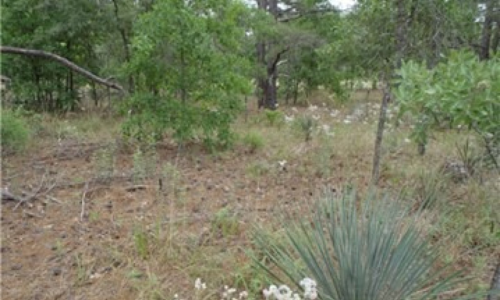
Community 6.1.1
Post Oak/Shortleaf Pine Woodland
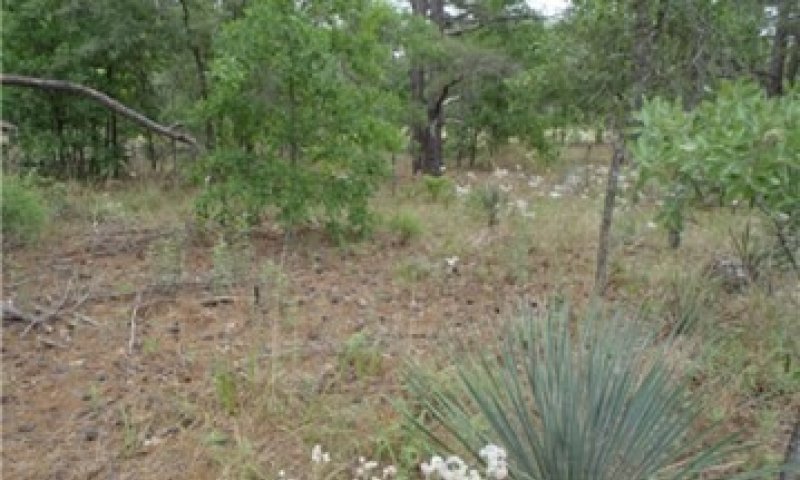
Figure 7. Post Oak/Shortleaf Pine Woodland on the Tonkawa series. Photo by Tyson Hart 2014-NRCS
The Post oak/Shortleaf pine woodland phase (1.1.1) is the first community in the Woodland State (1.1). Litter accumulation is moderate and understory vegetation is naturally sparse. The overstory canopy is post, blackjack, and bluejack oak, interspersed with black hickory (Carya texana) and shortleaf pine. The occurrence of either post oak or shortleaf pine in the overstory at any given site is between 10 and 50 percent. Bluejack and blackjack oak have established on the sites at 10 to 30 percent, and black hickory ranges from 0 to 10 percent of the overall canopy structure. The Very Deep Sandy Uplands ecological site is unique with the pine layer and the oak layer being similar in height. The lack of clay in the soil profile reduces the amount of nutrients that can accumulate in the soil, reducing the overall height of the shortleaf pines. The pine trees may also have a yellowish tint to their needles resulting from lack of nutrients. Both communities are characterized by a sparse ground layer with large patches of bare ground and litter. Threeawn can occupy much of the ground cover, as they are considered first successional grasses. The lack of nutrients and water holding capactiy make colonization possible by species able to withstand the harsh conditions. Little bluestem (Schizachrium scoparium) and panic-grasses (Dichanthelium sp.) may be common, but not abundant. Indicator plants include Gulf Coast yucca, Texas bullnettle (Cnidosolus texanus), Noseburns (Tragia sp.), plains snakecotton (Froelichia floridana), and Louisiana nerveray (Tetragonotheca ludoviciana).
Table 6. Ground cover
| Tree foliar cover | 0-15% |
|---|---|
| Shrub/vine/liana foliar cover | 0-15% |
| Grass/grasslike foliar cover | 20-50% |
| Forb foliar cover | 15-50% |
| Non-vascular plants | 0% |
| Biological crusts | 0% |
| Litter | 15-50% |
| Surface fragments >0.25" and <=3" | 0% |
| Surface fragments >3" | 0% |
| Bedrock | 0% |
| Water | 0% |
| Bare ground | 15-35% |
Table 7. Canopy structure (% cover)
| Height Above Ground (ft) | Tree | Shrub/Vine | Grass/ Grasslike |
Forb |
|---|---|---|---|---|
| <0.5 | 0-5% | 0-5% | 10-35% | 10-35% |
| >0.5 <= 1 | 3-5% | 3-15% | 5-25% | 5-20% |
| >1 <= 2 | 0-5% | 3-15% | 5-25% | 3-15% |
| >2 <= 4.5 | 0-3% | 0-10% | 0-15% | 0-10% |
| >4.5 <= 13 | 5-25% | 0-5% | – | – |
| >13 <= 40 | 5-25% | 0-5% | – | – |
| >40 <= 80 | 10-40% | – | – | – |
| >80 <= 120 | 0-10% | – | – | – |
| >120 | – | – | – | – |
Community 6.1.2
Post Oak/Shortleaf Pine Woodland/Thick Understory
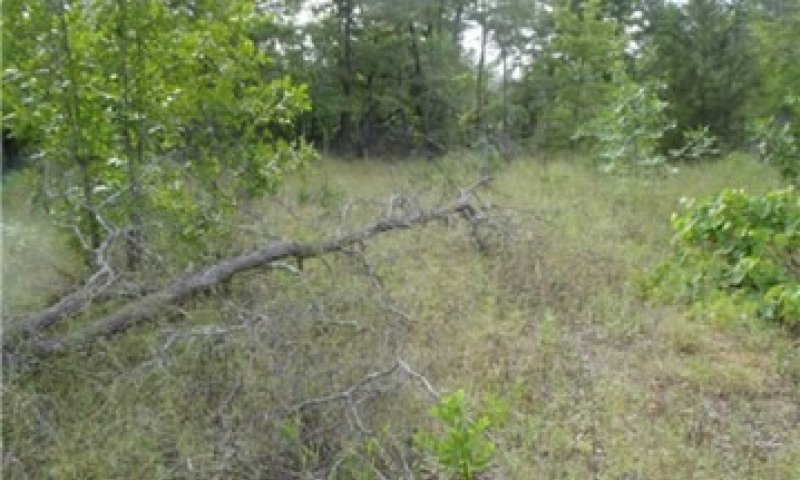
Figure 8. Post Oak/Shortleaf pine woodland Understory Community on the Tonkawa series. Photo by Tyson Hart-NRCS-2014
The Post Oak/Shortleaf Pine woodland/thick understory understory phase (1.1.2) has an increased accumulation of previous year's growth of grasses, forbs, and shrubs, increasing the fuel load for fire. Litter has built up, bare ground has lessened, and last year’s vegetative growth may still be seen on the ground layer. Under natural conditions, only fire tolerant saplings will grow into the Woodland State (1.1).
Community 6.1.3
Post Oak/Shortleaf Pine - Tree Harvest
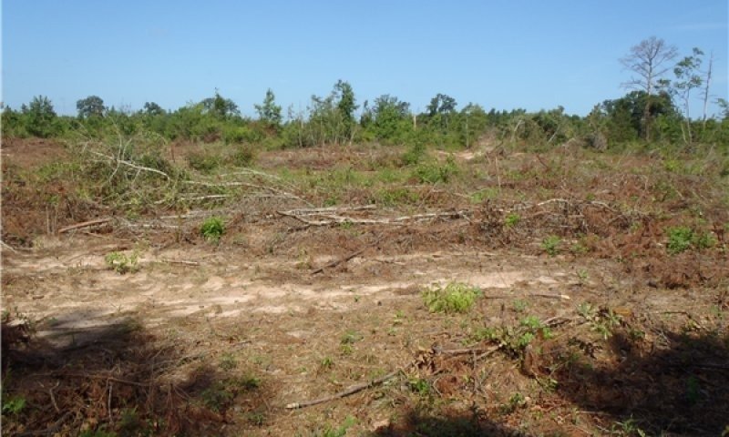
Figure 9. Post Oak/Shortleaf pine- Tree harvest Community on the Tonkawa series. Photo by Tyson Hart- NRCS-2014
The Post Oak/Shortleaf Pine-tree harvest phase (1.1.3) is a result of production harvest and clearcutting the overstory trees. The plant communities from State (1.1) may return initially, but if the natural disturbance of fire, or overstory stand management do not occur, the site will transition into the Mixed Forest Community (1.2.1).
Community 6.1.4
Post Oak/Shortleaf Pine-Natural Disaster
The Post Oak/Shortleaf Pine-Natural Disaster phase (1.1.4) is a result of natural environmental disturbances like hurricanes, tornados, etc. The plant communities from State (1.1) may return initially, but if the natural disturbance of fire, or overstory stand management do not occur, the site will transition into the Mixed Forest Community (1.2.1).
Pathway CP 1.1a
Community 6.1.1 to 6.1.2
The driver for the community shift is time since the last fire. As post-fire time increases, so does the foliar cover by shrub species. As the grasses and forbs age, their senesced leaves increase fine fuel levels.
Pathway CP 1.1c
Community 6.1.1 to 6.1.3
The driver of this community shift is due to the land manager maximizing agricultural production. Merchantable timber is harvested by clearcut, then the site is prepared and re-planted if needed. Loblolly pines are usually the species of choice because its one of the fastest growing of all of the southern pine trees. Loblolly trees do not depend on fire to sprout up like shortleaf and longleaf pines do.
Pathway CP 1.1b
Community 6.1.1 to 6.1.4
The driver of this community is caused by a natural disaster. Tornados and hurricanes occur in this MLRA causing a shift in the community. The path of a tornado in the forest can completely level an area, this will trigger young seedlings on the ground to develop given light in the understory.
Pathway CP 1.2a
Community 6.1.2 to 6.1.1
The driver for the community shift is fire. As fire burns through the understory, it encourages a diverse herbaceous layer while suppressing shrubs and unwanted woody species. This will allow shortleaf pines to establish and native grasses and forbs to sprout. Shrubs and woody vegetation must be controlled until a canopy cover trees 40-60 percent exists. Once the canopy is establish this reduces sunlight to the understory reducing the growth of most shrubs.
Pathway CP 1.3a
Community 6.1.3 to 6.1.1
This pathway is a prolonged period of time but can be possible by re-planting, shrub control, and the use of control burns. Partial or selective cutting is also key to re-establish a southern pine landscape. Shortleaf and longleaf pines are fire demanding species. After a shortleaf pine is 2 years old, a controlled burn is used to control the understory species. The controlled burn can minimize shrubs and help bring up native grasses and forbs.
Pathway CP 1.4a
Community 6.1.4 to 6.1.1
This pathway is a prolonged period of time but can be possible by re-planting, shrub control, and the use of control burns. Partial or selective cutting is also key to re-establish a southern pine landscape. This pathway is possible due to the high annual precipitation in this area. The controlled burn can minimize shrubs and help bring up native grasses and forbs. Re-planting a monoculture of trees will help bring back species to sites to which where they are adapted. Shrubs and woody vegetation must be controlled until a canopy cover of 40 to 60 percent exists. Once the canopy is establish this reduces sunlight to the understory reducing the growth of most shrubs.
State 6.2
Fire Suppressed
There is one community in the Fire Suppressed state (1.2): the Mixed Forest/canopy cover and litter accumulation community (1.2.1). The Mixed Forest community represents a steady-state for the Very Deep Sandy Uplands. Without fire or management, the site begins to lose the vegetative indicators that make the ecological site unique. The plant communities will stay constant without disturbance or intervention.
Community 6.2.1
Mixed Forest - Increased Canopy/Litter Accumulation
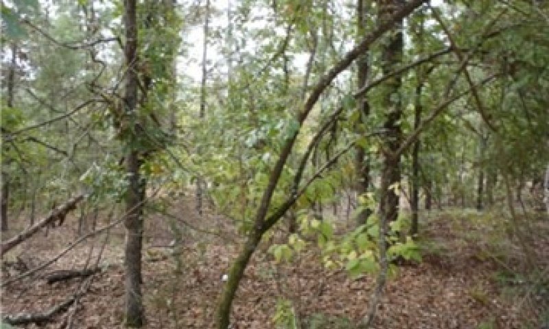
Figure 10. Mixed Forest Community on the Tonkawa series. Photo by Tyson Hart- NRCS-2014
The mixed forest community has crossed a threshold in which normal environmental events cannot transition the community back to the State (1.1). The crossing of this threshold represents a closure in the overstory canopy, which limits the productivity of the ground layer. The limited ground layer does not provide enough fuel to harbor a burn with the intensity found in State (1.1). Hardwood litter usually covers the ground, also retarding fire in this state. The understory plant layer only contains remnants of the reference community and possibly no reference community indicator species. Shade tolerant grasses, such as longleaf woodoats (Chasmanthium sessiliflorum), forbs, and greenbriers (Smilax sp.) may be the only ground-layer species. The canopy closure is usually filled in by species from State (1.1). Added litter accumulation lessens the impact of the droughty soil at the surface. As more litter occurs, water retention is slightly higher. This helps in the establishment of more overstory species, further closing the canopy. Because the site lacks the diversity of the reference state, the wildlife diversity will be limited to generalist species, species requiring a closed canopy, and those seeking refuge. This ecological state requires management to restore the reference community. Selective timber harvest to reduce the basal area is the first step to allow the understory to return. More frequent than natural prescribed burns (3 to 5 years) will help suppress the hardwood regeneration, but only after understory fuel levels are adequate. Intense summer fires may also be required. The suppression of overstory seedlings will allow the reference plant community to establish.
Table 8. Ground cover
| Tree foliar cover | 5-15% |
|---|---|
| Shrub/vine/liana foliar cover | 5-20% |
| Grass/grasslike foliar cover | 0-10% |
| Forb foliar cover | 0-10% |
| Non-vascular plants | 0% |
| Biological crusts | 0% |
| Litter | 50-90% |
| Surface fragments >0.25" and <=3" | 0% |
| Surface fragments >3" | 0% |
| Bedrock | 0% |
| Water | 0% |
| Bare ground | 5-20% |
Table 9. Canopy structure (% cover)
| Height Above Ground (ft) | Tree | Shrub/Vine | Grass/ Grasslike |
Forb |
|---|---|---|---|---|
| <0.5 | 0-5% | 5-15% | 0-10% | 0-10% |
| >0.5 <= 1 | 0-5% | 5-10% | 0-5% | 0-5% |
| >1 <= 2 | 0-5% | 5-10% | 0-5% | 0-5% |
| >2 <= 4.5 | 10-20% | 5-15% | 0-3% | 0-3% |
| >4.5 <= 13 | 20-60% | – | – | – |
| >13 <= 40 | 20-60% | – | – | – |
| >40 <= 80 | 20-80% | – | – | – |
| >80 <= 120 | 0-10% | – | – | – |
| >120 | – | – | – | – |
State 6.3
Disturbed
The Disturbed state (1.3) is a result of production harvest and management using herbicides and controlled burns (fire). Pine harvest production is used by landowners for its pulp and paper productions including cardboard, shipping products and particle board. Herbicides can disturb the natural growth of an understory but is necessary to control unwanted woody species and shrubs in the understory. A fire would represent a natural disturbance like a lightning strike in the forest. The fire helps the growth of shortleaf pines and also helps suppress shrubs and woody vegetation. Fire will also allow native grasses and forbs to establish in the understory.
Community 6.3.1
Post Oak/ Pine-Production Harvest
The Post Oak/Pine-Production harvest (1.3.1) phase is a result of production harvesting, and clearcutting the overstory trees. The plant communities from State (1.1) may return initially, but if the natural disturbance of fire, or overstory stand management do not occur, the site will transition into the Mixed Forest Community (1.2.1).
State 6.4
Plantation
The Pine Plantation State (1.4) is a result of conversion activities. The landowner has maximized silviculture production by planting a monoculture of pine species, usually loblolly pine. Loblolly pine grows fast and has shorter rotation lengths and is preferred by landowners for timber production. Fire is usually not needed when growing loblolly pine like it is needed for growing shortleaf and longleaf pine. Pesticides are used to control the Pine beetle and Pine tip moths which can have an effect in the growth of the the pine trees on the plantation.
Community 6.4.1
Pine/Hardwood
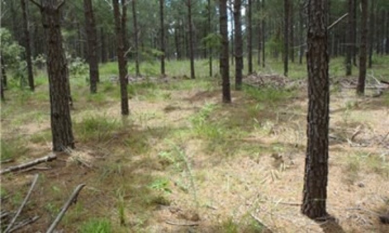
Figure 11. Pine/Hardwood Plantation Community on the Tonkawa series. Photo by Tyson Hart-NRCS-2014
In the immediate years following the initial tree planting, the understory community will resemble State (1.1). During this early growth period, the landowner will typically remove unwanted hardwoods and herbaceous plants to reduce competition with the planted pine trees. As the overstory canopy closes, less understory management is required due to sunlight restrictions at the ground layer.
Transition T1A
State 6.1 to 6.2
The transition from a Woodland state (1.1) to the Mixed Forest state (1.2) is a result of time and long periods (greater than 20 years) of no fire and/or forest management practices. Without fire to suppress tree seedlings, biomass and diversity is lost from the grass and forb layers of the system.
Transition T1B
State 6.1 to 6.3
The transition is due to the land manager maximizing silviculture potential. Merchantable timber is harvested by clearcut. The clearcutting technique requires the removal of all plant species in the area. This benefits tree species that require full sunlight to grow like maple, cedar pine, and birch species. The hardwoods are used for profit, pulp and timber is is a good financial income for landowners. Tree harvesting can also be used for prevention of tree diseases, habitat improvement, and recreation.
Transition T1C
State 6.1 to 6.4
The transition is due to the land manager maximizing agricultural production. Merchantable timber is harvested by clearcut, then the site is prepared and planted to monoculture of tree species. Loblolly pine is preferably used by landowners because of its quick growth for timber production and requires less management. Some landowners are starting to re-introduce shortleaf pine back into the forest where it was first established. This takes more management from landowners, fire is necessary for the growth of shortleaf pines. Shortleaf pines also require well drained soils and are native to upland plains where is loblolly has been recorded on all types of landforms.
Restoration pathway R2A
State 6.2 to 6.1
Restoration of this community to the reference state begins with a selective timber harvest. Removing unwanted trees opens up the canopy, allowing sunlight penetration to the ground. Years of overstory growth have limited the fuel necessary to have an effective fire. Time will be needed to encourage understory growth. Once the herbaceous layer has established, more frequent than natural burn (3 to 5 years) may be required to suppress the woody vegetation.
Transition T2A
State 6.2 to 6.4
The transition is due to the land manager maximizing silviculture potential. Merchantable timber is harvested by clearcut, then the site is prepared and planted to a monoculture of trees.
Restoration pathway R3A
State 6.3 to 6.1
This restoration pathway can be accomplished in different ways depending on goals. One option is to create canopy openings by reducing the number of overstory trees. Then, restore the resulting canopy gaps with species from the Woodland State's (1.1) understory. Restoring the understory may include planting shortleaf pine and oak species found in the Woodland State (1.1). This method keeps the woodland structure intact and slowly changes the species composition.
Transition T3A
State 6.3 to 6.4
The transition is due to the land manager maximizing agricultural production. Merchantable timber is harvested by clearcut. The clearcutting technique requires the removal of all plant species in the area. After the clearcut the site is prepared and planted to a monoculture of trees for timber production or restoration of historic pine species like shortleaf pine.
Restoration pathway R4A
State 6.4 to 6.1
This restoration path can be accomplished by planting a mix of oak and pine species to their natural frequencies (see State 1.1 Overstory Composition table), trying to attain a 40 to 60 percent mature overstory canopy. Management will be required to control unwanted species by control burns, heavy machinery, and/or herbicides. The herbaceous understory will take time to develop, but this process can be expedited if adapted plant material is available.
Transition T4A
State 6.4 to 6.2
Transition of this community to the fire suppressed state begins with a selective timber harvest. This allows to open up the canopy, allowing sunlight penetration to the ground. Sunlight will allow native grasses and forbs establish in the understory. Planting a monoculture of pine and oak trees will establish a mix forest community. This community transition can also be established by neglecting the plantation understory. Without fire, mowing, or herbicides, the brush canopy becomes a dense thicket.
Land use 7
Pasture
The Pasture land use is a result of conversion activities. The landowner has maximized agriculture production by planting a monoculture of introduced grass species. A woodland with 15 percent slope or greater is not recommended for a pasture. It is not recommended to remove all trees in your pasture unless the landowner is maximizing grass production. Trees provide shade and depth to your pasture and will help prevent soil erosion.
State 7.1
Planted Pasture
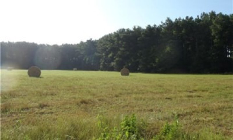
Figure 12. Planted Pasture on the Tonkawa series. Photo by Tyson Hart.
Typical introduced pasture grass species include bahiagrass (Paspalum notatum) and different varieties of bermudagrass (Cynodon dactylon). The grasses are grown for livestock production through direct grazing or baling hay for later use. Many landowners use herbicides to reduce unwanted plant competition which yields a plant community unrepresentative of State (1.1) or subsequent vegetative states.
Community 8
Community 9
Community 10
Community 11
Community 12
Conversion C1A
Land use 6 to 7
This land use conversion occurs when landowners want to convert the forest to a pasture state. The use of clearcut harvesting, heavy machinery (plow), herbicides, and seeding of a monoculture of introduced grasses is needed to make this transition.
Pathway 1.1c
Community 1 to 10
Pathway 1.1b
Community 1 to 12
Pathway 1.3a
Community 10 to 1
Pathway 1.4a
Community 12 to 1
Additional community tables
Table 10. Community 2.1 forest overstory composition
| Common name | Symbol | Scientific name | Nativity | Height (ft) | Canopy cover (%) | Diameter (in) | Basal area (square ft/acre) |
|---|---|---|---|---|---|---|---|
|
Tree
|
|||||||
| shortleaf pine | PIEC2 | Pinus echinata | Native | – | 10–50 | – | – |
| post oak | QUST | Quercus stellata | Native | – | 10–50 | – | – |
| blackjack oak | QUMA3 | Quercus marilandica | Native | – | 10–30 | – | – |
| bluejack oak | QUIN | Quercus incana | Native | – | 10–30 | – | – |
| black hickory | CATE9 | Carya texana | Native | – | 0–10 | – | – |
Table 11. Community 2.1 forest understory composition
| Common name | Symbol | Scientific name | Nativity | Height (ft) | Canopy cover (%) | |
|---|---|---|---|---|---|---|
|
Grass/grass-like (Graminoids)
|
||||||
| arrowfeather threeawn | ARPU8 | Aristida purpurascens | Native | – | 5–35 | |
| little bluestem | SCSC | Schizachyrium scoparium | Native | – | 5–35 | |
| longleaf woodoats | CHSE2 | Chasmanthium sessiliflorum | Native | – | 5–15 | |
| variable panicgrass | DICO2 | Dichanthelium commutatum | Native | – | 1–15 | |
| red lovegrass | ERSE | Eragrostis secundiflora | Native | – | 1–15 | |
| sedge | CAREX | Carex | Native | – | 1–5 | |
|
Forb/Herb
|
||||||
| Gulf Coast yucca | YULO | Yucca louisianensis | Native | – | 1–10 | |
| anisescented goldenrod | SOOD | Solidago odora | Native | – | 1–10 | |
| Texas bullnettle | CNTE | Cnidoscolus texanus | Native | – | 1–10 | |
| Canadian horseweed | COCA5 | Conyza canadensis | Native | – | 0–10 | |
| hogwort | CRCA6 | Croton capitatus | Native | – | 0–5 | |
| sessileleaf ticktrefoil | DESE | Desmodium sessilifolium | Native | – | 0–3 | |
| nettleleaf noseburn | TRUR2 | Tragia urticifolia | Native | – | 0–3 | |
| plains snakecotton | FRFL | Froelichia floridana | Native | – | 0–3 | |
| St. Andrew's cross | HYHY | Hypericum hypericoides | Native | – | 0–3 | |
| whitemouth dayflower | COER | Commelina erecta | Native | – | 1–3 | |
| Texas pricklypear | OPENL | Opuntia engelmannii var. lindheimeri | Native | – | 0–1 | |
| annual ragweed | AMAR2 | Ambrosia artemisiifolia | Native | – | 0–1 | |
| sericea lespedeza | LECU | Lespedeza cuneata | Native | – | 0–1 | |
| silverleaf nightshade | SOEL | Solanum elaeagnifolium | Native | – | 0–1 | |
| Virginia spiderwort | TRVI | Tradescantia virginiana | Native | – | 0–1 | |
|
Fern/fern ally
|
||||||
| western brackenfern | PTAQ | Pteridium aquilinum | Native | – | 0–5 | |
|
Shrub/Subshrub
|
||||||
| American beautyberry | CAAM2 | Callicarpa americana | Native | – | 5–15 | |
| winged sumac | RHCO | Rhus copallinum | Native | – | 3–15 | |
| yaupon | ILVO | Ilex vomitoria | Native | – | 1–10 | |
| farkleberry | VAAR | Vaccinium arboreum | Native | – | 0–3 | |
|
Tree
|
||||||
| bluejack oak | QUIN | Quercus incana | Native | – | 5–20 | |
| blackjack oak | QUMA3 | Quercus marilandica | Native | – | 1–5 | |
| post oak | QUST | Quercus stellata | Native | – | 1–5 | |
| black hickory | CATE9 | Carya texana | Native | – | 1–5 | |
| shortleaf pine | PIEC2 | Pinus echinata | Native | – | 1–3 | |
| loblolly pine | PITA | Pinus taeda | Native | – | 1–3 | |
|
Vine/Liana
|
||||||
| summer grape | VIAE | Vitis aestivalis | Native | – | 1–10 | |
| muscadine | VIRO3 | Vitis rotundifolia | Native | – | 1–10 | |
| cat greenbrier | SMGL | Smilax glauca | Native | – | 1–5 | |
Interpretations
Animal community
Dove will especially utilize the sites as they forage for seeds on the ground. Dove need the ability to walk around on open ground and find seeds, as compared to other seed-eating birds which can feed directly from the plant. Encouragement of seed-producing grasses and forbs will attract more birds. Turkey and quail will utilize the site to some degree, but in combination with other sites. The grass layer may be too sparse to provide nesting habitat, but the presence of mature oaks will provide roosting areas. If the canopy is open, a diverse forb layer will create an abundance of insects. The insects provide high-quality protein in their diet, especially for newly hatched chicks.
Deer will utilize the site as the community matures and browse the saplings and desired shrubs. As with most deer habitat, deer utilize a large array of ecological sites throughout their life. Well-managed browse, cover, and natural food sources provide the best habitat.
Migratory songbirds and woodpeckers use the site as well. Locations with fire and snags will typically have a higher diversity of birds. Fruits from the shrub species (American beautyberry and yaupon) are readily consumed by birds as well.
Grazing animals primarily use grasses as their food source. While grasses can be in abundance on the Very Deep Sandy Uplands, the sites will have to be specifically managed for grazing to produce enough biomass. Reduction of basal area, below 50 square feet per acre, will create more openings for light to penetrate to the ground layer, therefore allowing more biomass to be produced.
Hydrological functions
Due to the sandy surface layer this soil absorbs nearly all rainfall and under normal conditions there is little runoff. The infiltration adds to aquifers and springs often occur at the base of the slopes.
Recreational uses
Much of this land is leased for deer hunting purposes. Some areas are used by all-terrain vehicles (ATV), as the sandy surface texture has the same characteristics as sand dunes.
Wood products
These very deep sandy soils have a low to moderate potential for pine management. The 50-year site index for loblolly pine ranges between 65 feet and 75 feet (45 to 50 feet on a 25-year curve), depending on slope and slope position. The higher site indices are found on the lower portions of steep slopes. The yield from a natural, unmanaged stand of loblolly pine, over a 50-year period, is approximately 86 cubic feet per acre per year. Management can substantially increase this yield. Because these soils are loose when dry, access and equipment operability is poor. During extended dry periods, rutting is also possible. They are well suited for access and equipment operability during wet periods.
These soils are only moderately suited for roads and log landings on the flatter slopes and poorly suited on slopes exceeding 15 percent. Erosion problems will occur as slopes increase beyond 15 percent. Site preparation methods that minimize soil disturbance should be used. Burning should not be used in site preparation operations. Seedling mortality may be severe, so planting only high-quality seedlings is paramount. Proper seedling care along with planting depth and compaction will also be important. Attention should be given to the possible leaching of fertilizers and of chemicals when herbicides are used for site preparation. Choose appropriate chemicals and application methods to prevent the possible contamination of groundwater.
Other products
Fruits, nuts, acorns, and seeds of the trees, shrubs, vines, and herbaceous plants are used for food, jellies, and jam. Sand may be used for construction purposes.
Supporting information
Inventory data references
These site descriptions were developed as part a Provisional Ecological Site project using historic soil survey manuscripts, available site descriptions, and low intensity field traverse sampling. Future work to validate the information is needed. This will include field activities to collect low, medium, and high-intensity sampling, soil correlations, and analysis of that data. A final field review, peer review, quality control, and quality assurance review will be completed to produce the final document.
Contributors
Tyson Hart
Antonio Argullin
Approval
Marji Patz, 6/16/2025
Rangeland health reference sheet
Interpreting Indicators of Rangeland Health is a qualitative assessment protocol used to determine ecosystem condition based on benchmark characteristics described in the Reference Sheet. A suite of 17 (or more) indicators are typically considered in an assessment. The ecological site(s) representative of an assessment location must be known prior to applying the protocol and must be verified based on soils and climate. Current plant community cannot be used to identify the ecological site.
| Author(s)/participant(s) | |
|---|---|
| Contact for lead author | |
| Date | 06/16/2025 |
| Approved by | David Kraft |
| Approval date | |
| Composition (Indicators 10 and 12) based on | Annual Production |
Indicators
-
Number and extent of rills:
-
Presence of water flow patterns:
-
Number and height of erosional pedestals or terracettes:
-
Bare ground from Ecological Site Description or other studies (rock, litter, lichen, moss, plant canopy are not bare ground):
-
Number of gullies and erosion associated with gullies:
-
Extent of wind scoured, blowouts and/or depositional areas:
-
Amount of litter movement (describe size and distance expected to travel):
-
Soil surface (top few mm) resistance to erosion (stability values are averages - most sites will show a range of values):
-
Soil surface structure and SOM content (include type of structure and A-horizon color and thickness):
-
Effect of community phase composition (relative proportion of different functional groups) and spatial distribution on infiltration and runoff:
-
Presence and thickness of compaction layer (usually none; describe soil profile features which may be mistaken for compaction on this site):
-
Functional/Structural Groups (list in order of descending dominance by above-ground annual-production or live foliar cover using symbols: >>, >, = to indicate much greater than, greater than, and equal to):
Dominant:
Sub-dominant:
Other:
Additional:
-
Amount of plant mortality and decadence (include which functional groups are expected to show mortality or decadence):
-
Average percent litter cover (%) and depth ( in):
-
Expected annual annual-production (this is TOTAL above-ground annual-production, not just forage annual-production):
-
Potential invasive (including noxious) species (native and non-native). List species which BOTH characterize degraded states and have the potential to become a dominant or co-dominant species on the ecological site if their future establishment and growth is not actively controlled by management interventions. Species that become dominant for only one to several years (e.g., short-term response to drought or wildfire) are not invasive plants. Note that unlike other indicators, we are describing what is NOT expected in the reference state for the ecological site:
-
Perennial plant reproductive capability:
Print Options
Sections
Font
Other
The Ecosystem Dynamics Interpretive Tool is an information system framework developed by the USDA-ARS Jornada Experimental Range, USDA Natural Resources Conservation Service, and New Mexico State University.
Click on box and path labels to scroll to the respective text.
| 1.1c | - | Clearcut harvesting |
|---|---|---|
| 1.1b | - | Natural disaster(tornado, hurricane, etc) |
| 1.3a | - | Natural Succession |
| 1.4a | - | Natural Succession |
Land use 6 submodel, ecosystem states
| T1A | - | Fire suppression/ No management |
|---|---|---|
| T1B | - | Production harvest |
| T1C | - | Clearcut, site preparation, tree planting |
| R2A | - | Select timber harvest, prescribed burn |
| T2A | - | Clearcut, site preparation, tree planting |
| R3A | - | Planting of trees and grasses/ shrub control |
| T3A | - | Clearcut, planted monoculture of trees |
| R4A | - | Gap-phase regression or clearcut with tree planting |
| T4A | - | Fire suppression, no management, natural succession |