Natural Resources
Conservation Service
Ecological site F134XY305LA
West Central Somewhat Poorly Drained Loess Terrace - PROVISIONAL
Last updated: 3/24/2025
Accessed: 02/06/2026
General information
Provisional. A provisional ecological site description has undergone quality control and quality assurance review. It contains a working state and transition model and enough information to identify the ecological site.
MLRA notes
Major Land Resource Area (MLRA): 134X–Southern Mississippi Valley Loess
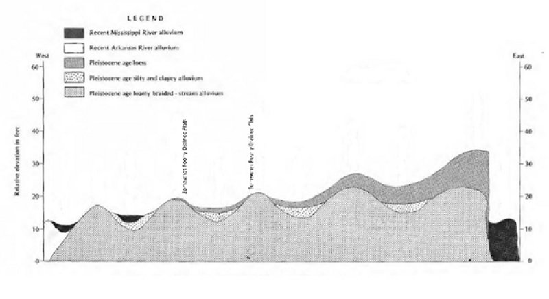
MLRA 134, Southern Mississippi Valley Loess, is in Mississippi (39 percent), Tennessee (23 percent), Louisiana (15 percent), Arkansas (11 percent), Kentucky (9 percent), Missouri (2 percent), and Illinois (1 percent). It makes up about 26,520 square miles (68,715 square kilometers). The northern part of the area includes Paducah and Murray, Kentucky; Paragould, Jonesboro, and Forrest City, Arkansas; and Memphis, Dyersburg, Bartlett, and Germantown, Tennessee. The southern part includes Yazoo City, Clinton, and Jackson, Mississippi, and Baton Rouge, Opelousas, Lafayette, and New Iberia, Louisiana. This portion is the central western part of the MLRA in Louisiana and Arkansas. It is in the Macon Ridge Section of the EPA Ecoregions in sub-section 73j. The dissected plains in this MLRA have a loess mantle that is thick at the valley wall and thins rapidly as distance from the valley wall increases. This portion of the MLRA is distinct from other portions of the MLRA because of the influences of the Mississippi River and it series of entrenchments and adjacent old channels of the Arkansas River, such channels as Bayou Bartholomew, Bayou Bonnne Idee, Boeuf River, and segments of the Ouachita River. The Macon Ridge has been inhabited prior to European Settlement, Poverty Point is located on the east central portion of the Macon Ridge and has earthworks dating back to 1700-1100 BC.
Classification relationships
Major Land Resource Area (MLRA) and Land Resource Unit (LRU) (USDA-Natural Resources Conservation Service, 2006)
The Natural Communities of Louisiana - (Louisiana Natural Heritage Program - Louisiana Department of Wildlife and Fisheries)
EPA Level IV Ecoregion
Ecological site concept
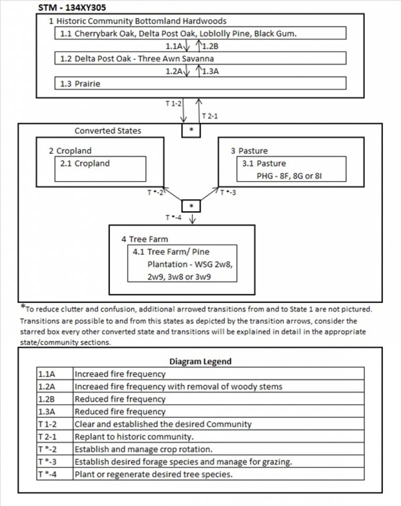
Somewhat poorly drained soils that formed in thin loess or water reworked loess deposits on broad nearly level to gently sloping uplands and stream terraces. Potential soil limitations that could drive the ecological site processes could include a fragipan or restrictive layer, acidity, high water table or high exchangeable Al (Aluminum). This soil chemistry limitation is significant because, Aluminum (Al) toxicity limits production on strongly acidic soils, pH values at or below 5, toxic forms of Al solubilized into the soil solution, inhibiting root growth and function (Kochian, 2005). The site includes multiple historic communities, Prairie and Woodland (If fire is excluded it will maintain a Forest community, if burned Prairie community or open woodland with a herbaceous understory). Cherrybark oak, Delta Post oak, Loblolly pine and Black gum are species that would historically colonize the site.
Associated sites
| F134XY302LA |
West Central Swales/Depressions Wet Flats - PROVISIONAL The Swales Depression and Wet Flats sites will be at a lower level on the landscape. |
|---|---|
| F134XY306LA |
West Central Well Drained Loamy Ridge - PROVISIONAL The Well Drained loamy Ridge site will be found at a higher landscape position. |
Similar sites
| F134XY304LA |
West Central Somewhat Poorly Drained Flats - PROVISIONAL SWPD Flats is similar to this site with little or no Loess influence. |
|---|
Table 1. Dominant plant species
| Tree |
Not specified |
|---|---|
| Shrub |
Not specified |
| Herbaceous |
Not specified |
Click on box and path labels to scroll to the respective text.

