Natural Resources
Conservation Service
Ecological site PX136X00X420
Triassic Basin Upland Forest, Moist
Accessed: 04/29/2025
General information
Provisional. A provisional ecological site description has undergone quality control and quality assurance review. It contains a working state and transition model and enough information to identify the ecological site.
MLRA notes
Major Land Resource Area (MLRA): 136X–Southern Piedmont
This area is in North Carolina (29 percent), Georgia (27 percent), Virginia (21 percent), South Carolina (16 percent), and Alabama (7 percent). It makes up about 64,395 square miles (166,865 square kilometers). (Ag Bulletin 296)
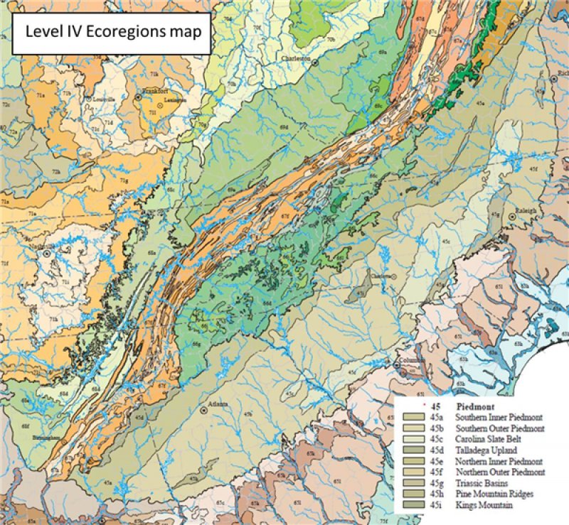
The northeast-southwest trending Piedmont ecoregion comprises a transitional area between the mostly mountainous ecoregions of the Appalachians to the northwest and the relatively flat coastal plain to the southeast. It is a complex mosaic of Precambrian and Paleozoic metamorphic and igneous rocks with moderately dissected irregular plains and some hills. (EPA Ecoregions descriptions)
ADD APPROPRIATE ECOREGION DESCRIPTION(S)
Classification relationships
A PROVISIONAL ECOLOGICAL SITE is a conceptual grouping of soil map unit components within a Major Land Resource Area (MLRA) based on the similarities in response to management. Although there may be wide variability in the productivity of the soils grouped into a Provisional Site, the soil vegetation interactions as expressed in the State and Transition Model are similar and the management actions required to achieve objectives, whether maintaining the existing ecological state or managing for an alternative state, are similar. Provisional Sites are likely to be refined into more precise group during the process of meeting the APPROVED ECOLOGICAL SITE DESCRIPTION criteria.
This PROVISIONAL ECOLOGICAL SITE has been developed to meet the standards established in the National Ecological Site Handbook. The information associated with this ecological site does not meet the Approved Ecological Site Description Standard, but it has been through a Quality Control and Quality Assurance processes to assure consistency and completeness. Further investigations, reviews and correlations are necessary before it becomes an Approved Ecological Site Description.
Ecological site concept
This dry-mesic forest occurs on well-drained soils of the Triassic Basin in the Southern Piedmont. Stands are dominated by Quercus alba and often Quercus rubra, Carya ovata, or Carya carolinae-septentrionalis in combination with other species of Quercus and Carya (i.e., Quercus velutina, Carya alba, Carya glabra). Other overstory and understory species that may occur include Fraxinus americana, Liquidambar styraciflua, Carya ovalis, Liriodendron tulipifera, Juniperus virginiana var. virginiana, Cercis canadensis, Cornus florida, Viburnum rafinesquianum, Viburnum prunifolium, Ostrya virginiana, Chionanthus virginicus, Ulmus americana, Carpinus caroliniana, Pinus taeda, and Pinus echinata. Proportions of Liquidambar styraciflua, Liriodendron tulipifera, Acer rubrum, and Pinus spp. increase following disturbance. Herbaceous species and vines that may occur within this community include Desmodium nudiflorum, Galium circaezans, Maianthemum racemosum ssp. racemosum, Polygonatum biflorum var. biflorum, Uvularia perfoliata, Aristolochia serpentaria, Scleria oligantha, Botrychium virginianum, Agrimonia rostellata, Bromus pubescens, Carex albicans, Carex laxiflora var. laxiflora, Carex planispicata, Dichanthelium boscii, Elymus hystrix var. hystrix, Festuca subverticillata, Scutellaria elliptica, and Tiarella cordifolia var. collina. Other stands have high cover of scrambling vines, such Parthenocissus quinquefolia, Bignonia capreolata, and Vitis rotundifolia, that preclude a diversity of herbaceous species.
Table 1. Dominant plant species
| Tree |
(1) Quercus alba |
|---|---|
| Shrub |
Not specified |
| Herbaceous |
Not specified |
Legacy ID
F136XY420NC
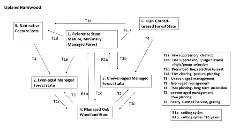
Click on box and path labels to scroll to the respective text.

