
Major Land Resource Area 143X
Northeastern Mountains
Accessed: 04/06/2026
Description
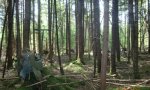
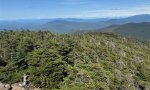
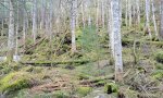
MLRA 143 (fig. 143-1) is in Maine (51 percent), New York (27 percent), Vermont (13 percent), New Hampshire (7 percent), and Massachusetts (2 percent). It makes up about 34,409 square miles (89,118 square kilometers). The MLRA consists of rolling hills and mountains covered by Wisconsin till. It is in three parts separated by other MLRAs. The western part is in New York (primarily the Adirondack Mountains). The central part is mainly in the Green Mountains in Vermont and the Berkshires in Massachusetts. The eastern part is in New Hampshire and most of northern Maine. The western part of MLRA 143 in the Adirondack Mountains has a distinct boundary with the physiographically dissimilar Saint Lawrence-Champlain Plain. The middle part that encompasses the Green Mountains has a diffuse boundary as it blends into the northern part of the New England and Eastern New York Uplands on the foothills of the Green Mountains. The southern boundary of the easternmost part of MLRA 143 has the same diffuse boundary. The northern boundary of the MLRA is the Canadian border. Precipitation, perennial streams, and lakes provide an abundance of water. In the parts of the MLRA in New York and Vermont, the surface water is used primarily for recreation and the steep terrain provides numerous opportunities for hydropower facilities. The surface water in the part of the MLRA in New Hampshire, Maine, and Massachusetts is used for recreation, light industry (textile and paper mills), and public supply. The surface water throughout the MLRA generally is of excellent quality. Acid rain is a concern. The acidity removes metals, such as aluminum, iron, and mercury, from soils. These contaminants enter the streams, lakes, and reservoirs and eventually the food chain. This area supports northern hardwoods, spruce, and fir. The most common trees are sugar maple (Acer saccharum), American beech (Fagus grandifolia), yellow birch (Betula alleghaniensis), black cherry (Prunus serotina), eastern white pine (Pinus strobus), balsam fir (Abies balsamea), red spruce (Picea rubens), eastern hemlock (Tsuga canadensis), black spruce (Picea mariana), and quaking aspen (Populus tremuloides). Sugar maple, yellow birch, American beech, red spruce, and eastern hemlock are dominant on the better drained soils on hills and ridges. Red spruce and balsam fir are dominant on the wetter soils on long, gentle slopes and in depressions. Stunted balsam fir and red spruce are common on many of the high mountaintops. Wood for lumber and pulp for the paper industry are the principal forest products. Maple sugar is an important product in many areas. Most farming is a part-time enterprise on isolated farms. Much of the area in the Adirondack Mountains in New York is in a State park, and much of the area in New Hampshire is part of the White Mountain National Forest. Although most of the area in New England is privately owned, a large part is in national forests, State forests, or State parks. This MLRA is widely used for year-round recreation. Conservation practices on forestland generally include forest stand improvement and proper construction, use, and maintenance of skid trails, water bars, access roads, and log landings. Critical area planting and sediment-control measures are needed on construction sites, ski slopes, and recreation trails. Conservation practices on cropland generally include conservation tillage, contour strip-cropping, crop rotations, crop residue management (primarily mulch-till), cover crops, diversions, and grassed waterways.
Key publications
Next steps
-
1
Select an ecological site
Select an ecological site using the list, keys, photos, briefcase, or quick search option located on this page. -
2
Explore the ecological site description
Next, learn more about the selected ecological site and its characteristic dynamics by browsing the ecological site description and exploring alternative state and transition model formats.
Ecological site list
-
i
Key Characteristics
- Site occurs along major rivers and streams and experiences regular flooding, or would in the absence of dams and other water control structures
- Broad floodplain of large river system. Includes channel banks, stream terraces, and/or natural levies and associated oxbow ponds and marshes
-
i
Key Characteristics
- Site occurs along major rivers and streams and experiences regular flooding, or would in the absence of dams and other water control structures
- Floodplain of small river system. Includes channel banks, stream terraces, and sometimes small marshes and oxbow ponds if flooded regularly
-
i
Key Characteristics
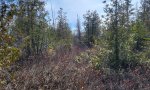
- Site does not occur along major rivers and streams, or if it does occur near major rivers and streams it is not influenced by regular flooding events (even in the absence of dams)
- Soils somewhat poorly-drained or drier, or, a combination of poorly-drained soils and drier soils in a complex throughout site
- Site does not occur in alpine/subalpine zone and has a frigid soil temp regime) often represented below 2,500 feet (762 meters) in elevation
- Site capable of producing greater than 20% persistent tree cover
- All soil components greater than 20 inches deep (50 cm)
- Predominant soil texture is finer than sandy
- Predominant soil texture is fine or fine-silty
-
i
Key Characteristics
- Site does not occur along major rivers and streams, or if it does occur near major rivers and streams it is not influenced by regular flooding events (even in the absence of dams)
- Soils somewhat poorly-drained or drier, or, a combination of poorly-drained soils and drier soils in a complex throughout site
- Site does not occur in alpine/subalpine zone and has a frigid soil temp regime) often represented below 2,500 feet (762 meters) in elevation
- Site capable of producing greater than 20% persistent tree cover
- All soil components greater than 20 inches deep (50 cm)
- Predominant soil texture is finer than sandy
- Predominant soil texture is coarser than fine-silty
- Loamy surface soils underlain by soils finer than sandy or sandy-skeletal
- Soils moderately well- to well-drained, often with somewhat poorly-drained components
- Site occurs on gentle to steep slopes (greater than 5%), typically spodosols or inceptisols lacking significant organic matter accumulation
-
i
Key Characteristics
- Site does not occur along major rivers and streams, or if it does occur near major rivers and streams it is not influenced by regular flooding events (even in the absence of dams)
- Soils somewhat poorly-drained or drier, or, a combination of poorly-drained soils and drier soils in a complex throughout site
- Site does not occur in alpine/subalpine zone and has a frigid soil temp regime) often represented below 2,500 feet (762 meters) in elevation
- Site capable of producing greater than 20% persistent tree cover
- All soil components greater than 20 inches deep (50 cm)
- Predominant soil texture is finer than sandy
- Predominant soil texture is coarser than fine-silty
- Loamy surface soils underlain by soils finer than sandy or sandy-skeletal
- Soils poorly drained mapped with somewhat-poorly drained components
- Site occurs on the toeslope of a large watershed with moderate to steep slopes above, where nutrients and water accumulate
-
i
Key Characteristics
- Site does not occur along major rivers and streams, or if it does occur near major rivers and streams it is not influenced by regular flooding events (even in the absence of dams)
- Soils somewhat poorly-drained or drier, or, a combination of poorly-drained soils and drier soils in a complex throughout site
- Site does not occur in alpine/subalpine zone and has a frigid soil temp regime) often represented below 2,500 feet (762 meters) in elevation
- Site capable of producing greater than 20% persistent tree cover
- All soil components greater than 20 inches deep (50 cm)
- Predominant soil texture is finer than sandy
- Predominant soil texture is coarser than fine-silty
- Loamy surface soils underlain by soils finer than sandy or sandy-skeletal
- Soils moderately well- to well-drained, often with somewhat poorly-drained components
- Site occurs in protected coves and drainageways with very thick, dark surface A horizon greater than 12 inches (30 cm), very high in organic matter
-
i
Key Characteristics
- Site does not occur along major rivers and streams, or if it does occur near major rivers and streams it is not influenced by regular flooding events (even in the absence of dams)
- Soils somewhat poorly-drained or drier, or, a combination of poorly-drained soils and drier soils in a complex throughout site
- Site does not occur in alpine/subalpine zone and has a frigid soil temp regime) often represented below 2,500 feet (762 meters) in elevation
- Site capable of producing greater than 20% persistent tree cover
- All soil components greater than 20 inches deep (50 cm)
- Predominant soil texture is finer than sandy
- Predominant soil texture is coarser than fine-silty
- Loamy surface soils underlain by sandy or sandy-skeletal strata
-
i
Key Characteristics
- Site does not occur along major rivers and streams, or if it does occur near major rivers and streams it is not influenced by regular flooding events (even in the absence of dams)
- Soils somewhat poorly-drained or drier, or, a combination of poorly-drained soils and drier soils in a complex throughout site
- Site does not occur in alpine/subalpine zone and has a frigid soil temp regime) often represented below 2,500 feet (762 meters) in elevation
- Site capable of producing greater than 20% persistent tree cover
- All soil components greater than 20 inches deep (50 cm)
- Predominant soil texture is sandy or sandy-skeletal
- Soil well-drained or drier
-
i
Key Characteristics
- Site does not occur along major rivers and streams, or if it does occur near major rivers and streams it is not influenced by regular flooding events (even in the absence of dams)
- Soils somewhat poorly-drained or drier, or, a combination of poorly-drained soils and drier soils in a complex throughout site
- Site does not occur in alpine/subalpine zone and has a frigid soil temp regime) often represented below 2,500 feet (762 meters) in elevation
- Site capable of producing greater than 20% persistent tree cover
- All soil components greater than 20 inches deep (50 cm)
- Predominant soil texture is sandy or sandy-skeletal
- Soil moderately well-drained or somewhat poorly-drained
-
i
Key Characteristics
- Site does not occur along major rivers and streams, or if it does occur near major rivers and streams it is not influenced by regular flooding events (even in the absence of dams)
- Soils somewhat poorly-drained or drier, or, a combination of poorly-drained soils and drier soils in a complex throughout site
- Site does not occur in alpine/subalpine zone and has a frigid soil temp regime) often represented below 2,500 feet (762 meters) in elevation
- Site capable of producing greater than 20% persistent tree cover
- Shallow soils less than 20 inches (50 cm) deep, or a combination of shallow and moderately deep soils 20-40 inches (50-100 cm) deep, over bedrock
- Mineral soils, or a combination of organic and mineral soils together
- All soils less than 20 inches (50 cm) deep over bedrock
-
i
Key Characteristics
- Site does not occur along major rivers and streams, or if it does occur near major rivers and streams it is not influenced by regular flooding events (even in the absence of dams)
- Soils somewhat poorly-drained or drier, or, a combination of poorly-drained soils and drier soils in a complex throughout site
- Site does not occur in alpine/subalpine zone and has a frigid soil temp regime) often represented below 2,500 feet (762 meters) in elevation
- Site capable of producing greater than 20% persistent tree cover
- Shallow soils less than 20 inches (50 cm) deep, or a combination of shallow and moderately deep soils 20-40 inches (50-100 cm) deep, over bedrock
- Mineral soils, or a combination of organic and mineral soils together
- Soils vary from 10-40 inches (25-100 cm) in depth over bedrock
- Soils lacking very dark colors associated with high organic matter content
-
i
Key Characteristics
- Site does not occur along major rivers and streams, or if it does occur near major rivers and streams it is not influenced by regular flooding events (even in the absence of dams)
- Soils somewhat poorly-drained or drier, or, a combination of poorly-drained soils and drier soils in a complex throughout site
- Site does not occur in alpine/subalpine zone and has a frigid soil temp regime) often represented below 2,500 feet (762 meters) in elevation
- Site capable of producing greater than 20% persistent tree cover
- Shallow soils less than 20 inches (50 cm) deep, or a combination of shallow and moderately deep soils 20-40 inches (50-100 cm) deep, over bedrock
- Mineral soils, or a combination of organic and mineral soils together
- Soils vary from 10-40 inches (25-100 cm) in depth over bedrock
- Soils with very high organic matter content, very dark brown and/or maroon in color below the E horizon
-
i
Key Characteristics
- Site does not occur along major rivers and streams, or if it does occur near major rivers and streams it is not influenced by regular flooding events (even in the absence of dams)
- Soils somewhat poorly-drained or drier, or, a combination of poorly-drained soils and drier soils in a complex throughout site
- Site does not occur in alpine/subalpine zone and has a frigid soil temp regime) often represented below 2,500 feet (762 meters) in elevation
- Site capable of producing greater than 20% persistent tree cover
- Shallow soils less than 20 inches (50 cm) deep, or a combination of shallow and moderately deep soils 20-40 inches (50-100 cm) deep, over bedrock
- Shallow organic soils with pH less than 4.5 and large areas of open canopy with exposed bedrock
-
i
Key Characteristics
- Site does not occur along major rivers and streams, or if it does occur near major rivers and streams it is not influenced by regular flooding events (even in the absence of dams)
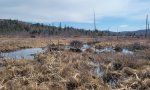
- Soils poorly- and/or very poorly-drained throughout site
- Wetland area consisting of multiple associated plant communities, most of which are too wet to support greater than 20% tree cover
- Soils mostly muck
-
i
Key Characteristics
- Site does not occur along major rivers and streams, or if it does occur near major rivers and streams it is not influenced by regular flooding events (even in the absence of dams)
- Soils poorly- and/or very poorly-drained throughout site
- Wetland area consisting of multiple associated plant communities, most of which are too wet to support greater than 20% tree cover
- Soils mostly peat or mucky peat
- Soil pH mostly greater than 4.5 throughout wetland
-
i
Key Characteristics
- Site does not occur along major rivers and streams, or if it does occur near major rivers and streams it is not influenced by regular flooding events (even in the absence of dams)
- Soils poorly- and/or very poorly-drained throughout site
- Wetland area consisting of multiple associated plant communities, most of which are too wet to support greater than 20% tree cover
- Soils mostly peat or mucky peat
- Soil pH less than 4.5 in most of the wetland complex
-
i
Key Characteristics
- Site does not occur along major rivers and streams, or if it does occur near major rivers and streams it is not influenced by regular flooding events (even in the absence of dams)
- Soils poorly- and/or very poorly-drained throughout site
- Wetland area consisting of multiple associated plant communities, most of which support greater than 20% tree cover
- Most soils on the site have less than 40 inches (100 cm) organic deposits on surface
- Soils form a complex of poorly-drained soils on mounds and very poorly-drained soils in depressions
- Soil textures loamy or fine loamy with a densely compacted horizon within 40 inches (100 cm) of the soil surface
-
i
Key Characteristics
- Site does not occur along major rivers and streams, or if it does occur near major rivers and streams it is not influenced by regular flooding events (even in the absence of dams)
- Soils poorly- and/or very poorly-drained throughout site
- Wetland area consisting of multiple associated plant communities, most of which support greater than 20% tree cover
- All soils on the site are very poorly-drained with greater than 40 inches (100 cm) of organic mucky peat deposits on the surface
-
i
Key Characteristics
- Site does not occur along major rivers and streams, or if it does occur near major rivers and streams it is not influenced by regular flooding events (even in the absence of dams)
- Soils poorly- and/or very poorly-drained throughout site
- Wetland area consisting of multiple associated plant communities, most of which support greater than 20% tree cover
- Most soils on the site have less than 40 inches (100 cm) organic deposits on surface
- Soils form a complex of poorly-drained soils on mounds and very poorly-drained soils in depressions
- Soil textures typically sandy or coarse-loamy without a densely compacted horizon within 40 inches (100 cm) of soil surface
-
i
Key Characteristics
- Site does not occur along major rivers and streams, or if it does occur near major rivers and streams it is not influenced by regular flooding events (even in the absence of dams)
- Soils poorly- and/or very poorly-drained throughout site
- Wetland area consisting of multiple associated plant communities, most of which support greater than 20% tree cover
- Most soils on the site have less than 40 inches (100 cm) organic deposits on surface
- All soils on the site are poorly-drained with very little or no very poorly-drained inclusions (soil textures may vary from fine to coarse)
-
i
Key Characteristics
- Site does not occur along major rivers and streams, or if it does occur near major rivers and streams it is not influenced by regular flooding events (even in the absence of dams)
- Soils somewhat poorly-drained or drier, or, a combination of poorly-drained soils and drier soils in a complex throughout site
- Site does not occur in alpine/subalpine zone and has a frigid soil temp regime) often represented below 2,500 feet (762 meters) in elevation
- Site capable of producing greater than 20% persistent tree cover
- All soil components greater than 20 inches deep (50 cm)
- Predominant soil texture is finer than sandy
- Predominant soil texture is coarser than fine-silty
- Loamy surface soils underlain by soils finer than sandy or sandy-skeletal
- Soils poorly drained mapped with somewhat-poorly drained components
- Site occurs on relatively flat expanses with less than 5% slope, rather than the toeslope of a large watershed
-
i
Key Characteristics
- Site does not occur along major rivers and streams, or if it does occur near major rivers and streams it is not influenced by regular flooding events (even in the absence of dams)
- Soils somewhat poorly-drained or drier, or, a combination of poorly-drained soils and drier soils in a complex throughout site
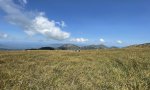
- Site occurs in alpine/subalpine zone and has a cryic soil temp regime) often represented above 2,500 feet (762 meters) in elevation
- Site above tree line and exposed to too much wind scour to support growth of more than a few scattered, very short trees (~2 meters)
-
i
Key Characteristics
- Site does not occur along major rivers and streams, or if it does occur near major rivers and streams it is not influenced by regular flooding events (even in the absence of dams)
- Soils somewhat poorly-drained or drier, or, a combination of poorly-drained soils and drier soils in a complex throughout site
- Site occurs in alpine/subalpine zone and has a cryic soil temp regime) often represented above 2,500 feet (762 meters) in elevation
- Site at or below tree line, supports tree growth
- Tree growth stunted (typically less than a few feet tall [~2 meters]) due to high elevations and landscape position exposed to wind scour
-
i
Key Characteristics
- Site does not occur along major rivers and streams, or if it does occur near major rivers and streams it is not influenced by regular flooding events (even in the absence of dams)
- Soils somewhat poorly-drained or drier, or, a combination of poorly-drained soils and drier soils in a complex throughout site
- Site occurs in alpine/subalpine zone and has a cryic soil temp regime) often represented above 2,500 feet (762 meters) in elevation
- Site at or below tree line, supports tree growth
- Site supports growth of trees greater than a few feet (~2 meters) tall
Ecological site map
Basemap
Find me
Find point
Full screen
Zoom in to display soil survey map units for an area of interest, and zoom out to display MLRAs. Select a map unit polygon to view ecological sites correlated to that map unit. View a brief description of an ecological site by clicking on its name in the map popup. Soil survey correlations may not be accurate, and ecological site classification of a location should always be verified in the field. Each selection may require the transfer of several hundred KB of data.
Ecological site keys
Ecological site photos
Print Options
Sections
Font
Other
Briefcase
Add ecological sites and Major Land Resource Areas to your briefcase by clicking on the briefcase (![]() ) icon wherever it occurs. Drag and drop items to reorder. Cookies are used to store briefcase items between browsing sessions. Because of this, the number of items that can be added to your briefcase is limited, and briefcase items added on one device and browser cannot be accessed from another device or browser. Users who do not wish to place cookies on their devices should not use the briefcase tool. Briefcase cookies serve no other purpose than described here and are deleted whenever browsing history is cleared.
) icon wherever it occurs. Drag and drop items to reorder. Cookies are used to store briefcase items between browsing sessions. Because of this, the number of items that can be added to your briefcase is limited, and briefcase items added on one device and browser cannot be accessed from another device or browser. Users who do not wish to place cookies on their devices should not use the briefcase tool. Briefcase cookies serve no other purpose than described here and are deleted whenever browsing history is cleared.
Ecological sites
Major Land Resource Areas
The Ecosystem Dynamics Interpretive Tool is an information system framework developed by the USDA-ARS Jornada Experimental Range, USDA Natural Resources Conservation Service, and New Mexico State University.