Natural Resources
Conservation Service
Ecological site VX158X01X401
Isohyperthermic Ustic Naturalized Grassland Koa haole/guineagrass/glycine (Leucaena leucocephala/Urochloa maxima/Neonotonia wightii)
Last updated: 4/17/2025
Accessed: 04/10/2026
General information
Provisional. A provisional ecological site description has undergone quality control and quality assurance review. It contains a working state and transition model and enough information to identify the ecological site.
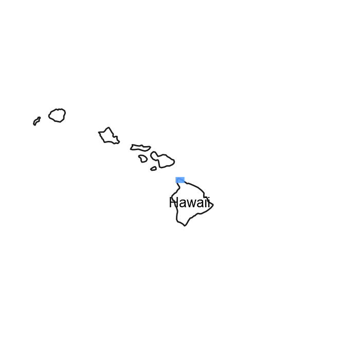
Figure 1. Mapped extent
Areas shown in blue indicate the maximum mapped extent of this ecological site. Other ecological sites likely occur within the highlighted areas. It is also possible for this ecological site to occur outside of highlighted areas if detailed soil survey has not been completed or recently updated.
MLRA notes
Major Land Resource Area (MLRA): 158X–Semiarid and Subhumid Low Mountain Slopes
MLRA 158 – Semiarid and Subhumid Low Mountain Slopes
This MLRA occurs in the State of Hawaii on the islands of Hawaii, Maui, Lanai, Molokai, Oahu, and Kauai. It consists primarily of nearly level to moderately steep slopes that are dissected in places by gulches. It occurs on leeward, drier sides of the older volcanoes within the Hawaiian Islands. Elevation ranges from sea level to 1600 feet (0 to 490 meters). Geology is largely highly weathered volcanic ash overlying basic igneous rocks. Alluvium derived from basic igneous rocks occurs in some areas. Average annual precipitation typically ranges from 10 to 30 inches (255 to 760 millimeters), rising to over 60 inches (1525 millimeters) in some areas, and mostly occurs from November through March. Much of the rainfall occurs in kona storms during winter. Average annual temperatures range from 69 to 76 degrees F (21 to 24 degrees C), with very little seasonal variation. Soils are mostly Oxisols, Mollisols, and Aridisols with isohyperthermic soil temperature regime and ustic or aridic (torric) soil moisture regimes. Native vegetation is rare and consists of species characteristic of dry forests or savannas, such as lama, koaia, wiliwili, ohe makai, and ulei. Naturalized grasses, such as buffelgrass and guineagrass, and trees, such as koa haole and kiawe, are common.
Classification relationships
This ecological site occurs within Major Land Resource Area (MLRA) 158 - Arid and Semiarid Low Mountain Slopes.
Ecological site concept
This ecological site is largely naturalized grassland at low elevations on the northwestern slope of Kohala on Hawaii, the northwestern slope of Haleakala and northern slope of West Maui on Maui, the central plateau of Lanai, multiple parts of Molokai, the central valley of Oahu, and the eastern lowlands of Kauai. Much of the area is or has been in intensive agriculture or has been developed. Principal landowners are large private land companies, ranches, and the State of Hawaii. It can be accessed on Hawaii along Route 270 from west of Hawi to Kapaau and along Route 250 from about 10 miles south of Hawi to Hawi. It is accessible on Maui along Baldwin Avenue between the coast and Makawao and along Route 340 around the northern coast of West Maui. On Lanai, examples can be seen south of Lanai City along Route 440 and northwest of Lanai City along the road to Garden of the Gods. On Molokai, it is accessed along Route 460 in the Maunaloa highlands and in the Hoolehua area. On Oahu, it is accessed mostly in the central valley between Waipio and Waialua along H2 and Routes 803 and 99. On Kauai, it is accessed between Koloa and the coast and along Route 51/56 between Lihue Airport and Anahola.
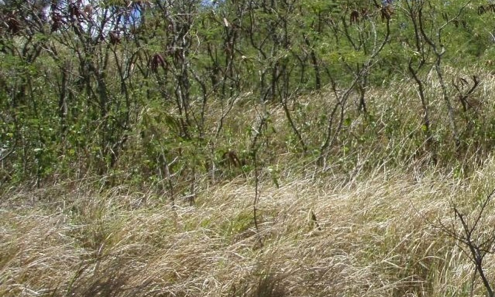
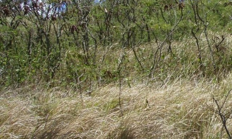
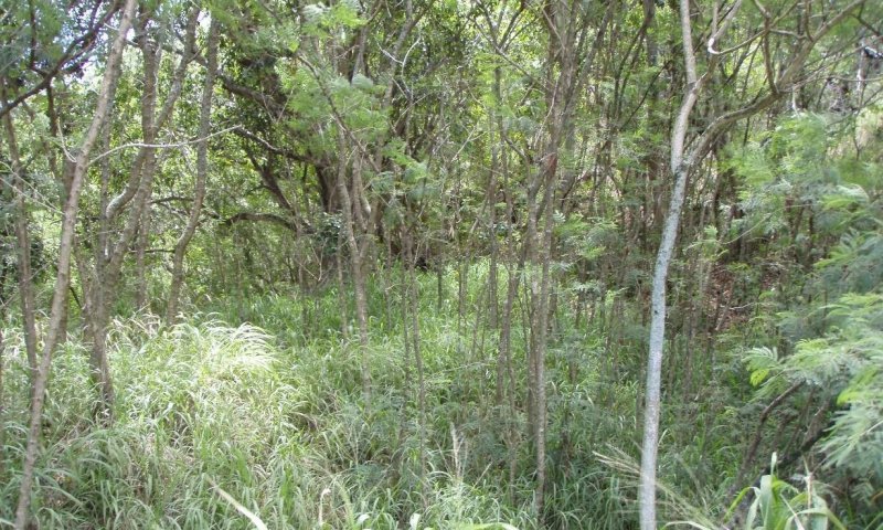
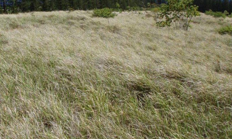
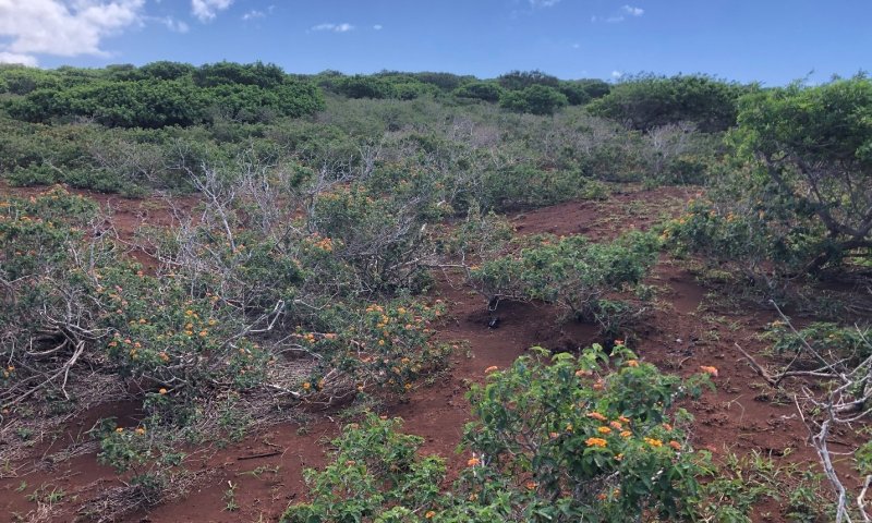
The central concept of the Isohyperthermic Ustic Naturalized Grassland is of well drained, moderately deep to very deep soils, most of which have mollic (high organic matter and base saturation), oxic (highly weathered, low fertility), or ultic (weathered, low base saturation) properties, and that formed in residuum, volcanic ash, or alluvium. Included are a shallow soil with andic (formed in young volcanic ash) properties and a deep soil with vertic (clayey, forming deep cracks when dry) properties. Annual air temperatures and rainfall are associated with very warm (isohyperthermic) to warm (isothermic), seasonally dry (ustic or ustic/aridic intergrade) soil conditions. Elevations range from sea level (0 meters) to about 2500 feet (770 meters). Because very little of the original native vegetation remains, the reference state of this ecological site consists of the dominant naturalized grassland vegetation. The dominant grass species is guineagrass (Urochloa maxima). Common naturalized trees are koa haole (Leucaena leucocephala) and christmasberry (Schinus terebinthifolius).
Associated sites
| VX160X01X007 |
Isothermic Ustic Naturalized Grassland The Isothermic Ustic Naturalized Grassland occurs only on Maui. It adjoins the high elevation boundary of the Isohyperthermic Ustic Naturalized Grassland on that island. The Isothermic Ustic Naturalized Grassland has a cooler soil temperature regime (isothermic), same soil moisture regime (ustic), lesser average annual rainfall (20 to 50 versus 30 to 60 inches), higher elevation range (700 to 5100 versus 0 to 2100 feet), similar but possibly more diverse native dry forest, and different dominant forage grass species (guineagrass and kikuyugrass versus guineagrass) compared to the Isohyperthermic Ustic Naturalized Grassland. Soils are nearly all Andisols rather than Mollisols, Oxisols, and Ultisols that occur in the Isohyperthermic Ustic Naturalized Grassland. |
|---|---|
| VX158X01X005 |
Naturalized Grassland 50 to 90 inch PZ Ohia lehua/kikuyugrass (Metrosideros polymorpha/Pennisetum clandestinum) The Naturalized Grassland, 50 to 90 Inch Precipitation Zone occurs on the islands of Kauai, Lanai, Molokai, Oahu, and Maui. It has cooler soils (isothermic and cooler part of isohyperthermic), moister soils (udic and moist ustic), greater average annual rainfall (50 to 90 versus 30 to 60 inches), and has kikuyugrass rather than guineagrass as the dominant forage grass species. Soils in the Naturalized Grassland, 50 to 90 Inch Precipitation Zone are primarily Andisols, Andic Inceptisols, and Ultisols rather than the Mollisols, Oxisols, and Ultisols of the Isohyperthermic Ustic Naturalized Grassland. |
| VX157X01X003 |
Rocky Volcanic Ash Savanna The Rocky Volcanic Ash Savanna is on the islands of Hawaii and Maui. It has the same soil temperature regime (isohyperthermic), same soil moisture regime (mostly torric), lower average annual rainfall (7 to 20 versus 15 to 30 inches), higher elevation range (0 to about 2200 feet), supports sparse native tree species rather than primarily shrubs and grasses, and has soil conditions that support the dominance of kiawe as the main introduced tree species compared to the Torric Naturalized Grassland. The ecological sites share buffelgrass as a potential dominant forage grass species. The soils in the Rocky Volcanic Ash Savanna are rockier and have finer subsoils than those in the Torric Naturalized Grassland. |
| VX158X01X002 |
Isohyperthermic Torric Naturalized Grassland Kiawe/buffelgrass (Prosopis pallida/Pennisetum ciliare) The Isohyperthermic Torric Naturalized Grassland is on the islands of Maui, Molokai, Lanai, and Kauai. It has the same soil temperature regime (isohyperthermic), a drier soil moisture regime (torric), lesser average annual rainfall (10 to 30 versus 30 to 60 inches), similar elevation range, and supports plant species that thrive in drier, hotter environments compared to the Rocky Volcanic Ash Savanna. The Isohyperthermic Torric Naturalized Grassland has buffelgrass as the dominant forage grass species, whereas guineagrass is dominant in most of the Isohyperthermic Ustic Naturalized Grassland. The soils in the Isohyperthermic Torric Naturalized Grassland are similar to those of Isohyperthermic Ustic Naturalized Grassland. |
Similar sites
| VX161A01X008 |
Isohyperthermic Ustic Naturalized Grassland The Ustic Naturalized Grassland occurs only on Hawaii. It has the same soil temperature regime, soil moisture regime, and rainfall as the Isohyperthermic Ustic Naturalized Grassland. However, it runs to higher elevations up to 2700 versus 2100 feet) and so has some cooler areas, and it has shallow and very shallow, relatively coarse soils formed in volcanic ash over pahoehoe, giving it less water-holding capacity and rooting depth than the Isohyperthermic Ustic Naturalized Grassland. The two ecological sites share guineagrass as the typical forage grass species. The Ustic Naturalized Grassland has koa and mamane trees which do not occur in the IJsohyperthermic Ustic Naturalized Grassland. |
|---|
Table 1. Dominant plant species
| Tree |
(1) Leucaena leucocephala |
|---|---|
| Shrub |
Not specified |
| Herbaceous |
(1) Urochloa maxima |
Legacy ID
R158XY401HI
Click on box and path labels to scroll to the respective text.
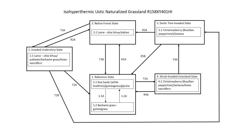
Ecosystem states
States 1, 5 and 2 (additional transitions)
| R1A | - | It may be possible to restore State 1 to a plant community resembling State 3 Native Forest. Weed control must be applied to forage species and the many opportunistic plant species that would invade the site. Weed control would be a perpetual process to maintain the site. Wildfire must be excluded by establishment and maintenance of a firebreak; domestic and feral ungulates must be excluded by a suitably designed and maintained fence or application of animal control measures. Extensive planting of native species would follow. |
|---|---|---|
| T1A | - | State 1 Reference transitions to State 4 Shrub Invaded Grassland with the gradual invasion of weedy shrubs and small trees which occur in the absence of disturbance such as fire or brush control. If the site contained abundant koa haole before abandonment, these small trees will overtop the guineagrass and greatly increase in abundance. This transition may be avoided through application of brush management and invasive plant species control. |
| T2A | - | State 2 Invaded Understory transitions to State 1 Reference by land clearing with heavy machinery followed up by invasive plant species control. Land clearing would probably promote germination of the weed seed bank in the soil, requiring additional weed control. After clearing and weed control, the site would be planted to forage species. |
| R2A | - | State 2 Invaded Understory may be restored to a facsimile of State 3 Native Forest, by removal of the introduced understory through application invasive plant species control. Reintroduction of native understory species is required. The site must be fenced securely or animal control measures implemented to exclude domestic and feral ungulates from the site. |
| T2B | - | State 2 Invaded Understory transitions to State 5 Exotic Tree Invaded by growth of introduced tree species through and above the native canopy. Lack of reproduction leads to gradual loss of most native tree species. This transition can be avoided by applying brush management and invasive plant species control. |
| T3B | - | State 3 Native Forest transitions to State 1 Reference by clearing the forest with heavy machinery and planting desirable forage species. Apply brush management and invasive plant species control as needed. |
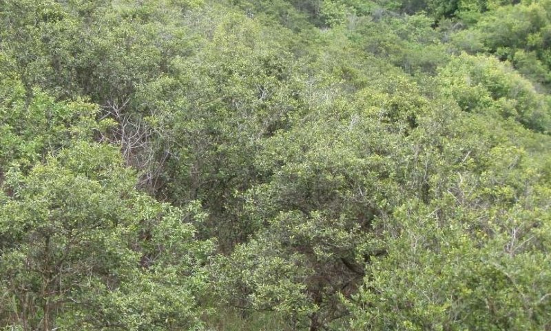
| T3A | - | State 3 Native Forest transitions to State 2 Invaded Understory through grazing, browsing, rooting, and trampling by domestic or feral ungulates (cows, sheep, deer, goats, and pigs). These activities destroy small native plant species and seedlings and saplings of large species. Regeneration of the native forest is prevented, leading to tree populations consisting almost entirely of mature plants. Lack of competition from native plants, introduction of weed seeds, and disturbance of the soil lead to an understory dominated by introduced plant species. Weeds can invade intact native forest even in the absence of ungulates and gradually bring about the transition. Invasive vines, shrubs, and small trees will grow under intact native canopies and begin to degrade the forest. Eventually, introduced grasses provide fine fuels that can carry wildfires that destroy the native tree canopy. This transition may be avoided by excluding domestic livestock and feral ungulates from the site with fencing or animal control measures and by implementing invasive plant species control. |
| R4A | - | State 4 Shrub Invaded Grassland can be restored to State 1 Reference by brush management with follow-up invasive plant species control of resprouting shrubs and emerging weedy forbs. Forage species may then be replanted and maintained by prescribed grazing. For large, densely weedy sites or if fast results are not required, it is possible to eliminate invasive small trees, shrubs, and undergrowth by planting glycine (Neonotonia wightii) to overtop and smother weeds; this is done in conjunction with foraging by sheep and goats to consume smaller weeds. Eventually, the dead trees and shrubs collapse under the weight of the glycine; the glycine is then eaten by livestock. This process takes about eight years (Gordon Cran, Kapapala Ranch, personal communication, 2006). |
| T4A | - | State 4 Shrub Invaded Grassland transitions to State 5 Exotic Tree Invaded in the absence of disturbances such as fire or brush control. Fast-growing introduced tree species invade Shrub Invaded Grassland and quickly overtop shrubs. This transition may be avoided with implementation of brush control and invasive plant species control. |
| R5B | - | State 5 Exotic Tree Invaded may be restored to State 1 Reference. Total clearing of the site would be necessary. If clearing is done by heavy machinery, soil disturbance would occur. This would probably induce germination of the weed seed bank and increase the potential for soil erosion. Invasive plant species control and brush management must then be applied multiple times to control new weed germination and resprouting. After clearing and weed control, the site would be planted to forage species. Domestic and feral ungulates must be excluded until forages are well established; prescribed grazing must then be applied. |
| R5A | - | It may be possible to restore State 5 Exotic Tree Invaded to a community resembling State 3 Native Forest. Total clearing of the site would be necessary. Alternatively, it may be worthwhile to kill taller weed species in place by herbicide applications in order to provide some shelter from the sun. If clearing is done by heavy machinery, soil disturbance would occur. This would induce germination of the weed seed bank and increase the potential for soil erosion. Invasive plant species control and brush management would be long-term. A firebreak must be created and maintained, and ungulates would have to be excluded by a suitable fence or by invasive species pest management. |
State 1 submodel, plant communities
| P1.1A | - | Community phase 1.1 converts to phase 1.2 by fire that reduces competitiveness of guineagrass and allows invasion of weeds, particularly undesirable grasses. Continuous grazing without adequate rest for preferred forages will have the same result. This conversion by either factor can be avoided if timely application of deferred and/or prescribed grazing is carried out to control guineagrass stature and to allow recovery of desirable species before weeds become dominant. |
|---|---|---|
| P1.2A | - | Community phase 1.2 can be converted to phase 1.1 by removing undesirable species and favoring and/or reestablishing desirable pasture species. If adequate stands of guineagrass remain, prescribed grazing may eventually effect the conversion. Pitted beardgrass and Natal red top have some value as forage. However, barbwire grass, Colombian bluestem, and broomsedge beardgrass are very unpalatable to livestock and therefore difficult to control by grazing. If pasture condition is very poor, weed control followed by reestablishment of guineagrass will be necessary. |