Ustic Fog Drip Forest
Scenario model
Current ecosystem state
Select a state
Management practices/drivers
Select a transition or restoration pathway
-
Transition T1A
State 1 Reference will transition to State 2 Invaded Understory through the activities of introduced ungulates such as cattle, pigs, goats, and sheep. These animals trample and consume the native understory of tree seedlings, grasses, shrubs, and vines and destroy the soil microbiotic crust by trampling. This opens the site to establishment of introduced grasses, forbs, and vines.
More details -
Restoration pathway R2A
State 2 Invaded Understory may be restored to State 1 Reference, or a facsimile of it, by a combination of fire protection, ungulate exclusion, weed control, and native plant reestablishment.
More details -
Transition T2B
State 2 Invaded Understory transitions to State 3 Naturalized Grassland mechanical clearing or by wildfire caused by lightning, arson, or vehicle catalytic converters. It can also make this transition gradually as mature trees die off when their reproduction is suppressed due to browsing, trampling, competition from dense stands of introduced grasses and herbs, or smothering by Cape-ivy.
More details -
Transition T2A
State 2 Invaded Understory transitions to State 4 Denuded when large numbers of introduced mouflon (Ovis orientalis orientalis) and feral sheep are present. They are capable of stripping this ecological site of nearly all vegetation if their numbers are not controlled by hunting. Intensive hunting from helicopters has been necessary at times.
More details -
Restoration pathway R3A
State 3 Naturalized Grassland may gradually restore itself to State 2 Invaded Understory on sites that still contain moderate native tree cover. Removal of ungulates and absence of fire would allow some reproduction of native trees, resulting in an open forest with a weedy, overgrown herbaceous understory.
More details -
Restoration pathway R4A
Removal of mouflon and feral sheep by shooting and fencing allows any existing seed bank to regrow. Replanting of native tree and shrub species may be necessary.
More details -
No transition or restoration pathway between the selected states has been described
Target ecosystem state
Select a state
State 1
Reference State


Description
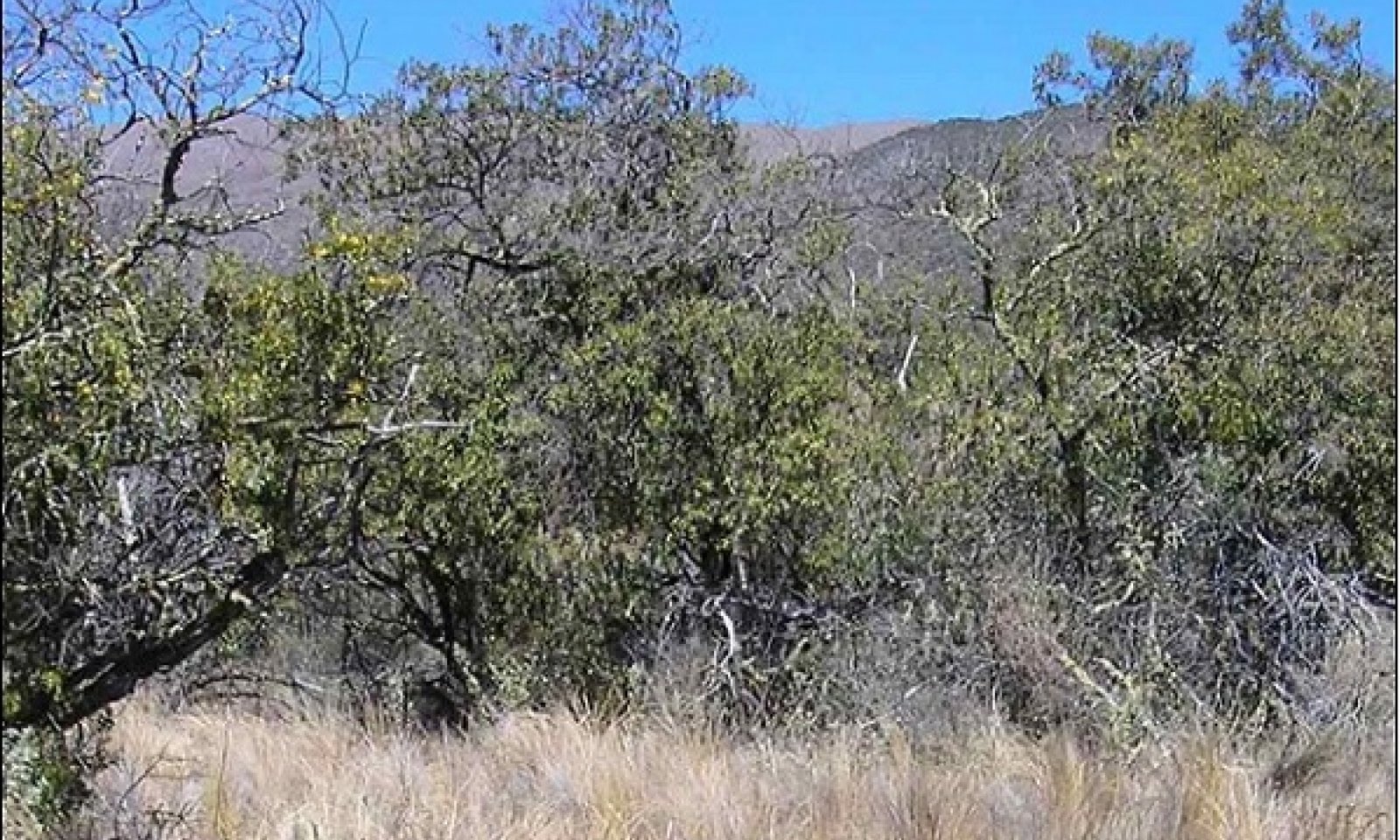
This state consists of one community phase. Tree cover is somewhat clumped. Open areas between clumps are dominated by bunchgrasses or shrub thickets. These forests have standing live timber of 100 to 400 cubic feet per acre, with a representative value of about 300 cubic feet per acre; these estimates may be conservative. Few mountain sandalwood trees remain due to extensive harvesting in the early 19th century. Akoko or alpine sandmat (Chamaesyce olowaluana) and mountain pilo or alpine mirrorplant (Coprosma montana) trees are browsed heavily by ungulates. It is likely that their former size and abundance are greatly underestimated in our data. Long-term vegetation plots in this ecological site that are securely fenced against ungulates contain much more abundant and diverse native vegetation, and going to higher elevations, than outside the plots.
Submodel
State 2
Invaded Understory State


Description
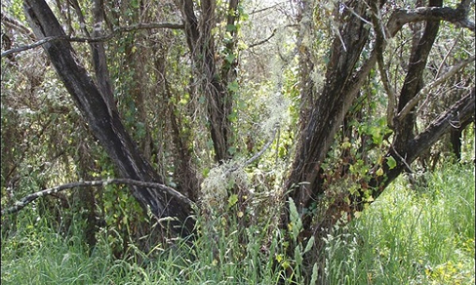
This state is comprised of one community phase. Most native bunchgrasses, vines, shrubs, tree seedlings and saplings, and microbiotic crusts have been destroyed by ungulates and by competition from introduced plant species. They have been replaced by a dense cover of introduced grasses and forbs and patches of bare soil. Tree abundance is still high but lower than in the Reference State because tree reproduction has been impeded for many years. Native tree diversity is lower than in the Reference State.
With ungulate exclusion and weed control, this state can be restored to State 1 Reference State. With continued managed livestock grazing and protection from feral ungulates, it will gradually transition to State 3 Naturalized Grassland. With exposure to large numbers of feral ungulates, it will transition to State 4 Denuded.
Submodel
State 3
Naturalized Grassland State


Description
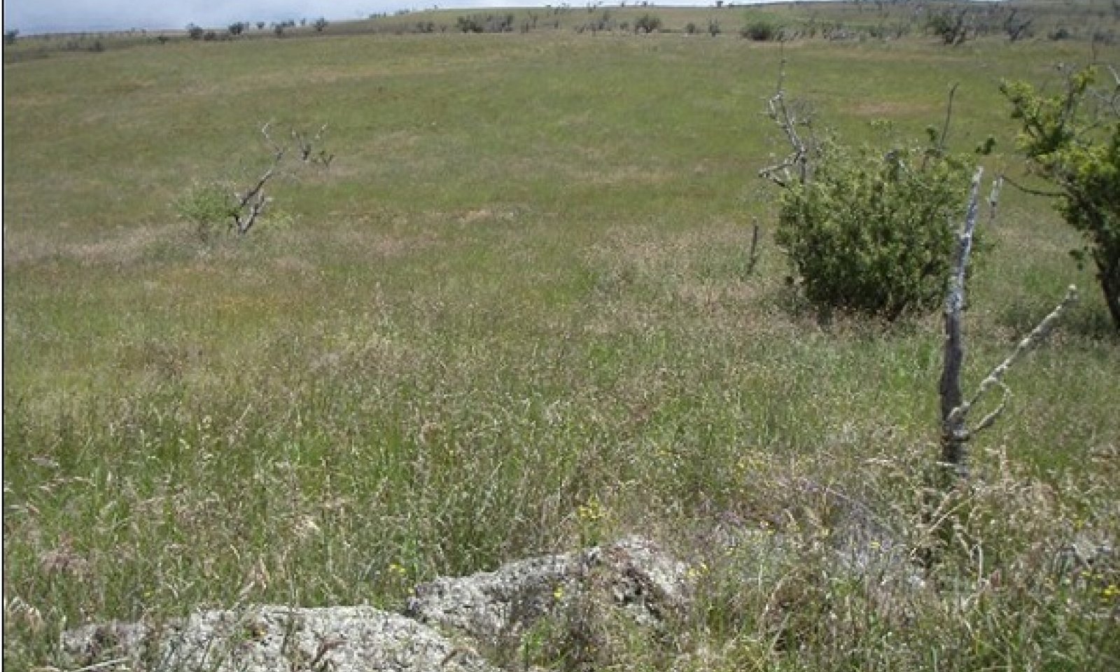
This state is comprised of three community phases. An open canopy of remnant native trees may be present. Reduced or absent tree cover results in stronger surface winds, more intense solar radiation reaching the soil surface, and reduced or nonexistent fog interception and throughfall.
Introduced, perennial, cool-season (C3) grass species with high forage value dominate this state under good grazing management. Continuous grazing that does not allow the favored forage species time to recover from defoliation or to reproduce from seed results in shifting to phases that contain increased abundance of cool-season perennial grass species of lower value forage value, annual grasses, and weedy forbs.
Still heavier grazing pressure and summer grazing results in an increase of kikuyugrass (Pennisetum clandestinum) cover, which is more tolerant of heavy defoliation and loss of reproductive parts than cool-season bunchgrasses such as common velvetgrass (Holcus lanatus) and orchardgrass (Dactylis glomerata). Kikuyugrass is a desired forage species in some other ecological sites. However, in this ecological site this warm-season (C4) species does not grow particularly well. At lower elevations of this ecological site, kikuyugrass can be a fair forage, particularly during extended dry climate cycles that inhibit growth of other forages. At higher elevations, kikuyugrass increases in cover but has low vigor.
Application of prescribed grazing and weed control measures can the condition of community phases that have been degraded. In some cases, reseeding of desired cool-season grasses may be worthwhile.
Submodel
Description
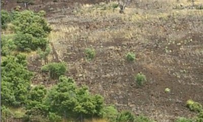
This state consists of one community phase. It results from long-term grazing and browsing by feral and mouflon sheep. Mouflon were introduced on Mauna Kea in the 1960s as a game animal and increased rapidly in numbers. Uncontrolled destruction of vegetation resulted in large areas of higher elevations of Mauna Kea becoming nearly devoid of vegetation. Intensive control of these animals allowed recovery of the vegetation over a period of 30 to 40 years in areas where a sufficient seed bank still existed in the soil. Some areas were actively replanted with native species.
Submodel
Mechanism
State 1 Reference will transition to State 2 Invaded Understory through the activities of introduced ungulates such as cattle, pigs, goats, and sheep. These animals trample and consume the native understory of tree seedlings, grasses, shrubs, and vines and destroy the soil microbiotic crust by trampling. This opens the site to establishment of introduced grasses, forbs, and vines.
Mechanism
State 2 Invaded Understory may be restored to State 1 Reference, or a facsimile of it, by a combination of fire protection, ungulate exclusion, weed control, and native plant reestablishment.
Mechanism
State 2 Invaded Understory transitions to State 3 Naturalized Grassland mechanical clearing or by wildfire caused by lightning, arson, or vehicle catalytic converters. It can also make this transition gradually as mature trees die off when their reproduction is suppressed due to browsing, trampling, competition from dense stands of introduced grasses and herbs, or smothering by Cape-ivy.
Mechanism
State 2 Invaded Understory transitions to State 4 Denuded when large numbers of introduced mouflon (Ovis orientalis orientalis) and feral sheep are present. They are capable of stripping this ecological site of nearly all vegetation if their numbers are not controlled by hunting. Intensive hunting from helicopters has been necessary at times.
Mechanism
State 3 Naturalized Grassland may gradually restore itself to State 2 Invaded Understory on sites that still contain moderate native tree cover. Removal of ungulates and absence of fire would allow some reproduction of native trees, resulting in an open forest with a weedy, overgrown herbaceous understory.
Model keys
Briefcase
Add ecological sites and Major Land Resource Areas to your briefcase by clicking on the briefcase (![]() ) icon wherever it occurs. Drag and drop items to reorder. Cookies are used to store briefcase items between browsing sessions. Because of this, the number of items that can be added to your briefcase is limited, and briefcase items added on one device and browser cannot be accessed from another device or browser. Users who do not wish to place cookies on their devices should not use the briefcase tool. Briefcase cookies serve no other purpose than described here and are deleted whenever browsing history is cleared.
) icon wherever it occurs. Drag and drop items to reorder. Cookies are used to store briefcase items between browsing sessions. Because of this, the number of items that can be added to your briefcase is limited, and briefcase items added on one device and browser cannot be accessed from another device or browser. Users who do not wish to place cookies on their devices should not use the briefcase tool. Briefcase cookies serve no other purpose than described here and are deleted whenever browsing history is cleared.
Ecological sites
Major Land Resource Areas
The Ecosystem Dynamics Interpretive Tool is an information system framework developed by the USDA-ARS Jornada Experimental Range, USDA Natural Resources Conservation Service, and New Mexico State University.


