Major Land Resource Area 222X
Southern Alaska Coastal Mountains
Accessed: 04/10/2026
Description
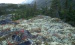
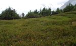
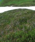
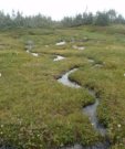
This area is in the Southern Alaska Region and includes the higher elevations of the Coast, St. Elias, Chugach, and Kenai Mountains. The area makes up about 26,335 square miles. The terrain consists of steep, rugged, high-relief mountains. Glaciers and ice fields make up about 54 percent of the area. Unglaciated portions of the area are deeply incised with narrow to broad valleys. Flood plains and stream terraces on valley floors rapidly give rise to steep alluvial fans and mountain footslopes. Elevation ranges from sea level at the base of tidewater glaciers and ice fields to 18,008 feet at the summit of Mt. St. Elias (USDA 2006). During the Pleistocene epoch, the area was covered with glacial ice. As the glacial ice melted, sediments were deposited by the melting ice. However, most of the original glacial deposits have eroded away or have been buried by colluvium and slope alluvium, which covers more than 90 percent of the present unglaciated landscape. The remaining glacial and glaciofluvial deposits and recent fluvial deposits are generally restricted to the bottoms of the larger valleys. Paleozoic, Mesozoic, and Lower Tertiary stratified sedimentary rocks, and occasionally Paleozoic intrusive rocks, underlie much of the area and are exposed on steep mountain slopes and ridges (USDA 2006). Miscellaneous (non-soil) areas make up more than 90 percent of this MLRA. The most common miscellaneous areas are rock outcrop, rubble land, chutes, and glaciers. The dominant soil orders in this area are Spodosols and Histosols. The soils in the area have a cryic soil temperature regime or a subgelic soil temperature class, a udic or aquic soil moisture regime, and mixed or amorphic mineralogy (USDA 2006). The vegetation of this area lies in the true alpine life zone. Alpine vegetation consists of a variety of dwarf scrub and herbaceous communities. Willow scrub is common in drainages. Lichens, scattered herbs, and dwarf shrubs dominate bedrock exposures and very shallow soils. In general, there is little or no plant growth at elevations above about 7,500 feet (USDA 2006). At lower elevations, subalpine vegetation consists of a variety of mountain hemlock and tall scrub communities. These subalpine plant communities typically occur at elevations between 1500 to 3000 feet (Boggs et al. 2010, Carstensen 2007, Jaques 1983; Martin et al. 1995). The switch to subalpine vegetation marks the transition to the Alexander Archipelago-Gulf of Alaska Coast Area. The area is almost entirely undeveloped wild land. Remote wild-land recreation is the principal land use in this area. The rugged, high mountains, extensive glaciers and ice fields, and wilderness qualities of the area attract visitors from around the world. Small rural communities along the road system are the only permanent settlements. Part of the Wrangell-St. Elias Bay National Park and Preserve, the Glacier Bay National Park and Preserve, the Misty Fjords National Monument, the Chugach National Forest, and the Tongass National Forest are in this MLRA.
Key publications
Next steps
-
1
Select an ecological site
Select an ecological site using the list, keys, photos, briefcase, or quick search option located on this page. -
2
Explore the ecological site description
Next, learn more about the selected ecological site and its characteristic dynamics by browsing the ecological site description and exploring alternative state and transition model formats.