Natural Resources
Conservation Service
Ecological site R227XY205AK
Loamy Flood Plain, Wet
Accessed: 01/22/2026
General information
Provisional. A provisional ecological site description has undergone quality control and quality assurance review. It contains a working state and transition model and enough information to identify the ecological site.

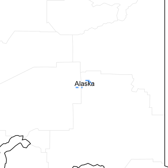
Figure 1. Mapped extent
Areas shown in blue indicate the maximum mapped extent of this ecological site. Other ecological sites likely occur within the highlighted areas. It is also possible for this ecological site to occur outside of highlighted areas if detailed soil survey has not been completed or recently updated.
Table 1. Dominant plant species
| Tree |
(1) Picea glauca |
|---|---|
| Shrub |
(1) Salix reticulata |
| Herbaceous |
(1) Carex aquatilis |
Physiographic features
: This site consists of level to, on rare occasions, strongly sloping flood plains formed in stratified sandy and silty alluvium over very gravelly and cobbly alluvium along clear water rivers and streams. Terrace height above mean summer channel level is typically 3 feet (0.9 m) or less and the site is frequently to occasionally flooded. Throughout most of the growing season, the water table remains at or near the surface; ponded areas are common. Elevation is generally from 2400 to 2900 feet (732 to 884 m).
In the Gulkana River area, this site occurs primarily along the upper Middle Fork and in scattered locations along the Main Stem between Paxson Lake and the Middle Fork confluence and along the upper North Branch. This site likely occurs along low to moderate gradient reaches of other non-glacial streams and rivers elsewhere in the Copper River basin.
Table 2. Representative physiographic features
| Landforms |
(1)
Flood plain
|
|---|---|
| Flooding duration | Long (7 to 30 days) |
| Flooding frequency | Occasional |
| Elevation | 732 – 884 m |
| Slope | 0 – 5% |
| Water table depth | 0 – 61 cm |
| Aspect | Aspect is not a significant factor |
Climatic features
The subarctic continental climate of this site is characterized by long cold winters and short warm summers. Mean January temperature is -2 °F.; mean July temperature is 54 °F. Mean annual precipitation ranges from 15 to 21 inches. Annual snowfall ranges from 54 to 102 inches. The frost-free season is about 60 to 80 days (28 °F. base temperature). The growing season varies greatly from year to year and frosts can occur during any summer month.
Table 3. Representative climatic features
| Frost-free period (average) | 80 days |
|---|---|
| Freeze-free period (average) | 0 days |
| Precipitation total (average) | 533 mm |
Figure 2. Monthly average minimum and maximum temperature
Influencing water features
Soil features
: The weakly developed soils on this site have a mantle of stratified sandy and silty alluvium less than 10 to as much as 37 inches (25 to 94 cm) thick over very gravelly and cobbly alluvium. The surface organic mat ranges from 0 to occasionally as much as 13 inches ( 0 to 33 cm). Depth to seasonal high water table ranges from 0 to 18 inches (0 to 46 cm) and the soils are poorly to very poorly drained. During most years, the water table is at or near the surface during much of the growing season and ponded areas are common. Aquic conditions including redox depletions and/or a reduced matrix are present within 10 inches (25 cm) of the mineral surface.
Table 4. Representative soil features
| Surface texture |
(1) Fine sandy loam (2) Sandy loam |
|---|---|
| Soil depth | 152 cm |
| Available water capacity (0-101.6cm) |
0.05 – 0.46 cm |
Ecological dynamics
This site occurs in areas on the flood plains that are consistently wet because of flooding, infiltration of ground water, shallow water table, and ponding associated with dam building by beavers. Soils include both those that are very shallow to gravel and cobble (Tangoe soils) as well as those with a moderately thick to thick surface layer of stratified sandy and silty alluvium (Swedna soils). The key factor appears to be the nearly continuous occurrence of the shallow water table. On slightly elevated or otherwise better drained microsites, Carex aquatilis decreases in abundance and is replaced by Calamagrostis canadensis, Arctagrostis latifolia, and other herbs common to the flood plains. Immediately adjacent to the river channel, beaver ponds, and other areas of ponded water, the willow shrub layer becomes more open and patchy and the vegetation is totally dominated by Carex aquatilis and other tall, bright green sedges.
This site probably is rarely burned by wild fire because of wet conditions. Even during the dry summer of 1994, a shallow water table and ponded conditions were found throughout this site. If the vegetation were burned, the willow and herbaceous cover would be expected to rapidly regeneration from sprouting by root crowns and other underground plant parts.
State and transition model

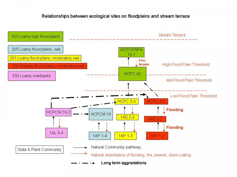
More interactive model formats are also available.
View Interactive Models
More interactive model formats are also available.
View Interactive Models
Click on state and transition labels to scroll to the respective text
Ecosystem states
State 1 submodel, plant communities
State 2 submodel, plant communities
State 1
Low willow-water sedge scrub
Community 1.1
Low willow-water sedge scrub
Low willow/water sedge scrub consists of occasionally open to closed willow 2 to 4 feet (0.6 to 1.2 m) in height, with a moderately open to closed layer of water sedge in the understory. Ponded water is common to well-represented on the ground surface. Shrub canopy cover typically ranges from 50 to 90 percent, although it is frequently less in stands transitional to the sedge-grass riparian meadow cover type. Dominant willows include Salix planifolia and S. barclayi. Other shrubs are relatively unimportant except for Potential fruticosa, which is common in most stands. Canopy cover of the herbaceous layer is variable but usually ranges from 50 to over 75 percent. Carex aquatilis is the dominant herb; other herbs are usually of minor importance. Frequently occurring species include Calamagrostis canadensis, Potential palustris, and Salix reticulata and Rubus arcticus on slightly elevated microsites. Aquatic mosses are usually abundant in low microsites. Setting Distribution and extent: river corridor; primarily the upper Middle Fork, occasional on the lower Middle Fork and Main Stem north of Canyon Rapids; moderate extent Elevation: 2,350 to 2,900 feet (716 to 884 m) Landforms: level to occasionally moderately sloping flood plains; terrace height generally less than about 5 feet (less than about 1.5 m) Principal soils: Swedna, high elevation; Hisna; and Tangoe, wet, frequently flooded Depth to seasonally high water table: 0 to 20 inches (0 to 51 cm); extensive ponding during much of the growing season Flooding frequency: frequent to occasional Successional Status Low willow/water sedge scrub is generally too wet for tree growth. Where it occurs, this cover type is presumably potential vegetation. Towards the wet extreme of the type, Low willow/water sedge is transitional to Sedge-grass riparian meadow. Willow canopy cover drops to as little as 25 percent and the distinction between the scrub and meadow types becomes arbitrary. In many places, site conditions favorable to Low willow/water sedge scrub appear to be maintained by beaver activity. Elsewhere, conditions are maintained by proximity to the river channel. A change in beaver activity or down-cutting or migration of the channel improves drainage and could cause a succession of the vegetation toward Low willow/herb scrub. Riparian-Wetland Classification: Palustrine scrub-shrub, semi-permanently flooded, mineral (Cowardin et al. 1979); riparian
Table 5. Ground cover
| Tree foliar cover | 1-15% |
|---|---|
| Shrub/vine/liana foliar cover | 1-85% |
| Grass/grasslike foliar cover | 1-80% |
| Forb foliar cover | 1-15% |
| Non-vascular plants | 1-90% |
| Biological crusts | 0% |
| Litter | 1-70% |
| Surface fragments >0.25" and <=3" | 0% |
| Surface fragments >3" | 0% |
| Bedrock | 0% |
| Water | 0% |
| Bare ground | 1-5% |
State 2
Sparsely vegetated alluvium
Community 2.1
Sparsely vegetated alluvium
Additional community tables
Interpretations
Animal community
Beaver activity is extensive on this site. In many places, the shallow water table and ponded conditions appear to be partly if not entirely attributed to dam building. Often, the beaver dams themselves form the escarpment breaks between different terrace levels. Channels between ponds appear to maintained and possibly created by beavers.
At certain times of the year, this site undoubtedly provides excellent feeding habitat for moose. Willow in most stands is moderately hedged, primarily from winter browsing. Sedges and other herbaceous vegetation are likely used to some extent in spring and early summer. Ducks, swans, and a variety of other birds use this site for feeding, nesting, hunting, and other activities.
Supporting information
Contributors
Michelle Schuman
Rangeland health reference sheet
Interpreting Indicators of Rangeland Health is a qualitative assessment protocol used to determine ecosystem condition based on benchmark characteristics described in the Reference Sheet. A suite of 17 (or more) indicators are typically considered in an assessment. The ecological site(s) representative of an assessment location must be known prior to applying the protocol and must be verified based on soils and climate. Current plant community cannot be used to identify the ecological site.
| Author(s)/participant(s) | |
|---|---|
| Contact for lead author | |
| Date | |
| Approved by | |
| Approval date | |
| Composition (Indicators 10 and 12) based on | Annual Production |
Indicators
-
Number and extent of rills:
-
Presence of water flow patterns:
-
Number and height of erosional pedestals or terracettes:
-
Bare ground from Ecological Site Description or other studies (rock, litter, lichen, moss, plant canopy are not bare ground):
-
Number of gullies and erosion associated with gullies:
-
Extent of wind scoured, blowouts and/or depositional areas:
-
Amount of litter movement (describe size and distance expected to travel):
-
Soil surface (top few mm) resistance to erosion (stability values are averages - most sites will show a range of values):
-
Soil surface structure and SOM content (include type of structure and A-horizon color and thickness):
-
Effect of community phase composition (relative proportion of different functional groups) and spatial distribution on infiltration and runoff:
-
Presence and thickness of compaction layer (usually none; describe soil profile features which may be mistaken for compaction on this site):
-
Functional/Structural Groups (list in order of descending dominance by above-ground annual-production or live foliar cover using symbols: >>, >, = to indicate much greater than, greater than, and equal to):
Dominant:
Sub-dominant:
Other:
Additional:
-
Amount of plant mortality and decadence (include which functional groups are expected to show mortality or decadence):
-
Average percent litter cover (%) and depth ( in):
-
Expected annual annual-production (this is TOTAL above-ground annual-production, not just forage annual-production):
-
Potential invasive (including noxious) species (native and non-native). List species which BOTH characterize degraded states and have the potential to become a dominant or co-dominant species on the ecological site if their future establishment and growth is not actively controlled by management interventions. Species that become dominant for only one to several years (e.g., short-term response to drought or wildfire) are not invasive plants. Note that unlike other indicators, we are describing what is NOT expected in the reference state for the ecological site:
-
Perennial plant reproductive capability:
Print Options
Sections
Font
Other
The Ecosystem Dynamics Interpretive Tool is an information system framework developed by the USDA-ARS Jornada Experimental Range, USDA Natural Resources Conservation Service, and New Mexico State University.
Click on box and path labels to scroll to the respective text.