Natural Resources
Conservation Service
Ecological site R230XY610AK
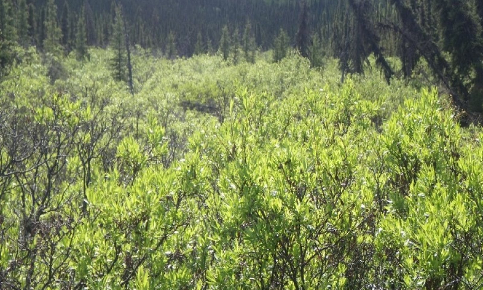
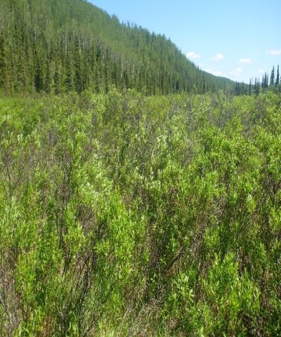
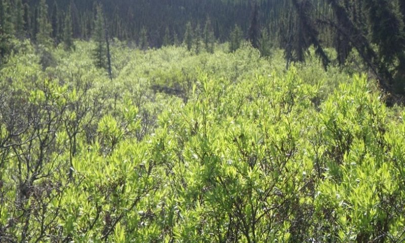
Boreal Scrub Silty Frozen Drainages
Last updated: 6/11/2025
Accessed: 04/10/2026
General information
Provisional. A provisional ecological site description has undergone quality control and quality assurance review. It contains a working state and transition model and enough information to identify the ecological site.
MLRA notes
Major Land Resource Area (MLRA): 230X–Yukon-Kuskokwim Highlands
The Yukon-Kuskokwim Highlands (MLRA 230X) include the most western parts of Interior Alaska (Land Resource Region X2) and have a continental climate. MLRA 230X is approximately 42,300 square miles spread across mountain, hills, and valleys. Flood plain systems are common. The watershed drains into the Bering Sea to the west and Bristol Bay to the southwest. Major rivers include the Yukon, Innoko, Kuskokwim, Mulchatna, and Nushagak Rivers. This sparsely populated area is mostly undeveloped wildland. Residents use this remote area primarily for subsistence hunting, fishing, and gathering. Villages are primarily located along rivers along the MLRA 230X boundary and include Greyling, Nulato, and Koyukuk. Federally managed lands in the MLRA include parts of Innoko, Nowitna, and Koyukuk National Wildlife Refuges.
Geology and Soils
The Yukon-Kuskokwim Highlands MLRA was mostly unglaciated during the Pleistocene. Glaciers were limited to the Lime Hills in the southeast. Glacial moraines and drift are evident in areas of past glacial activity. Unglaciated upland areas are covered with colluvium and slope alluvium originating from bedrock. Loess deposits cover gentle sloping hills and footslopes of mountains near major rivers. Bedrock material is primarily sedimentary rocks with intrusive volcanic rock (USDA, 2022).
This MLRA is in the zone of discontinuous permafrost. Permafrost is most common in finely textured soils on terraces, gently sloping hills, and cold mountain footslopes. It is typically absent from flood plains and mountain backslopes. Across the MLRA, permafrost presence decreases as proximity to the Yukon-Kuskokwim delta increases.
The dominant soil orders are Gelisols, Entisols, Inceptisols, and Spodosols. Gelisols support shallow to deep permafrost and often have a perched water table for at least part of the growing season. Inceptisols, Spodosols, and Entisols lack permafrost. Two important factors that prevent permafrost aggradation are groundwater connectivity and thick bands of sandy and/or gravelly soil horizons. Inceptisols have minimal development and are common on alpine scrublands and high flood plains. Entisols are common on mountain backslopes and scoured flood plains. Spodosols support a spodic soil horizon and are common in the acidic soils underlying spruce forests and ericaceous shrublands. Non-soil areas such as rock outcrops, rubble lands and beaches make up approximately ten percent of the MLRA surface.
Climate
The Yukon-Kuskokwim Highlands MLRA has short, warm summers and cold, long winters. Mean annual precipitation is 10 to 15 inches at low elevations and increases to 20 to 40 inches at higher elevations (USDA, 2022). Annual snowfall is between 80 and 100 inches. Mean annual temperatures ranges from 25 to 32 degrees F (SNAP, 2014a; SNAP, 2014b).
Vegetation
Vegetation is mainly influenced by site and soil characteristics such as temperature-degree days, exposure, soil depth, and soil hydrology. Dwarf scrublands are prevalent on shallow soils on convex slopes and in the alpine. Mesic, lowland slopes are a mix of forests and shrublands of alder, willow, and ericaceous shrubs. Cold slopes generally support black spruce, while warm slopes support white spruce. Valley bottoms and steep slopes support a deciduous forest. Tussock tundra is associated with wet soils underlain by shallow permafrost and is ubiquitous across the lower footslopes of mountains and the coastal plain (USDA, 2022).
Fire
Fire is a major disturbance across the Yukon-Kuskokwim Highlands. Low severity fires destroy the canopy but leave the organic mat and rootstock mostly undisturbed. The vegetative community progresses directly back to a forest. Severe forest fires are stand replacement events. Post-first communities typically pass through an herbaceous meadow community before ericaceous shrubs, birch, and willows colonize. Drier soils may support a deciduous aspen or birch forest, while moist soils support cottonwoods and spruce. On all forest and woodland ecological sites, post-fire succession leads to a relatively rapid accumulation of organic matter and mosses on the surface. This accumulation results in decreases in soil temperature, biologic activity, and nutrient availability and a gradual decrease in site productivity.
LRU notes
MLRA 230X contains three life zones defined by the physiological limits of plant communities along an elevational gradient. The boreal life zone is the elevational band where forest communities dominate. Non-forested areas in the boreal life zone are often hydrologically driven, and are either too wet (i.e., bogs) or too dry (i.e., river bluffs) to support forest communities. Subalpine and alpine vegetation dominates at higher elevations. The subalpine zone is a transitional band between the boreal and the alpine life zones, and is characterized by sparse, stunted trees. Shrub height can be over four feet. Trees are absent from the alpine, and all shrubs are dwarf or prostrate. In general, the boreal life zone occurs below 1,200 feet; the subalpine life zone occurs between 1,200 and 1,600 feet; and the alpine life zone occurs above 1,600 feet.
Within each life zone, there are plant assemblages associated with cold and warm slopes. Slope temperature is a factor of slope steepness, aspect, and shading from surrounding ridges and mountains. Warm slopes occur on southeast to west aspects that are moderate to very steep and are not shaded by the surrounding landscape. Cold slopes occur on northwest to east facing slopes, occur in shaded slope positions, or occur in low-lying areas that are cold air sinks. Examples of shaded positions include head slopes, low relief backslopes of hills, and the base of hills and mountains shaded by adjacent mountain peaks. Warm boreal slopes have a cryic soil temperature regime and lack permafrost. White spruce forests are an indicator of warm boreal slopes. Cold boreal slope soils have a gelic soil temperature regime and commonly have permafrost. In this area, black spruce forests and woodlands are an indicator of cold boreal slopes.
Classification relationships
Alaska Vegetation Classification:
Closed tall scrub (I.A.3 - level III) / Closed tall shrub swamp (II.B.1.f - level IV)
(Viereck et al., 1992)
Circumboreal Vegetation Map:
Western North American Boreal Deciduous Shrub Swamp
(Jorgensen and Meidinger, 2015)
BioPhysical Settings:
7316240 – Western North American Boreal Deciduous Shrub Swamp
(Landfire, 2009)
Ecological site concept
Ecological Site characteristics:
• Occurs in the boreal life zone in drainages on hills and plains
• These very deep soils have permafrost at moderately deep depths
• Soils formed in alluvium and are capped with approximately 9-inches of organic material
• Soils flood and pond. These very poorly drained soils have a surface water table throughout the growing season
• The reference plant community is a tall willow scrubland with graminoids, forbs, and mosses dominating the understory
• Hydrologic influences support one community in the reference state
Associated sites
| F230XY611AK |
Boreal Forest Loamy Frozen Slopes Ecological site F230XY611AK describes black spruce forests on cold, forested slopes. Ecological site 610 occurs in slope drainages, which are interspersed among the black spruce forest. |
|---|---|
| F230XY612AK |
Boreal Forest Loamy Slopes Ecological site F230XY612AK describes white spruce forest on warm slopes. Ecological site 610 occurs in slope drainages, which are interspersed among the white spruce forest. |
| R230XY620AK |
Boreal Peat Frozen Flats Complex R230XY620AK describes the tussock tundra. Ecological site 610 describes frozen drainages that pass through the tussock tundra. |
Similar sites
| F230XY613AK |
Boreal Forest Loamy Moist Slopes F230XY613AK and R230XY610AK share similar willow shrublands vegetation in the reference state. R230XY610 contains permafrost and a flooding regime that exclude trees that are common in F230XY613AK. |
|---|
Table 1. Dominant plant species
| Tree |
Not specified |
|---|---|
| Shrub |
(1) Salix pulchra |
| Herbaceous |
(1) Calamagrostis canadensis |
Click on box and path labels to scroll to the respective text.