
Natural Resources
Conservation Service
Ecological site R236XY107AK
Western Alaska Maritime Scrub Gravelly Drainages
Last updated: 2/13/2024
Accessed: 02/09/2026
General information
Provisional. A provisional ecological site description has undergone quality control and quality assurance review. It contains a working state and transition model and enough information to identify the ecological site.

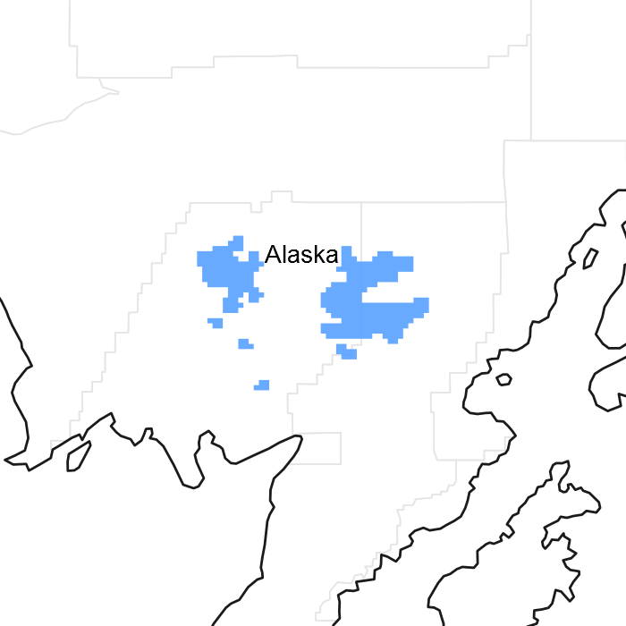
Figure 1. Mapped extent
Areas shown in blue indicate the maximum mapped extent of this ecological site. Other ecological sites likely occur within the highlighted areas. It is also possible for this ecological site to occur outside of highlighted areas if detailed soil survey has not been completed or recently updated.
MLRA notes
Major Land Resource Area (MLRA): 236X–Bristol Bay-Northern Alaska Peninsula Lowlands
MLRA 236 is in the western region of Alaska. It covers approximately 19,575 square miles and extends inland from Bristol Bay. It is defined by an expanse of nearly level to rolling lowlands, uplands, and low to moderate hills bordered by long footslopes of mountains. The climate near the coast is dominantly maritime, but the weather systems of Interior Alaska may have a strong influence on inland areas. The entire MLRA was covered by glacial ice during the early to middle Pleistocene. MLRA 236 is dominantly sparsely populated, undeveloped wildland. The communities of Dillingham and King Salmon and other villages are in the MLRA.
Ecological site concept
Information about the ecological site concept is in the "Ecological Dynamics" section.
This report provides baseline inventory data for the vegetation in this ecological site. Future data collection is needed to provide further information about existing plant communities and the disturbance regimes that would result in transitions from one community to another.
Similar sites
| R236XY109AK |
Subarctic Low Scrub Peat Drainages Ecological site R236XY107AK commonly is at higher elevations that have steeper slopes than site R236XY109AK (Western Alaska Maritime Graminoid Peat Drainages). Site R236XY109AK is in drainageways that are wider than 10 meters, and site R236XY107AK commonly is in drainageways that are much narrower. This contributes to differences in the natural drainage class of the soils and the frequency and duration of ponding, leading to distinctly different reference states and community phases. |
|---|---|
| R236XY136AK |
Subarctic Low Scrub Loamy Plain Drainages Site R236XY136AK (Western Alaska Maritime Scrub Loamy Drainages) is in lowland drainageways that have steep surrounding slopes (more than 10 percent). The slopes surrounding site R236XY107AK typically are less steep. Site R236XY136AK is correlated to soils mapped at the Order 2 level of intensity, and site R236XY107AK is correlated to soils mapped at the Order 3 level of intensity. The scale of mapping affects how landscapes and landforms are defined and described in terms of soils, plant communities, and land uses, making it necessary to describe the ecological sites differently. |
Table 1. Dominant plant species
| Tree |
Not specified |
|---|---|
| Shrub |
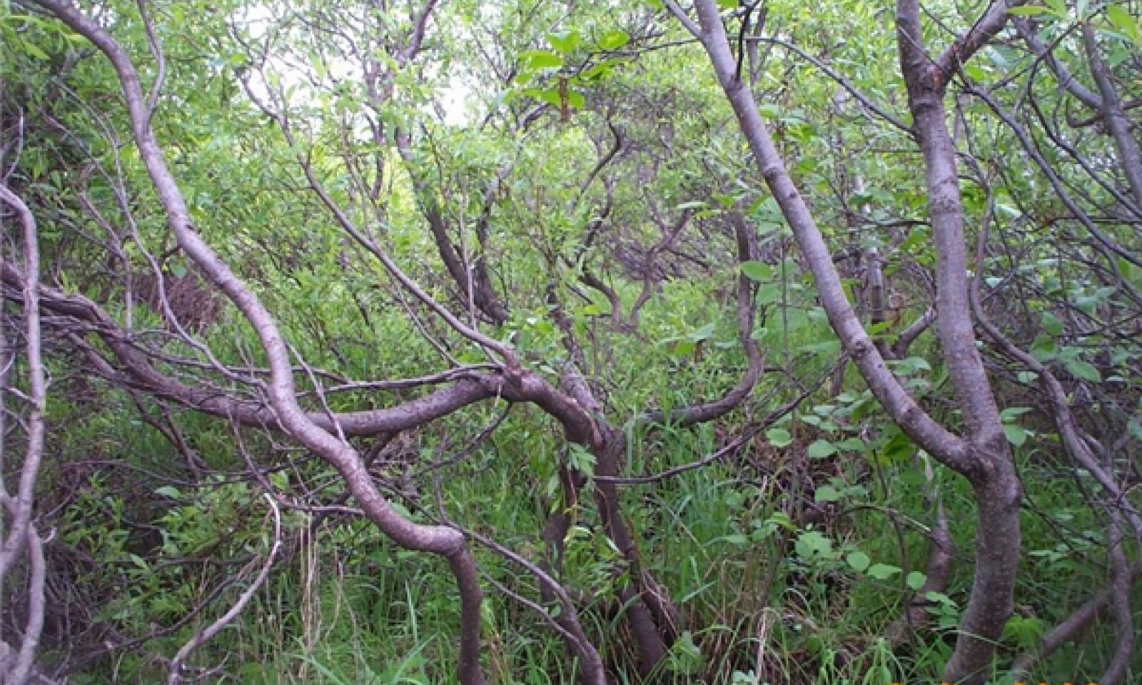
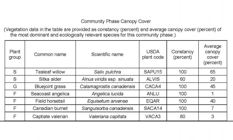
(1) Salix pulchra |
| Herbaceous |
(1) Calamagrostis canadensis |
Click on box and path labels to scroll to the respective text.

