
Arctic High-Center Polygon Complex

Scenario model
Current ecosystem state
Select a state
Management practices/drivers
Select a transition or restoration pathway
-
Transition T1
thermal erosion of ice-wedges
More details -
No transition or restoration pathway between the selected states has been described
Target ecosystem state
Select a state
Description
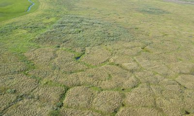
This state relates to low-relief, high-center polygons, which are polygon with relatively flat centers that are raised relative to its boundary. There are two associated plant communities related to polygon microtopography in this state: domed center of the polygon (community 1.1) and ice wedge trough (community 1.2). The troughs are perennially ponded with shallow water and support a wet graminoid herbaceous community dominated by various sedges. The polygon dome are dominated by tussock forming sedges. Soils pond briefly after snowmelt.
Submodel
Description
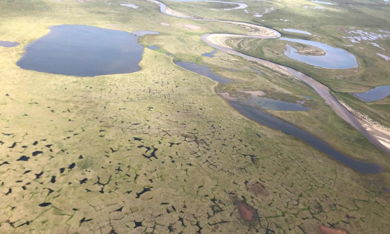
This state relates to high-relief, high-center polygons, which are polygon with sloping centers that are often significantly raised relative to its boundary. There are two associated plant communities related to polygon microtopography in this state: domed center of the polygon (community 1.1) and ice wedge trough (community 1.2). The troughs are often perennially ponded with shallow water and supports a wet graminoid herbaceous community dominated by various sedges. The polygon dome is dominated by dwarf scrubs, sedges, and various moss. Due to changes in hydrology, tussocks are commonly dead or dying.
Submodel
Mechanism
Increased soil temperatures lead to the degradation of ice wedges associated with high-center polygon. As ground subsidence increases, ice wedge trough have increased amounts of water and the dome of high-center polygon have decreased ponding frequency and drier soils. This is a process that naturally occurs over hundreds or thousands of years. Anthropogenic disturbance to the soils can rapidly trigger this transition.
Model keys
Briefcase
Add ecological sites and Major Land Resource Areas to your briefcase by clicking on the briefcase (![]() ) icon wherever it occurs. Drag and drop items to reorder. Cookies are used to store briefcase items between browsing sessions. Because of this, the number of items that can be added to your briefcase is limited, and briefcase items added on one device and browser cannot be accessed from another device or browser. Users who do not wish to place cookies on their devices should not use the briefcase tool. Briefcase cookies serve no other purpose than described here and are deleted whenever browsing history is cleared.
) icon wherever it occurs. Drag and drop items to reorder. Cookies are used to store briefcase items between browsing sessions. Because of this, the number of items that can be added to your briefcase is limited, and briefcase items added on one device and browser cannot be accessed from another device or browser. Users who do not wish to place cookies on their devices should not use the briefcase tool. Briefcase cookies serve no other purpose than described here and are deleted whenever browsing history is cleared.
Ecological sites
Major Land Resource Areas
The Ecosystem Dynamics Interpretive Tool is an information system framework developed by the USDA-ARS Jornada Experimental Range, USDA Natural Resources Conservation Service, and New Mexico State University.