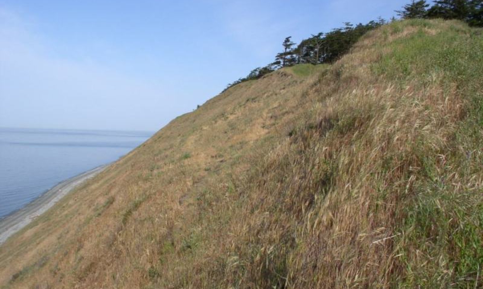
Salt Water Bluff
Scenario model
Current ecosystem state
Select a state
Management practices/drivers
Select a transition or restoration pathway
- Transition T1A More details
- Transition T1B More details
- Restoration pathway R2A More details
- Transition T2A More details
- Restoration pathway R3A More details
- Restoration pathway R3B More details
-
No transition or restoration pathway between the selected states has been described
Target ecosystem state
Select a state
Description
The soils that support this native plant community typically occur on steep bluffs directly above unprotected marine waters. This ecological site description may also occur on flatter slopes adjacent to or at the toe-slopes of the bluffs. The soils are generally sandy and droughty, with very dark A horizons in the soil profile. Typical soil components are Xerorthents and Umbric Dystrochrepts.
In comparison to other native prairie plant communities, these communities generally show an increase in Red Fescue (Festuca rubra) with a related reduction in the amount of Roemer’s fescue (Festuca roemeri). Other common native plants are Oregon gumweed (Grindelia stricta), field chickweed (Cerastium arvense), yarrow (Achillea millefolium), Hooker’s onion (Allium acuminatum), woodrush (Luzula comosa), bare-stem lomatium (Lomatium nudicaule) and great camas (Camassia leichtlinii). These soils are influenced by the various ‘Cold Phase’ abiotic factors such as prevailing winds (especially across marine waters) and proximity to unprotected marine waters, that will cause these locales to be cooler than the climate generally associated with these soil component. The effect on the plant community is generally the absence of Oregon white oak (Quercus garryana) from the community.
Submodel
Submodel
Mechanism
Fire or brush control or other disturbances such as erosion, sloughing or landslides in the presence of exotic species.
Mechanism
Tree removal and restoration by existing plant release or planting of native species.
Model keys
Briefcase
Add ecological sites and Major Land Resource Areas to your briefcase by clicking on the briefcase (![]() ) icon wherever it occurs. Drag and drop items to reorder. Cookies are used to store briefcase items between browsing sessions. Because of this, the number of items that can be added to your briefcase is limited, and briefcase items added on one device and browser cannot be accessed from another device or browser. Users who do not wish to place cookies on their devices should not use the briefcase tool. Briefcase cookies serve no other purpose than described here and are deleted whenever browsing history is cleared.
) icon wherever it occurs. Drag and drop items to reorder. Cookies are used to store briefcase items between browsing sessions. Because of this, the number of items that can be added to your briefcase is limited, and briefcase items added on one device and browser cannot be accessed from another device or browser. Users who do not wish to place cookies on their devices should not use the briefcase tool. Briefcase cookies serve no other purpose than described here and are deleted whenever browsing history is cleared.
Ecological sites
Major Land Resource Areas
The Ecosystem Dynamics Interpretive Tool is an information system framework developed by the USDA-ARS Jornada Experimental Range, USDA Natural Resources Conservation Service, and New Mexico State University.
