
Natural Resources
Conservation Service
Ecological site R004AB200OR
Tidal Marsh and Estuary
Last updated: 1/23/2025
Accessed: 02/09/2026
General information
Provisional. A provisional ecological site description has undergone quality control and quality assurance review. It contains a working state and transition model and enough information to identify the ecological site.
MLRA notes
Major Land Resource Area (MLRA): 004A–Sitka Spruce Belt
This resource area is along the coast of the Pacific Ocean. It is characterized by a marine climate and coastal fog belt. The parent material is primarily glacial, marine, or alluvial sediment and some scattered areas of Tertiary sedimentary rock and organic deposits. Glacial deposits are dominant in the northern part of the MLRA in Washington; marine and alluvial deposits and eolian sand are dominant along the southern part of the Washington coast and extending into Oregon. The mean annual precipitation ranges from 52 to 60 inches near the beaches to more than 190 inches in the inland areas of the MLRA.
Andisols and Inceptisols are the dominant soil orders in the MLRA, but Spodosols, Entisols, and Histosols are also present. The soils are shallow to very deep and very poorly drained to somewhat excessively drained. They are on hilly marine terraces and drift plains; coastal uplands, hills, and foothills; flood plains; and coastal dunes, marshes, and estuaries.
The soil temperature regimes of MLRA 4A are moderated by the proximity to the Pacific Ocean, which eases the differences between the mean summer and winter temperatures. The seasonal differences in temperature are more pronounced in adjacent MLRAs further inland. Included in MLRA 4A are soils in cooler areas at higher elevations or on northerly aspects that have an isofrigid temperature regime.
The soil moisture regimes of MLRA 4A are typified by soils that do not have an extended dry period during normal years. Many of the soils further inland in MLRA 2 have a dry period in summer. Soils in low-lying areas and depressions of MLRA 4A are saturated in the rooting zone for extended periods due to a high water table or long or very long periods of flooding or ponding.
LRU notes
The Central Sitka Spruce Belt land resource unit (LRU B) of MLRA 4A is along the west coast of Washington and Oregon. The LRU extends from the Chehalis River in Washington to South Slough in Oregon, and it is bounded on the west by the Pacific Ocean. This area consists of sand dunes, flood plains, and marine terraces that extend a few miles east and are parallel to the Pacific Ocean, and it transitions to steeper and higher elevation ridges and mountainsides of the western slopes of the Coast Range in Oregon. Near the shore in coastal lowland areas, the parent material is dominantly eolian (wind-deposited) sand, alluvium, and marine sediment. Residuum, colluvium, and landslide deposits derived from sedimentary and basaltic sources are on the coastal foothills and mountains, and minor additions of recent alluvium are along the river valleys. Several major rivers carved steep, narrow valleys through the coastal mountains and foothills before entering broader coastal valleys. Subduction zones along the Pacific Coast may cause significant earthquakes and tsunamis, which would disrupt the ecological processes beyond what is described in this ecological site description.
Ecological site concept
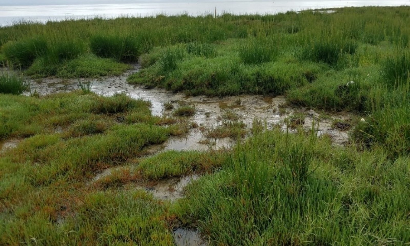
This ecological site is on the western coastline of the Pacific Northwest, from southern Washington through central Oregon. Marshes and estuaries are at low elevations that are tidally influenced. The areas are saline to brackish. Hydrology is the primary abiotic driver of the ecological site. The vegetation commonly is patchy. The distribution and diversity of the vegetation are influenced by freshwater inputs, tidal flooding, and evaporation. The soils associated with this site formed in mixed alluvium along tidally influenced flood plains, and they are subject to a high water table and flooding. Slopes range from 0 to 3 percent.
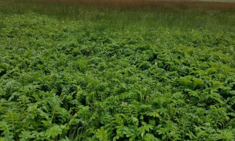
The vegetation is well adapted to tidal fluctuations, salt spray, brackish water, and saltwater. The most common species include pickleweed (Salicornia virginia), Pacific silverweed (Argentina egedii), marsh jaumea (Jaumea carnosa), pursh seepweed (Suaeda calceoliformis), saltgrass (Distichlis spicata), tufted hairgrass (Deschampsia cespitosa), seaside arrowgrass (Triglochin maritima), common threesquare (Schoenoplectus pungens), and Lyngbye’s sedge (Carex lynbnyei).
The most common disturbance is alteration of the watershed and hydrologic system. Tidal inundation and channel flow may be altered by dams, dikes, and levees. Storm surges may flood the marsh and estuary causing movement of sediment and an increase in the amount of large driftwood on the site.

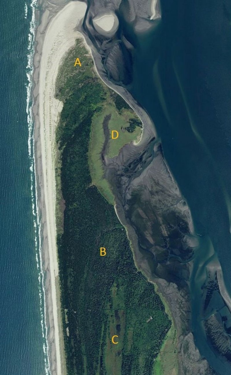
Figure 1. The area designated as “A” is the Foredune Scrub and Grassland site, “B” is the Dune Forest site, “C” is the Aquic Interdune site, and “D” is the Tidal Marsh and Estuary site.
Table 1. Dominant plant species
| Tree |
Not specified |
|---|---|
| Shrub |
Not specified |
| Herbaceous |
(1) Salicornia |
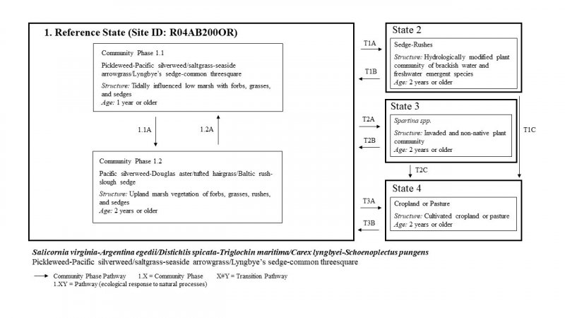
Click on box and path labels to scroll to the respective text.


