
Description
This resource area is along the coast of the Pacific Ocean. It is characterized by a marine climate and coastal fog belt. The parent material is primarily glacial, marine, or alluvial sediment and some scattered areas of Tertiary sedimentary rock and organic deposits. Glacial deposits are dominant in the northern part of the MLRA in Washington; marine and alluvial deposits and eolian sand are dominant along the southern part of the Washington coast and extending into Oregon. The mean annual precipitation ranges from 52 to 60 inches near the beaches to more than 190 inches in the inland areas of the MLRA. Andisols and Inceptisols are the dominant soil orders in the MLRA, but Spodosols, Entisols, and Histosols are also present. The soils are shallow to very deep and very poorly drained to somewhat excessively drained. They are on hilly marine terraces and drift plains; coastal uplands, hills, and foothills; flood plains; and coastal dunes, marshes, and estuaries. The soil temperature regimes of MLRA 4A are moderated by the proximity to the Pacific Ocean, which eases the differences between the mean summer and winter temperatures. The seasonal differences in temperature are more pronounced in adjacent MLRAs further inland. Included in MLRA 4A are soils in cooler areas at higher elevations or on northerly aspects that have an isofrigid temperature regime. The soil moisture regimes of MLRA 4A are typified by soils that do not have an extended dry period during normal years. Many of the soils further inland in MLRA 2 have a dry period in summer. Soils in low-lying areas and depressions of MLRA 4A are saturated in the rooting zone for extended periods due to a high water table or long or very long periods of flooding or ponding.
Key publications
Geographic subunits
Land Resource Unit 1. The Northern Sitka Spruce Belt land resource unit (LRU A) of MLRA 4A is along the northwest coast of the Olympic Peninsula to the Chehalis River in Washington State. The parent material is dominantly glacial deposits derived from continental or alpine sources. This LRU extends from the northwesternmost corner of the Olympic Peninsula south to the northern edge of Grays Harbor. It is bounded on the west by the Pacific Ocean and on the east by the Olympic Mountains. Several major rivers carved valleys through the glacially derived landscape and deposited more recent alluvium. These include the Sol Duc, Bogachiel, Hoh, Queets, Quinault, and Humptulips Rivers.
Land Resource Unit 2. The Central Sitka Spruce Belt land resource unit (LRU B) of MLRA 4A is along the west coast of Washington and Oregon. The LRU extends from the Chehalis River in Washington to South Slough in Oregon, and it is bounded on the west by the Pacific Ocean. This area consists of sand dunes, flood plains, and marine terraces that extend a few miles east and are parallel to the Pacific Ocean, and it transitions to steeper and higher elevation ridges and mountainsides of the western slopes of the Coast Range in Oregon. Near the shore in coastal lowland areas, the parent material is dominantly eolian (wind-deposited) sand, alluvium, and marine sediment. Residuum, colluvium, and landslide deposits derived from sedimentary and basaltic sources are on the coastal foothills and mountains, and minor additions of recent alluvium are along the river valleys. Several major rivers carved steep, narrow valleys through the coastal mountains and foothills before entering broader coastal valleys. Subduction zones along the Pacific Coast may cause significant earthquakes and tsunamis, which would disrupt the ecological processes beyond what is described in this ecological site description.
Land Resource Unit 3. The Southern Sitka Spruce Belt land resource unit (LRU C) of MLRA 4A is along the west coast of Oregon. This LRU extends from the northern edge of South Slough to the Chetco River, and it is bounded on the west by the Pacific Ocean. The area consists of sand dunes, flood plains, and marine terraces that extend a few miles east and are parallel to the Pacific Ocean, and it transitions to steeper, higher elevation ridges and foothills of the western slopes of the Coast Range. The soils in the coastal lowland areas dominantly formed in eolian (wind-deposited) sand, alluvium, and marine sediment. The soils in the coastal foothills formed in residuum, colluvium, and landslide deposits derived from sedimentary and basaltic rock. Minor additions of recent alluvium are along the river valleys. Several major rivers that have headwaters in the coastal mountains carved steep, narrow valleys through the foothills before entering the broader coastal valleys. Subduction zones along the Pacific Coast may cause significant earthquakes and tsunamis, which would disrupt the ecological processes beyond what is described in this ecological site description.
Next steps
-
1
Select an ecological site
Select an ecological site using the list, keys, photos, briefcase, or quick search option located on this page. -
2
Explore the ecological site description
Next, learn more about the selected ecological site and its characteristic dynamics by browsing the ecological site description and exploring alternative state and transition model formats.
Ecological site list
-
-
-
-
-
-
i
Key Characteristics
- Site is located within the Northern Sitka Spruce Belt Land Resource Unit A (LRU 4AA). This unit occurs on the west coast of the Olympic Peninsula north of the Chehalis River in Washington.
- Site is commonly found on floodplains and stream terraces.
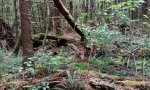
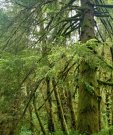
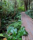
- Site is located on levee and river terraces that are affected by flooding. It is often forested, and common overstory species are primarily Sitka spruce and black cottonwood. Understory species are predominantly vine maple, salmonberry, western swordfern, and Oregon oxalis.
-
i
Key Characteristics
- Site is located within the Northern Sitka Spruce Belt Land Resource Unit A (LRU 4AA). This unit occurs on the west coast of the Olympic Peninsula north of the Chehalis River in Washington.
- Site is located in a low-lying water table recharge area and has soils that are typically ponded during the growing season.
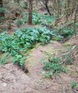
- Site is located in forested depressions on glacial drift plains with a seasonal high water table. Common overstory species include western redcedar, western hemlock, and Sitka spruce. Understory species include American skunkcabbage and deer fern.
-
i
Key Characteristics
- Site is located within the Northern Sitka Spruce Belt Land Resource Unit A (LRU 4AA). This unit occurs on the west coast of the Olympic Peninsula north of the Chehalis River in Washington.
- Site is found on glacial drift plains.
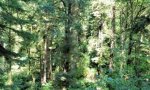
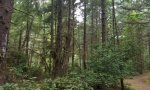
- Site not as above. Typically, the site is forested and trees are erect. The most common overstory species include Sitka spruce and western hemlock. Understory species are primarily evergreen huckleberry, salal, western swordfern, and Oregon oxalis.
-
i
Key Characteristics
- Site is located within the Northern Sitka Spruce Belt Land Resource Unit A (LRU 4AA). This unit occurs on the west coast of the Olympic Peninsula north of the Chehalis River in Washington.
- Site is found on glacial drift plains.
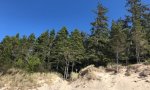
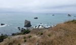
- Site is located on coastal headlands and hills influenced by wind pruning and salt spray. These sites primarily feature stunted krummholz conifers. The most common overstory species includes Sitka spruce and shore pine. Common understory species include salal, evergreen huckleberry, false lily of the valley, and western brackenfern.
-
i
Key Characteristics
- Site is located within the Central Sitka Spruce Belt Land Resource Unit B (LRU 4AB). This unit occurs along the west coast between the Chehalis River in Washington and South Slough in Oregon.
- Site is commonly found on flat floodplains and stream terraces.
- Site is located on levee and river terraces. It is often forested, and common overstory species are primarily Sitka spruce and red alder. Understory species are predominantly salmonberry, rusty menziesia, common ladyfern, and Oregon oxalis.
-
i
Key Characteristics
- Site is located within the Central Sitka Spruce Belt Land Resource Unit B (LRU 4AB). This unit occurs along the west coast between the Chehalis River in Washington and South Slough in Oregon.
- Site is commonly found on flat floodplains and stream terraces.
- Site is found in depressions, oxbows, and back swamps. It is often forested, and common overstory species include Sitka spruce and red alder. Understory species are predominately salmonberry, American skunkcabbage, and slough sedge.
-
i
Key Characteristics
- Site is located within the Central Sitka Spruce Belt Land Resource Unit B (LRU 4AB). This unit occurs along the west coast between the Chehalis River in Washington and South Slough in Oregon.
- Site is located in a low-lying water table recharge area and has soils that are typically ponded during the growing season.
- Site is located in forested depressions with a high seasonal water table. Common overstory species include western redcedar, western hemlock, and Sitka spruce. Understory species include American skunkcabbage and slough sedge.
-
i
Key Characteristics
- Site is located within the Central Sitka Spruce Belt Land Resource Unit B (LRU 4AB). This unit occurs along the west coast between the Chehalis River in Washington and South Slough in Oregon.
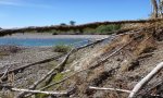
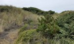
- The site is found along beach zones.
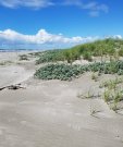
- The site is located on a stabilized dune that no longer moves due to eolian processes. The site is typically forested, and common species include Sitka spruce, shore pine, salal, evergreen huckleberry, and western brackenfern.
-
i
Key Characteristics
- Site is located within the Central Sitka Spruce Belt Land Resource Unit B (LRU 4AB). This unit occurs along the west coast between the Chehalis River in Washington and South Slough in Oregon.
- Site is found on coastal uplands.
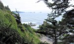
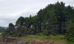
- Site is forested and located on coastal hills, mountains, and headlands that are exposed to high winds and salt spray. The most common species include Sitka spruce, western hemlock, salal, salmonberry, western swordfern, and false lily of the valley.
-
i
Key Characteristics
- Site is located within the Central Sitka Spruce Belt Land Resource Unit B (LRU 4AB). This unit occurs along the west coast between the Chehalis River in Washington and South Slough in Oregon.
- Site is found on coastal uplands.
- Site is forested and located on mountain hillsides, terraces, and ridges. This site is located along the MLRA 4a and MLRA 1 transition zone. Common species include western hemlock, Sitka spruce, Douglas-fir, rusty menziesia, red huckleberry, western swordfern, and common ladyfern.
-
i
Key Characteristics
- Site is located within the Central Sitka Spruce Belt Land Resource Unit B (LRU 4AB). This unit occurs along the west coast between the Chehalis River in Washington and South Slough in Oregon.
- Site is found on coastal uplands.
- Site is forested and located on wave cut terraces that are influenced by coastal salt spray. Common species include Sitka spruce, salal, salmonberry, western swordfern, and false lily of the valley.
-
i
Key Characteristics
- Site is located within the Central Sitka Spruce Belt Land Resource Unit B (LRU 4AB). This unit occurs along the west coast between the Chehalis River in Washington and South Slough in Oregon.
- Site is found on coastal uplands.
- Site is located on coastal headlands, hills, and marine terraces that are exposed to high winds and salt spray. These sites primarily feature stunted krummholz conifers. The most common overstory species include Sitka spruce and shore pine. Common understory species include salal, salmonberry, western brackenfern, and Pacific reedgrass.
-
i
Key Characteristics
- Site is located in the Southern Sitka Spruce Belt Land Resource Unit C (LRU 4AC). This unit occurs along the west coast between South Slough and the Chetco River in Oregon.
- Site is commonly found on floodplains and stream terraces associated.
- Site is located on levee and river terraces. The site is typically forested, and common overstory species are primarily Sitka spruce and red alder. Understory species are predominantly salmonberry, salal, and common ladyfern.
-
i
Key Characteristics
- Site is located in the Southern Sitka Spruce Belt Land Resource Unit C (LRU 4AC). This unit occurs along the west coast between South Slough and the Chetco River in Oregon.
- Site is commonly found on floodplains and stream terraces associated.
- Site is found in depressions, oxbows, and back swamps that have a seasonal high water table. The site is typically forested, and common overstory species include Sitka spruce and red alder. Understory species are predominately salmonberry and American skunkcabbage.
-
i
Key Characteristics
- Site is located in the Southern Sitka Spruce Belt Land Resource Unit C (LRU 4AC). This unit occurs along the west coast between South Slough and the Chetco River in Oregon.
- Site is located in a low-lying water table recharge area and has soils that are typically ponded during the growing season.
- Site is forested and located in depressions, marine terraces, and seeps on mountain slopes. Common plant species include western hemlock, Sitka spruce, and American skunkcabbage.
-
i
Key Characteristics
- Site is located in the Southern Sitka Spruce Belt Land Resource Unit C (LRU 4AC). This unit occurs along the west coast between South Slough and the Chetco River in Oregon.
- The site is found along beach zones.
- The site is located on a stabilized dune that no longer moves due to eolian processes. This site is typically forested, and common species include Sitka spruce, shore pine, California wax myrtle, and evergreen huckleberry.
-
i
Key Characteristics
- Site is located in the Southern Sitka Spruce Belt Land Resource Unit C (LRU 4AC). This unit occurs along the west coast between South Slough and the Chetco River in Oregon.
- Site is found on coastal uplands.
- Site is located coastal hills, mountains, and headlands that are exposed to high winds and salt spray. The site is typically forested, and most common species include Sitka spruce, white fir, evergreen huckleberry, salmonberry, and western swordfern.
-
i
Key Characteristics
- Site is located in the Southern Sitka Spruce Belt Land Resource Unit C (LRU 4AC). This unit occurs along the west coast between South Slough and the Chetco River in Oregon.
- Site is found on coastal uplands.
- Site is forested and located on mountain hillsides, terraces, side slopes, and ridges. This site is located along the MLRA 4a and MLRA 1 transition zone. Common species include Sitka spruce, salal, red huckleberry, and western swordfern.
-
i
Key Characteristics
- Site is located within the Northern Sitka Spruce Belt Land Resource Unit A (LRU 4AA). This unit occurs on the west coast of the Olympic Peninsula north of the Chehalis River in Washington.
- Site is located in a low-lying water table recharge area and has soils that are typically ponded during the growing season.
- Site is located in non-forested bogs, fens, or depressions on glacial drift plains with a seasonal high water table. Soils are typically anaerobic during part of the growing season. Common species include bog labrador tea, western bog laurel, sedges, and sphagnum mosses.
-
i
Key Characteristics
- Site is located within the Central Sitka Spruce Belt Land Resource Unit B (LRU 4AB). This unit occurs along the west coast between the Chehalis River in Washington and South Slough in Oregon.
- Site is commonly found on flat floodplains and stream terraces.
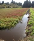
- Site is found on oxbows, back swamps, and channels that have a seasonal high water table. Soils are typically anaerobic during part of the growing season. It is often non-forested, and the most common species are Douglas spirea, American skunkcabbage, and slough sedge.
-
i
Key Characteristics
- Site is located within the Central Sitka Spruce Belt Land Resource Unit B (LRU 4AB). This unit occurs along the west coast between the Chehalis River in Washington and South Slough in Oregon.
- Site is located in a low-lying water table recharge area and has soils that are typically ponded during the growing season.
- Site is located in non-forested bogs, fens, or depressions with a seasonal high water table. Soils are typically anaerobic during part of the growing season. Common species include western labrador tea, western bog laurel, sedges, and sphagnum mosses.
-
i
Key Characteristics
- Site is located within the Central Sitka Spruce Belt Land Resource Unit B (LRU 4AB). This unit occurs along the west coast between the Chehalis River in Washington and South Slough in Oregon.
- The site is found along beach zones.
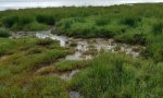
- The site is located in a tidally influenced lowlands. The site is non-forested, and the most common species include pickleweed, Pacific silverweed, saltgrass, seaside arrowgrass, Lyngbye’s sedge, and common threesquare.
-
i
Key Characteristics
- Site is located within the Central Sitka Spruce Belt Land Resource Unit B (LRU 4AB). This unit occurs along the west coast between the Chehalis River in Washington and South Slough in Oregon.
- The site is found along beach zones.
- The site is located on a strand or dune and is still actively reworked by eolian processes. This site is typically non-forested, and common species include coastal sand verbena, American searocket, and American dunegrass.
-
i
Key Characteristics
- Site is located within the Central Sitka Spruce Belt Land Resource Unit B (LRU 4AB). This unit occurs along the west coast between the Chehalis River in Washington and South Slough in Oregon.
- The site is found along beach zones.
- The site is located in areas commonly described as dune slack and features a seasonally-high water table within 50 cm of the surface. The site is typically non-forested. Common plants include Hooker willow, California wax myrtle, Pacific silverweed, and slough sedge.
-
i
Key Characteristics
- Site is located in the Southern Sitka Spruce Belt Land Resource Unit C (LRU 4AC). This unit occurs along the west coast between South Slough and the Chetco River in Oregon.
- Site is commonly found on floodplains and stream terraces associated.
- Site is found on oxbows, back swamps, and channels that have a seasonal high water table. Soils are typically anaerobic during part of the growing season. The site is typically non-forested, and most common species are Douglas spirea, American skunkcabbage, and slough sedge.
-
i
Key Characteristics
- Site is located in the Southern Sitka Spruce Belt Land Resource Unit C (LRU 4AC). This unit occurs along the west coast between South Slough and the Chetco River in Oregon.
- Site is found on coastal uplands.
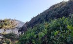
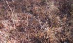
- Site is occurs on convex headlands or bluffs that are exposed to high winds and salt spray. Soils are generally shallow or moderately deep to bedrock. These sites may locally be known as balds or prairies. The site is non-forested, and the most common species include kinnikinnick, black crowberry, Canada goldenrod, cascade desertparsley, Pacific reedgrass, and red fescue.


Ecological site map
Basemap
Find me
Find point
Full screen
Zoom in to display soil survey map units for an area of interest, and zoom out to display MLRAs. Select a map unit polygon to view ecological sites correlated to that map unit. View a brief description of an ecological site by clicking on its name in the map popup. Soil survey correlations may not be accurate, and ecological site classification of a location should always be verified in the field. Each selection may require the transfer of several hundred KB of data.
Ecological site keys
Ecological site photos
Print Options
Sections
Font
Other
Briefcase
Add ecological sites and Major Land Resource Areas to your briefcase by clicking on the briefcase (![]() ) icon wherever it occurs. Drag and drop items to reorder. Cookies are used to store briefcase items between browsing sessions. Because of this, the number of items that can be added to your briefcase is limited, and briefcase items added on one device and browser cannot be accessed from another device or browser. Users who do not wish to place cookies on their devices should not use the briefcase tool. Briefcase cookies serve no other purpose than described here and are deleted whenever browsing history is cleared.
) icon wherever it occurs. Drag and drop items to reorder. Cookies are used to store briefcase items between browsing sessions. Because of this, the number of items that can be added to your briefcase is limited, and briefcase items added on one device and browser cannot be accessed from another device or browser. Users who do not wish to place cookies on their devices should not use the briefcase tool. Briefcase cookies serve no other purpose than described here and are deleted whenever browsing history is cleared.
Ecological sites
Major Land Resource Areas
The Ecosystem Dynamics Interpretive Tool is an information system framework developed by the USDA-ARS Jornada Experimental Range, USDA Natural Resources Conservation Service, and New Mexico State University.