
Natural Resources
Conservation Service
Ecological site F009XY002WA
Mesic Xeric Loamy Hills Ponderosa Pine Warm Dry Grass
Last updated: 4/01/2025
Accessed: 02/07/2026
General information
Provisional. A provisional ecological site description has undergone quality control and quality assurance review. It contains a working state and transition model and enough information to identify the ecological site.
MLRA notes
Major Land Resource Area (MLRA): 009X–Palouse and Nez Perce Prairies
Almost all of MLRA 9 lies within the Walla Walla Plateau Section of the Columbia Plateaus Province of the Intermontane Plateaus. The area is characterized by an undulating basalt plateau that has been highly dissected. The major streams have cut deep, steep-walled canyons. The plateau is nearly level to steeply sloping, and its surface is moderately dissected or strongly dissected. Slopes are mostly hilly and steep. Some areas in the southeastern portion of this MLRA are in the Blue Mountain Section of the Columbia Plateaus Province. Small areas on the eastern edge of the area are in the Northern Rocky Mountains Province of the Rocky Mountain System.
Classification relationships
Major land resource area (MLRA): 9 - Palouse & Nez Perce Prairie
LRU – Common Resource Areas (CRA):
9.1 - Channeled Scablands
9.12 - Moist Loess Islands
9.2 - Palouse Hills
9.3 - Dissected Loess Uplands (very limited acres)
Relationship to Other Established Classifications:
United States National Vegetation Classification (2008) – A3447 Ponderosa Pine / Herbaceous Understory Central Rocky Mt. Forest & Woodland Alliance
Washington Natural Heritage Program. Ecosystems of Washington State, A Guide to Identification, Rocchio and Crawford, 2015 – Northern Rocky Mountain Ponderosa Pine Woodland and Savanna
Description of Ecoregions of the United States, USFS PN # 1391, 1995 - M332 Middle Rocky Mt. Forest-Steppe-Coniferous Forest-Alpine Meadow Province
Level III and IV Ecoregions of WA, US EPA, June 2010 - 15r Okanogan – Colville Xeric Valleys & Foothills and 15s Spokane Valley Outwash Plains
This ecological site includes the following USDA Forest Service Plant Associations: PIPO/PSSP, PIPO/FEID, and PIPO-PSME/PSSP.
Ecological site concept
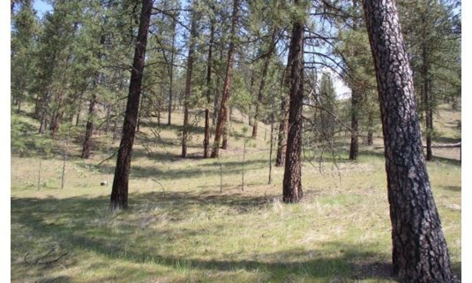
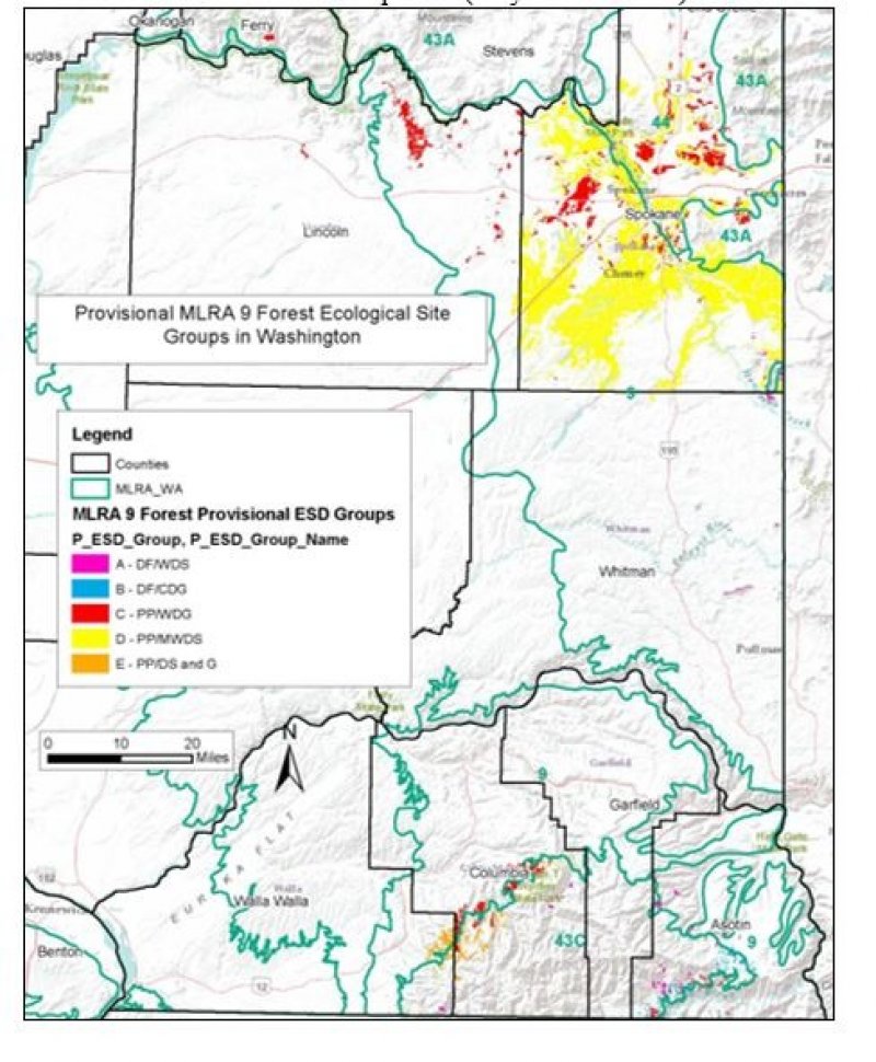
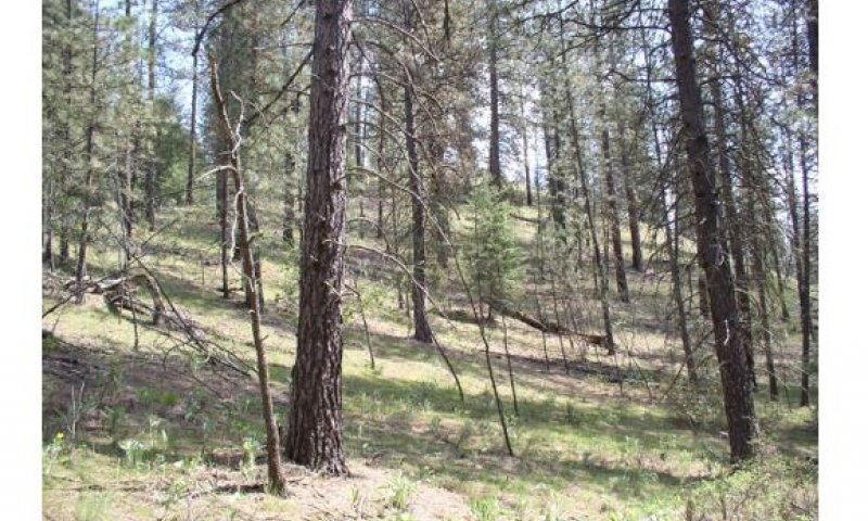
The Mesic Xeric Loamy hills, Ponderosa Pine Warm Dry Grass ecological site (ES) is primarily found in Ferry, Lincoln, Spokane, and Whitman Counties, but limited in Columbia, Garfield and Asotin Counties. The ecological site is comprised of the modal Ponderosa pine (Pinus ponderosa)/Idaho fescue (Festuca idahoensis) plant association, as well as the Ponderosa pine/bluebunch wheatgrass (Pseudoroegneria spicata) and the less extensive Ponderosa pine/pinegrass (Calamagrostis rubescens) associations.
Associated sites
| F009XY001WA |
Mesic Xeric Loamy Hills and Canyons Ponderosa Pine Moderately Warm Dry Shrub Is slightly cooler. |
|---|---|
| F009XY003WA |
Warm Dry Ridges Hills and Canyons Ponderosa Pine Dry Shrub and Grass |
Similar sites
| F009XY001WA |
Mesic Xeric Loamy Hills and Canyons Ponderosa Pine Moderately Warm Dry Shrub Is slightly cooler. |
|---|---|
| F009XY003WA |
Warm Dry Ridges Hills and Canyons Ponderosa Pine Dry Shrub and Grass |

Figure 1.
Table 1. Dominant plant species
| Tree |
(1) Pinus ponderosa |
|---|---|
| Shrub |
Not specified |
| Herbaceous |
(1) Festuca idahoensis |
Click on box and path labels to scroll to the respective text.
Ecosystem states
| T1A | - | The natural fire regime intervals changed to 50 or more years allowing understory pine regeneration |
|---|---|---|
| T1B | - | Invasion of introduced perennial and annual grasses |
| T1C | - | Land converted to crop, pasture, or urban development |
| R2A | - | Overstory thinning followed by prescribed fire |
| R3A | - | Site preparation, native grass reseeding, weed control, grazing protection followed by prescribed burning |
State 1 submodel, plant communities
| 1.1A | - | Time. Lack of fire allowing pine regeneration |
|---|---|---|
| 1.2B | - | Ground fires reoccur returning site to open pine/grass site |
| 1.2A | - | Time, continued lack of fire allowing pine cohorts to form dense stands. |
| 1.3A | - | Stand replacing fire, dense understory pine stands killed, some large overstory pine survive. |
| 1.4A | - | Natural fire interval resumes, maintaining open pine stand with abundant bunchgrass. |
| 1.4B | - | Lack of reoccurring fire causing increase in pine establishment. |


