Natural Resources
Conservation Service
Ecological site R010XC020OR
SR Loamy 9-12 PZ
Last updated: 4/10/2025
Accessed: 02/09/2026
General information
Provisional. A provisional ecological site description has undergone quality control and quality assurance review. It contains a working state and transition model and enough information to identify the ecological site.

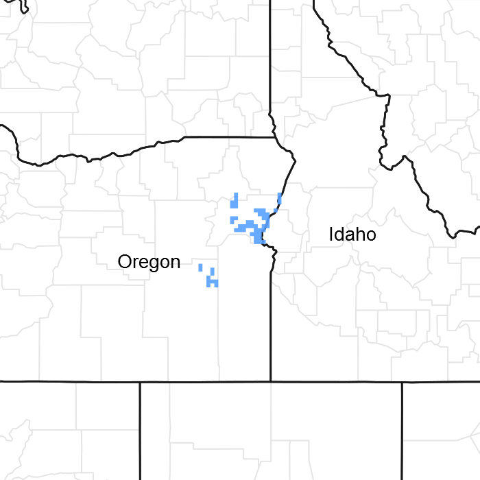
Figure 1. Mapped extent
Areas shown in blue indicate the maximum mapped extent of this ecological site. Other ecological sites likely occur within the highlighted areas. It is also possible for this ecological site to occur outside of highlighted areas if detailed soil survey has not been completed or recently updated.
Associated sites
| R010XC021OR |
SR Clayey 9-12 PZ SR Clayey 9-12 PZ |
|---|---|
| BX010X00C022 |
Silty 9-12 PZ Snake River Warm Plains SR Silty 9-12 PZ |
| R010XC035OR |
SR Shallow 9-12 PZ SR Shallow 9-12 PZ |
| R010XC043OR |
SR South 9-12 PZ SR South 9-12" PZ |
| R010XC063OR |
SR Droughty North 9-12 PZ SR Droughty North 9-12 PZ |
| R010XC064OR |
SR North 9-12 PZ SR North 9-12" PZ |
Similar sites
| R010XC035OR |
SR Shallow 9-12 PZ SR Shallow 9-12 PZ (shallower depth, lower production) |
|---|---|
| R010XC021OR |
SR Clayey 9-12 PZ SR Clayey 9-12 PZ (fine surface texture, clayey subsoil at shallower depth, different composition - bluebunch wheatgrass strongly dominant) |
| BX010X00C022 |
Silty 9-12 PZ Snake River Warm Plains SR Silty 9-12 PZ (very fine sandy loam to silt surface, lower elevation, different composition – beardless wheatgrass dominant) |
Table 1. Dominant plant species
| Tree |
Not specified |
|---|---|
| Shrub |
(1) Artemisia tridentata ssp. wyomingensis |
| Herbaceous |
(1) Pseudoroegneria spicata |
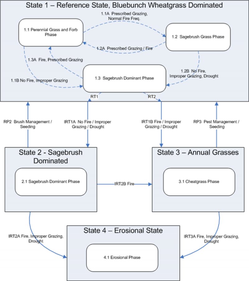
Click on box and path labels to scroll to the respective text.
