
Natural Resources
Conservation Service
Ecological site R024XY027NV
CLAYPAN 12-16 P.Z.
Last updated: 3/07/2025
Accessed: 04/10/2026
General information
Provisional. A provisional ecological site description has undergone quality control and quality assurance review. It contains a working state and transition model and enough information to identify the ecological site.
MLRA notes
Major Land Resource Area (MLRA): 024X–Humboldt Basin and Range Area
Major land resource area (MLRA) 24, the Humboldt Area, covers an area of approximately 8,115,200 acres (12,680 sq. mi.). It is found in the Great Basin Section of the Basin and Range Province of the Intermontane Plateaus. Elevations range from 3,950 to 5,900 feet (1,205 to 1,800 meters) in most of the area, some mountain peaks are more than 8,850 feet (2,700 meters).
A series of widely spaced north-south trending mountain ranges are separated by broad valleys filled with alluvium washed in from adjacent mountain ranges. Most valleys are drained by tributaries to the Humboldt River. However, playas occur in lower elevation valleys with closed drainage systems. Isolated ranges are dissected, uplifted fault-block mountains. Geology is comprised of Mesozoic and Paleozoic volcanic rock and marine and continental sediments. Occasional young andesite and basalt flows (6 to 17 million years old) occur at the margins of the mountains. Dominant soil orders include Aridisols, Entisols, Inceptisols and Mollisols. Soils of the area are generally characterized by a mesic soil temperature regime, an aridic soil moisture regime and mixed geology. They are generally well drained, loamy and very deep.
Approximately 75 percent of MLRA 24 is federally owned, the remainder is primarily used for farming, ranching and mining. Irrigated land makes up about 3 percent of the area; the majority of irrigation water is from surface water sources, such as the Humboldt River and Rye Patch Reservoir. Annual precipitation ranges from 6 to 12 inches (15 to 30 cm) for most of the area, but can be as much as 40 inches (101 cm) in the mountain ranges. The majority of annual precipitation occurs as snow in the winter. Rainfall occurs as high-intensity, convective thunderstorms in the spring and fall.
Ecological site concept
This ecological site occurs on summits and mountain side slopes. Landform shapes are smooth to slightly convex or convex-linear. Soils are moderately deep, well drained and formed in residuum derived from volcanic parent material. The soil profile is characterized by a dark surface horizon (mollic epipedon), a horizon of clay accumulation (argillic horizon) 4 to 12 inches (10 to 30cm) from the soil surface. Important abiotic factors contributing to the presence of this site include an abrupt boundary in the upper soil profile that results in wet non-satiated conditions during the spring and early summer. Under natural conditions the reference state is dominated by low sagebrush (ARAR8), Idaho fescue (FEID), and bluebunch wheatgrass (PSSPS).
Associated sites
| R024XY032NV |
LOAMY SLOPE 14+ P.Z. The soil profile is characterized by a mollic (pachic) epipedon and greater than 35 percent rock fragments by volume. |
|---|---|
| R024XY013NV |
LOAMY 10-12 P.Z. The soil profile is characterized by a mollic epipedon, a mesic soil temperature regime and aridic bordering on xeric soil moisture regime. The sagebrush found on this site is primarily basin big sagebrush (ARTRT), with Wyoming sagebrush (ARTRW8) confined to the transitions. |
| R024XY016NV |
Mountain Ridge Soils associated with this site are shallow, well drained, on convex-convex landform positions. The reference plant community is dominated by low sagebrush (ARAR8), black sagebrush (ARNO4) and Idaho fescue (FEID). |
| R024XY021NV |
Loamy Slope 12-14 P.Z. Soils are moderately deep, well drained, and formed in residuum/colluvium derived from volcanic parent material. The soil profile is characterized by a dark surface horizon (mollic epipedon), a horizon of clay accumulation (argillic horizon) within 12 inches (30 cm), and 18-35 percent clay in the particle size control section. |
| R024XY029NV |
SOUTH SLOPE 12-16 P.Z. Site is found on all but north facing side slopes of hills and mountains with slopes greater than 30 percent. The soils associated with this site are deep to moderately deep, and well drained. The reference plant community is dominated by mountain big sagebrush (ARTRV) and bluebunch wheatgrass (PSSPS) |
Similar sites
| R024XY018NV |
Claypan 10-12 P.Z. Soils are moderately deep with a light-colored surface horizon; Bluebunch wheatgrass (PSSPS)-Thurber's needlegrass (ACTH7) codominant grasses; less productive site |
|---|---|
| R024XY016NV |
Mountain Ridge Soils are very shallow to shallow with greater than 40 percent rock fragments; less productive site |
Table 1. Dominant plant species
| Tree |
Not specified |
|---|---|
| Shrub |
(1) Artemisia arbuscula |
| Herbaceous |
(1) Festuca idahoensis |
Physiographic features
This ecological site is on linear to slightly convex mountain summits, side slopes and intermountain valley fans. Slope gradients are less than 30 percent. Elevations are 6,500 to about 9,500 feet (1,981 to about 2,896 m).
Table 2. Representative physiographic features
| Landforms |
(1)
Mountains
> Mountain slope
(2) Mountains > Ridge |
|---|---|
| Runoff class | High to very high |
| Flooding frequency | None |
| Ponding frequency | None |
| Elevation | 6,500 – 9,500 ft |
| Slope | 2 – 75% |
| Aspect | Aspect is not a significant factor |
Climatic features
The climate is semiarid, characterized by cold, moist winters and warm, somewhat dry summers. Average annual precipitation is 12 to over 16 inches (30 to over 41 cm). Mean annual air temperature are 42 to 44 degrees F. The average growing season is about 70 to 100 days. Weather stations with a long-term data record are currently not available for this ecological site. Associated climate data will be updated when information becomes available.
Table 3. Representative climatic features
| Frost-free period (characteristic range) | 80-100 days |
|---|---|
| Freeze-free period (characteristic range) | 70-90 days |
| Precipitation total (characteristic range) | 13-15 in |
| Frost-free period (actual range) | 70-110 days |
| Freeze-free period (actual range) | 60-100 days |
| Precipitation total (actual range) | 12-16 in |
| Frost-free period (average) | 90 days |
| Freeze-free period (average) | 80 days |
| Precipitation total (average) | 14 in |
Influencing water features
Influencing water features associated are not associated with this site.
Wetland description
N/A
Soil features
The soils associated with this site are shallow, well drained and formed in residuum and colluvium derived from volcanic rock. The soil profile is characterized by a dark colored surface horizon (mollic epipedon) and a horizon of clay accumulation (argillic) 6 to 12 inches (15 to 30 cm) from the soil surface. These soils have greater than 18 percent clay in the particle size control section, 20 percent or greater cover of rock fragments on the soil surface, and up to 50 percent rock fragments by volume in the subsoil.
The argillic horizon swells on wetting and shrinks and cracks upon drying. The swelling of the subsoil upon wetting results in poor soil aeration during early spring, creating wet non-satiated conditions in the upper soil profile. The subsoils interfere with deep root development but some roots, mainly of shrubs and tap-rooted forbs, penetrate the subsoil along vertical cleavage planes.
Representative soil components associated with this site include Belate, Chen, Cleavage, Cotant, Decram, Layview, Ninemile, Spinlin, and Walti.
Table 4. Representative soil features
| Parent material |
(1)
Colluvium
–
volcanic rock
(2) Residuum – volcanic rock (3) Colluvium – igneous rock (4) Residuum – igneous rock |
|---|---|
| Surface texture |
(1) Gravelly loam (2) Extremely cobbly loam (3) Cobbly loam |
| Family particle size |
(1) Loamy-skeletal (2) Fine |
| Drainage class | Well drained |
| Permeability class | Slow to moderate |
| Soil depth | 14 – 30 in |
| Surface fragment cover <=3" | 15 – 32% |
| Surface fragment cover >3" | 5 – 20% |
| Available water capacity (0-40in) |
1.75 – 4.7 in |
| Soil reaction (1:1 water) (0-40in) |
6.6 – 7.8 |
| Subsurface fragment volume <=3" (Depth not specified) |
11 – 32% |
| Subsurface fragment volume >3" (Depth not specified) |
3 – 12% |
Ecological dynamics
An ecological site is the product of all the environmental factors responsible for its development and it has a set of key characteristics that influence a site’s resilience to disturbance and resistance to invasives. Key characteristics include 1) climate (precipitation, temperature), 2) topography (aspect, slope, elevation, and landform), 3) hydrology (infiltration, runoff), 4) soils (depth, texture, structure, organic matter), 5) plant communities (functional groups, productivity), and 6) natural disturbance regime (fire, herbivory, etc.) (Caudle et al. 2013). Biotic factors that influence resilience include site productivity, species composition and structure, and population regulation and regeneration (Chambers et al. 2013).
This ecological site is dominated by deep-rooted cool season, perennial bunchgrasses and long-lived shrubs (50+ years) with high root to shoot ratios. Community types with little sagebrush as the dominant shrub were found to have soil depths (and thus available rooting depths) of 71 to 81 centimeters in a study in northeast Nevada (Jensen 1990). These shrubs have a flexible generalized root system with development of both deep taproots and laterals near the surface (Comstock and Ehleringer 1992). Dominant perennial bunchgrasses, Idaho fescue and bluebunch wheatgrass, generally have shallower root systems than the shrubs, but root densities are often as high as or higher than those of shrubs in the upper 0.5 m but taper off more rapidly. Differences in root depth distributions between grasses and shrubs result in resource partitioning in these shrub/grass systems.
The Great Basin sagebrush communities have high spatial and temporal variability in precipitation both among years and within growing seasons. Periodic drought regularly influences sagebrush ecosystems and drought duration and severity have increased throughout the 20th century in much of the Intermountain West. Major shifts away from historical precipitation patterns have the greatest potential to alter ecosystem function and productivity. Low sagebrush is fairly drought tolerant but also tolerates periodic wetness during some portion of the growing season. Species composition and productivity can be altered by the timing of precipitation and water availability with the soil profile (Bates et al. 2006).
Prior to 1897, mean fire return intervals for little sagebrush communities have been estimated to be from 35 to over 100 years. Fire risk is greatest following a wet, productive year when there is greater production of fine fuels (Beardall and Sylvester 1976). Nutrient availability is typically low but increases with elevation and closely follows moisture availability. The invasibility of plant communities is often linked to resource availability. Disturbance can decrease resource uptake due to damage or mortality of the native species and depressed competition. It can also increase resource pools via the decomposition of dead plant material following disturbance. The invasion of sagebrush communities by cheatgrass (Bromus tectorum) has been linked to disturbances (fire, abusive grazing) that have resulted in fluctuations in resources (Chambers et al. 2007). The introduction of annual weedy species, like cheatgrass, may cause an increase in fire frequency and eventually lead to an annual state. Conversely, as fire frequency decreases, sagebrush will increase and with inappropriate grazing management, the perennial bunchgrasses and forbs may be reduced. Low sagebrush is also susceptible to the sagebrush defoliator Aroga moth. Aroga moth can partially or entirely kill individual plants or entire stands of big sagebrush (Furniss and Barr 1975), but the research is inconclusive of the damage sustained by little sagebrush populations.
This ecological site has low to moderate resilience to disturbance and resistance to invasion. Increased resilience increases with elevation, aspect, increased precipitation and increased nutrient availability. As ecological condition declines, little sagebrush species and Douglas rabbitbrush become dominant with increases of bottlebrush squirreltail, Sandberg's bluegrass, and mat forming forbs in the understory. The potential invaders include cheatgrass, medusahead, rabbitbrush, snakeweed, and annual mustards.
State and transition model
More interactive model formats are also available.
View Interactive Models
Click on state and transition labels to scroll to the respective text
| T1A | - | Introduction of non-native species |
|---|---|---|
| T1B | - | Loss of deep-rooted perennial bunchgrass |
| T2A | - | Loss of deep-rooted perennial bunchgrass |
| T2B | - | Increase size and frequency of wildfire |
| R3A | - | Herbicide treatment and seeding with native species |
| T3A | - | Increased size and frequency of wildfire |
State 1 submodel, plant communities
State 2 submodel, plant communities
State 3 submodel, plant communities
State 4 submodel, plant communities
State 1
Reference State
The Reference State 1.0 is a representative of the natural range of variability under pristine conditions. State dynamics are maintained by interactions between climatic patterns and disturbance regimes. Negative feedbacks enhance ecosystem resilience and contribute to the stability of the state. These include the presence of all structural and functional groups, low fine fuel loads, and retention of organic matter and nutrients. Plant community phase changes are primarily driven by fire, periodic drought and/or insect or disease attack. Due to the nature and extent of disturbance in this site, all three plant community phases would likely occur in a mosaic across the landscape.
Characteristics and indicators. Low sagebrush is killed by fire and does not sprout (Young 1983). Establishment after fire is from seed, generally blown in and not from the seed bank (Bradley et al. 1992). Fire risk is greatest following a wet, productive year when there is greater production of fine fuels (Beardall and Sylvester 1976). Fire return intervals have been estimated at 100-200 years in low sagebrush (Artemisia Arbuscula) dominated sites (Kitchen and McArthur 2007) and likely is similar in the black sagebrush ecosystem; however, historically fires were probably patchy due to the low productivity of these sites.
Dominant plant species
-
little sagebrush (Artemisia arbuscula), shrub
-
Idaho fescue (Festuca idahoensis), grass
-
bluebunch wheatgrass (Pseudoroegneria spicata), grass
Community 1.1
Community Phase
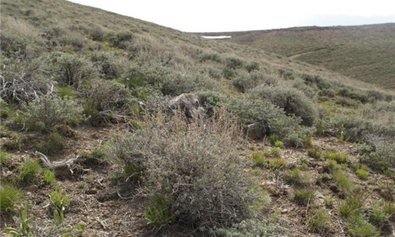
Figure 1. Claypan 12-16 P.Z. Community Phase 1.1
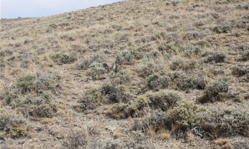
Figure 2. Claypan 12-16 P.Z. Community Phase 1.1 (2)
The reference community is dominated by Idaho fescue, bluebunch wheatgrass and low sagebrush. Balsamroot, Thurber's needlegrass, and bluegrasses are other important species associated with this site. These tend to be forb rich sites (5-15 percent by weight). Potential vegetative composition is about 60 percent grasses, 10 percent forbs and 30 percent shrubs. Approximate ground cover (basal and crown) is 25 to 40 percent.
Dominant plant species
-
little sagebrush (Artemisia arbuscula), shrub
-
Idaho fescue (Festuca idahoensis), grass
Figure 3. Annual production by plant type (representative values) or group (midpoint values)
Table 5. Annual production by plant type
| Plant type | Low (lb/acre) |
Representative value (lb/acre) |
High (lb/acre) |
|---|---|---|---|
| Grass/Grasslike | 360 | 480 | 720 |
| Shrub/Vine | 180 | 240 | 360 |
| Forb | 60 | 80 | 120 |
| Total | 600 | 800 | 1200 |
Community 1.2
Community Phase
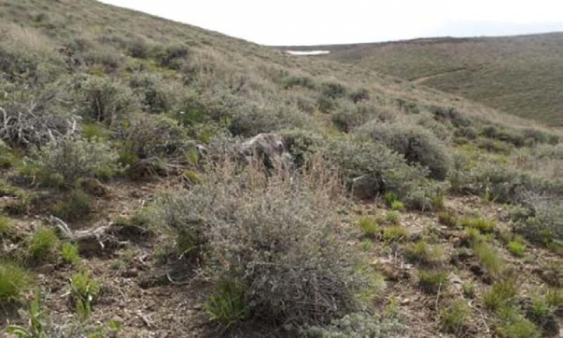
Figure 4. Plant community 1.2a
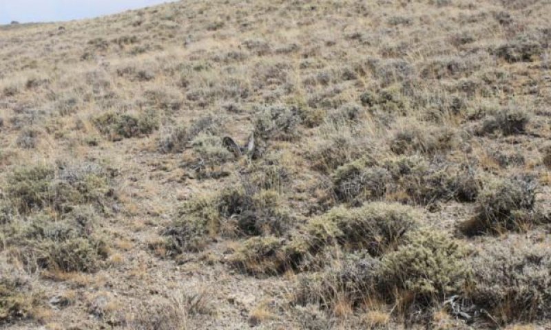
Figure 5. Plant community 1.2b
This community phase is characterized by a post-disturbance, early seral, plant community. Sagebrush and other shrubs are reduced, or patchy. Perennial bunchgrasses and forbs dominate the visual aspect of the plant community. Disturbance tolerant shrubs such as Ribes or rabbitbrush will sprout from the root-crown following low and medium intensity wildfire and may dominate the plant community 2 to 5 years post-disturbance.
Resilience management. Low sagebrush is killed by fire and does not sprout (Young 1983). Establishment after fire is from seed, generally blown in and not from the seed bank (Bradley et al. 1992). Fire risk is greatest following a wet, productive year when there is greater production of fine fuels (Beardall and Sylvester 1976). Fire return intervals have been estimated at 100-200 years in black sagebrush (Artemisia nova) dominated sites (Kitchen and McArthur 2007) and likely is similar in the low sagebrush ecosystem; however, historically fires were probably patchy due to the low productivity of these sites. Mature Idaho fescue plants are commonly reported to be severely damaged by fire in all seasons (Wright et al. 1979). Initial mortality may be high (in excess of 75%) on severe burns, but usually varies from 20 to 50% (Barrington et al 1988). Rapid burns have been found to leave little damage to root crowns, and new tillers are produced with onset of fall moisture (Johnson et al. 1994).
Community 1.3
Community Phase
This community phase is characteristics of a late-seral community phase. Decadent sagebrush dominates the overstory and the deep-rooted perennial bunchgrasses reduced in both vigor and productivity due to competition for light, moisture and nutrient resources. Sandberg bluegrass is stable or increasing in the understory.
Pathway 1.1A
Community 1.1 to 1.2
Low severity fire creates grass/sagebrush mosaic; high severity fire significantly reduces sagebrush cover and leads to early/mid seral community, dominated by grass and forbs.
Context dependence. Fires are typically low severity resulting in a mosaic pattern due to low fuel loads. A fire following an unusually wet spring facilitating an increase in fine fuels may be more severe and reduce sagebrush cover to trace amounts. Frequency and intensity of wildfire is primarily driven by cover and amount of herbaceous vegetation.
Pathway 1.1B
Community 1.1 to 1.3
Time and lack of disturbance such as fire allows for sagebrush to increase and become decadent. Prolonged drought and repeated heavy growing season grazing of bunchgrasses or combinations of these will generally cause a decline in perennial bunchgrasses and fine fuels reducing fire frequency and favoring dominance by sagebrush.
Pathway 1.2A
Community 1.2 to 1.1
Absence of disturbance and natural regeneration over time allows sagebrush to recover. Recovery of sagebrush depends on the availability of a local seed source (patches of mature shrubs) as well as precipitation patterns favorable for germination and seedling recruitment. Sagebrush seedlings are susceptible to less than favorable conditions for several years.
Context dependence. Recovery time of low sagebrush following fire is variable (Young 1983). After fire, if regeneration conditions are favorable, low sagebrush recovers in 2 to 5 years, however on harsh sites where cover is low to begin with and/or erosion occurs after fire, recovery may require more than 10 years (Young 1983). Slow regeneration may subsequently worsen erosion (Blaisdell 1982).
Pathway 1.3A
Community 1.3 to 1.1
Low intensity, patchy wildfire or insect infestation would reduce sagebrush overstory creating a mosaic on the landscape. Sagebrush cover is reduced and perennial bunchgrasses and forbs increase, dominating disturbed patches due to an increase in light, moisture and nutrient resources.
Pathway 1.3B
Community 1.3 to 1.2
Wide spread, high severity fire significantly reduces sagebrush cover leading to early mid-seral community.
Context dependence. Fire will decrease or eliminate the overstory of sagebrush and allow for the perennial bunchgrasses to dominate the site. If non-natives are present nearby this site is at-risk of invasion following fire due to increased resource availability.
State 2
Current Potential State
This state is similar to the Reference State 1.0. Ecological function has not changed, however the resiliency of the state has been reduced by the presence of invasive weeds. This state has the same three general community phases. These non-natives can be highly flammable, and can promote fire where historically fire had been infrequent. Negative feedbacks enhance ecosystem resilience and contribute to the stability of the state. These include the presence of all structural and functional groups, low fine fuel loads and retention of organic matter and nutrients. Positive feedbacks decrease ecosystem resilience and stability of the state. These include the non-natives’ high seed output, persistent seed bank, rapid growth rate, ability to cross pollinate and adaptations for seed dispersal.
Characteristics and indicators. Management would be to maintain high diversity of native species to promote organic matter inputs and reduce dispersal and seed production of the non-native invasive species.
Dominant plant species
-
little sagebrush (Artemisia arbuscula), shrub
-
Idaho fescue (Festuca idahoensis), grass
-
bluebunch wheatgrass (Pseudoroegneria spicata), grass
Community 2.1
Community Phase
This community is compositionally similar to the Reference State Community 1.1. This community phase also has a trace of annual weeds. Low sagebrush, bluebunch wheatgrass, Idaho fescue and perennial forbs dominate the site. Other shrubs and perennial grasses make up smaller components of this site.
Resilience management. The presence of non-native annuals has reduced site resilience. Management actions should focus on maintaining the presence of all functional and structural groups and minimizing wildfire and soil disturbing practices.
Community 2.2
Community Phase
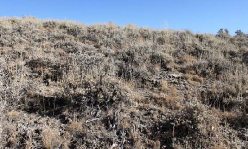
Figure 6. Plant community 2.2
This community is characteristic of a post-wildfire plant community with non-native annuals. Annual non-native species may be stable or increasing. Depending on fire severity patches of intact sagebrush may remain. Perennial bunchgrasses and forbs recover rapidly and may be a significant component for a number of years following fire.
Resilience management. Sandberg’s bluegrass has been found to increase following fire likely due to its low stature and productivity (Daubenmire 1975) and may retard reestablishment of deeper rooted bunchgrass.
Community 2.3
Community Phase (At Risk)
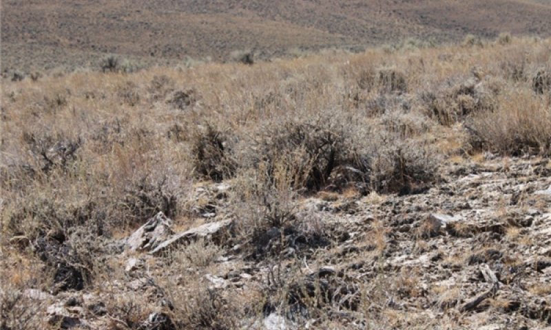
Figure 7. Claypan 12-16 P.Z. Community Phase 2.3
This community is characterized by an increase in low sagebrush, balsamroot, and bluegrass. Deep-rooted perennial bunchgrasses are reduced to trace amounts, bluegrass is dominant herbaceous species. Annual non-natives are stable or increasing.
Pathway 2.1a
Community 2.1 to 2.2
Prolonged drought and repeated heavy growing season grazing of bunchgrasses. Fire reduces the shrub overstory and allows for perennial bunchgrasses to dominate the site. Fire may be patchy resulting in a mosaic pattern with patches of mature sagebrush remaining. Annual non-native species are likely to increase after fire.
Pathway 2.1b
Community 2.1 to 2.3
Lack of disturbance and natural regeneration over time allows for sagebrush to increase. Coupled with chronic drought reduces fine fuels and leads to a reduced fire frequency, allowing low sagebrush to become decadent. Annual non-natives and Sandberg's bluegrass are stable or increasing.
Context dependence. Inappropriate grazing management further reduces the perennial bunchgrass understory; conversely Sandberg's bluegrass may increase in the understory depending on grazing management.
Pathway 2.2a
Community 2.2 to 2.1
Lack of disturbance and natural regeneration over time allows the shrub component to recover. The re-establishment of sagebrush may take many years.
Context dependence. Recovery time of low sagebrush following fire is variable (Young 1983). After fire, if regeneration conditions are favorable, low sagebrush recovers in 2 to 5 years, however on harsh sites where cover is low to begin with and/or erosion occurs after fire, recovery may require more than 10 years (Young 1983). Slow regeneration may subsequently worsen erosion (Blaisdell 1982).
Pathway 2.3b
Community 2.3 to 2.1
Management and/or disturbance that reduces shrubs will allow for the perennial bunchgrasses in the understory to increase. Low sagebrush remains in a patchy or mosaic pattern.
Context dependence. Heavy late-fall or winter grazing may cause mechanical damage and subsequent death to sagebrush, facilitating an increase in the herbaceous understory. Brush treatments with minimal soil disturbance will also decrease sagebrush and release the perennial understory.
Pathway 2.3a
Community 2.3 to 2.2
Fire will decrease or eliminate the overstory of sagebrush and allow for the perennial bunchgrasses to dominate the site. Fires will typically be widespread resulting in removal of the overstory shrub community. Annual non-native species respond well to fire and may increase post-burn.
Context dependence. Brush management, prescribed grazing and release from drought also facilitates recovery of perennial bunchgrasses. Non-native annuals may also increase. Sandberg’s bluegrass has been found to increase following fire likely due to its low stature and productivity (Daubenmire 1975) and may retard reestablishment of deeper rooted bunchgrass.
State 3
Shrub State
This state is characterized by dominance of low sagebrush and rabbitbrush. The deep-rooted perennial bunchgrass component is missing and the understory is dominated by bluegrass and/or annual non-native species. Nutrient cycling and energy cycling have been truncated by the lack of deep-rooted bunchgrasses. Pedestalling and bare ground has increased and soil moisture is reduced due to the redistribution of water off site.
Dominant plant species
-
little sagebrush (Artemisia arbuscula), shrub
-
bluegrass (Poa), grass
Community 3.1
Community Phase
This community is dominated by low sagebrush and rabbitbrush. Annual non-native species and bluegrass dominate the understory and bare ground is increasing.
Resilience management. This community phase is at-risk of increased soil erosion
Community 3.2
Community Phase
This community is similar to community phase 3.1 in species composition. However, soils are actively eroding, bare ground is increasing, and excessive frost-heaving and pedestalling of plants is apparent.
Pathway 3.1a
Community 3.1 to 3.2
Further degradation from excessive herbivory, prolonged drought, or other significant soil erosion events.
Context dependence. Inappropriate or excessive sheep grazing could also reduce cover of sagebrush and allow for sprouting shrubs to dominate the community. Brush treatments with minimal soil disturbance may also facilitate increased rabbitbrush and Sandberg’s bluegrass.
Pathway 3.2a
Community 3.2 to 3.1
Time and lack of disturbance and/or management that favors the establishment and growth of sagebrush. The establishment of low sagebrush on harsh sites may require more than 10 years (Young 1983). Slow regeneration may subsequently worsen erosion (Blaisdell 1982).
State 4
Eroded State
This state is dominated by annual non-native species, such as cheatgrass, annual mustards, and medusahead. Soil moisture, soil nutrients and soil organic matter distribution and cycling are severely altered due to degraded soil surface conditions.
Dominant plant species
-
little sagebrush (Artemisia arbuscula), shrub
-
yellow rabbitbrush (Chrysothamnus viscidiflorus), shrub
-
cheatgrass (Bromus tectorum), grass
Community 4.1
Community Phase
Figure 8. Claypan 12-16 P.Z. Community Phase 4.1 (Burned)
This community is dominated by annual non-native species, such as cheatgrass, mustard, medusahead, etc. Erosion of the site may be significant; however, stones and cobbles present on the soil surface will help mitigate some erosional processes. Trace amounts of bluegrass remain. There is no known restoration pathway.
Transition T1A
State 1 to 2
Trigger: This transition is caused by the introduction of non-native annual plants, such as cheatgrass and mustards. Slow variables: Over time the annual non-native species will increase within the community. Threshold: Any amount of introduced non-native species causes an immediate decrease in the resilience of the site. Annual non-native species cannot be easily removed from the system and have the potential to significantly alter disturbance regimes from their historic range of variation.
Transition T1B
State 1 to 3
Trigger: Repeated, heavy, growing season grazing will decrease or eliminate deep rooted perennial bunchgrasses, increase Sandberg bluegrass and favor shrub growth and establishment. From community phase 1.3 to community phase 3.2: Severe fire will remove sagebrush overstory, decrease perennial bunchgrasses and enhance Sandberg bluegrass. Slow variables: Long term decrease in deep-rooted perennial grass density. Threshold: Loss of deep-rooted perennial bunchgrasses changes nutrient cycling, nutrient redistribution, and reduces soil organic matter.
Transition T2A
State 2 to 3
Trigger: Prolonged drought coupled with excessive herbivory will decrease or eliminate deep-rooted perennial bunchgrasses. Soil disturbing practices/management actions will also reduce sagebrush and favor an increase in Sandberg bluegrass. Slow variables: Long term decrease in deep-rooted perennial grass seed production, reproduction, and density allows for an increase in Sandberg bluegrass and shrub growth and establishment. Threshold: Loss of deep-rooted perennial bunchgrasses changes nutrient cycling, reduces soil organic matter, and results in the redistribution of precipitation - increased runoff and decreased infiltration.
Transition T2B
State 2 to 4
Trigger: Multiple wildfires and/or soil disturbing treatments that remove native species. Slow variables: Increased seed production and cover of annual non-native species. Threshold: Increased, continuous fine fuels modify the fire regime by changing frequency, intensity, size and spatial variability of fires. Changes in plant community composition and spatial variability of vegetation due to the loss of perennial bunchgrasses and sagebrush truncate energy capture and impact the temporal and spatial aspects of nutrient cycling and distribution.
Restoration pathway R3A
State 3 to 2
Herbicide treatment, followed seeding with native perennial bunchgrasses, and grazing management that facilitating reestablishment or an increase in perennial bunchgrasses and a decline in shrubs. Probability of success is low. Risk of increased soil erosion and establishment on non-natives is high. Frost heaving in the spring may reduce seedling establishment.
Transition T3A
State 3 to 4
Trigger: Multiple wildfires and/or soil disturbing treatments that remove native species. Slow variables: Increased seed production and cover of annual non-native species. Threshold: Increased, continuous fine fuels modify the fire regime by changing frequency, intensity, size and spatial variability of fires. Changes in plant community composition and spatial variability of vegetation due to the loss of perennial bunchgrasses and sagebrush truncate energy capture and impact the temporal and spatial aspects of nutrient cycling and distribution.
Additional community tables
Table 6. Community 1.1 plant community composition
| Group | Common name | Symbol | Scientific name | Annual production (lb/acre) | Foliar cover (%) | |
|---|---|---|---|---|---|---|
|
Grass/Grasslike
|
||||||
| 1 | Primary Perennial Grasses | 272–608 | ||||
| Idaho fescue | FEID | Festuca idahoensis | 160–320 | – | ||
| bluebunch wheatgrass | PSSPS | Pseudoroegneria spicata ssp. spicata | 80–160 | – | ||
| bluegrass | POA | Poa | 16–64 | – | ||
| Thurber's needlegrass | ACTH7 | Achnatherum thurberianum | 16–64 | – | ||
| 2 | Secondary Perennial Grasses | 16–64 | ||||
| Webber needlegrass | ACWE3 | Achnatherum webberi | 4–24 | – | ||
| squirreltail | ELEL5 | Elymus elymoides | 4–24 | – | ||
| thickspike wheatgrass | ELLAL | Elymus lanceolatus ssp. lanceolatus | 4–24 | – | ||
| basin wildrye | LECI4 | Leymus cinereus | 4–24 | – | ||
| spike fescue | LEKI2 | Leucopoa kingii | 4–24 | – | ||
|
Forb
|
||||||
| 3 | Perennial Forbs | 40–100 | ||||
| aster | ASTER | Aster | 4–40 | – | ||
| balsamroot | BALSA | Balsamorhiza | 4–40 | – | ||
| tapertip hawksbeard | CRAC2 | Crepis acuminata | 4–40 | – | ||
| fleabane | ERIGE2 | Erigeron | 4–40 | – | ||
| buckwheat | ERIOG | Eriogonum | 4–40 | – | ||
| lupine | LUPIN | Lupinus | 4–40 | – | ||
| phlox | PHLOX | Phlox | 4–40 | – | ||
|
Shrub/Vine
|
||||||
| 4 | Primary Shrubs | 160–240 | ||||
| little sagebrush | ARAR8 | Artemisia arbuscula | 160–240 | – | ||
| 5 | Secondary Shrubs | 16–64 | ||||
| Utah serviceberry | AMUT | Amelanchier utahensis | 8–24 | – | ||
| yellow rabbitbrush | CHVI8 | Chrysothamnus viscidiflorus | 8–24 | – | ||
| currant | RIBES | Ribes | 8–24 | – | ||
Interpretations
Animal community
Livestock Interpretations:
Domestic sheep and, to a much lesser degree, cattle consume low sagebrush, particularly during the spring, fall, and winter (Sheehy and Winward 1981). Severe trampling damage to supersaturated soils could occur if sites are used in early spring when there is abundant snowmelt. Trampling damage, particularly from cattle or horses, in low sagebrush habitat types is greatest when high clay content soils are wet. In drier areas with more gravelly soils, no serious trampling damage occurs, even when the soils are wet (Hironaka et al. 1983). Idaho fescue is favored by light to moderate grazing (Ganskopp and Bedell 1980) and is moderately resistant to trampling (Cole 1987). Heavy grazing may lead to replacement of Idaho fescue with non-native species such as cheatgrass (Mueggler 1984). Bunchgrasses, in general, best tolerate light grazing after seed formation. Britton and others (1979) observed the effects of harvest date on basal area of 5 bunchgrasses in eastern Oregon, including Idaho fescue, and found grazing from August to October (after seed set) has the least impact on these bunchgrasses. Therefore, abusive grazing during the growing season will reduce perennial bunchgrasses, with the exception of Sandberg’s bluegrass (Tisdale and Hironaka 1981). Abusive grazing by cattle or horses will likely increase low sagebrush, rabbitbrush and some forbs such as arrowleaf balsamroot. Annual non-native weedy species such as cheatgrass and mustards, and potentially medusahead, may invade.
This site has limited value for livestock grazing, due to steep slopes. Grazing management should be keyed to dominant grasses production. Idaho fescue provides important forage for many types of domestic livestock. The foliage cures well and is preferred by livestock in late fall and winter. Bluebunch wheatgrass is considered one of the most important forage grass species on western rangelands for livestock. Although bluebunch wheatgrass can be a crucial source of forage, it is not necessarily the most highly preferred species. Thurber’s needlegrass species begin growth early in the year and remain green throughout a relatively long growing season. This pattern of development enables animals to use Thurber’s needlegrass when many other grasses are unavailable. Cattle prefer Thurber’s needlegrass in early spring before fruits have developed as it becomes less palatable when mature. Thurber’s needlegrasses are grazed in the fall only if the fruits are softened by rain. Bluegrass is a widespread forage grass. It is one of the earliest grasses in the spring and is sought by domestic livestock and several wildlife species. Nevada bluegrass is a palatable species, but its production is closely tied to weather conditions. It produces little forage in drought years, making it a less dependable food source than other perennial bunchgrasses. Domestic sheep and to a much lesser degree cattle consume low sagebrush, particularly during the spring, fall and winter.
Stocking rates vary over time depending upon season of use, climate variations, site, and previous and current management goals. A safe starting stocking rate is an estimated stocking rate that is fine tuned by the client by adaptive management through the year and from year to year.
Wildlife Interpretations:
Idaho fescue provides important forage for several wildlife species. It is reported to be good forage for pronghorn, and deer in ranges of northern Nevada. Bluebunch wheatgrass is considered one of the most important forage grass species on western rangelands for wildlife. Bluebunch wheatgrass does not generally provide sufficient cover for ungulates, however, mule deer are frequently found in bluebunch-dominated grasslands. Thurber needlegrass is valuable forage for wildlife. Low sagebrush is considered a valuable browse plant during the spring, fall and winter months. In some areas it is of little value in winter due to heavy snow. Mule deer utilize and sometimes prefer low sagebrush, particularly in winter and early spring. Sagebrush-grassland communities provide critical sage-grouse breeding and nesting habitats. Sagebrush is a crucial component of their diet year-round, and sage-grouse select sagebrush almost exclusively for cover.
Hydrological functions
Runoff is high to very high. Permeability is very slow to moderate. Hydrologic soil groups are B, C, and D. Rills are none. Rock fragments armor the surface. Water flow patterns are none to rare. Rock fragments armor the surface. Pedestals are none to rare. Occurrence is usually limited to areas of water flow patterns. Frost heaving of shallow rooted plants should not be considered an indicator of soil erosion. Gullies are none. Perennial herbaceous plants (especially deep-rooted bunchgrasses [i.e., Idaho fescue]) slow runoff and increase infiltration. Shrub canopy and associated litter break raindrop impact and provide opportunity for snow catch and accumulation on site.
Recreational uses
Aesthetic value is derived from the diverse floral and faunal composition and the colorful flowering of wild flowers and shrubs during the spring and early summer. This site offers rewarding opportunities to photographers and for nature study. This site is used for hiking and has potential for upland and big game hunting.
Other information
Low sagebrush can be successfully transplanted or seeded in restoration.
Supporting information
Inventory data references
NRCS-RANGE-417 = 6 records
NV-ECS-1 = 6 records
Type locality
| Location 1: Humboldt County, NV | |
|---|---|
| Township/Range/Section | T35N R39E S19 |
| UTM zone | N |
| UTM northing | 4527236 |
| UTM easting | 446727 |
| Latitude | 40° 53′ 40″ |
| Longitude | 117° 37′ 56″ |
| General legal description | NW¼SW¼ About 6 miles southeast of Winnemucca, Water Canyon area, Sonoma Range, Humboldt County, Nevada. This site also occurs in Eureka, Lander, and Pershing Counties, Nevada. |
Other references
Barrington, M., S. Bunting, and G. Wright. 1988. A fire management plan for Craters of the Moon National Monument. Cooperative Agreement CA-9000-8-0005. Moscow, ID: University of Idaho, Range Resources Department. 52 p. Draft.
Beardall, L.E. and V.E. Sylvester. 1976. Spring burning for removal of sagebrush competition in Nevada. In: Proceedings, Tall Timbers fire ecology conference and fire and land management symposium; 1974 October 8-10; Missoula, MT. No. 14. Tallahassee, FL: Tall Timbers Research Station:539-547 p.
Blaisdell, J. P., R.B Murray, and D.E. McArthur. 1982. Managing Intermountain rangelands--sagebrush-grass ranges. Gen. Tech. Rep. INT-134. Ogden, UT: U.S. Department of Agriculture, Forest Service, Intermountain Forest and Range Experiment Station. 41 p.
Bradley, A.F., N.V. Noste, and W.C. Fischer. 1992. Fire ecology of forests and woodlands in Utah. Gen. Tech. Rep. INT-287. Ogden, UT. U.S. Department of Agriculture, Forest Service, Intermountain Research Station. 128 p.
Britton, C.M., F.A. Sneva, and R.G. Clark. 1979. Effect of harvest date on five bunchgrasses of eastern Oregon. In: 1979 Progress report: research in rangeland management. Special Report 549. Corvallis, OR: Oregon State University, Agricultural Experiment Station:16-19 p. In cooperation with: U.S. Department of Agriculture, SEA-AR.
Caudle, D., J. DiBenedetto, M. Karl, H. Sanchez, and C. Talbot. 2013. Interagency ecological site handbook for rangelands. Available at: http://jornada.nmsu.edu/sites/jornada.nmsu.edu/files/InteragencyEcolSiteHandbook.pdf
Chambers, J., B. Bradley, C. Brown, C. D’Antonio, M. Germino, J. Grace, S. Hardegree, R. Miller, and D. Pyke. 2013. Resilience to Stress and Disturbance, and Resistance to Bromus tectorum L. Invasion in Cold Desert Shrublands of Western North America. Ecosystems:1-16 p.
Cole, D.N. 1987. Effects of three seasons of experimental trampling on five montane forest communities and a grassland in western Montana, USA. Biological Conservation 40:219-244.
Conrad, C.E. and C.E. Poulton. 1966. Effect of a wildfire on Idaho fescue and bluebunch wheatgrass. Journal of Range Management 19(3):138-141.
Daubenmire, R.F. 1975. Plant succession on abandoned fields, and fire influences, in a steppe area in southeastern Washington. Northwest Science 49(1):36-48.
Fire Effects Information System (Online; http://www.fs.fed.us/database/feis/plants/).
Ganskopp, D.C. and T.E. Bedell. 1980. Effects of grazing and drought on range grasses. Extension Circular 1006. Corvallis, OR: Oregon State University, Extension Service. 7 p.
Hironaka, M., M.A. Fosberg, and A.H. Winward. 1983. Sagebrush-grass habitat types of southern Idaho. Bulletin Number 35. Moscow, ID: University of Idaho, Forest, Wildlife and Range Experiment Station. 44 p.
Johnson, C.G., Jr., R.R. Clausnitzer, P.J. Mehringer, and C.D. Oliver. 1994. Biotic and abiotic processes of Eastside ecosystems: the effects of management on plant and community ecology and on stand and landscape vegetation dynamics. Gen. Tech. Rep. PNW-GTR-322. Portland, OR: U.S. Department of Agriculture, Forest Service, Pacific Northwest Research Station. 66 p.
Kitchen, S. G. and E. D. McArthur. 2007. Big and black sagebrush landscapes. Pages 73-95 in Fire ecology and mangement of the major ecosystems of southern Utah. Gen. Teck. Rep. RMRMS-GTR-202. U.S. Department of Agriculture, Forest Service, Rocky Mountain Research Station, Fort Collins, CO.
Kuntz, D.E. 1982. Plant response following spring burning in an Artemisia tridentata subsp. vaseyana/Festuca idahoensis habitat type. Moscow, ID: University of Idaho. 73 p. Thesis.
Mueggler, W.F. 1984. Diversity of western rangelands. In: Natural diversity in forest ecosystems: Proceedings; 1982; Athens, GA. Athens, GA: University of Georgia, Institute of Ecology: 211-217 p.
Robberecht, R.D and G.E. Defosse. 1995. The relative sensitivity of two bunchgrass species to fire. International Journal of Wildland Fire 5(3):127-134.
Sheehy, D.P. and A.H. Winward. 1981. Relative palatability of seven Artemisia taxa to mule deer and sheep. Journal of Range Management 34(5):397-399.
Tisdale, E.W. and M. Hironaka. 1981. The sagebrush-grass region: a review of the ecological literature. Bull. 33. Moscow, ID: University of Idaho, Forest, Wildlife and Range Experiment Station. 31 p.
USDA-NRCS Plants Database (Online; http://www.plants.usda.gov).
Wright, H.A., L.F. Neuenschwander, and C.M. Britton. 1979. The role and use of fire in sagebrush-grass and pinyon-juniper plant communities: A state-of-the-art review. Gen. Tech. Rep. INT-58. Ogden, UT: U.S. Department of Agriculture, Forest Service, Intermountain Forest and Range Experiment Station. 48 p.
Young, R.P. 1983. Fire as a vegetation management tool in rangelands of the Intermountain region. In: Monsen, S.B. and N. Shaw (eds). Managing Intermountain rangelands--improvement of range and wildlife habitats: Proceedings of symposia; 1981 September 15-17; Twin Falls, ID; 1982 June 22-24; Elko, NV. Gen. Tech. Rep. INT-157. Ogden, UT. U.S. Department of Agriculture, Forest Service, Intermountain Forest and Range Experiment Station.18-31 p.
Contributors
CP/GKB
A. Argullin/E. Hourihan
Approval
Kendra Moseley, 3/07/2025
Rangeland health reference sheet
Interpreting Indicators of Rangeland Health is a qualitative assessment protocol used to determine ecosystem condition based on benchmark characteristics described in the Reference Sheet. A suite of 17 (or more) indicators are typically considered in an assessment. The ecological site(s) representative of an assessment location must be known prior to applying the protocol and must be verified based on soils and climate. Current plant community cannot be used to identify the ecological site.
| Author(s)/participant(s) | Patti Novak-Echenique |
|---|---|
| Contact for lead author | State Rangeland Management Specialist |
| Date | 03/18/2010 |
| Approved by | Kendra Moseley |
| Approval date | |
| Composition (Indicators 10 and 12) based on | Annual Production |
Indicators
-
Number and extent of rills:
Rills are none. Rock fragments armor the surface. -
Presence of water flow patterns:
Water flow patterns are none to rare. Rock fragments armor the surface. A few may occur on steeper slopes after summer convection storms or rapid snowmelt. They will be short (<1m), meandering and disconnected. They will begin to heal during the following growing season. -
Number and height of erosional pedestals or terracettes:
Pedestals are none to rare. Occurrence is usually limited to areas of water flow patterns. Frost heaving of shallow rooted plants should not be considered an indicator of soil erosion. -
Bare ground from Ecological Site Description or other studies (rock, litter, lichen, moss, plant canopy are not bare ground):
Bare Ground ± 5-20% depending on amount of surface rock fragments. -
Number of gullies and erosion associated with gullies:
None -
Extent of wind scoured, blowouts and/or depositional areas:
None -
Amount of litter movement (describe size and distance expected to travel):
Fine litter (foliage from grasses and annual & perennial forbs) expected to move distance of slope length during intense summer convection storms or rapid snowmelt events. Persistent litter (large woody material) will remain in place except during large rainfall events. -
Soil surface (top few mm) resistance to erosion (stability values are averages - most sites will show a range of values):
Soil stability values should be 3 to 6 on most soil textures found on this site. (To be field tested). -
Soil surface structure and SOM content (include type of structure and A-horizon color and thickness):
Surface structure is typically very fine to thick platy or subangular blocky. Soil surface colors are browns and soils have a mollic epipedon. Organic matter of the surface 2 to 4 inches is typically less than 2 percent dropping off quickly below. Organic matter content can be more or less depending on micro-topography. -
Effect of community phase composition (relative proportion of different functional groups) and spatial distribution on infiltration and runoff:
Perennial herbaceous plants (especially deep-rooted bunchgrasses [i.e., Idaho fescue]) slow runoff and increase infiltration. Shrub canopy and associated litter break raindrop impact and provide opportunity for snow catch and accumulation on site. -
Presence and thickness of compaction layer (usually none; describe soil profile features which may be mistaken for compaction on this site):
Compacted layers are none. Subangular blocky, platy, or massive sub-surface horizons or subsoil argillic horizons are not to be interpreted as compacted. -
Functional/Structural Groups (list in order of descending dominance by above-ground annual-production or live foliar cover using symbols: >>, >, = to indicate much greater than, greater than, and equal to):
Dominant:
Reference Plant Community: Deep-rooted, cool season, perennial bunchgrasses > low shrubs (low sagebrush).Sub-dominant:
Associated shrubs > shallow-rooted, cool season, perennial bunchgrasses > deep-rooted, cool season, perennial forbs > fibrous, shallow-rooted, cool season, perennial forbs = annual forbsOther:
succulents, microbiotic crustsAdditional:
Although fire is rare on this site, with an extended fire return interval, the shrub component will increase at the expense of the herbaceous component. -
Amount of plant mortality and decadence (include which functional groups are expected to show mortality or decadence):
Dead branches within individual shrubs common and standing dead shrub canopy material may be as much as 20 percent of total woody canopy; some of the mature bunchgrasses (<10 percent) have dead centers. -
Average percent litter cover (%) and depth ( in):
Between plant interspaces (± 20-35 percent) and litter depth is ±¼ inch. -
Expected annual annual-production (this is TOTAL above-ground annual-production, not just forage annual-production):
For normal or average growing season (through June) ± 800 lbs/ac; Spring moisture significantly affects total production. Favorable years ± 1200 lbs/ac and unfavorable years ± 600 lbs/ac. -
Potential invasive (including noxious) species (native and non-native). List species which BOTH characterize degraded states and have the potential to become a dominant or co-dominant species on the ecological site if their future establishment and growth is not actively controlled by management interventions. Species that become dominant for only one to several years (e.g., short-term response to drought or wildfire) are not invasive plants. Note that unlike other indicators, we are describing what is NOT expected in the reference state for the ecological site:
Potential invaders include cheatgrass, Russian thistle, halogeton, and annual mustards. -
Perennial plant reproductive capability:
All functional groups should reproduce in average (or normal) and above average growing season years. Reduced growth and reproduction occur during extreme or extended drought periods.
Print Options
Sections
Font
Other
The Ecosystem Dynamics Interpretive Tool is an information system framework developed by the USDA-ARS Jornada Experimental Range, USDA Natural Resources Conservation Service, and New Mexico State University.
Click on box and path labels to scroll to the respective text.
| T1A | - | Introduction of non-native species |
|---|---|---|
| T1B | - | Loss of deep-rooted perennial bunchgrass |
| T2A | - | Loss of deep-rooted perennial bunchgrass |
| T2B | - | Increase size and frequency of wildfire |
| R3A | - | Herbicide treatment and seeding with native species |
| T3A | - | Increased size and frequency of wildfire |