Major Land Resource Area 024X
Humboldt Basin and Range Area
Accessed: 04/10/2026
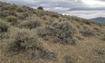
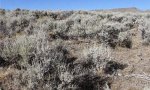
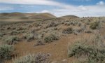
Description
MLRA is in Nevada (94 percent) and Oregon (6 percent). It makes up about 13,380 square miles (34,655 square kilometers). The area is characterized by a series of widely spaced, north-south-trending, uplifted fault-block mountain ranges that are separated by wide valleys filled with alluvium and lacustrine materials. Precipitation and elevation increase toward the extensive lava plateaus to the east and west. MLRA 24 has a gradual boundary with MLRAs 23, 25, and 27. The externally drained plateaus of MLRA 24 contrast with the internally drained plateaus and basins of MLRA 23. Directly to the east in MLRA 25, precipitation increases and mean annual temperature decreases, resulting in a shorter growing season and increased available soil moisture. To the southwest in MLRA 27, soil temperatures warm and elevations decrease, giving way to extensive playas, visible shorelines, and piedmont slopes dominated by Bailey’s greasewood.
Key publications
Geographic subunits
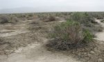
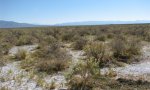
Land Resource Unit 2. MLRA DX02402X - Lacustrine influenced basins and playas Topography: This LRU represents the lowest, driest part of the MLRA 24. Topography is dominated by basins floors and playas of the upper Lahontan Basin. Elevations are <1500m, with a median value of 1350m. This area generally flat, median slopes values are <2% and 95% of the area is <15%. Soil characteristics: Soils in this area are derived from lacustrine sediment, with a mesic soil temperature regime and typic aridic or aridic-xeric soil moisture regime. Soils are very deep and saline and/or sodic. Benchmark soils typical of MLRA 24 include, Boton Series, a Duric Torriorthent on lake plains and basin floors that formed in lacustrine sediments. Somewhat poorly drained Halaquepts (Wendane series) also occurs on basin floors that formed in alluvium on flood plains. Climate: The basin floors are warmer and dryer than the surrounding LRUs. Mean annual precipitation ranges from 226-506mm (8-22”) with a median value of 222mm (8.7”) (25th-75th% = 210-235mm), mean annual air temperature ranges from 9.1-10.34C (F). Evaporation exceeds precipitation for the entire area. Soil characteristics typically have a negative impact on infiltration further minimizing effective moisture. Biological Resources: Shadscale and bud sagebrush associated with Indian ricegrass and bottlebrush squirreltail are dominant on the drier sites. Black greasewood, basin wildrye are locally important on low terraces and flood plains. Winterfat is prevalent on very deep, fine textured soils.
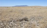
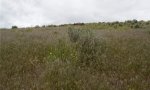
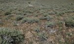
Land Resource Unit 3. MLRA DX02403X – Peidmont slope Topography: This LRU is characterized by alluvial material of the basin and range. Topography is dominated by peidmont slope including alluvial fans and rock pediments. Elevations range from 1400-1900m, with a median value of 1600m. This area is not characterized by high relief, with the typical slope value being 10% or less, but may be as high as 45% in limited areas. Soil characteristics: Soils comprising this LRU formed in alluvium derived from mixed parent material, with a mesic soil temperature regime and an aridic bordering on xeric or xeric bordering on aridic soil moisture regime. Lower elevations areas of this LRU commonly have soils that have a typic aridic soil moisture regime. Haplocambids formed in loess over alluvium on lower alluvial fans and alluvial flats (Broyles and Weso series) and in alluvium on higher alluvial fans (Davey, Enko, and McConnel series). Shallow Argidurids formed in alluvium on fan remnants (Tumtum series) and in loess and alluvium on fan remnants and plateaus (Dewar series). Climate: Mean annual precipitation ranges from 228-342mm (8- 13”) with a median value 263mm (10”) (25th to 75th% =242-296mm), mean annual air temperature ranges from 8.66-10.47 C (47.5-50.8 F). Climate information in this section is derived from PRISM raster data, it should be considered an estimation and corrected when additional climate data is available. Evapotranspiration exceeds precipitation throughout the entire LRU. Biological Resources: This area supports shrub-grass vegetation. Shadscale is dominant at lower elevations of this LRU and big sagebrush and spiny hopsage are extensive on upper elevations. Indian ricegrass and needleandthread on common on sandy soils.
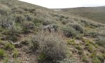
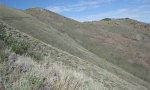
Land Resource Unit 5. MLRA DX02405X – Residuum/Colluvium hills and mountains Topography: This LRU represents the higher elevation mountainous portions of MLRA 24. It is characterized by hills and mountains and areas of high relief. Elevations are greater than 1900m. Slopes range from 8-65% with a median value of 40%. Soil characteristics: Soils primarily formed in residuum and/or colluvium. Soil temperatures range from mesic to frigid to cryic. Soil moisture is aridic bordering on xeric or xeric. Typical soils include moderately deep Haplargids (Roca series) formed in colluvium and residuum on hills and mountain slopes. Moderately deep Argixerolls (Reluctan series) formed in colluvium and residuum on hills, mountains, and plateaus. Benchmark soil series include Roca, a Xeric Halpargid on hills and mountains, formed in residuum and colluvium from volcanic rock and supports big sagebrush and bluebunch wheatgrass. Climate: Mean annual precipitation ranges from 12 to 21” (321-538mm), with a median value of 422mm (16”). Precipitation comes primarily in the forms of snow in the winterMean annual air temperature ranges from 4.9-9.45 C (40-49F). Evapotranspiration exceeds precipitation except at the upper elevations of this LRU. Biological Resources: Low sagebrush is common on soils shallow to a clay horizon. Black sagebrush and big sagebrush are also found throughout the area. Thurber needlegrass, bluebunch wheatgrass, basin wildrye, squirreltail, Sandberg bluegrass, forbs, and Douglas rabbitbrush are common associated plants. Idaho fescue and snowberry are locally important on sites where moisture is favorable and a limited amount Singleleaf pinyon and Utah juniper are found on high rocky areas.
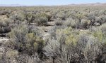
Land Resource Unit 6. MLRA DX02406X – Dissected Lava Plateau Topography: This LRU is characterized by volcanic tablelands, uplifted plateaus, and dissected lava plains in the northern basin and range. Parts of this area was previously included in MLRA 23. Creation of this LRU will result in increased consistency in MLRA concepts across state boundaries, while continuing to recognize that this area is unique from the surrounding areas. Soil characteristics: Soils formed in loess influenced residuum and colluvium. Soil temperatures range from mesic to frigid and soil moisture ranges from aridic bordering on xeric to xeric. Depth to bedrock varies greatly with amount of deposition and/weathering. Soils of this MLRA range from shallow to very deep and are typically characterized by mollic epipedon at the higher elevations. Ochric epipedons are common at the lower limited of this LRU. Climate: mean annual precipitation ranges from <8” in the valleys and playas to more than 16” in the mountains and high elevation plateaus (220-420mm). Precipitation primarily comes as snow during the winter months. Summer thunder storms provide limited and inconsistent, but an important source of moisture Biological Resources: vegetation in this LRU is characterized by a mix of big sage brush (Artemisia tridentata) and bunchgrass. Higher precipitation zones typically support mountain big sagebrush (A. tridentata subsp vaseyana), Idaho fescue (Festuca idahoensis) and bluebunch wheatgrass (Pseudoridgeneria spicata). Lower elevation portions of this LRU support Wyoming big sagebrush (A. tridentata subsp wyomingensis), Indian ricegrass (Achnatherum hymenoides) and Thurber’s needlegrass (Achnatherum thurberania). Basin big sagerush (A. tridentata subsp tridentata) and western juniper (Juniperus occidentalis) can also be found scattered throughout the area.
Next steps
-
1
Select an ecological site
Select an ecological site using the list, keys, photos, briefcase, or quick search option located on this page. -
2
Explore the ecological site description
Next, learn more about the selected ecological site and its characteristic dynamics by browsing the ecological site description and exploring alternative state and transition model formats.
Ecological site list
-
i
Key Characteristics
- Soil characterized by an aridic bordering on xeric soil moisture regime. These soils experience brief periods of moisture in the soil profile typically when plants are dormant. Leaching is minimal and salts may accumulate in the soil profile.
- Soils are moderately well to excessively drained.
- Soil sandy throughout, water removed from soil rapidly
-
-
i
Key Characteristics
- Sites receive less than 8 inches annual precipitation. Soil characterized by a typic aridic soil moisture regime.
- Soil not silty, typically gravelly fine sandy loam
-
i
Key Characteristics
- Soil characterized by a typic aridic soil moisture regime. These soils have physical and chemical properties that keep them dry throughout the year. There is little to no leaching and salts accumulate in the soil profile.
- Soil characterized by water table within 100cm of surface (somewhat poorly or poorly drained soils).
- Soils are poorly drained.
- Soils, relative to RXY024XY009NV, have less of an ability to provide water to plants (lower available water capacity).
-
i
Key Characteristics
- Soil characterized by a typic aridic soil moisture regime. These soils have physical and chemical properties that keep them dry throughout the year. There is little to no leaching and salts accumulate in the soil profile.
- Soils are well, somewhat excessive, or excessively drained (no water table within 150cm of soil surface).
- Soil not sandy throughout, water removed from the soil readily but NOT rapidly
- Soil typically has a fine-silty or fine particle size class (have a small percentage of fine sands or coarser including fragments up to 7.5 cm in diameter).
- Dominant shrub is Shadscale saltbush followed by greasewood as a second dominant shrub. Abiotic factor to differentiate the dominance compared to R024XY013OR is pending.
-
-
i
Key Characteristics
- Sites receive less than 8 inches annual precipitation. Soil characterized by a typic aridic soil moisture regime.
- Soil characterized by a silty texture at surface and throughout the profile.
- Soils at this site are typically on basin floors and inset fans.
-
i
Key Characteristics
- Soil characterized by an aridic bordering on xeric soil moisture regime. These soils experience brief periods of moisture in the soil profile typically when plants are dormant. Leaching is minimal and salts may accumulate in the soil profile.
- Soils are moderately well to excessively drained.
- Soil not sandy throughout, water removed from the soil readily but NOT rapidly
- Soil not strongly sodium effected (can support Wyoming and basin sagebrush).
- Soil typically has less than 35 percent clay in the subsoil (has a fine-loamy or coarse-loamy particle size).
- Site is typically at elevations above 4000 feet.
- Soil at this site typically does not have a clay layer (argilllic horizon).
- pHs typically do not go above 8.8 in the soils at this site.
- Soils at this site are typically on inset fans.
-
i
Key Characteristics
- Site receives 8 inches or more annual precipitation. Soils characterized by a aridic bordering on xeric soil moisture regime.
- Soil greater than 50cm deep (moderately deep, deep, or very deep)
- subsurface accumulation of clay (argillic horizon) present
- Mapped in Nevada. Likely the same site as R024XY016OR.
-
-
i
Key Characteristics
- Soil characterized by an aridic bordering on xeric soil moisture regime. These soils experience brief periods of moisture in the soil profile typically when plants are dormant. Leaching is minimal and salts may accumulate in the soil profile.
- Soils are somewhat poorly or poorly drained
- Soil is characterized by periodic saturation (moisture regime not aquic). See also R024XY608OR.
- Site is typically on floodplains and inset fans.
-
i
Key Characteristics
- Soil characterized by an aridic bordering on xeric soil moisture regime. These soils experience brief periods of moisture in the soil profile typically when plants are dormant. Leaching is minimal and salts may accumulate in the soil profile.
- Soils are somewhat poorly or poorly drained
- Soil is characterized by periodic saturation (moisture regime not aquic). See also R024XY608OR.
- Site is typically on depressional lake beds.
-
i
Key Characteristics
- Soil characterized by an aridic bordering on xeric soil moisture regime. These soils experience brief periods of moisture in the soil profile typically when plants are dormant. Leaching is minimal and salts may accumulate in the soil profile.
- Soils are somewhat poorly or poorly drained
- Soil characterized by continuous saturation (aquic soil moisture regime).
- Soil characterized by an ochric epipedon
- Soil characterized by less than 35 percent clay in the particle size control section (soil not clayey or fine)
- water table 71 to 100cm from the soil surface
-
i
Key Characteristics
- Soil characterized by an aridic bordering on xeric soil moisture regime. These soils experience brief periods of moisture in the soil profile typically when plants are dormant. Leaching is minimal and salts may accumulate in the soil profile.
- Soils are moderately well to excessively drained.
- Soils may have brief or occasional ponding.
-
i
Key Characteristics
- Soil characterized by a typic aridic soil moisture regime. These soils have physical and chemical properties that keep them dry throughout the year. There is little to no leaching and salts accumulate in the soil profile.
- Soil characterized by water table within 100cm of surface (somewhat poorly or poorly drained soils).
- Soils are typically somewhat poorly drained.
- Site is typically in elevations greater than or equal to 5000 feet.
-
i
Key Characteristics
- Soil characterized by an aridic bordering on xeric soil moisture regime. These soils experience brief periods of moisture in the soil profile typically when plants are dormant. Leaching is minimal and salts may accumulate in the soil profile.
- Soils are moderately well to excessively drained.
- Soil not sandy throughout, water removed from the soil readily but NOT rapidly
- Soil not strongly sodium effected (can support Wyoming and basin sagebrush).
- Soil typically has greater than 35 percent clay in the subsoil (is fine textured or ashy).
-
i
Key Characteristics
- Soil characterized by a typic aridic soil moisture regime. These soils have physical and chemical properties that keep them dry throughout the year. There is little to no leaching and salts accumulate in the soil profile.
- Soil characterized by water table within 100cm of surface (somewhat poorly or poorly drained soils).
- Soils are poorly drained.
- Soils, relative to RXY024XY002OR, have more of an ability to provide water to plants (higher available water capacity).
- Soil characterized by an aridic bordering on xeric soil moisture regime. These soils experience brief periods of moisture in the soil profile typically when plants are dormant. Leaching is minimal and salts may accumulate in the soil profile.
- Soils are somewhat poorly or poorly drained
- Soil characterized by continuous saturation (aquic soil moisture regime).
- Soil characterized by an ochric epipedon
- Soil characterized by less than 35 percent clay in the particle size control section (soil not clayey or fine)
- water table 36 to 100cm, soil characterized by longer duration saturation above 50cm
-
-
i
Key Characteristics
- Soil characterized by an aridic bordering on xeric soil moisture regime. These soils experience brief periods of moisture in the soil profile typically when plants are dormant. Leaching is minimal and salts may accumulate in the soil profile.
- Soils are somewhat poorly or poorly drained
- Soil characterized by continuous saturation (aquic soil moisture regime).
- Soil characterized by an ochric epipedon
- Soil characterized by greater than 35 percent clay in the particle size control section (clayey, fine, smeticitic classification). See also R024XY044NV.
-
i
Key Characteristics
- Soil characterized by an aridic bordering on xeric soil moisture regime. These soils experience brief periods of moisture in the soil profile typically when plants are dormant. Leaching is minimal and salts may accumulate in the soil profile.
- Soils are moderately well to excessively drained.
- Soil not sandy throughout, water removed from the soil readily but NOT rapidly
- Soil not strongly sodium effected (can support Wyoming and basin sagebrush).
- Soil typically has less than 35 percent clay in the subsoil (has a fine-loamy or coarse-loamy particle size).
- Site is typically at elevations below 4000 feet.
-
i
Key Characteristics
- Soil characterized by a typic aridic soil moisture regime. These soils have physical and chemical properties that keep them dry throughout the year. There is little to no leaching and salts accumulate in the soil profile.
- Soil characterized by water table within 100cm of surface (somewhat poorly or poorly drained soils).
- Soils are typically somewhat poorly drained.
- Site is typically in elevations below 5000 feet.
- Compared with R025XY015NV, this site typically has a longer duration of flooding. More study on soil moisture is needed.
-
-
i
Key Characteristics
- Soil characterized by a typic aridic soil moisture regime. These soils have physical and chemical properties that keep them dry throughout the year. There is little to no leaching and salts accumulate in the soil profile.
- Soils are well, somewhat excessive, or excessively drained (no water table within 150cm of soil surface).
- Soil not sandy throughout, water removed from the soil readily but NOT rapidly
- Soil typically has a fine-silty or fine particle size class (have a small percentage of fine sands or coarser including fragments up to 7.5 cm in diameter).
- Primary shrub is sickle saltbush. An abiotic factor determining why the dominance of sickle saltbush is pending.
-
-
i
Key Characteristics
- Soil characterized by a mollic epipedon
- soil characterized by a mesic soil temperature regime (mean annual soil temperature is between 8 and 15 degree C) and aridic bordering on xeric or xeric bordering on aridic soil temperature regime. Site represents the transition between landforms dominated by Wyoming big sagebrush and landforms dominated by mountain big sagebrush.
- This site is typically at elevations greater than 6,000 feet. Soils at this site have an abrupt clay layer (argillic horizon) near the surface supporting low sagebrush.
-
i
Key Characteristics
- Soil characterized by a typic aridic soil moisture regime. These soils have physical and chemical properties that keep them dry throughout the year. There is little to no leaching and salts accumulate in the soil profile.
- Soils are well, somewhat excessive, or excessively drained (no water table within 150cm of soil surface).
- Soil not sandy throughout, water removed from the soil readily but NOT rapidly
- Soil typically has a fine-silty or fine particle size class (have a small percentage of fine sands or coarser including fragments up to 7.5 cm in diameter).
- Dominant shrub is greasewood. Second dominant shrub is Shadscale saltbush. Abiotic factor to differentiate the dominance compared to R024XY0003NV is pending.
-
i
Key Characteristics
- Sites receive less than 8 inches annual precipitation. Soil characterized by a typic aridic soil moisture regime.
- Soil characterized by a silty texture at surface and throughout the profile.
- soils at this site are typically on fan skirts and fan aprons.
-
i
Key Characteristics
- Soil characterized by an aridic bordering on xeric soil moisture regime. These soils experience brief periods of moisture in the soil profile typically when plants are dormant. Leaching is minimal and salts may accumulate in the soil profile.
- Soils are moderately well to excessively drained.
- Soil not sandy throughout, water removed from the soil readily but NOT rapidly
- Soil sodium effected in surface expressed by supporting greasewood and other salt tolerant species and high pH in the 9s.
- Soils at this site are mesic (warmer compared to R024XY625OR and R024XY645OR).
-
i
Key Characteristics
- Soil characterized by a typic aridic soil moisture regime. These soils have physical and chemical properties that keep them dry throughout the year. There is little to no leaching and salts accumulate in the soil profile.
- Soil characterized by water table within 100cm of surface (somewhat poorly or poorly drained soils).
- Soils are typically somewhat poorly drained.
- Site is typically in elevations below 5000 feet.
- Compared with R024XY011NV this site has a briefer duration of flooding. More study on soil moisture is needed.
-
-
i
Key Characteristics
- Soil characterized by a mollic epipedon
- soil characterized by a frigid or cryic soil temperature regime (mean annual soil temperature between 0 to 8 degree C)
- accumulation of clay (argillic horizon) present
- soil depth 50cm or less (shallow or very shallow)
- Greater than 35 percent rock fragments (skeletal) by volume throughout the soil profile.
- Landform shape convex-convex, found on ridges and shoulders of mountains.
-
i
Key Characteristics
- Site receives 8 inches or more annual precipitation. Soils characterized by a aridic bordering on xeric soil moisture regime.
- Soil greater than 50cm deep (moderately deep, deep, or very deep)
- subsurface accumulation of clay (argillic horizon) present
- Mapped in Oregon. Likely the same site as R024XY005NV.
-
i
Key Characteristics
- Site receives 8 inches or more annual precipitation. Soils characterized by a aridic bordering on xeric soil moisture regime.
- Soil greater than 50cm deep (moderately deep, deep, or very deep)
- subsurface accumulation of clay (argillic horizon) typically absent.
- Soils at this site typically are on sand sheet landforms and have a coarse surface texture (loamy sand or sandy loam).
-
i
Key Characteristics
- Site receives 8 inches or more annual precipitation. Soils characterized by a aridic bordering on xeric soil moisture regime.
- Soil less than 50cm deep (shallow)
- Soil shallow to a subsurface horizon weakly to strongly cemented by silica (duripan) and non-effervescent above the duripan.
- Soil characterized by an ochric epipedon
- Soil characterized by a mesic soil temperature regime (mean annual soil temperature is between 8 and 15 degree C) and aridic bordering on xeric or xeric bordering on aridic soil moisture regime.
- Soil depth 50cm or less (shallow or very shalllow)
- accumulation of clay (argillic horizon) present
- Depth to bedrock ranges from 36 to 50cm (shallow).
- This site typically is on maximum slopes of 15 percent.
- This site is typically on terraces and fan remnants and typically has a silica cemented layer (duripan) or soft bedrock within 50 to 100 cm of the soil surface.
-
i
Key Characteristics
- Soil characterized by a mollic epipedon
- soil characterized by a frigid or cryic soil temperature regime (mean annual soil temperature between 0 to 8 degree C)
- accumulation of clay (argillic horizon) present
- Ochric epipedon
-
-
i
Key Characteristics
- Soil characterized by an aridic bordering on xeric soil moisture regime. These soils experience brief periods of moisture in the soil profile typically when plants are dormant. Leaching is minimal and salts may accumulate in the soil profile.
- Soils are moderately well to excessively drained.
- Soil not sandy throughout, water removed from the soil readily but NOT rapidly
- Soil not strongly sodium effected (can support Wyoming and basin sagebrush).
- Soil typically has less than 35 percent clay in the subsoil (has a fine-loamy or coarse-loamy particle size).
- Site is typically at elevations above 4000 feet.
- Soil at this site typically has a clay layer (argillic horizon).
-
i
Key Characteristics
- Soil characterized by a mollic epipedon
- soil characterized by a mesic soil temperature regime (mean annual soil temperature is between 8 and 15 degree C) and aridic bordering on xeric or xeric bordering on aridic soil temperature regime. Site represents the transition between landforms dominated by Wyoming big sagebrush and landforms dominated by mountain big sagebrush.
- This site is typically at elevations less than 6,000 feet.
- Soils at this site typically do not have a significant clay layer.
- Soil characterized by an ochric epipedon
- Soil characterized by a mesic soil temperature regime (mean annual soil temperature is between 8 and 15 degree C) and aridic bordering on xeric or xeric bordering on aridic soil moisture regime.
- Soil depth 50cm or less (shallow or very shalllow)
- accumulation of clay (argillic horizon) present
- Depth to bedrock ranges from 36 to 50cm (shallow).
- Soils at this site typically have a dark surface horizon (mollic epipedon; moist color value and chroma 2/3 moist, and 5/2 dry).
-
i
Key Characteristics
- Soil characterized by an ochric epipedon
- Soil characterized by a mesic soil temperature regime (mean annual soil temperature is between 8 and 15 degree C) and aridic bordering on xeric or xeric bordering on aridic soil moisture regime.
- Soil depth 50cm or less (shallow or very shalllow)
- accumulation of clay (argillic horizon) present
- Depth to bedrock ranges from 13 to 38cm (very shallow or shallow), but is typically less than 25cm.
- Soils at this site typically have a high amount of calcium carbonates relative to R024XY057NV.
-
i
Key Characteristics
- Soil characterized by an aridic bordering on xeric soil moisture regime. These soils experience brief periods of moisture in the soil profile typically when plants are dormant. Leaching is minimal and salts may accumulate in the soil profile.
- Soils are moderately well to excessively drained.
- Soil not sandy throughout, water removed from the soil readily but NOT rapidly
- Soil sodium effected in surface expressed by supporting greasewood and other salt tolerant species and high pH in the 9s.
- Soils at this site are mesic (warmer compared to R024XY625OR and R024XY645OR).
-
i
Key Characteristics
- Soil characterized by a mollic epipedon
- soil characterized by a frigid or cryic soil temperature regime (mean annual soil temperature between 0 to 8 degree C)
- accumulation of clay (argillic horizon) absent
- Soil depth greater than 150cm (very deep)
- Less than 35 percent rock fragments by volume throughout the soil profile
-
i
Key Characteristics
- Soil characterized by an ochric epipedon
- Soil characterized by a mesic soil temperature regime (mean annual soil temperature is between 8 and 15 degree C) and typic aridic soil moisture regime.
- The soils at this site have high pH's (in the 9's) close to the surface.
-
i
Key Characteristics
- Soil characterized by an ochric epipedon
- Soil characterized by a mesic soil temperature regime (mean annual soil temperature is between 8 and 15 degree C) and aridic bordering on xeric or xeric bordering on aridic soil moisture regime.
- Soil depth 50cm or less (shallow or very shalllow)
- accumulation of clay (argillic horizon) present
- Depth to bedrock ranges from 36 to 50cm (shallow).
- This site typically is on maximum slopes of 15 percent.
- Stony
-
i
Key Characteristics
- Soil characterized by a mollic epipedon
- soil characterized by a mesic soil temperature regime (mean annual soil temperature is between 8 and 15 degree C) and aridic bordering on xeric or xeric bordering on aridic soil temperature regime. Site represents the transition between landforms dominated by Wyoming big sagebrush and landforms dominated by mountain big sagebrush.
- This site is typically at elevations less than 6,000 feet.
- The soils at this site have a clay layer but it is more gradual clay layer at deeper depths compared to R024XY013NV.
- Soil characterized by a mollic epipedon
- soil characterized by a frigid or cryic soil temperature regime (mean annual soil temperature between 0 to 8 degree C)
- accumulation of clay (argillic horizon) present
- soil depth 50cm or less (shallow or very shallow)
- Less than 35 percent rock fragments by volume throughout the soil profile. Smooth to slightly convex-linear landform shape.
-
i
Key Characteristics
- Soil characterized by an ochric epipedon
- Soil characterized by a mesic soil temperature regime (mean annual soil temperature is between 8 and 15 degree C) and aridic bordering on xeric or xeric bordering on aridic soil moisture regime.
- Soil depth greater than 50cm.
- Site is on south aspects and slopes range from 15 to 50 percent.
-
i
Key Characteristics
- Soil characterized by a mollic epipedon
- soil characterized by a frigid or cryic soil temperature regime (mean annual soil temperature between 0 to 8 degree C)
- accumulation of clay (argillic horizon) present
- Soil 50 to 100cm deep (moderately deep). Greater than 35 percent rock fragments by volume throughout the soil profile (loamy-skeletal)
-
i
Key Characteristics
- Site receives 8 inches or more annual precipitation. Soils characterized by a aridic bordering on xeric soil moisture regime.
- Soil less than 50cm deep (shallow)
- Shallow to a subsurface horizon weakly to strongly cemented by silica (duripan) and violently effervescent throughout.
- Soil characterized by an ochric epipedon
- Soil characterized by a mesic soil temperature regime (mean annual soil temperature is between 8 and 15 degree C) and aridic bordering on xeric or xeric bordering on aridic soil moisture regime.
- Soil depth 50cm or less (shallow or very shalllow)
- accumulation of clay (argillic horizon) typically absent
- Depth to hard bedrock ranges from 18 to 36cm (very shallow and shallow), but typically less than 25cm.
-
-
i
Key Characteristics
- Soil characterized by an ochric epipedon
- Soil characterized by a mesic soil temperature regime (mean annual soil temperature is between 8 and 15 degree C) and aridic bordering on xeric or xeric bordering on aridic soil moisture regime.
- Soil depth 50cm or less (shallow or very shalllow)
- accumulation of clay (argillic horizon) present
- Depth to bedrock ranges from 36 to 50cm (shallow).
- Site is typically on slopes ranging from 15 to 50 percent.
- This site is typically at elevations ranging from 4,000 to 5,000 feet.
-
-
i
Key Characteristics
- Soil characterized by a mollic epipedon
- soil characterized by a frigid or cryic soil temperature regime (mean annual soil temperature between 0 to 8 degree C)
- accumulation of clay (argillic horizon) absent
- Soil depth 100 to 150cm (deep)
-
i
Key Characteristics
- Soil characterized by an ochric epipedon
- Soil characterized by a mesic soil temperature regime (mean annual soil temperature is between 8 and 15 degree C) and aridic bordering on xeric or xeric bordering on aridic soil moisture regime.
- Soil depth 50cm or less (shallow or very shalllow)
- accumulation of clay (argillic horizon) typically absent
- Depth to hard bedrock 36 to 50cm (shallow).
- This site is typically at elevations below 5500 feet.
-
i
Key Characteristics
- Soil characterized by an ochric epipedon
- Soil characterized by a mesic soil temperature regime (mean annual soil temperature is between 8 and 15 degree C) and aridic bordering on xeric or xeric bordering on aridic soil moisture regime.
- Soil depth greater than 50cm.
- Site is on north aspects and slopes are typically greater than 50 percent.
-
i
Key Characteristics
- Soil characterized by an ochric epipedon
- Soil characterized by a mesic soil temperature regime (mean annual soil temperature is between 8 and 15 degree C) and aridic bordering on xeric or xeric bordering on aridic soil moisture regime.
- Soil depth 50cm or less (shallow or very shalllow)
- accumulation of clay (argillic horizon) present
- Depth to bedrock ranges from 36 to 50cm (shallow).
- Site is typically on slopes ranging from 15 to 50 percent.
- This site is typically at elevations ranging from 5,000 to 6,000 feet.
-
i
Key Characteristics
- Soil characterized by a typic aridic soil moisture regime. These soils have physical and chemical properties that keep them dry throughout the year. There is little to no leaching and salts accumulate in the soil profile.
- Soils are well, somewhat excessive, or excessively drained (no water table within 150cm of soil surface).
- Soil sandy throughout, water removed from soil rapidly
- SAR over 45, thin layer of loess
-
i
Key Characteristics
- Soil characterized by a mollic epipedon
- soil characterized by a frigid or cryic soil temperature regime (mean annual soil temperature between 0 to 8 degree C)
- accumulation of clay (argillic horizon) absent
- Soil depth 50 to 100cm (moderately deep)
-
-
i
Key Characteristics
- Soil characterized by an ochric epipedon
- Soil characterized by a mesic soil temperature regime (mean annual soil temperature is between 8 and 15 degree C) and aridic bordering on xeric or xeric bordering on aridic soil moisture regime.
- Soil depth 50cm or less (shallow or very shalllow)
- accumulation of clay (argillic horizon) typically absent
- Depth to soft, highly weathered, bedrock 36 to 50cm (shallow).
-
i
Key Characteristics
- Soil characterized by a mollic epipedon
- soil characterized by a frigid or cryic soil temperature regime (mean annual soil temperature between 0 to 8 degree C)
- accumulation of clay (argillic horizon) absent
- Soil depth greater than 150cm (very deep)
- Greater than 35 percent rock fragments (skeletal) by volume throughout the soil profile. Site dominated by threetip sagebrush.
-
i
Key Characteristics
- Soil characterized by a typic aridic soil moisture regime. These soils have physical and chemical properties that keep them dry throughout the year. There is little to no leaching and salts accumulate in the soil profile.
- Soils are well, somewhat excessive, or excessively drained (no water table within 150cm of soil surface).
- Soil sandy throughout, water removed from soil rapidly
- Sodium adsorption ratio (SAR) below 100cm greater than 13
-
i
Key Characteristics
- Soil characterized by an ochric epipedon
- Soil characterized by a mesic soil temperature regime (mean annual soil temperature is between 8 and 15 degree C) and aridic bordering on xeric or xeric bordering on aridic soil moisture regime.
- Soil depth 50cm or less (shallow or very shalllow)
- accumulation of clay (argillic horizon) present
- Depth to bedrock ranges from 13 to 38cm (very shallow or shallow), but is typically less than 25cm.
- Soils at this site typically have a low amount of calcium carbonates relative to R024XY021OR.
-
i
Key Characteristics
- Site receives 8 inches or more annual precipitation. Soils characterized by a aridic bordering on xeric soil moisture regime.
- Soil greater than 50cm deep (moderately deep, deep, or very deep)
- subsurface accumulation of clay (argillic horizon) typically absent.
- Soils at this site typically have a silica cemented layer or other restrictive feature (paralithic contact) within 100 cm of the soils surface.
-
i
Key Characteristics
- Sites receive less than 8 inches annual precipitation. Soil characterized by a typic aridic soil moisture regime.
- Soil characterized by a silty texture at surface and throughout the profile.
- Soils at this site have a root restrictive layer (duripan) at a depth of 50 cm or shallower.
-
i
Key Characteristics
- Soil characterized by a typic aridic soil moisture regime. These soils have physical and chemical properties that keep them dry throughout the year. There is little to no leaching and salts accumulate in the soil profile.
- Soil characterized by water table within 100cm of surface (somewhat poorly or poorly drained soils).
- Soils are poorly drained.
- Salt-affected near the surface of floodplains
-
i
Key Characteristics
- Soil characterized by an aridic bordering on xeric soil moisture regime. These soils experience brief periods of moisture in the soil profile typically when plants are dormant. Leaching is minimal and salts may accumulate in the soil profile.
- Soils are somewhat poorly or poorly drained
- Soil characterized by continuous saturation (aquic soil moisture regime).
- Soil characterized by a mollic epipedon
- Seasonal high water table greater than 30cm from soil surface
-
i
Key Characteristics
- Soil characterized by a typic aridic soil moisture regime. These soils have physical and chemical properties that keep them dry throughout the year. There is little to no leaching and salts accumulate in the soil profile.
- Soils are well, somewhat excessive, or excessively drained (no water table within 150cm of soil surface).
- Soil sandy throughout, water removed from soil rapidly
- Sodium adsorption ratio (SAR) less than 13 throughout
-
i
Key Characteristics
- Soil characterized by a typic aridic soil moisture regime. These soils have physical and chemical properties that keep them dry throughout the year. There is little to no leaching and salts accumulate in the soil profile.
- Soils are well, somewhat excessive, or excessively drained (no water table within 150cm of soil surface).
- Soil not sandy throughout, water removed from the soil readily but NOT rapidly
- Soils at site typically have less than 18 percent clay in the subsoil and greater than 15 percent fine sand or coarser including fragments up to 7.5 cm in diameter (coarse-loamy or coarse-silty).
-
-
-
i
Key Characteristics
- Soil characterized by an aridic bordering on xeric soil moisture regime. These soils experience brief periods of moisture in the soil profile typically when plants are dormant. Leaching is minimal and salts may accumulate in the soil profile.
- Soils are moderately well to excessively drained.
- Soil not sandy throughout, water removed from the soil readily but NOT rapidly
- Soil not strongly sodium effected (can support Wyoming and basin sagebrush).
- Soil typically has less than 35 percent clay in the subsoil (has a fine-loamy or coarse-loamy particle size).
- Site is typically at elevations above 4000 feet.
- Soil at this site typically does not have a clay layer (argilllic horizon).
- pH typically ranges into the 9's at depth for the soil at this site.
-
i
Key Characteristics
- Soil characterized by a typic aridic soil moisture regime. These soils have physical and chemical properties that keep them dry throughout the year. There is little to no leaching and salts accumulate in the soil profile.
- Soil characterized by water table within 100cm of surface (somewhat poorly or poorly drained soils).
- Soils are typically somewhat poorly drained.
- Site is typically in elevations below 5000 feet.
- Compared with R024XY011NV and R024XY015NV the soil profile is potentially wetter longer, higher in the profile to make the site unfavorable for Basin wildrye.
-
i
Key Characteristics
- Soil characterized by a typic aridic soil moisture regime. These soils have physical and chemical properties that keep them dry throughout the year. There is little to no leaching and salts accumulate in the soil profile.
- Soils are well, somewhat excessive, or excessively drained (no water table within 150cm of soil surface).
- Soil not sandy throughout, water removed from the soil readily but NOT rapidly
- Soil typically has a fine-silty or fine particle size class (have a small percentage of fine sands or coarser including fragments up to 7.5 cm in diameter).
- Dominant shrub is greasewood. Second dominant shrub is Shadscale saltbush. Abiotic factor to differentiate the dominance compared to R024XY0003NV is pending. This site is very similar (if not the same as) R024XY013OR
-
i
Key Characteristics
- Soil characterized by an aridic bordering on xeric soil moisture regime. These soils experience brief periods of moisture in the soil profile typically when plants are dormant. Leaching is minimal and salts may accumulate in the soil profile.
- Soils are moderately well to excessively drained.
- Soil not sandy throughout, water removed from the soil readily but NOT rapidly
- Soil not strongly sodium effected (can support Wyoming and basin sagebrush).
- Soil typically has less than 35 percent clay in the subsoil (has a fine-loamy or coarse-loamy particle size).
- Site is typically at elevations above 4000 feet.
- Soil at this site typically does not have a clay layer (argilllic horizon).
- pHs typically do not go above 8.8 in the soils at this site.
- Soils at this site are typically on lake terrace landforms.
-
i
Key Characteristics
- Site receives 8 inches or more annual precipitation. Soils characterized by a aridic bordering on xeric soil moisture regime.
- Soil greater than 50cm deep (moderately deep, deep, or very deep)
- subsurface accumulation of clay (argillic horizon) present
- This site is within coppice mound and playette features. The Wyoming big sagebrush is on mounds. The soils at this site may experience brief to occasional periods of ponding.
-
i
Key Characteristics
- Soil characterized by an aridic bordering on xeric soil moisture regime. These soils experience brief periods of moisture in the soil profile typically when plants are dormant. Leaching is minimal and salts may accumulate in the soil profile.
- Soils are somewhat poorly or poorly drained
- Soil characterized by continuous saturation (aquic soil moisture regime).
- Soil has a histic epipedon. Soil saturated at or near the surface year round.
- Soils at these sites have an aquic moisture regime (typically too moist to support most desert shrubs).
-
i
Key Characteristics
- Soil characterized by an ochric epipedon
- Soil characterized by a mesic soil temperature regime (mean annual soil temperature is between 8 and 15 degree C) and aridic bordering on xeric or xeric bordering on aridic soil moisture regime.
- Soil depth greater than 50cm.
- Site is on north aspects typically on slopes greater than 50 percent.
-
i
Key Characteristics
- Soil characterized by an aridic bordering on xeric soil moisture regime. These soils experience brief periods of moisture in the soil profile typically when plants are dormant. Leaching is minimal and salts may accumulate in the soil profile.
- Soils are moderately well to excessively drained.
- Soil not sandy throughout, water removed from the soil readily but NOT rapidly
- Soil not strongly sodium effected (can support Wyoming and basin sagebrush).
- Soil typically has less than 35 percent clay in the subsoil (has a fine-loamy or coarse-loamy particle size).
- Site is typically at elevations above 4000 feet.
- Soil at this site typically does not have a clay layer (argilllic horizon).
- pHs typically do not go above 8.8 in the soils at this site.
- Soils at this site are typically on lakebed landforms.
-
i
Key Characteristics
- Soil characterized by an aridic bordering on xeric soil moisture regime. These soils experience brief periods of moisture in the soil profile typically when plants are dormant. Leaching is minimal and salts may accumulate in the soil profile.
- Soils are moderately well to excessively drained.
- Soil not sandy throughout, water removed from the soil readily but NOT rapidly
- Soil sodium effected in surface expressed by supporting greasewood and other salt tolerant species and high pH in the 9s.
- Temperature regime of the soils at this site are frigidcolder compared to R024XY022NV and R024XY014OR.
-
i
Key Characteristics
- Soil characterized by an ochric epipedon
- Soil characterized by a mesic soil temperature regime (mean annual soil temperature is between 8 and 15 degree C) and aridic bordering on xeric or xeric bordering on aridic soil moisture regime.
- Soil depth greater than 50cm.
- Site typically has access to a water table a deep, depths indicated by the presence of greasewood (may be near a hot spring). Soil may have high pHs (in the 9s at depth) The surface pH is typically 8.8 or less indicated by the presence of Wyoming sagebrush.
-
-
i
Key Characteristics
- Soil characterized by an ochric epipedon
- Soil characterized by a mesic soil temperature regime (mean annual soil temperature is between 8 and 15 degree C) and typic aridic soil moisture regime.
- The pH does not typically go beyond 8.8 or 9. The soils are skeletal which means 35 percent rock fragments in the particle size control section (subsoil) are common.
-
-
i
Key Characteristics
- Soil characterized by an aridic bordering on xeric soil moisture regime. These soils experience brief periods of moisture in the soil profile typically when plants are dormant. Leaching is minimal and salts may accumulate in the soil profile.
- Soils are moderately well to excessively drained.
- Soil not sandy throughout, water removed from the soil readily but NOT rapidly
- Soil sodium effected in surface expressed by supporting greasewood and other salt tolerant species and high pH in the 9s.
- Temperature regime of the soils at this site are frigid (colder compared to R024XY022NV and R024XY014OR). Soils at this site may experience brief periods of ponding and are more productive relative to the other sites that drop out at the same spot in the key.
-
i
Key Characteristics
- Site receives 8 inches or more annual precipitation. Soils characterized by a aridic bordering on xeric soil moisture regime.
- Soil greater than 50cm deep (moderately deep, deep, or very deep)
- subsurface accumulation of clay (argillic horizon) typically absent.
- Soils at this site typically have a dark colored surface horizon (mollic epipedon) or are close to achieving the mollic epipedon criteria (10YR 3/2 moist, 10YR 5/2 dry).
-
i
Key Characteristics
- Soil characterized by an ochric epipedon
- Soil characterized by a mesic soil temperature regime (mean annual soil temperature is between 8 and 15 degree C) and aridic bordering on xeric or xeric bordering on aridic soil moisture regime.
- Soil depth greater than 50cm.
- This site is on north aspects typically below 4,000 feet.


Ecological site map
Basemap
Find me
Find point
Full screen
Zoom in to display soil survey map units for an area of interest, and zoom out to display MLRAs. Select a map unit polygon to view ecological sites correlated to that map unit. View a brief description of an ecological site by clicking on its name in the map popup. Soil survey correlations may not be accurate, and ecological site classification of a location should always be verified in the field. Each selection may require the transfer of several hundred KB of data.
Ecological site keys
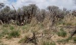
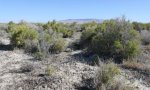
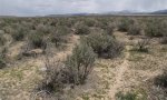
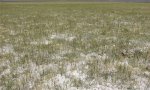
Ecological site photos
Print Options
Sections
Font
Other
Briefcase
Add ecological sites and Major Land Resource Areas to your briefcase by clicking on the briefcase (![]() ) icon wherever it occurs. Drag and drop items to reorder. Cookies are used to store briefcase items between browsing sessions. Because of this, the number of items that can be added to your briefcase is limited, and briefcase items added on one device and browser cannot be accessed from another device or browser. Users who do not wish to place cookies on their devices should not use the briefcase tool. Briefcase cookies serve no other purpose than described here and are deleted whenever browsing history is cleared.
) icon wherever it occurs. Drag and drop items to reorder. Cookies are used to store briefcase items between browsing sessions. Because of this, the number of items that can be added to your briefcase is limited, and briefcase items added on one device and browser cannot be accessed from another device or browser. Users who do not wish to place cookies on their devices should not use the briefcase tool. Briefcase cookies serve no other purpose than described here and are deleted whenever browsing history is cleared.
Ecological sites
Major Land Resource Areas
The Ecosystem Dynamics Interpretive Tool is an information system framework developed by the USDA-ARS Jornada Experimental Range, USDA Natural Resources Conservation Service, and New Mexico State University.