Natural Resources
Conservation Service
Ecological site R024XY112OR
DRY SODIC FLOODPLAIN
Accessed: 02/08/2026
General information
Provisional. A provisional ecological site description has undergone quality control and quality assurance review. It contains a working state and transition model and enough information to identify the ecological site.

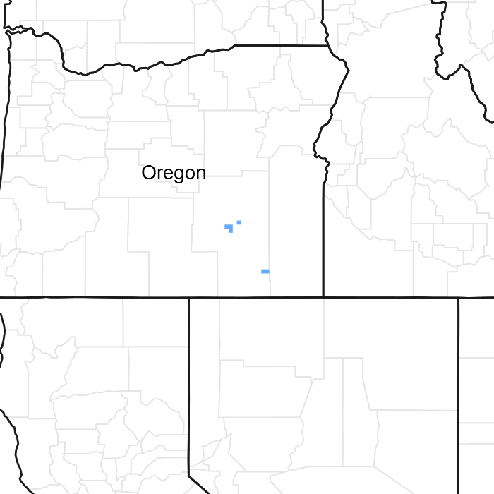
Figure 1. Mapped extent
Areas shown in blue indicate the maximum mapped extent of this ecological site. Other ecological sites likely occur within the highlighted areas. It is also possible for this ecological site to occur outside of highlighted areas if detailed soil survey has not been completed or recently updated.
Ecological site concept
This ecological site occurs on alluvial flats. Soils are deep, poorly to somewhat poorly drained, and formed in alluvium derived from mixed rocks with a component of volcanic ash. The soil profile is characterized by an ochric epipdeon, a pH greater than 8.0 throughout, sodicity (SAR) greater than 30 and a water table between 90 to 150cm at some point during the spring. Soil textures are fine sandy loam or silt clay loam.
Important abiotic factors include crusting & baking of the surface layer upon drying, inhibiting water infiltration and seedling emergence. High salt concentrations reduce seed viability, germination and the available water capacity of these soils. Full consideration should be given to combining this ecological site concept with Sodic Flat 6-8" PZ (024XY011NV), Sodic Flat 8-10" (024XY008NV) and Sodic Flat (024XYXY001OR). These site do not compete on soil characteristics, abiotic factors or species composition.
Associated sites
| R024XY003OR |
SODIC BOTTOM Sodic Bottom (greater available subsurface moisture, higher production, different composition – SAVE4/LECI4-DISP association w/greater amount of LECI4) |
|---|---|
| R024XY004OR |
DRY FLOODPLAIN 6-10 PZ Dry Floodplain (longer flooding duration and greater available surface and subsurface moisture, lower salts and carbonates, higher production, different composition– ARTRT/LECI4-LETR5 association) |
| R024XY015OR |
DESERT LOAM 6-10 PZ Desert Loam 6-10 PZ (upland position, typically a shallow soil, lack of additional subsurface moisture, different composition – ATCO-PIDE4/ELEL5 association) |
| R024XY016OR |
LOAMY 8-10 PZ Loamy 8-10 PZ (upland position, lower salts and carbonates, different composition–ARTRW8/ACTH7-PSSPS-ACHY association) |
| R024XY017OR |
SHALLOW LOAM 8-10 PZ Shallow Loam 8-10 PZ (upland position, shallow soil, lower salts and carbonates, lack of additional subsurface moisture, different composition– ARTRW8/ACTH7-ACHY-PSSPS association) |
Similar sites
| R024XY625OR |
ALKALINE BASIN 8-10 PZ Alkaline Basin 8-10 PZ (lower salts and carbonates, different composition– SAVE4-ARTRT/LECI4-DISP association w/higher amount of ARTRT and LECI4) |
|---|---|
| R024XY003OR |
SODIC BOTTOM Sodic Bottom (greater available subsurface moisture, higher production, different composition – SAVE4/LECI4-DISP association w/greater amount of LECI4) |
Table 1. Dominant plant species
| Tree |
Not specified |
|---|---|
| Shrub |
(1) Sarcobatus vermiculatus |
| Herbaceous |
(1) Distichlis spicata |
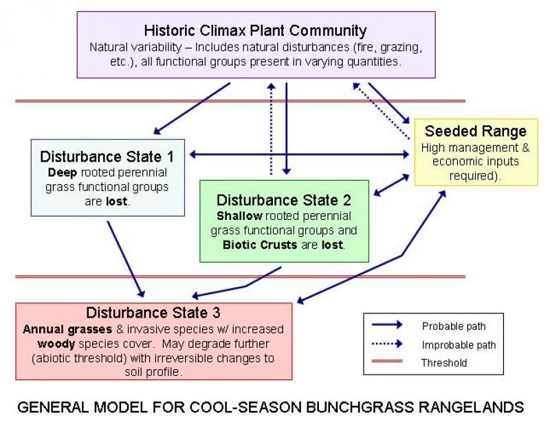
Click on box and path labels to scroll to the respective text.
