Natural Resources
Conservation Service
Ecological site R030XA102AZ
Breaks 3-6" p.z.
Last updated: 10/21/2024
Accessed: 01/17/2026
General information
Provisional. A provisional ecological site description has undergone quality control and quality assurance review. It contains a working state and transition model and enough information to identify the ecological site.

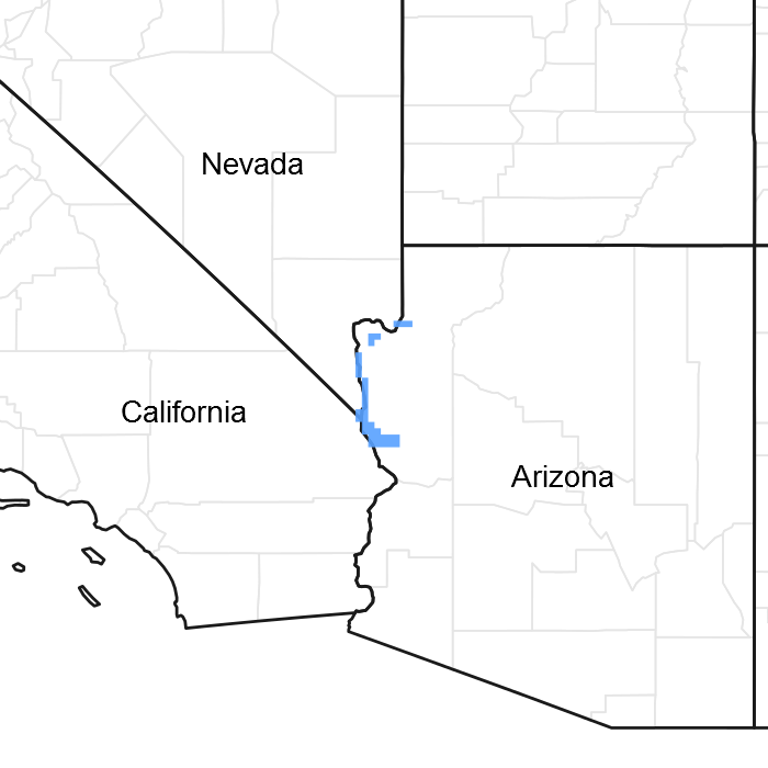
Figure 1. Mapped extent
Areas shown in blue indicate the maximum mapped extent of this ecological site. Other ecological sites likely occur within the highlighted areas. It is also possible for this ecological site to occur outside of highlighted areas if detailed soil survey has not been completed or recently updated.
MLRA notes
Major Land Resource Area (MLRA): 030X–Mojave Basin and Range
This unit occurs within the Basin and Range Province and is characterized by broad basins, valleys, and old lakebeds. Widely spaced mountains trending north to south occur throughout the area. Isolated, short mountain ranges are separated by an aggraded desert plain. The mountains are fault blocks that have been tilted up. Long alluvial fans coalesce with dry lakebeds between some of the ranges.
LRU notes
AZ LRU 30-1 – Lower Mohave Desert
Elevations range from 400 to 2500 feet and precipitation averages 3 to 6 inches per year. Vegetation includes creosotebush, white bursage, Mormon tea, and brittlebush. The soil temperature regime is hyperthermic and the soil moisture regime is typic aridic.
Ecological site concept
This ecological site is located on steep slopes of terraces adjacent to the Colorado River. Soils are moderately deep to deep.
Table 1. Dominant plant species
| Tree |
Not specified |
|---|---|
| Shrub |
(1) Larrea tridentata |
| Herbaceous |
Not specified |
Click on box and path labels to scroll to the respective text.