Natural Resources
Conservation Service
Ecological site R030XY023NV
SALINE MEADOW
Last updated: 2/24/2025
Accessed: 04/03/2026
General information
Provisional. A provisional ecological site description has undergone quality control and quality assurance review. It contains a working state and transition model and enough information to identify the ecological site.
Ecological site concept
This site occurs on alluvial flats, lake plains, or axial stream floodplains on all exposures. Slopes range from 0 to 4 percent, but slope gradients of 0 to 2 percent are most typical. Elevations are 1000 to 5400 feet.
This site falls under group concept R030XB023CA.
Associated sites
| R030XY024NV |
SALINE BOTTOM |
|---|
Similar sites
| R030XY022NV |
WET MEADOW more productive site; JUNCU-CAREX codominant species; SPAI minor species |
|---|---|
| R030XY024NV |
SALINE BOTTOM less productive site; ATLE dominant shrub |
Table 1. Dominant plant species
| Tree |
Not specified |
|---|---|
| Shrub |
Not specified |
| Herbaceous |
(1) Sporobolus airoides |
Physiographic features
This site occurs on alluvial flats, lake plains, or axial stream floodplains on all exposures. Slopes range from 0 to 4 percent, but slope gradients of 0 to 2 percent are most typical. Elevations are 1000 to 5400 feet.
Table 2. Representative physiographic features
| Landforms |
(1)
Alluvial flat
(2) Flood plain (3) Lake plain |
|---|---|
| Flooding duration | Very brief (4 to 48 hours) to brief (2 to 7 days) |
| Flooding frequency | Rare to occasional |
| Ponding frequency | None |
| Elevation | 1,000 – 5,400 ft |
| Slope | 4% |
| Water table depth | 40 – 60 in |
| Aspect | Aspect is not a significant factor |
Climatic features
The climate is hot and arid, with mild winters and very hot summers. Precipitation is greatest in the winter with a lesser secondary peak in summer, typical of the Mojave Desert. Average annual precipitation is 3 to 7 inches. Mean annual air temperature is 55 to 76 degrees F. The average growing season is about 140 to 360 days.
Table 3. Representative climatic features
| Frost-free period (average) | 360 days |
|---|---|
| Freeze-free period (average) | |
| Precipitation total (average) | 5 in |
Figure 1. Monthly average minimum and maximum temperature
Influencing water features
This site may experience brief ponding in depressional areas and flooding adjacent to perennial streams.
Soil features
The soils are deep to very deep alluvium from mixed sources. These soils are moderately too strongly alkaline, calcareous throughout and poorly drained. Water table depths range from 27 to 48 inches during the summer months. Permeability is slow to moderate, runoff is very slow and there may be some brief ponding in depression areas. Soil series associated with this ecological site include Land, a fine-silty, mixed superactive, thermic Typic Aquisalid and Paradise, a coarse-loamy, thermic Typic Calciaquoll.
Table 4. Representative soil features
| Surface texture |
(1) Silty clay loam |
|---|---|
| Family particle size |
(1) Loamy |
| Drainage class | Somewhat poorly drained |
| Permeability class | Slow |
| Soil depth | 52 – 60 in |
| Surface fragment cover <=3" | Not specified |
| Surface fragment cover >3" | Not specified |
| Available water capacity (0-40in) |
2.21 – 3.98 in |
| Calcium carbonate equivalent (0-40in) |
5 – 40% |
| Electrical conductivity (0-40in) |
8 mmhos/cm |
| Sodium adsorption ratio (0-40in) |
12 |
| Soil reaction (1:1 water) (0-40in) |
7.9 – 9 |
| Subsurface fragment volume <=3" (Depth not specified) |
19% |
| Subsurface fragment volume >3" (Depth not specified) |
2% |
Ecological dynamics
The reference plant community is dominated by alkali sacaton, rush and inland saltgrass. Drought and infrequent wildfire are natural disturbances determining long-term plant community dynamics. Plant community composition is also determined by soil salinity. The soil associated with this site is strongly affected by salt in the upper profile limiting the native vegetation to those able to grow well in salt affected soils.
Inappropriate grazing management will allow shrubs, inland saltgrass and unpalatable rushes and sedges increase while, alkali sacaton and other palatable grasses, sedges and rushes decrease. Forbs such as dock and thistle will increase under continuous disturbance. Willow, saltbush, mesquite, Russian olive and saltcedar readily increase and/or invade this site under drought conditions.
Where severe stream entrenchment occurs, the potential for this site is lost due to the change in soil moisture balance. Stream entrenchment lowers the groundwater level, which is important for maintaining the desirable vegetation composition dominated by graminoides. Deep-rooted shrubs and trees tolerate lower groundwater levels and drought conditions better than relatively shallow rooted forbs and grasses.
Fire Ecology:
Historic fire return intervals of adjacent plant communities (creosotebush scrub) ranged from 35 to >100 years. Alkali sacaton is classified as tolerant of, but not resistant to, fire. Top-killing by fire is probably frequent, and the plants can be killed by severe fire. Rush is fire tolerant when dormant and top-killed by fire during the growing season. It establishes after fire through seed and/or lateral spread by rhizomes. Saltgrass rhizomes occur deep in the soil where they are insulated from the heat of most fires. Saltgrass survives fire by sending up new growth from rhizomes. Sedge is top-killed by fire, with rhizomes protected by insulating soil. The rhizomes of sedge species may be killed by high-severity fires that remove most of the soil organic layer. Reestablishment after fire occurs by seed establishment and/or rhizomatous spread.
Shrubs are uncommon on this site, but provide important habitat and browse for wildlife. Mesquite is top-killed by fire but commonly re-sprouts. Willow also sprouts from the root crown following fire and is among the first species to appear. Saltbush can survive low severity fires. Post-fire regeneration commonly occurs through seed, big saltbush is capable of producing an abundant amount of seed.
State and transition model

More interactive model formats are also available.
View Interactive Models
More interactive model formats are also available.
View Interactive Models
Click on state and transition labels to scroll to the respective text
Ecosystem states
State 1 submodel, plant communities
State 2 submodel, plant communities
State 3 submodel, plant communities
State 1
Reference State
The reference state is representative of the natural range of variation under pristine conditions. Community phase changes are primarily driven by periodic wildfire and the drought cycle. Interactions between disturbance patterns and weather events determine plant community dynamics. Fire plays a significant role in plant community phase changes due to high production of herbaceous plants. However, the time between fire is highly variable and dependent on site productivity. Periodic flooding can be expected in certain site locations.
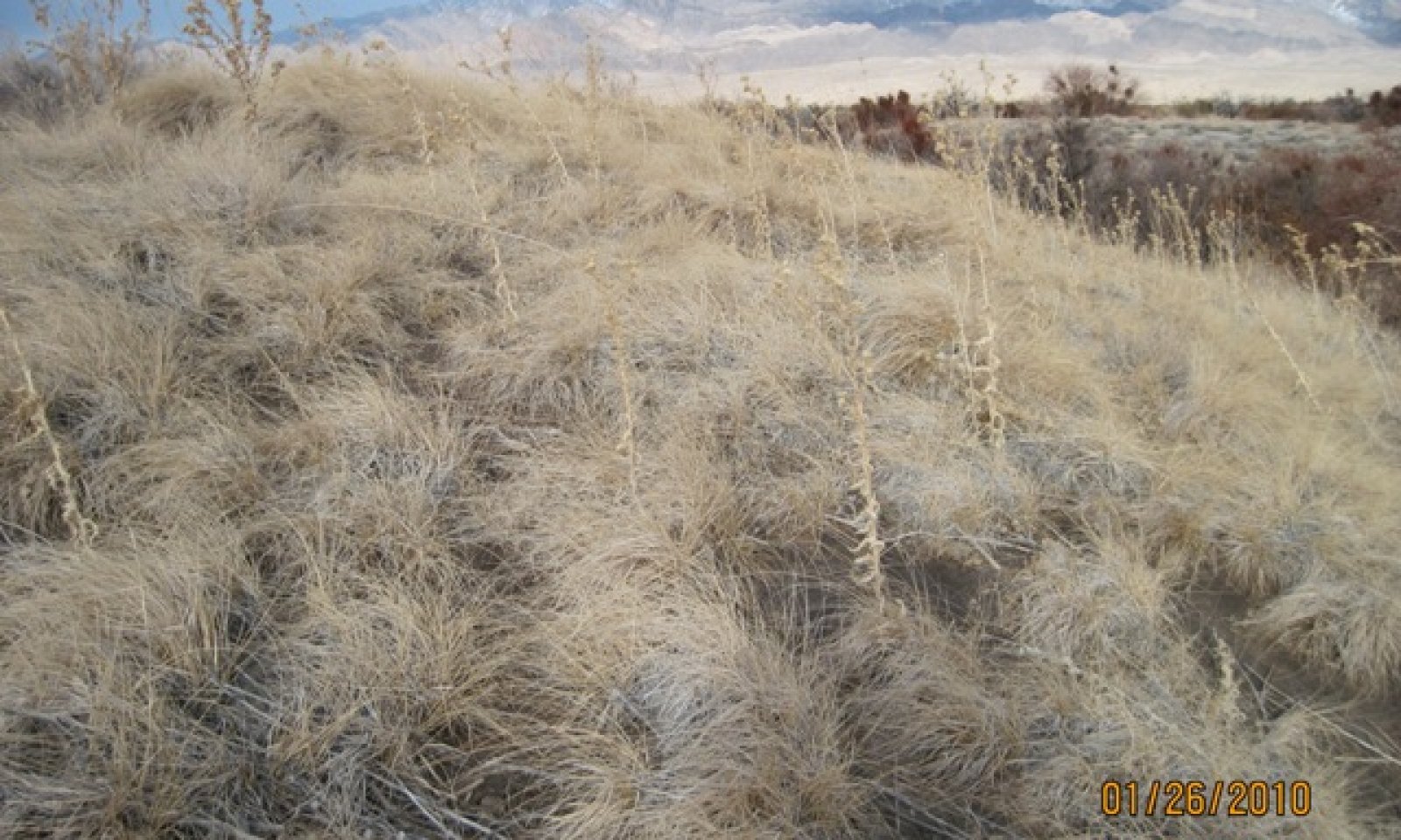
Community 1.1
Reference Plant Community

Figure 2. Spring Mound
The plant community is dominated by alkali sacaton, rush species, and inland saltgrass. Potential vegetative composition is about 88% grasses, 10% forbs, and 2% shrubs. Approximate ground cover (basal and crown) is about 45 to 70 percent. This plant community is representative of a healthy late seral stage.
Figure 3. Annual production by plant type (representative values) or group (midpoint values)
Table 5. Annual production by plant type
| Plant type | Low (lb/acre) |
Representative value (lb/acre) |
High (lb/acre) |
|---|---|---|---|
| Grass/Grasslike | 880 | 1320 | 2640 |
| Forb | 100 | 150 | 300 |
| Shrub/Vine | 20 | 30 | 60 |
| Total | 1000 | 1500 | 3000 |
Community 1.2
Plant Community 1.2
This plant community is characterized by increased woody vegetation including mesquite and big saltbush. Drought conditions favor the expansion of shrubs into previously grass dominated sites. Alkali sacaton and Juncus have low tolerance for shade and drought and experience decreased vigor and reproductive capacity. Saltgrass remains stable or increases, due to its tolerance of drought and disturbed conditions.
Community 1.3
Plant Community 1.3
This plant community is characteristic of an early seral plant community. Wildfire resulting from drought removes woody vegetation and temporarily increases understory grass and grass-likes. Native vegetation recovers quickly. Alkali sacaton, Juncus and saltgrass reproduce from rhizomes and are tolerant of wildfire. Historically, ranges with saltgrass regularly experienced wildfire and may increase in cover following fire. This plant community is ‘at-risk’ of invasion by non-native species. Non-natives are able to take advantage of increased availability of critical resources following wildfire or other disturbance.
Pathway 1.1a
Community 1.1 to 1.2
Lowering of the water table, long-term drought and/or inadequate rest and recovery.
Pathway 1.1b
Community 1.1 to 1.3
Infrequent wildfire removes existing vegetation.
Pathway 1.2a
Community 1.2 to 1.3
Wildfire, prolonged drought, disease and/or insect attack.
Pathway 1.3a
Community 1.3 to 1.1
Release from drought leads to recovery on the herbaceous species and time allows for the reestablishment of shrubs.
State 2
Invaded State
The invaded state is characterized by the presence of non-native species. A biotic threshold has been crossed with the introduction of non-native species that cannot be easily removed from the plant community and have the potential to significantly alter natural disturbance regimes from the historic range of variation. Ecological resilience is reduced by the presence of non-natives. In addition to non-native annual grasses this site is also capable of supporting large woody non-natives, such as Russian olive and saltcedar. Russian olive and saltcedar were introduced for horticulture purposes and have been intentionally planted in many areas.
Community 2.1
Plant Community 2.1
This plant community is compositionally similar to the reference plant community with the presence of non-natives. Ecological processes are not compromised at this time, however, ecological resilience is reduced making it more difficult for this plant community to recover following disturbance. Management should focus on maintaining natural ground water levels, slowing the spread of non-natives and reducing surface disturbances.
Community 2.2
Plant Community 2.2
This plant community is characterized by increased woody vegetation, native and non-native. Deep rooted shrubs and trees tolerate lower ground water levels and drought conditions better than shallow rooted forbs and grasses. This plant community phase is considered ‘at-risk’. Saltcedar is a very efficient competitor against native species, especially where salinity levels are increased and water table levels are lower. Management should focus on eliminating saltcedar as soon as it is detected. Methods used to manage the spread of saltcedar including combinations of herbicide, mechanical and biological controls. Saltcedar is capable of extracting water from unsaturated soil horizons (facultative phreatophyte) leading to decreased available ground water and increased salinity of the soil causing long-term impacts on plant community dynamics.
Community 2.3
Plant Community 2.3
This plant community is characterized by sprouting shrubs and recovering native species. Non-natives may increase following wildfire. Dominant native grasses and grass-likes are tolerant of periodic wildfire and may increase in cover. Saltcedar and Russian olive sprout from surviving root crown following fire and may increase in invasability without careful management.
Pathway 2.1a
Community 2.1 to 2.2
Long-term drought conditions favor increased woody vegetation.
Pathway 2.1b
Community 2.1 to 2.3
Wildfire removes existing vegetation.
Pathway 2.2a
Community 2.2 to 2.3
Wildfire removes existing vegetation.
Pathway 2.3a
Community 2.3 to 2.1
Natural regeneration, absence of wildfire and management focused on controlling non-natives.
State 3
Degraded State
This alternative stable state is characterized by reduced groundwater levels and the associated changes in plant community composition and structure. Lowering the water table has many impacts on the plant community including loss of biodiversity, diminished wildlife habitat value, and increased soil salinity. Meadow vegetation will be lost with decreasing ground water levels.
Community 3.1
Plant Community 3.1
This plant community is shrub dominated. Much of the native perennial vegetation has been lost. Plant community experiences changes in the density and rate of spread of vegetation. Chemical and nutrient composition of plant biomass creates a feedback preventing native vegetation from recovering.
Community 3.2
Plant Community 3.2
This plant community is characterized by decreased vegetative cover. Non-native species persist through drought and fire. Extensive inputs of energy and resources is required in order to increase ecosystem services provided by this plant community.
Pathway 3.1a
Community 3.1 to 3.2
Wildfire and/or drought
Pathway 3.2a
Community 3.2 to 3.1
Absence from disturbance and regeneration over time.
Transition T1a
State 1 to 2
Introduction of non-natives due to a combination of factors including: 1) surface disturbance, 2) changes in the kinds of animals and their grazing patterns, 3) drought and/or 4) changes in fire history.
Transition T1b
State 1 to 3
Anthropogenic lowering of the ground water level, caused by intentional draining or road building leading to changes in vegetation composition, pattern and extent.
Transition T2
State 2 to 3
Groundwater lowering caused by non-natives.
Additional community tables
Table 6. Community 1.1 plant community composition
| Group | Common name | Symbol | Scientific name | Annual production (lb/acre) | Foliar cover (%) | |
|---|---|---|---|---|---|---|
|
Grass/Grasslike
|
||||||
| 1 | Primary Perennial Grasses/Grasslikes | 780–1350 | ||||
| alkali sacaton | SPAI | Sporobolus airoides | 450–750 | – | ||
| rush | JUNCU | Juncus | 150–300 | – | ||
| saltgrass | DISP | Distichlis spicata | 150–225 | – | ||
| sedge | CAREX | Carex | 30–75 | – | ||
| 2 | Secondary Perennial Grasses | 75–225 | ||||
| common reed | PHAU7 | Phragmites australis | 8–75 | – | ||
| alkali cordgrass | SPGR | Spartina gracilis | 8–75 | – | ||
|
Forb
|
||||||
| 3 | Perennial | 75–225 | ||||
| Mojave thistle | CIMO | Cirsium mohavense | 8–45 | – | ||
| marsh elder | IVA | Iva | 8–45 | – | ||
| dock | RUMEX | Rumex | 8–45 | – | ||
| 4 | Annual | 1–45 | ||||
|
Shrub/Vine
|
||||||
| 5 | Primary Shrubs | 1–45 | ||||
| big saltbush | ATLE | Atriplex lentiformis | 1–30 | – | ||
| mesquite | PROSO | Prosopis | 1–30 | – | ||
| willow | SALIX | Salix | 1–30 | – | ||
Interpretations
Animal community
Livestock Interpretations:
This site is suitable for livestock grazing. Grazing management should be keyed to perennial grass production. Alkali sacaton is a valuable forage species in arid and semiarid regions. Plants are tolerant to moderate grazing and can produce abundant herbage utilized by livestock. Rush is described as a fair to good forage species for cattle. On average, rush’s palatability is considered medium to moderately low. Rush is considered palatable early in the growing season when plants are young and tender, but as stems mature and toughen palatability declines. Saltgrass's value as forage depends primarily on the relative availability of other grasses of higher nutritional value and palatability. It can be an especially important late summer grass in arid environments after other forage grasses have deceased. Saltgrass is rated as a fair to good forage species only because it stays green after most other grasses dry. Livestock generally avoid saltgrass due to its coarse foliage. Saltgrass is described as an increaser under grazing pressure. Sedge provides good to fair forage for domestic grazing.
Stocking rates vary over time depending upon season of use, climate variations, site, and previous and current management goals. A safe starting stocking rate is an estimated stocking rate that is fine tuned by the client by adaptive management through the year and from year to year.
Wildlife Interpretations:
The western salt desert shrub and grassland communities where alkali sacaton is common support an abundance of mule deer, pronghorn, carnivores, small mammals, birds, amphibians, and reptiles. Rush provides food for several wildlife species and waterfowl. Rush is an important cover species for a variety of small birds, upland game birds, birds of prey, and waterfowl. Saltgrass provides cover for a variety of bird species, small mammals, and arthropods and is on occasion used as forage for several big game wildlife species. Sedges have a high to moderate resource value for elk and a medium value for mule deer. Elk consume beaked sedge later in the growing season.
Hydrological functions
Runoff is low to very low. Permeability is somewhat poorly drained. Rills and waterflow patterns are none. Deep-rooted perennial herbaceous bunchgrasses slow runoff and increase infiltration. Relatively dense foliar cover of perennial grasses and associated litter break raindrop impact and slow overland flow.
Recreational uses
This site offers rewarding opportunities to photographers and for nature study. This site has potential for upland and big game hunting.
Other information
Alkali sacaton is one of the most commonly used species for seeding and stabilizing disturbed lands. Due to alkali sacaton’s salt tolerance, is recommended for native grass seeding on subirrigated saline sites. Given its extensive system of rhizomes and roots which form a dense sod, saltgrass is considered a suitable species for controlling wind and water erosion.
Supporting information
Type locality
| Location 1: Clark County, NV | |
|---|---|
| Township/Range/Section | T16S R68E S30 |
| UTM zone | N |
| UTM northing | 730311 |
| UTM easting | 4044005 |
| Latitude | 36° 30′ 49″ |
| Longitude | 114° 25′ 41″ |
| General legal description | Along Virgin River near Overton, Clark County, Nevada. |
| Location 2: Nye County, NV | |
| Township/Range/Section | T18S R50E S3 |
| UTM zone | N |
| UTM northing | 560182 |
| UTM easting | 4030309 |
| Latitude | 36° 24′ 57″ |
| Longitude | 116° 19′ 43″ |
| General legal description | Ash Meadows area, Nye County, Nevada. |
Other references
Fire Effects Information System (Online; http://www.fs.fed.us/database/feis/plants/).
USDA-NRCS Plants Database (Online; http://www.plants.usda.gov).
Contributors
HA
Approval
Sarah Quistberg, 2/24/2025
Rangeland health reference sheet
Interpreting Indicators of Rangeland Health is a qualitative assessment protocol used to determine ecosystem condition based on benchmark characteristics described in the Reference Sheet. A suite of 17 (or more) indicators are typically considered in an assessment. The ecological site(s) representative of an assessment location must be known prior to applying the protocol and must be verified based on soils and climate. Current plant community cannot be used to identify the ecological site.
| Author(s)/participant(s) | P.Novak-Echenique/E.Hourihan |
|---|---|
| Contact for lead author | State Rangeland Management Specialist |
| Date | 10/18/2011 |
| Approved by | Sarah Quistberg |
| Approval date | |
| Composition (Indicators 10 and 12) based on | Annual Production |
Indicators
-
Number and extent of rills:
None
-
Presence of water flow patterns:
None
-
Number and height of erosional pedestals or terracettes:
None -
Bare ground from Ecological Site Description or other studies (rock, litter, lichen, moss, plant canopy are not bare ground):
Bare Ground 10-20% -
Number of gullies and erosion associated with gullies:
None -
Extent of wind scoured, blowouts and/or depositional areas:
None -
Amount of litter movement (describe size and distance expected to travel):
Fine litter (foliage of grasses and annual & perennial forbs) only expected to move during periods of flooding by adjacent streams. Persistent litter (large woody material) will remain in place except during peak flooding periods. -
Soil surface (top few mm) resistance to erosion (stability values are averages - most sites will show a range of values):
Soil stability values will range from 3 to 6. (To be field tested.) -
Soil surface structure and SOM content (include type of structure and A-horizon color and thickness):
Soil surface structure is platy or massive. Soil surface colors are light and soils are characterized by an ochric epipedon. Organic matter can range from 1 to 3 percent in the upper 10 inches. -
Effect of community phase composition (relative proportion of different functional groups) and spatial distribution on infiltration and runoff:
Deep-rooted perennial herbaceous bunchgrasses slow runoff and increase infiltration. Relatively dense foliar cover of perennial grasses and associated litter break raindrop impact and slow overland flow. -
Presence and thickness of compaction layer (usually none; describe soil profile features which may be mistaken for compaction on this site):
None - Platy or massive subsurface layers are not to be interpreted as compaction. -
Functional/Structural Groups (list in order of descending dominance by above-ground annual-production or live foliar cover using symbols: >>, >, = to indicate much greater than, greater than, and equal to):
Dominant:
Reference Plant Community: Deep-rooted, warm season, perennial grasses >>Sub-dominant:
rhizomatous, cool season, perennial grasses and grass-like plants > deep-rooted, cool season, perennial forbs > shallow-rooted, cool season, perennial bunchgrasses > fibrous, shallow-rooted, cool season, perennial forbs > shrubs.Other:
Grass-like plantsAdditional:
-
Amount of plant mortality and decadence (include which functional groups are expected to show mortality or decadence):
Herbaceous plant mortality or decadence uncommon. -
Average percent litter cover (%) and depth ( in):
Within plant interspaces (± 80%) and depth (1 to 3 in). -
Expected annual annual-production (this is TOTAL above-ground annual-production, not just forage annual-production):
For normal or average growing season (September thru July) ± 1500 lbs/ac; favorable 3000+ lbs/ac; unfavorable 1000 lbs/ac -
Potential invasive (including noxious) species (native and non-native). List species which BOTH characterize degraded states and have the potential to become a dominant or co-dominant species on the ecological site if their future establishment and growth is not actively controlled by management interventions. Species that become dominant for only one to several years (e.g., short-term response to drought or wildfire) are not invasive plants. Note that unlike other indicators, we are describing what is NOT expected in the reference state for the ecological site:
Potential invaders include saltcedar and Russian olive. -
Perennial plant reproductive capability:
All functional groups should reproduce in most years.
Print Options
Sections
Font
Other
The Ecosystem Dynamics Interpretive Tool is an information system framework developed by the USDA-ARS Jornada Experimental Range, USDA Natural Resources Conservation Service, and New Mexico State University.
Click on box and path labels to scroll to the respective text.