
Natural Resources
Conservation Service
Ecological site R030XY045NV
DUNES 3-7 P.Z.
Last updated: 2/24/2025
Accessed: 03/24/2026
General information
Provisional. A provisional ecological site description has undergone quality control and quality assurance review. It contains a working state and transition model and enough information to identify the ecological site.
Ecological site concept
This site occurs on stabilized sand dunes and sand sheets as part of the playa complex.
This site is part of the group concept represented by R030XB045CA.
Associated sites
| R030XA010NV |
GRAVELLY SANDY LOAM 3-5 P.Z. |
|---|---|
| R030XB004NV |
SANDY 5-7 P.Z. |
Similar sites
| R030XA064NV |
LOAMY BOTTOM More productive site; SPAI-LECI4 codominant grasses; does not occur on sand dunes |
|---|
Table 1. Dominant plant species
| Tree |
Not specified |
|---|---|
| Shrub |
(1) Prosopis |
| Herbaceous |
Not specified |
Physiographic features
This site occurs on stabilized sand dunes and sand sheets. Slope gradients range from 4 to 30 percent, but slope gradients of 4 to 15 percent are most typical. Elevations are 1000 to about 5000 feet.
Table 2. Representative physiographic features
| Landforms |
(1)
Dune
(2) Sand sheet |
|---|---|
| Elevation | 1,000 – 5,000 ft |
| Slope | 4 – 30% |
| Aspect | Aspect is not a significant factor |
Climatic features
The climate is arid with hot, dry summers and warm, moist winters. Average annual precipitation is 3 to about 7 inches. Mean annual air temperature is 55 to 76 degrees F. The average growing season is about 230 to 360 days.
Table 3. Representative climatic features
| Frost-free period (average) | 360 days |
|---|---|
| Freeze-free period (average) | |
| Precipitation total (average) | 7 in |
Figure 1. Monthly average minimum and maximum temperature
Influencing water features
There are no influencing water features associated with this site.
Soil features
The soils associated with this site are coarse textured aeolian deposits derived from mixed rock sources. These soils are very deep and somewhat excessively drained. The coarse textured, single-grained, surface soils are at least 20 inches in depth. Surface cover of pebble-sized rock fragments is typically less than 2 percent. Because of rapid intake and deep percolation of water, the loss of soil moisture due to evaporation is reduced and runoff is low to very low. The soils are extremely susceptible to wind erosion. Small "blow-out" spots are common and, collectively, may represent as much as 5 percent of the total surface area for the site. Potential for sheet and rill erosion is slight, but wind erosion potential is high. The soil series associated with this site is Bluepoint, a mixed, thermic Typic Torripsamment. The soils have a typic-aridic soil moisture regime and an ochric epipedon. The soils are calcareous in some part or all of the control section with 0 to 2 percent gypsum or calcium carbonate by volume.
Table 4. Representative soil features
| Surface texture |
(1) Fine sand |
|---|---|
| Family particle size |
(1) Sandy |
| Drainage class | Somewhat excessively drained |
| Permeability class | Rapid |
| Soil depth | 72 – 84 in |
| Surface fragment cover <=3" | 2% |
| Surface fragment cover >3" | Not specified |
| Available water capacity (0-40in) |
2.95 – 5.91 in |
| Calcium carbonate equivalent (0-40in) |
15% |
| Electrical conductivity (0-40in) |
4 mmhos/cm |
| Sodium adsorption ratio (0-40in) |
1 – 12 |
| Soil reaction (1:1 water) (0-40in) |
7.6 – 8.2 |
| Subsurface fragment volume <=3" (Depth not specified) |
15% |
| Subsurface fragment volume >3" (Depth not specified) |
Not specified |
Ecological dynamics
Aeolian processes, which are presumably the dominant mechanism of soil detachment and transport on this ecological site, are largely responsible for the removal of nutrient-rich soil particles from the intercanopy areas and the deposition onto shrub patches. This sediment redistribution leads to the accumulation of nutrients under the shrub canopies, a process known as "islands of fertility" (Schlesinger et al. 1990). Thus, the landscape exhibits a mosaic of sources and sinks, with bare soil interspaces acting as sources and vegetated patches as sinks of nutrients and sediments (Puigdefabregas 2005). Hydrological processes, such as infiltration and runoff, determine the conditions favorable for the establishment and survival of different vegetation functional groups with a consequent impact on the structure and function of these systems.
Fine sediments are redistributed by aeolian processes from the interspaces on the mesquite mounds where they remain sheltered by the vegetation. This process leads to the formation of an area of fine-textured soils with higher concentration of wind borne fines inside the shrub patch. These fine-textured soils have a lower infiltration rate, thus runoff occurs from the middle of the mesquite mounds toward the edges where it infiltrates. The edges of the mounds are ideal sites for the uptake of water by the existing plants or growth and establishment of new plants. Thus the formation and development of coppice dunes, and of associated vegetation patterns results from the interaction between hydrologic and aeolian processes (Ravi et al 2007).
Honey mesquite is a deciduous, thorny shrub or small tree exhibiting a high degree of variation in growth form. All mesquites have a strong tendency for apical dominance and a well-developed crown. Undisturbed trees therefore develop into single-stemmed trees. If the aboveground growth is damaged or removed, such as by freezing weather, drought, fire, trampling, browsing, cutting, or herbicide treatment, dormant buds located on the underground stem initiate new growth, resulting in the many-stemmed growth form. Honey mesquite's root system is well adapted to dry climates, during and shortly after seedling establishment, the rate of root growth exceeds that of shoot growth. Honey mesquite is a facultative phreatophyte which extracts moisture from a large volume of soil through a well-developed root system of both shallow and deep roots. Honey mesquite's taproot commonly reaches depths of 40 feet (12 m) when subsurface water is available. Sands are most effective at absorbing light rains and the moisture is readily absorbed by the shallow roots. As a legume, honey mesquite is capable of housing N2-fixing bacteria in nodes along its roots; it is also commonly heavily colonized by arbuscular mycorrhizal fungi. Mesquites obtain about half of their nitrogen from symbiotic bacteria housed in root nodules(Steinberg 2001). Growth during the spring and early summer is relatively fast. As summer progresses, the stomata close during the hot, dry midday but remain open in early mornings and late afternoons. Mesquite drops its leaves in fall when air temperatures moderate and rain returns (Pavlik 2008).
Mistletoe (Phoradendron) is a common parasite on mesquite. Mistletoe takes a long time to kill a tree but certainly causes decline. Mistletoe infections cause swelling and witches’ brooms. Old severe infections may result in swollen areas of dead wood that are brittle and break easily. As ecological condition deteriorates, perennial grasses decrease while mesquite, creosotebush, wolfberry, and shadscale increase. Species likely to invade this site are exotic annual forbs and grasses.
Fire Ecology:
It is assumed that fuels in the Mojave Desert were so discontinuous in the past that fire was infrequent. The estimated historic fire return interval for mesquite communities ranges from 35 to 100+ years. When the aboveground portion of honey mesquite is damaged by fire, regeneration occurs by sprouting from lateral roots in the upper 1 foot (0.3 m) of soil and establishing from seed. Mature plants contain numerous, dormant buds on the upper 12 inches (30 cm) of the taproots where they are insulated from the heat of most fires. Following top-kill by fire, numerous sprouts arise from the underground buds. Even 6- month- old seedlings have sufficiently developed underground stem buds to allow plants to survive "cool" burns.
Screwbean mesquite can survive fire, but little is known of the adaptations that allow for this. Weak resprouting after fire has been reported, from surviving apical buds or adventitious buds on the root crown. Fire top-kills or kills fourwing saltbush, depending upon ecotype. Fourwing saltbush may sprout after top-kill. Indian ricegrass is slightly to moderately damaged by fire depending on fire intensity and season. Indian ricegrass regenerates from seed following fire.
State and transition model

More interactive model formats are also available.
View Interactive Models
More interactive model formats are also available.
View Interactive Models
Click on state and transition labels to scroll to the respective text
Ecosystem states
State 1 submodel, plant communities
State 2 submodel, plant communities
State 1
Reference State
This state is representative of the natural range of variability under pristine conditions. Plant community phase changes are primarily driven by long-term drought, infrequent wildfire, insect attack, mistletoe infestation, and/or disease. Interactions between weather patterns and disturbance regimes determine plant community dynamics. Maintenance of the reference plant community is largely dependent on the presence of subsurface water. Honey mesquite is well adapted to surviving in dry climates, but it is a facultative phreatophyte able to extract moisture from large volumes of soil through its well-developed root system. The taproot of honey mesquite commonly reaches to depths of 40ft., though taproots up to 190ft. have been observed. Watertable draw down or other frequently reoccurring surface disturbances, such as wildfire, reduce perennial vegetation and increase bare ground leaving the soil susceptible to wind and water erosion. Increased erosion could possibly result in the transition to an eroded state (State 3). However, this state has not been identified on the landscape at this time. If additional stable states are identified in the future this model will be revised to reflect such findings.
Community 1.1
Reference Plant Community
This plant community is dominated by mesquite and fourwing saltbush. Catclaw, wolfberry and Indian ricegrass are other important species associated with this site. Potential vegetative composition is about 10 percent grasses, 10percent forbs and 80 percent shrubs. Approximate ground cover (basal and crown) is 15 to 25 percent. The reference plant community is representative of a healthy climax condition.
Figure 2. Annual production by plant type (representative values) or group (midpoint values)
Table 5. Annual production by plant type
| Plant type | Low (lb/acre) |
Representative value (lb/acre) |
High (lb/acre) |
|---|---|---|---|
| Shrub/Vine | 320 | 480 | 720 |
| Forb | 40 | 60 | 90 |
| Grass/Grasslike | 40 | 60 | 90 |
| Total | 400 | 600 | 900 |
Community 1.2
Plant Community 1.2
This plant community is characterized by a more active dune system, decreased vegetation and increased bare ground. Severe drought conditions have reduced perennial vegetative cover leading to the destabilization of the soil. Mesquite is able to withstand all but the most severe droughts due to the extensive root system, therefore this plant community phase may take many years to develop. As vegetation cover decreases, dunes become more active, changing their general distribution and shape of the landscape. This plant community is identified as ‘at risk’ and inappropriate land management could result in further soil loss and erosion.
Community 1.3
Plant Community 1.3
This plant community is characterized by the removal of mature woody vegetation. Mesquite can recover quickly from fire, depending on season of the burn. Dormant season fires only top-kill mesquite and sprouting frequently occurs from the root-crown. Associated shrub species including catclaw acacia and ephedra easily sprout from the root-crown post-fire. Herbaceous vegetation temporarily increases post fire. Wildfire is infrequent in this plant community due to low fuel loading. This plant community shows high resilience following wildfire due to the ability to sprout from the root crown.
Pathway 1.1a
Community 1.1 to 1.2
Prolonged drought, water table drawdown and/or vegetation die-off due to mistletoe.
Pathway 1.1b
Community 1.1 to 1.3
Infrequent wildfire.
Pathway 1.2a
Community 1.2 to 1.1
Release from drought allows for the re-establishment of perennial vegetation important for stabilization.
Pathway 1.3a
Community 1.3 to 1.1
Absence from disturbance and natural regeneration over time.
State 2
Invaded State
The invaded state is characterized by the presence of non-native species in the understory. A biotic threshold has been crossed with the introduction of non-native species that cannot easily be removed from the system and have the potential to significantly alter natural disturbance regimes from their historic range of variation. Ecological resilience is reduced by the presence of non-natives. These non-native annuals are highly flammable and promote wildfires where fires historically have been infrequent.
Community 2.1
Invaded Plant Community 2.1
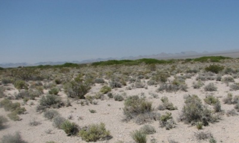
Figure 3. mesquite dunes (in the distance of this photo)
This plant community is similar to the reference plant community with a trace of non-natives in the understory. Ecological processes are not compromised at this time, however, ecological resilience is reduced. Management should focus on reducing surface disturbance and the threat of wildfire.
Community 2.2
Invaded Plant Community 2.2
This plant community characterized a long-term drought condition. Drought conditions favor native species, because they have special adaptations required to survive long periods of low-moisture conditions. Non-native annuals remain in plant community but experience reduced vigor and reproductive capacity. Management of this plant community phase should focus on protecting native vegetation.
Community 2.3
Invaded Plant Community 2.3
This plant community is characterized by the dominance of non-natives. Release from drought can initiate the germination of seeds in the soil, native or non-native. A wildfire can also increase plant available resources by removing competing native vegetation. This plant community is identified as ‘at risk’, careful management is needed to ensure remaining native vegetation is not lost. Non-native annuals do not provide adequate soil stabilization leaving this site susceptible to wind and water erosion. Management should focus on reducing the threat of wildfire through management of non-native biomass.
Pathway 2.1a
Community 2.1 to 2.2
Prolonged drought reduces non-native annual biomass.
Pathway 2.2a
Community 2.2 to 2.3
Release from drought or wildfire increase resources available to non-natives.
Pathway 2.3a
Community 2.3 to 2.1
Changes in management and favorable weather patterns reduce non-native biomass and allow for the regeneration of native species.
Transition T1
State 1 to 2
Introduction of non-native species due to a combination of factors including: 1) surface disturbance, 2) changes in the kinds of animals and their grazing patterns, 3) drought and/or 4) changes in fire history.
Additional community tables
Table 6. Community 1.1 plant community composition
| Group | Common name | Symbol | Scientific name | Annual production (lb/acre) | Foliar cover (%) | |
|---|---|---|---|---|---|---|
|
Grass/Grasslike
|
||||||
| 1 | Primary Perennial Grasses | 12–90 | ||||
| Indian ricegrass | ACHY | Achnatherum hymenoides | 12–90 | – | ||
| 2 | Seconday Perennial Grasses | 12–48 | ||||
| big galleta | PLRI3 | Pleuraphis rigida | 3–12 | – | ||
| alkali sacaton | SPAI | Sporobolus airoides | 3–12 | – | ||
| sand dropseed | SPCR | Sporobolus cryptandrus | 3–12 | – | ||
|
Forb
|
||||||
| 3 | Perennial Frobs | 12–48 | ||||
| 4 | Secondary Forbs | 1–60 | ||||
|
Shrub/Vine
|
||||||
| 5 | Primary Shrubs | 336–570 | ||||
| fourwing saltbush | ATCA2 | Atriplex canescens | 120–240 | – | ||
| honey mesquite | PRGL2 | Prosopis glandulosa | 105–150 | – | ||
| screwbean mesquite | PRPU | Prosopis pubescens | 105–150 | – | ||
| creosote bush | LATR2 | Larrea tridentata | 5–30 | – | ||
| 6 | Secondary Shrubs | 30–90 | ||||
| catclaw acacia | ACGR | Acacia greggii | 3–30 | – | ||
| burrobush | AMDU2 | Ambrosia dumosa | 3–30 | – | ||
| shadscale saltbush | ATCO | Atriplex confertifolia | 3–30 | – | ||
| jointfir | EPHED | Ephedra | 3–30 | – | ||
| desert-thorn | LYCIU | Lycium | 3–30 | – | ||
| pricklypear | OPUNT | Opuntia | 3–30 | – | ||
Interpretations
Animal community
Livestock Interpretations:
This site is suited to livestock grazing. Grazing management should be keyed to Indian ricegrass and the palatable shrub species. The fruits of honey and screwbean mesquite are valuable forage for livestock. Cattle, horses, domestic sheep and goats, mules, and burros eat large quantities of the ripe fruit during summer and fall. Domestic animals disperse the seeds of honey mesquite, contributing to its regeneration. Livestock do not consume the foliage to any great extent. Foliage consumption is high only during drought years, especially in the early spring when other forage is sparse. Mesquite increases on ranges where inappropriate grazing pressure has removed more palatable species.
Fourwing saltbush is one of the most palatable shrubs in the West. Its protein, fat, and carbohydrate levels are comparable to alfalfa. It provides nutritious forage for all classes of livestock. Palatability is rated as good for domestic sheep and domestic goats; fair for cattle; fair to good for horses in winter, poor for horses in other seasons.
Indian ricegrass is highly palatable to livestock and wildlife. It is a preferred feed for cattle, horses and elk in all seasons. It is considered a preferred feed for sheep, deer and antelope in spring and a desirable feed for sheep, deer, and antelope in late fall and winter. It reaches its peak production from mid-June through mid-July. It holds its nutrient value well at maturity. Indian ricegrass establishes slowly and new seedings should not be grazed until at least late summer or fall of the second growing season. It makes its initial growth in early spring and matures seed by mid summer.
Stocking rates vary over time depending upon season of use, climate variations, site, and previous and current management goals. A safe starting stocking rate is an estimated stocking rate that is fine tuned by the client by adaptive management through the year and from year to year.
Wildlife Interpretations:
Honey and screwbean mesquite are important trees to wildlife for both cover and as a food source. The seeds are eaten by jackrabbits, Gambel quail, songbirds and various small mammals. Western chipmunks, ground squirrels, pocket mice, and various species of kangaroo and wood rats consume the foliage. A variety of birds also nest in the tree's canopy. Fourwing saltbush provides valuable habitat and year-round browse for wildlife. Granivorous birds consume the fruits and wild ungulates, rodents and lagomorphs readily consume all aboveground portions of the plant. Indian ricegrass is considered an excellent food source for birds and rodents. It is considered good cover habitat for small animals and birds.
Hydrological functions
Runoff is low to very low. Permeability is rapid. Rills and water flow patterns are none. Runoff occurs from the middle of the mesquite mounds toward the edges where it infiltrates and provides suitable sites for growth and establishment of new plants.
Other products
Many parts of honey mesquite were useful to indigenous groups of California, the Southwest and northern Mexico. The Cahuilla picked the flowers of honey mesquite in the spring and roasted them in a pit of heated stones, after which they were formed into balls and eaten. The blossoms were also utilized in making a tea. Many tribes in southern California and the Southwest including the Timbisha Shoshone, Nevada and Utah Southern Paiute, Kawaiisu, Cahuilla, Panamint, Luiseno, Pima, Yuma, and Commanche ate the edible pods. The seeds made into a fermented pinole was a favorite intoxicating drink. The Cahuilla gathered the pods in two stages, green or ripe. The green pods were pounded into a juicy pulp and consumed as a summer beverage. The ripe pods were eaten without any processing or were pounded into a flour in a mortar and then placed in a vessel, dampened with water, and left for 24 hours to harden. The meal was formed into cakes and eaten dry, made into a mush, or mixed with water for a beverage.
Screwbean mesquite was also a food source for many southwestern tribes. Screwbean mesquite was used by many southwestern tribes in a variety of other ways. The bark and roots had medicinal value and were used to treat wounds. The use of gum, bark, and blossoms as food, medicine, dyes, and in making pottery have been reported for other southwestern mesquites, but it is uncertain if screwbean mesquite was also used for these purposes.
Fourwing saltbush is traditionally important to Native Americans. They ground the seeds for flour. The leaves, placed on coals, impart a salty flavor to corn and other roasted food. Top-growth produces a yellow dye. Young leaves and shoots were used to dye wool and other materials. The roots and flowers were ground to soothe insect bites.
The nutritious seed of Indian ricegrass was one of the staple foods of Native American.
Other information
Fourwing saltbush is widely used in rangeland and riparian improvement and reclamation projects, including burned area recovery. It is probably the most widely used shrub for restoration of winter ranges and mined land reclamation.
One of Indian ricegrass' greatest values is for stabilizing sites susceptible to wind erosion. It is well adapted to stabilization of disturbed sandy soils in mixes with other species. It is naturally an early invader onto disturbed sandy sites (after and in concert with needle and thread grass). It is also one of the first to establish on cut and fill slopes.
Supporting information
Type locality
| Location 1: Clark County, NV | |
|---|---|
| Township/Range/Section | T23S R55E S10 |
| General legal description | S½ Section 10, T23S. R55E. MDBM. About 2 miles southeast of Stump Spring, along unpaved road road leading from Sandy to Hidden Hills Ranch (south of Pahrump), Clark County, Nevada. This site also occurs in southern Lincoln Counties, Nevada. |
Other references
Pavlik, B. 2008. The California Deserts: An Ecological Rediscovery. University of California Press, Berkeley. 365 pp.
Puigdefabregas, J. 2005. The role of vegetation patterns in structuring runoff and sediment fluxes in drylands, Earth Surf. Processes Landforms, 30, 133– 147.
Ravi. S., P. D'Odorico, and G.S. Okin. 2007. Hydrologic and aeolian controls on vegetation patterns in arid landscapes. Geophysical Research Letters. Vol. 34, L24S23, doi:10.1029/2007GL031023.
Schlesinger, W. H., J. F. Reynolds, G. L. Cunningham, L. F. Huenneke, W. M. Jarrell, R. A. Virginia, and W. G. Whitford. 1990. Biological feedbacks in global desertification, Science, 147, 1043– 1048.
Steinberg, Peter. 2001. Prosopis glandulosa. In: Fire Effects Information System, [Online]. U.S. Department of Agriculture, Forest Service, Rocky Mountain Research Station, Fire Sciences Laboratory (Producer). Available: http://www.fs.fed.us/database/feis/ [2011, December 6].
USDA-NRCS Plants Database (Online; http://www.plants.usda.gov).
Contributors
HA
Approval
Sarah Quistberg, 2/24/2025
Rangeland health reference sheet
Interpreting Indicators of Rangeland Health is a qualitative assessment protocol used to determine ecosystem condition based on benchmark characteristics described in the Reference Sheet. A suite of 17 (or more) indicators are typically considered in an assessment. The ecological site(s) representative of an assessment location must be known prior to applying the protocol and must be verified based on soils and climate. Current plant community cannot be used to identify the ecological site.
| Author(s)/participant(s) | P. Novak-Echenique |
|---|---|
| Contact for lead author | State Rangeland Management Specialist |
| Date | 10/19/2011 |
| Approved by | Sarah Quistberg |
| Approval date | |
| Composition (Indicators 10 and 12) based on | Annual Production |
Indicators
-
Number and extent of rills:
None -
Presence of water flow patterns:
None -
Number and height of erosional pedestals or terracettes:
Pedestals are common with occurrence due to wind scouring. -
Bare ground from Ecological Site Description or other studies (rock, litter, lichen, moss, plant canopy are not bare ground):
Bare Ground 40-50%. -
Number of gullies and erosion associated with gullies:
None -
Extent of wind scoured, blowouts and/or depositional areas:
Slight to moderate wind scouring. -
Amount of litter movement (describe size and distance expected to travel):
Fine litter (foliage from grasses and annual & perennial forbs) expected to move unsheltered distance during heavy wind. Persistent litter (large woody material) will remain in place except during intense summer convection storms. -
Soil surface (top few mm) resistance to erosion (stability values are averages - most sites will show a range of values):
Soil stability values should be 1 to 3 on the sandy soil textures found on this site. (To be field tested.) -
Soil surface structure and SOM content (include type of structure and A-horizon color and thickness):
Surface structure is single grained. Soil surface colors are light and soils are typified by an ochric epipedon. Organic matter of the surface 2 to 3 inches is typically 1 to 1.5 percent dropping off quickly below. Organic matter content can be more or less depending on micro-topography. -
Effect of community phase composition (relative proportion of different functional groups) and spatial distribution on infiltration and runoff:
Perennial herbaceous plants (especially deep-rooted bunchgrasses [i.e., Indian ricegrass]) slow runoff and increase infiltration. Shrub canopy and associated litter break raindrop impact. -
Presence and thickness of compaction layer (usually none; describe soil profile features which may be mistaken for compaction on this site):
Compacted layers are none. -
Functional/Structural Groups (list in order of descending dominance by above-ground annual-production or live foliar cover using symbols: >>, >, = to indicate much greater than, greater than, and equal to):
Dominant:
Reference Plant Community: Tall shrubs (mesquite) > low shrubs (saltbush) >>Sub-dominant:
associated shrubs > deep-rooted, cool season, perennial bunchgrasses> perennial, rhizomatous grass> deep-rooted, perennial forbs = fibrous, shallow-rooted, annual forbs.Other:
Additional:
-
Amount of plant mortality and decadence (include which functional groups are expected to show mortality or decadence):
Dead branches within individual shrubs common and standing dead shrub canopy material may be as much as 35% of total woody canopy; some of the mature bunchgrasses (<20%) have dead centers. -
Average percent litter cover (%) and depth ( in):
Between plant interspaces 10-20% and depth (± ¼in.) -
Expected annual annual-production (this is TOTAL above-ground annual-production, not just forage annual-production):
For normal or average growing season (February thru May) ± 600 lbs/ac; Spring moisture significantly affects total production. -
Potential invasive (including noxious) species (native and non-native). List species which BOTH characterize degraded states and have the potential to become a dominant or co-dominant species on the ecological site if their future establishment and growth is not actively controlled by management interventions. Species that become dominant for only one to several years (e.g., short-term response to drought or wildfire) are not invasive plants. Note that unlike other indicators, we are describing what is NOT expected in the reference state for the ecological site:
Potential invaders include red brome, Mediterranean grass, redstem filaree and annual mustards. -
Perennial plant reproductive capability:
All functional groups should reproduce in average (or normal) and above average growing season years. Some functinal groups will not reproduce in unfavorable years.
Print Options
Sections
Font
Other
The Ecosystem Dynamics Interpretive Tool is an information system framework developed by the USDA-ARS Jornada Experimental Range, USDA Natural Resources Conservation Service, and New Mexico State University.
Click on box and path labels to scroll to the respective text.