Saline Lowland Green River Basin (SL GRB)
Scenario model
Current ecosystem state
Select a state

Management practices/drivers
Select a transition or restoration pathway
- Transition T1A More details
- Transition T1B More details
- Restoration pathway R2A More details
- Transition T2A More details
- Restoration pathway R3A More details
- Restoration pathway R3B More details
-
No transition or restoration pathway between the selected states has been described
Target ecosystem state
Select a state
Description
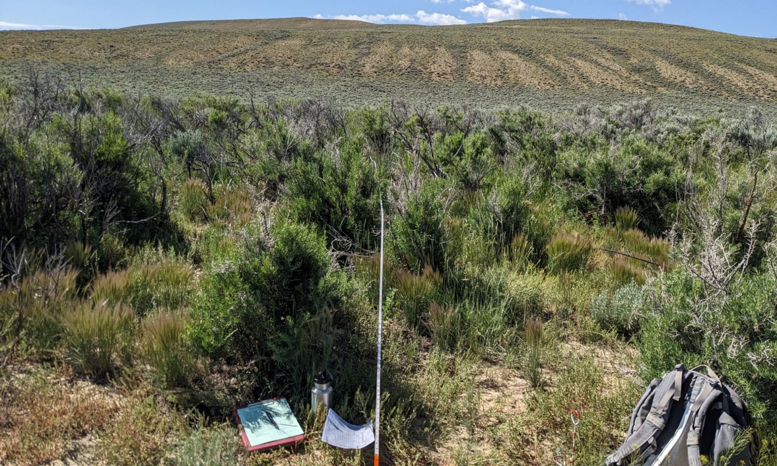
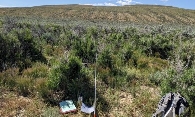
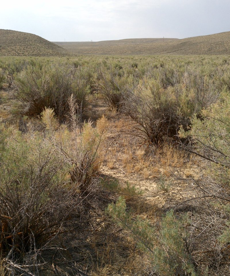
The Reference state consists of three plant communities: the greasewood and basin wildrye community (1.1), the basin wildrye and greasewood community (1.2), and the basin wildrye and Gardner's saltbush community (1.3). Each plant community differs in percent composition and foliar cover of grasses and shrubs. Forbs are a minor component. The basin wildrye and greasewood plant community phase (1.2) is typically the early seral stages of this state. As greasewood becomes more dominant on this site, the site transitions to the greasewood and basin wildrye plant community (1.1). Drivers of these plant communities include: drought, fire, herbivory, and flood. To reach the greasewood and basin wildrye plant community, this ecological site must endure sufficient time without shrub killing events and overgrazing.
Submodel
Description
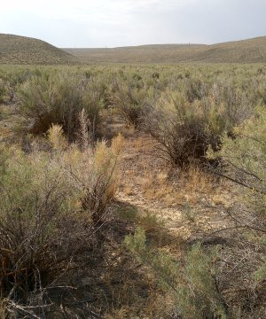
This state develops as a result of continuous grazing by wildlife and domestic livestock. Dominant grasses include thickspike wheatgrass and Sandberg bluegrass. Greasewood has increased, with annual production often reaching 65 percent. Rubber and yellow rabbitbrush may occur but typically do not exceed 10 percent combined. The total annual production (air-dry weight) of this state is about 600 pounds per acre, but it can range from about 400 pounds per acre in unfavorable years to about 1100 pounds per acre in above average years. The state is moderately stable and somewhat vulnerable to excessive erosion. The biotic integrity of this plant community is usually intact. However, this state can be at risk depending on how far a shift has occurred in plant composition towards greasewood. The watershed is usually functioning. However, it can become at risk when canopy cover of greasewood and/or bare ground increases.
Brush Management followed by deferment for 1 to 2 years as part of a prescribed grazing plan will eventually result in a plant community very similar to the reference plant community (greasewood and basin wildrye state). Care should be taken when planning brush management to consider wildlife habitat and critical winter ranges. Wildfire followed by heavy continuous season-long grazing will result in the invaded state.
Submodel
Description
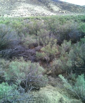
This plant community is a result of heavy, season-long grazing by wildlife and livestock. Halogeton, Gardner’s saltbush, rhizomatous wheatgrass, and bare ground are also a major part of this state. Greasewood dominates, often exceeding 60 percent of the annual production. Sparse saline tolerant grasses and annual forbs make up the majority of the understory. The total annual production (air-dry weight) of this state is about 300 pounds per acre, but it can range from about 100 pounds per acre in unfavorable years to about 500 pounds per acre in above average years. The site is at risk and not well protected from excessive erosion. Grazing for wildlife and cattle has been reduced. The biotic integrity of this plant community is not intact. The amount of bare ground puts the watershed at risk for increased runoff. Chemical brush management and re-seeding followed by deferment for 1 to 2 years as part of a prescribed grazing plan may return this state to near reference plant community (greasewood and basin wildrye). Additional deferment may be necessary and should be prescribed on an individual site basis.
Submodel
Mechanism
Continuous grazing
Context dependence
A transition to the grazing resistant state depends on landform and severity of grazing, flooding, and fire. Narrow channels are usually more desirable to wildlife and livestock than surrounding upland areas, so these areas are grazed more intensely. Native bunchgrasses will be utilized quickly. Continuous grazing without rest will allow thickspike wheatgrass and greasewood to increase.
Mechanism
Continuous grazing without sufficient rest after disturbance events
Context dependence
Fire, flood, or other disturbance events followed by insufficient rest from grazing can trigger a transition from the reference state to the invaded state. Such a transition must occur rapidly and depends on severity of disturbance events and grazing. Landform also affects the likelihood of such a transition; narrow channels are less susceptible to fire, despite being more desirable to wildlife and livestock than surrounding upland areas. Severe flooding followed by erosion, grazing, and compaction are the primary mechanisms for transition in a narrow channel. Such events allow invasive plants such as cheatgrass and halogeton to establish. In larger and less concave areas such as a flood plane, fire followed by erosion, grazing, and compaction allow invasive plants to establish.
Mechanism
Rest from grazing
Context dependence
Restoration to reference state depends on land form, severity of grazing, flooding, and fire. In narrow channels, native shrubs and bunchgrasses may be harder to restore because these areas are grazed more intensely than nearby upland areas. Restoration of shrubs after fire and flooding events is less likely in narrow channels if these areas are continuously grazed by livestock and wildlife. In larger areas such as floodplains, restoration is more likely to succeed as long as the area is rested from grazing. Reseeding and/or mechanical treatments may be necessary if the understory is overtaken by Gardner's saltbush. Such practices may allow native bunchgrasses to reestablish.
Mechanism
Continuous Grazing
Context dependence
As bare ground increases, invasive plants such as cheatgrass and halogeton establish on this site. A transition to the grazing resistant state depends on landform and severity of grazing, flooding, and fire. Disturbances such as fire will accelerate a transition from the grazing resistant state to the invaded state. Narrow channels are usually more desirable to wildlife and livestock than surrounding upland areas, so these areas are grazed more intensely and may become invaded more quickly.
Mechanism
Rest from grazing or rest from grazing with reseeding, mechanical, or herbicide treatments
Context dependence
Restoration to reference state depends on severity of prior disturbance events, grazing, landform, and prevalence of invasive plants. In narrow channels, native shrubs and bunchgrasses may be harder to restore because these areas are grazed more intensely than nearby upland areas. Restoration of shrubs after fire and flooding events is less likely in narrow channels if these areas are continuously grazed by livestock and wildlife. In larger areas such as floodplains, restoration is more likely to succeed as long as the area is rested from grazing. In all cases, additional input may be needed to restore native grasses and shrubs. Such input may include reseeding, herbicide treatments to remove cheatgrass and halogeton, and exclosure cages.
Mechanism
Rest from grazing
Context dependence
Severity of grazing and compaction will determine how quickly shrubs and perennial bunchgrasses can reestablish. In some cases, annual grasses and undesirable forbs may completely dominate the site. Inputs such as herbicide treatment or prescribed fire may be necessary to return the state to the grazing resistant state, which will eventually return to the reference state.
Model keys
Briefcase
Add ecological sites and Major Land Resource Areas to your briefcase by clicking on the briefcase (![]() ) icon wherever it occurs. Drag and drop items to reorder. Cookies are used to store briefcase items between browsing sessions. Because of this, the number of items that can be added to your briefcase is limited, and briefcase items added on one device and browser cannot be accessed from another device or browser. Users who do not wish to place cookies on their devices should not use the briefcase tool. Briefcase cookies serve no other purpose than described here and are deleted whenever browsing history is cleared.
) icon wherever it occurs. Drag and drop items to reorder. Cookies are used to store briefcase items between browsing sessions. Because of this, the number of items that can be added to your briefcase is limited, and briefcase items added on one device and browser cannot be accessed from another device or browser. Users who do not wish to place cookies on their devices should not use the briefcase tool. Briefcase cookies serve no other purpose than described here and are deleted whenever browsing history is cleared.
Ecological sites
Major Land Resource Areas
The Ecosystem Dynamics Interpretive Tool is an information system framework developed by the USDA-ARS Jornada Experimental Range, USDA Natural Resources Conservation Service, and New Mexico State University.