Major Land Resource Area 034A
Cool Central Desertic Basins and Plateaus
Accessed: 04/03/2026
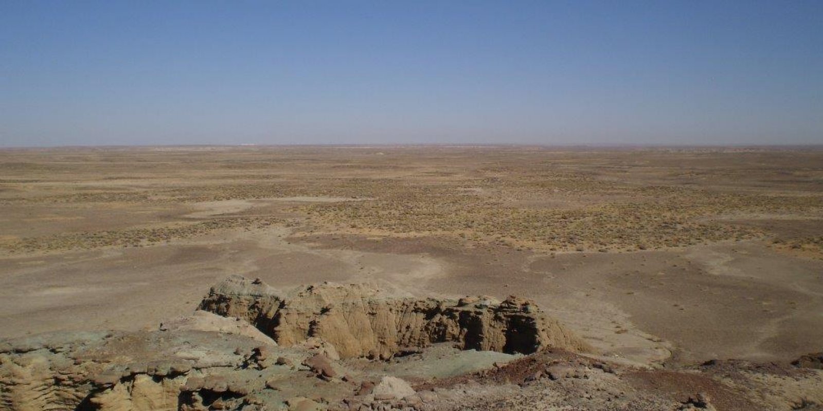
Description
This area is in Wyoming (85 percent), Colorado (13 percent), and Utah (2 percent). It makes up about 33,005 square miles (85,525 square kilometers). The cities of Laramie, Pinedale, Rawlins, and Rock Springs, Wyoming, and Craig and Meeker, Colorado, are in this MLRA. Interstate 80 bisects the northern part of the MLRA. About 85 percent of this area is in the Wyoming Basin Province of the Rocky Mountain System, 5 percent is in the Middle Rocky Mountains Province of the Rocky Mountain System, and 10 percent is in the Uinta Basin Section of the Colorado Plateaus Province of the Intermontane Plateaus. The part of the area in the Uinta Basin Section is in Colorado. The Wyoming Basin is bounded on most sides by mountains. The Owl Creek Mountains, the Big Horn Mountains, and the Wind River Range are to the north; the Salt Range and Wasatch Mountains are to the west; and the Laramie and Sierra Madre Mountains are to the east. The part of the MLRA in Colorado is bounded on the south by the Roan Plateau, on the east by the Elkhead Mountains, and on the west by Dinosaur National Monument. In most of the MLRA, elevation ranges from 5,200 feet (1,585 meters) to 7,500 feet (2,285 meters). Small mountainous areas have an elevation as high as 9,200 feet (2,805 meters). The extent of the Hydrologic Unit Areas (identified by fourdigit numbers) that make up this MLRA is as follows: Great Divide-Upper Green (1404), 47 percent; North Platte (1018), 28 percent; White-Yampa (1405), 16 percent; Bighorn (1008), 6 percent; Bear (1601), 2 percent; and Powder-Tongue (1009), 1 percent. The Popo Agie, Sweetwater, Laramie, Green, and North Platte Rivers run through the northern part of this MLRA, and the Little Snake, Yampa, and White Rivers run through the southern part. This area is dominated by residual basin-floor geologic materials. Shale and sandstone are the dominant rock types. The Tertiary-age Bridger, Laney, Green River, Wasatch, Wind River, and Browns Park Formations dominate the MLRA. Cretaceous-age formations occur as small areas throughout the MLRA. The dominant Cretaceous formations are the Lewis and Lance Formations and the members of the Mesa Verde Group. Quaternary alluvial and eolian deposits occur throughout the MLRA. Glacial deposits occur primarily on outwash terraces in the vicinity of Pinedale, Wyoming. The small mountain ranges in this MLRA are made up of Precambrian igneous and metamorphic rocks. The average annual precipitation generally is 7 to 12 inches (180 to 305 millimeters), but it ranges from 7 to 32 inches (180 to 815 millimeters). Much of the precipitation occurs as snow from October through April and as rain from May through September. These precipitation events occur as a result of cold fronts moving through the area. Occasional convective thunderstorms produce small amounts of rain during the period June through September. The driest period is usually June through August. The average annual temperature generally is 40 to 44 degrees F (5 to 7 degrees C), but it ranges from 33 to 47 degrees F (0 to 8 degrees C). The freeze-free period averages 105 days and ranges from 45 to 160 days. The dominant soil orders in this MLRA are Aridisols and Entisols. Some representative suborders are Argids, Cambids, Calcids, Orthents, Fluvents, and Psamments. The most extensive and representative great groups are Haplargids (Forelle, Ryan Park, Ryark, and Maysprings series), Haplocambids (Poposhia, Kemmerer, and Chaperton series), Haplocalcids (Fiveoh, Langspring, and Tieside series), Torriorthents (Moyerson, Blazon, and Haterton series), Natrargids (Tisworth and Tismid series), Calciargids (Rock River and Cushool series), Torrifluvents (Cowestglen and Battlement series), and Torripsamments (Maybell and Kandaly series). The dominant soil temperature regime is frigid, and the dominant soil moisture regime is aridic. The soils receiving less than 8 inches (205 millimeters) of precipitation annually have an aridic soil moisture regime. The soils receiving 8 to 14 inches (205 to 355 millimeters) have an aridic soil moisture regime that borders on ustic. The soils receiving 14 to 16 inches (355 to 405 millimeters) have an ustic soil moisture regime that borders on aridic. On the lower slopes of the minor mountain ranges, the soils that receive 16 to 20 inches (405 to 510 millimeters) of precipitation generally have a frigid soil temperature regime and an ustic soil moisture regime. The soils at the highest elevations in the small mountain ranges have a cryic soil temperature regime and a udic soil moisture regime that borders on ustic. Some soils with a mesic soil temperature regime occur at the lowest elevations in the southern part of the MLRA. Soils with mixed or smectitic mineralogy are dominant. Many of the soils are shallow or moderately deep to shale or sandstone bedrock. Many formed in slope alluvium or residuum derived from shale or sandstone. Soils that formed in stream- or river-deposited alluvium are near the major waterways. Most of the soils are well drained. Most are calcareous.
Key publications
Geographic subunits
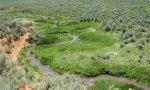
Land Resource Unit 1. The Green River Basin LRU is located in the lower Green River drainage of Wyoming extending from Big Piney, Wyoming at the north to Manila, Utah in the south. It is located between the Bear River Divide on the west and the Rock Springs Uplift on the east, with an area of this LRU located in the Washakie Basin in the southeast corner of Sweetwater County, Wyoming as well. The total area of this LRU is approximately 4,230,000 acres. It shares boundaries with MLRA 47 and 46 (proposed). This LRU is dominated by the Green River and Bridger Formations, Eocene aged formations of sedimentation from ancient Lake Gosiute. These formations are well known to be fossil bearing. They are also the source of one of the largest trona (sodium carbonate) beds in the world, resulting in substantial mining activities (Dyni, USGS). The soils in the Green River Basin are dominated by older Aridisols containing thin argillic and calcic horizons and younger shallow undeveloped Entisols residing on raw parent geology. The Green River Basin has a heavy influence of sodium and other soluble salts on lower accumulation landforms and along dry to slightly wet drainage ways and alluvial flats. The soils in this LRU are very closely tied to their parent geology with some having either hard or soft bedrock contacts above a depth of 6 feet. This LRU has an ustic aridic soil moisture regime and frigid soil temperature regime. The precipitation pattern is fairly flat with a slight spike in the winter. Winter temperatures are cold allowing snow to accumulated and stay until spring. This precipitation pattern results in Wyoming Big Sagebrush domination with cool season grasses and forb understories. The mean annual soil temperatures are between 40-46° F (4.4-7.8 C) and average precipitation is between 7 and 9” (177-230 mm) annually. Elevations of this LRU range between 5800’ and 6500’ (1770-1980 m). The Green River and its tributaries flow through this LRU allowing for irrigated hayland production as isolated areas where the Bureau of Reclamation built dams and canal systems. The Green River is also a world class blue ribbon trout fishery. The largest agricultural land use in this LRU is grazing by livestock. Wildlife in this LRU are abundant, consisting largely of sagebrush obligate species. This LRU is home to large populations of Greater Sage Grouse, Sage Thrasher, Pronghorn, and Mule Deer. This LRU is distinguishable from other LRU’s in that it is home to a variety of salt desert shrubs, such as shadscale, spiny hopsage, and spiny horsebrush. The production potential for ES’s in this LRU are lower than those around it.
Land Resource Unit 10. The Browns Park LRU is situated in the south central portion of the MLRA on the Utah and Colorado border along the Green River. It is in a valley within the Uinta Mountains. The LRU is approximately 185,000 acres and shares a boundary with MLRA 47. The LRU is dominated by Tertiary sandstone, sitlstone, volcanic ash and Quaternary pediment surfaces. Major formations include: Browns Park fluvial siltstone, claystone and volcanic ash. Uinta Mountain group of dark red sandstone and green fluvial shales. Pediment surfaces of poorly sorted sand and gravel deposits from alluvial fans. The soils in the Browns Park LRU are dominated by younger Inceptisols and very young Entisols. The geology and wind patterns have created very sandy soils throughout this LRU. The sandy soils have minimized the impacts of salts to the plant communities and soils. The younger soils are naturally very erosional and not stable enough to develop argillic and calcic horizons. Some of the soils have formed on sandy alluvial fans and along the drainage ways with slight salt influence. The LRU has an ustic-aridic soil moisture regime and a mesic soil temperature regime. The precipitation pattern is fairly flat across the entire year. Summers are hot with little precipitation. The mean annual soil temperature is between 47 and 51° F (8.3-10.5 C) and the average annual precipitation is between 7 and 9” (177-230 mm). The elevational range is between 5350’ and 6450’ (1630-1965 m). Water resources in this LRU are good. The Green River provides irrigation along its flood plain. Along with its tributaries, the river provides ample amounts of surface water for livestock. Plant community potential in this LRU consist of a mix of cool and warm season grasses along with sagebrush and salt desert shrubs. Land uses in the LRU are typical of this MLRA with livestock grazing as the largest use of the land.
Land Resource Unit 2. The Pinedale Plateau LRU is located in the upper Green River Drainage from Pinedale, Wyoming at the north working southward to Farson, Wyoming and easterly to South Pass, Wyoming. It is situated between the Wyoming Range and Wind River Range largely in Sublette County with some areas in northern Sweetwater County and a small portion of Fremont County. The total area of this LRU is approximately 1,210,000 acres. It shares a boundary with MLRA 46 (proposed). This LRU is dominated by the New Fork Tongue of the Wasatch formation, a large artesian aquifer that is estimated to hold large amounts of water with relatively quick recharge (Dana, Smith 1973). It is also home to the Lance Formation, a cretaceous strata that is part of the Mesaverde Group, which holds large amounts of hydrocarbons, giving way to one of the largest on shore natural gas fields (Jonah Field) (Bowker et al 2000). The soils in the Pinedale Plateau are dominated by older Alfisols with thick argillic and calcic horizons and younger deep alluvial soils along drainage ways and in river bottoms. Salts are not a major influence in the Pinedale Plateau but do collect along wet catchment areas and are a mix of sodium, calcium carbonate, and other soluble salts. Soils are tied closely to their parent geology but are more developed and older so typically do not have bedrock contact within 6 feet. This LRU has an aridic ustic soil moisture regime and frigid soil temperature regime. The precipitation pattern is fairly flat with a slight spike in the winter. Winter temperatures are cold allowing snow to accumulated and stay until spring. This lends perfectly to cool season grasses and forbs to flourish, also allowing Big Sagebrush to establish and dominate the landscape. The mean annual soil temperatures are between 36-40° F (2.2-4.4 C) and average precipitation is between 9 and 12” (230-305 mm) annually. Elevations of this LRU range between 6500’ and 7500’ (1980-2280 m). The Green River and its tributaries flow through this LRU allowing for irrigated hayland production as isolated areas along live streams and established irrigation company canals. The Green River is also a world class blue ribbon trout fishery. The largest agricultural land use in this LRU is grazing by livestock. Wildlife in this LRU are abundant, consisting largely of sagebrush obligate species, this LRU is home to large populations of Greater Sage Grouse, Sage Thrasher, Pronghorn, Mule Deer and Elk. There is a large mule deer winter range in this LRU and is a major conduit for many big game species to migrate from the neighboring mountain areas to the lower elevations and back.
Land Resource Unit 3. The Basin Rims LRU is located on and around the Rock Springs uplift east of Rock Springs, Wyoming, it runs from Steamboat Mountain at the north to the border of the Browns Park LRU in the south, it includes the higher elevations between the Green River Basin and the Great Divide Basin. The LRU is approximately 2,260,000 acres and shared a boundary with MLRA 46 (proposed). The LRU is dominated by Upper Cretaceous rocks flanked by the Wasatch and Fort Union Formations. (Flores, Bader USGS) The Fort Union formation is a coal bearing formation resulting in several coal mining operations, including the Jim Bridger and Black Butte coal mines along with the Jim Bridger Power Plant which uses coal produced from these mines. The soils in the Basin Rim are dominated by younger un-developed Inceptisols with thin cambic and calcic horizons. The Basin Rim LRU also has a large amount of shallow young soils residing on raw parent geology. Some areas contain older more stable Alfisols with thicker argillic horizons on non-erosional surfaces. Quite of few of the soils in this LRU have either a soft or hard bedrock contact within 6 feet and are strongly tied to their parent geology. Salts are not a major influence in this LRU but do accumulate in closed basins and along dry to slightly wet drainage ways. The Basin Rim LRU also contains a very large active sand dune system moving west to east into the Great Divide Basin. The LRU has an aridic ustic soil moisture regime and a frigid soil temperature regime. The precipitation pattern is fairly flat with a slight spike in winter precipitation. There are inclusions of typic ustic and ustic aridic soil moisture regimes. Solar radiation and shallow soils on south and west facing slopes, these slopes support juniper where north and east slopes do not. The mean annual soil temperature of the LRU is between 40 and 44° F (4.4-6.7 C) and average precipitation between 9 and 15” (230-380 mm) annually. The elevation range is between 6500’ and 7500’ (230-2280 m). Water resources in this LRU are limited. Very few live streams are present in this LRU, with a few intermittent and ephemeral streams. Most of the stock water is provided from ground water through water wells. There is a fair amount of wildlife in this area, with a large desert elk herd that resides in the area and surrounding LRU’s year long. There are also herds of pronghorn and mule deer that reside in the area, although these species tend to migrate in and out of the area seasonally. Plant community potential in this LRU tend to be more like the foothills of the neighboring Uinta Mountains than that of the surrounding desert. There is a good population of Utah Juniper (with a mix of Rocky Mountain Juniper) and limber pine trees and understories of bluebunch wheatgrass with other cool season grasses. Land uses in the LRU are typical of this MLRA with livestock grazing and mineral extraction, in this case, coal mining, as the largest use of the land.
Land Resource Unit 4. The Great Divide Basin LRU is located in the heart of MLRA 34A. It extends from Baggs, WY in the south to near Jeffrey City, WY in the north. It is flanked by Delaney Rim on the west, Atlantic Rim on the east and Green Mountain on the north. This LRU is approximately 2,200,000 acres and shares a boundary with MLRA 48A. The LRU is dominated by the Battle Springs formation. Unlike the Green River and Wasatch formations, which are intertwined with each other, the Battle Springs formation is a single homogenous formation of Eocene age (Pipiringos, Denson 1970) which is known to hold uranium deposits. Uranium mining in this area was conducted until the mid-1990’s when uranium prices fell and was no longer economical. Since then, there has been some effort to again extract uranium from this area. The soils in the Great Divide Basin LRU are equally shared by old Aridisols with thick argillic and calcic horizons and shallow young Entisols on raw geology. Salts in the Great Divide Basin LRU play a major role in soil development with a lot of soils having a natric or sodium dominated horizon and very high salt concentrations on the surface. Most of the soils in the closed basin are very deep with high salt concentrations and neighboring soils on the hillslopes having either a hard or soft bedrock contact within 6 feet. The LRU has an ustic aridic soil moisture regime and a frigid soil temperature regime. The precipitation pattern, again, is fairly flat, however, unlike the Green River Basin LRU, this LRU has a slight spike in the summer precipitation, allowing for a reduction in the potential amount of sagebrush and the minor presence of some warm season grasses. The mean annual soil temperature is between 44 and 46° F (6.7-7.8 C) and the average annual precipitation is between 7 and 9” (177-230 mm). It elevational range is between 6200’ and 7000’ (1890-2130 m). Water resources in this LRU and very limited as much of the LRU is a closed basin between the Continental Divide, which splits and makes the borders of the LRU. There are a few live, intermittent and ephemeral streams in the LRU, however, most of the available water is from ground water sources in wells. There is a fair amount of wildlife in this area, with a large desert elk herd that resides in the area and surrounding LRU’s year long. There are also herds of pronghorn and mule deer that reside in the area, although these species tend to migrate in and out of the area seasonally. Plant community potential in this LRU consist of a mix of cool and minor amounts of warm season grasses and big sagebrush, with birdfoot sagebrush comprising most of the natric soils. Land uses in the LRU are typical of this MLRA with livestock grazing and mineral extraction as the largest use of the land.
Land Resource Unit 5. The Beaver Rim LRU is located largely in the southeast corner of Fremont County, Wyoming. It extends from Cedar Ridge near Lander, Wyoming on the west to the Rattlesnake Hills on the east, MLRA 32 to the north, and the Granite Mountains to the south. This LRU is approximately 1,500,000 acres and shares a boundary with MLRA 32. The LRU is dominated by the Wind River formation, an Eocene aged formation derived from deposition from the surrounding Wind River and Washakie Ranges and the Owl Creek and Granite Mountains uplift (Seeland, 1978). This formation is known to have deposits of hydrocarbons and uranium. There are other geologic inclusions in this LRU, such as the Cretaceous-aged Granite Mountains at the southern boundary. The soils in the Beaver Rim are dominated by older Alfisols with thick calcic and argillic horizons. The Beaver Rim LRU has more calcium carbonate influence then neighboring LRU’s due to limestone and volcanic tuft parent materials. Along the edges of the LRU, some younger Inceptisols are found with some having either soft or hard bedrock contacts, before 6 feet. Though the soils are closely tied to their parent geology, they are older and more developed than neighboring LRUs. The LRU has an aridic ustic soil moisture regime and a frigid soil temperature regime. The precipitation pattern is fairly flat with a slight spike in spring moisture. The mean annual soil temperature of the LRU is between 44 and 48° F (6.7-8.8 C) and the average annual precipitation is between 9 and 12” (230-305 mm). The elevational range of the LRU is 5400’ to 7500’ (1650-2280 m). Water resources in this LRU are good. The Sweetwater River allows for some flood irrigation along its flood plain near Jeffrey City, Wyoming. This river and its tributaries, supply ample amounts of ground water for water well pumping for livestock water. There are areas of the LRU where water becomes more scarce, making it a little more difficult to distribute livestock. There is a fair amount of wildlife in this area, with a large elk herd that migrates in and out of the area and surrounding LRU’s year long. There are also herds of pronghorn and mule deer that reside in the area, although these species tend to migrate in and out of the area seasonally. Plant communities in the LRU consist of a mix of big sagebrush and cool season grasses, this is the only LRU where bluebunch wheatgrass/Montana wheatgrass is the dominant cool season grass in the understory. Land uses in the LRU are typical of this MLRA with livestock grazing and mineral extraction (oil and gas) as the largest use of the land.
Land Resource Unit 6. The Lower Sweetwater LRU is in the northeast corner of the MLRA, mostly in Natrona County, Wyoming. It is bordered by Green Mountain to the south, the southern tip of the Big Horn Mountains to the north, MLRA 32 to the west and MLRA 58B to the east. The LRU is approximately 1,200,000 acres and shares a boundary with MLRAs 32 and 58B. The LRU is dominated by the Wind River formation, an Eocene aged formation derived from deposition from the surrounding Wind River and Washakie Ranges and the Owl Creek and Granite Mountains uplift (Seeland, 1978). This formation is known to have deposits of hydrocarbons and uranium. There are other geologic inclusions in this LRU, such as the Miocene-aged Split Rock Formation running though the LRU (Love, 1961). The soils in the Lower Sweetwater LRU are dominated by very deep old Alfisols with very thick argillic and calcic horizons. Other soils include slightly younger Alfisols with thinner argillc and calcic horizons and young Fluvent soils along the many dry to slightly wet drainage ways. The soils in this LRU are old on very stable landforms with minimal erosional surfaces creating the thick argillic and calcic horizons. Salts do not play a major role in this LRU, but do accumulate in a couple lower areas. Water resources in this LRU are good. The Sweetwater River allows for some flood irrigation along its flood plain near Independence Rock. Along with its tributaries, supply ample amounts of surface water for livestock water. There are areas of the LRU where water becomes more scarce, making more difficult to distribute livestock. The LRU has an aridic-ustic soil moisture regime, with a few typic-ustic inclusions (higher elevations) and a frigid soil temperature regime and a few mesic inclusions (lower elevations). The precipitation pattern is fairly flat with a slight spike in spring moisture. With warmer temperatures and more summer precipitation there is an increase in the amount of warm season plants in areas. The mean annual soil temperature of the LRU is between 44 and 48° F (6.7-8.8 C) and the average annual precipitation is between 10 and 15” (254-380 mm). The elevational range of the LRU is 5500’ to 7500’ (1670-2280 m). Plant community potential in this LRU is grass dominated with big sagebrush scattered throughout. There are areas where warm season grasses and forbs are present, giving this LRU different plant potentials than surrounding LRU’s. Land uses in the LRU are typical of this MLRA with livestock grazing and mineral extraction (oil and gas) as the largest use of the land.
Land Resource Unit 7. The Platte Valley LRU is in the eastern portion of the MLRA mostly in Carbon County, Wyoming. It is bordered by the Sierra Madre’s to the south and the Laramie Mountains to the east and north. It extends from the Rawlins Uplift on the west to the Shirley Basin on the north and east. This LRU is approximately 2,300,000 acres and shares a boundary with MLRAs 48A and 49. The LRU is dominated by the Hanna, Medicine Bow, Ferris and Mesaverda formations along with the Steele Shale. These are Eocene-aged formations known to be coal producing (Flores etal, USGS). Coal mining was a large part of this area’s history, however, most of the coal production in the area has since ceased. The soils in the Platte Valley LRU are a good mix of older Alfisols with moderate argillic and calcic horizons, younger parent geology dominated soils, and slightly wet to very wet drainage ways and basins. Salts have a moderate influence in this LRU with some areas accumulating enough sodium to have natric horizons and salt accumulation at the surface. Quite a few of these soils are dominated by parent geology and have either a soft or hard bedrock contact within 6 feet. The LRU has an aridic ustic soil moisture regime and a frigid soil temperature regime. The precipitation pattern is fairly flat with a slight spike in spring moisture. The mean annual soil temperature of the LRU is between 42 and 45° F (5.6-7.2 C) and the average annual precipitation is between 9 and 12” (230-305 mm). The elevational range of the LRU is 6500’ to 7500’ (1980-2280 m). Water resources in this LRU are good. The North Platte and Medicine Bow Rivers provides flood irrigation along the flood plains near the towns of Saratoga, Elk Mountain and Medicine Bow. Along with its tributaries, there is ample amounts of surface water for livestock water. There are areas of the LRU where water becomes more scarce, making it more difficult to distribute livestock. Plant communities in this LRU consist of big sagebrush and a mix of cool and minor amounts warm season grasses, with birdfoot sagebrush comprising most of the natric soils. Land uses in the LRU are typical of this MLRA with livestock grazing and mineral extraction as the largest use of the land.
Land Resource Unit 8. The Laramie Basin LRU is situated on the far eastern edge of the MLRA. It extends from the southeast boundary of the MLRA to Rock River, Wyoming in the north. It is settled in between the Medicine Bow Mountains and the Laramie Mountains in eastern Wyoming. The LRU is approximately 1,610,000 acres and shares a boundary with MLRAs 48A and 49. The LRU is dominated by alluvium and colluvium deposits from the surrounding mountains, along with the Wind River and Wagon Bed formations. The Wagon Bed formation is a middle Eocene aged formation that is known to hold fossil beds. Soils in the Laramie Basin LRU are dominated by very old Alfisols with thick argillic and calcic horizons. The LRU also has a quite few soils formed on wet drainage ways with minimal salt influence. The soils in this LRU are closely tied to their parent geology, but are old and very deep with very few having any bedrock contact within 6 feet. Most of the smaller clay sized particles have collected in heavier texture basins dotted throughout this LRU. The LRU has an aridic-ustic soil moisture regime, with a few typic ustic inclusions (higher elevations) and a frigid soil temperature regime. The precipitation pattern is fairly flat with a spike in summer moisture, giving way for more grass production and lack of big sagebrush and higher potential for warm season grasses. The mean annual soil temperature of the LRU is between 40 and 42° F (4.4-5.6 C) and the average annual precipitation is between 10 and 15” (254-380 mm). The elevational range of the LRU is 6900’ to 7500’ (2100-2280 mm). Water resources in this LRU are good. The Laramie River provides flood irrigation along its flood plain. Along with its tributaries, the river supplies surface water for livestock. Plant community potential in this LRU consist of a mix of cool and warm season grasses. With the influx of summer moisture, big sagebrush cannot compete with the grasses in this LRU. The only sagebrush of any significance is silver sagebrush, found in the heavier soils in the bottom lands (overflow). Land uses in the LRU are typical of this MLRA with livestock grazing as the largest use of the land.
Land Resource Unit 9. The Yampa Valley LRU is situated in the south central portion of the MLRA, mostly in Moffat County, Colorado. Powder Rim is the border in the north, the mountains in Moffat County from the other boundaries. The LRU is approximately 1,800,000 acres and shares a boundary with MLRAs 48A and 47. The LRU is dominated by Tertiary sandstone, mudstone, and shale with Cretaceous marine shales. Major formations include: the Wasatch pink sandstone, Fort Union brown sandstone and shale with coal beds, Lewis marine shale, and Mancos marine shale with calcareous sandstones. The soils in the Yampa Valley LRU are a good mix of older Alfisols with moderately thick arigillc and calcic horizons and slightly younger more parent geology dominated soils. These younger soils are closely tied to parent geology and many of them have either soft or hard bedrock contact within 6 feet. The older Alfiols are on more stable landforms with non-erosional surfaces. Some of the soils also formed in recent alluvium with a mix of sandstones and shales. Salt influence is minimal in the LRU, though some areas have accumulated enough to have natric or sodic horizons. The LRU has an aridic-ustic soil moisture regime, with isolated areas of typic ustic, and a frigid soil temperature regime. The precipitation pattern is fairly flat with a slight spike in winter precipitation. Summers are hot with little precipitation. The mean annual soil temperature is between 44 and 48° F (6.7-8.8 C) and the average annual precipitation is between 9 and 15” (230-380 mm). The elevational range is between 5740’ and 7200’ (1750-2200 m). Water resources in this LRU are good. The Yampa River provides flood irrigation along its flood plain. Along with its tributaries, the river provides ample amounts of surface water for livestock. Plant communities in this LRU consist of a mix of cool season grasses along with sagebrush. Land use in the LRU are typical of this MLRA with livestock grazing and mineral extraction as the largest use of the land.
Next steps
-
1
Select an ecological site
Select an ecological site using the list, keys, photos, briefcase, or quick search option located on this page. -
2
Explore the ecological site description
Next, learn more about the selected ecological site and its characteristic dynamics by browsing the ecological site description and exploring alternative state and transition model formats.
Ecological site list
-
i
Key Characteristics
- Upland site that does not receive additional moisture
- Soil depth moderately deep to deep, 20-60” (50-150cm) with moderate to high AWC and without root limiting layers that inhibit the productivity potential (productivity potential variable)
- Soils not like 1. above
- Site without significant rock fragments on soil surface
- Soil surface texture <32% clay at least 5” (13cm) thick, but without strongly contrasting surface and subsurface textures
- Soil surface texture not as above
- Very fine sandy loam, loam, silt loam, sandy clay loam, or light clay loam surface texture, at least 5” (13cm) thick, predominantly loam or sandy clay loam
- Slopes <15%; Wy big sagebrush dominant; (Note: if loam surface overlays a heavy argillic layer (>35% clay) within 2-15” (5-30cm) with early (alkali) sagebrush dominant, go to Loamy Argillic) LOAMY
- If in Green River Basin
- Soil depth moderately deep to deep (>20” (50cm)) without root restricting layer that inhibits the productivity potential
- Sites are not affected by soil chemistry
- Sites without high volume of coarse fragments
- Sites not as above
- Soil textures range from loamy fine sand to clay loam
- Soils very fine sandy loams to clay loams, a good variety and even mix of grass species
- Slopes <30%, productivity potential is high, well-drained site (Note: soils with <6” (15cm) sandy loam surface layer over sandy clay loam or clay loam is included)
-
i
Key Characteristics
- Upland site that does not receive additional moisture
- Soil depth moderately deep to deep, 20-60” (50-150cm) with moderate to high AWC and without root limiting layers that inhibit the productivity potential (productivity potential variable)
- Site affected by significant soil chemistry (strongly alkaline with pH >8.5) within 15” (38cm); typically moderately to strongly saline (EC >8mmhos/cm), sodic (SAR >13, EC <4mmhos/cm), saline-sodic (SAR >13, EC >4mmhos/cm), OR high in calcium carbonates, violently effervescent with CCE >15%; Note: loamy sand and sandy loam surface textures at least 5” (13cm) thick must have SAR >13 within 10” (25cm)
- Soil highly calcareous, violently effervescent (>15% CCE) within upper 15” (38cm), but not saline, sodic, saline-sodic or gypsic
- Soils very fine sandy loams to sandy clay loams with violent effervescence (>15%CCE) within 6-15” (15-38cm) of the soil surface; Wyoming big sagebrush dominant shrub LOAMY CALCAREOUS Note: if conditions found outside GRB or PP LRU, go to Shallow Loamy, Calcareous
- If in Green River Basin
- Soil depth moderately deep to deep (>20” (50cm)) without root restricting layer and is NOT skeletal and/or south or west facing that inhibits the productivity potential
- Site affected by soil chemistry (salinity, sodicity, and/or calcium carbonates) within the rooting depth of herbaceous plants (Top 20” (50cm))
- Soils highly calcareous (>15% CCE within top 20” (50cm)), but not saline (<4mmhos/cm)
- Soils very fine sandy loams to sandy clay loams, with violent effervescence (>15%CCE) between 10” (25cm) and 20” (50cm) of the soil surface
- Soil depth moderately deep to deep (>20” (50cm)) without root restricting layer that inhibits the productivity potential
- Site affected by soil chemistry (salinity, sodicity, and/or calcium carbonates) within the rooting depth of herbaceous plants (Top 20” (50cm))
- Soils highly calcareous (>15% CCE within top 20” (50cm)), but not saline (<4mmhos/cm)
- Soils very fine sandy loams to sandy clay loams, with violent effervescence (>15%CCE) between 10” (25cm) and 20” (50cm) of the soil surface
-
i
Key Characteristics
- Site in a lowland position (drainageway or swale) that receives significant additional moisture from runoff of adjacent slopes or intermittent/perennial streams or a water table (HIGH productivity potential)
- Site not saline
- Site not as above
- Site receives additional moisture through snow melt or runoff. Site occurs in drainageways, depressions, and other concave forms, additional moisture accumulation influences plant communities more than other abiotic factors.
-
i
Key Characteristics
- Site in a lowland position (drainageway or swale) that receives significant additional moisture from runoff of adjacent slopes or intermittent/perennial streams or a water table (HIGH productivity potential)
- Site moderately to strongly saline (>8mmhos/cm) within 20” (50cm) and dominated by salt tolerant species
- Site not as above
- Site typically in or adjacent to perennial or intermittent stream or ephemeral drainage, receives overland flow from adjacent slopes; if water table1 is present, it is within 48” (122cm) during some of the growing season (moderately well-drained); greasewood, inland saltgrass, alkali sacaton, basin wildrye, and western wheatgrass common
-
i
Key Characteristics
- Soil depth moderately deep to deep (>20” (50cm)) without root restricting layer and is NOT skeletal and/or south or west facing that inhibits the productivity potential
- Sites are not affected by soil chemistry
- Sites without high volume of coarse fragments
- Site has less 35% or less clay within the upper portion of the profile.
- Soils that are coarse (sand, loamy fine sand to fine sandy loam)
- Soils loamy fine sand to fine sandy loam, (Note: Soils with <6” (15cm) sandy loam surface layer over sandy clay loam or clay loams are excluded, go to III.B.2.ii.c)
-
i
Key Characteristics
- Upland site that does not receive additional moisture
- Soil depth moderately deep to deep, 20-60” (50-150cm) with moderate to high AWC and without root limiting layers that inhibit the productivity potential (productivity potential variable)
- Soils not like 1. above
- Site without significant rock fragments on soil surface
- Soil surface or subsurface textures have high clay content (>32% clay) at least 5” (13cm), slight to severe soil cracking in dry conditions may occur and vertic properties are common
- Soil surface not as above
- Clay loam surface textures (32-40% clay), at least 5” (13cm) thick; cracking common during dry summer months, though not severe (<40% clay in subsurface); Wyoming big sagebrush dominant with western wheatgrass (green needlegrass east of the Cont. Divide) CLAYEY
- If in Pinedale Plateau
- Soil depth moderately deep to deep (>20” (50cm)) without root restricting layer and is NOT skeletal and/or south or west facing that inhibits the productivity potential
- Sites are not affected by soil chemistry
- Sites without high volume of coarse fragments
- Sandy clay loam, silty clay loam and clay loam surface, soil cracking common during dry summer months, though not severe (>36% clay in subsurface)
-
i
Key Characteristics
- Soil depth moderately deep to deep (>20” (50cm)) without root restricting layer and is NOT skeletal and/or south or west facing that inhibits the productivity potential
- Sites are not affected by soil chemistry
- Sites with a high volume of coarse fragments in top 20” (>35% by volume). Site occurs along terrace breaks, steep slopes, or terraces with coarse fragments up to 10” diameter covering 50-75% of surface and making up 40-50% volume in top 20” (50cm), may have lime horizon below 12”, often westerly aspect and windswept ridges, soils are excessively well drained loamy sands, sandy loams and fine sandy loams (See II. B. 2. i. a)
-
i
Key Characteristics
- Upland site that does not receive additional moisture
- Soil depth moderately deep to deep, 20-60” (50-150cm) with moderate to high AWC and without root limiting layers that inhibit the productivity potential (productivity potential variable)
- Site affected by significant soil chemistry (strongly alkaline with pH >8.5) within 15” (38cm); typically moderately to strongly saline (EC >8mmhos/cm), sodic (SAR >13, EC <4mmhos/cm), saline-sodic (SAR >13, EC >4mmhos/cm), OR high in calcium carbonates, violently effervescent with CCE >15%; Note: loamy sand and sandy loam surface textures at least 5” (13cm) thick must have SAR >13 within 10” (25cm)
- Soil highly calcareous, violently effervescent (>15% CCE) within upper 15” (38cm), but not saline, sodic, saline-sodic or gypsic
- Soils very fine sandy loams to sandy clay loams with violent effervescence (>15%CCE) at the soil surface; winterfat dominant shrub with Indian ricegrass and bottlebrush squirreltail common; Note: if conditions found outside PP LRU, make note “site not developed” LIMY
- If in Pinedale Plateau
- Soil depth moderately deep to deep (>20” (50cm)) without root restricting layer and is NOT skeletal and/or south or west facing that inhibits the productivity potential
- Site affected by soil chemistry (salinity, sodicity, and/or calcium carbonates) within the rooting depth of herbaceous plants (Top 20” (50cm))
- Soils highly calcareous (>15% CCE within top 20” (50cm)), but not saline (<4mmhos/cm)
- Soils very fine sandy loams to sandy clay loams, violent effervescence (>15%CCE) at the soil surface
- Soil depth moderately deep to deep (>20” (50cm)) without root restricting layer that inhibits the productivity potential
- Site affected by soil chemistry (salinity, sodicity, and/or calcium carbonates) within the rooting depth of herbaceous plants (Top 20” (50cm))
- Soils highly calcareous (>15% CCE within top 20” (50cm)), but not saline (<4mmhos/cm)
- Soils very fine sandy loams to sandy clay loams, violent effervescence (>15%CCE) at the soil surface
-
i
Key Characteristics
- Upland site that does not receive additional moisture
- Soil depth moderately deep to deep, 20-60” (50-150cm) with moderate to high AWC and without root limiting layers that inhibit the productivity potential (productivity potential variable)
- Soils not like 1. above
- Site without significant rock fragments on soil surface
- Soil surface texture <32% clay at least 5” (13cm) thick, but without strongly contrasting surface and subsurface textures
- Soil surface texture not as above
- Very fine sandy loam, loam, silt loam, sandy clay loam, or light clay loam surface texture, at least 5” (13cm) thick, predominantly loam or sandy clay loam
- Slopes <15%; Wy big sagebrush dominant; (Note: if loam surface overlays a heavy argillic layer (>35% clay) within 2-15” (5-30cm) with early (alkali) sagebrush dominant, go to Loamy Argillic) LOAMY
- If in Pinedale Plateau
- Soil depth moderately deep to deep (>20” (50cm)) without root restricting layer and is NOT skeletal and/or south or west facing that inhibits the productivity potential
- Sites are not affected by soil chemistry
- Sites without high volume of coarse fragments
- Sites not as above
- Soil textures range from loamy fine sand to clay loam
- Slopes <30%, productivity potential is high, well-drained site (Note: soils with <6” (15cm) sandy loam surface layer over sandy clay loam or clay loam is included)
-
i
Key Characteristics
- Soil depth very shallow (<10” (25cm)), shallow (10-20” (25-50cm)) OR moderately deep to deep (>20” (>50cm), skeletal (>35% coarse fragments by volume in top 20” (50cm”)) soils on south and west aspects and/or with a root restricting layer which react like shallow soils (LOW productivity potential)
- Soils shallow (10-20” (25-50cm)), but may include moderately deep to deep (>20” (>50cm)) skeletal soils on south and west aspects, >15% slopes, productivity potential is LOW
- Site without highly calcareous subsoil or bedrock, OR if lime horizon present, accompanied by high volume of coarse fragments at soil surface, slopes variable
- Soils without high amount of coarse fragments at soil surface, but still may be skeletal, have root restricting layer, shallow to bedrock
- Root restricting (7-15” 18-30cm) clay loam to clay subsoil layer (>40% clay) with sharply contrasting loam to clay loam surface textures, soil may develop large cracks when dry
- Soil depth very shallow (<10” (25cm)), shallow (10-20” (25-50cm)) OR moderately deep to deep (>20” (>50cm), skeletal (>35% coarse fragments by volume in top 20” (50cm”)) soils on south and west aspects and/or with a root restricting layer which react like shallow soils (LOW productivity potential)
- Soils shallow (10-20” (25-50cm)), but may include moderately deep to deep (>20” (>50cm)) skeletal soils on south and west aspects, >15% slopes, productivity potential is LOW
- Site without highly calcareous subsoil or bedrock, OR if lime horizon present, accompanied by high volume of coarse fragments at soil surface, slopes variable
- Soils without high amount of coarse fragments at soil surface, but still may be skeletal, have root restricting layer, shallow to bedrock
- Clay loam, silty clay loam, or clay over fractured shale bedrock or loam over root restricting clay layer
- Root restricting (7-15” 18-30cm) clay loam to clay subsoil layer (>40% clay) with sharply contrasting loam to clay loam surface textures, soil may develop large cracks when dry
-
i
Key Characteristics
- Upland site that does not receive additional moisture
- Soil depth moderately deep to deep, 20-60” (50-150cm) with moderate to high AWC and without root limiting layers that inhibit the productivity potential (productivity potential variable)
- Site affected by significant soil chemistry (strongly alkaline with pH >8.5) within 15” (38cm); typically moderately to strongly saline (EC >8mmhos/cm), sodic (SAR >13, EC <4mmhos/cm), saline-sodic (SAR >13, EC >4mmhos/cm), OR high in calcium carbonates, violently effervescent with CCE >15%; Note: loamy sand and sandy loam surface textures at least 5” (13cm) thick must have SAR >13 within 10” (25cm)
- Soil highly calcareous, violently effervescent (>15% CCE) within upper 15” (38cm), but not saline, sodic, saline-sodic or gypsic
- Soils very fine sandy loams to sandy clay loams with violent effervescence (>15%CCE) within 6-15” (15-38cm) of the soil surface; Wyoming big sagebrush dominant shrub LOAMY CALCAREOUS Note: if conditions found outside GRB or PP LRU, go to Shallow Loamy, Calcareous
- If in Pinedale Plateau
- Soil depth moderately deep to deep (>20” (50cm)) without root restricting layer and is NOT skeletal and/or south or west facing that inhibits the productivity potential
- Site affected by soil chemistry (salinity, sodicity, and/or calcium carbonates) within the rooting depth of herbaceous plants (Top 20” (50cm))
- Soils highly calcareous (>15% CCE within top 20” (50cm)), but not saline (<4mmhos/cm)
- Soils very fine sandy loams to sandy clay loams, with violent effervescence (>15%CCE) between 10” (25cm) and 20” (50cm) of the soil surface
-
i
Key Characteristics
- Site in a lowland position (bottom) that receives significant additional moisture from runoff of adjacent slopes or intermittent/perennial streams or a water table (HIGH productivity potential)
- Site not saline
- Site not as above
- Site not as above
- Site drier than above, more likely on intermittent drainage without gravel bars and high water table during growing season
- Surface textures range from sandy loam to light silty clay loam (if redox features are present they are below 40” (100cm))
-
i
Key Characteristics
- Soil depth moderately deep to deep (>20” (50cm)) without root restricting layer and is NOT skeletal and/or south or west facing that inhibits the productivity potential
- Site affected by soil chemistry (salinity, sodicity, and/or calcium carbonates) within the rooting depth of herbaceous plants (Top 20” (50cm))
- Soils slightly saline to moderately saline or greater (>4mmhos/cm), calcareous or not. Surface textures range from sandy loam to clay loam, moderately saline or greater (>8mmhos/cm), or sodic (SAR >13, EC <4mmhos) (if root restrictive layer present and productivity very low consider Shale site – Group II)
-
i
Key Characteristics
- Soil depth moderately deep to deep (>20” (50cm)) without root restricting layer and is NOT skeletal and/or south or west facing that inhibits the productivity potential
- Sites are not affected by soil chemistry
- Sites without high volume of coarse fragments
- Sites not as above
- Excessively drained soils that are very coarse (loamy sand to sand), on nearly level to rolling uplands or dunes, dark or light colored
-
i
Key Characteristics
- Soil depth moderately deep to deep (>20” (50cm)) without root restricting layer and is NOT skeletal and/or south or west facing that inhibits the productivity potential
- Sites are not affected by soil chemistry
- Sites without high volume of coarse fragments
- Sites not as above
- Soil textures range from loamy fine sand to clay loam
- Soils loamy fine sand to fine sandy loam, (Note: Soils with <6” (15cm) sandy loam surface layer over sandy clay loam or clay loams are excluded, go to III.B.2.ii.b.2)
-
i
Key Characteristics
- Soil depth very shallow (<10” (25cm)), shallow (10-20” (25-50cm)) OR moderately deep to deep (>20” (>50cm), skeletal (>35% coarse fragments by volume in top 20” (50cm”)) soils on south and west aspects and/or with a root restricting layer which react like shallow soils (LOW productivity potential)
- Soils very shallow(<10” (25cm)), but may include areas of exposed bedrock and pockets of deep soil, often on steep (up to 55%) south and west facing slopes with VERY LOW productivity potential
- Bedrock is soft or hard clay shale bedrock that may be saline, occurs in upland position on moderately to steeply sloping land (5-25% slope)
-
i
Key Characteristics
- Soil depth very shallow (<10” (25cm)), shallow (10-20” (25-50cm)) OR moderately deep to deep (>20” (>50cm), skeletal (>35% coarse fragments by volume in top 20” (50cm”)) soils on south and west aspects and/or with a root restricting layer which react like shallow soils (LOW productivity potential)
- Soils shallow (10-20” (25-50cm)), but may include moderately deep to deep (>20” (>50cm)) skeletal soils on south and west aspects, >15% slopes, productivity potential is LOW
- Site without highly calcareous subsoil or bedrock, OR if lime horizon present, accompanied by high volume of coarse fragments at soil surface, slopes variable
- Soils without high amount of coarse fragments at soil surface, but still may be skeletal, have root restricting layer, shallow to bedrock
- Well-drained fine sandy loam to silty loams over sedimentary bedrock or loams with root restricting layer (i.e. rock layer and/or similar layer)
-
i
Key Characteristics
- Soil depth very shallow (<10” (25cm)), shallow (10-20” (25-50cm)) OR moderately deep to deep (>20” (>50cm), skeletal (>35% coarse fragments by volume in top 20” (50cm”)) soils on south and west aspects and/or with a root restricting layer which react like shallow soils (LOW productivity potential)
- Soils shallow (10-20” (25-50cm)), but may include moderately deep to deep (>20” (>50cm)) skeletal soils on south and west aspects, >15% slopes, productivity potential is LOW
- Site with a highly calcareous subsoil (<10” (25cm)), often gravelly or skeletal subsoil OR underlain by soft calcareous materials and slopes >15%
- Moderately deep to deep soil (>20” (50cm)) with highly calcareous (violent effervescence (>15%CCE)) subsoil at <10” (25cm), often gravelly or skeletal and on 15 to 35% slopes, (compare with II. B. 2. i. a)
-
i
Key Characteristics
- Soil depth very shallow (<10” (25cm)), shallow (10-20” (25-50cm)) OR moderately deep to deep (>20” (>50cm), skeletal (>35% coarse fragments by volume in top 20” (50cm”)) soils on south and west aspects and/or with a root restricting layer which react like shallow soils (LOW productivity potential)
- Soils shallow (10-20” (25-50cm)), but may include moderately deep to deep (>20” (>50cm)) skeletal soils on south and west aspects, >15% slopes, productivity potential is LOW
- Site without highly calcareous subsoil or bedrock, OR if lime horizon present, accompanied by high volume of coarse fragments at soil surface, slopes variable
- Soils without high amount of coarse fragments at soil surface, but still may be skeletal, have root restricting layer, shallow to bedrock
- Well drained loamy sand, sandy loams, or fine sandy loams over sedimentary bedrock or calcium carbonate or similar layer that restricts rooting depth
-
i
Key Characteristics
- Soil depth very shallow (<10” (25cm)), shallow (10-20” (25-50cm)) OR moderately deep to deep (>20” (>50cm), skeletal (>35% coarse fragments by volume in top 20” (50cm”)) soils on south and west aspects and/or with a root restricting layer which react like shallow soils (LOW productivity potential)
- Soils very shallow(<10” (25cm)), but may include areas of exposed bedrock and pockets of deep soil, often on steep (up to 55%) south and west facing slopes with VERY LOW productivity potential
- Bedrock commonly fractured sandstone, shale, or siltstone, commonly on windswept ridges (within 8” (20cm), productivity very low (if productivity is higher and coarse fragments are present, go to II. B. 2. ii)
-
i
Key Characteristics
- Upland site that does not receive additional moisture
- Soil depth moderately deep to deep, 20-60” (50-150cm) with moderate to high AWC and without root limiting layers that inhibit the productivity potential (productivity potential variable)
- Soils not like 1. above
- Site without significant rock fragments on soil surface
- Soil surface texture <32% clay at least 5” (13cm) thick, but without strongly contrasting surface and subsurface textures
- Soil surface texture not as above
- Very fine sandy loam, loam, silt loam, sandy clay loam, or light clay loam surface texture, at least 5” (13cm) thick, predominantly loam or sandy clay loam
- Slopes <15%; Wy big sagebrush dominant; (Note: if loam surface overlays a heavy argillic layer (>35% clay) within 2-15” (5-30cm) with early (alkali) sagebrush dominant, go to Loamy Argillic) LOAMY
- If in Beaver Rim
- Precipitation is 10-14 inches; site has no water table or receives run-in moisture; family particle size is fine-loamy; surface texture is loam, clay loam, sandy clay loam or gravelly loam
-
i
Key Characteristics
- Upland site that does not receive additional moisture
- Soil depth moderately deep to deep, 20-60” (50-150cm) with moderate to high AWC and without root limiting layers that inhibit the productivity potential (productivity potential variable)
- Soils not like 1. above
- Site without significant rock fragments on soil surface
- Soil surface texture <32% clay at least 5” (13cm) thick, but without strongly contrasting surface and subsurface textures
- Soil surface texture not as above
- Very fine sandy loam, loam, silt loam, sandy clay loam, or light clay loam surface texture, at least 5” (13cm) thick, predominantly loam or sandy clay loam
- Slopes <15%; Wy big sagebrush dominant; (Note: if loam surface overlays a heavy argillic layer (>35% clay) within 2-15” (5-30cm) with early (alkali) sagebrush dominant, go to Loamy Argillic) LOAMY
- If in Platte Valley
- Precipitation is 10-14 inches; site has no water table or receives run-in moisture; family particle size is fine-loamy; surface texture is loam, clay loam, sandy clay loam or gravelly loam
-
i
Key Characteristics
- Site in a lowland position (bottom) that receives significant additional moisture from runoff of adjacent slopes or intermittent/perennial streams or a water table (HIGH productivity potential)
- Site not saline
- Site with a water table present and visible for at least part of the growing season above 40 inches.
- Site has fluctuating water table above surface part of growing season (redox features in top 12” (30cm))
- With the prominent riparian gravels
- Water table fluctuates low enough to encourage woody riparian species.
-
 ProvisionalR034AA011UT/R034AA011UTRiparian Complex Perennial Gravelly VIII/E4 (Northwest Territory Sedge)i
Key Characteristics
- Site in a lowland position (bottom) that receives significant additional moisture from runoff of adjacent slopes or intermittent/perennial streams or a water table (HIGH productivity potential)
- Site not saline
- Site with a water table present and visible for at least part of the growing season above 40 inches.
- Site has fluctuating water table above surface part of growing season (redox features in top 12” (30cm))
- With the prominent riparian gravels
- Water table fluctuates and remains high enough to restrict the woody species.
-
i
Key Characteristics
- Site in a lowland position (bottom) that receives significant additional moisture from runoff of adjacent slopes or intermittent/perennial streams or a water table (HIGH productivity potential)
- Site not saline
- Site with a water table present and visible for at least part of the growing season above 40 inches.
- Site has fluctuating water table above surface part of growing season (redox features in top 12” (30cm))
- Without the prominent riparian gravels
-
i
Key Characteristics
- Site in a lowland position (bottom) that receives significant additional moisture from runoff of adjacent slopes or intermittent/perennial streams or a water table (HIGH productivity potential)
- Site not saline
- Site with a water table present and visible for at least part of the growing season above 40 inches.
- Site has a water table within rooting depth of herbaceous species (12-24” (30-60cm)) during most of the growing season
-
 ProvisionalR034AA201UT/R034AA201UTSemi-desert Saline Well-Drained Terraces (Indian ricegrass/ Greasewood)i
Key Characteristics
- Site in a lowland position (bottom) that receives significant additional moisture from runoff of adjacent slopes or intermittent/perennial streams or a water table (HIGH productivity potential)
- Site moderately to strongly saline (>8mmhos/cm) within 20” (50cm) and dominated by salt tolerant species
- Site adjacent to perennial or intermittent streams, receiving some overland flow from adjacent slopes, with moderately good drainage, but water table within 36” (within rooting depth of woody plants, but not herbaceous plants) during most of the growing season
-
ProvisionalR034AA203UT/R034AA203UTSemi-desert Saline Terraces (Gardner's saltbush/ Bluebunch wheatgrass)i
Key Characteristics
- Site in a lowland position (bottom) that receives significant additional moisture from runoff of adjacent slopes or intermittent/perennial streams or a water table (HIGH productivity potential)
- Site moderately to strongly saline (>8mmhos/cm) within 20” (50cm) and dominated by salt tolerant species
- Site may receive periodic overflow from adjacent slopes, located in lowland position but water is typically channeled into gullies so that plants are not receiving a lot of benefit from additional moisture
-
i
Key Characteristics
- Site is in an upland position and does not receive additional effective moisture from runoff of adjacent slopes and there is no water table.
- Soil depth very shallow (<10” (25cm)), shallow (10-20” (25-50cm)) OR moderately deep to deep (>20” (>50cm), skeletal (>35% coarse fragments by volume in top 20” (50cm”)) soils on south and west aspects and/or with a root restricting layer which react like shallow soils (LOW productivity potential)
- Site with a highly calcareous subsoil with highly calcareous (violent effervescence (>15%CCE)) subsoil at <10” (25cm), often gravelly or skeletal and on 15 to 35% slopes, Moderately deep to deep soil (>20” (50cm)) , (compare with II. B. 2. i. a)
-
i
Key Characteristics
- Site is in an upland position and does not receive additional effective moisture from runoff of adjacent slopes and there is no water table.
- Soil depth very shallow (<10” (25cm)), shallow (10-20” (25-50cm)) OR moderately deep to deep (>20” (>50cm), skeletal (>35% coarse fragments by volume in top 20” (50cm”)) soils on south and west aspects and/or with a root restricting layer which react like shallow soils (LOW productivity potential)
- Site without highly calcareous subsoil or bedrock, OR if lime horizon present, accompanied by high volume of coarse fragments at soil surface, slopes variable
- Soils without high amount of coarse fragments at soil surface, but still may be skeletal, have root restricting layer, shallow to bedrock
- Well-drained soils with 35% or less clay in the mineral soil surface and are over sedimentary bedrock or loams with root restricting layer (i.e. rock layer and/or similar layer)
- Soil textures are silt loam to loams
-
i
Key Characteristics
- Site is in an upland position and does not receive additional effective moisture from runoff of adjacent slopes and there is no water table.
- Soil depth very shallow (<10” (25cm)), shallow (10-20” (25-50cm)) OR moderately deep to deep (>20” (>50cm), skeletal (>35% coarse fragments by volume in top 20” (50cm”)) soils on south and west aspects and/or with a root restricting layer which react like shallow soils (LOW productivity potential)
- Site without highly calcareous subsoil or bedrock, OR if lime horizon present, accompanied by high volume of coarse fragments at soil surface, slopes variable
- Soils without high amount of coarse fragments at soil surface, but still may be skeletal, have root restricting layer, shallow to bedrock
- Root restricting (7-15” 18-30cm) clay loam to clay subsoil layer (>40% clay) with sharply contrasting loam to clay loam surface textures, soil may develop large cracks when dry
-
ProvisionalR034AA215UT/R034AA215UTSemi-desert Dense Clay (Low and/ or Early sagebrush/ Rhizomatous wheatgrass)i
Key Characteristics
- Site is in an upland position and does not receive additional effective moisture from runoff of adjacent slopes and there is no water table.
- Soil depth moderately deep to deep (>20” (50cm)) without root restricting layer and is NOT skeletal and/or south or west facing that inhibits the productivity potential; Sites are not affected by soil chemistry
- Sandy clay loam, silty clay loam and clay loam surface, soil cracking common during dry summer months, though not severe (>36% clay in subsurface)
- Heavy clay soils (>40%) at surface with severe soil cracking in dry conditions may occur, very sticky when wet, (slick spot)
-
i
Key Characteristics
- Site is in an upland position and does not receive additional effective moisture from runoff of adjacent slopes and there is no water table.
- Soil depth moderately deep to deep (>20” (50cm)) without root restricting layer and is NOT skeletal and/or south or west facing that inhibits the productivity potential; Sites are not affected by soil chemistry
- Site not as above
- Soil not as above, Clay content is not greater than 35% by is greater than 15% in the mineral soil surface layer (1-2")
- Soil textures range from loamy fine sand to clay loam
-
ProvisionalR034AA223UT/R034AA223UTSemi-desert Silt Loam (Wyoming big sagebrush/ Bluebunch wheatgrass)i
Key Characteristics
- Site is in an upland position and does not receive additional effective moisture from runoff of adjacent slopes and there is no water table.
- Soil depth moderately deep to deep (>20” (50cm)) without root restricting layer and is NOT skeletal and/or south or west facing that inhibits the productivity potential; Sites are not affected by soil chemistry
- Site not as above
- Soil not as above, Clay content is not greater than 35% by is greater than 15% in the mineral soil surface layer (1-2")
- Soil textures range from silty loamy to silty clay loam
-
ProvisionalR034AA228UT/R034AA228UTSemi-desert Gravel (Bluebunch wheatgrass/ Wyoming big sagebrush)i
Key Characteristics
- Site is in an upland position and does not receive additional effective moisture from runoff of adjacent slopes and there is no water table.
- Soil depth very shallow (<10” (25cm)), shallow (10-20” (25-50cm)) OR moderately deep to deep (>20” (>50cm), skeletal (>35% coarse fragments by volume in top 20” (50cm”)) soils on south and west aspects and/or with a root restricting layer which react like shallow soils (LOW productivity potential)
- Site without highly calcareous subsoil or bedrock, OR if lime horizon present, accompanied by high volume of coarse fragments at soil surface, slopes variable
- Soil is skeletal with coarse fragments common on surface and throughout profile (>35% by volume in top 20” (50cm))
- Site occurs along terrace breaks, steep slopes, or terraces with coarse fragments up to 10” diameter covering 50-75% of surface and making up 40-50% volume in top 20” (50cm), may have lime horizon below 12”, often westerly aspect and windswept ridges, soils are excessively well drained loamy sands, sandy loams and fine sandy loams
-
i
Key Characteristics
- Site is in an upland position and does not receive additional effective moisture from runoff of adjacent slopes and there is no water table.
- Soil depth very shallow (<10” (25cm)), shallow (10-20” (25-50cm)) OR moderately deep to deep (>20” (>50cm), skeletal (>35% coarse fragments by volume in top 20” (50cm”)) soils on south and west aspects and/or with a root restricting layer which react like shallow soils (LOW productivity potential)
- Site without highly calcareous subsoil or bedrock, OR if lime horizon present, accompanied by high volume of coarse fragments at soil surface, slopes variable
- Soils without high amount of coarse fragments at soil surface, but still may be skeletal, have root restricting layer, shallow to bedrock
- Well-drained soils with 35% or less clay in the mineral soil surface and are over sedimentary bedrock or loams with root restricting layer (i.e. rock layer and/or similar layer)
- Soil textures are fine sandy loam to loams
-
ProvisionalR034AA237UT/R034AA237UTSemi-desert Loamy Run-on (Basin big sagebrush/ Mixed bunchgrass)i
Key Characteristics
- Site in a lowland position (bottom) that receives significant additional moisture from runoff of adjacent slopes or intermittent/perennial streams or a water table (HIGH productivity potential)
- Site not saline
- Surface textures range from sandy loam to light silty clay loam (if redox features are present they are below 40” (100cm))
-
i
Key Characteristics
- Site is in an upland position and does not receive additional effective moisture from runoff of adjacent slopes and there is no water table.
- Soil depth moderately deep to deep (>20” (50cm)) without root restricting layer and is NOT skeletal and/or south or west facing that inhibits the productivity potential; Sites are not affected by soil chemistry
- Sandy clay loam, silty clay loam and clay loam surface, soil cracking common during dry summer months, though not severe (>36% clay in subsurface)
- Silty clay loam and clay loams soil cracking common during dry summer months, though not severe (>36% clay in subsurface)
-
i
Key Characteristics
- Site is in an upland position and does not receive additional effective moisture from runoff of adjacent slopes and there is no water table.
- Soil depth very shallow (<10” (25cm)), shallow (10-20” (25-50cm)) OR moderately deep to deep (>20” (>50cm), skeletal (>35% coarse fragments by volume in top 20” (50cm”)) soils on south and west aspects and/or with a root restricting layer which react like shallow soils (LOW productivity potential)
- Site without highly calcareous subsoil or bedrock, OR if lime horizon present, accompanied by high volume of coarse fragments at soil surface, slopes variable
- Soil is skeletal with coarse fragments common on surface and throughout profile (>35% by volume in top 20” (50cm))
- Fractured sedimentary bedrock at 10-20” (25-50cm) with cobble, stone, and angular fragments on the surface and throughout soil profile, inclusions of very shallow to deep pockets of soil, loamy well drained soils commonly on south & west facing slopes(productivity potential higher than Very Shallow (VS) site)
-
i
Key Characteristics
- Site is in an upland position and does not receive additional effective moisture from runoff of adjacent slopes and there is no water table.
- Soil depth moderately deep to deep (>20” (50cm)) without root restricting layer and is NOT skeletal and/or south or west facing that inhibits the productivity potential; Sites are not affected by soil chemistry
- Site not as above
- Excessively drained soils that are very coarse (loamy sand to sand), on nearly level to rolling uplands or dunes, dark or light colored
-
i
Key Characteristics
- Upland site that does not receive additional moisture
- Soil depth moderately deep to deep, 20-60” (50-150cm) with moderate to high AWC and without root limiting layers that inhibit the productivity potential (productivity potential variable)
- Soils not like 1. above
- Site without significant rock fragments on soil surface
- Soil surface or subsurface textures have high clay content (>32% clay) at least 5” (13cm), slight to severe soil cracking in dry conditions may occur and vertic properties are common
- Soil surface not as above
- Clay loam surface textures (32-40% clay), at least 5” (13cm) thick; cracking common during dry summer months, though not severe (<40% clay in subsurface); Wyoming big sagebrush dominant with western wheatgrass (green needlegrass east of the Cont. Divide) CLAYEY
- If in Green River and Great Divide Basin
- Soil depth moderately deep to deep (>20” (50cm)) without root restricting layer and is NOT skeletal and/or south or west facing that inhibits the productivity potential
- Sites are not affected by soil chemistry
- Sites without high volume of coarse fragments
- Sandy clay loam, silty clay loam and clay loam surface, soil cracking common during dry summer months, though not severe (>36% clay in subsurface)
- Upland site that does not receive additional moisture as above
- Soil depth moderately deep to deep (>20”) without root restricting layer that inhibits the productivity potential
- Sites not saline and/or alkaline
- Soils without high volume of coarse fragments
- Soils textures are heavy and range from silty clay to heavy clay, slight to severe soil cracking in dry conditions
- Soil textures range from silty clay through finer silty and sandy clay loams, soil cracking common during dry summer months, though not severe, soils can be lighter in texture when clay size carbonates are present - Wyoming big sagebrush, Gardner’s saltbush and winterfat
- Soil depth moderately deep to deep (>20” (50cm)) without root restricting layer that inhibits the productivity potential
- Sites are not affected by soil chemistry
- Sites without high volume of coarse fragments
- Surface soil textures are heavy, slight to severe soil cracking in dry conditions may occur
- Sandy clay loam, silty clay loam and clay loams soil cracking common during dry summer months, though not severe (>36% clay in subsurface)
-
i
Key Characteristics
- Upland site that does not receive additional moisture as above
- Soil depth moderately deep to deep (>20”) without root restricting layer that inhibits the productivity potential
- Sites not saline and/or alkaline
- Soils without high volume of coarse fragments
- Soils textures are heavy and range from silty clay to heavy clay, slight to severe soil cracking in dry conditions
- Heavy clay soils (silty clays or clays) at the surface or in a subsurface layer, low or early sage common
- Heavy clay soils with severe soil cracking in dry conditions, very sticky when wet, (slick spot), low sage common
- Soil depth moderately deep to deep (>20” (50cm)) without root restricting layer that inhibits the productivity potential
- Sites are not affected by soil chemistry
- Sites without high volume of coarse fragments
- Surface soil textures are heavy, slight to severe soil cracking in dry conditions may occur
- Heavy clay soils (>40%) at surface with severe soil cracking in dry conditions may occur, very sticky when wet, (slick spot)
-
i
Key Characteristics
- Upland site that does not receive additional moisture
- Soil depth very shallow, <10” (25cm); shallow, 10-20” (25-50cm); OR moderately deep to deep, >20” (>50cm) and skeletal, >35% coarse fragments by volume in upper 20” (50cm”), OR with low Available Water-holding Capacity (AWC) OR a root limiting layer which reacts like shallow soils (VERY LOW to MODERATE productivity potential, 150-1,200 lb/ac)
- Soils not like 1 above
- Soils shallow, 10-20” (25-50cm), but may include soils moderately deep to deep, 20-60” (50-150cm) and skeletal within upper 20” (50cm)
- Soils not like a above
- Soil is typically skeletal within upper 10” (25%) with high amounts of gravels and/or cobbles up to 10” (25cm) diameter covering 50-75% of the soil surface with gravelly sandy loamy or loam surface textures; strong effervescence may occur below 10” (25cm); occurring on summit and shoulder landform positions with simple, moderately steep to steep slopes 10-45%; bluebunch wheatgrass and winterfat common, Wyoming big sagebrush on leeward slopes GRAVEL
- If in Green River & Great Divide Basins
- Soil depth very shallow (<10” (25cm)), shallow (10-20” (25-50cm)) OR moderately deep to deep (>20” (>50cm), skeletal (>35% coarse fragments by volume in top 20” (50cm”)) soils on south and west aspects and/or with a root restricting layer which react like shallow soils (LOW productivity potential)
- Soils shallow (10-20” (25-50cm)), but may include moderately deep to deep (>20” (>50cm)) skeletal soils on south and west aspects, >15% slopes, productivity potential is LOW
- Site without highly calcareous subsoil or bedrock, OR if lime horizon present, accompanied by high volume of coarse fragments at soil surface, slopes variable
- Site occurs along terrace breaks, steep slopes, or terraces with coarse fragments up to 10” diameter covering 50-75% of surface and making up 40-50% volume in top 20” (50cm), may have lime horizon below 12”, often westerly aspect and windswept ridges, soils are excessively well drained loamy sands, sandy loams and fine sandy loams
- Upland site that does not receive additional moisture as above
- Soil depth very shallow (<10”), shallow (10-20”) OR moderately deep to deep (>20”) reacting like shallow soils due to root restrictive layer or on south and west facing slopes (LOW productivity potential)
- Soils shallow (10-20”), but may include moderately deep to deep gravelly or cobbly soils, soils with a root restrictive layer, and/or south and west facing slopes that react like shallow soils, productivity potential is LOW
- Site not as above
- Coarse fragments common on surface and throughout profile (>35% by volume in top 20”)
- Site occurs along terrace breaks, steep slopes or stream terraces with coarse fragments up to 10” diameter covering 50-75% of surface and making up 40-50% volume in top 20”, may have calcic horizon below 12 inches, bluebunch wheatgrass and variety of woody plants may be present
- Upland site that does not receive additional moisture as above
- Soil depth moderately deep to deep (>20”) without root restricting layer that inhibits the productivity potential
- Sites not saline and/or alkaline
- Site occurs along terrace breaks, steep slopes or stream terraces with coarse fragments up to 10” diameter covering 50-75% of surface and making up 40-50% volume in top 20”, may have calcic horizon below 12 inches, bluebunch wheatgrass and variety of woody plants may be present
-
i
Key Characteristics
- Upland site that does not receive additional moisture
- Soil depth moderately deep to deep, 20-60” (50-150cm) with moderate to high AWC and without root limiting layers that inhibit the productivity potential (productivity potential variable)
- Site affected by significant soil chemistry (strongly alkaline with pH >8.5) within 15” (38cm); typically moderately to strongly saline (EC >8mmhos/cm), sodic (SAR >13, EC <4mmhos/cm), saline-sodic (SAR >13, EC >4mmhos/cm), OR high in calcium carbonates, violently effervescent with CCE >15%; Note: loamy sand and sandy loam surface textures at least 5” (13cm) thick must have SAR >13 within 10” (25cm)
- Soil saline, sodic, or saline-sodic; may or may not have 5-15%, by weight, gypsum (CaSO4•2H20); may or may not be highly calcareous
- Clay loam, silty clay, or clay surface textures (>35% clay), sometimes with thin sandy loam cap up to 3” (8cm), that are slightly saline (4-8mmhos/cm), but strongly alkaline (pH >8.5) with 0-15% gypsum, very slow permeability; birdfoot sagebrush dominates (found in Great Divide Basin and 10-14E Foothills and Basins East) IMPERVIOUS CLAY
- If in Green River and Great Divide Basin
- Soil depth moderately deep to deep (>20” (50cm)) without root restricting layer and is NOT skeletal and/or south or west facing that inhibits the productivity potential
- Site affected by soil chemistry (salinity, sodicity, and/or calcium carbonates) within the rooting depth of herbaceous plants (Top 20” (50cm))
- Soils slightly saline to moderately saline or greater (>4mmhos/cm), calcareous or not.
- Silty clay and clay surface textures that are only slightly saline (<8mmhos/cm), but strongly alkaline (pH >8.5), permeability very low
- Upland site that does not receive additional moisture as above
- Soil depth very shallow (<10”), shallow (10-20”) OR moderately deep to deep (>20”) reacting like shallow soils due to root restrictive layer or on south and west facing slopes (LOW productivity potential)
- Soils very shallow (<10”), but may include areas of exposed bedrock and pockets of deep soil, often on steep (up to 55%) south and west facing slopes with VERY LOW productivity potential
- Soils are very fine textured and have a high concentration of exchangeable sodium throughout the profile, birdfoot sage and sandberg bluegrass
- Upland site that does not receive additional moisture as above
- Soil depth very shallow (<10”), shallow (10-20”) OR moderately deep to deep (>20”) reacting like shallow soils due to root restrictive layer or on south and west facing slopes (LOW productivity potential)
- Soils shallow (10-20”), but may include moderately deep to deep gravelly or cobbly soils, soils with a root restrictive layer, and/or south and west facing slopes that react like shallow soils, productivity potential is LOW
- Soils are very fine textured and have a high concentration of exchangeable sodium throughout the profile, birdfoot sage and sandberg bluegrass
- Upland site that does not receive additional moisture as above
- Soil depth moderately deep to deep (>20”) without root restricting layer that inhibits the productivity potential
- Sites that are saline and/or alkaline
- Site not as above
- Soils are very fine textured and have a high concentration of exchangeable sodium throughout the profile, birdfoot sage common woody species
- Soil depth moderately deep to deep (>20” (50cm)) without root restricting layer that inhibits the productivity potential
- Site affected by soil chemistry (salinity, sodicity, and/or calcium carbonates) within the rooting depth of herbaceous plants (Top 20” (50cm))
- Soils slightly saline to moderately saline or greater (>4mmhos/cm), calcareous or not.
- Silty clay and clay surface textures that are only slightly saline (<8mmhos/cm), but strongly alkaline (pH >8.5), permeability very low
-
i
Key Characteristics
- Upland site that does not receive additional moisture
- Soil depth moderately deep to deep, 20-60” (50-150cm) with moderate to high AWC and without root limiting layers that inhibit the productivity potential (productivity potential variable)
- Soils not like 1. above
- Site without significant rock fragments on soil surface
- Soil surface texture <32% clay at least 5” (13cm) thick, but without strongly contrasting surface and subsurface textures
- Soil surface texture not as above
- Very fine sandy loam, loam, silt loam, sandy clay loam, or light clay loam surface texture, at least 5” (13cm) thick, predominantly loam or sandy clay loam
- Slopes <15%; Wy big sagebrush dominant; (Note: if loam surface overlays a heavy argillic layer (>35% clay) within 2-15” (5-30cm) with early (alkali) sagebrush dominant, go to Loamy Argillic) LOAMY
- If in Green River and Great Divide Basin
- Soil depth moderately deep to deep (>20” (50cm)) without root restricting layer and is NOT skeletal and/or south or west facing that inhibits the productivity potential
- Sites are not affected by soil chemistry
- Sites without high volume of coarse fragments
- Site has less 35% or less clay within the upper portion of the profile.
- Soils that are in the Sandy Loam to clay loam range, Slopes >30% productivity potential is high, well-drained site (Note: soils with <6” (15cm) sandy loam surface layer over sandy clay loam or clay loam is included)
- Upland site that does not receive additional moisture as above
- Soil depth moderately deep to deep (>20”) without root restricting layer that inhibits the productivity potential
- Sites not saline and/or alkaline
- Soils without high volume of coarse fragments
- Soil textures not as above
- Soil textures range from very fine sandy loam to clay loam
- Soils sandy loams to clay loams, a good variety and even mix of grass species
- Not as above
- Productivity potential is high when have a sandy loam surface and fine-loamy soil; common plants; Wyoming big sage, Indian ricegrass, needleandthread, and Sandberg bluegrass. Common plants without sandy loam surface and lower productivity than sandy surface version– Wyoming big sagebrush, Indian ricegrass, sandberg bluegrass, and thickspike wheatgrass
-
i
Key Characteristics
- Site in a low lying position (drainageway, flood plain, adjacent alluvial fan or concave position) with simple1 and nearly level (0-3%) slopes that receives additional moisture from runoff of adjacent slopes or intermittent/perennial streams or a water table (HIGH productivity potential, >1,200 lb/ac)
- Soils not like A above
- Soils not like 1 above
- Soils not like i. above
- Site adjacent to perennial stream, well drained to excessively well-drained and fluctuating water table, 24-60” (60- 150cm), but within 36” (90cm) during some of the growing season, rooting depth of woody plants, but not herbaceous plants; cottonwood or remnants may be present; gravelly with gravel bars often present; basin wildrye, needleandthread, western wheatgrass, woods rose and other woody species common LOWLAND
- If in Green River and Great Divide Basin
- Site in a lowland position (drainageway or swale) that receives significant additional moisture from runoff of adjacent slopes or intermittent/perennial streams or a water table (HIGH productivity potential)
- Site not saline
- Site not as above
- Site adjacent to perennial or intermittent streams, with moderate to excessive drainage, and fluctuating water table 24-60”(60-152cm), within 36”(90cm) (rooting depth of woody plants, but not herbaceous plants) during some of the growing season, cottonwood or remnants may be present, (soil texture varies on gravel bars and pockets of bare gravel often present)
- Site in a lowland position that receives significant additional moisture from runoff of adjacent slopes or from intermittent/perennial streams or a water table (HIGH Productivity Potential)
- Sites that are not saline and/or alkaline
- Site not as above
- Sites with a water table
- Site in a lowland position, adjacent to intermittent/perennial stream and water table usually >3 feet (within rooting depth of woody plants, but not within rooting depth of herbaceous plants), cottonwoods or remnants thereof may be present, gravel bars and pockets of bare gravel often present, Cottonwoods, rhizomatous wheatgrass, and other woody species
-
i
Key Characteristics
- Site in a low lying position (drainageway, flood plain, adjacent alluvial fan or concave position) with simple1 and nearly level (0-3%) slopes that receives additional moisture from runoff of adjacent slopes or intermittent/perennial streams or a water table (HIGH productivity potential, >1,200 lb/ac)
- Soils moderately to strongly saline (EC >8mmhos/cm), sodic (SAR >13, EC <4mmhos/cm), or saline-sodic (SAR >13, EC >4mmhos/cm) within 15” (38cm) and dominated by salt tolerant species species (i.e. greasewood, Nutall’s alkaligrass, inland saltgrass, alkali sacaton)
- Soils not like 1. above
- Site typically in or adjacent to perennial or intermittent stream or ephemeral drainage, receives overland flow from adjacent slopes; if water table is present, it is within 48 inches (122 cm) during some time of the growing season (moderately well-drained); greasewood, inland saltgrass, alkali sacaton, basin wildrye, and western wheatgrass common SALINE LOWLAND
- If in Green River and Great Divide Basin
- Site in a lowland position that receives significant additional moisture from runoff of adjacent slopes or from intermittent/perennial streams or a water table (HIGH Productivity Potential)
- Sites that are saline and/or alkaline, dominated by salt tolerant species (greasewood, inland saltgrass, alkali sacaton, alkali muhly)
- Site not as above
- Site in a lowland position and water table usually >3 feet (within rooting depth of woody plants, but not within rooting depth of herbaceous plants), dominated by greasewood, inland saltgrass, basin wildrye (no big sage on this site)
- Site in a lowland position (bottom) that receives significant additional moisture from runoff of adjacent slopes or intermittent/perennial streams or a water table (HIGH productivity potential)
- Site moderately to strongly saline (>8mmhos/cm) within 20” (50cm) and dominated by salt tolerant species
- Site not as above
- Site adjacent to perennial or intermittent streams, receiving some overland flow from adjacent slopes, with moderately good drainage, but water table within 36” (within rooting depth of woody plants, but not herbaceous plants) during most of the growing season
-
ProvisionalR034AY140WY/R034AY140WYSaline Lowland Drained Green River and Great Divide Basins (SLDr)i
Key Characteristics
- Site in a low lying position (drainageway, flood plain, adjacent alluvial fan or concave position) with simple1 and nearly level (0-3%) slopes that receives additional moisture from runoff of adjacent slopes or intermittent/perennial streams or a water table (HIGH productivity potential, >1,200 lb/ac)
- Soils moderately to strongly saline (EC >8mmhos/cm), sodic (SAR >13, EC <4mmhos/cm), or saline-sodic (SAR >13, EC >4mmhos/cm) within 15” (38cm) and dominated by salt tolerant species species (i.e. greasewood, Nutall’s alkaligrass, inland saltgrass, alkali sacaton)
- Soils not like 1. above
- Site in or adjacent to perennial or intermittent stream or ephemeral drainage, receives periodic overflow from adjacent slopes; well-drained; water table >60“ (150cm); gullies present; shallow-rooted plants not receiving benefit from additional moisture; removal of water from site through channelization; greasewood and Gardner’s saltbush common, big sagebrush may be present SALINE LOWLAND, DRAINED
- If in Green River and Great Divide Basin
- Site in a lowland position (drainageway or swale) that receives significant additional moisture from runoff of adjacent slopes or intermittent/perennial streams or a water table (HIGH productivity potential)
- Site moderately to strongly saline (>8mmhos/cm) within 20” (50cm) and dominated by salt tolerant species
- Site not as above
- Site in or adjacent to perennial or intermittent stream or ephemeral drainage, receives periodic overflow from adjacent slopes; well-drained; water table >60“ (150cm); gullies present; shallow-rooted plants not receiving benefit from additional moisture; removal of water from site through channelization; greasewood and Gardner’s saltbush common, big sagebrush may be present.
- Site in a lowland position that receives significant additional moisture from runoff of adjacent slopes or from intermittent/perennial streams or a water table (HIGH Productivity Potential)
- Sites that are saline and/or alkaline, dominated by salt tolerant species (greasewood, inland saltgrass, alkali sacaton, alkali muhly)
- Site not as above
- Site may receive periodic overflow from adjacent slopes, may be in a lowland position but water is typically channeled into gullies so that plants are not receiving a lot of benefit from additional moisture, greasewood and Gardner’s saltbush common species, grey molly, seepweed
- Upland site that does not receive additional moisture as above
- Soil depth moderately deep to deep (>20”) without root restricting layer that inhibits the productivity potential
- Sites that are saline and/or alkaline
- Alluvial flats and alluvial drains that may receive periodic overflow from adjacent slopes, but water table is deeper than 6’; greasewood, Gardner’s saltbush, squirreltail and Indian ricegrass
- Site in a lowland position (bottom) that receives significant additional moisture from runoff of adjacent slopes or intermittent/perennial streams or a water table (HIGH productivity potential)
- Site moderately to strongly saline (>8mmhos/cm) within 20” (50cm) and dominated by salt tolerant species
- Site not as above
- Site may receive periodic overflow from adjacent slopes, located in lowland position but water is typically channeled into gullies so that plants are not receiving a lot of benefit from additional moisture
-
i
Key Characteristics
- Site in a low lying position (drainageway, flood plain, adjacent alluvial fan or concave position) with simple1 and nearly level (0-3%) slopes that receives additional moisture from runoff of adjacent slopes or intermittent/perennial streams or a water table (HIGH productivity potential, >1,200 lb/ac)
- Soils moderately to strongly saline (EC >8mmhos/cm), sodic (SAR >13, EC <4mmhos/cm), or saline-sodic (SAR >13, EC >4mmhos/cm) within 15” (38cm) and dominated by salt tolerant species species (i.e. greasewood, Nutall’s alkaligrass, inland saltgrass, alkali sacaton)
- Site typically in drainageway or floodplain and has a water table within rooting depth of herbaceous species, 12-36” (30-90cm), during most of the growing season; grasses such as alkali sacaton, basin wildrye, Nutall’s alkaligrass common (typically few shrubs present) SALINE SUBIRRIGATED
- If in Green River and Great Divide Basin
- Site in a lowland position (drainageway or swale) that receives significant additional moisture from runoff of adjacent slopes or intermittent/perennial streams or a water table (HIGH productivity potential)
- Site moderately to strongly saline (>8mmhos/cm) within 20” (50cm) and dominated by salt tolerant species
- Site has a water table within rooting depth of herbaceous species (20-40” (50-100cm)) during most of the growing season
- Site in a lowland position that receives significant additional moisture from runoff of adjacent slopes or from intermittent/perennial streams or a water table (HIGH Productivity Potential)
- Sites that are saline and/or alkaline, dominated by salt tolerant species (greasewood, inland saltgrass, alkali sacaton, alkali muhly)
- Water table within rooting depth of herbaceous species (20-40”) during some or most of the growing season, dominated by grasses such as alkali sacaton, alkali muhly, alkali bluegrass, saltgrass, wiregrass (typically no shrubs present)
- Site in a lowland position (bottom) that receives significant additional moisture from runoff of adjacent slopes or intermittent/perennial streams or a water table (HIGH productivity potential)
- Site moderately to strongly saline (>8mmhos/cm) within 20” (50cm) and dominated by salt tolerant species
- Site has a water table within rooting depth of herbaceous species (20-40” (50-100cm)) during most of the growing season
-
i
Key Characteristics
- Upland site that does not receive additional moisture
- Soil depth moderately deep to deep, 20-60” (50-150cm) with moderate to high AWC and without root limiting layers that inhibit the productivity potential (productivity potential variable)
- Site affected by significant soil chemistry (strongly alkaline with pH >8.5) within 15” (38cm); typically moderately to strongly saline (EC >8mmhos/cm), sodic (SAR >13, EC <4mmhos/cm), saline-sodic (SAR >13, EC >4mmhos/cm), OR high in calcium carbonates, violently effervescent with CCE >15%; Note: loamy sand and sandy loam surface textures at least 5” (13cm) thick must have SAR >13 within 10” (25cm)
- Soil saline, sodic, or saline-sodic; may or may not have 5-15%, by weight, gypsum (CaSO4•2H20); may or may not be highly calcareous
- Soils not like a. above
- Surface textures include sandy loam, loam, silt loam, sandy clay loam, and clay loam, moderately saline or greater (>8mmhos/cm), or sodic (SAR >13, EC <4mmhos), with 0-15% gypsum; gently sloping (1-10%); Gardner’s saltbush, winterfat, bud sagebrush, Indian ricegrass, a n d bottlebrush squirreltail common; SALINE UPLAND Note: if root limiting layer present, moderate to steep sloping, or productivity potential very low, go to SHALE
- If in Green River and Great Divide Basin
- Soil depth moderately deep to deep (>20” (50cm)) without root restricting layer and is NOT skeletal and/or south or west facing that inhibits the productivity potential
- Site affected by soil chemistry (salinity, sodicity, and/or calcium carbonates) within the rooting depth of herbaceous plants (Top 20” (50cm))
- Soils slightly saline to moderately saline or greater (>4mmhos/cm), calcareous or not.
- Surface textures range from sandy loam to clay loam, moderately saline or greater (>8mmhos/cm), or sodic (SAR >13, EC <4mmhos) (if root restrictive layer present and productivity very low consider Shale site – Group II)
- Upland site that does not receive additional moisture as above
- Soil depth moderately deep to deep (>20”) without root restricting layer that inhibits the productivity potential
- Sites that are saline and/or alkaline
- Site not as above
- Gardners saltbush (heavy clay soils and natric) and/or winterfat (calcic) and/ shadscale (coarser soils) (if root restrictive layer present and productivity very low consider Shale site)
- Soil depth moderately deep to deep (>20” (50cm)) without root restricting layer that inhibits the productivity potential
- Site affected by soil chemistry (salinity, sodicity, and/or calcium carbonates) within the rooting depth of herbaceous plants (Top 20” (50cm))
- Soils slightly saline to moderately saline or greater (>4mmhos/cm), calcareous or not.
- Surface textures range from sandy loam to clay loam, moderately saline or greater (>8mmhos/cm), or sodic (SAR >13, EC <4mmhos) (if root restrictive layer present and productivity very low consider Shale site – Group II)
-
i
Key Characteristics
- Upland site that does not receive additional moisture
- Soil depth moderately deep to deep, 20-60” (50-150cm) with moderate to high AWC and without root limiting layers that inhibit the productivity potential (productivity potential variable)
- Soils not like 1. above
- Site without significant rock fragments on soil surface
- Soil surface texture <32% clay at least 5” (13cm) thick, but without strongly contrasting surface and subsurface textures
- Sand to loamy sand surface texture, at least 5” (13cm) thick, on nearly level to rolling1 (0-16% slope) uplands or dunes, dark or light colored; basin big sagebrush dominant with needle and thread, Indian ricegrass, and thickspike wheatgrass; spiny hopsage common in 7-9GR zone SANDS
- If in Green River and Great Divide Basin
- Soil depth moderately deep to deep (>20” (50cm)) without root restricting layer and is NOT skeletal and/or south or west facing that inhibits the productivity potential
- Sites are not affected by soil chemistry
- Sites without high volume of coarse fragments
- Site has less 35% or less clay within the upper portion of the profile.
- Soils that are coarse (sand, loamy fine sand to fine sandy loam)
- Excessively drained soils that are very coarse (loamy sand to sand), on nearly level to rolling uplands or dunes, dark or light colored
- Upland site that does not receive additional moisture as above
- Soil depth moderately deep to deep (>20”) without root restricting layer that inhibits the productivity potential
- Sites not saline and/or alkaline
- Soils without high volume of coarse fragments
- Soil textures not as above
- Soil textures are very coarse (loamy sand to sand), sometimes as dunes (psamments), dark or light colored, spiny hopsage, Basin Big Sage, needleandthread and Indian ricegrass are dominant species
- Soil depth moderately deep to deep (>20” (50cm)) without root restricting layer that inhibits the productivity potential
- Sites are not affected by soil chemistry
- Sites without high volume of coarse fragments
- Sites not as above
- Excessively drained soils that are very coarse (loamy sand to sand), on nearly level to rolling uplands or dunes, dark or light colored
-
i
Key Characteristics
- Upland site that does not receive additional moisture
- Soil depth moderately deep to deep, 20-60” (50-150cm) with moderate to high AWC and without root limiting layers that inhibit the productivity potential (productivity potential variable)
- Soils not like 1. above
- Site without significant rock fragments on soil surface
- Soil surface texture <32% clay at least 5” (13cm) thick, but without strongly contrasting surface and subsurface textures
- Soil surface texture not as above
- Loamy fine sand to fine sandy loam surface texture, at least 5” (13cm) thick, predominantly sandy loam; Wyoming big sagebrush, needle and thread & Indian ricegrass dominant SANDY
- If in Green River and Great Divide Basin
- Upland site that does not receive additional moisture as above
- Soil depth moderately deep to deep (>20”) without root restricting layer that inhibits the productivity potential
- Sites not saline and/or alkaline
- Soils without high volume of coarse fragments
- Soil textures not as above
- Soil textures range from very fine sandy loam to clay loam
- Soils fine sandy loams to loamy sands, needleandthread and Indian ricegrass are abundant species
- Productivity potential is high; common plant species are: Wyoming big sagebrush, spiny hopsage, needleandthread and Indian ricegrass are dominant species
- Soil depth moderately deep to deep (>20” (50cm)) without root restricting layer that inhibits the productivity potential
- Sites are not affected by soil chemistry
- Sites without high volume of coarse fragments
- Sites not as above
- Soil textures range from loamy fine sand to clay loam
- Soils loamy fine sand to fine sandy loam, (Note: Soils with <6” (15cm) sandy loam surface layer over sandy clay loam or clay loams are excluded, go to 11b)
-
i
Key Characteristics
- Upland site that does not receive additional moisture
- Soil depth very shallow, <10” (25cm); shallow, 10-20” (25-50cm); OR moderately deep to deep, >20” (>50cm) and skeletal, >35% coarse fragments by volume in upper 20” (50cm”), OR with low Available Water-holding Capacity (AWC) OR a root limiting layer which reacts like shallow soils (VERY LOW to MODERATE productivity potential, 150-1,200 lb/ac)
- Soils moderately to strongly saline (EC >8mmhos/cm), sodic (SAR >13, EC <4mmhos/cm), or saline-sodic (SAR >13, EC >4mmhos/cm) within 15” (38cm) and dominated by salt tolerant species (i.e. Gardner’s saltbush)
- Soils very shallow; clay loam surface texture, bedrock soft or hard shale bedrock that is typically saline, sodic, or saline- sodic, occurs in upland position on moderate to steep sloping land (5-25% slope); Gardner’s saltbush and western wheatgrass common, with VERY LOW productivity potential (<350 lb/ac) SHALE
- If in Green River & Great Divide Basin
- Soil depth very shallow (<10” (25cm)), shallow (10-20” (25-50cm)) OR moderately deep to deep (>20” (>50cm), skeletal (>35% coarse fragments by volume in top 20” (50cm”)) soils on south and west aspects and/or with a root restricting layer which react like shallow soils (LOW productivity potential)
- Soils very shallow(<10” (25cm)), but may include areas of exposed bedrock and pockets of deep soil, often on steep (up to 55%) south and west facing slopes with VERY LOW productivity potential
- Bedrock is soft or hard clay shale bedrock that may be saline, occurs in upland position on moderately to steeply sloping land (5-25% slope)
- Upland site that does not receive additional moisture as above
- Soil depth very shallow (<10”), shallow (10-20”) OR moderately deep to deep (>20”) reacting like shallow soils due to root restrictive layer or on south and west facing slopes (LOW productivity potential)
- Soils very shallow (<10”), but may include areas of exposed bedrock and pockets of deep soil, often on steep (up to 55%) south and west facing slopes with VERY LOW productivity potential
- Site not as above
- Site found in uplands, slopes typically 5-25%, with outcrops of clay shale bedrock that may be saline and/or alkaline in various degrees, gardners saltbush , squirreltail, Indian ricegrass
- Soil depth very shallow (<10” (25cm)), shallow (10-20” (25-50cm)) OR moderately deep to deep (>20” (>50cm), skeletal (>35% coarse fragments by volume in top 20” (50cm”)) soils on south and west aspects and/or with a root restricting layer which react like shallow soils (LOW productivity potential)
- Soil depth very shallow (<10” (25cm)), shallow (10-20” (25-50cm)) OR moderately deep to deep (>20” (>50cm), skeletal (>35% coarse fragments by volume in top 20” (50cm”)) soils on south and west aspects and/or with a root restricting layer which react like shallow soils (LOW productivity potential)
- Soils very shallow(<10” (25cm)), but may include areas of exposed bedrock and pockets of deep soil, often on steep (up to 55%) south and west facing slopes with VERY LOW productivity potential
- Bedrock is soft or hard clay shale bedrock that may be saline, occurs in upland position on moderately to steeply sloping land (5-25% slope)
-
i
Key Characteristics
- Upland site that does not receive additional moisture
- Soil depth very shallow, <10” (25cm); shallow, 10-20” (25-50cm); OR moderately deep to deep, >20” (>50cm) and skeletal, >35% coarse fragments by volume in upper 20” (50cm”), OR with low Available Water-holding Capacity (AWC) OR a root limiting layer which reacts like shallow soils (VERY LOW to MODERATE productivity potential, 150-1,200 lb/ac)
- Soils not like 1 above
- Soils shallow, 10-20” (25-50cm), but may include soils moderately deep to deep, 20-60” (50-150cm) and skeletal within upper 20” (50cm)
- Soils not like a above
- Soils not like 1 above
- Fractured sedimentary bedrock at 10-20” (25-50cm) with outcropping sandstone bedrock and rock fragments on the surface and throughout soil profile; slopes complex1 with very shallow to deep pockets of soil, loamy well- drained soils, commonly on south & west facing slopes (productivity potential higher than Very Shallow site); juniper common with Wyoming big sagebrush and bluebunch wheatgrass SHALLOW BREAKS
- If in Green River & Great Divide Basin
- Soil depth very shallow (<10” (25cm)), shallow (10-20” (25-50cm)) OR moderately deep to deep (>20” (>50cm), skeletal (>35% coarse fragments by volume in top 20” (50cm”)) soils on south and west aspects and/or with a root restricting layer which react like shallow soils (LOW productivity potential)
- Soils shallow (10-20” (25-50cm)), but may include moderately deep to deep (>20” (>50cm)) skeletal soils on south and west aspects, >15% slopes, productivity potential is LOW
- Site without highly calcareous subsoil or bedrock, OR if lime horizon present, accompanied by high volume of coarse fragments at soil surface, slopes variable
- Fractured sedimentary bedrock at 10-20” (25-50cm) with gravel, cobble, stone, and angular fragments on the surface and throughout soil profile, inclusions of very shallow to deep pockets of soil, loamy well drained soils commonly on south & west facing slopes(productivity potential higher than Very Shallow (VS) site)
- Upland site that does not receive additional moisture as above
- Soil depth very shallow (<10”), shallow (10-20”) OR moderately deep to deep (>20”) reacting like shallow soils due to root restrictive layer or on south and west facing slopes (LOW productivity potential)
- Soils shallow (10-20”), but may include moderately deep to deep gravelly or cobbly soils, soils with a root restrictive layer, and/or south and west facing slopes that react like shallow soils, productivity potential is LOW
- Site not as above
- Coarse fragments common on surface and throughout profile (>35% by volume in top 20”)
- Site with fractured sedimentary bedrock at less than 20” with gravel, cobble, stone, and angular fragments on the surface and throughout soil profile, inclusions of very shallow to deep pockets of soil, Utah Juniper
- Soil depth very shallow (<10” (25cm)), shallow (10-20” (25-50cm)) OR moderately deep to deep (>20” (>50cm), skeletal (>35% coarse fragments by volume in top 20” (50cm”)) soils on south and west aspects and/or with a root restricting layer which react like shallow soils (LOW productivity potential)
- Soils shallow (10-20” (25-50cm)), but may include moderately deep to deep (>20” (>50cm)) skeletal soils on south and west aspects, >15% slopes, productivity potential is LOW
- Site without highly calcareous subsoil or bedrock, OR if lime horizon present, accompanied by high volume of coarse fragments at soil surface, slopes variable
- Soil is skeletal with coarse fragments common on surface and throughout profile (>35% by volume in top 20” (50cm))
- Fractured sedimentary bedrock at 10-20” (25-50cm) with gravel, cobble, stone, and angular fragments on the surface and throughout soil profile, inclusions of very shallow to deep pockets of soil, loamy well drained soils commonly on south & west facing slopes(productivity potential higher than Very Shallow (VS) site)
-
i
Key Characteristics
- Upland site that does not receive additional moisture
- Soil depth very shallow, <10” (25cm); shallow, 10-20” (25-50cm); OR moderately deep to deep, >20” (>50cm) and skeletal, >35% coarse fragments by volume in upper 20” (50cm”), OR with low Available Water-holding Capacity (AWC) OR a root limiting layer which reacts like shallow soils (VERY LOW to MODERATE productivity potential, 150-1,200 lb/ac)
- Soils not like 1 above
- Soils shallow, 10-20” (25-50cm), but may include soils moderately deep to deep, 20-60” (50-150cm) and skeletal within upper 20” (50cm)
- Soils not like a above
- Soils not like 1 above
- Soils without high amounts of rock fragments on the soil surface, but may have occasional outcropping bedrock and are shallow to lithic contact or skeletal within 10-20” (25-50cm)
- Soils not like 1 above
- Soils not like a above
- Sandy clay loam, clay loam, or silty clay loam surface textures (>32% clay), at least 5” (13cm) thick, over fractured shale bedrock, winterfat and Wy big sage common east of Continental Divide; OR fine sandy loam, loam, sandy clay loam, or clay loam surface (<32% clay) over a root limiting heavy argillic horizon (35-50% clay) with slow to very slow permeability within upper 20” (50cm), early sagebrush dominant west of Continental Divide SHALLOW CLAYEY
- If in Green River & Great Divide Basin
- Soil depth very shallow (<10” (25cm)), shallow (10-20” (25-50cm)) OR moderately deep to deep (>20” (>50cm), skeletal (>35% coarse fragments by volume in top 20” (50cm”)) soils on south and west aspects and/or with a root restricting layer which react like shallow soils (LOW productivity potential)
- Soils shallow (10-20” (25-50cm)), but may include moderately deep to deep (>20” (>50cm)) skeletal soils on south and west aspects, >15% slopes, productivity potential is LOW
- Soils without high amount of coarse fragments at soil surface, but still may be skeletal, have root restricting layer, shallow to bedrock
- Clay loam, or silty clay loam over fractured shale bedrock
- Upland site that does not receive additional moisture as above
- Soil depth very shallow (<10”), shallow (10-20”) OR moderately deep to deep (>20”) reacting like shallow soils due to root restrictive layer or on south and west facing slopes (LOW productivity potential)
- Soils shallow (10-20”), but may include moderately deep to deep gravelly or cobbly soils, soils with a root restrictive layer, and/or south and west facing slopes that react like shallow soils, productivity potential is LOW
- Site not as above
- Sites without a lot of coarse fragments
- Silty clays or heavier textured soils, soil may develop large cracks when dry, early sage dominant shrub
- Upland site that does not receive additional moisture as above
- Soil depth moderately deep to deep (>20”) without root restricting layer that inhibits the productivity potential
- Sites not saline and/or alkaline
- Soils without high volume of coarse fragments
- Soils textures are heavy and range from silty clay to heavy clay, slight to severe soil cracking in dry conditions
- Heavy clay soils (silty clays or clays) at the surface or in a subsurface layer, low or early sage common
- Silty clays or heavier textured soils; with root restricting clay subsoil layer with coarse to fine textures above within 20” from surface, soil may develop large cracks when dry, early sage, sandberg bluegrass and squirreltail
-
i
Key Characteristics
- Upland site that does not receive additional moisture
- Soil depth very shallow, <10” (25cm); shallow, 10-20” (25-50cm); OR moderately deep to deep, >20” (>50cm) and skeletal, >35% coarse fragments by volume in upper 20” (50cm”), OR with low Available Water-holding Capacity (AWC) OR a root limiting layer which reacts like shallow soils (VERY LOW to MODERATE productivity potential, 150-1,200 lb/ac)
- Soils not like 1 above
- Soils shallow, 10-20” (25-50cm), but may include soils moderately deep to deep, 20-60” (50-150cm) and skeletal within upper 20” (50cm)
- Soils not like a above
- Soils not like 1 above
- Soils without high amounts of rock fragments on the soil surface, but may have occasional outcropping bedrock and are shallow to lithic contact or skeletal within 10-20” (25-50cm)
- Soils not like 1 above
- Soils not like a above
- Fine sandy loam, loam, silt loam, sandy clay loam or light clay loam surface textures (<32% clay) over sedimentary bedrock or skeletal; Wyoming big sagebrush dominant shrub SHALLOW LOAMY
- If in Green River & Great Divide Basin
- Soil depth very shallow (<10” (25cm)), shallow (10-20” (25-50cm)) OR moderately deep to deep (>20” (>50cm), skeletal (>35% coarse fragments by volume in top 20” (50cm”)) soils on south and west aspects and/or with a root restricting layer which react like shallow soils (LOW productivity potential)
- Soils shallow (10-20” (25-50cm)), but may include moderately deep to deep (>20” (>50cm)) skeletal soils on south and west aspects, >15% slopes, productivity potential is LOW
- Soils without high amount of coarse fragments at soil surface, but still may be skeletal, have root restricting layer, shallow to bedrock
- Well-drained fine sandy loam to silty loams over sedimentary bedrock or loams with root restricting layer (i.e. rock layer and/or similar layer)
- Upland site that does not receive additional moisture as above
- Soil depth very shallow (<10”), shallow (10-20”) OR moderately deep to deep (>20”) reacting like shallow soils due to root restrictive layer or on south and west facing slopes (LOW productivity potential)
- Soils shallow (10-20”), but may include moderately deep to deep gravelly or cobbly soils, soils with a root restrictive layer, and/or south and west facing slopes that react like shallow soils, productivity potential is LOW
- Site not as above
- Sites without a lot of coarse fragments
- Soils not as above
- Sandy loams to clay loam textured soils over various bedrock types usually shale or siltstone; common plants are Wyoming big sage, sandberg bluegrass, thickspike wheatgrass bluebunch wheatgrass
- Upland site that does not receive additional moisture as above
- Soil depth moderately deep to deep (>20”) without root restricting layer that inhibits the productivity potential
- Sites not saline and/or alkaline
- Soils without high volume of coarse fragments
- Soil textures not as above
- Soil textures range from very fine sandy loam to clay loam
- Soils sandy loams to clay loams, a good variety and even mix of grass species
- Not as above
- Productivity is low, acting shallow soil with restrictive features (rock layer, calcic or both with 20” of surface) or loamy-skeletal has Wyoming Big Sage intermixed with early/low sagebrush, Indian ricegrass, sandberg bluegrass, and mock goldenweed
-
i
Key Characteristics
- Upland site that does not receive additional moisture
- Soil depth very shallow, <10” (25cm); shallow, 10-20” (25-50cm); OR moderately deep to deep, >20” (>50cm) and skeletal, >35% coarse fragments by volume in upper 20” (50cm”), OR with low Available Water-holding Capacity (AWC) OR a root limiting layer which reacts like shallow soils (VERY LOW to MODERATE productivity potential, 150-1,200 lb/ac)
- Soils not like 1 above
- Soils shallow, 10-20” (25-50cm), but may include soils moderately deep to deep, 20-60” (50-150cm) and skeletal within upper 20” (50cm)
- Soils not like a above
- Soils not like 1 above
- Soils without high amounts of rock fragments on the soil surface, but may have occasional outcropping bedrock and are shallow to lithic contact or skeletal within 10-20” (25-50cm)
- Soils not like 1 above
- Loamy sand or sandy loam surface textures, at least 5” (13cm) thick, over sandstone that restricts rooting depth; carbonates (strong effervescence) may be present; Indian ricegrass, needleandthread common, Wyoming big sagebrush usually present SHALLOW SANDY
- If in Green River & Great Divide Basin
- Soil depth very shallow (<10” (25cm)), shallow (10-20” (25-50cm)) OR moderately deep to deep (>20” (>50cm), skeletal (>35% coarse fragments by volume in top 20” (50cm”)) soils on south and west aspects and/or with a root restricting layer which react like shallow soils (LOW productivity potential)
- Soils shallow (10-20” (25-50cm)), but may include moderately deep to deep (>20” (>50cm)) skeletal soils on south and west aspects, >15% slopes, productivity potential is LOW
- Soils without high amount of coarse fragments at soil surface, but still may be skeletal, have root restricting layer, shallow to bedrock
- Well drained loamy sand, sandy loams, or fine sandy loams over sedimentary bedrock or calcium carbonate or similar layer that restricts rooting depth
- Upland site that does not receive additional moisture as above
- Soil depth very shallow (<10”), shallow (10-20”) OR moderately deep to deep (>20”) reacting like shallow soils due to root restrictive layer or on south and west facing slopes (LOW productivity potential)
- Soils shallow (10-20”), but may include moderately deep to deep gravelly or cobbly soils, soils with a root restrictive layer, and/or south and west facing slopes that react like shallow soils, productivity potential is LOW
- Site not as above
- Sites without a lot of coarse fragments
- Soils not as above
- Fine sandy loams or coarser textured soils over sandstone or sandy shale, Indian ricegrass and needleandthread dominant grass species on site
- Upland site that does not receive additional moisture as above
- Soil depth moderately deep to deep (>20”) without root restricting layer that inhibits the productivity potential
- Sites not saline and/or alkaline
- Soils without high volume of coarse fragments
- Soil textures not as above
- Soil textures range from very fine sandy loam to clay loam
- Soils fine sandy loams to loamy sands, needleandthread and Indian ricegrass are abundant species
- Productivity potential is low and restrictive feature (calcic, rock layer or both) within 20” of surface of the soil or sandy-skeletal; and common plant species Indian ricegrass, Wyoming big sagebrush and needleandthread
-
i
Key Characteristics
- Site in a low lying position (drainageway, flood plain, adjacent alluvial fan or concave position) with simple1 and nearly level (0-3%) slopes that receives additional moisture from runoff of adjacent slopes or intermittent/perennial streams or a water table (HIGH productivity potential, >1,200 lb/ac)
- Soils not like A above
- Soils not like 1 above
- Site adjacent to perennial stream and a water table within 12-24” (30-60cm) during most of the growing season with occasional to frequent flooding during runoff events; basin wildrye, tufted hairgrass, slender wheatgrass, shrubby cinquefoil, sedges, rushes, and willows common SUBIRRIGATED
- If in Green River and Great Divide Basin
- Site in a lowland position (drainageway or swale) that receives significant additional moisture from runoff of adjacent slopes or intermittent/perennial streams or a water table (HIGH productivity potential)
- Site not saline
- Site not as above
- Site has a water table within rooting depth of herbaceous species (12-24” (30-60cm)) during most of the growing season
- Site in a lowland position that receives significant additional moisture from runoff of adjacent slopes or from intermittent/perennial streams or a water table (HIGH Productivity Potential)
- Sites that are not saline and/or alkaline
- Site not as above
- Sites with a water table
- Water table within rooting depth of herbaceous species (typically above 20”) during part of the growing season, tufted hairgrass, some sedges, rushes, and willows may be present
- Site in a lowland position (bottom) that receives significant additional moisture from runoff of adjacent slopes or intermittent/perennial streams or a water table (HIGH productivity potential)
- Site not saline
- Site not as above
- Site has a water table within rooting depth of herbaceous species (12-24” (30-60cm)) during most of the growing season
-
i
Key Characteristics
- Upland site that does not receive additional moisture
- Soil depth very shallow, <10” (25cm); shallow, 10-20” (25-50cm); OR moderately deep to deep, >20” (>50cm) and skeletal, >35% coarse fragments by volume in upper 20” (50cm”), OR with low Available Water-holding Capacity (AWC) OR a root limiting layer which reacts like shallow soils (VERY LOW to MODERATE productivity potential, 150-1,200 lb/ac)
- Soils not like 1 above
- Soils very shallow, <10” (25cm), often on steep (30-60%) slopes with LOW productivity potential (<500 lb/ac)
- Variable surface textures; commonly interbedded sandstone, shale, or siltstone, on ridges and simple1, steep, slopes (>35%) productivity low (if productivity not low, go to 9b); bluebunch wheatgrass common, a variety of shrub species may be present, commonly with scattered juniper VERY SHALLOW
- If in Green River & Great Divide Basins
- Soil depth very shallow (<10” (25cm)), shallow (10-20” (25-50cm)) OR moderately deep to deep (>20” (>50cm), skeletal (>35% coarse fragments by volume in top 20” (50cm”)) soils on south and west aspects and/or with a root restricting layer which react like shallow soils (LOW productivity potential)
- Soils very shallow(<10” (25cm)), but may include areas of exposed bedrock and pockets of deep soil, often on steep (up to 55%) south and west facing slopes with VERY LOW productivity potential
- Bedrock commonly fractured sandstone, shale, or siltstone, commonly on windswept ridges (within 8” (20cm), productivity very low (if productivity is higher and coarse fragments are present, go to II. B. 2. ii)
- Upland site that does not receive additional moisture as above
- Soil depth very shallow (<10”), shallow (10-20”) OR moderately deep to deep (>20”) reacting like shallow soils due to root restrictive layer or on south and west facing slopes (LOW productivity potential)
- Soils very shallow (<10”), but may include areas of exposed bedrock and pockets of deep soil, often on steep (up to 55%) south and west facing slopes with VERY LOW productivity potential
- Site not as above
- Site not as above, upland with steep slopes (25-50%), commonly on windswept ridges, fractured bedrock of various types, soil depth <10” in depth; bluebunch wheatgrass, Indian ricegrass and variety of woody shrubs (if rock fragments are present, gravelly)
- Soil depth very shallow (<10” (25cm)), shallow (10-20” (25-50cm)) OR moderately deep to deep (>20” (>50cm), skeletal (>35% coarse fragments by volume in top 20” (50cm”)) soils on south and west aspects and/or with a root restricting layer which react like shallow soils (LOW productivity potential)
- Soil depth very shallow (<10” (25cm)), shallow (10-20” (25-50cm)) OR moderately deep to deep (>20” (>50cm), skeletal (>35% coarse fragments by volume in top 20” (50cm”)) soils on south and west aspects and/or with a root restricting layer which react like shallow soils (LOW productivity potential)
- Soils very shallow(<10” (25cm)), but may include areas of exposed bedrock and pockets of deep soil, often on steep (up to 55%) south and west facing slopes with VERY LOW productivity potential
- Bedrock commonly fractured sandstone, shale, or siltstone, commonly on windswept ridges (within 8” (20cm), productivity very low (if productivity is higher and coarse fragments are present, go to II. B. 2. ii)
-
i
Key Characteristics
- Site in a low lying position (drainageway, flood plain, adjacent alluvial fan or concave position) with simple1 and nearly level (0-3%) slopes that receives additional moisture from runoff of adjacent slopes or intermittent/perennial streams or a water table (HIGH productivity potential, >1,200 lb/ac)
- Soils not like A above
- Site typically in drainageway or floodplain and has a high water table for most of the growing season and redox features in upper 12” (30cm); frequent flooding; Nebraska sedge, northern reedgrass, tufted hairgrass common, occasionally willows WETLAND
- If in Green River and Great Divide Basin
- Site in a lowland position (drainageway or swale) that receives significant additional moisture from runoff of adjacent slopes or intermittent/perennial streams or a water table (HIGH productivity potential)
- Site not saline
- Site has fluctuating water table above surface part of growing season (redox features in top 12” (30cm))
- Site in a lowland position that receives significant additional moisture from runoff of adjacent slopes or from intermittent/perennial streams or a water table (HIGH Productivity Potential)
- Sites that are not saline and/or alkaline
- Site poorly drained with water table above surface part of growing season, Nebraska sedge, tufted hairgrass, water sedge, and willows common species
- Site in a lowland position (bottom) that receives significant additional moisture from runoff of adjacent slopes or intermittent/perennial streams or a water table (HIGH productivity potential)
- Site not saline
- Site has fluctuating water table above surface part of growing season (redox features in top 12” (30cm))
-
i
Key Characteristics
- Upland site that does not receive additional moisture
- Soil depth moderately deep to deep, 20-60” (50-150cm) with moderate to high AWC and without root limiting layers that inhibit the productivity potential (productivity potential variable)
- Soils not like 1. above
- Site without significant rock fragments on soil surface
- Soil surface or subsurface textures have high clay content (>32% clay) at least 5” (13cm), slight to severe soil cracking in dry conditions may occur and vertic properties are common
- Soil surface not as above
- Clay loam surface textures (32-40% clay), at least 5” (13cm) thick; cracking common during dry summer months, though not severe (<40% clay in subsurface); Wyoming big sagebrush dominant with western wheatgrass (green needlegrass east of the Cont. Divide) CLAYEY
- If in Foothills and Basins West
- Upland site that does not receive additional moisture as above
- Soil depth moderately deep to deep (>20”) without root restricting layer that inhibits the productivity potential
- Sites that are not saline and/or alkaline
- Sites without high volume of coarse fragments
- Soil textures are heavy, slight to severe soil cracking in dry conditions
- Soil textures range from silty clay through finer silty and sandy clay loams, soil cracking common during dry summer months, though not severe, Wyoming big sagebrush common, but sparse, with a lot of western wheatgrass
-
i
Key Characteristics
- Site in a low lying position (drainageway, flood plain, adjacent alluvial fan or concave position) with simple1 and nearly level (0-3%) slopes that receives additional moisture from runoff of adjacent slopes or intermittent/perennial streams or a water table (HIGH productivity potential, >1,200 lb/ac)
- Soils not like A above
- Soils not like 1 above
- Soils not like i. above
- Soils not like a. above
- Site drier than perennial stream site, more likely on intermittent or ephemeral drainage or floodplain terrace, without gravel bars and high water table during growing season
- Clay loam, silty clay loam, or silty clay surface textures (>32% clay) at least 5” (13cm) thick; if redox features are present they, are below 40” (100cm); heavy presence of western wheatgrass, slender wheatgrass, basin wildrye, basin big sagebrush or silver sagebrush CLAYEY OVERFLOW
- If in Foothills and Basins West
- Site in a lowland position (bottom) that receives significant additional moisture from runoff of adjacent slopes or intermittent/perennial streams or a water table (HIGH productivity potential)
- Site not saline
- Site not as above
- Site not as above
- Site drier than above, more likely on intermittent drainage without gravel bars and high water table during growing season
- Site similar to above with heavier textured soils (clay loam, silty clay loam, and silty clay) (if redox features are present they are below 40” (100cm))
- Site in a lowland position that receives significant additional moisture from runoff of adjacent slopes or from intermittent/perennial streams or a water table (HIGH Productivity Potential)
- Sites that are not saline and/or alkaline
- Site not as above
- Site not as above
- Site not as above
- Site similar to above with heavy textured soils (finer portions of silty clay loams to sandy clay loams and clay loams), heavy presence of western wheatgrass and other plants basin wildrye, sandberg bluegrass and muttongrass
- Site in a lowland position (bottom) that receives significant additional moisture from runoff of adjacent slopes or intermittent/perennial streams or a water table (HIGH productivity potential)
- Site drier than above, more likely on intermittent drainage without gravel bars and high water table during growing season
- Surface textures range from sandy loam to light silty clay loam (if redox features are present they are below 40” (100cm))
- Site similar to above with heavier textured soils (clay loam, silty clay loam, and silty clay) (if redox features are present they are below 40” (100cm))
-
i
Key Characteristics
- Upland site that does not receive additional moisture
- Soil depth moderately deep to deep, 20-60” (50-150cm) with moderate to high AWC and without root limiting layers that inhibit the productivity potential (productivity potential variable)
- Soils not like 1. above
- Site with rock fragments on soil surface, >50% cover gravels and cobbles on summit or shoulder landform positions OR stony or bouldery surfaces in glacial till, slopes simple or complex and variable
- Sandy loam or loam surface textures with stony or bouldery surface associated with glacial till with complex1, strongly sloping to very steep slopes COARSE UPLAND
- If in Foothills and Basins West
- Upland site that does not receive additional moisture as above
- Soil depth very shallow (<10”), shallow (10-20”) OR moderately deep to deep (>20”) reacting like shallow soils due to root restrictive layer or on south and west facing slopes (LOW productivity potential)
- Soils shallow (10-20”), but may include moderately deep to deep gravelly or cobbly soils, soils with a root restrictive layer, and/or south and west facing slopes that react like shallow soils (see Group III (II. B. for acting shallow soils)
- Soil not as above
- High volume( >35%) of rock fragments & possible a calcic horizon
- Rock fragments common on surface and throughout profile (>35% by volume in top 20”)
- Site occurs along terrace breaks, steep slopes, or stream terraces with coarse fragments up to 10” diameter covering 50-75% of surface and making up 40-50% volume in top 20”, may have calcic horizon below 10” bluebunch wheatgrass and variety of woody plants (fringed sagebrush and if calcic – black sagebrush) may be present
- Upland site that does not receive additional moisture as above
- Soil depth moderately deep to deep (>20”) without root restricting layer that inhibits the productivity potential
- Sites that are not saline and/or alkaline
- Sites with a high volume of coarse fragments in top 20” (>35% by volume)
- Site occurs in a variety of upland positions, boulders found in abundance on surface, at least 35% volume of coarse fragments in top 20”, generally increasing with depth, (loamy-skeletal soils from glacial till) bluebunch wheatgrass, bitterbrush, and Wyoming big sage common, productivity high
-
i
Key Characteristics
- Upland site that does not receive additional moisture
- Soil depth moderately deep to deep, 20-60” (50-150cm) with moderate to high AWC and without root limiting layers that inhibit the productivity potential (productivity potential variable)
- Soils not like 1. above
- Site without significant rock fragments on soil surface
- Soil surface or subsurface textures have high clay content (>32% clay) at least 5” (13cm), slight to severe soil cracking in dry conditions may occur and vertic properties are common
- Surface texture with high clay content (>40% clay), at least 5” (13cm) thick; severe soil cracking in dry conditions may occur, very sticky when wet; low sage dominant; Note: site not common and typically does not occur with less than 15” (380mm) ppt; for eroded early (alkali) sagebrush dominated sites missing surface layer, see Loamy Argillic. DENSE CLAY
- If in Foothills and Basins West
- Upland site that does not receive additional moisture as above
- Soil depth moderately deep to deep (>20”) without root restricting layer that inhibits the productivity potential
- Sites that are not saline and/or alkaline
- Sites without high volume of coarse fragments
- Soil textures are heavy, slight to severe soil cracking in dry conditions
- Heavy clay soils (silty clays or clays), low or early sage common
- Heavy clay soils with severe soil cracking in dry conditions, very sticky when wet, (slick spot), low sage squirreltail and muttongrass
-
i
Key Characteristics
- Upland site that does not receive additional moisture
- Soil depth very shallow, <10” (25cm); shallow, 10-20” (25-50cm); OR moderately deep to deep, >20” (>50cm) and skeletal, >35% coarse fragments by volume in upper 20” (50cm”), OR with low Available Water-holding Capacity (AWC) OR a root limiting layer which reacts like shallow soils (VERY LOW to MODERATE productivity potential, 150-1,200 lb/ac)
- Soils not like 1 above
- Soils shallow, 10-20” (25-50cm), but may include soils moderately deep to deep, 20-60” (50-150cm) and skeletal within upper 20” (50cm)
- Soils not like a above
- Soil is typically skeletal within upper 10” (25%) with high amounts of gravels and/or cobbles up to 10” (25cm) diameter covering 50-75% of the soil surface with gravelly sandy loamy or loam surface textures; strong effervescence may occur below 10” (25cm); occurring on summit and shoulder landform positions with simple, moderately steep to steep slopes 10-45%; bluebunch wheatgrass and winterfat common, Wyoming big sagebrush on leeward slopes GRAVEL
- If in Foothills & Basins West
- Soil depth very shallow (<10” (25cm)), shallow (10-20” (25-50cm)) OR moderately deep to deep (>20” (>50cm), skeletal (>35% coarse fragments by volume in top 20” (50cm”)) soils on south and west aspects and/or with a root restricting layer which react like shallow soils (LOW productivity potential)
- Soils shallow (10-20” (25-50cm)), but may include moderately deep to deep (>20” (>50cm)) skeletal soils on south and west aspects, >15% slopes, productivity potential is LOW
- Site without highly calcareous subsoil or bedrock, OR if lime horizon present, accompanied by high volume of coarse fragments at soil surface, slopes variable
- Soil is skeletal with coarse fragments common on surface and throughout profile (>35% by volume in top 20” (50cm))
- Site occurs along terrace breaks, steep slopes, or terraces with coarse fragments up to 10” diameter covering 50-75% of surface and making up 40-50% volume in top 20” (50cm), may have lime horizon below 12”, often westerly aspect and windswept ridges, soils are excessively well drained loamy sands, sandy loams and fine sandy loams
- Upland site that does not receive additional moisture as above
- Soil depth moderately deep to deep (>20”) without root restricting layer that inhibits the productivity potential
- Sites that are not saline and/or alkaline
- Sites with a high volume of coarse fragments in top 20” (>35% by volume)
- Site occurs along terrace breaks, steep slopes or along stream terraces with rock fragments up to 10” diameter covering 50-75% of surface and making up 40-50% volume in top 20”, may have lime horizon below 12 inches, bluebunch wheatgrass and variety of woody plants may be present
- Soil depth very shallow (<10” (25cm)), shallow (10-20” (25-50cm)) OR moderately deep to deep (>20” (>50cm), skeletal (>35% coarse fragments by volume in top 20” (50cm”)) soils on south and west aspects and/or with a root restricting layer which react like shallow soils (LOW productivity potential)
- Soils shallow (10-20” (25-50cm)), but may include moderately deep to deep (>20” (>50cm)) skeletal soils on south and west aspects, >15% slopes, productivity potential is LOW
- Site without highly calcareous subsoil or bedrock, OR if lime horizon present, accompanied by high volume of coarse fragments at soil surface, slopes variable
- Soil is skeletal with coarse fragments common on surface and throughout profile (>35% by volume in top 20” (50cm))
- Site occurs along terrace breaks, steep slopes, or terraces with coarse fragments up to 10” diameter covering 50-75% of surface and making up 40-50% volume in top 20” (50cm), may have lime horizon below 12”, often westerly aspect and windswept ridges, soils are excessively well drained loamy sands, sandy loams and fine sandy loams
-
i
Key Characteristics
- Upland site that does not receive additional moisture
- Soil depth very shallow, <10” (25cm); shallow, 10-20” (25-50cm); OR moderately deep to deep, >20” (>50cm) and skeletal, >35% coarse fragments by volume in upper 20” (50cm”), OR with low Available Water-holding Capacity (AWC) OR a root limiting layer which reacts like shallow soils (VERY LOW to MODERATE productivity potential, 150-1,200 lb/ac)
- Soils not like 1 above
- Soils very shallow, <10” (25cm), often on steep (30-60%) slopes with LOW productivity potential (<500 lb/ac)
- Cobbly, stony, or bouldery loamy sand or sandy loam surface textures over igneous bedrock; black sagebrush, bluebunch wheatgrass common IGNEOUS
- If in Foothills & Basins West
- Upland site that does not receive additional moisture as above
- Soil depth very shallow (<10”), shallow (10-20”) OR moderately deep to deep (>20”) reacting like shallow soils due to root restrictive layer or on south and west facing slopes (LOW productivity potential)
- Soils very shallow (<10”), but may include areas of exposed bedrock and pockets of deep soil, often on steep (up to 55%) south and west facing slopes
- Bedrock igneous or volcanic, black sage, bluebunch wheatgrass, sandberg bluegrass, squirreltail are common plants
-
i
Key Characteristics
- Upland site that does not receive additional moisture
- Soil depth moderately deep to deep, 20-60” (50-150cm) with moderate to high AWC and without root limiting layers that inhibit the productivity potential (productivity potential variable)
- Soils not like 1. above
- Site without significant rock fragments on soil surface
- Soil surface texture <32% clay at least 5” (13cm) thick, but without strongly contrasting surface and subsurface textures
- Soil surface texture not as above
- Very fine sandy loam, loam, silt loam, sandy clay loam, or light clay loam surface texture, at least 5” (13cm) thick, predominantly loam or sandy clay loam
- Slopes <15%; Wy big sagebrush dominant; (Note: if loam surface overlays a heavy argillic layer (>35% clay) within 2-15” (5-30cm) with early (alkali) sagebrush dominant, go to Loamy Argillic) LOAMY
- If in Foothills and Basins West
- Upland site that does not receive additional moisture as above
- Soil depth moderately deep to deep (>20”) without root restricting layer that inhibits the productivity potential
- Sites that are not saline and/or alkaline
- Sites without high volume of coarse fragments
- Soil textures not as above
- Soil textures range from very fine sandy loam to clay loam
- Soils very fine sandy loams to clay loams, a good variety and even mix of grass species
- Soils not as above
- Soil not as above
- Productivity potential is high when have a sandy loam surface and fine-loamy soil; common plants; Wyoming big sage, Indian ricegrass, needleandthread, and Sandberg bluegrass. Common plants without sandy loam surface and lower productivity than sandy surface version– Wyoming big sagebrush, Junegrass, sulphur buckwheat, Indian ricegrass, sandberg bluegrass, and thickspike wheatgrass
-
i
Key Characteristics
- Site in a low lying position (drainageway, flood plain, adjacent alluvial fan or concave position) with simple1 and nearly level (0-3%) slopes that receives additional moisture from runoff of adjacent slopes or intermittent/perennial streams or a water table (HIGH productivity potential, >1,200 lb/ac)
- Soils not like A above
- Soils not like 1 above
- Soils not like i. above
- Site adjacent to perennial stream, well drained to excessively well-drained and fluctuating water table, 24-60” (60- 150cm), but within 36” (90cm) during some of the growing season, rooting depth of woody plants, but not herbaceous plants; cottonwood or remnants may be present; gravelly with gravel bars often present; basin wildrye, needleandthread, western wheatgrass, woods rose and other woody species common LOWLAND
- If in Foothills and Basins West
- Site in a lowland position (bottom) that receives significant additional moisture from runoff of adjacent slopes or intermittent/perennial streams or a water table (HIGH productivity potential)
- Site not saline
- Site not as above
- Site not as above
- Site adjacent to perennial or intermittent streams, with moderate to excessive drainage, and fluctuating water table 24-60”(60-152cm), within 36”(90cm) (rooting depth of woody plants, but not herbaceous plants) during some of the growing season, cottonwood or remnants may be present, (soil texture varies on gravel bars and pockets of bare gravel often present)
- Site in a lowland position that receives significant additional moisture from runoff of adjacent slopes or from intermittent/perennial streams or a water table (HIGH Productivity Potential)
- Sites that are not saline and/or alkaline
- Site not as above
- Site not as above
- Site in a lowland position, adjacent to intermittent/perennial stream and water table usually >3 feet (within rooting depth of woody plants, but not within rooting depth of herbaceous plants; gravel bars and pockets of bare gravel often present,) cottonwoods or remnants thereof may be present, silver buffaloberry, slender wheatgrass, woods rose and other woody species common
-
i
Key Characteristics
- Site in a low lying position (drainageway, flood plain, adjacent alluvial fan or concave position) with simple1 and nearly level (0-3%) slopes that receives additional moisture from runoff of adjacent slopes or intermittent/perennial streams or a water table (HIGH productivity potential, >1,200 lb/ac)
- Soils not like A above
- Soils not like 1 above
- Soils not like i. above
- Soils not like a. above
- Site drier than perennial stream site, more likely on intermittent or ephemeral drainage or floodplain terrace, without gravel bars and high water table during growing season
- Surface textures range from sandy loam to light silty clay loam (<32% clay); if redox features are present, they are below 40” (100cm); basin big sagebrush, silver sagebrush, slender wheatgrass, and/or Canby’s bluegrass common (Loamy Overflow only occurs east of Continental Divide) OVERFLOW/LOAMY OVERFLOW
- If in Foothills and Basins West
- Site in a lowland position that receives significant additional moisture from runoff of adjacent slopes or from intermittent/perennial streams or a water table (HIGH Productivity Potential)
- Sites that are not saline and/or alkaline
- Site not as above
- Site not as above
- Site not as above
- Site receives periodic overflow from adjacent slopes, but without a water table within rooting depth of woody plants, basin big sagebrush, basin wildrye, western wheatgrass and/or Sandberg Bluegrass common
- Site in a lowland position that receives significant additional moisture from runoff of adjacent slopes or from intermittent/perennial streams or a water table (HIGH Productivity Potential)
- Sites that are not saline and/or alkaline
- Site not as above
- Sites without a water table within rooting depth of woody plants receives extra intermittent water from periodic overflow from adjacent slopes; common plants basin big sagebrush, rubber rabbitbrush, Basin Wildrye, and sandberg bluegrass
-
i
Key Characteristics
- Upland site that does not receive additional moisture
- Soil depth very shallow, <10” (25cm); shallow, 10-20” (25-50cm); OR moderately deep to deep, >20” (>50cm) and skeletal, >35% coarse fragments by volume in upper 20” (50cm”), OR with low Available Water-holding Capacity (AWC) OR a root limiting layer which reacts like shallow soils (VERY LOW to MODERATE productivity potential, 150-1,200 lb/ac)
- Soils not like 1 above
- Soils shallow, 10-20” (25-50cm), but may include soils moderately deep to deep, 20-60” (50-150cm) and skeletal within upper 20” (50cm)
- Soils highly calcareous (violently effervescent, CCE >15%, or secondary carbonates covering rock fragments on all sides) within 6-15” (15-38cm), typically skeletal OR shallow to lithic contact, parent material consisting of soft, calcareous material
- Shallow sandy or loamy soils, 10-20” (25-50cm) to lithic contact, often cobbly or channery with steep, simple slopes >35%, underlain by soft calcareous parent material with outcrops of calcareous sedimentary parent material; true mountain mahogany, bluebunch wheatgrass, Indian ricegrass common ROCKY HILLS
- If in Foothills & Basins West
- Soil depth very shallow (<10” (25cm)), shallow (10-20” (25-50cm)) OR moderately deep to deep (>20” (>50cm), skeletal (>35% coarse fragments by volume in top 20” (50cm”)) soils on south and west aspects and/or with a root restricting layer which react like shallow soils (LOW productivity potential)
- Soils shallow (10-20” (25-50cm)), but may include moderately deep to deep (>20” (>50cm)) skeletal soils on south and west aspects, >15% slopes, productivity potential is LOW
- Site with a highly calcareous subsoil (<10” (25cm)), often gravelly or skeletal subsoil OR underlain by soft calcareous materials and slopes >15%
- Shallow sandy and loamy soils (10-20” (25-50cm)), often cobbly or channery with slopes >35%, underlain by soft calcareous materials with many outcrops of sedimentary rock (often associated with Limestone parent material)
- Upland site that does not receive additional moisture as above
- Soil depth very shallow (<10”), shallow (10-20”) OR moderately deep to deep (>20”) reacting like shallow soils due to root restrictive layer or on south and west facing slopes (LOW productivity potential)
- Soils shallow (10-20”), but may include moderately deep to deep gravelly or cobbly soils, soils with a root restrictive layer, and/or south and west facing slopes that react like shallow soils (see Group III (II. B. for acting shallow soils)
- Soil not as above
- Site with a highly calcareous subsoil OR underlain by soft calcareous materials
- Shallow soil (10-20”) usually bedrock is soft sandstones (ESD) but mapped on dolomite (Sublette) with many rock outcrops, Mountain Mahogany, Indian ricegrass, and bluebunch wheatgrass are common
- Soil depth very shallow (<10” (25cm)), shallow (10-20” (25-50cm)) OR moderately deep to deep (>20” (>50cm), skeletal (>35% coarse fragments by volume in top 20” (50cm”)) soils on south and west aspects and/or with a root restricting layer which react like shallow soils (LOW productivity potential)
- Soils shallow (10-20” (25-50cm)), but may include moderately deep to deep (>20” (>50cm)) skeletal soils on south and west aspects, >15% slopes, productivity potential is LOW
- Site with a highly calcareous subsoil (<10” (25cm)), often gravelly or skeletal subsoil OR underlain by soft calcareous materials and slopes >15%
- Shallow sandy and loamy soils (10-20” (25-50cm)), often cobbly or channery with slopes >35%, underlain by soft calcareous materials with many outcrops of sedimentary rock (often associated with Lime Stone parent material)
-
i
Key Characteristics
- Site in a lowland position (bottom) that receives significant additional moisture from runoff of adjacent slopes or intermittent/perennial streams or a water table
- Water table is present or signs of a water table during some portion of the year may be present.
- Site adjacent to perennial or intermittent streams, with moderate to excessive drainage, and fluctuating 24-60”, within 36” (rooting depth of woody plants, but not herbaceous plants) during some of the growing season
-
i
Key Characteristics
- Site in a low lying position (drainageway, flood plain, adjacent alluvial fan or concave position) with simple1 and nearly level (0-3%) slopes that receives additional moisture from runoff of adjacent slopes or intermittent/perennial streams or a water table (HIGH productivity potential, >1,200 lb/ac)
- Soils moderately to strongly saline (EC >8mmhos/cm), sodic (SAR >13, EC <4mmhos/cm), or saline-sodic (SAR >13, EC >4mmhos/cm) within 15” (38cm) and dominated by salt tolerant species species (i.e. greasewood, Nutall’s alkaligrass, inland saltgrass, alkali sacaton)
- Soils not like 1. above
- Site typically in or adjacent to perennial or intermittent stream or ephemeral drainage, receives overland flow from adjacent slopes; if water table is present, it is within 48 inches (122 cm) during some time of the growing season (moderately well-drained); greasewood, inland saltgrass, alkali sacaton, basin wildrye, and western wheatgrass common SALINE LOWLAND
- If in Foothills and Basins West
- Site in a lowland position (bottom) that receives significant additional moisture from runoff of adjacent slopes or intermittent/perennial streams or a water table (HIGH productivity potential)
- Site moderately to strongly saline (>8mmhos/cm) within 20” (50cm) and dominated by salt tolerant species
- Site not as above
- Site adjacent to perennial or intermittent streams, receiving some overland flow from adjacent slopes, with moderately good drainage, but water table within 36” (within rooting depth of woody plants, but not herbaceous plants) during most of the growing season
- Site in a lowland position that receives significant additional moisture from runoff of adjacent slopes or from intermittent/perennial streams or a water table (HIGH Productivity Potential)
- Sites that are saline and/or alkaline, dominated by salt tolerant species (greasewood, inland saltgrass, Gardner’s saltbush, alkali sacaton, alkali muhly)
- Site not as above
- Site in a lowland position and water table usually >3 feet (within rooting depth of woody plants, but not within rooting depth of herbaceous plants), dominated by greasewood, inland saltgrass, Nutall’s alkaligrass, basin wildrye, western wheatgrass
-
i
Key Characteristics
- Site in a low lying position (drainageway, flood plain, adjacent alluvial fan or concave position) with simple1 and nearly level (0-3%) slopes that receives additional moisture from runoff of adjacent slopes or intermittent/perennial streams or a water table (HIGH productivity potential, >1,200 lb/ac)
- Soils moderately to strongly saline (EC >8mmhos/cm), sodic (SAR >13, EC <4mmhos/cm), or saline-sodic (SAR >13, EC >4mmhos/cm) within 15” (38cm) and dominated by salt tolerant species species (i.e. greasewood, Nutall’s alkaligrass, inland saltgrass, alkali sacaton)
- Soils not like 1. above
- Site in or adjacent to perennial or intermittent stream or ephemeral drainage, receives periodic overflow from adjacent slopes; well-drained; water table >60“ (150cm); gullies present; shallow-rooted plants not receiving benefit from additional moisture; removal of water from site through channelization; greasewood and Gardner’s saltbush common, big sagebrush may be present SALINE LOWLAND, DRAINED
- If in Foothills and Basins West
- Site in a lowland position (bottom) that receives significant additional moisture from runoff of adjacent slopes or intermittent/perennial streams or a water table (HIGH productivity potential)
- Site moderately to strongly saline (>8mmhos/cm) within 20” (50cm) and dominated by salt tolerant species
- Site not as above
- Site may receive periodic overflow from adjacent slopes, located in lowland position but water is typically channeled into gullies so that plants are not receiving a lot of benefit from additional moisture
- Site in a lowland position that receives significant additional moisture from runoff of adjacent slopes or from intermittent/perennial streams or a water table (HIGH Productivity Potential)
- Sites that are saline and/or alkaline, dominated by salt tolerant species (greasewood, inland saltgrass, Gardner’s saltbush, alkali sacaton, alkali muhly)
- Site not as above
- Site may receive periodic overflow from adjacent slopes, may be in a lowland position but water is typically channeled into gullies or alkali flats so that plants are not receiving a lot of benefit from additional moisture, greasewood, Gardner’s saltbush, alkali sacaton, squirreltail, Indian ricegrass and sandberg bluegrass
- Upland site that does not receive additional moisture as above
- Soil depth moderately deep to deep (>20”) without root restricting layer that inhibits the productivity potential
- Sites that are saline and/or alkaline
- Alluvial flats and alluvial drains that may receive periodic overflow from adjacent slopes, but water table is deeper than 6’; greasewood, Gardner’s saltbush, squirreltail and Indian ricegrass
-
i
Key Characteristics
- Site in a low lying position (drainageway, flood plain, adjacent alluvial fan or concave position) with simple1 and nearly level (0-3%) slopes that receives additional moisture from runoff of adjacent slopes or intermittent/perennial streams or a water table (HIGH productivity potential, >1,200 lb/ac)
- Soils moderately to strongly saline (EC >8mmhos/cm), sodic (SAR >13, EC <4mmhos/cm), or saline-sodic (SAR >13, EC >4mmhos/cm) within 15” (38cm) and dominated by salt tolerant species species (i.e. greasewood, Nutall’s alkaligrass, inland saltgrass, alkali sacaton)
- Site typically in drainageway or floodplain and has a water table within rooting depth of herbaceous species, 12-36” (30-90cm), during most of the growing season; grasses such as alkali sacaton, basin wildrye, Nutall’s alkaligrass common (typically few shrubs present) SALINE SUBIRRIGATED
- If in Foothills and Basins West
- Site in a lowland position (bottom) that receives significant additional moisture from runoff of adjacent slopes or intermittent/perennial streams or a water table (HIGH productivity potential)
- Site moderately to strongly saline (>8mmhos/cm) within 20” (50cm) and dominated by salt tolerant species
- Site has a water table within rooting depth of herbaceous species (20-40” (50-100cm)) during most of the growing season
- Site in a lowland position that receives significant additional moisture from runoff of adjacent slopes or from intermittent/perennial streams or a water table (HIGH Productivity Potential)
- Sites that are saline and/or alkaline, dominated by salt tolerant species (greasewood, inland saltgrass, Gardner’s saltbush, alkali sacaton, alkali muhly)
- Water table within rooting depth of herbaceous species (20-40”) during some or most of the growing season, dominated by grasses such as saltgrass, wiregrass, alkali sacaton, alkali muhly, sandberg bluegrass, Nuttall’s alkaligrass (typically no shrubs present)
-
i
Key Characteristics
- Upland site that does not receive additional moisture
- Soil depth moderately deep to deep, 20-60” (50-150cm) with moderate to high AWC and without root limiting layers that inhibit the productivity potential (productivity potential variable)
- Site affected by significant soil chemistry (strongly alkaline with pH >8.5) within 15” (38cm); typically moderately to strongly saline (EC >8mmhos/cm), sodic (SAR >13, EC <4mmhos/cm), saline-sodic (SAR >13, EC >4mmhos/cm), OR high in calcium carbonates, violently effervescent with CCE >15%; Note: loamy sand and sandy loam surface textures at least 5” (13cm) thick must have SAR >13 within 10” (25cm)
- Soil saline, sodic, or saline-sodic; may or may not have 5-15%, by weight, gypsum (CaSO4•2H20); may or may not be highly calcareous
- Soils not like a. above
- Surface textures include sandy loam, loam, silt loam, sandy clay loam, and clay loam, moderately saline or greater (>8mmhos/cm), or sodic (SAR >13, EC <4mmhos), with 0-15% gypsum; gently sloping (1-10%); Gardner’s saltbush, winterfat, bud sagebrush, Indian ricegrass, a n d bottlebrush squirreltail common; SALINE UPLAND Note: if root limiting layer present, moderate to steep sloping, or productivity potential very low, go to SHALE
- If in Foothills and Basins West
- Upland site that does not receive additional moisture as above
- Soil depth moderately deep to deep (>20”) without root restricting layer that inhibits the productivity potential
- Sites that are saline and/or alkaline
- Gardners saltbush, winterfat, Indian ricegrass, and squirreltail common (if root restrictive layer <20” depth is present and productivity very low consider Shale site)
-
i
Key Characteristics
- Upland position, or sights receiving no additional moisture.
- Soil depth moderately deep to deep (>20” (50cm)) without root restricting layer that inhibits the productivity potential
- Sites are not affected by soil chemistry
- Precipitation greater than 10"
- Silty clay loam and clay loams soil cracking common during dry summer months, though not severe (>36% clay in subsurface)
-
i
Key Characteristics
- Upland site that does not receive additional moisture
- Soil depth moderately deep to deep, 20-60” (50-150cm) with moderate to high AWC and without root limiting layers that inhibit the productivity potential (productivity potential variable)
- Soils not like 1. above
- Site without significant rock fragments on soil surface
- Soil surface texture <32% clay at least 5” (13cm) thick, but without strongly contrasting surface and subsurface textures
- Sand to loamy sand surface texture, at least 5” (13cm) thick, on nearly level to rolling1 (0-16% slope) uplands or dunes, dark or light colored; basin big sagebrush dominant with needle and thread, Indian ricegrass, and thickspike wheatgrass; spiny hopsage common in 7-9GR zone SANDS
- If in Foothills and Basins West
- Upland site that does not receive additional moisture as above
- Soil depth moderately deep to deep (>20”) without root restricting layer that inhibits the productivity potential
- Sites that are not saline and/or alkaline
- Sites without high volume of coarse fragments
- Soil textures not as above
- Soil textures are very coarse (loamy sand to sand), sometimes as dunes, dark or light colored, needleandthread, Indian ricegrass, thickspike wheatgrass and basin big sagebrush
-
i
Key Characteristics
- Upland site that does not receive additional moisture
- Soil depth moderately deep to deep, 20-60” (50-150cm) with moderate to high AWC and without root limiting layers that inhibit the productivity potential (productivity potential variable)
- Soils not like 1. above
- Site without significant rock fragments on soil surface
- Soil surface texture <32% clay at least 5” (13cm) thick, but without strongly contrasting surface and subsurface textures
- Soil surface texture not as above
- Loamy fine sand to fine sandy loam surface texture, at least 5” (13cm) thick, predominantly sandy loam; Wyoming big sagebrush, needle and thread & Indian ricegrass dominant SANDY
- If in Foothills and Basins West
- Upland site that does not receive additional moisture as above
- Soil depth moderately deep to deep (>20”) without root restricting layer that inhibits the productivity potential
- Sites that are not saline and/or alkaline
- Sites without high volume of coarse fragments
- Soil textures not as above
- Soil textures range from very fine sandy loam to clay loam
- Soils fine sandy loams to loamy sands, needleandthread and Indian ricegrass are dominant species
- Productivity potential is high; common plant species are: Wyoming big sagebrush, needleandthread and Indian ricegrass are dominant species
-
i
Key Characteristics
- Upland site that does not receive additional moisture
- Soil depth very shallow, <10” (25cm); shallow, 10-20” (25-50cm); OR moderately deep to deep, >20” (>50cm) and skeletal, >35% coarse fragments by volume in upper 20” (50cm”), OR with low Available Water-holding Capacity (AWC) OR a root limiting layer which reacts like shallow soils (VERY LOW to MODERATE productivity potential, 150-1,200 lb/ac)
- Soils moderately to strongly saline (EC >8mmhos/cm), sodic (SAR >13, EC <4mmhos/cm), or saline-sodic (SAR >13, EC >4mmhos/cm) within 15” (38cm) and dominated by salt tolerant species (i.e. Gardner’s saltbush)
- Soils very shallow; clay loam surface texture, bedrock soft or hard shale bedrock that is typically saline, sodic, or saline- sodic, occurs in upland position on moderate to steep sloping land (5-25% slope); Gardner’s saltbush and western wheatgrass common, with VERY LOW productivity potential (<350 lb/ac) SHALE
- If in Foothills & Basins West
- Upland site that does not receive additional moisture as above
- Soil depth very shallow (<10”), shallow (10-20”) OR moderately deep to deep (>20”) reacting like shallow soils due to root restrictive layer or on south and west facing slopes (LOW productivity potential)
- Soils very shallow (<10”), but may include areas of exposed bedrock and pockets of deep soil, often on steep (up to 55%) south and west facing slopes
- Bedrock not igneous or volcanic
- Soils are saline and/alkaline; bedrock is soft or hard clay shale bedrock that may be saline and/or alkaline in various degrees, Gardner’s saltbush, winterfat, sandberg bluegrass, squirreltail, Indian ricegrass and western wheatgrass are common species, productivity very low
- Upland site that does not receive additional moisture as above
- Soil depth very shallow (<10”), shallow (10-20”) OR moderately deep to deep (>20”) reacting like shallow soils due to root restrictive layer or on south and west facing slopes (LOW productivity potential)
- Soils shallow (10-20”), but may include moderately deep to deep gravelly or cobbly soils, soils with a root restrictive layer, and/or south and west facing slopes that react like shallow soils (see Group III (II. B. for acting shallow soils)
- Soils are saline and/alkaline; bedrock is soft or hard clay shale bedrock that may be saline and/or alkaline in various degrees, Gardner’s saltbush, winterfat, sandberg bluegrass, squirreltail, Indian ricegrass and western wheatgrass are common species, productivity very low
-
i
Key Characteristics
- Upland site that does not receive additional moisture
- Soil depth very shallow, <10” (25cm); shallow, 10-20” (25-50cm); OR moderately deep to deep, >20” (>50cm) and skeletal, >35% coarse fragments by volume in upper 20” (50cm”), OR with low Available Water-holding Capacity (AWC) OR a root limiting layer which reacts like shallow soils (VERY LOW to MODERATE productivity potential, 150-1,200 lb/ac)
- Soils not like 1 above
- Soils shallow, 10-20” (25-50cm), but may include soils moderately deep to deep, 20-60” (50-150cm) and skeletal within upper 20” (50cm)
- Soils not like a above
- Soils not like 1 above
- Fractured sedimentary bedrock at 10-20” (25-50cm) with outcropping sandstone bedrock and rock fragments on the surface and throughout soil profile; slopes complex1 with very shallow to deep pockets of soil, loamy well- drained soils, commonly on south & west facing slopes (productivity potential higher than Very Shallow site); juniper common with Wyoming big sagebrush and bluebunch wheatgrass SHALLOW BREAKS
- If in Foothills & Basins West
- Soil depth very shallow (<10” (25cm)), shallow (10-20” (25-50cm)) OR moderately deep to deep (>20” (>50cm), skeletal (>35% coarse fragments by volume in top 20” (50cm”)) soils on south and west aspects and/or with a root restricting layer which react like shallow soils (LOW productivity potential)
- Soils shallow (10-20” (25-50cm)), but may include moderately deep to deep (>20” (>50cm)) skeletal soils on south and west aspects, >15% slopes, productivity potential is LOW
- Site without highly calcareous subsoil or bedrock, OR if lime horizon present, accompanied by high volume of coarse fragments at soil surface, slopes variable
- Soil is skeletal with coarse fragments common on surface and throughout profile (>35% by volume in top 20” (50cm))
- Fractured sedimentary bedrock at 10-20” (25-50cm) with cobble, stone, and angular fragments on the surface and throughout soil profile, inclusions of very shallow to deep pockets of soil, loamy well drained soils commonly on south & west facing slopes(productivity potential higher than Very Shallow (VS) site)
- Upland site that does not receive additional moisture as above
- Soil depth very shallow (<10”), shallow (10-20”) OR moderately deep to deep (>20”) reacting like shallow soils due to root restrictive layer or on south and west facing slopes (LOW productivity potential)
- Soils shallow (10-20”), but may include moderately deep to deep gravelly or cobbly soils, soils with a root restrictive layer, and/or south and west facing slopes that react like shallow soils (see Group III (II. B. for acting shallow soils)
- Soil not as above
- High volume( >35%) of rock fragments & possible a calcic horizon
- Rock fragments common on surface and throughout profile (>35% by volume in top 20”)
- Fractured sedimentary bedrock at 10-20” with gravel, cobble, stone, and angular fragments on the surface and throughout soil profile, inclusions of very shallow to deep pockets of soil, commonly on south and west facing slopes, Utah juniper, Indian ricegrass, Limber pine replaces Utah juniper in Sublette county
- Upland site that does not receive additional moisture as above
- Soil depth very shallow (<10”), shallow (10-20”) OR moderately deep to deep (>20”) reacting like shallow soils due to root restrictive layer or on south and west facing slopes (LOW productivity potential)
- Soils shallow (10-20”), but may include moderately deep to deep gravelly or cobbly soils, soils with a root restrictive layer, and/or south and west facing slopes that react like shallow soils (see Group III (II. B. for acting shallow soils)
- Soil not as above
- High volume( >35%) of rock fragments & possible a calcic horizon
- Soils without high amount (<35%) of rock fragments
- Soils not as above
- Coarse-loamy or fine sandy loams soils over sandstone or sandy shale
- Coarse textured soils over sandstone; , inclusions of very shallow to deep pockets of soil, commonly on south and west facing slopes, Utah juniper, Indian ricegrass, Limber pine replaces Utah juniper in Sublette county
-
i
Key Characteristics
- Upland site that does not receive additional moisture
- Soil depth very shallow, <10” (25cm); shallow, 10-20” (25-50cm); OR moderately deep to deep, >20” (>50cm) and skeletal, >35% coarse fragments by volume in upper 20” (50cm”), OR with low Available Water-holding Capacity (AWC) OR a root limiting layer which reacts like shallow soils (VERY LOW to MODERATE productivity potential, 150-1,200 lb/ac)
- Soils not like 1 above
- Soils shallow, 10-20” (25-50cm), but may include soils moderately deep to deep, 20-60” (50-150cm) and skeletal within upper 20” (50cm)
- Soils not like a above
- Soils not like 1 above
- Soils without high amounts of rock fragments on the soil surface, but may have occasional outcropping bedrock and are shallow to lithic contact or skeletal within 10-20” (25-50cm)
- Soils not like 1 above
- Soils not like a above
- Sandy clay loam, clay loam, or silty clay loam surface textures (>32% clay), at least 5” (13cm) thick, over fractured shale bedrock, winterfat and Wy big sage common east of Continental Divide; OR fine sandy loam, loam, sandy clay loam, or clay loam surface (<32% clay) over a root limiting heavy argillic horizon (35-50% clay) with slow to very slow permeability within upper 20” (50cm), early sagebrush dominant west of Continental Divide SHALLOW CLAYEY
- If in Foothills & Basins West
- Upland site that does not receive additional moisture as above
- Soil depth very shallow (<10”), shallow (10-20”) OR moderately deep to deep (>20”) reacting like shallow soils due to root restrictive layer or on south and west facing slopes (LOW productivity potential)
- Soils shallow (10-20”), but may include moderately deep to deep gravelly or cobbly soils, soils with a root restrictive layer, and/or south and west facing slopes that react like shallow soils (see Group III (II. B. for acting shallow soils)
- Soil not as above
- High volume( >35%) of rock fragments & possible a calcic horizon
- Soils without high amount (<35%) of rock fragments
- Soils not as above
- Soils not as above
- Silty clays or heavier textured soils; soil may develop large cracks when dry, early sage, winterfat, and bluebunch wheatgrass, muttongrass, and western wheatgrass
- Upland site that does not receive additional moisture as above
- Soil depth moderately deep to deep (>20”) without root restricting layer that inhibits the productivity potential
- Sites that are not saline and/or alkaline
- Sites without high volume of coarse fragments
- Soil textures are heavy, slight to severe soil cracking in dry conditions
- Heavy clay soils (silty clays or clays), low or early sage common
- Root restricting clay subsoil layer(silty clays or heavier textured soils) with coarse to fine textures above, soil may develop large cracks when dry, early sage , Indian ricegrass, western wheatgrass, muttongrass, and if in Sublette county letterman’s needlegrass
- Upland site that does not receive additional moisture as above
- Soil depth moderately deep to deep (>20”) without root restricting layer that inhibits the productivity potential
- Sites that are not saline and/or alkaline
- Sites without high volume of coarse fragments
- Soil textures not as above
- Soil textures range from very fine sandy loam to clay loam
- Soils very fine sandy loams to clay loams, a good variety and even mix of grass species
- Soils not as above
- Root restricting clay subsoil layer with coarse to fine textures above, soil may develop large cracks when dry, early sage, Indian ricegrass, sandberg bluegrass and in Sublette – letterman’s needlegrass
- Soil depth very shallow (<10” (25cm)), shallow (10-20” (25-50cm)) OR moderately deep to deep (>20” (>50cm), skeletal (>35% coarse fragments by volume in top 20” (50cm”)) soils on south and west aspects and/or with a root restricting layer which react like shallow soils (LOW productivity potential)
- Soils shallow (10-20” (25-50cm)), but may include moderately deep to deep (>20” (>50cm)) skeletal soils on south and west aspects, >15% slopes, productivity potential is LOW
- Site without highly calcareous subsoil or bedrock, OR if lime horizon present, accompanied by high volume of coarse fragments at soil surface, slopes variable
- Soils without high amount of coarse fragments at soil surface, but still may be skeletal, have root restricting layer, shallow to bedrock
- Clay loam, silty clay loam, or clay over fractured shale bedrock or loam over root restricting clay layer
- Clay loam, or silty clay loam over fractured shale bedrock
-
i
Key Characteristics
- Upland site that does not receive additional moisture
- Soil depth very shallow, <10” (25cm); shallow, 10-20” (25-50cm); OR moderately deep to deep, >20” (>50cm) and skeletal, >35% coarse fragments by volume in upper 20” (50cm”), OR with low Available Water-holding Capacity (AWC) OR a root limiting layer which reacts like shallow soils (VERY LOW to MODERATE productivity potential, 150-1,200 lb/ac)
- Soils not like 1 above
- Soils shallow, 10-20” (25-50cm), but may include soils moderately deep to deep, 20-60” (50-150cm) and skeletal within upper 20” (50cm)
- Soils not like a above
- Soils not like 1 above
- Soils without high amounts of rock fragments on the soil surface, but may have occasional outcropping bedrock and are shallow to lithic contact or skeletal within 10-20” (25-50cm)
- Gravelly, cobbly, or very cobbly sandy loam to loam soil surface textures over igneous parent material, typically granite or schist; antelope bitterbrush dominant with black sagebrush and bluebunch wheatgrass common SHALLOW IGNEOUS
- If in Foothills & Basins West
- Upland site that does not receive additional moisture as above
- Soil depth very shallow (<10”), shallow (10-20”) OR moderately deep to deep (>20”) reacting like shallow soils due to root restrictive layer or on south and west facing slopes (LOW productivity potential)
- Soils shallow (10-20”), but may include moderately deep to deep gravelly or cobbly soils, soils with a root restrictive layer, and/or south and west facing slopes that react like shallow soils (see Group III (II. B. for acting shallow soils)
- Soil not as above
- High volume( >35%) of rock fragments & possible a calcic horizon
- Soils without high amount (<35%) of rock fragments
- Medium to fine textured soils over igneous or volcanic bedrock, black sage or maybe bitterbrush common shrubs, bluebunch wheatgrass, Indian ricegrass, and letterman’s needlegrass
-
i
Key Characteristics
- Upland site that does not receive additional moisture
- Soil depth very shallow, <10” (25cm); shallow, 10-20” (25-50cm); OR moderately deep to deep, >20” (>50cm) and skeletal, >35% coarse fragments by volume in upper 20” (50cm”), OR with low Available Water-holding Capacity (AWC) OR a root limiting layer which reacts like shallow soils (VERY LOW to MODERATE productivity potential, 150-1,200 lb/ac)
- Soils not like 1 above
- Soils shallow, 10-20” (25-50cm), but may include soils moderately deep to deep, 20-60” (50-150cm) and skeletal within upper 20” (50cm)
- Soils not like a above
- Soils not like 1 above
- Soils without high amounts of rock fragments on the soil surface, but may have occasional outcropping bedrock and are shallow to lithic contact or skeletal within 10-20” (25-50cm)
- Soils not like 1 above
- Soils not like a above
- Fine sandy loam, loam, silt loam, sandy clay loam or light clay loam surface textures (<32% clay) over sedimentary bedrock or skeletal; Wyoming big sagebrush dominant shrub SHALLOW LOAMY
- If in Foothills & Basins West
- Upland site that does not receive additional moisture as above
- Soil depth very shallow (<10”), shallow (10-20”) OR moderately deep to deep (>20”) reacting like shallow soils due to root restrictive layer or on south and west facing slopes (LOW productivity potential)
- Soils shallow (10-20”), but may include moderately deep to deep gravelly or cobbly soils, soils with a root restrictive layer, and/or south and west facing slopes that react like shallow soils (see Group III (II. B. for acting shallow soils)
- Soil not as above
- High volume( >35%) of rock fragments & possible a calcic horizon
- Soils without high amount (<35%) of rock fragments
- Soils not as above
- Soils not as above
- Very fine sandy loams to clay loam textured soils over various bedrock types (commonly limestone, siltstone, or shale), Wyoming big sage intermixed with early/low sage, bluebunch wheatgrass, Indian ricegrass and squirreltall
- Upland site that does not receive additional moisture as above
- Soil depth moderately deep to deep (>20”) without root restricting layer that inhibits the productivity potential
- Sites that are not saline and/or alkaline
- Sites without high volume of coarse fragments
- Soil textures not as above
- Soil textures range from very fine sandy loam to clay loam
- Soils very fine sandy loams to clay loams, a good variety and even mix of grass species
- Soils not as above
- Soil not as above
- Productivity is low, acting shallow soil with restrictive features (rock layer, calcic or both with 20” of surface) or loamy-skeletal has Wyoming Big Sage intermixed with early/low sagebrush, Indian ricegrass, sandberg bluegrass and mock goldenweed
- Soil depth very shallow (<10” (25cm)), shallow (10-20” (25-50cm)) OR moderately deep to deep (>20” (>50cm), skeletal (>35% coarse fragments by volume in top 20” (50cm”)) soils on south and west aspects and/or with a root restricting layer which react like shallow soils (LOW productivity potential)
- Soils shallow (10-20” (25-50cm)), but may include moderately deep to deep (>20” (>50cm)) skeletal soils on south and west aspects, >15% slopes, productivity potential is LOW
- Site without highly calcareous subsoil or bedrock, OR if lime horizon present, accompanied by high volume of coarse fragments at soil surface, slopes variable
- Soils without high amount of coarse fragments at soil surface, but still may be skeletal, have root restricting layer, shallow to bedrock
- Well-drained fine sandy loam to silty loams over sedimentary bedrock or loams with root restricting layer (i.e. rock layer and/or similar layer)
-
i
Key Characteristics
- Upland site that does not receive additional moisture
- Soil depth very shallow, <10” (25cm); shallow, 10-20” (25-50cm); OR moderately deep to deep, >20” (>50cm) and skeletal, >35% coarse fragments by volume in upper 20” (50cm”), OR with low Available Water-holding Capacity (AWC) OR a root limiting layer which reacts like shallow soils (VERY LOW to MODERATE productivity potential, 150-1,200 lb/ac)
- Soils not like 1 above
- Soils shallow, 10-20” (25-50cm), but may include soils moderately deep to deep, 20-60” (50-150cm) and skeletal within upper 20” (50cm)
- Soils highly calcareous (violently effervescent, CCE >15%, or secondary carbonates covering rock fragments on all sides) within 6-15” (15-38cm), typically skeletal OR shallow to lithic contact, parent material consisting of soft, calcareous material
- Shallow and skeletal OR moderately deep to deep and skeletal, highly calcareous (violent effervescence, 15%CCE, or secondary carbonates covering rock fragments on all sides) soils within 6-15” (15- 38cm); typically high amounts of gravels and skeletal at or near the soil surface; black sagebrush dominant shrub SHALLOW LOAMY, CALCAREOUS
- If in Foothills & Basins West
- Upland site that does not receive additional moisture as above
- Soil depth very shallow (<10”), shallow (10-20”) OR moderately deep to deep (>20”) reacting like shallow soils due to root restrictive layer or on south and west facing slopes (LOW productivity potential)
- Soils shallow (10-20”), but may include moderately deep to deep gravelly or cobbly soils, soils with a root restrictive layer, and/or south and west facing slopes that react like shallow soils (see Group III (II. B. for acting shallow soils)
- Soil not as above
- Site with a highly calcareous subsoil OR underlain by soft calcareous materials
- Soil <20” in depth to limestone, dolomite or calcareous sandstone; common plants are black sagebrush, and bluebunch wheatgrass and Junegrass
- Upland site that does not receive additional moisture as above
- Soil depth moderately deep to deep (>20”) without root restricting layer that inhibits the productivity potential
- Sites that are not saline and/or alkaline
- Sites without high volume of coarse fragments
- Soil textures not as above
- Soil textures range from very fine sandy loam to clay loam
- Soils very fine sandy loams to clay loams, a good variety and even mix of grass species
- Moderately deep to deep soil (>20”) with calcic layer with high calcareous content – white color (violent effervescence) subsoil <20” in depth, maybe skeletal - black sage, Indian ricegrass, squirreltail and bluebunch wheatgrass are common plants species
- Soil depth very shallow (<10” (25cm)), shallow (10-20” (25-50cm)) OR moderately deep to deep (>20” (>50cm), skeletal (>35% coarse fragments by volume in top 20” (50cm”)) soils on south and west aspects and/or with a root restricting layer which react like shallow soils (LOW productivity potential)
- Soils shallow (10-20” (25-50cm)), but may include moderately deep to deep (>20” (>50cm)) skeletal soils on south and west aspects, >15% slopes, productivity potential is LOW
- Site with a highly calcareous subsoil (<10” (25cm)), often gravelly or skeletal subsoil OR underlain by soft calcareous materials and slopes >15%
- Moderately deep to deep soil (>20” (50cm)) with highly calcareous (violent effervescence (>15%CCE)) subsoil at <10” (25cm), often gravelly or skeletal and on 15 to 35% slopes, (compare with II. B. 2. i. a)
-
i
Key Characteristics
- Upland site that does not receive additional moisture
- Soil depth very shallow, <10” (25cm); shallow, 10-20” (25-50cm); OR moderately deep to deep, >20” (>50cm) and skeletal, >35% coarse fragments by volume in upper 20” (50cm”), OR with low Available Water-holding Capacity (AWC) OR a root limiting layer which reacts like shallow soils (VERY LOW to MODERATE productivity potential, 150-1,200 lb/ac)
- Soils not like 1 above
- Soils shallow, 10-20” (25-50cm), but may include soils moderately deep to deep, 20-60” (50-150cm) and skeletal within upper 20” (50cm)
- Soils not like a above
- Soils not like 1 above
- Soils without high amounts of rock fragments on the soil surface, but may have occasional outcropping bedrock and are shallow to lithic contact or skeletal within 10-20” (25-50cm)
- Soils not like 1 above
- Loamy sand or sandy loam surface textures, at least 5” (13cm) thick, over sandstone that restricts rooting depth; carbonates (strong effervescence) may be present; Indian ricegrass, needleandthread common, Wyoming big sagebrush usually present SHALLOW SANDY
- If in Foothills & Basins West
- Upland site that does not receive additional moisture as above
- Soil depth very shallow (<10”), shallow (10-20”) OR moderately deep to deep (>20”) reacting like shallow soils due to root restrictive layer or on south and west facing slopes (LOW productivity potential)
- Soils shallow (10-20”), but may include moderately deep to deep gravelly or cobbly soils, soils with a root restrictive layer, and/or south and west facing slopes that react like shallow soils (see Group III (II. B. for acting shallow soils)
- Soil not as above
- High volume( >35%) of rock fragments & possible a calcic horizon
- Soils without high amount (<35%) of rock fragments
- Soils not as above
- Coarse-loamy or fine sandy loams soils over sandstone or sandy shale
- Fine sandy loams or coarser textured soils over sandstone or sandy shale, Wyoming big Sage, Indian ricegrass, and needleandthread
- Upland site that does not receive additional moisture as above
- Soil depth moderately deep to deep (>20”) without root restricting layer that inhibits the productivity potential
- Sites that are not saline and/or alkaline
- Sites without high volume of coarse fragments
- Soil textures not as above
- Soil textures range from very fine sandy loam to clay loam
- Soils fine sandy loams to loamy sands, needleandthread and Indian ricegrass are dominant species
- Productivity potential is low and restrictive feature (calcic, rock layer or both) within 20” of surface of the soil or sandy-skeletal; and common plant species Indian ricegrass, Wyoming big sagebrush and needleandthread
- Soil depth very shallow (<10” (25cm)), shallow (10-20” (25-50cm)) OR moderately deep to deep (>20” (>50cm), skeletal (>35% coarse fragments by volume in top 20” (50cm”)) soils on south and west aspects and/or with a root restricting layer which react like shallow soils (LOW productivity potential)
- Soils shallow (10-20” (25-50cm)), but may include moderately deep to deep (>20” (>50cm)) skeletal soils on south and west aspects, >15% slopes, productivity potential is LOW
- Site without highly calcareous subsoil or bedrock, OR if lime horizon present, accompanied by high volume of coarse fragments at soil surface, slopes variable
- Soils without high amount of coarse fragments at soil surface, but still may be skeletal, have root restricting layer, shallow to bedrock
- Well drained loamy sand, sandy loams, or fine sandy loams over sedimentary bedrock or calcium carbonate or similar layer that restricts rooting depth
-
i
Key Characteristics
- Site in a low lying position (drainageway, flood plain, adjacent alluvial fan or concave position) with simple1 and nearly level (0-3%) slopes that receives additional moisture from runoff of adjacent slopes or intermittent/perennial streams or a water table (HIGH productivity potential, >1,200 lb/ac)
- Soils not like A above
- Soils not like 1 above
- Site adjacent to perennial stream and a water table within 12-24” (30-60cm) during most of the growing season with occasional to frequent flooding during runoff events; basin wildrye, tufted hairgrass, slender wheatgrass, shrubby cinquefoil, sedges, rushes, and willows common SUBIRRIGATED
- If in Foothills and Basins West
- Site in a lowland position (bottom) that receives significant additional moisture from runoff of adjacent slopes or intermittent/perennial streams or a water table (HIGH productivity potential)
- Site not saline
- Site not as above
- Site has a water table within rooting depth of herbaceous species (12-24” (30-60cm)) during most of the growing season
- Site in a lowland position that receives significant additional moisture from runoff of adjacent slopes or from intermittent/perennial streams or a water table (HIGH Productivity Potential)
- Sites that are not saline and/or alkaline
- Site not as above
- Water table within rooting depth of herbaceous species (typically above 20”) during part of the growing season, tufted hairgrass, shrubby cinquefoil, inland sedge, Nebraska sedge, western wheatgrass, rushes, and willows
-
i
Key Characteristics
- Upland site that does not receive additional moisture
- Soil depth very shallow, <10” (25cm); shallow, 10-20” (25-50cm); OR moderately deep to deep, >20” (>50cm) and skeletal, >35% coarse fragments by volume in upper 20” (50cm”), OR with low Available Water-holding Capacity (AWC) OR a root limiting layer which reacts like shallow soils (VERY LOW to MODERATE productivity potential, 150-1,200 lb/ac)
- Soils not like 1 above
- Soils very shallow, <10” (25cm), often on steep (30-60%) slopes with LOW productivity potential (<500 lb/ac)
- Variable surface textures; commonly interbedded sandstone, shale, or siltstone, on ridges and simple1, steep, slopes (>35%) productivity low (if productivity not low, go to 9b); bluebunch wheatgrass common, a variety of shrub species may be present, commonly with scattered juniper VERY SHALLOW
- If in Foothills & Basins West
- Upland site that does not receive additional moisture as above
- Soil depth very shallow (<10”), shallow (10-20”) OR moderately deep to deep (>20”) reacting like shallow soils due to root restrictive layer or on south and west facing slopes (LOW productivity potential)
- Soils very shallow (<10”), but may include areas of exposed bedrock and pockets of deep soil, often on steep (up to 55%) south and west facing slopes
- Bedrock not igneous or volcanic
- Site not as above, commonly on windswept ridges, fractured bedrock of various types, common plants are bluebunch wheatgrass, Indian ricegrass, squirreltail and occasionally Utah Juniper productivity very low (if productivity is high and coarse fragments are present, go to #7)
-
i
Key Characteristics
- Site in a low lying position (drainageway, flood plain, adjacent alluvial fan or concave position) with simple1 and nearly level (0-3%) slopes that receives additional moisture from runoff of adjacent slopes or intermittent/perennial streams or a water table (HIGH productivity potential, >1,200 lb/ac)
- Soils not like A above
- Site typically in drainageway or floodplain and has a high water table for most of the growing season and redox features in upper 12” (30cm); frequent flooding; Nebraska sedge, northern reedgrass, tufted hairgrass common, occasionally willows WETLAND
- If in Foothills and Basins West
- Site in a lowland position (bottom) that receives significant additional moisture from runoff of adjacent slopes or intermittent/perennial streams or a water table (HIGH productivity potential)
- Site not saline
- Site has fluctuating water table above surface part of growing season (redox features in top 12” (30cm))
- Site in a lowland position that receives significant additional moisture from runoff of adjacent slopes or from intermittent/perennial streams or a water table (HIGH Productivity Potential)
- Sites that are not saline and/or alkaline
- Site poorly drained with water table above surface part of growing season, Nebraska sedge, water sedge, northern reedgrass, tufted hairgrass, and willows, common species
-
i
Key Characteristics
- Site in a lowland position (bottom) that receives significant additional moisture from runoff of adjacent slopes or intermittent/perennial streams or a water table
- No indications of a water table, low depressional areas or swales.
- In foothills at higher precipitation
-
i
Key Characteristics
- Upland position, or sights receiving no additional moisture.
- Soil depth moderately deep to deep (>20” (50cm)) without root restricting layer that inhibits the productivity potential
- Sites are not affected by soil chemistry
- Precipitation greater than 10"
- Soils less than 36% clay in the subsurface.
- Soils with Loamy sand to fine sandy loam textures
- Excessively drained soils that are very coarse (loamy sand to sand), on nearly level to rolling uplands or dunes
-
i
Key Characteristics
- Upland position, or sights receiving no additional moisture.
- Soil depth moderately deep to deep (>20” (50cm)) without root restricting layer that inhibits the productivity potential
- Sites are not affected by soil chemistry
- Precipitation greater than 10"
- Soils less than 36% clay in the subsurface.
- Productivity potential is high, well-drained site, sandy loam surface layer over sandy clay loam or clay loam
- Slopes less than 30%
-
i
Key Characteristics
- Upland position, or sights receiving no additional moisture.
- Soil depth very shallow (<10” (25cm)), shallow (10-20” (25-50cm)) OR moderately deep to deep (>20” (>50cm)
- Fractured sedimentary bedrock at 10-20” (25-50cm) with gravel, cobble, stone, and angular fragments on the surface and throughout soil profile, inclusions of very shallow to deep pockets of soil, with Loamy well drained soils.
- Higher precipitation, foothills.
-
i
Key Characteristics
- Upland position, or sights receiving no additional moisture.
- Soil depth moderately deep to deep (>20” (50cm)) without root restricting layer that inhibits the productivity potential
- Sites are not affected by soil chemistry
- Precipitation greater than 10"
- Soils less than 36% clay in the subsurface.
- Productivity potential is high, well-drained site, sandy loam surface layer over sandy clay loam or clay loam
- Slopes greater than 30%
-
i
Key Characteristics
- Upland site that does not receive additional moisture
- Soil depth moderately deep to deep, 20-60” (50-150cm) with moderate to high AWC and without root limiting layers that inhibit the productivity potential (productivity potential variable)
- Soils not like 1. above
- Site without significant rock fragments on soil surface
- Soil surface or subsurface textures have high clay content (>32% clay) at least 5” (13cm), slight to severe soil cracking in dry conditions may occur and vertic properties are common
- Soil surface not as above
- Clay loam surface textures (32-40% clay), at least 5” (13cm) thick; cracking common during dry summer months, though not severe (<40% clay in subsurface); Wyoming big sagebrush dominant with western wheatgrass (green needlegrass east of the Cont. Divide) CLAYEY
- If in High Plains Southeast
- Upland site that does not receive additional moisture as above
- Soil depth moderately deep to deep (>20”) without root restricting layer that inhibits the productivity potential
- Sites that are not saline and/or alkaline
- Sites without high volume of coarse fragments
- Soil textures are heavy, slight to severe soil cracking in dry conditions
- Well drained sandy clay loam, silty clay loam and clay loams soil cracking common during dry summer months, though not severe, birdfoot sagebrush common, but sparse, with a lot of western wheatgrass, green needlegrass
-
i
Key Characteristics
- Site in a low lying position (drainageway, flood plain, adjacent alluvial fan or concave position) with simple1 and nearly level (0-3%) slopes that receives additional moisture from runoff of adjacent slopes or intermittent/perennial streams or a water table (HIGH productivity potential, >1,200 lb/ac)
- Soils not like A above
- Soils not like 1 above
- Soils not like i. above
- Soils not like a. above
- Site drier than perennial stream site, more likely on intermittent or ephemeral drainage or floodplain terrace, without gravel bars and high water table during growing season
- Clay loam, silty clay loam, or silty clay surface textures (>32% clay) at least 5” (13cm) thick; if redox features are present they, are below 40” (100cm); heavy presence of western wheatgrass, slender wheatgrass, basin wildrye, basin big sagebrush or silver sagebrush CLAYEY OVERFLOW
- If in High Plains Southeast
- Site in a lowland position (bottom) that receives significant additional moisture from runoff of adjacent slopes or intermittent/perennial streams or a water table (high productivity potential)
- Sites that are not saline and/or alkaline
- Site not as above
- Site not as above
- Site not as above
- Site similar to above with heavy textured soils (well-drained clay loams, silty clay loams and silty clays), Site occurs on gently sloping lands along intermittent streams and draws. Heavy presence of western wheatgrass, slender wheatgrass, basin wildrye
-
i
Key Characteristics
- Upland site that does not receive additional moisture
- Soil depth moderately deep to deep, 20-60” (50-150cm) with moderate to high AWC and without root limiting layers that inhibit the productivity potential (productivity potential variable)
- Soils not like 1. above
- Site with rock fragments on soil surface, >50% cover gravels and cobbles on summit or shoulder landform positions OR stony or bouldery surfaces in glacial till, slopes simple or complex and variable
- Sandy loam or loam surface textures with stony or bouldery surface associated with glacial till with complex1, strongly sloping to very steep slopes COARSE UPLAND
- If in High Plains Southeast
- Upland site that does not receive additional moisture as above
- Soil depth moderately deep to deep (>20”) without root restricting layer that inhibits the productivity potential
- Sites that are not saline and/or alkaline
- Sites with a high volume of coarse fragments in top 20” (>35% by volume)
- Site occurs in a variety of upland positions, soils are well drained very sandy loam, loam, silt loam, and clay loam with 35% or more coarse fragments (gravel, cobble, stone, and flagstone) within 8” of the surface and generally increasing with depth, bluebunch wheatgrass, little bluestem, bitterbrush, and black sagebrush, productivity high
-
i
Key Characteristics
- Upland site that does not receive additional moisture as above
- Soil depth moderately deep to deep (>20”) without root restricting layer that inhibits the productivity potential
- Sites that are not saline and/or alkaline
- Sites without high volume of coarse fragments
- Soil textures are heavy, slight to severe soil cracking in dry conditions
- Heavy clay soils (silty clays or clays), low or early sage common
- Heavy clay soils with severe soil cracking in dry conditions, very sticky when wet, (slick spot), western wheatgrass, squirreltail, low sagebrush
-
i
Key Characteristics
- Upland site that does not receive additional moisture
- Soil depth very shallow, <10” (25cm); shallow, 10-20” (25-50cm); OR moderately deep to deep, >20” (>50cm) and skeletal, >35% coarse fragments by volume in upper 20” (50cm”), OR with low Available Water-holding Capacity (AWC) OR a root limiting layer which reacts like shallow soils (VERY LOW to MODERATE productivity potential, 150-1,200 lb/ac)
- Soils not like 1 above
- Soils shallow, 10-20” (25-50cm), but may include soils moderately deep to deep, 20-60” (50-150cm) and skeletal within upper 20” (50cm)
- Soils not like a above
- Soil is typically skeletal within upper 10” (25%) with high amounts of gravels and/or cobbles up to 10” (25cm) diameter covering 50-75% of the soil surface with gravelly sandy loamy or loam surface textures; strong effervescence may occur below 10” (25cm); occurring on summit and shoulder landform positions with simple, moderately steep to steep slopes 10-45%; bluebunch wheatgrass and winterfat common, Wyoming big sagebrush on leeward slopes GRAVEL
- If in High Plains Southeast
- Upland site that does not receive additional moisture as above
- Soil depth very shallow (<10”), shallow (10-20”) OR moderately deep to deep (>20”) reacting like shallow soils due to root restrictive layer (ex. heavy calcic (~30%+), heavy argillic, and/or rocks) or on south and west facing slopes (LOW productivity potential)
- Soils shallow (10-20”), but may include moderately deep to deep gravelly or cobbly soils, soils with a root restrictive layer, and/or south and west facing slopes that react like shallow soils, productivity potential is LOW
- Site without calcareous subsoil or bedrock, OR if lime horizon present, accompanied by high volume of coarse fragments
- Coarse fragments common on surface and throughout profile (>35% by volume in top 20”)
- Site occurs along terrace breaks, steep slopes, or stream terraces with coarse fragments up to 10” diameter covering 50-75% of surface and making up 40-50% volume in top 20”, may have lime horizon below 12”, soils are excessively well drained loamy sands, sandy loams and fine sandy loams, common plants are bluebunch wheatgrass, Indian ricegrass, needleandthread with a variety of woody plants may be present, productivity potential VERY LOW
- Upland site that does not receive additional moisture as above
- Soil depth moderately deep to deep (>20”) without root restricting layer that inhibits the productivity potential
- Sites that are not saline and/or alkaline
- Sites with a high volume of coarse fragments in top 20” (>35% by volume)
- Site occurs along terrace breaks, steep slopes, or stream terraces with coarse fragments up to 10” diameter covering 50-75% of surface and making up 40-50% volume in top 20”, may have lime horizon below 12”, soils are excessively well drained loamy sands, sandy loams and fine sandy loams, common plants are bluebunch wheatgrass, Indian ricegrass, needleandthread with a variety of woody plants may be present, productivity potential VERY LOW
-
i
Key Characteristics
- Upland site that does not receive additional moisture
- Soil depth moderately deep to deep, 20-60” (50-150cm) with moderate to high AWC and without root limiting layers that inhibit the productivity potential (productivity potential variable)
- Site affected by significant soil chemistry (strongly alkaline with pH >8.5) within 15” (38cm); typically moderately to strongly saline (EC >8mmhos/cm), sodic (SAR >13, EC <4mmhos/cm), saline-sodic (SAR >13, EC >4mmhos/cm), OR high in calcium carbonates, violently effervescent with CCE >15%; Note: loamy sand and sandy loam surface textures at least 5” (13cm) thick must have SAR >13 within 10” (25cm)
- Soil saline, sodic, or saline-sodic; may or may not have 5-15%, by weight, gypsum (CaSO4•2H20); may or may not be highly calcareous
- Clay loam, silty clay, or clay surface textures (>35% clay), sometimes with thin sandy loam cap up to 3” (8cm), that are slightly saline (4-8mmhos/cm), but strongly alkaline (pH >8.5) with 0-15% gypsum, very slow permeability; birdfoot sagebrush dominates (found in Great Divide Basin and 10-14E Foothills and Basins East) IMPERVIOUS CLAY
- If in High Plains Southeast
- Upland site that does not receive additional moisture as above
- Soil depth moderately deep to deep (>20”) without root restricting layer that inhibits the productivity potential
- Sites that are not saline and/or alkaline
- Sites without high volume of coarse fragments
- Soil textures are heavy, slight to severe soil cracking in dry conditions
- Heavy clay soils (silty clays or clays), low or early sage common
- These clay soils have a high alkaline reaction from the surface down. Some salinity may be present. Permeability is very low. Common grasses are western wheatgrass, squirreltail, Indian ricegrass with shrubs being birdfoot sagebrush and gardener’s saltbush
-
i
Key Characteristics
- Upland site that does not receive additional moisture
- Soil depth moderately deep to deep, 20-60” (50-150cm) with moderate to high AWC and without root limiting layers that inhibit the productivity potential (productivity potential variable)
- Soils not like 1. above
- Site without significant rock fragments on soil surface
- Soil surface texture <32% clay at least 5” (13cm) thick, but without strongly contrasting surface and subsurface textures
- Soil surface texture not as above
- Very fine sandy loam, loam, silt loam, sandy clay loam, or light clay loam surface texture, at least 5” (13cm) thick, predominantly loam or sandy clay loam
- Slopes <15%; Wy big sagebrush dominant; (Note: if loam surface overlays a heavy argillic layer (>35% clay) within 2-15” (5-30cm) with early (alkali) sagebrush dominant, go to Loamy Argillic) LOAMY
- If in High Plains Southeast
- Upland site that does not receive additional moisture as above
- Soil depth moderately deep to deep (>20”) without root restricting layer that inhibits the productivity potential
- Sites that are not saline and/or alkaline
- Sites without high volume of coarse fragments
- Soil textures not as above
- Soil textures range from very fine sandy loam to clay loam
- Soils very fine sandy loams to clay loams, a good variety and even mix of grass species
- Productivity potential is high, well-drained with very fine sandy loam, loam or silt loam surfaces. Soils with fine sandy loam surface layers, (<6” thick), and loam or clay loam subsoils are included. Wyoming big sagebrush is dominant with western wheatgrass, sandberg bluegrass, Junegrass, Bluebunch wheatgrass, and needleandthread
-
i
Key Characteristics
- Site in a low lying position (drainageway, flood plain, adjacent alluvial fan or concave position) with simple1 and nearly level (0-3%) slopes that receives additional moisture from runoff of adjacent slopes or intermittent/perennial streams or a water table (HIGH productivity potential, >1,200 lb/ac)
- Soils not like A above
- Soils not like 1 above
- Soils not like i. above
- Soils not like a. above
- Site drier than perennial stream site, more likely on intermittent or ephemeral drainage or floodplain terrace, without gravel bars and high water table during growing season
- Surface textures range from sandy loam to light silty clay loam (<32% clay); if redox features are present, they are below 40” (100cm); basin big sagebrush, silver sagebrush, slender wheatgrass, and/or Canby’s bluegrass common (Loamy Overflow only occurs east of Continental Divide) OVERFLOW/LOAMY OVERFLOW
- If in High Plains Southeast
- Site in a lowland position (bottom) that receives significant additional moisture from runoff of adjacent slopes or intermittent/perennial streams or a water table (high productivity potential)
- Sites that are not saline and/or alkaline
- Site not as above
- Site not as above
- Site not as above
- Surface textures range from sandy loam to light silty clay loam. Site receives more than normal moisture from overflow of intermittent streams running from adjacent slopes, but without a water table within rooting depth of woody plants, basin big sagebrush, silver sage, slender wheatgrass, western wheatgrass, and/or canby/sandberg bluegrass common
-
i
Key Characteristics
- Site in a low lying position (drainageway, flood plain, adjacent alluvial fan or concave position) with simple1 and nearly level (0-3%) slopes that receives additional moisture from runoff of adjacent slopes or intermittent/perennial streams or a water table (HIGH productivity potential, >1,200 lb/ac)
- Soils not like A above
- Soils not like 1 above
- Soils not like i. above
- Site adjacent to perennial stream, well drained to excessively well-drained and fluctuating water table, 24-60” (60- 150cm), but within 36” (90cm) during some of the growing season, rooting depth of woody plants, but not herbaceous plants; cottonwood or remnants may be present; gravelly with gravel bars often present; basin wildrye, needleandthread, western wheatgrass, woods rose and other woody species common LOWLAND
- If in High Plains Southeast
- Site in a lowland position (bottom) that receives significant additional moisture from runoff of adjacent slopes or intermittent/perennial streams or a water table (high productivity potential)
- Sites that are not saline and/or alkaline
- Site not as above
- Site not as above
- Site is usually on gently sloping land along perennial or intermittent streams. Site is moderately good drainage water table within rooting depth of woody plants (>3 feet), but not within rooting depth of herbaceous plants during moat of the growing season, cottonwoods or remnants thereof may be present, (gravel bars and pockets of bare gravel often present, basin wildrye, needleandthread, western wheatgrass, woods rose and other woody species
-
i
Key Characteristics
- Upland position, or sights receiving no additional moisture.
- Soil depth moderately deep to deep (>20” (50cm)) without root restricting layer that inhibits the productivity potential
- Sites are not affected by soil chemistry
- Precipitation greater than 10"
- Soils less than 36% clay in the subsurface.
- Soils with Loamy sand to fine sandy loam textures
- Soils loamy fine sand to fine sandy loam
- Slope less than 30%
-
i
Key Characteristics
- Upland position, or sights receiving no additional moisture.
- Soil depth moderately deep to deep (>20” (50cm)) without root restricting layer that inhibits the productivity potential
- Sites are not affected by soil chemistry
- Precipitation greater than 10"
- Soils less than 36% clay in the subsurface.
- Soils with Loamy sand to fine sandy loam textures
- Soils loamy fine sand to fine sandy loam
- Slope greater than 30%
-
i
Key Characteristics
- Upland site that does not receive additional moisture
- Soil depth very shallow, <10” (25cm); shallow, 10-20” (25-50cm); OR moderately deep to deep, >20” (>50cm) and skeletal, >35% coarse fragments by volume in upper 20” (50cm”), OR with low Available Water-holding Capacity (AWC) OR a root limiting layer which reacts like shallow soils (VERY LOW to MODERATE productivity potential, 150-1,200 lb/ac)
- Soils not like 1 above
- Soils shallow, 10-20” (25-50cm), but may include soils moderately deep to deep, 20-60” (50-150cm) and skeletal within upper 20” (50cm)
- Soils highly calcareous (violently effervescent, CCE >15%, or secondary carbonates covering rock fragments on all sides) within 6-15” (15-38cm), typically skeletal OR shallow to lithic contact, parent material consisting of soft, calcareous material
- Shallow sandy or loamy soils, 10-20” (25-50cm) to lithic contact, often cobbly or channery with steep, simple slopes >35%, underlain by soft calcareous parent material with outcrops of calcareous sedimentary parent material; true mountain mahogany, bluebunch wheatgrass, Indian ricegrass common ROCKY HILLS
- If in High Plains Southeast
- Upland site that does not receive additional moisture as above
- Soil depth very shallow (<10”), shallow (10-20”) OR moderately deep to deep (>20”) reacting like shallow soils due to root restrictive layer (ex. heavy calcic (~30%+), heavy argillic, and/or rocks) or on south and west facing slopes (LOW productivity potential)
- Soils shallow (10-20”), but may include moderately deep to deep gravelly or cobbly soils, soils with a root restrictive layer, and/or south and west facing slopes that react like shallow soils, productivity potential is LOW
- Site with a highly calcareous subsoil OR underlain by soft calcareous materials
- Shallow sandy and loamy soils (10-20”) underlain by soft calcareous materials with many outcrops of sedimentary rock, mountain mahogany, bluebunch wheatgrass needleandthread, and western wheatgrass common
-
i
Key Characteristics
- Upland site that does not receive additional moisture
- Soil depth moderately deep to deep, 20-60” (50-150cm) with moderate to high AWC and without root limiting layers that inhibit the productivity potential (productivity potential variable)
- Site affected by significant soil chemistry (strongly alkaline with pH >8.5) within 15” (38cm); typically moderately to strongly saline (EC >8mmhos/cm), sodic (SAR >13, EC <4mmhos/cm), saline-sodic (SAR >13, EC >4mmhos/cm), OR high in calcium carbonates, violently effervescent with CCE >15%; Note: loamy sand and sandy loam surface textures at least 5” (13cm) thick must have SAR >13 within 10” (25cm)
- Soil saline, sodic, or saline-sodic; may or may not have 5-15%, by weight, gypsum (CaSO4•2H20); may or may not be highly calcareous
- Soils not like a. above
- Surface textures include fine sandy loam, loam, silt loam, and sandy clay loam (<32% clay); sodic or saline-sodic within 10-20” (25-50cm) of the soil surface, could be calcareous throughout, but slightly effervescent at surface and increasing with depth, permeability moderately slow to slow due to excess sodium (Laramie Basin LRU only) SALINE LOAMY
- If in Laramie Basin
- Site in a lowland position (bottom) that receives significant additional moisture from runoff of adjacent slopes or intermittent/perennial streams or a water table (high productivity potential)
- Sites that are saline and/or alkaline, dominated by salt tolerant species (greasewood, inland saltgrass, alkali sacaton)
- Site not as above
- Site may receive periodic overflow from adjacent slopes, may be in a lowland position but water is typically channeled into gullies so that plants are not receiving a lot of benefit from additional moisture, greasewood and Gardner’s saltbush common species, big sage (Basin and/or Wyoming) may be present
- Upland site that does not receive additional moisture as above
- Soil depth moderately deep to deep (>20”) without root restricting layer that inhibits the productivity potential
- Sites that are saline and/or alkaline
- Permeability is moderately slow to slow due to excess sodium in the substratum. Depth to horizons with excessive amounts of sodium and strongly alkaline reactions ranges from 10 to 20” . These horizons restrict deep root penetration by all but alkali-tolerant species. These soils are typically calcareous throughout and have salts which, although low at the surface and upper subsoil, increase with depth. Common grasses are western wheatgrass, bluebunch
- Soil depth moderately deep to deep (>20” (50cm)) without root restricting layer that inhibits the productivity potential
- Site affected by soil chemistry (salinity, sodicity, and/or calcium carbonates) within the rooting depth of herbaceous plants (Top 20” (50cm))
- Soils slightly saline to moderately saline or greater (>4mmhos/cm), calcareous or not.
- Loamy surface textures (fine sandy loam to sandy clay loam), sodic (SAR >13, EC <4mmhos/cm) or saline-sodic (SAR >13, EC >4mmhos/cm) within 10” (25cm) to 20” (50cm) of soil surface, calcareous throughout but slight at surface and increasing with depth, permeability moderately slow to slow due to excess sodium in the substratum……………….…(only in Laramie Basin LRU)
-
i
Key Characteristics
- Site in a low lying position (drainageway, flood plain, adjacent alluvial fan or concave position) with simple1 and nearly level (0-3%) slopes that receives additional moisture from runoff of adjacent slopes or intermittent/perennial streams or a water table (HIGH productivity potential, >1,200 lb/ac)
- Soils moderately to strongly saline (EC >8mmhos/cm), sodic (SAR >13, EC <4mmhos/cm), or saline-sodic (SAR >13, EC >4mmhos/cm) within 15” (38cm) and dominated by salt tolerant species species (i.e. greasewood, Nutall’s alkaligrass, inland saltgrass, alkali sacaton)
- Soils not like 1. above
- Site typically in or adjacent to perennial or intermittent stream or ephemeral drainage, receives overland flow from adjacent slopes; if water table is present, it is within 48 inches (122 cm) during some time of the growing season (moderately well-drained); greasewood, inland saltgrass, alkali sacaton, basin wildrye, and western wheatgrass common SALINE LOWLAND
- If in High Plains Southeast
- Site in a lowland position (bottom) that receives significant additional moisture from runoff of adjacent slopes or intermittent/perennial streams or a water table (high productivity potential)
- Sites that are saline and/or alkaline, dominated by salt tolerant species (greasewood, inland saltgrass, alkali sacaton)
- Site not as above
- Site is usually on gently sloping land along perennial or intermittent streams with moderately good drainage and moderately saline and/or alkaline water table >3’ (within rooting depth of woody plants, but not within rooting depth of herbaceous plants), dominated by alkali sacaton, basin wildrye, western wheatgrass, greasewood, inland saltgrass, (no big sage on this site)
-
i
Key Characteristics
- Site in a low lying position (drainageway, flood plain, adjacent alluvial fan or concave position) with simple1 and nearly level (0-3%) slopes that receives additional moisture from runoff of adjacent slopes or intermittent/perennial streams or a water table (HIGH productivity potential, >1,200 lb/ac)
- Soils moderately to strongly saline (EC >8mmhos/cm), sodic (SAR >13, EC <4mmhos/cm), or saline-sodic (SAR >13, EC >4mmhos/cm) within 15” (38cm) and dominated by salt tolerant species species (i.e. greasewood, Nutall’s alkaligrass, inland saltgrass, alkali sacaton)
- Site typically in drainageway or floodplain and has a water table within rooting depth of herbaceous species, 12-36” (30-90cm), during most of the growing season; grasses such as alkali sacaton, basin wildrye, Nutall’s alkaligrass common (typically few shrubs present) SALINE SUBIRRIGATED
- If in High Plains Southeast
- Site in a lowland position (bottom) that receives significant additional moisture from runoff of adjacent slopes or intermittent/perennial streams or a water table (high productivity potential)
- Sites that are saline and/or alkaline, dominated by salt tolerant species (greasewood, inland saltgrass, alkali sacaton)
- Site is somewhat poorly drained with moderately saline and/or alkaline water table within rooting depth of herbaceous species (20-40”) during most of the growing season, dominated by grasses such as alkali sacaton, basin wildrye, alkali/sandberg bluegrass, (typically no shrubs present)
-
i
Key Characteristics
- Upland site that does not receive additional moisture
- Soil depth moderately deep to deep, 20-60” (50-150cm) with moderate to high AWC and without root limiting layers that inhibit the productivity potential (productivity potential variable)
- Site affected by significant soil chemistry (strongly alkaline with pH >8.5) within 15” (38cm); typically moderately to strongly saline (EC >8mmhos/cm), sodic (SAR >13, EC <4mmhos/cm), saline-sodic (SAR >13, EC >4mmhos/cm), OR high in calcium carbonates, violently effervescent with CCE >15%; Note: loamy sand and sandy loam surface textures at least 5” (13cm) thick must have SAR >13 within 10” (25cm)
- Soil saline, sodic, or saline-sodic; may or may not have 5-15%, by weight, gypsum (CaSO4•2H20); may or may not be highly calcareous
- Soils not like a. above
- Surface textures include sandy loam, loam, silt loam, sandy clay loam, and clay loam, moderately saline or greater (>8mmhos/cm), or sodic (SAR >13, EC <4mmhos), with 0-15% gypsum; gently sloping (1-10%); Gardner’s saltbush, winterfat, bud sagebrush, Indian ricegrass, a n d bottlebrush squirreltail common; SALINE UPLAND Note: if root limiting layer present, moderate to steep sloping, or productivity potential very low, go to SHALE
- If in High Plains Southeast
- Upland site that does not receive additional moisture as above
- Soil depth moderately deep to deep (>20”) without root restricting layer that inhibits the productivity potential
- Sites that are saline and/or alkaline
- Gardner’s saltbush, winterfat, bud sage common with western wheatgrass, Indian ricegrass, squirreltail common grass species(if root restrictive layer present and productivity very low consider Shale site
-
i
Key Characteristics
- Upland site that does not receive additional moisture
- Soil depth moderately deep to deep, 20-60” (50-150cm) with moderate to high AWC and without root limiting layers that inhibit the productivity potential (productivity potential variable)
- Soils not like 1. above
- Site without significant rock fragments on soil surface
- Soil surface texture <32% clay at least 5” (13cm) thick, but without strongly contrasting surface and subsurface textures
- Sand to loamy sand surface texture, at least 5” (13cm) thick, on nearly level to rolling1 (0-16% slope) uplands or dunes, dark or light colored; basin big sagebrush dominant with needle and thread, Indian ricegrass, and thickspike wheatgrass; spiny hopsage common in 7-9GR zone SANDS
- If in High Plains Southeast
- Upland site that does not receive additional moisture as above
- Soil depth moderately deep to deep (>20”) without root restricting layer that inhibits the productivity potential
- Sites that are not saline and/or alkaline
- Sites without high volume of coarse fragments
- Soil textures not as above
- Excessively drained soils that are very coarse (loamy sand to sand), on nearly level to rolling uplands or dunes, dark or light colored, needleandthread Indian ricegrass, and thickspike wheatgrass are dominant species, basin big sagebrush/Wyoming big sagebrush may occur
-
i
Key Characteristics
- Upland site that does not receive additional moisture
- Soil depth moderately deep to deep, 20-60” (50-150cm) with moderate to high AWC and without root limiting layers that inhibit the productivity potential (productivity potential variable)
- Soils not like 1. above
- Site without significant rock fragments on soil surface
- Soil surface texture <32% clay at least 5” (13cm) thick, but without strongly contrasting surface and subsurface textures
- Soil surface texture not as above
- Loamy fine sand to fine sandy loam surface texture, at least 5” (13cm) thick, predominantly sandy loam; Wyoming big sagebrush, needle and thread & Indian ricegrass dominant SANDY
- If in High Plains Southeast
- Upland site that does not receive additional moisture as above
- Soil depth moderately deep to deep (>20”) without root restricting layer that inhibits the productivity potential
- Sites that are not saline and/or alkaline
- Sites without high volume of coarse fragments
- Soil textures not as above
- Soil textures range from very fine sandy loam to clay loam
- Soils fine sandy loam, sandy loam, and loamy sand, needleandthread & Indian ricegrass are dominant
- Productivity potential is high; well drained loamy fine sand, sandy loam, or fine sandy loam. Soils with fine sandy loam surface (<6”) thick with loam or clay loam subsoils are excluded (if excluded subsoils are present consider Loamy site, Group III, 12). needleandthread, Indian ricegrass, threadleaf sedge, and thickspike wheatgrass, with Wyoming big sagebrush and spineless horsebrush are dominant
-
i
Key Characteristics
- Upland site that does not receive additional moisture
- Soil depth very shallow, <10” (25cm); shallow, 10-20” (25-50cm); OR moderately deep to deep, >20” (>50cm) and skeletal, >35% coarse fragments by volume in upper 20” (50cm”), OR with low Available Water-holding Capacity (AWC) OR a root limiting layer which reacts like shallow soils (VERY LOW to MODERATE productivity potential, 150-1,200 lb/ac)
- Soils moderately to strongly saline (EC >8mmhos/cm), sodic (SAR >13, EC <4mmhos/cm), or saline-sodic (SAR >13, EC >4mmhos/cm) within 15” (38cm) and dominated by salt tolerant species (i.e. Gardner’s saltbush)
- Soils very shallow; clay loam surface texture, bedrock soft or hard shale bedrock that is typically saline, sodic, or saline- sodic, occurs in upland position on moderate to steep sloping land (5-25% slope); Gardner’s saltbush and western wheatgrass common, with VERY LOW productivity potential (<350 lb/ac) SHALE
- If in High Plains Southeast
- Upland site that does not receive additional moisture as above
- Soil depth very shallow (<10”), shallow (10-20”) OR moderately deep to deep (>20”) reacting like shallow soils due to root restrictive layer (ex. heavy calcic (~30%+), heavy argillic, and/or rocks) or on south and west facing slopes (LOW productivity potential)
- Soils very shallow (<10”), but may include areas of exposed bedrock and pockets of deep soil, often on steep (up to 55%) south and west facing slopes with VERY LOW productivity potential
- Bedrock not igneous or volcanic
- Bedrock is soft or hard clay shale bedrock that may be saline and/or alkaline in various degrees, occurs in upland position on moderately to steeply sloping land. Gardner’s saltbush, western cheatgrass, is common, productivity very low
-
i
Key Characteristics
- Upland site that does not receive additional moisture
- Soil depth very shallow, <10” (25cm); shallow, 10-20” (25-50cm); OR moderately deep to deep, >20” (>50cm) and skeletal, >35% coarse fragments by volume in upper 20” (50cm”), OR with low Available Water-holding Capacity (AWC) OR a root limiting layer which reacts like shallow soils (VERY LOW to MODERATE productivity potential, 150-1,200 lb/ac)
- Soils not like 1 above
- Soils shallow, 10-20” (25-50cm), but may include soils moderately deep to deep, 20-60” (50-150cm) and skeletal within upper 20” (50cm)
- Soils not like a above
- Soils not like 1 above
- Fractured sedimentary bedrock at 10-20” (25-50cm) with outcropping sandstone bedrock and rock fragments on the surface and throughout soil profile; slopes complex1 with very shallow to deep pockets of soil, loamy well- drained soils, commonly on south & west facing slopes (productivity potential higher than Very Shallow site); juniper common with Wyoming big sagebrush and bluebunch wheatgrass SHALLOW BREAKS
- If in High Plains Southeast
- Upland site that does not receive additional moisture as above
- Soil depth very shallow (<10”), shallow (10-20”) OR moderately deep to deep (>20”) reacting like shallow soils due to root restrictive layer (ex. heavy calcic (~30%+), heavy argillic, and/or rocks) or on south and west facing slopes (LOW productivity potential)
- Soils shallow (10-20”), but may include moderately deep to deep gravelly or cobbly soils, soils with a root restrictive layer, and/or south and west facing slopes that react like shallow soils, productivity potential is LOW
- Site without calcareous subsoil or bedrock, OR if lime horizon present, accompanied by high volume of coarse fragments
- Coarse fragments common on surface and throughout profile (>35% by volume in top 20”)
- Fractured sedimentary bedrock at 10-20” with gravel, cobble, stone, and angular fragments on the surface and throughout soil profile, inclusions of very shallow to deep pockets of soil, loamy well drained soils commonly on south & west facing slopes, juniper common with bluebunch wheatgrass, needleandthread, squirreltail (productivity potential higher than Very Shallow (VS) site)
-
i
Key Characteristics
- Upland site that does not receive additional moisture
- Soil depth very shallow, <10” (25cm); shallow, 10-20” (25-50cm); OR moderately deep to deep, >20” (>50cm) and skeletal, >35% coarse fragments by volume in upper 20” (50cm”), OR with low Available Water-holding Capacity (AWC) OR a root limiting layer which reacts like shallow soils (VERY LOW to MODERATE productivity potential, 150-1,200 lb/ac)
- Soils not like 1 above
- Soils shallow, 10-20” (25-50cm), but may include soils moderately deep to deep, 20-60” (50-150cm) and skeletal within upper 20” (50cm)
- Soils not like a above
- Soils not like 1 above
- Soils without high amounts of rock fragments on the soil surface, but may have occasional outcropping bedrock and are shallow to lithic contact or skeletal within 10-20” (25-50cm)
- Soils not like 1 above
- Soils not like a above
- Sandy clay loam, clay loam, or silty clay loam surface textures (>32% clay), at least 5” (13cm) thick, over fractured shale bedrock, winterfat and Wy big sage common east of Continental Divide; OR fine sandy loam, loam, sandy clay loam, or clay loam surface (<32% clay) over a root limiting heavy argillic horizon (35-50% clay) with slow to very slow permeability within upper 20” (50cm), early sagebrush dominant west of Continental Divide SHALLOW CLAYEY
- If in High Plains Southeast
- Upland site that does not receive additional moisture as above
- Soil depth very shallow (<10”), shallow (10-20”) OR moderately deep to deep (>20”) reacting like shallow soils due to root restrictive layer (ex. heavy calcic (~30%+), heavy argillic, and/or rocks) or on south and west facing slopes (LOW productivity potential)
- Soils shallow (10-20”), but may include moderately deep to deep gravelly or cobbly soils, soils with a root restrictive layer, and/or south and west facing slopes that react like shallow soils, productivity potential is LOW
- Site without calcareous subsoil or bedrock, OR if lime horizon present, accompanied by high volume of coarse fragments
- Soils without high amount of coarse fragments
- Soils not as above
- Well drained sandy clay loams, clay loams or silty clay loams or heavier textured soils OR root restricting clay subsoil layer with coarse to fine textures above, soil may develop large cracks when dry, winterfat dominant with western wheatgrass, Bluebunch wheatgrass and squirreltail
- Upland site that does not receive additional moisture as above
- Soil depth moderately deep to deep (>20”) without root restricting layer that inhibits the productivity potential
- Sites that are not saline and/or alkaline
- Sites without high volume of coarse fragments
- Soil textures are heavy, slight to severe soil cracking in dry conditions
- Heavy clay soils (silty clays or clays), low or early sage common
- Well drained sandy clay loams, clay loams or silty clay loams or heavier textured soils OR root restricting clay subsoil layer with coarse to fine textures above, soil may develop large cracks when dry, winterfat dominant with western wheatgrass, bluebunch wheatgrass and squirreltail
-
i
Key Characteristics
- Upland site that does not receive additional moisture
- Soil depth very shallow, <10” (25cm); shallow, 10-20” (25-50cm); OR moderately deep to deep, >20” (>50cm) and skeletal, >35% coarse fragments by volume in upper 20” (50cm”), OR with low Available Water-holding Capacity (AWC) OR a root limiting layer which reacts like shallow soils (VERY LOW to MODERATE productivity potential, 150-1,200 lb/ac)
- Soils not like 1 above
- Soils shallow, 10-20” (25-50cm), but may include soils moderately deep to deep, 20-60” (50-150cm) and skeletal within upper 20” (50cm)
- Soils not like a above
- Soils not like 1 above
- Soils without high amounts of rock fragments on the soil surface, but may have occasional outcropping bedrock and are shallow to lithic contact or skeletal within 10-20” (25-50cm)
- Soils not like 1 above
- Soils not like a above
- Fine sandy loam, loam, silt loam, sandy clay loam or light clay loam surface textures (<32% clay) over sedimentary bedrock or skeletal; Wyoming big sagebrush dominant shrub SHALLOW LOAMY
- If in High Plains Southeast
- Upland site that does not receive additional moisture as above
- Soil depth very shallow (<10”), shallow (10-20”) OR moderately deep to deep (>20”) reacting like shallow soils due to root restrictive layer (ex. heavy calcic (~30%+), heavy argillic, and/or rocks) or on south and west facing slopes (LOW productivity potential)
- Soils shallow (10-20”), but may include moderately deep to deep gravelly or cobbly soils, soils with a root restrictive layer, and/or south and west facing slopes that react like shallow soils, productivity potential is LOW
- Site without calcareous subsoil or bedrock, OR if lime horizon present, accompanied by high volume of coarse fragments
- Soils without high amount of coarse fragments
- Soils not as above
- Soils not as above
- Well-drained fine sandy loam and silty loams over sedimentary bedrock or loams with root restricting layer (calcium carbonate, rock layer and/or similar layer); with Wyoming big sagebrush or possibly Wyoming big sage intermixed with low sage/early sagebrush, dominant grasses are bluebunch wheatgrass, western wheatgrass, and sandberg bluegrass; a good mixed of different grass species
- Upland site that does not receive additional moisture as above
- Soil depth moderately deep to deep (>20”) without root restricting layer that inhibits the productivity potential
- Sites that are not saline and/or alkaline
- Sites without high volume of coarse fragments
- Soil textures not as above
- Soil textures range from very fine sandy loam to clay loam
- Soils very fine sandy loams to clay loams, a good variety and even mix of grass species
- Productivity potential is low; well-drained fine sandy loam & silty loams with root restricting layer (calcium carbonate, rock layer and/or similar layer);with Wyoming big sage or possibly Wyoming big sage intermixed with low sage/early sage, dominant grasses bluebunch wheatgrass, western wheatgrass, and sandberg bluegrass; a good mixed of different grass species
-
i
Key Characteristics
- Upland site that does not receive additional moisture
- Soil depth very shallow, <10” (25cm); shallow, 10-20” (25-50cm); OR moderately deep to deep, >20” (>50cm) and skeletal, >35% coarse fragments by volume in upper 20” (50cm”), OR with low Available Water-holding Capacity (AWC) OR a root limiting layer which reacts like shallow soils (VERY LOW to MODERATE productivity potential, 150-1,200 lb/ac)
- Soils not like 1 above
- Soils shallow, 10-20” (25-50cm), but may include soils moderately deep to deep, 20-60” (50-150cm) and skeletal within upper 20” (50cm)
- Soils not like a above
- Soils not like 1 above
- Soils without high amounts of rock fragments on the soil surface, but may have occasional outcropping bedrock and are shallow to lithic contact or skeletal within 10-20” (25-50cm)
- Soils not like 1 above
- Loamy sand or sandy loam surface textures, at least 5” (13cm) thick, over sandstone that restricts rooting depth; carbonates (strong effervescence) may be present; Indian ricegrass, needleandthread common, Wyoming big sagebrush usually present SHALLOW SANDY
- If in High Plains Southeast
- Upland site that does not receive additional moisture as above
- Soil depth very shallow (<10”), shallow (10-20”) OR moderately deep to deep (>20”) reacting like shallow soils due to root restrictive layer (ex. heavy calcic (~30%+), heavy argillic, and/or rocks) or on south and west facing slopes (LOW productivity potential)
- Soils shallow (10-20”), but may include moderately deep to deep gravelly or cobbly soils, soils with a root restrictive layer, and/or south and west facing slopes that react like shallow soils, productivity potential is LOW
- Site without calcareous subsoil or bedrock, OR if lime horizon present, accompanied by high volume of coarse fragments
- Soils without high amount of coarse fragments
- Soils not as above
- Soils not as above
- Well drained loamy sand, sandy loams, or fine sandy loams over sedimentary bedrock or calcium carbonate or similar layer that restricts rooting depth; common plant Indian ricegrass, threadleaf sedge, & needleandthread with fringed sagebrush, stemless mock goldenweed and/or Wyoming big sage
- Upland site that does not receive additional moisture as above
- Soil depth moderately deep to deep (>20”) without root restricting layer that inhibits the productivity potential
- Sites that are not saline and/or alkaline
- Sites without high volume of coarse fragments
- Soil textures not as above
- Soil textures range from very fine sandy loam to clay loam
- Soils fine sandy loam, sandy loam, and loamy sand, needleandthread & Indian ricegrass are dominant
- Productivity potential is low; well drained loamy sand, sandy loams, or fine sandy loams with root restricting layer (calcium carbonate, rock layer and/or similar layer); common plants are Indian ricegrass, threadleaf sedge, needleandthread, with fringed sagebrush, stemless mock goldenweed and/or Wyoming big sagebrush
-
i
Key Characteristics
- Upland site that does not receive additional moisture
- Soil depth moderately deep to deep, 20-60” (50-150cm) with moderate to high AWC and without root limiting layers that inhibit the productivity potential (productivity potential variable)
- Soils not like 1. above
- Site without significant rock fragments on soil surface
- Soil surface texture <32% clay at least 5” (13cm) thick, but without strongly contrasting surface and subsurface textures
- Soil surface texture not as above
- Very fine sandy loam, loam, silt loam, sandy clay loam, or light clay loam surface texture, at least 5” (13cm) thick, predominantly loam or sandy clay loam
- Slopes >15% (east of Continental Divide only, if west go to 13b); Wyoming big sagebrush dominant shrub STEEP LOAMY
- If in High Plains Southeast
- Upland site that does not receive additional moisture as above
- Soil depth moderately deep to deep (>20”) without root restricting layer that inhibits the productivity potential
- Sites that are not saline and/or alkaline
- Sites without high volume of coarse fragments
- Soil textures not as above
- Soil textures range from very fine sandy loam to clay loam
- Soils very fine sandy loams to clay loams, a good variety and even mix of grass species
- Well-drained soil with very fine sandy loam, loam, and silt loam with >15% slopes; common grasses are western wheatgrass, bluebunch wheatgrass, needleandthread, sandberg bluegrass, and shrubs Wyoming big sagebrush, and/or black sagebrush
- Soil depth moderately deep to deep (>20” (50cm)) without root restricting layer that inhibits the productivity potential
- Sites are not affected by soil chemistry
- Sites without high volume of coarse fragments
- Sites not as above
- Soil textures range from loamy fine sand to clay loam
- Soils very fine sandy loams to clay loams, a good variety and even mix of grass species
- Slopes >30% productivity potential is high, well-drained site (Note: soils with <6” (15cm) sandy loam surface layer over sandy clay loam or clay loam is included)
-
i
Key Characteristics
- Site in a low lying position (drainageway, flood plain, adjacent alluvial fan or concave position) with simple1 and nearly level (0-3%) slopes that receives additional moisture from runoff of adjacent slopes or intermittent/perennial streams or a water table (HIGH productivity potential, >1,200 lb/ac)
- Soils not like A above
- Soils not like 1 above
- Site adjacent to perennial stream and a water table within 12-24” (30-60cm) during most of the growing season with occasional to frequent flooding during runoff events; basin wildrye, tufted hairgrass, slender wheatgrass, shrubby cinquefoil, sedges, rushes, and willows common SUBIRRIGATED
- If in High Plains Southeast
- Site in a lowland position (bottom) that receives significant additional moisture from runoff of adjacent slopes or intermittent/perennial streams or a water table (high productivity potential)
- Sites that are not saline and/or alkaline
- Site not as above
- Site is somewhat poorly drained with water tables within rooting depth of herbaceous species (2-3 feet) during most of the growing season, basin wildrye, tufted hairgrass, western wheatgrass, slender wheatgrass, shrubby cinquefoil, some sedges, rushes, and willows may be present
-
i
Key Characteristics
- Upland site that does not receive additional moisture
- Soil depth very shallow, <10” (25cm); shallow, 10-20” (25-50cm); OR moderately deep to deep, >20” (>50cm) and skeletal, >35% coarse fragments by volume in upper 20” (50cm”), OR with low Available Water-holding Capacity (AWC) OR a root limiting layer which reacts like shallow soils (VERY LOW to MODERATE productivity potential, 150-1,200 lb/ac)
- Soils not like 1 above
- Soils very shallow, <10” (25cm), often on steep (30-60%) slopes with LOW productivity potential (<500 lb/ac)
- Variable surface textures; commonly interbedded sandstone, shale, or siltstone, on ridges and simple1, steep, slopes (>35%) productivity low (if productivity not low, go to 9b); bluebunch wheatgrass common, a variety of shrub species may be present, commonly with scattered juniper VERY SHALLOW
- If in High Plains Southeast
- Upland site that does not receive additional moisture as above
- Soil depth very shallow (<10”), shallow (10-20”) OR moderately deep to deep (>20”) reacting like shallow soils due to root restrictive layer (ex. heavy calcic (~30%+), heavy argillic, and/or rocks) or on south and west facing slopes (LOW productivity potential)
- Soils very shallow (<10”), but may include areas of exposed bedrock and pockets of deep soil, often on steep (up to 55%) south and west facing slopes with VERY LOW productivity potential
- Bedrock not igneous or volcanic
- Site not as above, commonly on windswept ridges, fractured bedrock of various types, and Juniper occasionally found on at higher elevations, common plants bluebunch wheatgrass, squirreltail, westerm wheatgrass, may have shrubs present (black sage, big sage)productivity very low (if productivity is high and coarse fragments are present, go to Gravelly)
-
i
Key Characteristics
- Site in a low lying position (drainageway, flood plain, adjacent alluvial fan or concave position) with simple1 and nearly level (0-3%) slopes that receives additional moisture from runoff of adjacent slopes or intermittent/perennial streams or a water table (HIGH productivity potential, >1,200 lb/ac)
- Soils not like A above
- Site typically in drainageway or floodplain and has a high water table for most of the growing season and redox features in upper 12” (30cm); frequent flooding; Nebraska sedge, northern reedgrass, tufted hairgrass common, occasionally willows WETLAND
- If in High Plains Southeast
- Site in a lowland position (bottom) that receives significant additional moisture from runoff of adjacent slopes or intermittent/perennial streams or a water table (high productivity potential)
- Sites that are not saline and/or alkaline
- Site poorly drained with fluctuating water table above surface part of growing season, Nebraska sedge, northern reedgrass, tufted hairgrass, and willows
-
i
Key Characteristics
- Upland position, or sights receiving no additional moisture.
- Soil depth moderately deep to deep (>20” (50cm)) without root restricting layer that inhibits the productivity potential
- Site affected by soil chemistry (salinity, sodicity, and/or calcium carbonates) within the rooting depth of herbaceous plants
- Surface textures range from sandy loam to clay loam, moderately saline or greater (>8mmhos/cm), or sodic (SAR >13, EC <4mmhos)
-
i
Key Characteristics
- Upland position, or sights receiving no additional moisture.
- Soil depth very shallow (<10” (25cm)), shallow (10-20” (25-50cm)) OR moderately deep to deep (>20” (>50cm)
- Fractured sedimentary bedrock at 10-20” (25-50cm) with gravel, cobble, stone, and angular fragments on the surface and throughout soil profile, inclusions of very shallow to deep pockets of soil, with Loamy well drained soils.
- Commonly on south & west facing slopes, lower precipitation, in the Cold Desert LRU.
-
i
Key Characteristics
- Site in a lowland position (bottom) that receives significant additional moisture from runoff of adjacent slopes or intermittent/perennial streams or a water table
- Water table is present or signs of a water table during some portion of the year may be present.
- Surface textures range from sandy loam to light silty clay loam (if redox features are present they are below 40” (100cm))
-
i
Key Characteristics
- Upland position, or sights receiving no additional moisture.
- Soil depth moderately deep to deep (>20” (50cm)) without root restricting layer that inhibits the productivity potential
- Site affected by soil chemistry (salinity, sodicity, and/or calcium carbonates) within the rooting depth of herbaceous plants
- Soils very fine sandy loams to sandy clay loams, violent effervescence (>15%CCE) at the soil surface, in the Cold Desert LRU.
-
i
Key Characteristics
- Upland position, or sights receiving no additional moisture.
- Soil depth moderately deep to deep (>20” (50cm)) without root restricting layer that inhibits the productivity potential
- Sites are not affected by soil chemistry
- Precipitation less than 10" (includes the 9-11" breaks)
- Soils are well-drained site with <6” (15cm) sandy loam surface layer over sandy clay loam or clay loam is included)
- Productivity potential is high
-
i
Key Characteristics
- Upland position, or sights receiving no additional moisture.
- Soil depth moderately deep to deep (>20” (50cm)) without root restricting layer that inhibits the productivity potential
- Sites are not affected by soil chemistry
- Precipitation less than 10" (includes the 9-11" breaks)
- Soils are well-drained site with <6” (15cm) sandy loam surface layer over sandy clay loam or clay loam is included)
- Temperature is lower and productivity slightly less, in the Cold Desert LRU.
-
i
Key Characteristics
- Upland position, or sights receiving no additional moisture.
- Soil depth moderately deep to deep (>20” (50cm)) without root restricting layer that inhibits the productivity potential
- Sites are not affected by soil chemistry
- Precipitation less than 10" (includes the 9-11" breaks)
- Soils are fine sandy loam or coarser in texture (less than 18% clay)
- Soils loamy fine sand to fine sandy loam, in the Cold Desert LRU.
-
i
Key Characteristics
- Upland position, or sights receiving no additional moisture.
- Soil depth very shallow (<10” (25cm)), shallow (10-20” (25-50cm)) OR moderately deep to deep (>20” (>50cm)
- Shallow due to sedimentary bedrock or a root restricting layer. Not fractured bedrock.
- Bedrock is soft or hard clay shale bedrock that may be saline, occurs in upland position on moderately to steeply sloping land (5-25% slope)
-
i
Key Characteristics
- Upland position, or sights receiving no additional moisture.
- Soil depth very shallow (<10” (25cm)), shallow (10-20” (25-50cm)) OR moderately deep to deep (>20” (>50cm)
- Shallow due to sedimentary bedrock or a root restricting layer. Not fractured bedrock.
- Well-drained fine sandy loam to silty loams over sedimentary bedrock or loams with root restricting layer (i.e. rock layer and/or similar layer)
-
i
Key Characteristics
- Site in a lowland position (bottom) that receives significant additional moisture from runoff of adjacent slopes or intermittent/perennial streams or a water table
- No indications of a water table, low depressional areas or swales.
- Silt loams to silty clay soil textures, lower precipitation.
-
i
Key Characteristics
- Upland position, or sights receiving no additional moisture.
- Soil depth moderately deep to deep (>20” (50cm)) without root restricting layer that inhibits the productivity potential
- Sites are not affected by soil chemistry
- Precipitation less than 10" (includes the 9-11" breaks)
- Soils are fine sandy loam or coarser in texture (less than 18% clay)
- Excessively drained soils that are very coarse (loamy sand to sand), on nearly level to rolling uplands or dunes, dark or light colored
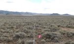
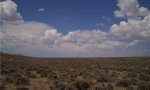
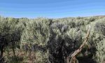
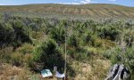
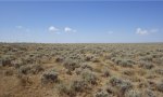
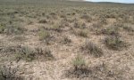
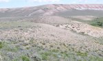
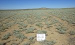
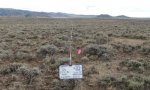
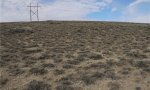
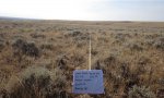
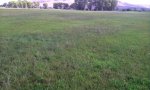
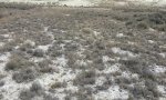
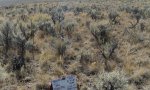
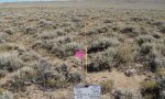
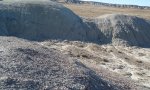
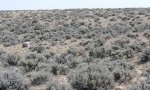
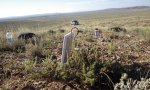
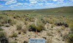
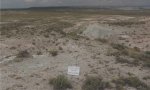
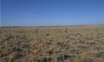
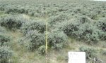
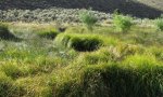
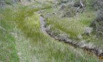
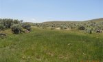
Ecological site map
Basemap
Find me
Find point
Full screen
Zoom in to display soil survey map units for an area of interest, and zoom out to display MLRAs. Select a map unit polygon to view ecological sites correlated to that map unit. View a brief description of an ecological site by clicking on its name in the map popup. Soil survey correlations may not be accurate, and ecological site classification of a location should always be verified in the field. Each selection may require the transfer of several hundred KB of data.
Ecological site keys
-
address notes above.. Have addressed all comments above and added to the keys to reflect.
-
I I.B.2.ii.a. Not sure what is fluctuating 24-60"? I suppose its rooting depth of woody plants? You were also consistent with using cm for other measurements, best use that here as well.
-
2 I.B.2.ii.b. Surface texture is used as criteria for b, but not for a. Its hard to get a read on differentiating criteria between the lowland and overflow sites.
-
3 II. Just a comment on the "and/or" following "south and west aspects". It would be more exact if it just said "and". But if you are saying that sites that are moderately deep to deep, that are present on this warmer aspect, will fall into category II, then maybe that should also be mentioned in the description of III.
Ecological site photos
Print Options
Sections
Font
Other
Briefcase
Add ecological sites and Major Land Resource Areas to your briefcase by clicking on the briefcase (![]() ) icon wherever it occurs. Drag and drop items to reorder. Cookies are used to store briefcase items between browsing sessions. Because of this, the number of items that can be added to your briefcase is limited, and briefcase items added on one device and browser cannot be accessed from another device or browser. Users who do not wish to place cookies on their devices should not use the briefcase tool. Briefcase cookies serve no other purpose than described here and are deleted whenever browsing history is cleared.
) icon wherever it occurs. Drag and drop items to reorder. Cookies are used to store briefcase items between browsing sessions. Because of this, the number of items that can be added to your briefcase is limited, and briefcase items added on one device and browser cannot be accessed from another device or browser. Users who do not wish to place cookies on their devices should not use the briefcase tool. Briefcase cookies serve no other purpose than described here and are deleted whenever browsing history is cleared.
Ecological sites
Major Land Resource Areas
The Ecosystem Dynamics Interpretive Tool is an information system framework developed by the USDA-ARS Jornada Experimental Range, USDA Natural Resources Conservation Service, and New Mexico State University.