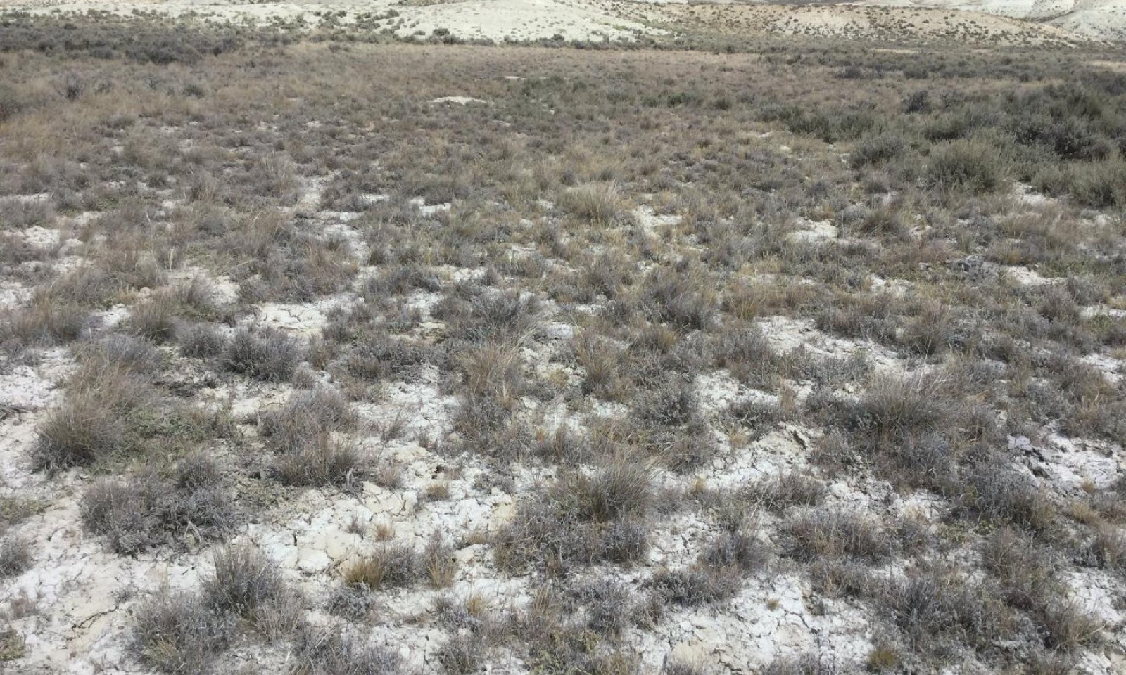
Saline Upland Pinedale Plateau (SU PP)
Circle-spoke model
Scenario model
Current plant community
Select a plant community
Management practices/drivers
Select a community pathway
- Pathway 1.1-1.2 More details
-
Transition T 1-2
Extreme soil-disturbance (e.g. oil and gas development, road construction, heavy use areas)
More details -
Transition T 2-3
Erosional event (high intensity storm) after extreme drought or herbivory (continuous, high intensity)
More details -
Restoration pathway R 3-2
Seeding (Critical Area Planting or Range Seeding) and Prescribed Grazing
More details -
No pathway between the selected plant communities has been described
Target plant community
Select a plant community
Description
The Reference State consists of two communities: the Desert Saltbush/Bunchgrass Community and the Desert Saltbush/Rhizomatous Grass Community. Each community differs in percent composition of bunchgrasses and percent shrub canopy cover. Shrub canopy cover is typically less than 25 percent. The dominant shrub species is Gardner's saltbush with winterfat sub-dominant. Dominant bunchgrasses are Indian ricegrass and bottlebrush squirreltail. Thickspike wheatgrass is the predominant rhizomatous grass. Annual and perennial forbs are a very minor component on this site.
Two important processes occur in the reference state and result in plant community changes: 1) grass-reducing disturbances such as drought and herbivory from small mammals (i.e. prairie dogs); and 2) time without those disturbances, generally referred to as "natural succession".
Prairie dogs select these sites for the protection they provide from predators by providing a clear line of site not provided for in sagebrush dominated sites. The white-tailed prairie dog, with intact pest and predator cycles, is thought to form smaller, more spread out colonies, likely due to habitat suitability and lower forage productivity in a desert environment compared to the large black-tailed prairie dog colonies of the prairies in the Great Plains. Predators and disease kept these small colonies on the move, preventing depletion of forage resources and allowed for recovery of the short-lived perennial bunchgrasses that dominate this site. As an example, Indian ricegrass lives approximately six years and relies upon an adequate seedbank to self-perpetuate. The reference prairie dog disturbance cycle is thought to fit within this timeframe.
Characteristics and indicators
This state is dependent upon an episodic herbivory regime that varies over time, allowing for recovery of shrub and bunchgrass components. When used as winter range, the shrub component is reduced to allow for grass dominance. When occupied by a prairie dog colony, the grass component is reduced to allow shrub dominance on the site.
Management actions or treatments are not typically used to mimic the natural disturbance regime due to fragile nature of the soils and lower productivity potential on this site. Prescribed fire is not used due to lack of fine fuels (Clause and Randall, 2014).
Resilience management
This site has moderate to moderately high resilience due to its aridic ustic (ustic bordering on aridic) soil moisture regime and frigid bordering on cryic temperature regime (Chambers et.al. 2014). Precipitation is typically low, but more effective with cooler temperatures and present when needed during the critical growth period (May through June). The site can usually recover after disturbance but is susceptible to delays in recovery during extreme climatic events such as drought.
The site has moderately high resistance to invasion by annual grasses because of climate limitations (dry and cold). The site may be susceptible to invasion after extreme disturbance during warmer climatic periods.
At the LRU scale, this site is less resilient than Sandy, Loamy, or Clayey sites, but is more resistant to invasion by annual invasive grasses. Lower resiliency and higher resistance is caused by soil chemistry, heavier soil textures, and reduced infiltration, making this site more susceptible to dry and drought conditions and harder for new plants to become established.
Submodel
Description
The Disturbed State is a result of extreme soil-disturbing activities outside of the normal disturbance regime expected for this site. Primary examples include road construction, oil and gas exploration, as well as livestock and recreation heavy use areas.
Characteristics and indicators
Primary indicators of this state are extreme soil disturbance associate with anthropogenic activities. Depending on the time since disturbance, recent climatic events, and reclamation efforts, the plant community could be dominated by annual weeds or it could be reclaimed to a variety of introduced or native species. This state could also be represented as a restoration from the Eroded State by a range planting dominated by non-natives such as Russian wildrye or crested wheatgrass dominant with Gardner's saltbush sub-dominant.
Resilience management
Site resilience is lower than the Reference State, but potentially higher than the Grazing Resistant or Eroded States. Site hydrology modifications exist, but may be temporary if proper reclamation occurs.
Site resistance to invasion by annual forbs is lower due to an increase in soil disturbance allowing niches in the understory for establishment. Common annuals to invade this site include kochia, Russian thistle, and halogeton. Cheatgrass may be present if introduced with seeding efforts, but does not dominate the site or influence site dynamics.
Submodel
Description
This state occurs when the "A" soil horizon has been lost and the subsoil is exposed, bringing the heavy clay soil layer or natric horizon closer to the surface.
Characteristics and indicators
There will be indicators of reduced soil and site stability as well as reduced hydrologic function, mainly water flow patterns, pedestals, rills, and gullies. Bare ground increases along with plant gap inter-space. Soil surface loss and degradation has occurred. Biotic integrity is affected by missing functional/structural groups and the loss of species diversity within functional/structural groups.
The site experiences little fluctuation in annual production from year to year because it is basically a monoculture of Gardner's saltbush. The site is less diverse with lower quality habitat for wildlife and pollinators.
Resilience management
Site resilience is lower than all other states because the site hydrology has been modified resulting in greater runoff during spring melt and rainfall events. Therefore, the site is drier and unable to recover as quickly after a disturbance. Soil loss and degradation prevents natural regeneration or restoration of the site.
Submodel
Mechanism
Extreme soil-disturbance from anthropogenic activity such as oil and gas development, road construction, and heavy use areas for livestock production or recreation.
Constraints to recovery
Recovery can be inhibited by soil chemistry (salinity), herbivory pressure, and prolonged drought conditions.
Context dependence
The transition to the Highly Disturbed State can occur quickly with one severe disturbance or over time as a result of the cumulative impacts of several recurring smaller disturbances such as salting areas for livestock production or continued recreational uses.
Mechanism
Extreme herbivory resulting in removal of perennial herbaceous vegetation followed by erosional event, typically associated with post-drought high intensity storms. This transition could also occur as a results of the cumulative impacts of many kinds and classes of herbivores such as livestock, wild horses, big game, and prairie dogs.
Constraints to recovery
Recovery can be inhibited by soil chemistry (salinity), herbivory pressure, and modified hydrology on the site.
Context dependence
This transition could also occur as a results of the cumulative impacts of many kinds and classes of herbivores such as livestock, wild horses, big game, and prairie dogs when not managed or occurring within the normal reference conditions (i.e. functioning pest and predator cycles). The timing and intensity of drought, herbivory, and intensity of post-drought storms can affect the resulting level of erosion and hydrologic modifications.
Mechanism
Restoration activities typically involve replacing top soil when it has been removed and deep ripping when site is compacted (after oil and gas exploration or other heavy equipment operations) followed by re-seeding efforts.
Historically, the eroded state was targeted for range seeding with introduced species such as Russian wildrye (Psathyrostachys juncea) which may not have completely restored the site hydrology, but by reintroducing mid-sized cool-season bunchgrasses, infiltration improves with structural/functional groups similar to the reference state.
Context dependence
This site has low potential for recovery due to soil chemistry and frequent drought conditions (https://www.nrcs.usda.gov/wps/cmis_proxy/https/ecm.nrcs.usda.gov%3a443/fncmis/resources/WEBP/ContentStream/idd_D0F7186E-0000-C21A-845D-CD210097FF99/0/PMC_Tech_Note_PM9A.pdf).
Drought and herbivory pressure will affect restoration success, and multiple attempts may be necessary before a reclamation or range seeding will succeed. If seeding of perennial vegetation is successful, it is possible for the site to provide some of the same ecosystem services as the Reference State.
Relevant conservation practices
| Practice | External resources |
|---|---|
|
Critical Area Planting |
|
|
Prescribed Grazing |
|
|
Range Planting |
Model keys
Briefcase
Add ecological sites and Major Land Resource Areas to your briefcase by clicking on the briefcase (![]() ) icon wherever it occurs. Drag and drop items to reorder. Cookies are used to store briefcase items between browsing sessions. Because of this, the number of items that can be added to your briefcase is limited, and briefcase items added on one device and browser cannot be accessed from another device or browser. Users who do not wish to place cookies on their devices should not use the briefcase tool. Briefcase cookies serve no other purpose than described here and are deleted whenever browsing history is cleared.
) icon wherever it occurs. Drag and drop items to reorder. Cookies are used to store briefcase items between browsing sessions. Because of this, the number of items that can be added to your briefcase is limited, and briefcase items added on one device and browser cannot be accessed from another device or browser. Users who do not wish to place cookies on their devices should not use the briefcase tool. Briefcase cookies serve no other purpose than described here and are deleted whenever browsing history is cleared.
Ecological sites
Major Land Resource Areas
The Ecosystem Dynamics Interpretive Tool is an information system framework developed by the USDA-ARS Jornada Experimental Range, USDA Natural Resources Conservation Service, and New Mexico State University.


