Ecological dynamics
Wyoming sagebrush is typically the dominant shrub in this community phase. Where Utah juniper has invaded, Wyoming big sagebrush and other shrubs decline, otherwise they dominate the community. Winterfat is dead or dying. Remaining perennial herbaceous vegetation is mostly found only in protected locations under shrubs. Invasive, non-native grasses and weeds including cheatgrass, annual mustards, redstem storksbill, etc. dominate the understory.
State 1
Reference State
The Reference State is a description of this ecological site just prior to Euro-American settlement but long after the arrival of Native Americans. The description of the Reference State was determined by NRCS Soil Survey Type Site Location information and familiarity with rangeland relict areas where they exist. The Reference State for this site would have been a shrub steppe characterized by Wyoming big sagebrush and associated native perennial forbs and grasses. A more complete list of species by lifeform for the Reference State is available in the accompanying tables in the “Plant Community Composition by Weight and Percentage” section of this document.
Community 1.1
Wyoming big sagebrush/ native perennial herbs
This community is dominated by Wyoming big sagebrush, Indian ricegrass and galleta. Shadscale and winterfat are also commonly present in the shrub layer. Indian ricegrass and galleta are the principle perennial grasses. Bottlebrush squirreltail is also commonly present. Abundant forbs including longleaf phlox and scarlet globemallow. Percent composition by air-dry weight is 35% grass, 10% forbs, and 55% shrubs. Natural fire frequency is estimated to be 10 to 70 years (USDA-FS, 2006).
Table 5. Annual production by plant type
| Plant type |
Low
(lb/acre) |
Representative value
(lb/acre) |
High
(lb/acre) |
| Shrub/Vine |
175 |
270 |
475 |
| Grass/Grasslike |
250 |
338 |
438 |
| Forb |
15 |
125 |
225 |
| Total |
440 |
733 |
1138 |
Table 6. Ground cover
| Tree foliar cover |
0%
|
| Shrub/vine/liana foliar cover |
24-26%
|
| Grass/grasslike foliar cover |
29-31%
|
| Forb foliar cover |
4-6%
|
| Non-vascular plants |
0%
|
| Biological crusts |
0%
|
| Litter |
0%
|
| Surface fragments >0.25" and <=3" |
0%
|
| Surface fragments >3" |
0%
|
| Bedrock |
0%
|
| Water |
0%
|
| Bare ground |
0%
|
Table 7. Canopy structure (% cover)
| Height Above Ground (ft) |
Tree |
Shrub/Vine |
Grass/
Grasslike |
Forb |
| <0.5 |
– |
– |
– |
– |
| >0.5 <= 1 |
– |
– |
– |
4-6% |
| >1 <= 2 |
– |
– |
29-31% |
– |
| >2 <= 4.5 |
– |
24-26% |
– |
– |
| >4.5 <= 13 |
– |
– |
– |
– |
| >13 <= 40 |
– |
– |
– |
– |
| >40 <= 80 |
– |
– |
– |
– |
| >80 <= 120 |
– |
– |
– |
– |
| >120 |
– |
– |
– |
– |
Community 1.2
Wyoming big sagebrush and juniper
This phase represents an extended period of time without a major disturbance such as fire; insect damage; or prolonged drought. Wyoming big sagebrush and shadscale increases significantly in percent composition. Winterfat and yellow rabbitbrush may increase also. Shrubs become decadent due to age. Perennial grasses and forbs lose vigor and juniper may have begun to encroach on the site. With the plant interspaces becoming larger from the reduction of rhizomatous grasses, soil erosion may accelerate because of the increased bare ground. Water flow patterns and pedestals become more abundant. Although the overall functionality of the site is still intact, it is at risk with further degradation.
Community 1.3
Indian ricegrass, needleandthread, galleta and sprouting shrubs
Native perennial bunchgrasses dominate this community phase. Wyoming big sagebrush and shadscale decrease in the community. Winterfat has the ability to re-sprout and re-establish following a fire. Yellow rabbitbrush and horsebrush species may increase significantly following fire and much of the excess fine fuel accumulation is removed. Fire tolerant shrubs typically persist as dominants in the community for 30 years or longer. Indian ricegrass and other cool season bunchgrasses flourish. Galleta increases in herbaceous cover.
Pathway 1
Community 1.1 to 1.2
Extended period of time without a major disturbance such as fire; insect damage; or prolonged drought. Fire frequency extends well beyond the 40 to 50 year average for the site.
Pathway 2
Community 1.1 to 1.3
Recent fire occurrence, lightning or human caused (1 – 30 years). Site is properly grazed.
Pathway 1
Community 1.2 to 1.3
This pathway occurs from the occurrence of a natural or human induced fire.
Pathway 1
Community 1.3 to 1.1
This represents the time following a fire with good grazing management, with a normal fire return interval of 40-50 years.
State 2
Current Potential
This state includes plant communities dominated by a diverse mixture of perennial grasses, a mixture of Wyoming big sagebrush and perennial grasses, and a community dominated by Wyoming big sagebrush. These community phases occur depending on the time since a disturbance that kills Wyoming big sagebrush has occurred, such as fire, insects, or drought, and grazing that provides adequate duration, timing, and intensity that maintain plant vigor and health of the plant community.
Plant communities in this state can include native, acclimatized, naturalized and invasive non-native species. This state is irreversibly changed from the reference state because these non-native species will now remain a permanent part of the community. This plant community has the composition, structure and cover present that facilitates the capture, storage, and safe release of precipitation, nutrients are being cycled through deep rooted perennial grasses, forbs, and evergreen shrubs, and cool season energy capture throughout the entire growing season (March to October) such that this plant community and site resiliency is maintained. With a lengthened fire return interval (greater than 60 years), an increase in sagebrush canopy occurs until sagebrush dominates resource use. This results in a decrease in vigor, cover and reproduction of perennial bunch grasses, and results in an increase in invasive annuals such as cheatgrass. This leads into transition T2b. With increased sagebrush cover, bare ground increases, resulting in a reduction in the capture, storage, and safe release of precipitation, a reduction in the amount of nutrient cycling and energy capture.
Community 2.1
Wyoming big sagebrush/perennial native herbs with minor component of exotic species
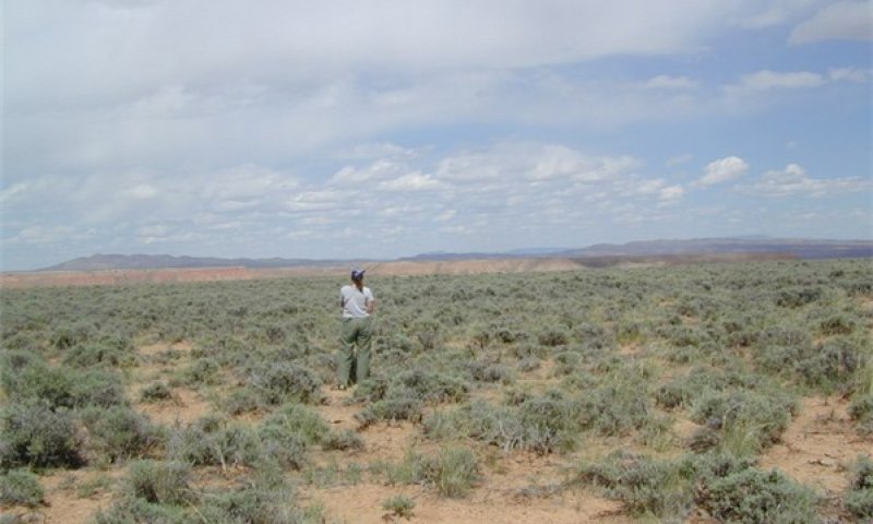
Figure 7. 2.1
Figure 8. 2.1
This community is dominated by Wyoming big sagebrush, Indian ricegrass and galleta. Shadscale and winterfat are also commonly present in the shrub layer. Indian ricegrass and galleta are the principle perennial grasses. Bottlebrush squirreltail is also commonly present. Abundant forbs including longleaf phlox and scarlet globemallow. Naturalized and invasive non-native species also exist. Percent composition by air-dry weight is 35% grass, 10% forbs, and 55% shrubs. Natural fire frequency is estimated to be 40 to 50 years.
| Jan |
Feb |
Mar |
Apr |
May |
Jun |
Jul |
Aug |
Sep |
Oct |
Nov |
Dec |
| J |
F |
M |
A |
M |
J |
J |
A |
S |
O |
N |
D |
Community 2.2
Wyoming big sagebrush/perennial native herbs with minor component of exotic species
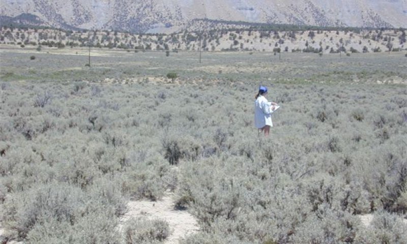
Figure 10. 2.2
Wyoming big sagebrush and shadscale increase significantly in percent composition. Winterfat and Yellow rabbitbrush may increase also. Shrubs become decadent due to age. Indian ricegrass, needleandthread and other cool season bunchgrasses begin to lose vigor because of improper grazing (including, season long overstocking, wrong season, etc.) and/or increased shrub competition and become dense with old vegetation. Galleta increases in herbaceous cover. This community is dominated by native species, but may include acclimatized, naturalized and invasive non-native species. Utah Juniper can encroach in this community phase and is small and low in cover. Percent composition by air-dry weight is 30% grass, 10% forbs, and 60% shrubs.
Community 2.3
Sprouting shrubs with herbaceous understory
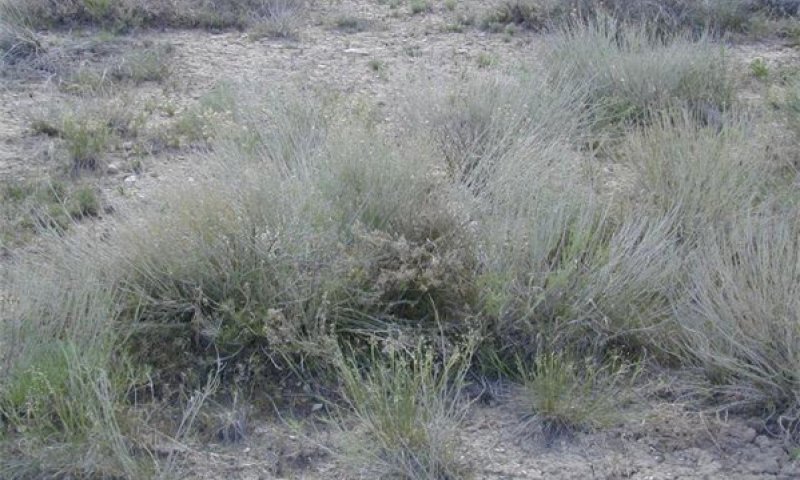
Figure 11. 2.3
Wyoming big sagebrush and Shadscale decrease in the community. Winterfat resprouts following the fire. Yellow rabbitbrush and horsebrush may increase significantly in the community following fire. Several native grasses dominate the understory. Fire tolerant shrubs typically persist as dominants in the community for 30 years or longer. This community is dominated by native species. Depending on the abundance of invasive annuals prior to the disturbance, will dictate their abundance post disturbance.
Community 2.4
Wyoming big sagebrush with a large component of annuals like cheatgrass.
Figure 12. 2.4
At risk community. Sagebrush is increasing in dominance and capturing site resources, reducing opportunity for perennial bunchgrasses to thrive. Fire frequency extends beyond the 40 – 50 year average for the site. Utah juniper may also begin invading the site if a seed source is available. An increase in sagebrush canopy until sagebrush dominates available resources, resulting in a decrease in vigor, cover and reproduction of perennial bunch grasses and forbs resulting in an increase in invasive annuals such as cheatgrass.
Community 2.5
Depleted Wyoming big sagebrush. Increased herbaceous component.

Figure 13. 2.5
Figure 14. 2.5
Depleted Wyoming big sagebrush. Herbaceous understory has increased significantly due to the reduced competition for resources. Scattered annual species are also present.
Pathway 1
Community 2.1 to 2.2
Wyoming big sagebrush/perennial native herbs with minor component of exotic species
Wyoming big sagebrush/perennial native herbs with minor component of exotic species
Improper grazing (including season long, overstocking, wrong season, etc.) and/or drought remove annual and perennial fine fuels from the site lessening the potential for fire to occur. Fire frequency extends beyond the 40 – 50 year average for the site. Utah juniper will often invade the site if a seed source is available.
Pathway 2
Community 2.1 to 2.3
Wyoming big sagebrush/perennial native herbs with minor component of exotic species
Sprouting shrubs with herbaceous understory
Fire removes non-sprouting shrubs from the community. Yellow rabbitbrush and/or horsebrush species become dominant. Recent fire occurrence (1 to 30 years).
Pathway 3
Community 2.1 to 2.4
Wyoming big sagebrush/perennial native herbs with minor component of exotic species
Wyoming big sagebrush with a large component of annuals like cheatgrass.
Improper grazing (including season long, overstocking, continual spring grazing, etc.) and/or drought remove perennial grass facilitating an increase in invasive annual species.
Pathway 4
Community 2.1 to 2.5
Wyoming big sagebrush/perennial native herbs with minor component of exotic species
Depleted Wyoming big sagebrush. Increased herbaceous component.
Wyoming big sagebrush significantly depleted due to brush management practices and/or heavy browsing by sheep and/or deer.
State 3
Juniper Encroachment
Native shrubs such as Wyoming big sagebrush or rabbitbrush dominate the site. The dominance depends on time since fire. Wyoming big sagebrush is non-sprouting and will be killed by fire. Rabbitbrush can sprout after a fire and can become the dominant shrub. This state typically has invasive grasses and/or forbs as the dominant understory species. There may be a few native species remaining, but they do not dominate. Utah junipers may increase to occupy a significant portion of the over story, if a seed source is present. Wyoming big sagebrush dominates the shrub layer and may be decadent due to age. Indian ricegrass and other native bunchgrasses are significantly reduced due to increased shrub competition and/or heavy grazing pressure. Galleta may increase. The threshold is crossed when invasive annuals including cheatgrass, annual mustards, redstem storksbill, etc. dominate the understory. The occurrence of fire extends well beyond the normal period for the site.
Community 3.1
Wyoming big sagebrush and/or Utah juniper, invasive annuals
Figure 15. 3.1
Wyoming sagebrush is typically the dominant shrub in this community phase. Where Utah juniper has invaded, Wyoming big sagebrush and other shrubs decline, otherwise they dominate the community. Winterfat is dead or dying. Remaining perennial herbaceous vegetation is mostly found only in protected locations under shrubs. Invasive, non-native grasses and weeds including cheatgrass, annual mustards, redstem storksbill, etc. dominate the understory.
Community 3.2
Juniper near Monoculture
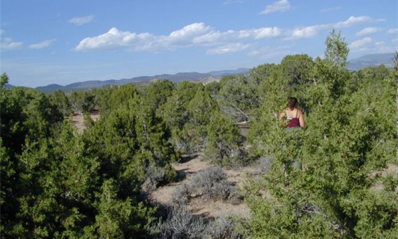
Figure 16. 3.2
The understory shrub and herbaceous has become very decadent or absent. A few scattered shrubs may still exist with the herbaceous component nearly nonexistent. Exposed soil results in increased runoff and erosion.
Pathway 1
Community 3.1 to 3.2
Wyoming big sagebrush and/or Utah juniper, invasive annuals
Sustained, long-term improper grazing (including season long, overstocking, wrong season, etc.); and/or prolonged drought. Lengthening of the fire return interval.
State 4
Invasive Annual State
Invasive grasses and forbs dominate this state. This may occur under a shortend fire return cycle which excludes native shrubs by frequent burning or this may occur with repeated improper grazing, or a combination of the two. Indian ricegrass and other native bunchgrasses are significantly reduced due to increased shrub competition and/or heavy grazing pressure. Galleta may increase. Only remnant perennial species remain. Highly combustible fine fuels from invasive annuals to dominate the community. Reoccurring fire is common. Fire frequency is 5 – 30 years.
Community 4.1
Invasive annuals
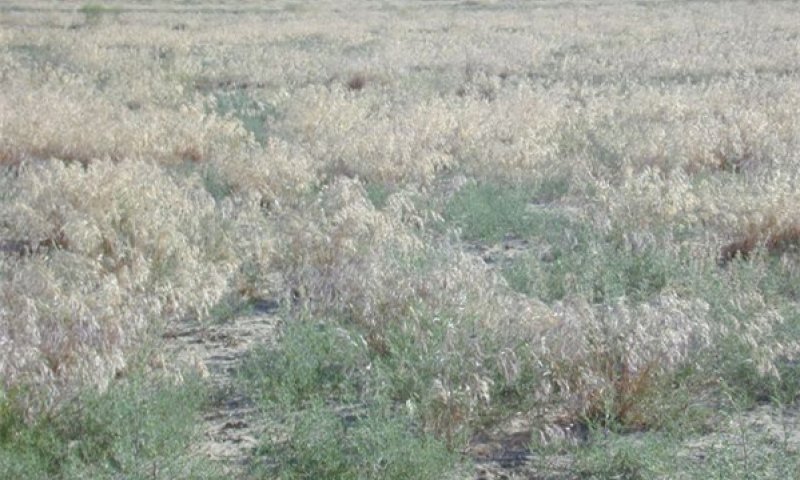
Figure 17. 4.1
Invasive annuals dominate this community phase. If shrubs are present, yellow rabbitbrush dominates the shrub layer. Remaining Winterfat is mostly dead. Horsebrush species can also be plentiful if conditions are right. Fire tolerant shrubs may persist as dominants with fire periods reoccurring at intervals of 5 - 30 years. Broom snakeweed may be a dominant episodic species when conditions are favorable. Only remnant perennial bunchgrasses remain, if any; invasive annuals including cheatgrass, annual mustards, redstem storksbill, etc. dominate the understory.
State 5
Seeded State
This state is seeded to rangeland species that are composed of mostly introduced species. Unwanted trees and/or shrubs are reduced but they may occupy a portion of the site through natural regeneration. Invasive annual grasses and weedy forb species primarily, cheatgrass and various annual mustards, may be present in the seeding, but do not dominate.
Community 5.1
Introduced Perennial Grasses
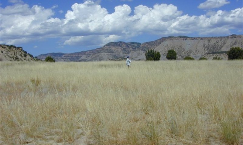
Figure 18. 5.1
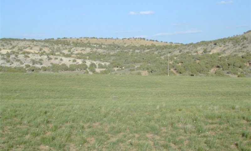
Figure 19. 5.1
This community is seeded to rangeland species that is composed of mostly introduced species. Unwanted trees and/or shrubs are reduced but they may occupy a portion of the site through natural regeneration. Invasive annual grasses and weedy forb species primarily, cheatgrass and various annual mustards, may be present in the seeding, but do not dominate. Range seedings, when healthy, are usually resistant to fire.
Community 5.2
Wyoming big sagebrush, introduced perennial grasses
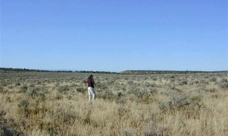
Figure 20. 5.2
This community includes the dominance of introduced perennial understory. Native shrubs are re-establishing.
Pathway 1
Community 5.1 to 5.2
Introduced Perennial Grasses
Wyoming big sagebrush, introduced perennial grasses
Over time Wyoming big sagebrush and other shrubs gradually move back into the site. The rate of this re-colonization may depend on external factors such as climate, management and grazing (both domestic and wildlife). Over time with the lack of disturbance such as brush management or fire, sagebrush reestablished itself on the site and dominates the herbaceous understory for resources.
Pathway 1
Community 5.2 to 5.1
Wyoming big sagebrush, introduced perennial grasses
Introduced Perennial Grasses
Site receives good grazing management. Mechanical, chemical, biological or fire disturbances reduce the woody vegetation components of the community. Perennial herbaceous vegetation very slowly recovers.
Transition 1
State 1 to 2
The threshold is crossed when there is an introduction of non-native species, primarily cheatgrass and various annual mustards, that become established in the community.
Restoration pathway 5-1
State 2 to 1
Reduction of browsing animals and/or proper grazing following chemical brush management treatment.
Transition 3
State 2 to 5
Disturbance such as a fire or brush management followed by a rangeland seeding.
Transition 1
State 3 to 4
Long-term improper grazing (including season long, overstocking, wrong season, etc.) and/or prolonged drought, fire causes State to cross a threshold into State 4.
Transition 2
State 3 to 5
Fire or brush management followed by a rangeland seeding of introduced, native or a combination rangeland species.
Restoration pathway 1
State 4 to 5
Seeding of introduced, native or a combination rangeland species with prescribed grazing.