Natural Resources
Conservation Service
Ecological site R036XY112CO
Shallow Sandy Loam (pinyon-Utah juniper)
Last updated: 12/20/2024
Accessed: 04/27/2025
General information
Provisional. A provisional ecological site description has undergone quality control and quality assurance review. It contains a working state and transition model and enough information to identify the ecological site.
MLRA notes
Major Land Resource Area (MLRA): 036X–Southwestern Plateaus, Mesas, and Foothills
This MLRA is in New Mexico (58 percent), Colorado (32 percent), and Utah (10 percent). It makes up about 23,885 square miles (61,895 square kilometers). The major towns in the area are Cortez and Durango, Colorado; Santa Fe and Los Alamos, New Mexico; and Monticello, Utah. The city of Grand Junction in Colorado, and Interstate 70 are just outside the northern tip of this area. Interstate 25 crosses through the middle of the MLRA, and U.S. Highway 550 runs along the MLRA’s southwest boundary in New Mexico. Mesa Verde National Park and the Bandelier, Hovenweep, Natural Bridges, Yucca House, and Colorado National Monuments are in the area. Many Indian reservations are in this MLRA. The largest are the Southern Ute, Ute Mountain, and Jicarilla Apache Reservations. Also in the area are the Cochiti, Jemez, Nambe, Navajo, Picuris, Pojoaque, San Felipe, San Ildefonso, San Juan, Sandia, Santa Ana, Santa Clara, Santa Domingo, Taos, Tesuque, and Zia Reservations.
This MLRA is within the Intermontane Plateaus Region. It is mainly in the Canyon Lands and Navajo Sections of the Colorado Plateau Province, partly in the Mexican Highland Section of the Basin and Range Province, and extends marginally into the Southern Rocky Mountains Province. Underlying sedimentary rock controls the landforms seen in most places, but fluvial landforms are in the Rio Grande Rift Basin at the southeastern portion of the MLRA. The elevation is commonly 4,600 to 8,500 feet (1,400 to 2,590 meters) and is generally highest (as high as 9,300 feet or 2,835 meters) in the foothills and high mesas that border the Southern Rocky Mountains. Relief is typically less than 1,500 feet (455 meters). The upper reaches of the Rio Grande and San Juan Rivers and their tributaries are in the part of this MLRA, near the Colorado and New Mexico state lines. The Rio Puerco and Rio Chama Rivers are in the New Mexico part of the MLRA. The Dolores and San Miguel Rivers are in the Colorado part of the MLRA, and a short reach of the Colorado River crosses this MLRA near the Utah and Colorado state lines.
Predominantly horizontal sedimentary beds from the Jurassic, Cretaceous, and Tertiary Periods underlie most of the MLRA. Representative formations are the Morrison Formation, Dakota Sandstone, Mancos Shale, Cliff House Sandstone, and other members of the Mesa Verde Group, including the Animas Formation and the San Jose Formation. The sedimentary rocks have eroded into plateaus, mesas, hills, and canyons. Thick eolian deposits from the Pleistocene Epoch blanket the tops of mesas in some areas. Small areas of Tertiary and Quaternary volcanic rocks, including cinder cones and lava flows, are in the Rio Grande Rift Basin in New Mexico. Broad valleys in the rift basin have accumulations of deep alluvial sediments, and fan remnants are commonplace.
The dominant soil orders in this MLRA are Alfisols, Inceptisols, Mollisols, Entisols, and Aridisols. The soil moisture regime is mainly ustic, but an aridic soil moisture regime that borders on ustic is present in some areas. The soil temperature regime is mesic or frigid. Mineralogy is dominantly mixed or smectitic. In warmer places of the MLRA, shallow Ustorthents (Menefee Series) formed in residuum on shale hills and mesas. Shallow Haplustalfs (Arabrab Series) and Torriorthents (Rizno Series) formed in material weathered from sandstone on mesas, hills, and cuestas. Moderately deep, loamy Haplargids (Gapmesa Series) and very deep, loamy Haplustalfs (Orlie series) formed in slope alluvium derived from sandstone and shale on mesas or fan remnants. Very deep, clayey Haplustepts (Roques series) formed in alluvium derived from shale on valley sides. Very deep, silty Haplustalfs (Cahona and Wetherill Series) formed in eolian deposits on hills and mesas. In cooler places, very deep, clayey Haplustalfs (Goldbug Series) formed in slope alluvium derived from sandstone and shale on hills and mesas. Shallow Argiustolls (Fivepine Series) formed in slope alluvium and residuum derived from sandstone. Moderately deep Argiustolls (Nortez Series) formed in eolian deposits derived from sandstone on hills and mesas.
Water commonly is scarce in areas away from the major streams. The Dolores, Animas, and San Juan Rivers, which are perennial streams in the northern end of the area, are major sources of irrigation water. It is used for municipal and industrial supplies as well as irrigation. The quality of some surface water has been degraded by the effects of upstream mining activities in the late 1800s. This mining occurred mainly in the upper reaches of the streams outside this MLRA. Ground water is the primary source of drinking water in many areas. In places some irrigation water is obtained from deep wells. Cretaceous and Jurassic sediments (Dakota and Morrison Formations and Entrada Sandstone) provide some ground water of variable quality in southwestern Colorado
The potential vegetation is grass and sagebrush at the lower elevations. Pinyon-juniper woodland and ponderosa pine forests are at mid elevations. Forests of Rocky Mountain Douglas-fir and white fir are at the higher elevations. Some common plants are Wyoming big sagebrush, western wheatgrass, galleta, needleandthread, and blue grama at the lower elevations; twoneedle pinyon, Utah juniper, Indian ricegrass, mountain mahogany, ponderosa pine, Gambel oak, Arizona fescue, and muttongrass at mid elevations; and Rocky Mountain Douglas-fir, white fir, mountain muhly, common snowberry, Parry’s oatgrass, and mountain brome at the higher elevations. Some of the major wildlife species in this area are mule deer, elk, coyote, black bear, mountain lion, black-tailed jackrabbit, Gunnison’s prairie dog, badger, piñon jay, black-billed magpie, mountain chickadee, red-breasted nuthatch, white-breasted nuthatch, collared lizard, fence lizard, and western rattlesnake. Reservoirs and rivers provide most of the fish habitat in this area. The ones at the higher elevations have cold-water species, such as rainbow trout and brown trout, and the ones at the lower elevations may have warm-water species, such as bass, bluegill, crappie, and catfish,
The various kinds of land use include private cropland(3 percent), private grassland(41 percent), federal grassland (39 percent), private forest (7 percent), federal forest (5 percent), private urban development (2 percent), and other private uses (3 percent). A majority of this MLRA supports natural vegetation and is used as grazing land or forestland. Cropland is also a significant land use. Where irrigation water is available, irrigated crops, such as wheat, barley, beans, oats, alfalfa, and hay, are grown. An area in Colorado and Utah is used as non-irrigated cropland, growing beans and winter wheat. The pinyon-juniper woodlands are a source of fuel wood. At the higher elevations, commercial timber is harvested, principally ponderosa pine and Rocky Mountain Douglas-fir. Some urban development is occurring in the vicinity of Santa Fe. The major soil resource concerns are wind erosion, water erosion, maintenance of the productivity of the soils, and management of soil moisture. Conservation practices on cropland generally include crop residue management, minimum tillage, and irrigation water management. Proper grazing use is a concern on grazing lands. The primary concerns in timbered areas are controlling erosion along roads and skid trails and minimizing surface compaction during timber harvesting.
Classification relationships
NRCS :
Major Land Resource Area 36, Southwestern Plateaus Mesas and Foothills (United States Department of Agriculture, Natural Resources Conservation Service, 2006).
USFS:
341Bg - Northeast Flank Subsection <341B Northern Canyonlands Section < 341 Intermountain Semi-desert and Desert (Cleland, etal., 2007).
M331Gf - Hills and Plateaus Subsection M331G South CentralHighlands Section M331 Southern Rocky Mountain Steppe -Open Woodland - Coniferous Forest - Alpine Meadow (Cleland, etal., 2007).
EPA:
20c Semiarid Benchlands and Canyonlands, < 20 ColoradoPlateau < 10.l Cold Deserts < 10 North American Deserts(Griffith,2006).
USGS: Colorado Plateau Province (Canyonlands Section)
Ecological site concept
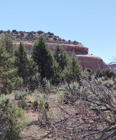
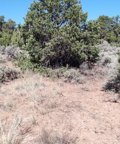
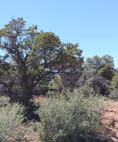
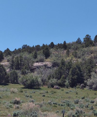
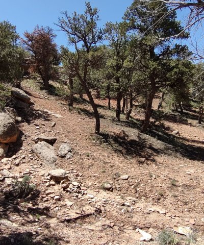
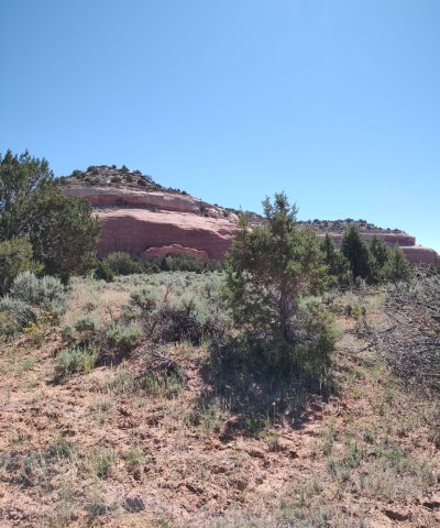
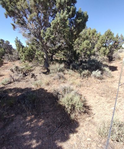
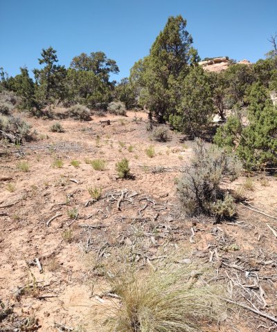
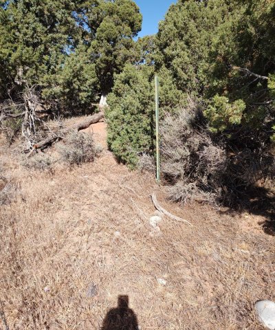
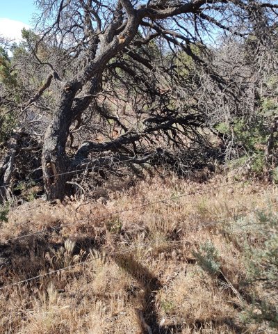
Shallow Sandy Loam (Pinyon- Utah Juniper) ecological site was drafted from the existing Shallow And Sandy Loam (Pinyon-Juniper) Range Site 34B (NRCS, March, 1996). This site was written prior to MLRA 36 being recognized in Colorado. This ecological site occurs on ridgelines, escarpments and side slopes. The soils are sandy in textures. Soils are derived from colluvium from igneous, metamorphic and sedimentary rock. The land cover is a grass community with a Pinyon and Utah Juniper community. It has an aridic ustic moisture regime and mesic temperature regime. The effective precipitation ranges from 12 to 16 inches.
Associated sites
| R036XY114CO |
Mountain Pinyon Mountain Pinyon is a gentle sloped (<25% slope) site with very shallow and shallow soils that are loamy in texture. This site is dominated by Pinyon, Utah Juniper. This site may have oakbrush in the understory. This site is in the 12 to 16 inch precipitation zone of foothills/upland. |
|---|---|
| R036XY445CO |
Steep Colluvial Slopes Steep Colluvial Slopes is a very steep (>25% slope) sloped site with very shallow to shallow soils that are clayey in texture. This site is dominated by Utah Juniper and pinyon. This site may have Wyoming big sagebrush in the understory. This site has 12 to 16 inches of precipitation. |
| R036XY284CO |
Loamy Foothills Loamy Foothills occurs on hills, benches and mesas on moderately deep to deep loamy textured soils derived from alluvium, slope alluvium eolian deposits, and colluvium. It is a Wyoming big sagebrush – Muttongrass community. It has an aridic ustic moisture regime and mesic temperature regime. The effective precipitation ranges from 12 to 16 inches. |
| R036XY287CO |
Stony Foothills Stony Foothill is a gentle sloped (<25% slope) site with moderately deep to deep that are loamy-skeletal in texture. This site is dominated by Pinyon, Utah Juniper. This site may have oakbrush in the understory. This site is in the 12 to 16 inch precipitation zone of foothills/upland. |
| R036XY310CO |
Sandy Foothills Site occurs on rolling uplands on mesas. Soils are deep sandy loams to loamy sands. Dominant plants are needle-and-thread, western wheatgrass, Wyoming big sagebrush, and balsamroot. |
Similar sites
| R036XY110CO |
Shallow Clay Loam (pinyon-Utah juniper) Shallow Clay Loam Pinyon-Juniper is a gentle sloped (<25% slopes) site with shallow soils that are clayey in texture. This site is dominated by Utah Juniper and scattered pinyon. This site may have Wyoming big sagebrush in the understory. This site is in the 8 to 12 inch precipitation zone of semidesert. |
|---|---|
| R036XY114CO |
Mountain Pinyon Mountain Pinyon is a gentle sloped (<25% slope) site with very shallow and shallow soils that are loamy in texture. This site is dominated by Pinyon, Utah Juniper. This site may have oakbrush in the understory. This site is in the 12 to 16 inch precipitation zone of foothills/upland. |
| R036XY315UT |
Upland Shallow Loam (pinyon-Utah juniper) Soils are very shallow to shallow with loamy textures. Soil surface texture is usually fine sandy loam. Slope ranges from 3-10%. It occurs on hills, mesas and structural benches. This site is dominated by pinyon and Utah Juniper. This site may have black sagebrush and mormon tea in the understory. This site is in the 12 to 16 inch precipitation zone of foothills/upland. |
| R036XY113CO |
Semidesert Juniper Loam Semidesert Juniper Loam is a gentle sloped (<25-30% slope) site with shallow soils that are loamy in texture. This site is dominated by Utah Juniper and scattered pinyon. This site may have Wyoming big sagebrush in the understory. Precipitation of this site is 8 to 12 inches. |
Table 1. Dominant plant species
| Tree |
(1) Pinus edulis |
|---|---|
| Shrub |
(1) Artemisia tridentata ssp. wyomingensis |
| Herbaceous |
(1) Achnatherum hymenoides |
Click on box and path labels to scroll to the respective text.
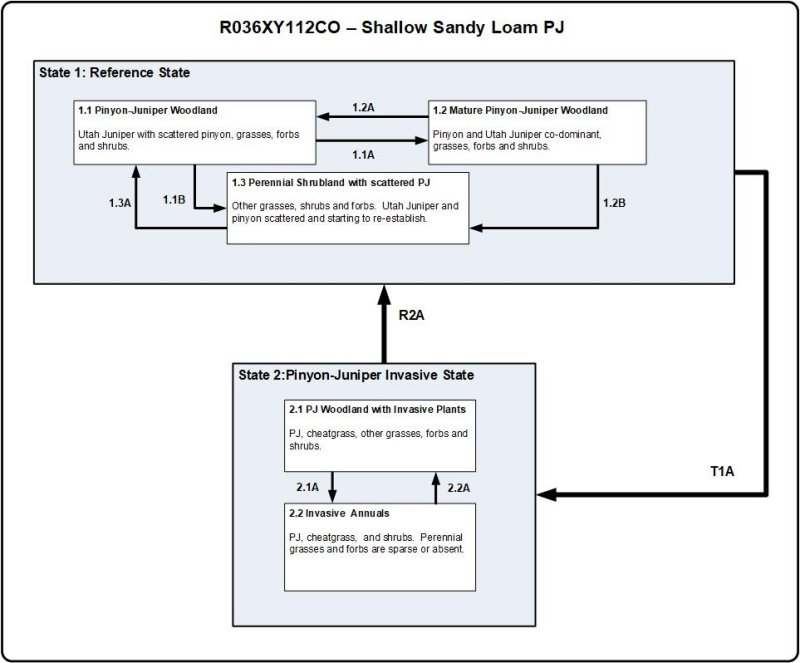
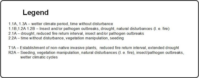
Ecosystem states
| R2A | - | Woody canopy reduction and reseeding |
|---|
State 1 submodel, plant communities
| 1.1A | - | Time with favorable precipitation |
|---|---|---|
| 1.1B | - | Fire, drought or insect/pathogen outbreaks |
| 1.2A | - | Fire, natural disturbances, drought or insect/pathogen outbreaks |
| 1.2B | - | Fire, drought or insect and pathogen outbreaks |
| 1.3A | - | Wetter precipitation years and time. |
State 2 submodel, plant communities
| 2.1A | - | Frequent fire or drought |
|---|---|---|
| 2.2A | - | Fire suppression, invasive species management, and seeding |
