
Natural Resources
Conservation Service
Ecological site R038XA112AZ
Sandy Loam Upland, Deep 12-16" p.z.
Last updated: 5/07/2020
Accessed: 02/11/2026
General information
Provisional. A provisional ecological site description has undergone quality control and quality assurance review. It contains a working state and transition model and enough information to identify the ecological site.
MLRA notes
Major Land Resource Area (MLRA): 038X–Mogollon Transition South
AZ 38.1 – Lower Mogollon Transition
Elevations range from 3000 to 4500 feet and precipitation averages 12 to 16 inches per year. Vegetation includes canotia, one-seed juniper, mesquite, catclaw acacia, jojoba, turbinella oak, ratany, shrubby buckwheat, algerita, skunkbush, tobosa, vine mesquite, bottlebrush squirreltail, grama species, curly mesquite, desert needlegrass and New Mexico feathergrass. The soil temperature regime is thermic and the soil moisture regime is ustic aridic. This unit occurs within the Transition Zone Physiographic Province and is characterized by canyons and structural troughs or valleys. Igneous, metamorphic and sedimentary rock classes occur on rough mountainous terrain in association with less extensive sediment filled valleys exhibiting little integrated drainage.
Associated sites
| R038XA102AZ |
Clayey Upland 12-16" p.z. Clayey Upland 12-16" p.z. |
|---|---|
| R038XA103AZ |
Clay Loam Upland 12-16" p.z. Clay Loam Upland 12-16" p.z. |
Table 1. Dominant plant species
| Tree |
Not specified |
|---|---|
| Shrub |
(1) Eriogonum wrightii |
| Herbaceous |
(1) Bouteloua curtipendula |
Physiographic features
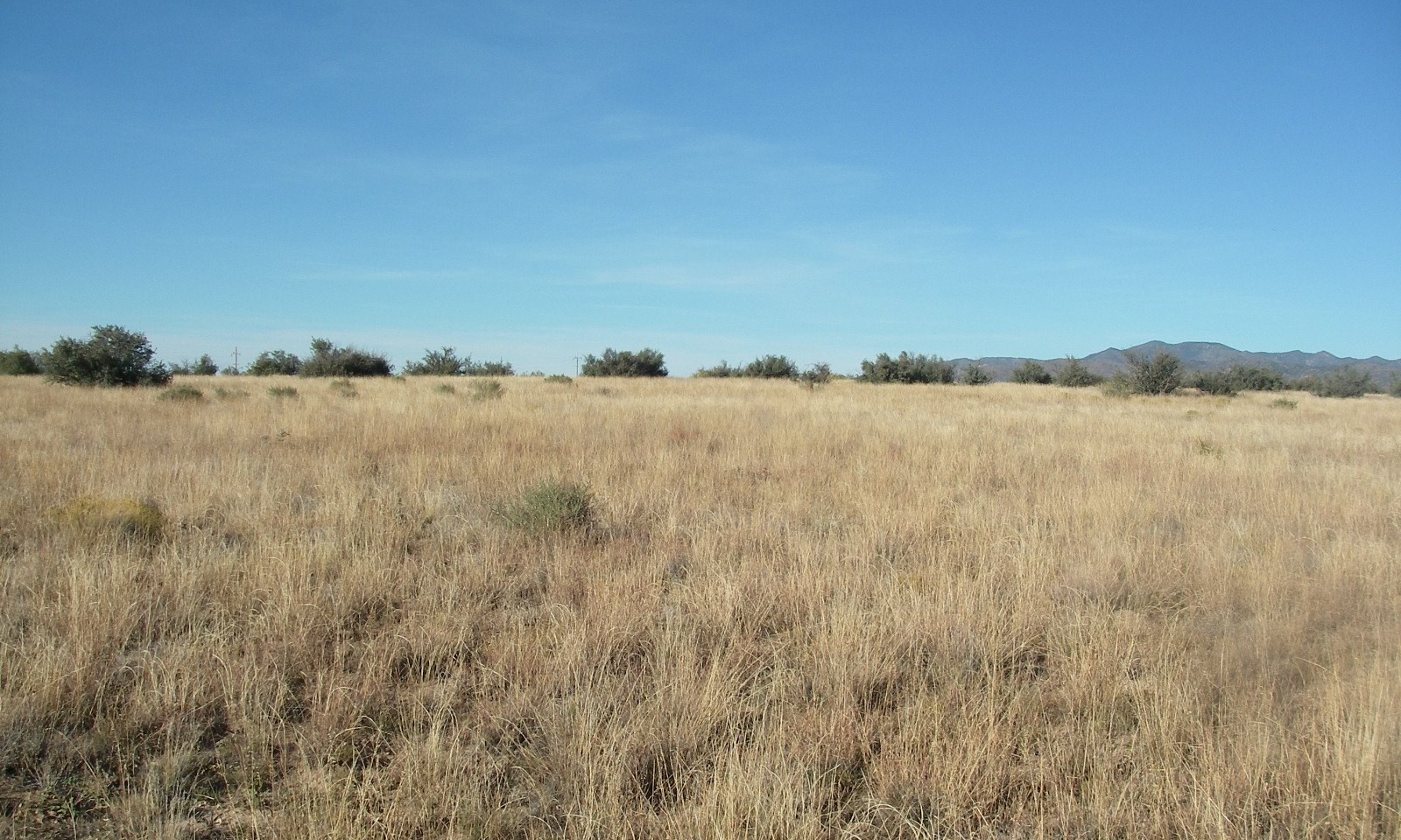
This site occurs at the lowest elevations of the interior chaparral zone in the Mogollon Transition area. It occurs in an upland position. It is on gentle slopes and fan terraces.
Table 2. Representative physiographic features
| Landforms |
(1)
Terrace
(2) Fan piedmont (3) Plain |
|---|---|
| Flooding frequency | None |
| Ponding frequency | None |
| Elevation | 3,100 – 4,600 ft |
| Slope | 1 – 10% |
| Aspect | N, E, S |
Climatic features
Precipitation in this common resource area averages 12 to 16 inches annually. The winter-summer rainfall ratio ranges from about 60/40% in the northwest part of the area to 50/50% in the southeast part. Summer rains fall July through September; are from high-intensity, convective thunderstorms. This moisture originates primarily from the Gulf of Mexico, but can come from the remnants of Pacific hurricanes in September. Winter moisture is frontal, originates in the north Pacific, and falls as rain or snow in widespread storms of low intensity and long duration. Snowfall ranges from a trace to 10 inches per year and can occur from November through March. Snow seldom persists for more than a day except on north aspects. May and June are the driest months of the year. Humidity is generally low all year. Average annual air temperatures range from 59 to 70 degrees F (thermic temperature regime). Daytime temperatures in the summer are commonly in the high 90’s. Freezing temperatures are common from October through April, usually during the night or early morning hours. The actual precipitation, available moisture and temperature vary, depending on, region, elevation, rain shadow effect and aspect.
Table 3. Representative climatic features
| Frost-free period (average) | 230 days |
|---|---|
| Freeze-free period (average) | 285 days |
| Precipitation total (average) | 16 in |
Figure 1. Monthly precipitation range
Figure 2. Monthly average minimum and maximum temperature
Influencing water features
There are no water features associated with this site.
Soil features
Typical taxonomic units where this site is mapped include: SSA-639 Black Hills-Sedona area MU's Perilla sandy loam-416, Perilla family loamy fine sand-430; SSA-661 Eastern Pinal and Southern Gila County area MU's Mallet-21, Combate-23, Combate-71; SSA-675 San Carlos IR area MU Combate-52.
Table 4. Representative soil features
| Parent material |
(1)
Alluvium
–
granite
|
|---|---|
| Surface texture |
(1) Loam (2) Coarse sandy loam (3) Sandy loam |
| Family particle size |
(1) Loamy |
| Drainage class | Well drained |
| Permeability class | Moderately rapid |
| Soil depth | 60 in |
| Surface fragment cover <=3" | 5 – 30% |
| Surface fragment cover >3" | Not specified |
| Available water capacity (0-40in) |
3.8 – 7 in |
| Calcium carbonate equivalent (0-40in) |
Not specified |
| Electrical conductivity (0-40in) |
2 mmhos/cm |
| Sodium adsorption ratio (0-40in) |
Not specified |
| Soil reaction (1:1 water) (0-40in) |
6.1 – 7.8 |
| Subsurface fragment volume <=3" (Depth not specified) |
20 – 25% |
| Subsurface fragment volume >3" (Depth not specified) |
Not specified |
Ecological dynamics
The plant communities found on an ecological site are naturally variable. Composition and production will vary with yearly conditions, location, aspect, and the natural variability of the soils. The historical climax plant community represents the natural potential plant communities found on relict or relatively undisturbed sites. Other plant communities described here represent plant communities that are known to occur when the site is disturbed by factors such as grazing, fire, or drought.
Production data provided in this site description is standardized to air-dry weight at the end of the summer growing season. The plant communities described in this site description are based on near normal rainfall years.
NRCS uses a Similarity Index to compare existing plant communities to the plant communities described here. Similarity Index is determined by comparing the production and composition of a plant community to the production and composition of a plant community described in this site description. To determine Similarity Index, compare the production (air-dry weight) of each species to that shown in the plant community description. For each species, count no more than the maximum amount shown for the species, and for each group, count no more than the maximum shown for the group. Divide the resulting total by the total normal year production shown in the plant community description. If rainfall has been significantly above or below normal, use the total production shown for above or below normal years. If field data is not collected at the end of the summer growing season, then the field data must be corrected to the end of the year production before comparing it to the site description. The growth curve can be used as a guide for estimating production at the end of the summer growing season.
State and transition model
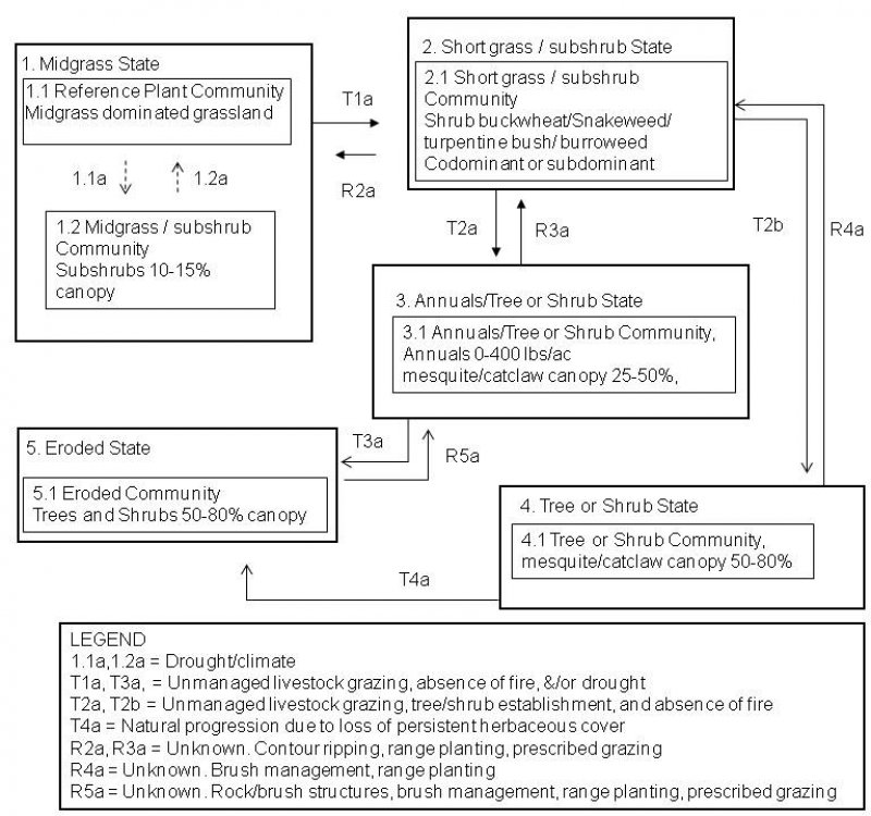
More interactive model formats are also available.
View Interactive Models
More interactive model formats are also available.
View Interactive Models
Click on state and transition labels to scroll to the respective text
State 1 submodel, plant communities
State 2 submodel, plant communities
State 3 submodel, plant communities
State 4 submodel, plant communities
State 5 submodel, plant communities
State 1
Midgrass State
The Midgrass State is the Reference Plant Community (RPC). It is a warm season dominated grassland (canopy cover of 55 to 65%). Cool and warm season annual grasses and forbs are well represented in the flora. Half shrubs and perennial forbs are an important group also. The coefficient of variation (CV) is a useful measure to compare variability of data sets. Warm season grasslands are dependent on winter moisture to keep root systems hydrated and prevent desiccation. Summer moisture is critical for restoration and maintenance of root systems as well as above ground growth and seed or vegetative reproduction vital to the maintenance of the community. No clear pattern exists for CV values of historic winter rainfall from climate stations in the vicinity of grasslands in the 12-16” precipitation zone of Southeastern Arizona (Land Resource Unit (LRU) 41-3) and grasslands in the 12-16” precipitation zone in Central Arizona (LRU 38-1); both are equally variable. However, climate stations in the vicinity of grasslands in these 2 LRU’s show distinct separation of CV values of historic summer precipitation values; partially explained by southeast Arizona being in closer proximity to summer moisture originating out of the Gulf of Mexico. The CV of historic summer precipitation at Walnut Grove, Yavapai County is 82; the climate station located closest to the RPC inventory location. Coefficient of variation values of historic summer precipitation at Willow Springs, Winkelman, Superior (Pinal County), San Carlos Lake, and Roosevelt Lake (Gila County) are 79, 79, 82, 78, and 82, respectively. The soil moisture/temperature regime of the lower elevation sites of Winkelman, Superior, and Roosevelt Lake do not fit LRU 38-1 very well. However, they are very near the transition between 40-1 and 38-1 and illustrate near equal variability of summer precipitation of these regions. This is contrasted with locations like Willcox (Cochise County) and San Manuel (Pinal County) in LRU 41-3 that have historic summer precipitation CV values of 69-72. Despite grasslands in LRU 38-1 experiencing approximately 10% more variable average summer rainfall the existence of these grassland communities can be observed. A high density/producing grass community on a calcareous soil is found in the southeast portion of LRU 38-1 on the extreme northwest portion of Willow Springs Ranch near the boundary with the 96 Ranch at an elevation of 3500 feet; evidence that climate in the far southeast portion of LRU 38-1 has the potential to support perennial grassland communities as found at the RPC documented in the far northwest portion of the LRU. Perennial grasslands in LRU 38-1 are likely more susceptible to the stressors that induce transitions to alternative states given the greater variability of summer rainfall in this region; especially shrub dominated communities that are so prevalent in this MLRA.
Community 1.1
Reference Plant Community

The Midgrass State is the Reference Plant Community. It is a warm season dominated grassland (canopy cover of 40 to 50%). Sideoats grama is the dominant perennial grass. Blue grama is an important grass at the upper elevations of the site and is replaced by black and hairy grama at lower elevations. Cool and warm season annual grasses and forbs are well represented in the flora. Half shrubs and perennial forbs are an important group also. Snakeweed and shrubby buckwheat are the primary shrubs that can increase at upper elevations; turpentine bush and burroweed at mid and lower elevations. Periodic wildfires likely occurred every 15 to 20 years; June through August, and controlled shrubs and succulents invading from adjacent, shallow soil, areas. In the absence of fire for long periods of time shrubs, trees and cacti can dominate the site. The interactions of drought, fire and grazing can result in a loss of perennial grass cover. Annuals, both native and non-native, can dominate the plant community in these situations . Non-native annuals can, over time, diminish the soil seed-bank of native annual species.
Figure 3. Annual production by plant type (representative values) or group (midpoint values)
Table 5. Annual production by plant type
| Plant type | Low (lb/acre) |
Representative value (lb/acre) |
High (lb/acre) |
|---|---|---|---|
| Grass/Grasslike | 500 | 800 | 1100 |
| Forb | 20 | 40 | 170 |
| Shrub/Vine | 40 | 60 | 80 |
| Tree | 2 | 5 | 10 |
| Total | 562 | 905 | 1360 |
Figure 4. Plant community growth curve (percent production by month). AZ3811, 38.1 12-16" p.z. all sites. Growth begins in the spring, most growth occurs in the summer..
| Jan | Feb | Mar | Apr | May | Jun | Jul | Aug | Sep | Oct | Nov | Dec |
|---|---|---|---|---|---|---|---|---|---|---|---|
| J | F | M | A | M | J | J | A | S | O | N | D |
| 0 | 0 | 1 | 7 | 15 | 20 | 22 | 20 | 10 | 5 | 0 | 0 |
Community 1.2
Midgrass/ Sub Shrub Plant Community
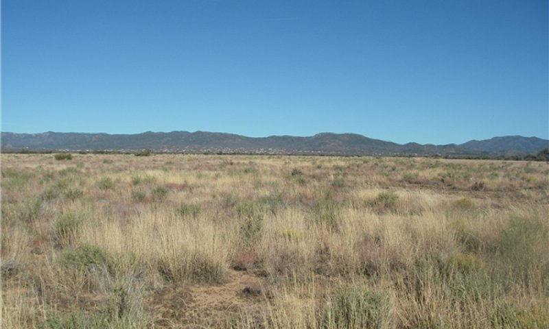
State 2
Short grass / subshrub State
Subshrubs increase in abundance due to reduced abundance/vigor of perennial grasses.
Community 2.1
Short grass / subshrub Community
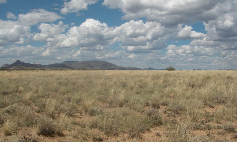
State 3
Annuals/Tree or Shrub State
Trees and shrubs have increased in the absence of periodic wildfire. Perennial grasses have been replaced by annual grasses and forbs.
Community 3.1
Annuals/Tree or Shrub Community,
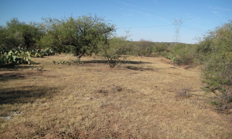
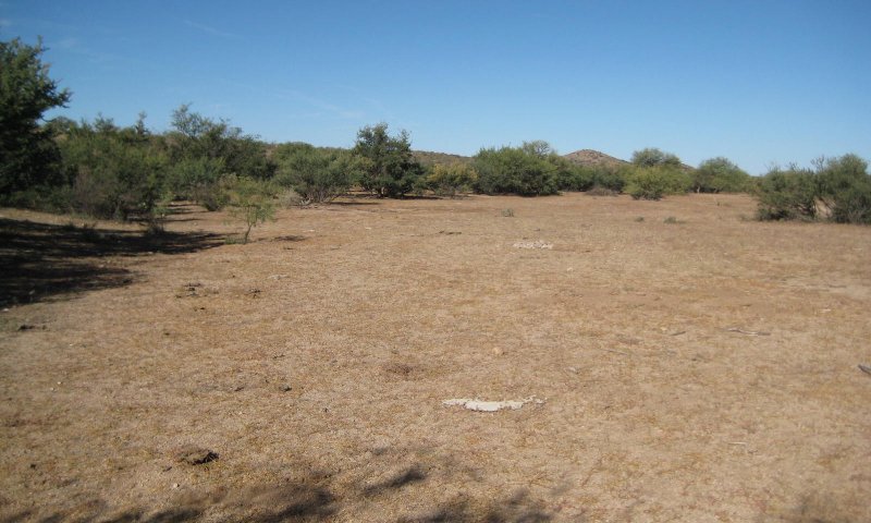
Perennial grasses have been reduced from the interaction of continuous high intensity herbivory and drought. Annual grasses make up the herbaceous understory and are absent in drought years. Trees and shrubs have increased in the absence of periodic wildfire.
State 4
Tree or Shrub State
Trees or shrubs have increased to dominate the site.
Community 4.1
Tree or Shrub Community
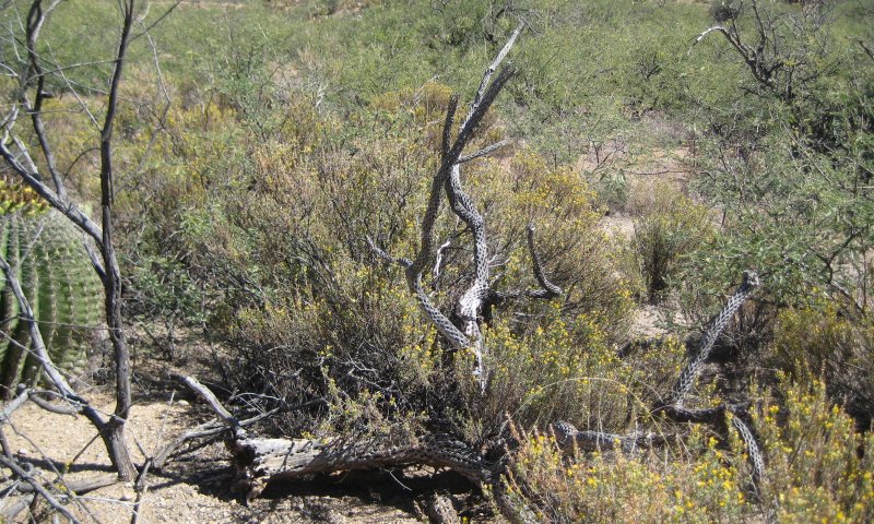
Trees or shrubs have increased to 50-80% canopy cover. Subshrubs dominate lower canopy levels at such high amounts that herbaceous species are severely limited.
State 5
Eroded State
Herbaceous cover has been reduced for so long that soils begin to erode.
Community 5.1
Eroded Community
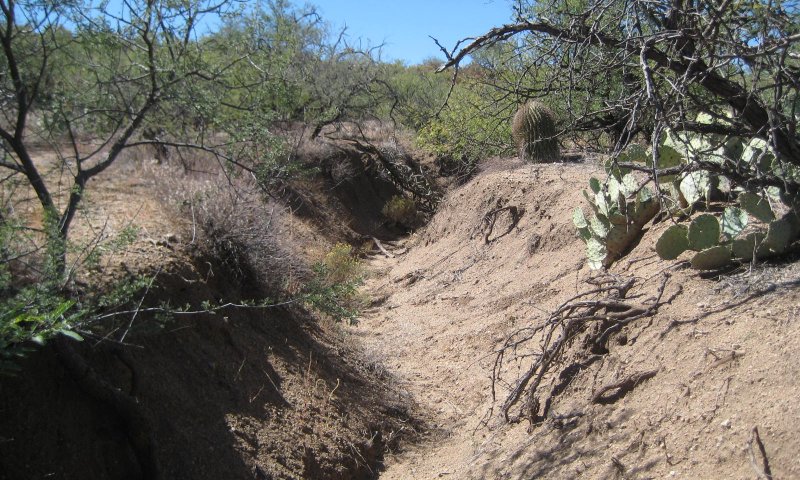
Trees, shrubs, and succulents dominate the plant community. Annual grasses and forbs are severely reduced due to very high levels of subshrubs that occupy most space among trees and succulents.
Additional community tables
Table 6. Community 1.1 plant community composition
| Group | Common name | Symbol | Scientific name | Annual production (lb/acre) | Foliar cover (%) | |
|---|---|---|---|---|---|---|
|
Grass/Grasslike
|
||||||
| 1 | Dominant perennial grasses | 320–660 | ||||
| sideoats grama | BOCU | Bouteloua curtipendula | 300–550 | – | ||
| black grama | BOER4 | Bouteloua eriopoda | 20–60 | – | ||
| blue grama | BOGR2 | Bouteloua gracilis | 0–50 | – | ||
| hairy grama | BOHI2 | Bouteloua hirsuta | 0–50 | – | ||
| 2 | Cool season grasses | 0–10 | ||||
| squirreltail | ELEL5 | Elymus elymoides | 0–10 | – | ||
| 3 | Misc. perennial grasses | 5–180 | ||||
| purple threeawn | ARPU9 | Aristida purpurea | 5–75 | – | ||
| red grama | BOTR2 | Bouteloua trifida | 0–20 | – | ||
| spidergrass | ARTE3 | Aristida ternipes | 1–20 | – | ||
| spidergrass | ARTEG | Aristida ternipes var. gentilis | 0–15 | – | ||
| bush muhly | MUPO2 | Muhlenbergia porteri | 0–15 | – | ||
| plains bristlegrass | SEVU2 | Setaria vulpiseta | 0–15 | – | ||
| Fendler threeawn | ARPUL | Aristida purpurea var. longiseta | 0–10 | – | ||
| cane bluestem | BOBA3 | Bothriochloa barbinodis | 0–5 | – | ||
| curly-mesquite | HIBE | Hilaria belangeri | 0–5 | – | ||
| green sprangletop | LEDU | Leptochloa dubia | 0–5 | – | ||
| Arizona cottontop | DICA8 | Digitaria californica | 0–5 | – | ||
| sand dropseed | SPCR | Sporobolus cryptandrus | 0–5 | – | ||
| fall witchgrass | DICO6 | Digitaria cognata | 0–2 | – | ||
| plains lovegrass | ERIN | Eragrostis intermedia | 0–1 | – | ||
| tanglehead | HECO10 | Heteropogon contortus | 0–1 | – | ||
| 4 | Annual grasses | 0–180 | ||||
| sixweeks fescue | VUOC | Vulpia octoflora | 1–50 | – | ||
| mucronate sprangeltop | LEPAB | Leptochloa panicea ssp. brachiata | 0–25 | – | ||
| small fescue | VUMI | Vulpia microstachys | 0–20 | – | ||
| sixweeks threeawn | ARAD | Aristida adscensionis | 1–20 | – | ||
| Mexican panicgrass | PAHI5 | Panicum hirticaule | 0–15 | – | ||
| Arizona signalgrass | URAR | Urochloa arizonica | 0–15 | – | ||
| Eastwood fescue | VUMIC | Vulpia microstachys var. ciliata | 0–10 | – | ||
| Rothrock's grama | BORO2 | Bouteloua rothrockii | 0–10 | – | ||
| prairie threeawn | AROL | Aristida oligantha | 0–5 | – | ||
| witchgrass | PACA6 | Panicum capillare | 0–5 | – | ||
| delicate muhly | MUFR | Muhlenbergia fragilis | 0–2 | – | ||
| littleseed muhly | MUMI | Muhlenbergia microsperma | 0–2 | – | ||
| Arizona brome | BRAR4 | Bromus arizonicus | 0–2 | – | ||
| feather fingergrass | CHVI4 | Chloris virgata | 0–2 | – | ||
| canyon cupgrass | ERLE7 | Eriochloa lemmonii | 0–1 | – | ||
| tufted lovegrass | ERPE | Eragrostis pectinacea | 0–1 | – | ||
| Mexican sprangletop | LEFUU | Leptochloa fusca ssp. uninervia | 0–1 | – | ||
| needle grama | BOAR | Bouteloua aristidoides | 0–1 | – | ||
| sixweeks grama | BOBA2 | Bouteloua barbata | 0–1 | – | ||
| Bigelow's bluegrass | POBI | Poa bigelovii | 0–1 | – | ||
|
Forb
|
||||||
| 5 | Perennial forbs | 5–40 | ||||
| weakleaf bur ragweed | AMCO3 | Ambrosia confertiflora | 1–5 | – | ||
| desert globemallow | SPAM2 | Sphaeralcea ambigua | 1–5 | – | ||
| brownplume wirelettuce | STPA4 | Stephanomeria pauciflora | 1–5 | – | ||
| Coues' cassia | SECO10 | Senna covesii | 0–2 | – | ||
| lacy tansyaster | MAPI | Machaeranthera pinnatifida | 0–2 | – | ||
| perennial rockcress | ARPE2 | Arabis perennans | 1–2 | – | ||
| desert marigold | BAMU | Baileya multiradiata | 0–1 | – | ||
| scarlet spiderling | BOCO | Boerhavia coccinea | 0–1 | – | ||
| desert mariposa lily | CAKE | Calochortus kennedyi | 0–1 | – | ||
| sego lily | CANU3 | Calochortus nuttallii | 0–1 | – | ||
| leatherweed | CRPO5 | Croton pottsii | 0–1 | – | ||
| Gregg's prairie clover | DAGR2 | Dalea greggii | 0–1 | – | ||
| Cooley's bundleflower | DECO2 | Desmanthus cooleyi | 0–1 | – | ||
| fleabane | ERIGE2 | Erigeron | 0–1 | – | ||
| wild dwarf morning-glory | EVAR | Evolvulus arizonicus | 0–1 | – | ||
| southwestern mock vervain | GLGO | Glandularia gooddingii | 0–1 | – | ||
| Indian rushpea | HOGL2 | Hoffmannseggia glauca | 0–1 | – | ||
| Wright's deervetch | LOWR | Lotus wrightii | 0–1 | – | ||
| dwarf desertpeony | ACNA2 | Acourtia nana | 0–1 | – | ||
| brownfoot | ACWR5 | Acourtia wrightii | 0–1 | – | ||
| trailing windmills | ALIN | Allionia incarnata | 0–1 | – | ||
| orange fameflower | PHAU13 | Phemeranthus aurantiacus | 0–1 | – | ||
| slender poreleaf | POGR5 | Porophyllum gracile | 0–1 | – | ||
| canaigre dock | RUHY | Rumex hymenosepalus | 0–1 | – | ||
| twinleaf senna | SEBA3 | Senna bauhinioides | 0–1 | – | ||
| New Mexico fanpetals | SINE | Sida neomexicana | 0–1 | – | ||
| silverleaf nightshade | SOEL | Solanum elaeagnifolium | 0–1 | – | ||
| white sagebrush | ARLUM2 | Artemisia ludoviciana ssp. mexicana | 0–1 | – | ||
| branched noseburn | TRRA5 | Tragia ramosa | 0–1 | – | ||
| Louisiana vetch | VILU | Vicia ludoviciana | 0–1 | – | ||
| 6 | Annual Forbs | 0–130 | ||||
| California poppy | ESCAM | Eschscholzia californica ssp. mexicana | 0–25 | – | ||
| bristly fiddleneck | AMTE3 | Amsinckia tessellata | 0–20 | – | ||
| Coulter's spiderling | BOCO2 | Boerhavia coulteri | 0–15 | – | ||
| desert Indianwheat | PLOV | Plantago ovata | 0–15 | – | ||
| Arizona poppy | KAGR | Kallstroemia grandiflora | 0–10 | – | ||
| Arizona popcornflower | PLAR | Plagiobothrys arizonicus | 0–10 | – | ||
| western tansymustard | DEPI | Descurainia pinnata | 0–10 | – | ||
| milkvetch | ASTRA | Astragalus | 0–5 | – | ||
| Coulter's lupine | LUSP2 | Lupinus sparsiflorus | 0–5 | – | ||
| slender goldenweed | MAGR10 | Machaeranthera gracilis | 0–5 | – | ||
| tanseyleaf tansyaster | MATA2 | Machaeranthera tanacetifolia | 0–5 | – | ||
| phacelia | PHACE | Phacelia | 0–5 | – | ||
| whitestem blazingstar | MEAL6 | Mentzelia albicaulis | 0–1 | – | ||
| green carpetweed | MOVE | Mollugo verticillata | 0–1 | – | ||
| combseed | PECTO | Pectocarya | 0–1 | – | ||
| manybristle chinchweed | PEPA2 | Pectis papposa | 0–1 | – | ||
| creamcups | PLCA5 | Platystemon californicus | 0–1 | – | ||
| sorrel buckwheat | ERPO4 | Eriogonum polycladon | 0–1 | – | ||
| Texas stork's bill | ERTE13 | Erodium texanum | 0–1 | – | ||
| Gordon's bladderpod | LEGO | Lesquerella gordonii | 0–1 | – | ||
| shaggyfruit pepperweed | LELA | Lepidium lasiocarpum | 0–1 | – | ||
| coastal bird's-foot trefoil | LOSA | Lotus salsuginosus | 0–1 | – | ||
| Arizona lupine | LUAR4 | Lupinus arizonicus | 0–1 | – | ||
| miniature lupine | LUBI | Lupinus bicolor | 0–1 | – | ||
| spurge | EUPHO | Euphorbia | 0–1 | – | ||
| star gilia | GIST | Gilia stellata | 0–1 | – | ||
| longleaf false goldeneye | HELOA2 | Heliomeris longifolia var. annua | 0–1 | – | ||
| crestrib morning-glory | IPCO2 | Ipomoea costellata | 0–1 | – | ||
| redstar | IPCO3 | Ipomoea coccinea | 0–1 | – | ||
| purslane | PORTU | Portulaca | 0–1 | – | ||
| spreading fanpetals | SIAB | Sida abutifolia | 0–1 | – | ||
| sleepy silene | SIAN2 | Silene antirrhina | 0–1 | – | ||
| thelypody | THELY | Thelypodium | 0–1 | – | ||
| woolly tidestromia | TILA2 | Tidestromia lanuginosa | 0–1 | – | ||
| wedgeleaf draba | DRCU | Draba cuneifolia | 0–1 | – | ||
| flatcrown buckwheat | ERDE6 | Eriogonum deflexum | 0–1 | – | ||
| miniature woollystar | ERDI2 | Eriastrum diffusum | 0–1 | – | ||
| spreading fleabane | ERDI4 | Erigeron divergens | 0–1 | – | ||
| carelessweed | AMPA | Amaranthus palmeri | 0–1 | – | ||
| hoary bowlesia | BOIN3 | Bowlesia incana | 0–1 | – | ||
| pitseed goosefoot | CHBE4 | Chenopodium berlandieri | 0–1 | – | ||
| Esteve's pincushion | CHST | Chaenactis stevioides | 0–1 | – | ||
| New Mexico thistle | CINE | Cirsium neomexicanum | 0–1 | – | ||
| scrambled eggs | COAU2 | Corydalis aurea | 0–1 | – | ||
| cryptantha | CRYPT | Cryptantha | 0–1 | – | ||
| American wild carrot | DAPU3 | Daucus pusillus | 0–1 | – | ||
| sacred thorn-apple | DAWR2 | Datura wrightii | 0–1 | – | ||
|
Shrub/Vine
|
||||||
| 7 | Evergreen shrubs | 0–15 | ||||
| Sonoran scrub oak | QUTU2 | Quercus turbinella | 0–5 | – | ||
| jojoba | SICH | Simmondsia chinensis | 0–5 | – | ||
| redberry buckthorn | RHCR | Rhamnus crocea | 0–1 | – | ||
| longleaf jointfir | EPTR | Ephedra trifurca | 0–1 | – | ||
| red barberry | MAHA4 | Mahonia haematocarpa | 0–1 | – | ||
| algerita | MATR3 | Mahonia trifoliolata | 0–1 | – | ||
| 8 | Miscellaneous large shrubs | 0–10 | ||||
| catclaw acacia | ACGR | Acacia greggii | 0–5 | – | ||
| whitethorn acacia | ACCO2 | Acacia constricta | 0–2 | – | ||
| water jacket | LYAN | Lycium andersonii | 0–1 | – | ||
| Berlandier's wolfberry | LYBE | Lycium berlandieri | 0–1 | – | ||
| catclaw mimosa | MIACB | Mimosa aculeaticarpa var. biuncifera | 0–1 | – | ||
| blue paloverde | PAFL6 | Parkinsonia florida | 0–1 | – | ||
| yellow paloverde | PAMI5 | Parkinsonia microphylla | 0–1 | – | ||
| skunkbush sumac | RHTR | Rhus trilobata | 0–1 | – | ||
| lotebush | ZIOBC | Ziziphus obtusifolia var. canescens | 0–1 | – | ||
| 9 | Dominant half shrubs | 10–50 | ||||
| bastardsage | ERWR | Eriogonum wrightii | 10–50 | – | ||
| fairyduster | CAER | Calliandra eriophylla | 0–10 | – | ||
| littleleaf ratany | KRER | Krameria erecta | 0–1 | – | ||
| rough menodora | MESC | Menodora scabra | 0–1 | – | ||
| desert zinnia | ZIAC | Zinnia acerosa | 0–1 | – | ||
| 10 | Succulents | 0–5 | ||||
| buck-horn cholla | CYAC8 | Cylindropuntia acanthocarpa | 0–1 | – | ||
| jumping cholla | CYFU10 | Cylindropuntia fulgida | 0–1 | – | ||
| Christmas cactus | CYLE8 | Cylindropuntia leptocaulis | 0–1 | – | ||
| walkingstick cactus | CYSP8 | Cylindropuntia spinosior | 0–1 | – | ||
| common sotol | DAWH2 | Dasylirion wheeleri | 0–1 | – | ||
| pinkflower hedgehog cactus | ECBO2 | Echinocereus bonkerae | 0–1 | – | ||
| Engelmann's hedgehog cactus | ECEN | Echinocereus engelmannii | 0–1 | – | ||
| redspine fishhook cactus | ECER2 | Echinomastus erectocentrus | 0–1 | – | ||
| pinkflower hedgehog cactus | ECFA | Echinocereus fasciculatus | 0–1 | – | ||
| candy barrelcactus | FEWI | Ferocactus wislizeni | 0–1 | – | ||
| Graham's nipple cactus | MAGR9 | Mammillaria grahamii | 0–1 | – | ||
| sacahuista | NOMI | Nolina microcarpa | 0–1 | – | ||
| cactus apple | OPEN3 | Opuntia engelmannii | 0–1 | – | ||
| purple pricklypear | OPMA8 | Opuntia macrocentra | 0–1 | – | ||
| tulip pricklypear | OPPH | Opuntia phaeacantha | 0–1 | – | ||
| banana yucca | YUBA | Yucca baccata | 0–1 | – | ||
| soaptree yucca | YUEL | Yucca elata | 0–1 | – | ||
| 11 | Increaser half-shrubs | 1–5 | ||||
| broom snakeweed | GUSA2 | Gutierrezia sarothrae | 1–5 | – | ||
| burroweed | ISTE2 | Isocoma tenuisecta | 0–1 | – | ||
| yerba de pasmo | BAPT | Baccharis pteronioides | 0–1 | – | ||
| button brittlebush | ENFR | Encelia frutescens | 0–1 | – | ||
| turpentine bush | ERLA12 | Ericameria laricifolia | 0–1 | – | ||
| threadleaf snakeweed | GUMI | Gutierrezia microcephala | 0–1 | – | ||
|
Tree
|
||||||
| 12 | Trees | 1–5 | ||||
| velvet mesquite | PRVE | Prosopis velutina | 0–5 | – | ||
| redberry juniper | JUCO11 | Juniperus coahuilensis | 0–1 | – | ||
| oneseed juniper | JUMO | Juniperus monosperma | 0–1 | – | ||
| Utah juniper | JUOS | Juniperus osteosperma | 0–1 | – | ||
Interpretations
Animal community
This site is suitable for grazing year round, and is easily traversed by livestock. Livestock grazing use is concentrated near trails, roads and waters. The site is susceptible to erosion in overgrazed areas like bed-grounds, livestock trails and slopes adjacent to water.
The site has good habitat diversity for a variety of desert wildlife species. It is home mainly to small mammals and birds and their associated predators. It is a foraging area for deer and antelope. Water developments are very important to both livestock and wildlife on this site.
Hydrological functions
Hydrologic relationships are very good. Coarse textured soils, high plant and litter cover and low bulk densities result in very little runoff in most years.
Recreational uses
Hunting, hiking, horseback riding, camping, bird watching, photography.
Wood products
Where mesquite has increased and grown to tree size, it provides both fuel-wood and posts.
Supporting information
Type locality
| Location 1: Yavapai County, AZ | |
|---|---|
| UTM zone | N |
| UTM northing | 3806611 |
| UTM easting | 348864 |
| General legal description | Just north of Highway 89 and approximately 4 miles West of Wilhoit, AZ. |
Contributors
Larry D. Ellicott
Steve Barker
Approval
Scott Woodall, 5/07/2020
Rangeland health reference sheet
Interpreting Indicators of Rangeland Health is a qualitative assessment protocol used to determine ecosystem condition based on benchmark characteristics described in the Reference Sheet. A suite of 17 (or more) indicators are typically considered in an assessment. The ecological site(s) representative of an assessment location must be known prior to applying the protocol and must be verified based on soils and climate. Current plant community cannot be used to identify the ecological site.
| Author(s)/participant(s) | Dave Womack, Bob Adams. |
|---|---|
| Contact for lead author | USDA NRCS, Tucson, AZ Area Office. |
| Date | 11/18/2010 |
| Approved by | Scott Woodall |
| Approval date | |
| Composition (Indicators 10 and 12) based on | Annual Production |
Indicators
-
Number and extent of rills:
None present on the site. -
Presence of water flow patterns:
Water flow patterns are difficult to discern. Soils are coarse textured and provide for very high rates of infiltration. In addition, there are approximately 3-5 perennial grass plants per square yard which provide very high sinuosity to any precipitation that exceeds intake rate of soil. -
Number and height of erosional pedestals or terracettes:
None present on the site. -
Bare ground from Ecological Site Description or other studies (rock, litter, lichen, moss, plant canopy are not bare ground):
10-20% -
Number of gullies and erosion associated with gullies:
None present on the site. -
Extent of wind scoured, blowouts and/or depositional areas:
None present on the site. -
Amount of litter movement (describe size and distance expected to travel):
Herbaceous litter is rarely transported from the site due to high intake rates of most soils. Intake rates for most soils are from 2-6 inches per hour. -
Soil surface (top few mm) resistance to erosion (stability values are averages - most sites will show a range of values):
Expect values of 5-6 across most of the site. With prolonged extreme drought stability of bare ground areas are expected to decrease due to absence of annual herbaceous litter and its contribution to organic matter of the soil surface. -
Soil surface structure and SOM content (include type of structure and A-horizon color and thickness):
Weak thin platy parting weak fine and medium granular structure; 1-2% organic matter content; Dry colors range from 7.5YR 5/3 to 10YR 4/2 dry and moist colors range from 7.5YR 3/3 to 10YR 2/2. -
Effect of community phase composition (relative proportion of different functional groups) and spatial distribution on infiltration and runoff:
Plant community is dominated by perennial bunch grasses that in addition to coarse textured soils promotes very high levels of infiltration and runoff only with very high intensity summer thunderstorms. -
Presence and thickness of compaction layer (usually none; describe soil profile features which may be mistaken for compaction on this site):
Not present on the site. Bw horizon very rarely has enough density to be mistaken for a compaction layer. -
Functional/Structural Groups (list in order of descending dominance by above-ground annual-production or live foliar cover using symbols: >>, >, = to indicate much greater than, greater than, and equal to):
Dominant:
MidgrassSub-dominant:
short grassesOther:
perennial forbs approx = sub shrubs > shrubs approx = trees = cacti = increaser half shrubsAdditional:
Above average winter and spring precipitation can result in annual grasses and forbs having greater production than short grasses -
Amount of plant mortality and decadence (include which functional groups are expected to show mortality or decadence):
Very little mortality of most plants. Perennial grasses have less than 5% mortality. -
Average percent litter cover (%) and depth ( in):
-
Expected annual annual-production (this is TOTAL above-ground annual-production, not just forage annual-production):
550 lbs/ac dry years; 900 lbs/ac average year; 1350 lbs/ac wet years. -
Potential invasive (including noxious) species (native and non-native). List species which BOTH characterize degraded states and have the potential to become a dominant or co-dominant species on the ecological site if their future establishment and growth is not actively controlled by management interventions. Species that become dominant for only one to several years (e.g., short-term response to drought or wildfire) are not invasive plants. Note that unlike other indicators, we are describing what is NOT expected in the reference state for the ecological site:
Red brome, mesquite, catclaw acacia, turpentine bush, snakeweed, burroweed, and cacti. -
Perennial plant reproductive capability:
All plants native to this site are adapted to the climate and are capable of producing seeds and stolons in most years except the most severe droughts.
Print Options
Sections
Font
Other
The Ecosystem Dynamics Interpretive Tool is an information system framework developed by the USDA-ARS Jornada Experimental Range, USDA Natural Resources Conservation Service, and New Mexico State University.
Click on box and path labels to scroll to the respective text.