
Natural Resources
Conservation Service
Ecological site R040XC326AZ
Desert Pavement 3"-7" p.z.
Last updated: 3/04/2025
Accessed: 04/03/2026
General information
Provisional. A provisional ecological site description has undergone quality control and quality assurance review. It contains a working state and transition model and enough information to identify the ecological site.
MLRA notes
Major Land Resource Area (MLRA): 040X–Sonoran Basin and Range
Major Land Resource Area (MLRA) 40 is the portion of Sonoran Desert that extends from northwest Mexico into southwestern Arizona and southeastern California. This MLRA is hot desert characterized by bimodal precipitation coupled with hot summers and mild winters. These conditions give rise to a rich biological diversity visually dominated by columnar cactus (saguaro) and leguminous trees (palo verde). This unit occurs within the Basin and Range Physiographic Province and is characterized by numerous mountain ranges that rise abruptly from broad, plain-like valleys and basins. Igneous and metamorphic rock classes dominate the mountain ranges, and basin sediments are combinations of fluvial, lacustrine, colluvial and alluvial deposits.
LRU notes
Land Resource Unit (LRU) 40-3, Colorado Sonoran Desert, is characterized by desert scrub vegetation with a high amount of desert pavement on relict fan remnants. Trees are common in large washes and hillslopes. Elevations range from 300 to 1200 feet, and precipitation averages 3 to 7 inches per year. Vegetation includes creosotebush, white bursage, brittlebush, Mormon tea, teddybear cholla, elephant tree, smoke tree, ocotillo, and big galleta. The soil temperature regime is hyperthermic and the soil moisture regime is typic aridic.
Classification relationships
USDA-NRCS Land Resource Regions and Major Land Resource Areas of the United States, the Caribbean, and the Pacific Basin: Western Range and Irrigated Region D Major Land Resource Area 40 - Sonoran Basin and Range Land Resource Unit 3 - Colorado Sonoran Desert Ecological Site Desert Pavement, 3"-7" p.z.
U.S. Environmental Protection Agency, Ecological Regions of North America: Level I, Region 10 North American Deserts Level II, 10.2 Warm Deserts Level III, Ecoregion 81, Sonoran Basin and Range Level IV, 81l, 81n, 81o.
USDA-USFS Ecological Subregions: Sections of the Conterminous United States Section 322 American Semidesert and Desert Province Section 322B, Sonoran Desert.
Ecological site concept
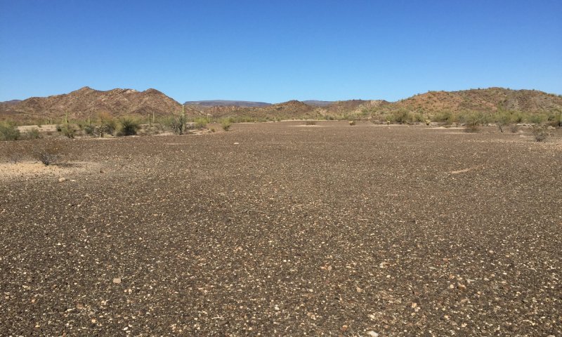
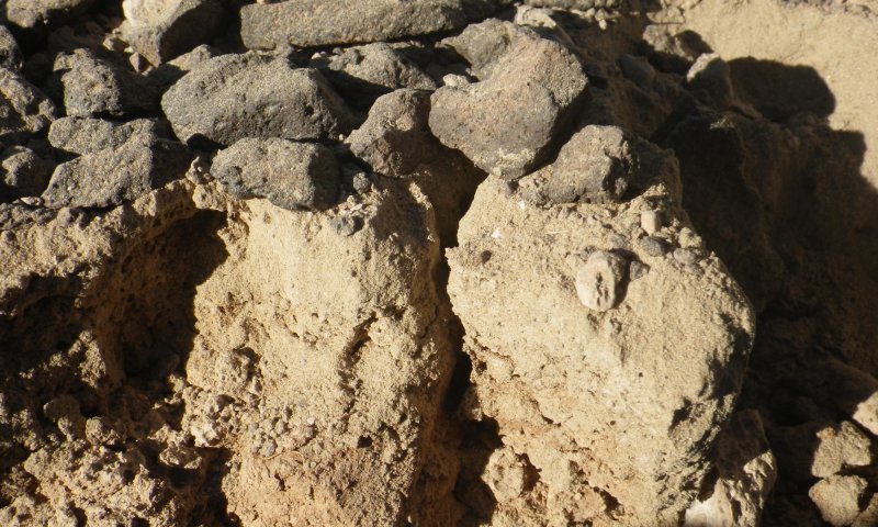
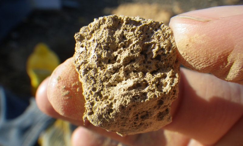
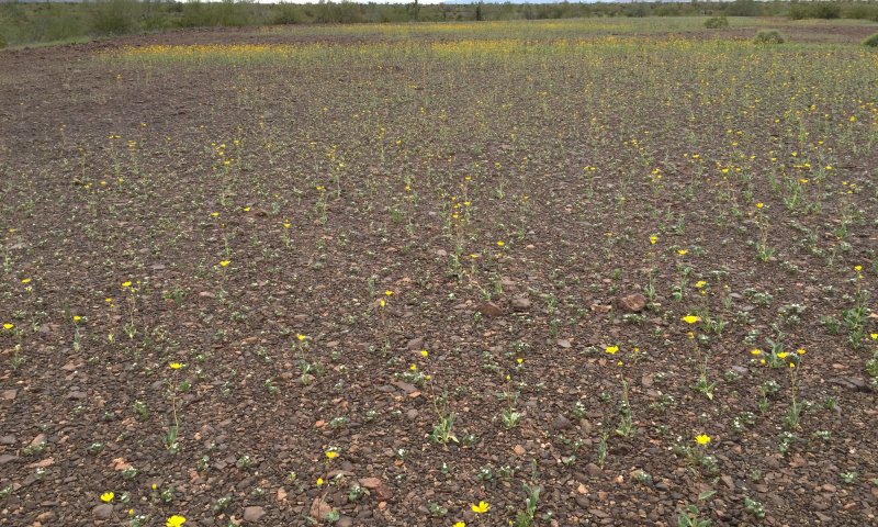
Desert Pavement, 3”-7" p.z., occurs on fan terraces and relict lakebed floors. Terrain is flat or nearly so ( slopes less than 4%). The soil surface is armored with interlocking rock cover and typically has a thick vesicular crust. Subsurface soils are highly variable. Vegetation is absent or nearly so. Aspect is barren land.
Associated sites
| R040XC311AZ |
Limy Upland, Deep 3"-7" p.z. Adjacent uplands, soils are skeletal without desert pavement cover |
|---|---|
| R040XC330AZ |
Sandy Loam Drainage 3"-7" p.z. Small drainages often originating on site |
| R040XC318AZ |
Sandy Wash 3"-7" p.z. Large drainagaes generally adjacent to or dissecting site |
Similar sites
| R040XB230AZ |
Desert Pavement 7"-10" p.z. Elevations 1,200'-2,000'. Less desert varnish, Av soil surface horizon |
|---|
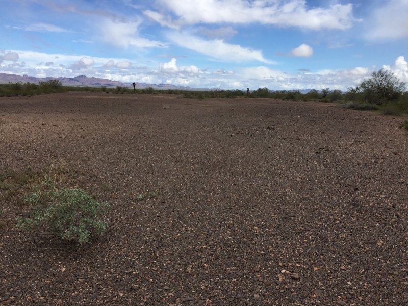
Figure 1. Desert Pavement, 3"-7" p.z..
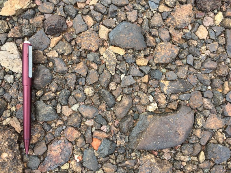
Figure 2. Interlocking gravels typical of desert pavement.
Table 1. Dominant plant species
| Tree |
Not specified |
|---|---|
| Shrub |
Not specified |
| Herbaceous |
(1) Forb, annual |
Click on box and path labels to scroll to the respective text.