
Natural Resources
Conservation Service
Ecological site R040XD001CA
Limy Hill 4-6" p.z.
Last updated: 3/11/2025
Accessed: 04/03/2026
General information
Provisional. A provisional ecological site description has undergone quality control and quality assurance review. It contains a working state and transition model and enough information to identify the ecological site.
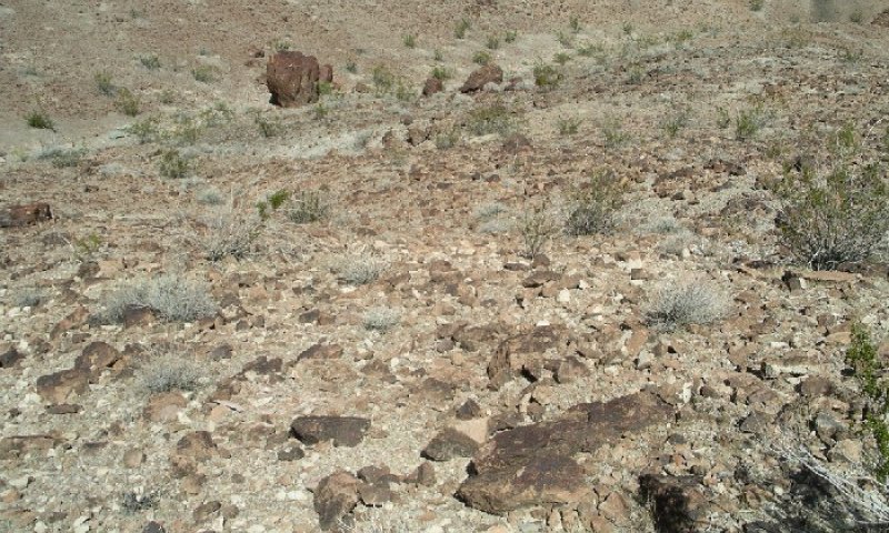
Figure 1. Mapped extent
Areas shown in blue indicate the maximum mapped extent of this ecological site. Other ecological sites likely occur within the highlighted areas. It is also possible for this ecological site to occur outside of highlighted areas if detailed soil survey has not been completed or recently updated.
MLRA notes
Major Land Resource Area (MLRA): 040X–Sonoran Basin and Range
MLRA Description:
Major land resource area (MLRA) 31 is the Lower Colorado Desert. This area is in the extreme southeastern part of California, in areas along the Colorado River, and in Western Arizona. The area is comprised of rough, barren, steep, and strongly dissected mountain ranges, generally northwest to southwest trending that are separated by intermontane basins. Elevation ranges from approximately 275 feet below sea level at the lowest point in the Salton Trough to 2700 feet along low northwest to southeast trending mountain ranges. The average annual precipitation is 2 to 6 inches with high temporal and spatial variability. Winter temperatures are mild, summer temperatures are hot, and seasonal and diurnal temperature fluctuations are large. Monthly minimum temperature averages range from 40 to 80 degrees F (4 to 27 degrees C). Monthly maximum temperature averages range from 65 to 110 degrees F (18 to 43 degrees C) (WRCC 2002). Temperatures are rarely below 28 degrees F, and extremely rarely fall below 24 degrees F. Precipitation is bimodal, with approximately 20 to 40 percent of annual precipitation falling between July and September. This summer rainfall, in combination with very hot temperatures and very few to no days of hard freeze are what characterize this MLRA and distinguish it from the Mojave Desert (MLRA 30).
Classification relationships
NDDB/Holland, R.F. 1986. Preliminary descriptions of the terrestrial natural communities of California - Mojave Creosote Bush. Sawyer, J.O. and T. Keeler-Wolf. 1995. Manual of California Vegetation - Creosote bush-White bursage series.
Ecological site concept
This ecological site occurs on hills (and rarely on side slopes of fan remnants), predominately on north-facing aspects, at elevations of 1280 to 1800 feet. Slopes are typically 15 to 50 percent. Soils are very shallow with very gravelly loamy fine sand or very gravelly loamy sand surface textures, with a high cover of surface gravels, and similar subsurface textures.
Production reference value (RV) is 175 pounds per acre, and depending on precipitation and annual forb production, ranges from 100 to 250 pounds per acre. Sparse creosote bush (Larrea tridentata) and burrobush (Ambrosia dumosa) dominate the site.
Data ranges in the physiographic data, climate data, water features, and soil data sections of this Ecological Site Description are based on major components only (15 percent of mapunit or greater).
Associated sites
| R040XD010CA |
Valley Wash This ephemeral stream is in broad valley bottoms, distal from the mountains. Desert willow and blue paloverde are present. |
|---|---|
| R040XD030CA |
Extremely Stony Fan Remnants This ecological site occurs on stony fan remnants, with high cover of teddy bear cholla. |
| R040XD034CA |
Gravelly, Braided, Ephemeral Stream This ecological site occurs on braided drainageways, with desert lavender and brittlebush dominant. |
Similar sites
| R030XD001CA |
Hyperthermic Dry Hills This ecological site occurs in the Mojave Desert on hyperthermic soils. It has higher production. |
|---|
Table 1. Dominant plant species
| Tree |
Not specified |
|---|---|
| Shrub |
(1) Larrea tridentata |
| Herbaceous |
(1) Plantago ovata |
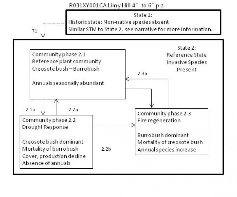
Click on box and path labels to scroll to the respective text.