Natural Resources
Conservation Service
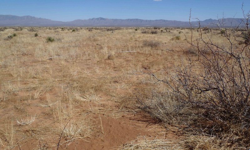
Ecological site R042BB012NM
Sandy, Desert Shrub
Last updated: 8/09/2019
Accessed: 03/24/2026
General information
Provisional. A provisional ecological site description has undergone quality control and quality assurance review. It contains a working state and transition model and enough information to identify the ecological site.
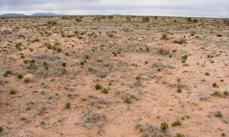
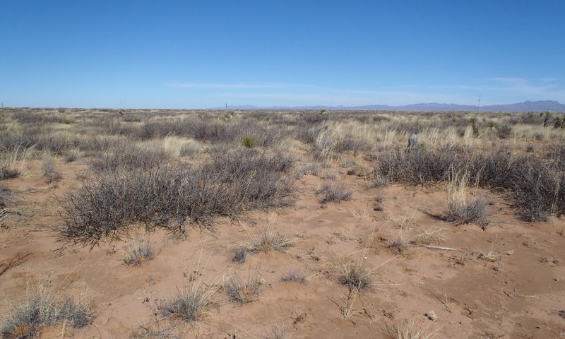
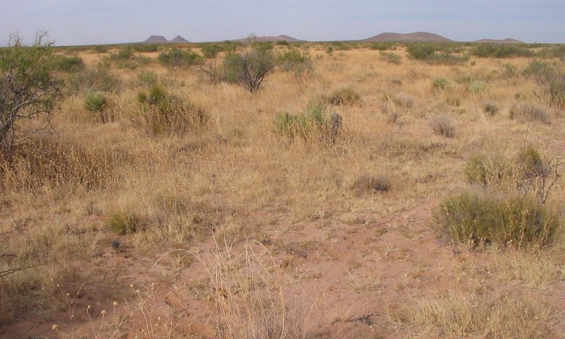
Figure 1. Mapped extent
Areas shown in blue indicate the maximum mapped extent of this ecological site. Other ecological sites likely occur within the highlighted areas. It is also possible for this ecological site to occur outside of highlighted areas if detailed soil survey has not been completed or recently updated.
Ecological site concept
Soil surface is loamy sand to medium sandy loam, soil profile has < 15% non-carbonate gravel by volume (but may see > 15% carbonate [caliche] gravels in some horizons) and not finer than clay loam. Soil has a calcic, cambic, or argillic horizon within 1 m. Bouteloua eriopoda, Sporobolus, Aristida, and Prosopis glandulosa are common plants.
Associated sites
| R042BB011NM |
Deep Sand, Desert Shrub Sandy sites are occasionally found adjacent to Deep Sand Sites. |
|---|---|
| R042BB015NM |
Shallow Sandy, Desert Shrub Sandy sites often exist in a mosaic with Shallow Sandy sites. |
Similar sites
| R042BB015NM |
Shallow Sandy, Desert Shrub Sandy and Shallow Sandy sites often contain similar vegetation communities and transitional pathways. |
|---|
Table 1. Dominant plant species
| Tree |
Not specified |
|---|---|
| Shrub |
Not specified |
| Herbaceous |
Not specified |
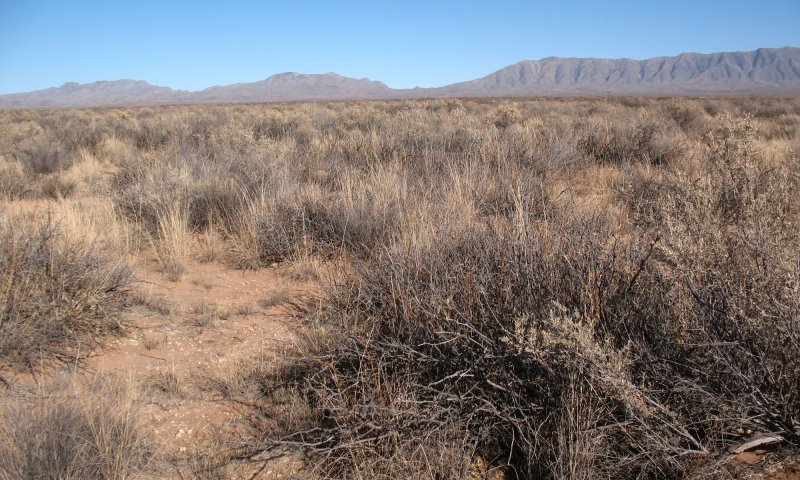
Physiographic features
This site usually occurs on level to gently sloping or undulating piedmont slopes, fan piedmonts, alluvial fan, fan remnant, dunes or plains. Slopes range from 1 to 15 percent, averaging less than 10 percent. Elevations range from 3,800 to 5,000 feet.
Table 2. Representative physiographic features
| Landforms |
(1)
Basin floor
(2) Fan piedmont (3) Alluvial fan |
|---|---|
| Flooding frequency | Very rare to rare |
| Ponding frequency | None |
| Elevation | 3,800 – 5,000 ft |
| Slope | 1 – 15% |
| Water table depth | 99 in |
| Aspect | Aspect is not a significant factor |
Climatic features
Annual average precipitation ranges from 7.35 to 11.90 inches. Wide fluctuations from year to year are common, ranging from a low of about 2 inches to a high of over 20 inches. At least one-half of the annual precipitation comes in the form of rainfall during July, August, and September. Precipitation in the form of snow or sleet averages less than 4 inches annually. The average annual air temperature is about 60 degree F. Summer maximums can exceed 100 degrees F. and winter minimums can go below zero. The average frost-free season exceeds 200 days and extends from April 1 to November 1. Both the temperature regime and rainfall distribution favor warm-season perennial plants on this site. Spring moisture conditions are only occasionally adequate to cause significant growth during this period of year. High winds from the west and southwest are common from March to June, which further tends to create poor soil moisture conditions in the springtime.
Climate data was obtained from
http://www.wrcc.dri.edu/summary/climsmnm.html
Table 3. Representative climatic features
| Frost-free period (average) | 194 days |
|---|---|
| Freeze-free period (average) | 215 days |
| Precipitation total (average) | 10 in |
Figure 2. Monthly precipitation range
Figure 3. Monthly average minimum and maximum temperature
Figure 4. Annual precipitation pattern
Figure 5. Annual average temperature pattern
Influencing water features
This site is not influenced by water from a wetland or stream.
Soil features
The soils are moderately deep to deep. Surface textures are fine sandy loam, sandy loam, loamy fine sand or gravelly sandy loam. Subsurface textures are fine sandy loam, sandy loam, loamy fine sand, gravelly sandy loam, gravelly sandy loam, loam, gravelly sandy clay loam, sandy clay loam or gravelly loamy sand.
Minimum and maximun values listed below represent the characteristic soils for this site.
Characteristic soils:
Dona Ana
Berino
Cacique
Pajarito
Mohave
Onite
Pintura
Gila
Maricopa
Cavalry
Nations
Pendero
Patriot
Table 4. Representative soil features
| Surface texture |
(1) Fine sandy loam (2) Sandy loam (3) Loamy fine sand |
|---|---|
| Family particle size |
(1) Sandy |
| Drainage class | Well drained to excessively drained |
| Permeability class | Moderately slow to rapid |
| Soil depth | 20 – 60 in |
| Surface fragment cover <=3" | 5 – 20% |
| Surface fragment cover >3" | Not specified |
| Available water capacity (0-40in) |
1 – 7 in |
| Calcium carbonate equivalent (0-40in) |
7% |
| Electrical conductivity (0-40in) |
4 mmhos/cm |
| Sodium adsorption ratio (0-40in) |
2 |
| Soil reaction (1:1 water) (0-40in) |
6.6 – 8.4 |
| Subsurface fragment volume <=3" (Depth not specified) |
5 – 35% |
| Subsurface fragment volume >3" (Depth not specified) |
Not specified |
Ecological dynamics
Historical plant communities were dominated by continuous cover of black grama (Bouteloua eriopoda) mixed with other grasses, especially dropseeds (Sporobolus spp.). Areas featuring the reference state are still common. Spatial variation in vegetation within the state may be governed by slight variations in soil texture of the surface or sub-surface soil horizons within the site. For example, dropseeds may increase as soils become coarser. Continuous heavy grazing coupled to drought periods leads to loss and fragmentation of black grama plants and increasing representation of dropseeds, threeawns (Aristida spp.), and snakeweed (Gutierrezia sarothrae) within this state. Black grama recovery is driven by recruitment from stolons into bare gaps. Scattered adult honey mesquite (Prosopis glandulosa) may be present.
Improperly managed grazing during multi-year periods of summer or spring drought can cause severe reduction, fragmentation, or total loss of black grama. Loss of black grama and increasingly large bare ground patches allow wind and water erosion to accelerate. Feedbacks to grass mortality ensue. Recovery by stolons is increasingly difficult as black grama patches become isolated and inter-patch areas erode. Climatic conditions are seldom suitable for black grama recovery and establishment by seed is limited in this species. Concurrently, honey mesquite, which is now present across the range of this ecological site, expands due to one or more of the following processes; spread of seed by livestock, climatic events favorable to establishment, reduced competition for soil water, and reduced fire frequency. Continued improper grazing on remnant grasses, exacerbated by native rodent and lagomorph herbivores and competition with shrubs, leads to loss of grasses in shrub interspaces, interspace erosion, and the formation of mesquite dunelands.
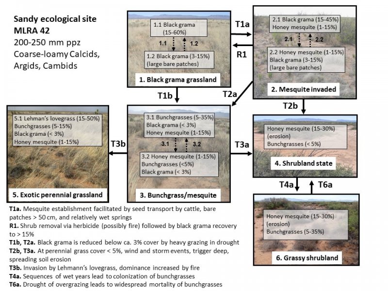
State and transition model
More interactive model formats are also available.
View Interactive Models
More interactive model formats are also available.
View Interactive Models
Click on state and transition labels to scroll to the respective text
Ecosystem states
| T1a | - | State 1 to 2: Mesquite establishment facilitated by seed transport by cattle, bare patches > 50 cm, and relatively wet springs. |
|---|---|---|
| T1b | - | State 1 to 3: Black grama is reduced to ca. 5% foliar cover by heavy grazing in drought. |
| R1 | - | State 2 to 1: Shrub removal via herbicide (possibly fire) followed by black grama recovery. |
| T2a | - | State 2 to 3: Black grama is reduced below ca. 5% foliar cover by heaving grazing in drought. |
| T2b | - | State 2 to 4: At perennial grass cover <5%, wind and storm events trigger deep, spreading soil erosion. |
| T3a | - | State 3 to 4: At perennial grass cover <5%, wind and storm events trigger deep, spreading soil erosion. |
| T3b | - | State 3 to 5: Invasion and spread of Lehmann lovegrass. |
| T4a | - | State 4 to 6: Sequences of wet years lead to colonization of bunchgrasses. |
| T6a | - | State 6 to 4: Drought or overgrazing leads to widespread mortality of bunchgrasses. |
State 1 submodel, plant communities
State 2 submodel, plant communities
State 3 submodel, plant communities
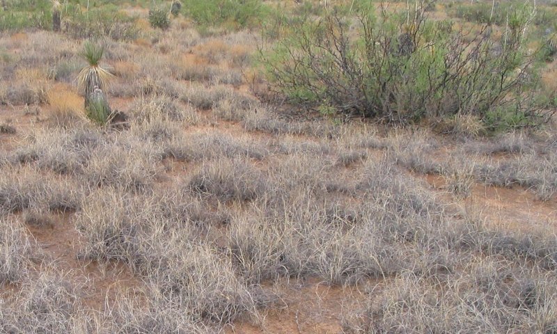
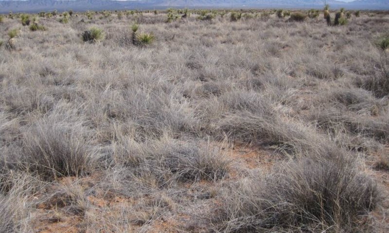
State 1
Black grama grassland
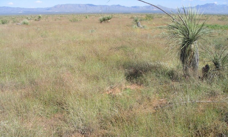
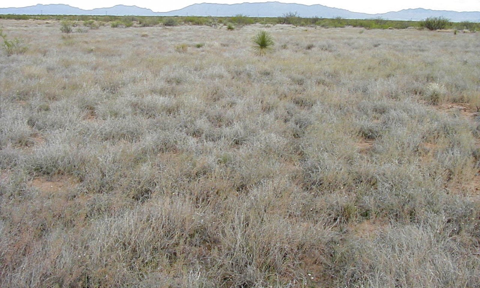
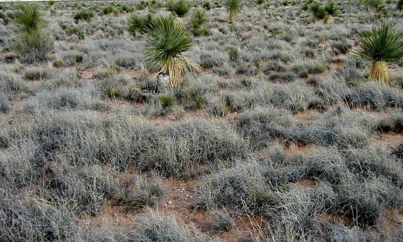
The historic plant community is dominated by black grama (Bouteloua eriopoda) and dropseeds (Sporobolus flexuosus, S. cryptandrus, and S. contractus) may be secondary dominants. Bush muhly (Muhlenbergia porteri) and threeawns (Aristida spp.) are other common grasses. Soaptree yucca (Yucca elata), longleaf ephedra (Ephedra trifurca), sand sage (Artemisia filifolia), and snakeweed (Gutierrezia sarothrae) are common shrubs. Through its high basal cover, high litter cover, and consequent low rates of erosion and high infiltration rates, black grama can regenerate through tillering and possibly by seed in some years. Overutilization of black grama and increasing rates of soil erosion and deposition when bare ground cover is high may result in an increasing relative abundance of dropseeds, threeawns, or snakeweed. It is also possible that in coarser soils, such as loamy sands, dropseeds dominate naturally. Two seasons without summer rains will also lead to black grama decline, but grasses such as dropseeds and threeawns are thought to be more sensitive to drought than black grama (Herbel et al. 1972). Snakeweed or dropseeds may become dominant within this state but black grama can gradually recover as long as some plants persist. Gibbens and Beck (1987) and Bestelmeyer et al. (2013) provide evidence for recovery of black grama within communities dominated by dropseeds or other plants. Campbell and Bombarger (1934) indicate that black grama can recover within snakeweed-dominated grassland.
Characteristics and indicators. Black grama is highly dominant and cover is largely continuous. There is evidence of black grama reproduction by stolon and possibly by seed. There are few large bare gaps (>1 m). Litter cover is abundant. Soil stability values range from 4-6 and poorly-developed biological crusts (Pedoderm class PDB) may be common in wet periods. Mesquite (Prosopis glandulosa) is sparse or absent (< 5% foliar cover). Black grama foliar cover levels approaching 5%, especially with loss of plants in large patches, should be cause for concern.
Resilience management. Black grama is the key plant of this site class due to its dominance in recent history, its high forage value, and its consequent sensitivity to grazing. Shifts away from black grama dominance are due to overgrazing and/or multi-year periods of summer or spring drought, or due to an accelerated rate of honey mesquite (Prosopis glandulosa) seed flow into black grama grassland and the establishment and growth of these shrubs. Continuous heavy grazing leads to declines in the proportional representation of black grama declines because it is preferred by cattle over other species, particularly outside the growing season (Paulsen and Ares 1962). Once black grama is locally extirpated, it tends not to recover because reproduction is primarily vegetative via stolons (Canfield 1939, Neilson 1986). Competition for water with neighboring shrubs, particularly in drought, can also limit grass growth, survival, and reestablishment (Snyder and Tartowski 2006). Consequently, resilience of the black grama grassland state is focused on 1) grazing management to avoid substantial reductions of black grama and 2) control of mesquite shrubs when mesquite recruitment is occurring. Stocking rates and grazing periods that leave stems (stolons) long enough for new plants (ramets) to take root and adequate cover to protect soils through the spring windy season is critical. This management apparently allowed black grama populations to survive extreme drought episodes in the 1930s and 1950s that led to B. eriopoda losses elsewhere (Bestelmeyer et al., 2013). Timely control of mesquite using aerial or spot treatments of a foliar herbicide blend (see http://aces.nmsu.edu/pubs/_b/B822/welcome.html). Herbicide treatment should be considered when there is evidence that mesquite recruitment is occurring. Individual, large mesquite plants, however, may be desirable wildlife habitat elements.
Dominant plant species
-
black grama (Bouteloua eriopoda), grass
Community 1.1
Black grama (15-60%)

Dominant plant species
-
black grama (Bouteloua eriopoda), grass
Figure 6. Annual production by plant type (representative values) or group (midpoint values)
Community 1.2
Black grama (3-15%) (large bare patches)
Dominant plant species
-
black grama (Bouteloua eriopoda), grass
Pathway P1.1
Community 1.1 to 1.2
Overutilization of black grama and increasing rates of soil erosion and deposition when bare ground cover is high may result in an increasing relative abundance of dropseeds, threeawns, or snakeweed. Two seasons without summer rains will also lead to black grama decline, but grasses such as dropseeds and threeawns are thought to be more sensitive to drought than black grama (Herbel et al. 1972). Snakeweed or dropseeds may become dominant within this state but black grama can recover as long as some plants persist.
Pathway P1.2
Community 1.2 to 1.1
Stocking rates and grazing periods that leave stems (stolons) long enough for new plants (ramets) to take root and adequate cover to protect soils through the spring windy season is critical. Gibbens and Beck (1987) and Bestelmeyer et al. (2013) provide evidence for recovery of black grama within communities dominated by dropseeds or other plants. Campbell and Bombarger (1934) indicate that black grama can recover within snakeweed-dominated grassland.
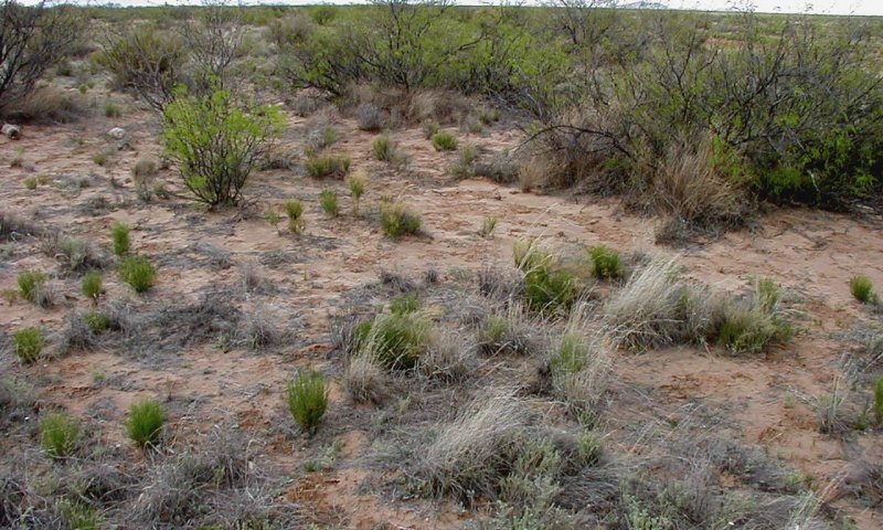
State 2
Mesquite invaded

Black grama continues to be the dominant perennial grass, but mesquite cover is sufficiently high to compete for space and resources with grasses. Mesquite plants may be very small and difficult to detect. Although fire may kill small (< 1.5 yr old; Wright et al. 1976) mesquite, it is unlikely that fire frequencies have been sufficient to remove mesquite from a grassland once a source of mesquite propagules has been connected to a grassland. Valentine (1936) indicates that beyond a height of 1-2 feet, mesquite begins to exclude grasses from around plant bases.
Characteristics and indicators. Black grama is the dominant perennial grass and mesquite are present and usually conspicuous, exceeding 5% foliar cover when leafed out. Black grama cover may be substantial but areas around shrubs devoid of grass. Typically, large patches devoid of black grama are common. Black grama foliar cover levels approaching 5% should be cause for concern.
Resilience management. Management of black grama is similar to State 1, but there should be additional concern for the effects of competition with shrubs, especially mesquite (P. glandulosa). Bestelmeyer et al. (2013) showed that, under heavy grazing pressure, the presence of shrubs (estimated at 7% foliar cover) increased the loss of black grama. Thus, managers might consider more conservative stocking rates in the presence of shrubs than indicated by grass production alone. Pierce et al. (2018) found that removal of shrubs, on a gradient from 2-18% foliar cover of mesquite, resulted in a doubling of black grama production and reproduction. Brush control using herbicides (e.g. 2,4,5-T) resulting in at least a 30% mesquite kill can result in increases in grasses (Herbel et al. 1983). Newer herbicides, such as remedy/reclaim or sendero with electrostatic application may be most effective at killing shrubs. The use of fire may also be possible in more productive environments with continuous grass cover and wetter climates (average >10" per year). Wright et al. (1976) observed that honey mesquite less than 2-3 years old were killed by fire, apparently because the bud zone meristem was still exposed. Older mesquite tolerate fire or other disturbances by resprouting from the bud zone if above ground parts are destroyed or damaged. Fire, however, may damage or kill black grama plants and reduce reproduction in more arid parts of Chihuahuan Desert (9” annual precipitation), especially if fires are followed by drought (Drewa et al. 2006).
Dominant plant species
-
honey mesquite (Prosopis glandulosa), shrub
-
black grama (Bouteloua eriopoda), grass
Community 2.1
Black grama (15-45%) Honey mesquite (1-15%)
Community 2.2
Honey mesquite (1-15%) Black grama (3-15%) (large bare patches)

Pathway P2.1
Community 2.1 to 2.2
Grazing pressure combined with competitive pressure from shrubs leads to reduction in black grama cover.
Pathway P2.2
Community 2.2 to 2.1
Brush control using herbicides (e.g. 2,4,5-T) resulting in at least a 30% mesquite kill can result in increases in grasses (Herbel et al. 1983). Stocking rates and grazing periods that leave stems (stolons) long enough for new plants (ramets) to take root and adequate cover to protect soils through the spring windy season is critical.
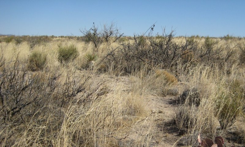
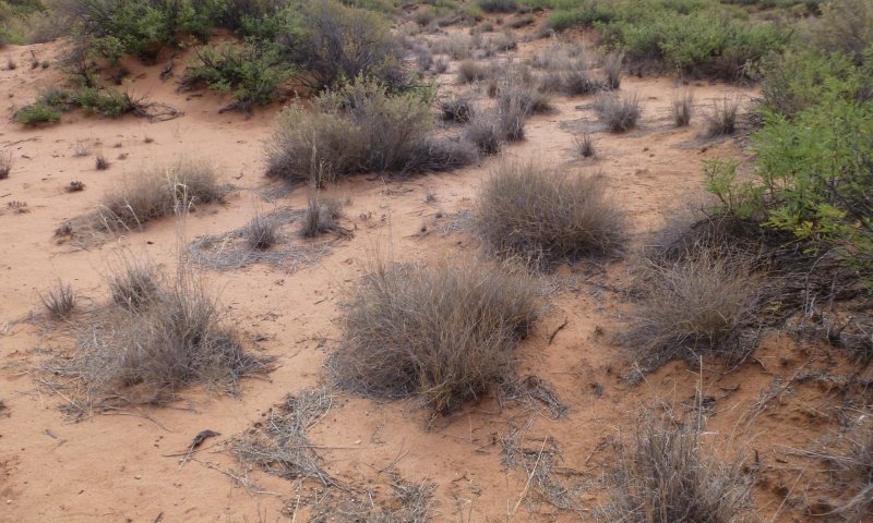
State 3
Bunchgrass/mesquite
Bunchgrasses, including dropseeds (Sporobolus airoides, S. cryptandrus, and S. contractus) and threeawns (Aristida purpurea, A. ternipes) are the dominant perennials grasses and black grama is rare (<5%).
Characteristics and indicators. Black grama foliar cover is < 5% and lower than that of bunchgrasses, but total plant canopy cover may range from 60-75% where perennial grasses remain healthy. Black grama exists as isolated patches, often featuring evidence of soil aggradation within these patches and soil erosion surrounding the patches where bunchgrasses occur (soil redistribution class is 3a). The % of a line transect in gaps >1 m may range from 37-56%. Poorly developed biological crusts (pedoderm PDB) are rare, but average surface soil stability values range from 3-5, subsurface (2.5 cm) values are 1-2. Mesquite cover is variable, but usually > 5% and must be < 15%.
Dominant plant species
-
honey mesquite (Prosopis glandulosa), shrub
-
mesa dropseed (Sporobolus flexuosus), grass
-
sand dropseed (Sporobolus cryptandrus), grass
-
spike dropseed (Sporobolus contractus), grass
-
purple threeawn (Aristida purpurea), grass
Community 3.1
Bunchgrasses (5-35%) Black grama (<3%) Honey mesquite (1-15%)
Black grama foliar cover is < 3% and lower than that of bunchgrasses, but total plant canopy cover may range from 60-75% where perennial grasses remain healthy. Black grama exists as isolated patches, often featuring evidence of soil aggradation within these patches and soil erosion surrounding the patches where bunchgrasses occur (soil redistribution class is 3a). The % of the line in canopy gaps >1 m may range from 37-56%. Poorly developed biological crusts (pedoderm PDB) are rare, but average surface soil stability values range from 3-5, subsurface (2.5 cm) values are 1-2. Mesquite cover is variable, but usually > 5% and must be < 15%.
Community 3.2
Honey mesquite (1-15%) Bunchgrass (<5%) Black grama (<3%)
Black grama foliar cover is <3% and bunchgrass cover is <5%. Honey mesquite cover is 1-15%. Annual forbs and grasses may dominate in wet years. Perennial grasses exist as isolated patches, often featuring evidence of soil aggradation within these patches and soil erosion surrounding the patches (soil redistribution class is 3a).
Pathway P3.1
Community 3.1 to 3.2
Grazing by livestock and native herbivores, competition from shrubs, erosion, and concentration of nutrients under adult shrubs eventually leads to persistent reductions of grass cover.
Pathway P3.2
Community 3.2 to 3.1
Reduced grazing pressure in concert with average to above average rainfall.
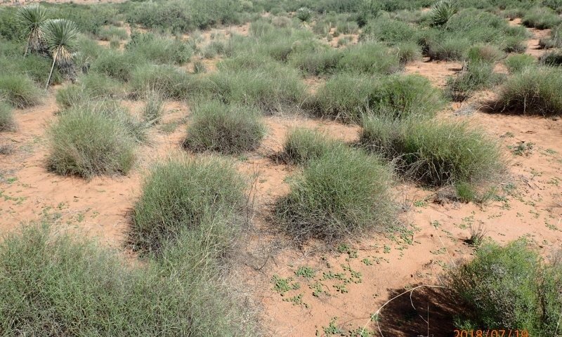
State 4
Shrubland

Mesquite are dominant and intershrub areas are typically eroded with a sparse vegetation cover of annual plants, perennial forbs, and subshrubs. On soils that are moderately deep or deep to restrictive soil horizons, soil accumulates on mesquite to form coppice dunes (or nabkas; Langford 2000) over time, which attain heights over 2 m on deeper soils. Saltbush (Atriplex canescens) may be common in mesquite coppice dunes. Perennial grasses, restricted to bunchgrasses, may establish and attain high cover in shrub interspaces during sequences of wet years (Peters et al., 2014). In other periods, grasses cannot establish due to soil water limitations, the instability of the substrate, and rodent and lagomorph herbivory on grass seedlings. In some cases, soil truncation exposes clay- and carbonate-rich subsoil that is very hard and does not permit plant establishment.
Characteristics and indicators. Mesquite is dominant and may form coppice dunes from 0.5-3 m high. Bunchgrasses are usually absent or restricted to coppice dunes. In extremely wet years, bush muhly, threeawns, and dropseeds may colonize interdunes . There is usually abundant evidence of wind erosion and deposition including extreme pedestalling, plant burial, highly sorted sand, ripples, and an exposed B horizon in interdunes.
Resilience management. Grazing rest during wet seasons to promote a transition to a Grassy shrubland state.
Dominant plant species
-
honey mesquite (Prosopis glandulosa), shrub
State 5
Exotic perennial grassland
Lehmann lovegrass monocultures occur, often as large patches occurring within areas otherwise dominated by bunchgrass/mesquite states.
Characteristics and indicators. Lehmann lovegrass is the dominant perennial grass.
Resilience management. Fire may promote Lehmann lovegrass dominance, but fire is rare in typic aridic, thermic soil climates. Little is known about management practices to promote or limit its expansion.
Dominant plant species
-
honey mesquite (Prosopis glandulosa), shrub
-
Lehmann lovegrass (Eragrostis lehmanniana), grass
State 6
Grassy shrubland
Formerly a community phase within the shrubland state, recent evidence suggests the grassy shrubland is a persistent state. Abundant cover of bunchgrasses, including bush muhly, dropseeds, and threeawns in the interspaces of mesquite shrubs or coppice dunes. Grass patches may accumulate soil and litter, creating environments that favor grass establishment and persistence. Black grama is not known to colonize shrubland states.
Characteristics and indicators. Mesquite is dominant, and bunchgrass cover may be patchy or co-dominant with mesquite (up to 30% foliare cover) nearly continuous in mesquite interspaces. Soil accumulation may be observed.
Resilience management. Care should be taken to manage grazing use to promote bunchgrass survival and recruitment during dry years. Severe drought may lead to a transition back to the shrubland state irrespective of grazing management.
Dominant plant species
-
honey mesquite (Prosopis glandulosa), shrub
-
spike dropseed (Sporobolus contractus), grass
-
sand dropseed (Sporobolus cryptandrus), grass
-
mesa dropseed (Sporobolus flexuosus), grass
-
purple threeawn (Aristida purpurea), grass
Transition T1a
State 1 to 2
Mesquite establishment rate is thought to be accelerated by 1) increased seed availability when cattle forage in shrubby areas and then transport and defecate mesquite seeds in grass-dominated patches and 2) reduced perennial grass cover that reduces competition for surface soil water between grasses and shrub seedlings. On the other hand, Herbel and Gibbens (1996) suggest that mesquite invasion can occur within apparently intact black grama stands, suggesting that competition may be less important than seed dispersal. In addition, a reduction of historical fire frequencies associated with fragmentation of perennial grass cover has been proposed, but there is little evidence that fire can be used to limit mesquite establishment in all but the most productive landscapes due to natural limitations in fuel continuity. The factors that have led to existing variations in mesquite density within black grama grasslands are poorly understood.
Constraints to recovery. Once established, mesquite shrubs are unlikely to suffer natural mortality due to drought, herbivory, or age (Goslee et al. 2003). Mesquite can live at least 60 years on the Jornada Experimental Range in south-central New Mexico and in desert grasslands of the Santa Rita Experimental Range in southeastern Arizona, mesquite live for over 200 years (McClaran 2003). Consequently, the spread of mesquite in black grama grasslands tends to accelerate over time without mesquite control (Goolsby 2012).
Context dependence. Increases in mesquite dominance within grasslands and associated grass declines have been shown to be distance-dependent (Yao et al. 2006, Goolsby 2012). Subsoil texture also controls the rate of shrub spread and grass loss over decadal timescales (Browning et al. 2012). Soils that are deep and with lower maximum clay content (9%) in the top 100 cm experienced a much faster rate of shrub encroachment than soils that had a root-limiting horizon (a petrocalcic or "caliche" layer) and higher maximum clay content (13.5 %) within the top 100 cm.
Transition T1b
State 1 to 3
Overgrazing of black grama plants in the context of multi-year drought is known to cause black grama mortality and persistent black grama reductions or extinction from large areas (Bestelmeyer et al. 2011), which may subsequently become dominated by bunchgrasses. The loss of perennial grass cover may create opportunities for mesquite shrub establishment and gradual increases in shrub dominance (see Transition 1a).
Constraints to recovery. Black grama does not recover due to limitations in seed establishment, and because too few plants are available to recolonize areas vegetatively.
Context dependence. It is suspected that this transition is most likely on soils that are > 1 m deep to a petrocalcic (caliche) horizon and have relatively low clay content, but this has not yet been quantified.
Restoration pathway R1
State 2 to 1
Mesquite can be killed by application of foliar herbicides (see http://aces.nmsu.edu/pubs/_b/B822/welcome.html). Black grama recovery into large bare patches surrounding killed shrubs can occur over time via clonal growth, or areas may be colonized initially by other grasses such as Sporobolus species. At this point, it is unclear if fire can be effectively used as a management tool to promote black grama dominance in most areas within MLRA 42. In sandy ecological sites in wetter areas (above 10 inches mean annual precipitation, not R042XB012NM), fire might be used as a tool to prevent mesquite regrowth or reestablishment. The successful use of fire in black grama grasslands, however, depends strongly upon the size of mesquite and probably on post-fire precipitation patterns that favor black grama recovery (Drewa and Havstad 2001).
Context dependence. Causes of spatial or temporal variations in the efficacy of herbicides is unknown. There is no evidence of fire promoting black grama dominance in LRU 42.2.
Transition T2a
State 2 to 3
Overgrazing of black grama plants in the context of multi-year drought is known to cause black grama mortality and persistent black grama reductions or extinction from large areas (Bestelmeyer et al. 2011), which may subsequently become dominated by bunchgrasses. An increased density of shrubs in state 2 exacerbates black grama loss by constraining recovery during wet years and hastening grass mortality due to competition for soil water (Pierce et al., 2018) .
Constraints to recovery. Black grama does not recover due to limitations in seed establishment, and because too few plants are available to recolonize areas vegetatively.
Context dependence. It is suspected that this transition is most likely on soils that are > 1 m deep to a petrocalcic (caliche) horizon and have relatively low clay content, but this has not yet been quantified.
Transition T2b
State 2 to 4
Loss of interspace grass cover due to heavy grazing and/or drought leads to increasing erosion and redistribution of soil to shrubs (Schlesinger et al., 1990) and out of the site (Gillette and Monger 2006). Erosion leads to loss of remaining grasses due to soil destabilization, exacerbated by increasingly concentrated rodent and livestock herbivory on grasses. Sediment deposition around mesquite shrubs leads to coppice dune formation. The factors responsible for the apparently great variation in the occurrence of this transition are not well understood.
Constraints to recovery. Accelerated wind erosion, sediment transport, and abrasion of grass seedlings is likely an important constraint to overall grass recovery, alongside seedling and grass herbivory by rodents and lagomorphs. Exposure of infertile soil horizons at the surface may also limit grass recovery. In addition, black grama recovery from seed is rarely observed due to unknown recruitment limitations in this climatic zone.
Context dependence. Grass loss and shrub encroachment has been observed to be more rapid on weakly developed soils without significant carbonate or clay accumulation (Browning et al. 2012).
Transition T3a
State 3 to 4
Similar to transition 2b: Loss of interspace grass cover due to heavy grazing and/or drought leads to increasing erosion and redistribution of soil to shrubs (Schlesinger et al., 1990) and out of the site (Gillette and Monger 2006). Erosion leads to loss of remaining grasses due to soil destabilization, exacerbated by increasingly concentrated rodent and livestock herbivory on grasses. Sediment deposition around mesquite shrubs leads to coppice dune formation. The factors responsible for the apparently great variation in the occurrence of this transition are not well understood.
Constraints to recovery. Similar to transition 2b: Accelerated wind erosion, sediment transport, and abrasion of grass seedlings is likely an important constraint to overall grass recovery, alongside seedling and grass herbivory by rodents and lagomorphs. Exposure of infertile soil horizons at the surface may also limit grass recovery. In addition, black grama recovery from seed is rarely observed due to unknown recruitment limitations in this climatic zone.
Context dependence. Similar to transition 2b: Grass loss and shrub encroachment has been observed to be more rapid on weakly developed soils without significant carbonate or clay accumulation (Browning et al. 2012).
Transition T3b
State 3 to 5
Lehmann lovegrass invades (usually associated with deliberately introduced seed used in roadside plantings) and becomes dominant, particularly during wet years. The circumstances under which lovegrass dominance occurs are unknown, but high late spring/early summer precipitation and warmer temperatures might promote this species.
Constraints to recovery. Lehmann lovegrass patches persist and spread, especially during wet years.
Context dependence. None yet known.
Transition T4a
State 4 to 6
Sequences of wet summers in the context of limited grazing use can catalyze bunchgrass establishment, sometimes featuring multiple establishment events in growing season (Peters et al. 2014).
Constraints to recovery. The formation of bunchgrass patches leads to soil stabilization and soil and litter accumulation, which might increase seasonal soil water availability. The abundance of plants might also surpass a threshold beyond which rodent and lagomorph herbivory has reduced impact on overall grass survival and recruitment.
Context dependence. This transition is not possible on soil or soil patches that have eroded to clay-rich hardpans.
Transition T6a
State 6 to 4
Drought alone or overgrazing leads to widespread mortality of bunchgrasses. Soil erosion and other feedbacks constraining grass recover resume.
Context dependence. None currently known
Additional community tables
Table 5. Community 1.1 plant community composition
| Group | Common name | Symbol | Scientific name | Annual production (lb/acre) | Foliar cover (%) | |
|---|---|---|---|---|---|---|
|
Grass/Grasslike
|
||||||
| 1 | Warm Season | 88–131 | ||||
| black grama | BOER4 | Bouteloua eriopoda | 88–131 | – | ||
| 2 | Warm Season | 66–88 | ||||
| spike dropseed | SPCO4 | Sporobolus contractus | 66–88 | – | ||
| sand dropseed | SPCR | Sporobolus cryptandrus | 66–88 | – | ||
| mesa dropseed | SPFL2 | Sporobolus flexuosus | 66–88 | – | ||
| 3 | Warm Season | 22–44 | ||||
| bush muhly | MUPO2 | Muhlenbergia porteri | 22–44 | – | ||
| 4 | Warm Season | 4–22 | ||||
| plains bristlegrass | SEVU2 | Setaria vulpiseta | 4–22 | – | ||
| 5 | Warm Season | 22–44 | ||||
| cane bluestem | BOBA3 | Bothriochloa barbinodis | 22–44 | – | ||
| Arizona cottontop | DICA8 | Digitaria californica | 22–44 | – | ||
| 6 | Warm Season | 4–22 | ||||
| tobosagrass | PLMU3 | Pleuraphis mutica | 4–22 | – | ||
| 7 | Warm Season | 22–44 | ||||
| threeawn | ARIST | Aristida | 22–44 | – | ||
| 8 | Warm Season | 4–22 | ||||
| Graminoid (grass or grass-like) | 2GRAM | Graminoid (grass or grass-like) | 4–22 | – | ||
| blue grama | BOGR2 | Bouteloua gracilis | 4–22 | – | ||
| low woollygrass | DAPU7 | Dasyochloa pulchella | 4–22 | – | ||
|
Shrub/Vine
|
||||||
| 9 | Shrub | 22–44 | ||||
| longleaf jointfir | EPTR | Ephedra trifurca | 22–44 | – | ||
| soaptree yucca | YUEL | Yucca elata | 22–44 | – | ||
| 10 | Shrub | 4–22 | ||||
| sand sagebrush | ARFI2 | Artemisia filifolia | 4–22 | – | ||
| fourwing saltbush | ATCA2 | Atriplex canescens | 4–22 | – | ||
| winterfat | KRLA2 | Krascheninnikovia lanata | 4–22 | – | ||
| broom dalea | PSSC6 | Psorothamnus scoparius | 4–22 | – | ||
| 11 | Cacti | 4–13 | ||||
| plains pricklypear | OPPO | Opuntia polyacantha | 4–13 | – | ||
| 12 | Shrub | 4–13 | ||||
| broom snakeweed | GUSA2 | Gutierrezia sarothrae | 4–13 | – | ||
|
Forb
|
||||||
| 13 | Forb | 13–22 | ||||
| croton | CROTO | Croton | 13–22 | – | ||
| buckwheat | ERIOG | Eriogonum | 13–22 | – | ||
| spurge | EUPHO | Euphorbia | 13–22 | – | ||
| globemallow | SPHAE | Sphaeralcea | 13–22 | – | ||
| 14 | Forb | 13–22 | ||||
| desert marigold | BAMU | Baileya multiradiata | 13–22 | – | ||
| touristplant | DIWI2 | Dimorphocarpa wislizeni | 13–22 | – | ||
| redstem stork's bill | ERCI6 | Erodium cicutarium | 13–22 | – | ||
| 15 | Forb | 4–13 | ||||
| dwarf desertpeony | ACNA2 | Acourtia nana | 4–13 | – | ||
| milkvetch | ASTRA | Astragalus | 4–13 | – | ||
| lambsquarters | CHAL7 | Chenopodium album | 4–13 | – | ||
| herb sophia | DESO2 | Descurainia sophia | 4–13 | – | ||
| Russian thistle | SAKA | Salsola kali | 4–13 | – | ||
| threadleaf ragwort | SEFLF | Senecio flaccidus var. flaccidus | 4–13 | – | ||
| silverleaf nightshade | SOEL | Solanum elaeagnifolium | 4–13 | – | ||
| 16 | Annual/Perennial Forbs | 4–22 | ||||
| Forb, annual | 2FA | Forb, annual | 4–22 | – | ||
| Forb, perennial | 2FP | Forb, perennial | 4–22 | – | ||
Interpretations
Animal community
This site provides habitat for pronghorn, badger, kit fox, desert cottontail, spotted ground squirrel, desert pocket gopher. desert pocket mouse, Banner-tailed kangaroo rat, Ord's dangaroo rat, Southern Plains woodrat, Western meadowlark, scaled quail, pyrrhuloxia, roadrunner, burrowing owl, New Mexico whiptail lizard, round tailed horned lizard and Couch's spadefoot toad, among other species.
Where large mesquite, yucca and cholla cactus are present, this site is a breeding area for Swainson's hawk. mockingbird, Scott's oriole, mourning dove and Chihuahuan raven. State transitions to shrub dominance are associated with a loss of grassland specialist species (pronghorn, banner-tailed kangaroo rat, scaled quail) and an increasing proportion of generalist and shrub specialist species.
Hydrological functions
The soils are capable of storing winter moisture for early spring growth by certain forbs and grasses. Effective rooting depth is often 60 inches or more, although adequate moisture is seldom available to make use of this for most plants.
Hydrologic Interpretations
Soil Series Hydrologic Group
Cacique C
Wink B
Berino B
Dona Ana B
Pajarito B
Mohave B
Onite B
Pintura A
Gila B
Maricopa B
Cavalry A
Nations B
Pendero B
Patriot B
The shrub and half shrub canopy on this site averages 8%.
Ground Cover (Average % of Surface Area)
Grasses and forbs:
plant density 16
Bare ground 73
Surface gravel 1
Surface cobble and stones 0
Litter - % of area 10
average depth in cm. 1
Recreational uses
Recreational potential is limited largely by the hot daytime summer temperatures and windy spring weather of the lower Sonoran Life Zone, within which the site is located. Suitability for camping and picknicking is fair, and hunting is fair for pronghorn antelope, quail, dove, and small game. Photography and bird-watching can be fair to good, especially during migration seasons. Most small animals of the site are nocturnal and secretive, seen only at night, early morning or evening. Scenic beauty is greatest during spring and sometimes summer months when flowering of forbs, shrubs, and cacti occurs.
Wood products
None
Other products
Grazing:
This site, at its potential, is suitable for grazing in all seasons of the year. Green forage in the form of annual forbs and a few early-season grasses is produced to some extent in the spring. The dominant production comes at the beginning of July and runs through September. The site is suitable for cattle, especially crossbreeds bred to withstand high summertime temperatures and long walks to water, and to sheep, goats, and horses.
Other information
Guide to suggested initial stocking rate acres per animal unit month (AUM).
Similarity Index Ac/Aum
SI - 100 - 76 3.8 - 5.0
SI - 75 - 51 4.5 - 6.5
SI - 50 - 26 6.0 - 10.5
SI - 25 - 0 10.5+
Supporting information
Other references
Other References:
Data collection for this site was done in conjunction with the progressive soil surveys within the Southern Desertic Basins, Plains and Mountains, Major Land Resource Areas of New Mexico. This site has been mapped and correlated with soils in the following soil surveys. Sierra County Dona Ana County Grant County Hidalgo County Luna County Otero County
Characteristic Soils Are:
Cacique fine sandy loam
Dona Ana fine sandy loam
Wink fine sandy loam
Harrisburg loamy fine sand
Berino fine sandy loam
Bucklebar fine sandy loam, sandy loam
Other Soils included are:
Wink loamy fine sand, less than 5”thick surface
Sonoita loamy fine sand, loamy sand
Cacique loamy fine sand Hueco loamy fine sand, less than 5”thick surface
Onite loamy fine sand
Bucklebar loamy fine sand
Pajarito fine sandy loam
Continental sandy loam
Contributors
Don Sylvester
Dr. Brandon Bestelmeyer
Laura Burkett
Approval
Scott Woodall, 8/09/2019
Rangeland health reference sheet
Interpreting Indicators of Rangeland Health is a qualitative assessment protocol used to determine ecosystem condition based on benchmark characteristics described in the Reference Sheet. A suite of 17 (or more) indicators are typically considered in an assessment. The ecological site(s) representative of an assessment location must be known prior to applying the protocol and must be verified based on soils and climate. Current plant community cannot be used to identify the ecological site.
| Author(s)/participant(s) | |
|---|---|
| Contact for lead author | |
| Date | |
| Approved by | |
| Approval date | |
| Composition (Indicators 10 and 12) based on | Annual Production |
Indicators
-
Number and extent of rills:
-
Presence of water flow patterns:
-
Number and height of erosional pedestals or terracettes:
-
Bare ground from Ecological Site Description or other studies (rock, litter, lichen, moss, plant canopy are not bare ground):
-
Number of gullies and erosion associated with gullies:
-
Extent of wind scoured, blowouts and/or depositional areas:
-
Amount of litter movement (describe size and distance expected to travel):
-
Soil surface (top few mm) resistance to erosion (stability values are averages - most sites will show a range of values):
-
Soil surface structure and SOM content (include type of structure and A-horizon color and thickness):
-
Effect of community phase composition (relative proportion of different functional groups) and spatial distribution on infiltration and runoff:
-
Presence and thickness of compaction layer (usually none; describe soil profile features which may be mistaken for compaction on this site):
-
Functional/Structural Groups (list in order of descending dominance by above-ground annual-production or live foliar cover using symbols: >>, >, = to indicate much greater than, greater than, and equal to):
Dominant:
Sub-dominant:
Other:
Additional:
-
Amount of plant mortality and decadence (include which functional groups are expected to show mortality or decadence):
-
Average percent litter cover (%) and depth ( in):
-
Expected annual annual-production (this is TOTAL above-ground annual-production, not just forage annual-production):
-
Potential invasive (including noxious) species (native and non-native). List species which BOTH characterize degraded states and have the potential to become a dominant or co-dominant species on the ecological site if their future establishment and growth is not actively controlled by management interventions. Species that become dominant for only one to several years (e.g., short-term response to drought or wildfire) are not invasive plants. Note that unlike other indicators, we are describing what is NOT expected in the reference state for the ecological site:
-
Perennial plant reproductive capability:
Print Options
Sections
Font
Other
The Ecosystem Dynamics Interpretive Tool is an information system framework developed by the USDA-ARS Jornada Experimental Range, USDA Natural Resources Conservation Service, and New Mexico State University.
Click on box and path labels to scroll to the respective text.
Ecosystem states
| T1a | - | State 1 to 2: Mesquite establishment facilitated by seed transport by cattle, bare patches > 50 cm, and relatively wet springs. |
|---|---|---|
| T1b | - | State 1 to 3: Black grama is reduced to ca. 5% foliar cover by heavy grazing in drought. |
| R1 | - | State 2 to 1: Shrub removal via herbicide (possibly fire) followed by black grama recovery. |
| T2a | - | State 2 to 3: Black grama is reduced below ca. 5% foliar cover by heaving grazing in drought. |
| T2b | - | State 2 to 4: At perennial grass cover <5%, wind and storm events trigger deep, spreading soil erosion. |
| T3a | - | State 3 to 4: At perennial grass cover <5%, wind and storm events trigger deep, spreading soil erosion. |
| T3b | - | State 3 to 5: Invasion and spread of Lehmann lovegrass. |
| T4a | - | State 4 to 6: Sequences of wet years lead to colonization of bunchgrasses. |
| T6a | - | State 6 to 4: Drought or overgrazing leads to widespread mortality of bunchgrasses. |