Natural Resources
Conservation Service
Ecological site F043AY516WA
Cool-Frigid, Xeric, Sandy Outwash Terraces, mixed ash surface (Douglas-fir/Cool Dry Grass) Pseudotsuga menziesii - Calamagrostis rubescens
Last updated: 10/14/2020
Accessed: 02/13/2026
General information
Provisional. A provisional ecological site description has undergone quality control and quality assurance review. It contains a working state and transition model and enough information to identify the ecological site.

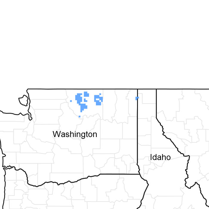
Figure 1. Mapped extent
Areas shown in blue indicate the maximum mapped extent of this ecological site. Other ecological sites likely occur within the highlighted areas. It is also possible for this ecological site to occur outside of highlighted areas if detailed soil survey has not been completed or recently updated.
MLRA notes
Major Land Resource Area (MLRA): 043A–Northern Rocky Mountains
Description of MLRAs can be found in: United States Department of Agriculture, Natural Resources Conservation Service. 2006. Land Resource Regions and Major Land Resource Areas of the United States, the Caribbean, and the Pacific Basin. U.S. Department of Agriculture Handbook 296.
LRU notes
Most commonly found in LRU 43A01 (Okanogan Plateau). This LRU is composed predominantly of glaciated slopes of foothills and mountains west of the Republic Graben and Sanpoil River. The LRU is in the portion of the Northern Rocky Mountains that was subjected to continental glaciation. The soils tend to be loamy andisols, mollisols and inceptisols with mixed to thick ash surfaces. Till, outwash and glacially scoured granitics are the dominant parent materials. Soil climate is a frigid or cryic temperature regime and xeric moisture regime with average annual precipitation around 450 mm (18 inches) and an average annual air temperature around 6.3 degrees C (43 degrees F). Elevation ranges from about 560 to 1530 m (2,540 to 5,020 feet).
Classification relationships
Relationship to Other Established Classifications:
United States National Vegetation Classification (2008) - A3395 Douglas fir- P. Pine / Herbaceous Understory Central Rocky Mt. Forest & Woodland Alliance
Washington Natural Heritage Program. Ecosystems of Washington State, A Guide to Identification, Rocchio and Crawford, 2015 - Northern Rocky Mt. Dry-Mesic Montane Mixed Conifer Forest (D. Fir – Pine)
Description of Ecoregions of the United States, USFS PN # 1391, 1995 - M333 Northern Rocky Mt. Forest-Steppe-Coniferous Forest-Alpine Meadow Province
Level III and IV Ecoregions of WA, US EPA, June 2010 - 15x Okanogan Highland Dry Forest. 15w Western Selkirk Maritime Forest. 15r Okanogan – Colville Xeric Valleys & Foothills.
This ecological site includes the following USDA Forest Service Plant Associations: PSME/CARU (Douglas-fir Series). (Williams et. al. 1995)
Ecological site concept
This site consists of outwash terraces (teads and risers), and footslopes of hills and mountains with the following characteristics: sandy soil materials; a water table (perched or apparent) more than 75 cm (30 in) below the soil surface during the April to October period; PSME/CARU habitat type.
Table 1. Dominant plant species
| Tree |
(1) Pseudotsuga menziesii var. glauca |
|---|---|
| Shrub |
Not specified |
| Herbaceous |
(1) Calamagrostis rubescens |
Click on box and path labels to scroll to the respective text.