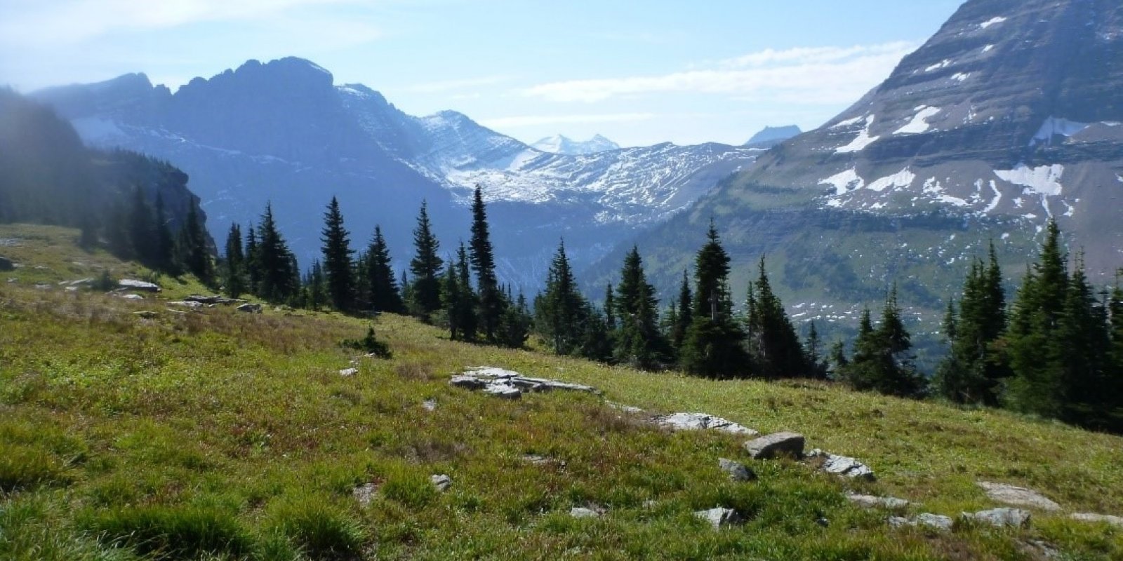
Major Land Resource Area 043A
Northern Rocky Mountains
Accessed: 04/03/2026
Description
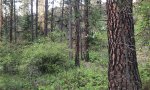
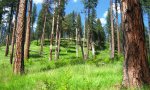
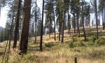
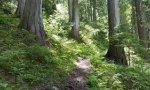
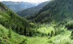
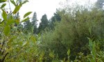
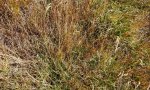
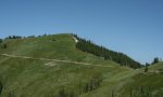
This MLRA is located in Montana (43 percent), Idaho (34 percent), and Washington (23 percent). It makes up about 31,435 square miles (81,460 square kilometers). It has no large cities or towns. It has many national forests, including the Okanogan, Colville, Kootenai, Lolo, Flathead, Coeur d’Alene, St. Joe, Clearwater, and Kaniksu National Forests. This MLRA is in the Northern Rocky Mountains Province of the Rocky Mountain System. It is characterized by rugged, glaciated mountains; thrust- and block-faulted mountains; and hills and valleys. Steep-gradient rivers have cut deep canyons. Natural and man-made lakes are common. The major Hydrologic Unit Areas (identified by four-digit numbers) that make up this MLRA are: Kootenai-Pend Oreille-Spokane (1701), 67 percent; Upper Columbia (1702), 18 percent; and Lower Snake (1706), 15 percent. Numerous rivers originate in or flow through this area, including, the Sanpoil, Columbia, Pend Oreille, Kootenai, St. Joe, Thompson, and Flathead Rivers. This area is underlain primarily by stacked slabs of layered sedimentary or metasedimentary bedrock. The bedrock formations range from Precambrian to Cretaceous in age. The rocks consist of shale, sandstone, siltstone, limestone, argillite, quartzite, gneiss, schist, dolomite, basalt, and granite. The formations have been faulted and stacked into a series of imbricate slabs by regional tectonic activity. Pleistocene glaciers carved a rugged landscape that includes sculpted hills and narrow valleys filled with till and outwash. Continental glaciation over road the landscape in the northern half of the MLRA while glaciation in the southern half was confined to montane settings. The average annual precipitation is 25 to 60 inches (635 to 1,525 millimeters) in most of this area, but it is as much as 113 inches (2,870 millimeters) in the mountains and is 10 to 15 inches (255 to 380 millimeters) in the western part of the area. Summers are dry. Most of the precipitation during fall, winter, and spring is snow. The average annual temperature is 32 to 51 degrees F (0 to 11 degrees C) in most of the area, decreasing with elevation. In most of the area, the freeze-free period averages 140 days and ranges from 65 to 215 days. It is longest in the low valleys of Washington, and it decreases in length with elevation. Freezing temperatures occur every month of the year on high mountains, and some peaks have a continuous cover of snow and ice. The dominant soil orders in this MLRA are Andisols, Inceptisols, and Alfisols. Many of the soils are influenced by Mount Mazama ash deposits. The soils in the area have a frigid or cryic soil temperature regime; have an ustic, xeric, or udic soil moisture regime; and dominantly have mixed mineralogy. They are shallow to very deep, are very poorly drained to well drained, and have most of the soil texture classes. The soils at the lower elevations include Udivitrands, Vitrixerands and Haplustalfs. The soils at the higher elevations include Dystrocryepts, Eutrocryepts, Vitricryands , and Haplocryalfs. Cryorthents, Cryepts, and areas of rock outcrop are on ridges and peaks above timberline The MLRA is home to diverse coniferous forests. Grand fir, Douglas-fir, western red cedar, western hemlock, western larch, lodgepole pine, subalpine fir, ponderosa pine, whitebark pine, and western white pine are the dominant overstory species, depending on precipitation, temperature, elevation, and landform aspect. The understory vegetation varies, also depending on climatic and landform factors. Some of the major wildlife species in this area are whitetailed deer, mule deer, elk, moose, black bear, grizzly bear, coyote, fox, and grouse. Fish, mostly in the trout and salmon families, are abundant in streams, rivers, and lakes. More than one-half of this area is federally owned and administered by the U.S. Department of Agriculture, Forest Service. Much of the privately-owned land is controlled by large commercial timber companies. The forested areas are used for wildlife habitat, recreation, watershed, livestock grazing, and timber production. Meadows provide summer grazing for livestock and big game animals. Less than 3 percent of the area is cropland.
Key publications
Next steps
-
1
Select an ecological site
Select an ecological site using the list, keys, photos, briefcase, or quick search option located on this page. -
2
Explore the ecological site description
Next, learn more about the selected ecological site and its characteristic dynamics by browsing the ecological site description and exploring alternative state and transition model formats.
Ecological site list
-
i
Key Characteristics
- Site Forested
- Site does not receive additional effective moisture
- Site in moist conditions (25-35 inches mean annual precipitation and 38-42 degrees F mean annual temperature and 70-90 days frost free, 2200-5000 feet elevation). Surface soil texture is gravelly ashy silt loam or gravelly silt loam or gravelly loam.
- soils ashy - Ashy Cool- Moist Woodland
-
i
Key Characteristics
- Site Forested
- Site does not receive additional effective moisture
- Site in dryer conditions, elevation driven
- Site in high elevation; cold conditions (35-70 or 50-70 frost free days, 30-60 or 40-0-60 inch mean annual precipitation, 37-43 degrees F mean annual temperature, 4000-8000 feet elevation.
- soils shallow - Shallow Cold Woodland
-
i
Key Characteristics
- Site Forested
- Site does not receive additional effective moisture
- Site in dryer conditions, elevation driven
- Site mid- to low-elevation (greater than 70 days frost free, less than 30 inches mean annual temperature)
- Site in moderate elevations; cool conditions (70-90 days frost free, 20-28 inches mean annual precipitation, 40-45 degree F mean annual temperature, 3000-5000 feet elevation).
- Soils shallow - Shallow Cool Woodland
-
i
Key Characteristics
- Site Forested
- Site does not receive additional effective moisture
- Site in dryer conditions, elevation driven
- Site mid- to low-elevation (greater than 70 days frost free, less than 30 inches mean annual temperature)
- Site in low elevations; warm conditions (70-95 or 75-105 frost free days, 17-25 inches mean annual precipitation, 40-45 degrees F mean annual temperature, 2900-5000 feet elevation).
- Soils shallow - Shallow Warm Woodland
-
i
Key Characteristics
- Site Forested
- Site receives additional effective moisture - Subirrigated Cool-Moist Woodland
-
i
Key Characteristics
- Site Forested
- Site does not receive additional effective moisture
- Site in dryer conditions, elevation driven
- Site in high elevation; cold conditions (35-70 or 50-70 frost free days, 30-60 or 40-0-60 inch mean annual precipitation, 37-43 degrees F mean annual temperature, 4000-8000 feet elevation.
- Soils not shallow - Upland Cold Woodland
-
i
Key Characteristics
- Site Forested
- Site does not receive additional effective moisture
- Site in dryer conditions, elevation driven
- Site mid- to low-elevation (greater than 70 days frost free, less than 30 inches mean annual temperature)
- Site in moderate elevations; cool conditions (70-90 days frost free, 20-28 inches mean annual precipitation, 40-45 degree F mean annual temperature, 3000-5000 feet elevation).
- Soils not shallow - Upland Cool Woodland
-
i
Key Characteristics
- Site Forested
- Site does not receive additional effective moisture
- Site in moist conditions (25-35 inches mean annual precipitation and 38-42 degrees F mean annual temperature and 70-90 days frost free, 2200-5000 feet elevation). Surface soil texture is gravelly ashy silt loam or gravelly silt loam or gravelly loam.
- Soils not ashy - Upland Cool - Moist Woodland
-
i
Key Characteristics
- Site Forested
- Site does not receive additional effective moisture
- Site in dryer conditions, elevation driven
- Site mid- to low-elevation (greater than 70 days frost free, less than 30 inches mean annual temperature)
- Site in low elevations; warm conditions (70-95 or 75-105 frost free days, 17-25 inches mean annual precipitation, 40-45 degrees F mean annual temperature, 2900-5000 feet elevation).
- Soils not shallow - Upland Warm Woodland
-
i
Key Characteristics
- Resides in the Lewis and/or Livingston Ranges in the northeastern most portion of this MLRA.
- Subalpine LifeZone
- Forested
- Lower Subalpine
- Moderately dry site conditions
-
i
Key Characteristics
- Resides in the Lewis and/or Livingston Ranges in the northeastern most portion of this MLRA.
- Subalpine LifeZone
- Forested
- Lower Subalpine
- Moist site conditions
-
i
Key Characteristics
- Resides in the Lewis and/or Livingston Ranges in the northeastern most portion of this MLRA.
- Subalpine LifeZone
- Forested
- Upper subalpine
-
i
Key Characteristics
- Resides in the Lewis and/or Livingston Ranges in the northeastern most portion of this MLRA.
- Subalpine LifeZone
- Forested
- Mid Subalpine
- Cool, moist site conditions
-
i
Key Characteristics
- Resides in the Lewis and/or Livingston Ranges in the northeastern most portion of this MLRA.
- Subalpine LifeZone
- Forested
- Mid Subalpine
- Cool dry site conditions
-
i
Key Characteristics
- Resides in the Lewis and/or Livingston Ranges in the northeastern most portion of this MLRA.
- Subalpine LifeZone
- Forested
- Lower Subalpine
- Frigid soil temperature regime
-
i
Key Characteristics
- Resides in the Lewis and/or Livingston Ranges in the northeastern most portion of this MLRA.
- Alpine LifeZone
- Treeline - Krummholtz
-
 ProvisionalF043AX959MT/F043AX959MTMontane Warm Dry Coniferous Douglas fir/white spirea-common snowberry/pinegrassi
Key Characteristics
- Resides in the Lewis and/or Livingston Ranges in the northeastern most portion of this MLRA.
- Montane LifeZone
- Forested
- Site does not reside on a floodplain
-
i
Key Characteristics
- Resides in the Lewis and/or Livingston Ranges in the northeastern most portion of this MLRA.
- Montane LifeZone
- Forested
- Site resides on a floodplain
-
i
Key Characteristics
- depth to SHWT <75cm
- mineral soil materials
- water table mostly >24 inches during May-Oct (MWD)…F043AY501WA
-
i
Key Characteristics
- depth to SHWT >75cm
- mesic to cool mesic zone
- cool-mesic
- moist xeric
-
i
Key Characteristics
- depth to SHWT >75cm
- mesic to cool mesic zone
- cool-mesic
- Xeric or dry-xeric
- xeric…(EX043AESG02)
- not sandy
- loamy
- ashy…F043AY505WA
-
i
Key Characteristics
- depth to SHWT >75cm
- mesic to cool mesic zone
- cool-mesic
- Xeric or dry-xeric
- xeric…(EX043AESG02)
- not sandy
- loamy
- mixed ash…F043AY506WA
-
i
Key Characteristics
- depth to SHWT >75cm
- mesic to cool mesic zone
- cool-mesic
- Xeric or dry-xeric
- xeric…(EX043AESG02)
- not sandy
- low awc…F043AY507WA
-
i
Key Characteristics
- depth to SHWT >75cm
- mesic to cool mesic zone
- cool-mesic
- Xeric or dry-xeric
- xeric…(EX043AESG02)
- sandy…F043AY508WA
-
i
Key Characteristics
- depth to SHWT >75cm
- warm-mesic zone…(EX043AESG03)
- sandy…F043AY509WA
-
i
Key Characteristics
- depth to SHWT >75cm
- warm-mesic zone…(EX043AESG03)
- not sandy
- low awc…F043AY510WA
-
i
Key Characteristics
- depth to SHWT >75cm
- warm-mesic zone…(EX043AESG03)
- not sandy
- loamy
- mixed ash…F043AY511WA
-
i
Key Characteristics
- depth to SHWT >75cm
- warm-mesic zone…(EX043AESG03)
- not sandy
- loamy
- ashy…F043AY512WA
-
i
Key Characteristics
- Cool-frigid…(EX043AESG04)
- Not High WT
- Dry-xeric
- Conifers dominate site
- Loamy
- Loamy
- Ashy…F043AY513WA
- Frigid or warm-frigid
- Warm-frigid
- Aquic Xeric … R043AY513ID
-
i
Key Characteristics
- Cool-frigid…(EX043AESG04)
- High WT…use F043AY514WA
- Cool-frigid…(EX043AESG04)
- Not High WT
- Dry-xeric
- Conifers dominate site
- Loamy
- Loamy
- Mixed ash…F043AY514WA
-
i
Key Characteristics
- Cool-frigid…(EX043AESG04)
- Not High WT
- Dry-xeric
- Conifers dominate site
- Loamy
- Low awc…F043AY515WA
-
i
Key Characteristics
- Cool-frigid…(EX043AESG04)
- Not High WT
- Dry-xeric
- Conifers dominate site
- Sandy…F043AY516WA
-
i
Key Characteristics
- Frigid or warm-frigid
- Warm-frigid
- Other
- Xeric (EX043AESG05)
- No high WT
- Not sandy
- Loamy
- Ashy…F043AY517WA
-
i
Key Characteristics
- Frigid or warm-frigid
- Warm-frigid
- Other
- Xeric (EX043AESG05)
- No high WT
- Not sandy
- Loamy
- Mixed ash…F043AY518WA
-
i
Key Characteristics
- Frigid or warm-frigid
- Warm-frigid
- Other
- Xeric (EX043AESG05)
- No high WT
- Not sandy
- Low awc…F043AY519WA
-
i
Key Characteristics
- Warm-cryic…F043AY520WA
-
i
Key Characteristics
- Frigid or warm-frigid
- Warm-frigid
- Other
- moist-xeric…(EX043AESG06)
- Loamy
- Ashy…F043AY521WA
-
i
Key Characteristics
- Frigid or warm-frigid
- Warm-frigid
- Other
- moist-xeric…(EX043AESG06)
- Loamy
- Mixed ash…F043AY522WA
-
i
Key Characteristics
- Frigid or warm-frigid
- Warm-frigid
- Other
- moist-xeric…(EX043AESG06)
- Low awc…F043AY523WA
-
i
Key Characteristics
- Frigid or cool frigid
- Udic (EX043AESG09)
- No High Water Table (>75cm)
- Loamy
- Not as above
- Ashy surface
-
i
Key Characteristics
- Frigid or cool frigid
- Udic (EX043AESG09)
- No High Water Table (>75cm)
- Loamy
- Not as above
- Mixed ash
-
i
Key Characteristics
- Warm frigid
- Other
- Udic (EX043AESG08)
- No High Water Table(>75cm)
- Loamy
- Not Low AWC
- Ashy surface
-
i
Key Characteristics
- Warm frigid
- Other
- Udic (EX043AESG08)
- High Water Table (<75cm)
- Frigid or cool frigid
- Udic (EX043AESG09)
- High Water Table (<75cm)
-
i
Key Characteristics
- Warm frigid
- Other
- Udic (EX043AESG08)
- No High Water Table(>75cm)
- Loamy
- Low AWC
-
i
Key Characteristics
- Warm frigid
- Other
- Dry udic (EX043AESG07)
- Loamy
- .Ashy surface
-
i
Key Characteristics
- Warm frigid
- Other
- Dry udic (EX043AESG07)
- Sandy;
-
i
Key Characteristics
- Cool-frigid…(EX043AESG04)
- Not High WT
- Moist-xeric
- Loamy
- Mountain sides…F043AY531WA
-
i
Key Characteristics
- Cool-frigid…(EX043AESG04)
- Not High WT
- Moist-xeric
- Loamy
- Terraces…F043AY532WA
-
i
Key Characteristics
- Cool-frigid…(EX043AESG04)
- Not High WT
- Dry-xeric
- Aspen dominates site…F043AY533WA (aspen-pinegrass)
-
i
Key Characteristics
- Frigid or warm-frigid
- Warm-frigid
- Other
- Xeric (EX043AESG05)
- High WT
-
i
Key Characteristics
- Warm-Mesic
- Non Aquic-Xeric
- Xeric… EX43AESG11 (Ponderosa pine/dry grass)
- Moderate to High Available Water Capacity
-
 ProvisionalF043AY536ID/F043AY536IDShallow Canyons and Hillsides 23-25" PZ Mesic Eastern Columbia Plateau Embaymentsi
Key Characteristics
- Warm-Mesic
- Non Aquic-Xeric
- Xeric… EX43AESG11 (Ponderosa pine/dry grass)
- Low Available Water Capacity
-
 ProvisionalF043AY537ID/F043AY537IDSkeletal Canyons and Hills 23-25" PZ Mesic Eastern Columbia Plateau Embaymentsi
Key Characteristics
- Mesic
- Xeric… EX43AESG12
- Low Available Water Capacity
-
 ProvisionalF043AY538ID/F043AY538IDAshy Basalt Canyons and Plateaus 23-25" PZ Mesic Clearwater Canyonsi
Key Characteristics
- Mesic
- Xeric… EX43AESG12
- Moderate to High Available Water Capacity
- Basalt geology
-
 ProvisionalF043AY539ID/F043AY539IDAshy Canyons and Plateaus 23-25" PZ Mesic Eastern Columbia Plateau Embaymentsi
Key Characteristics
- Mesic
- Xeric… EX43AESG12
- Moderate to High Available Water Capacity
- Other geology
-
 ProvisionalF043AY540ID/F043AY540IDSandy Mountain Slopes 19-24" PZ Frigid Western Bitterroot Foothillsi
Key Characteristics
- Warm-Frigid
- Other
- Xeric (EX43AESG13)
- Sandy
-
 ProvisionalF043AY541ID/F043AY541IDFragipan Foothills 19-24" PZ Frigid Eastern Columbia Plateau Embaymentsi
Key Characteristics
- Warm-Frigid
- Other
- Xeric (EX43AESG13)
- Loamy
- Fragipan present…F043AY541ID
- Warm-Frigid
- Other
- Xeric (EX43AESG13)
- Loamy
- Fragipan not present
- Moderate to High Available Water Capacity
- Other geology
- Seasonal HWT(perched)…use F043AY541ID
-
i
Key Characteristics
- Warm-Frigid
- Other
- Xeric (EX43AESG13)
- Loamy
- Fragipan not present
- Low Available Water Capacity…F043AY542ID
-
i
Key Characteristics
- Warm-Frigid
- Other
- Xeric (EX43AESG13)
- Loamy
- Fragipan not present
- Moderate to High Available Water Capacity
- Metasedimentary geology
- Ashy surface…F043AY543ID
- Warm-Frigid
- Other
- Xeric (EX43AESG13)
- Loamy
- Fragipan not present
- Moderate to High Available Water Capacity
- Other geology
- Seasonal HWT not present
- Other geology
- Ashy surface…use F043AY543ID
-
i
Key Characteristics
- Warm-Frigid
- Other
- Xeric (EX43AESG13)
- Loamy
- Fragipan not present
- Moderate to High Available Water Capacity
- Metasedimentary geology
- Mixed ash surface…F043AY544ID
-
 ProvisionalF043AY545ID/F043AY545IDAshy Basalt Hills and Canyons 19-24" PZ Frigid Clearwater Canyonsi
Key Characteristics
- Warm-Frigid
- Other
- Xeric (EX43AESG13)
- Loamy
- Fragipan not present
- Moderate to High Available Water Capacity
- Other geology
- Seasonal HWT not present
- Basalt geology…F043AY545ID
-
 ProvisionalF043AY546ID/F043AY546IDAshy Canyons and Mountains 19-24" PZ Frigid Western Bitterroot Foothillsi
Key Characteristics
- Warm-Frigid
- Other
- Xeric (EX43AESG13)
- Loamy
- Fragipan not present
- Moderate to High Available Water Capacity
- Other geology
- Seasonal HWT not present
- Other geology
- Mixed ash surface…F043AY546ID
-
 ProvisionalF043AY547ID/F043AY547IDFragipan Foothills 24-30" PZ Frigid Eastern Columbia Plateau Embaymentsi
Key Characteristics
- Warm-Frigid
- Other
- Moist-Xeric (EX43AESG14)
- Fragipan present
-
 ProvisionalF043AY548ID/F043AY548IDLoamy-skeletal Hills and Mountains 24-30" PZ Frigid Western Bitterroot Foothillsi
Key Characteristics
- Warm-Frigid
- Other
- Moist-Xeric (EX43AESG14)
- Fragipan not present
- Loamy
- Low Available Water Capacity…F043AY548ID
-
 ProvisionalF043AY549ID/F043AY549IDAshy over loamy-skeletal Mountains 24-30" PZ Frigid Bitterroot Metasedimentary Zonei
Key Characteristics
- Warm-Frigid
- Other
- Moist-Xeric (EX43AESG14)
- Fragipan not present
- Loamy
- Moderate to High Available Water Capacity
- Metasedimentary geology
- Ashy surface…F043AY549ID
-
i
Key Characteristics
- Warm-Frigid
- Other
- Moist-Xeric (EX43AESG14)
- Fragipan not present
- Loamy
- Moderate to High Available Water Capacity
- Metasedimentary geology
- Mixed ash surface…F043AY550ID
-
 ProvisionalF043AY551ID/F043AY551IDAshy Basalt Hills and Mountains 24-30" PZ Frigid Eastern Columbia Plateau Embaymentsi
Key Characteristics
- Warm-Frigid
- Other
- Moist-Xeric (EX43AESG14)
- Fragipan not present
- Loamy
- Moderate to High Available Water Capacity
- Other geology
- Basalt geology
-
 ProvisionalF043AY552ID/F043AY552IDAshy Hills and Mountains 24-30" PZ Frigid Western Bitterroot Foothillsi
Key Characteristics
- Warm-Frigid
- Other
- Moist-Xeric (EX43AESG14)
- Fragipan not present
- Loamy
- Moderate to High Available Water Capacity
- Other geology
- Other geology
- Ashy surface
-
 ProvisionalF043AY553ID/F043AY553IDVitrandic Hills and Mountains 24-30" PZ Frigid Western Bitterroot Foothillsi
Key Characteristics
- Warm-Frigid
- Other
- Moist-Xeric (EX43AESG14)
- Fragipan not present
- Loamy
- Moderate to High Available Water Capacity
- Other geology
- Other geology
- Mixed ash surface…F043AY553ID
-
i
Key Characteristics
- Cool-Frigid/Moist-Udic…Grand Fir Mosaic-2
-
 ProvisionalF043AY556ID/F043AY556IDFragipan Foothills 30-45" PZ Frigid Eastern Columbia Plateau Embaymentsi
Key Characteristics
- Frigid or Warm-Frigid
- Frigid
- Frigid/Udic
- Fragipan present
-
 ProvisionalF043AY557ID/F043AY557IDAshy Till Mountains and Valleys 30-45" PZ Frigid Bitterroot Metasedimentary Zonei
Key Characteristics
- Frigid or cool frigid
- Udic (EX043AESG09)
- No High Water Table (>75cm)
- Loamy
- Low AWC
- Frigid or Warm-Frigid
- Frigid
- Frigid/Udic
- Frangipan not present
- Water table not as above
- Low Available water Capacity
-
i
Key Characteristics
- Frigid or Warm-Frigid
- Frigid
- Frigid/Udic
- Frangipan not present
- Water table not as above
- Moderate to High Available Water Capacity
- Metasedimentary Geology
-
 ProvisionalF043AY559ID/F043AY559IDAshy Mountains and Valleys 30-45" PZ Frigid Western Bitterroot Foothillsi
Key Characteristics
- Frigid or Warm-Frigid
- Frigid
- Frigid/Udic
- Frangipan not present
- Water table not as above
- Moderate to High Available Water Capacity
- Other Geology
- Ashy surface
-
 ProvisionalF043AY560ID/F043AY560IDVitrandic Mountains and Valleys 30-45" PZ Frigid Western Bitterroot Foothillsi
Key Characteristics
- Frigid or Warm-Frigid
- Frigid
- Frigid/Udic
- Frangipan not present
- Apparent water table within 30 inches of surface some time during Apr-Oct period use
- Frigid or Warm-Frigid
- Frigid
- Frigid/Udic
- Frangipan not present
- Water table not as above
- Moderate to High Available Water Capacity
- Other Geology
- Mixed ash surface
-
 ProvisionalF043AY561ID/F043AY561IDFragipan Foothills 30-45" PZ Frigid Eastern Columbia Plateau Embaymentsi
Key Characteristics
- Frigid or Warm-Frigid
- Warm-Frigid
- Other
- Dry-Udic
- Fragipan present
-
i
Key Characteristics
- Frigid or Warm-Frigid
- Warm-Frigid
- Other
- Dry-Udic
- Fragipan not present
- Low Available Water Capacity
-
ProvisionalF043AY563ID/F043AY563IDAshy Metasedimentary Mountains 30-45" PZ Frigid Bitterroot Metasedimentary Zonei
Key Characteristics
- Frigid or Warm-Frigid
- Warm-Frigid
- Other
- Dry-Udic
- Fragipan not present
- Moderate to High Available Water Capacity
- Metasedimentary Geology
- Ashy surface
-
i
Key Characteristics
- Frigid or Warm-Frigid
- Warm-Frigid
- Other
- Dry-Udic
- Fragipan not present
- Moderate to High Available Water Capacity
- Metasedimentary Geology
- Mixed ash surface
-
ProvisionalF043AY565ID/F043AY565IDAshy Basalt Hills and Canyons 30-45" PZ Frigid Eastern Columbia Plateau Embaymentsi
Key Characteristics
- Frigid or Warm-Frigid
- Warm-Frigid
- Other
- Dry-Udic
- Fragipan not present
- Moderate to High Available Water Capacity
- Other Geology
- Basalt geology
- Ashy surface use
- Frigid or Warm-Frigid
- Warm-Frigid
- Other
- Dry-Udic
- Fragipan not present
- Moderate to High Available Water Capacity
- Other Geology
- Basalt geology
- Mixed ash surface
-
ProvisionalF043AY566ID/F043AY566IDDry Ashy Hills and Mountains 30-45" PZ Frigid Clearwater Mountainsi
Key Characteristics
- Frigid or Warm-Frigid
- Warm-Frigid
- Other
- Dry-Udic
- Fragipan not present
- Moderate to High Available Water Capacity
- Other Geology
- Other geology
- Ashy surface
-
ProvisionalF043AY567ID/F043AY567IDVitrandic Hills and Mountains 30-45" PZ Frigid Western Bitterroot Foothillsi
Key Characteristics
- Frigid or Warm-Frigid
- Warm-Frigid
- Other
- Dry-Udic
- Fragipan not present
- Moderate to High Available Water Capacity
- Other Geology
- Other geology
- Mixed ash surface
-
 ProvisionalF043AY568ID/F043AY568IDAshy Fragipan Hills 30-45" PZ Frigid Eastern Columbia Plateau Embaymentsi
Key Characteristics
- Frigid or Warm-Frigid
- Warm-Frigid
- Other
- Other
- Udic…EX43AESG17 (Western redcedar/moist herb)
- Fragipan present
- Ashy Surface
-
 ProvisionalF043AY569ID/F043AY569IDVitrandic Fragipan Hills 30-45" PZ Frigid Western Bitterroot Foothillsi
Key Characteristics
- Frigid or Warm-Frigid
- Warm-Frigid
- Other
- Other
- Udic…EX43AESG17 (Western redcedar/moist herb)
- Fragipan present
- Mixed ash surface
-
i
Key Characteristics
- Frigid or Warm-Frigid
- Warm-Frigid
- Other
- Other
- Udic…EX43AESG17 (Western redcedar/moist herb)
- Fragipan not present
- Not as above
- Metasedimentary geology
- Ashy Surface
-
i
Key Characteristics
- Frigid or Warm-Frigid
- Warm-Frigid
- Other
- Other
- Udic…EX43AESG17 (Western redcedar/moist herb)
- Fragipan not present
- Not as above
- Metasedimentary geology
- Mixed ash surface
-
 ProvisionalF043AY572ID/F043AY572IDAshy Basalt Hills and Canyons 30-45" PZ Frigid Eastern Columbia Plateau Embaymentsi
Key Characteristics
- Frigid or Warm-Frigid
- Warm-Frigid
- Other
- Other
- Udic…EX43AESG17 (Western redcedar/moist herb)
- Fragipan not present
- Not as above
- Other geology
- Basalt geology
- Ashy Surface
-
i
Key Characteristics
- Frigid or Warm-Frigid
- Warm-Frigid
- Other
- Other
- Udic…EX43AESG17 (Western redcedar/moist herb)
- Fragipan not present
- Not as above
- Other geology
- Basalt geology
- Mixed ash surface
-
 ProvisionalF043AY574ID/F043AY574IDAshy Hills and Mountains 30-45" PZ Frigid Western Bitterroot Foothillsi
Key Characteristics
- Frigid or Warm-Frigid
- Warm-Frigid
- Other
- Other
- Udic…EX43AESG17 (Western redcedar/moist herb)
- Fragipan not present
- Not as above
- Other geology
- Other geology
- Ashy Surface
-
 ProvisionalF043AY575ID/F043AY575IDVitrandic Hills and Mountains 30-45" PZ Frigid Western Bitterroot Foothillsi
Key Characteristics
- Frigid or Warm-Frigid
- Warm-Frigid
- Other
- Other
- Udic…EX43AESG17 (Western redcedar/moist herb)
- Fragipan not present
- Not as above
- Other geology
- Other geology
- Mixed ash surface
-
 ProvisionalF043AY576ID/F043AY576IDPoorly Drained Vitrandic Foothills 30-45" PZ Frigid Western Bitterroot Foothillsi
Key Characteristics
- Frigid or Warm-Frigid
- Warm-Frigid
- Other
- Other
- Udic…EX43AESG17 (Western redcedar/moist herb)
- Fragipan not present
- Apparent water table within 30 inches of surface some time during Apr-Oct period
-
i
Key Characteristics
- Frigid or Warm-Frigid
- Warm-Frigid
- Other
- Other
- Very moist-Udic
-
 ProvisionalF043AY578ID/F043AY578IDAshy Metasedimentary Mountain Slopes 30-45" PZ Cryic Bitterroot Metasedimentary Zonei
Key Characteristics
- Warm-Cryic
- Not Aquic
- Moist-Udic… EX43AESG18
- Metasedimentary geology… F043AY578ID
-
i
Key Characteristics
- Warm-Cryic
- Not Aquic
- Moist-Udic… EX43AESG18
- Other geology
- Mountain sides… F043AY579ID
-
i
Key Characteristics
- Warm-Cryic
- Not Aquic
- Moist-Udic… EX43AESG18
- Other geology
- Avalanche chutes… F043AY580ID
-
i
Key Characteristics
- Cryic or Cool-Cryic
- Cryic
- Moist-Udic…EX43AESG19
- Low Available Water Capacity… F043AY581ID
- Cryic
- Other
- Udic EX043AESG19 Cryic,
- Sandy…use F043AY581ID
- Cryic
- Other
- Udic EX043AESG19 Cryic,
- Loamy
- Low AWC…F043AY581ID
-
 ProvisionalF043AY582ID/F043AY582IDAshy Metasedimentary Mountain Slopes 30-45" PZ Cryic Bitterroot Metasedimentary Zonei
Key Characteristics
- Cryic or Cool-Cryic
- Cryic
- Moist-Udic…EX43AESG19
- Moderate to High Available Water Capacity
- Metasedimentary geology… F043AY582ID
-
i
Key Characteristics
- Cryic or Cool-Cryic
- Cryic
- Moist-Udic…EX43AESG19
- Moderate to High Available Water Capacity
- Other geology… F043AY583ID
- Cryic
- Other
- Udic EX043AESG19 Cryic,
- Loamy
- Ashy…use F043AY583ID
-
ProvisionalF043AY584ID/F043AY584IDPoorly Drained Floodplain Step 30-45" PZ Frigid Western Bitterroot Foothillsi
Key Characteristics
- Frigid or Warm-Frigid
- Warm-Frigid
- Aquic
- Floodplains of large river systems
- Mineral soils
-
ProvisionalF043AY585WA/F043AY585WAWarm-Frigid, Xeric, Sandy, Outwash Terraces (Douglas-fir Warm Dry Shrub)i
Key Characteristics
- Frigid or warm-frigid
- Warm-frigid
- Other
- Xeric (EX043AESG05)
- No high WT
- Sandy…F043AY585WA
- Warm-Frigid
- Other
- Moist-Xeric (EX43AESG14)
- Fragipan not present
- Sandy
-
ProvisionalF043AY586WA/F043AY586WAFrigid, Xeric, Sandy, Outwash Terraces (Douglas-fir-Grand Fir Cool Shrub)i
Key Characteristics
- Cool-frigid…(EX043AESG04)
- Not High WT
- Moist-xeric
- Sandy…F043AY586WA
-
ProvisionalF043AY589WA/F043AY589WACryic, Aquic, Loamy, Flood Plains (Engelmann spruce/ladyfern)(PIEN/COSE/ATFI)i
Key Characteristics
- Cryic
- Aquic…F043AY589WA
-
i
Key Characteristics
- Site does not reside in the Lewis or Livingston Ranges and is not forested, and resides in the 13-17 or 17-20 inch precipitation range
- Range site in 13-17" precipitation zone and is listed below, otherwise go to PES key. Sites included here: Gravelly, Droughty, Droughty steep, Shallow Droughty, Very shallow.
- Moderately deep to very deep soils and skeletal. Soils moderately deep, deep, or very deep (≥ 20” deep to bedrock, lithic, or paralithic root restrictive layer). Soil skeletal to within 20” of soil surface (averages > 35% rock fragments in the 10”-20” layer)
- Droughty Soils Soil loamy-skeletal or clayey-skeletal
- Flat to moderate slopes Slope < 15% – Droughty (Dr)
-
i
Key Characteristics
- Site does not reside in the Lewis or Livingston Ranges and is not forested, and resides in the 13-17 or 17-20 inch precipitation range
- Range site in 13-17" precipitation zone and is listed below, otherwise go to PES key. Sites included here: Gravelly, Droughty, Droughty steep, Shallow Droughty, Very shallow.
- Moderately deep to very deep soils and skeletal. Soils moderately deep, deep, or very deep (≥ 20” deep to bedrock, lithic, or paralithic root restrictive layer). Soil skeletal to within 20” of soil surface (averages > 35% rock fragments in the 10”-20” layer)
- Droughty Soils Soil loamy-skeletal or clayey-skeletal
- Steep slopes Slope ≥ 15% – Droughty Steep (DrStp)
-
i
Key Characteristics
- Site does not reside in the Lewis or Livingston Ranges and is not forested, and resides in the 13-17 or 17-20 inch precipitation range
- Range site in 13-17" precipitation zone and is listed below, otherwise go to PES key. Sites included here: Gravelly, Droughty, Droughty steep, Shallow Droughty, Very shallow.
- Shallow to very shallow soils
- Shallow soils Soil shallow (10” – 20” deep to bedrock, lithic, or paralithic root restrictive layer)
-
i
Key Characteristics
- Site does not reside in the Lewis or Livingston Ranges and is not forested, and resides in the 13-17 or 17-20 inch precipitation range
- Range site in 17-20" precipitation zone and is listed below, otherwise go to PES key. Sites included here: Droughty, Droughty Steep, Loamy steep, Stony, Shallow Droughty, Thin Loamy.
- Soils moderately deep to deep Soils moderately deep, deep, or very deep (≥ 20” deep to bedrock, lithic, or paralithic root restrictive layer)
- Not stony surface
- Soil skeletal to within 20” of soil surface (averages > 35% rock fragments in the 10”-20” layer). Soil loamy-skeletal or clayey-skeletal
- Slope < 15% – Droughty (Dr)
-
i
Key Characteristics
- Site does not reside in the Lewis or Livingston Ranges and is not forested, and resides in the 13-17 or 17-20 inch precipitation range
- Range site in 17-20" precipitation zone and is listed below, otherwise go to PES key. Sites included here: Droughty, Droughty Steep, Loamy steep, Stony, Shallow Droughty, Thin Loamy.
- Soils moderately deep to deep Soils moderately deep, deep, or very deep (≥ 20” deep to bedrock, lithic, or paralithic root restrictive layer)
- Not stony surface
- Soil skeletal to within 20” of soil surface (averages > 35% rock fragments in the 10”-20” layer). Soil loamy-skeletal or clayey-skeletal
- Slope ≥ 15% – Droughty Steep (DrStp)
-
i
Key Characteristics
- Site does not reside in the Lewis or Livingston Ranges and is not forested, and resides in the 13-17 or 17-20 inch precipitation range
- Range site in 17-20" precipitation zone and is listed below, otherwise go to PES key. Sites included here: Droughty, Droughty Steep, Loamy steep, Stony, Shallow Droughty, Thin Loamy.
- Soils moderately deep to deep Soils moderately deep, deep, or very deep (≥ 20” deep to bedrock, lithic, or paralithic root restrictive layer)
- Not stony surface
- Soils not skeletal
- Soils loamy and steep and mollic epipedon present: Soil not skeletal within 20” of soil surface (averages < 35% rock fragments in the 10”-20” layer) and Slope ≥15% and Clay content is < 32% (ribbon < 2” long) in surface mineral 4”
-
i
Key Characteristics
- Site does not reside in the Lewis or Livingston Ranges and is not forested, and resides in the 13-17 or 17-20 inch precipitation range
- Range site in 17-20" precipitation zone and is listed below, otherwise go to PES key. Sites included here: Droughty, Droughty Steep, Loamy steep, Stony, Shallow Droughty, Thin Loamy.
- Soils shallow and droughty
-
i
Key Characteristics
- Site not forested
- Site located in a floodplain - Bottomland (receives additional water, in the aquic soil moisture regime, frigid soil temperature regime, 0-2 percent slopes, 3200-4100 feet elevation).
-
i
Key Characteristics
- Site not forested
- Site not located in a floodplain
- Site does not receive additional effective moisture
- Soils Shallow - Shallow Grassland (14-25 inches mean annual precipitation, 43-46 degrees F mean annual temperature, 70-100 frost free days, 2900-5000 feet elevation).
-
i
Key Characteristics
- Site not forested
- Site not located in a floodplain
- Site receives additional effective moisture - Subirrigated Grassland (has high water table within 100 cm of surface, 20-30 inch mean annual precipitation, 41-45 degree F mean annual temperature, 75-95 days frost free).
-
i
Key Characteristics
- Site not forested
- Site not located in a floodplain
- Site does not receive additional effective moisture
- Soils not shallow
- Site in Alpine Lifezone - Upland Alpine (45-85 inches mean annual precipitation, 32-39 degrees F mean annual temperature, 25-50 days frost free, 5200-8500 feet elevation).
-
i
Key Characteristics
- Site not forested
- Site not located in a floodplain
- Site does not receive additional effective moisture
- Soils not shallow
- Site not in Alpine - Upland Grassland (14-19 inces mean annual precipitation, 41-45 degrees F mean annual temperature, 90-105 days frost free, 2700-4500 feet elevation).
-
i
Key Characteristics
- Resides in the Lewis and/or Livingston Ranges in the northeastern most portion of this MLRA.
- Subalpine LifeZone
- Non-forested
- Site is an avalanche including head, chute and run-out zones.
-
 ProvisionalR043AX962MT/R043AX962MTAlpine Unstable Talus rocky ledge penstemon (Penstemon ellipticus)i
Key Characteristics
- Resides in the Lewis and/or Livingston Ranges in the northeastern most portion of this MLRA.
- Alpine LifeZone
- Nonforested
- Site is a steep, unstable to stabilizing colluvial slope
-
i
Key Characteristics
- Resides in the Lewis and/or Livingston Ranges in the northeastern most portion of this MLRA.
- Alpine LifeZone
- Nonforested
- Site is a shallow meadow
-
 ProvisionalR043AX966MT/R043AX966MTMontane Loamy Outwash Terrace Richardson’s needlegrass (Achnatherum richardsonii)i
Key Characteristics
- Resides in the Lewis and/or Livingston Ranges in the northeastern most portion of this MLRA.
- Montane LifeZone
- Non-forested
- Non-riparian areas
- Site is a loamy outwash terrace
-
i
Key Characteristics
- Resides in the Lewis and/or Livingston Ranges in the northeastern most portion of this MLRA.
- Montane LifeZone
- Non-forested
- Non-riparian areas
- Site is a stable colluvial slope
-
 ProvisionalR043AX971MT/R043AX971MTAlpine Solifluction Terrace Dryas octopetala (Arctostaphylos uva-ursi/Salix arctica)i
Key Characteristics
- Resides in the Lewis and/or Livingston Ranges in the northeastern most portion of this MLRA.
- Alpine LifeZone
- Nonforested
- Site experience frost heave action resulting in solifluction lobes
-
i
Key Characteristics
- Resides in the Lewis and/or Livingston Ranges in the northeastern most portion of this MLRA.
- Alpine LifeZone
- Nonforested
- Site has shallow soils on a cirque floor
-
i
Key Characteristics
- Resides in the Lewis and/or Livingston Ranges in the northeastern most portion of this MLRA.
- Montane LifeZone
- Non-forested
- Riparian areas
- Soils organic and vegetation dominated by sedges
-
i
Key Characteristics
- Resides in the Lewis and/or Livingston Ranges in the northeastern most portion of this MLRA.
- Montane LifeZone
- Non-forested
- Riparian areas
- Soils organic and vegetation of shrubs and sedges
-
i
Key Characteristics
- Resides in the Lewis and/or Livingston Ranges in the northeastern most portion of this MLRA.
- Alpine LifeZone
- Nonforested
- Site has concave shape, vegetation dominated by low growing sedges
-
i
Key Characteristics
- Warm-Cryic
- Not Aquic
- Dry-Udic… R043AY501ID
-
ProvisionalR043AY502ID/R043AY502IDShallow Foothills and Canyons 16-22" PZ Mesic Clearwater Canyonsi
Key Characteristics
- Warm-Mesic
- Non Aquic-Xeric
- Dry-Xeric (PSSP/FEID/ACNE)
- Low AWC
-
i
Key Characteristics
- Warm-Mesic
- Non Aquic-Xeric
- Dry-Xeric (PSSP/FEID/ACNE)
- Loamy
-
i
Key Characteristics
- Mesic
- Dry-xeric
- Loamy
-
i
Key Characteristics
- Mesic
- Dry-xeric
- Low AWC
-
i
Key Characteristics
- depth to SHWT >75cm
- mesic to cool mesic zone
- cool-mesic
- Xeric or dry-xeric
- Dry-xeric…R043AY506WA
-
i
Key Characteristics
- depth to SHWT >75cm
- mesic to cool mesic zone
- mesic
- Dry-xeric
- Low Awc…R043AY507WA
-
i
Key Characteristics
- Cryic
- Other
- Other
- Moist-xeric…R043AY508WA
-
i
Key Characteristics
- Warm-Mesic
- Aquic-Xeric
-
ProvisionalR043AY510ID/R043AY510IDPoorly Drained Floodplains 23-25" PZ Mesic Columbia-Colville Valleysi
Key Characteristics
- depth to SHWT <75cm
- mineral soil materials
- Water table <24 inches during May to Oct (PD)…R043AY510ID
-
i
Key Characteristics
- Frigid or Warm-Frigid
- Frigid
- Frigid-Aquic
- Organic materials in seeps, depressions and backswamps
- Frigid or Warm-Frigid
- Warm-Frigid
- Aquic
- Floodplains of large river systems
- Organic soils
-
ProvisionalR043AY512ID/R043AY512IDLoamy High Water Table Floodplains 19-24" PZ Frigid Western Bitterroot Foothillsi
Key Characteristics
- Warm frigid
- Aquic
- Frigid or Warm-Frigid
- Warm-Frigid
- Aquic
- Floodplains and terraces foothill drainageways
- Poorly to very poorly drained sites (high water table during May-Oct = 0 to 14 inches)
-
ProvisionalR043AY513ID/R043AY513IDLoamy Poorly Drained Floodplains 19-24" PZ Frigid Western Bitterroot Foothillsi
Key Characteristics
- Warm-Frigid
- Aquic-Xeric
- Frigid or Warm-Frigid
- Warm-Frigid
- Aquic
- Floodplains and terraces foothill drainageways
- Somewhat poorly drained to poorly drained sites (high water table during May-Oct = 14 to 30 inches)
-
i
Key Characteristics
- Warm-Cryic
- Aquic
- Mineral soils…R043AY514ID
-
i
Key Characteristics
- Warm-Cryic
- Aquic
- Organic soils…use R043AY515ID
-
ProvisionalR043AY516ID/R043AY516IDShallow Mountain Slopes 24-30" PZ Frigid Western Selkirk Highlandsi
Key Characteristics
- Frigid or cool frigid
- Moist Xeric
- Low Awc
-
i
Key Characteristics
- Frigid or Warm-Frigid
- Frigid
- Frigid-Aquic
- Mineral materials on narrow floodplains


Ecological site map
Basemap
Find me
Find point
Full screen
Zoom in to display soil survey map units for an area of interest, and zoom out to display MLRAs. Select a map unit polygon to view ecological sites correlated to that map unit. View a brief description of an ecological site by clicking on its name in the map popup. Soil survey correlations may not be accurate, and ecological site classification of a location should always be verified in the field. Each selection may require the transfer of several hundred KB of data.
Ecological site keys
Ecological site photos
Print Options
Sections
Font
Other
Briefcase
Add ecological sites and Major Land Resource Areas to your briefcase by clicking on the briefcase (![]() ) icon wherever it occurs. Drag and drop items to reorder. Cookies are used to store briefcase items between browsing sessions. Because of this, the number of items that can be added to your briefcase is limited, and briefcase items added on one device and browser cannot be accessed from another device or browser. Users who do not wish to place cookies on their devices should not use the briefcase tool. Briefcase cookies serve no other purpose than described here and are deleted whenever browsing history is cleared.
) icon wherever it occurs. Drag and drop items to reorder. Cookies are used to store briefcase items between browsing sessions. Because of this, the number of items that can be added to your briefcase is limited, and briefcase items added on one device and browser cannot be accessed from another device or browser. Users who do not wish to place cookies on their devices should not use the briefcase tool. Briefcase cookies serve no other purpose than described here and are deleted whenever browsing history is cleared.
Ecological sites
Major Land Resource Areas
The Ecosystem Dynamics Interpretive Tool is an information system framework developed by the USDA-ARS Jornada Experimental Range, USDA Natural Resources Conservation Service, and New Mexico State University.