Shallow Canyons and Hillsides 23-25" PZ Mesic Eastern Columbia Plateau Embayments
Scenario model
Current ecosystem state
Select a state
Management practices/drivers
Select a transition or restoration pathway
- Transition T1A More details
- Transition T1B More details
- Transition T1C More details
- Restoration pathway R2A More details
- Restoration pathway R3A More details
-
No transition or restoration pathway between the selected states has been described
Target ecosystem state
Select a state
Description
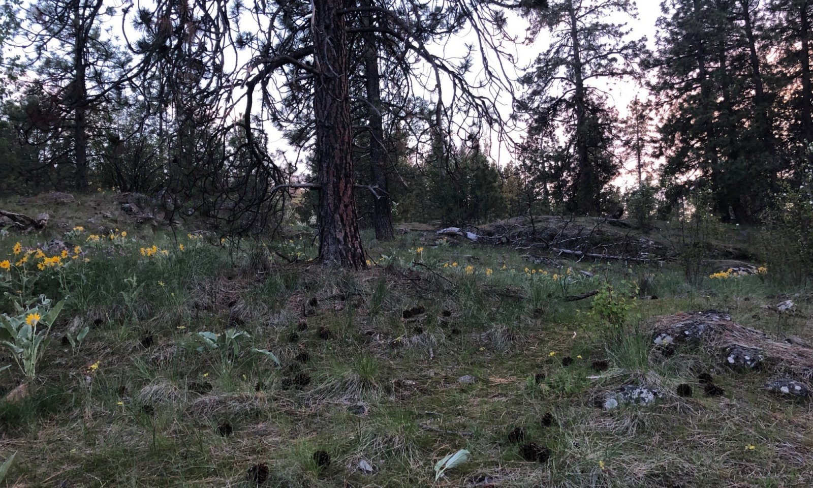
This state is dependent on the occurrence of frequent low intensity ground fires keeping an open grown pine stand with a dominant ground cover of bunchgrass. When fire intervals are infrequent pine regeneration can survive and a patchy pine woodland develops underneath the large old pine. With drought stress the large old pine can be subject to beetle kill and the understory pine stands subject to dwarf mistletoe infestation. It is also possible to have a stand replacement fire when stand density is increased and ladder fuels can reach the larger pine crowns.
Forest productivity is measured using site index (SI) and culmination of annual increment (CMAI). Ponderosa pine is the key tree species and site indexes ranges greatly depending on local site characteristics. Available data indicates a mean site index of 100 using (Meyer, 1961) with a CMAI of 102 cu. ft./yr at age 40 years.
The bulk of grass production is bluebunch wheatgrass and Idaho fescue. Other grass species included needle and thread grass, prairie junegrass, rough fescue, pine grass and sandberg bluegrass. The most prominent forbs were lupine, basalmroot, pussytoes, hawkweed, and yarrow. Shrubs tend to be present in only trace amounts. Tree regeneration is mostly ponderosa pine with an occasional Douglas-fir.
Submodel
Description
Fire Exclusion for 50+ years leads to a light to medium dense pine woodland with all ages present. Canopy cover ranges from 30- 60%. Canopy cover will be higher in the pine/fescue habitat. Mixed severity fires will create a mosaic of pine stands between burned areas which will seed in with pine maintaining a multi-level pine woodland.
Submodel
Description
Invasion of introduced perennial and annual cool season grasses from adjacent pastures, homesteads, and abandoned areas. One particular annual grass of concern from past overgrazing is the invasion of cheat grass. Once it gets established in the understory it will prevent native bunchgrasses from reestablishing and restoring site.
Description
Lower level terrain converted to crops, pasture or urban development. Much of the ponderosa pine ESDs are adjacent to local towns and cities. They have been converted to housing developments, shopping malls, or urban recreation areas. In the more rural areas, these sites have been converted to pastures and dry or irrigated cropland.
Mechanism
The natural fire regime intervals changed to 50+ years allowing understory pine regeneration to survive and grow creating more of a woodland site. Older larger pine now more susceptible to mortality from stand replacing fire.
Mechanism
Invasion of introduced perennial and annual grasses which outcompete native bunchgrasses
Mechanism
Overstory thinning and understory burning for specified time intervals to return site to Reference State 1.
Model keys
Briefcase
Add ecological sites and Major Land Resource Areas to your briefcase by clicking on the briefcase (![]() ) icon wherever it occurs. Drag and drop items to reorder. Cookies are used to store briefcase items between browsing sessions. Because of this, the number of items that can be added to your briefcase is limited, and briefcase items added on one device and browser cannot be accessed from another device or browser. Users who do not wish to place cookies on their devices should not use the briefcase tool. Briefcase cookies serve no other purpose than described here and are deleted whenever browsing history is cleared.
) icon wherever it occurs. Drag and drop items to reorder. Cookies are used to store briefcase items between browsing sessions. Because of this, the number of items that can be added to your briefcase is limited, and briefcase items added on one device and browser cannot be accessed from another device or browser. Users who do not wish to place cookies on their devices should not use the briefcase tool. Briefcase cookies serve no other purpose than described here and are deleted whenever browsing history is cleared.
Ecological sites
Major Land Resource Areas
The Ecosystem Dynamics Interpretive Tool is an information system framework developed by the USDA-ARS Jornada Experimental Range, USDA Natural Resources Conservation Service, and New Mexico State University.


