Alpine Unstable Talus rocky ledge penstemon (Penstemon ellipticus)
Circle-spoke model
Scenario model
Current ecosystem state
Select a state
Management practices/drivers
Select a transition or restoration pathway
-
No transition or restoration pathway between the selected states has been described
Target ecosystem state
Select a state
State 1
Reference


Description
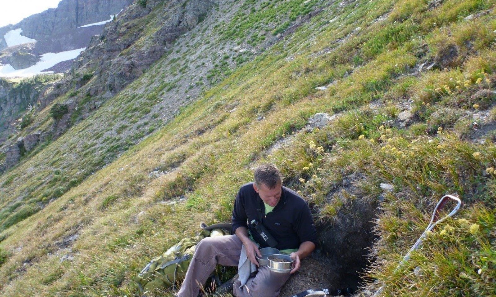
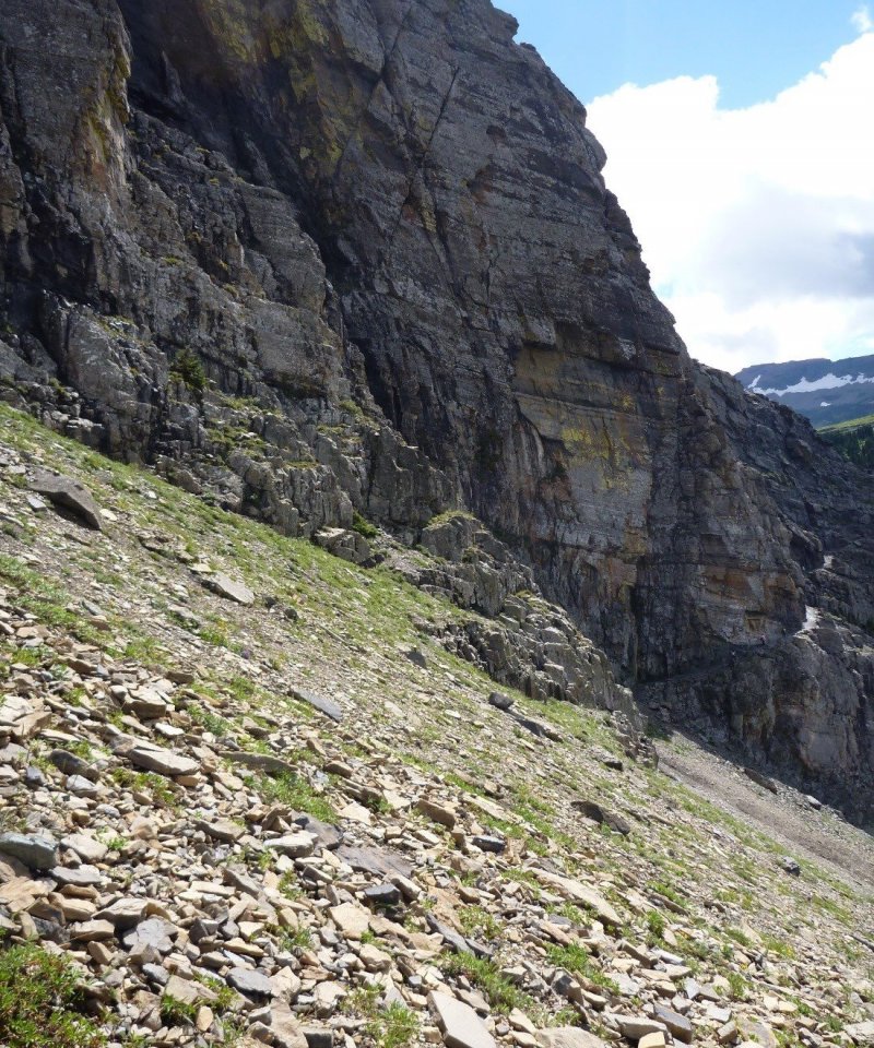
This ecological site encompasses the extensive talus and scree slopes at high elevations near the Continental Divide. Vegetation patterns on the slopes are differentiated by numerous factors including: slope stability, steepness, aspect, moisture supply, exposure to wind and snow duration. Due to the extreme mixing caused by the disturbance factors, there is little differentiation due to parent material. In general, the high elevation alpine flora has fewer species that are adapted to the harsh environmental conditions than lower elevation floras. This ecological site has even more constrained species that can thrive in the extreme conditions of this site. These species that are most adapted to this ecological site have less competitive advantage in more stable lower environments and are rarely found there. Slopes that have frequent or severe disturbances have been referred to as being permanent pioneer communities in that they do not progress successionally to more stable communities. Lusher vegetation communities may be lower down slope from late melting snow patches or other sources of water. Coarser textured substrates may lead to extreme, low species communities. Finer textured substrates may have more diversity. Moisture can be less of an issue for vegetation in general, due to the shingle-like rocks of the upper layers which effectively diminish the evaporation rates. This is evidenced by some mesophilic species within the communities. Regardless of community within State 1.0, the ground has very high cover of surface fragments, generally of all size classes. Vegetation canopy cover of the communities within State 1 have been found to range greatly from those having very little cover to higher vegetation cover averaging 80% in total of all lifeforms and strata. There are three types of adaptive strategies to the disturbance of talus or scree movement: passive migration, scree creeping and scree bankers (Damm 2001). Plants that use passive migration generally are small sized and do not send much of their root system down into the lower soil horizons. Therefore, they are not anchored firmly to the non-moving deeper parts of the talus but rather move with the active upper layers. Buttecandle (Cryptantha celosioides) and silverleaf phacelia (Phacelia hastata) are examples of this type. Another adaptive strategy is following the movement of the substrate (creeping) by growth of superficial prostrate shoots. Examples of plants include: rocky ledge penstemon (Penstemon ellipticus), common juniper (Juniperus communis) and nuttall’s rockcress (Arenaria nuttalli). A third adaptive strategy is to remain stable within the talus or scree and bank or block the movement downward. Roots extend deeply into the stable lower body of the talus slope by strong, often fibrous roots. This banking or blocking of rocks can form mounds which can stabilize slopes and initiate successional seres on not too extreme talus slopes. Examples of plants include: Sandberg bluegrass, Bluebunch wheatgrass, and Yellowdot saxifrage. The most extremely disturbed sites can have only the most adapted species Arenaria nuttallii and Stellaria americana. The reference community describes the site modal concept of unstable scree with little to moderate vegetation development with indicator species including rocky ledge penstemon (Penstemon ellipticus), Buttecandle (Cryptantha celosioides) and silverleaf phacelia (Phacelia hastata). It also has a sparse layer of tall mesophytic forb species including: rocky ragwort (Senecio megacephalus) and yellow columbine (Aquilegia flavescens). Phase 1.2 represents the community on moderately stable slopes with moderate vegetation cover that are predominantly graminoid species including Geyer’s sedge (Carex geyeri). It is related to the following community type. Regionally, there is a defined Geyer’s sedge grassland community type that occupies moderate to steep slopes on predominantly southern exposures in association with protected gully slopes near stream headwaters where streambeds are deeply incised in colluvial slopes resulting in unstable surfaces (NPS Veg Map Global Summary, Appendix G).
Talus slope vegetation have been studied in Canada as well. In the Caribou Range of British Columbia Canada, the vascular plant vegetation on limestone talus slopes was described and classified. Polster (1980) found that slope stability and aspect and moisture availability were major factors influencing vegetation pattern. They found that succession is initiated on coarse textured south facing slopes by mat forming species and on fine textured northern aspect by willow shrubs.
Submodel
Model keys
Briefcase
Add ecological sites and Major Land Resource Areas to your briefcase by clicking on the briefcase (![]() ) icon wherever it occurs. Drag and drop items to reorder. Cookies are used to store briefcase items between browsing sessions. Because of this, the number of items that can be added to your briefcase is limited, and briefcase items added on one device and browser cannot be accessed from another device or browser. Users who do not wish to place cookies on their devices should not use the briefcase tool. Briefcase cookies serve no other purpose than described here and are deleted whenever browsing history is cleared.
) icon wherever it occurs. Drag and drop items to reorder. Cookies are used to store briefcase items between browsing sessions. Because of this, the number of items that can be added to your briefcase is limited, and briefcase items added on one device and browser cannot be accessed from another device or browser. Users who do not wish to place cookies on their devices should not use the briefcase tool. Briefcase cookies serve no other purpose than described here and are deleted whenever browsing history is cleared.
Ecological sites
Major Land Resource Areas
The Ecosystem Dynamics Interpretive Tool is an information system framework developed by the USDA-ARS Jornada Experimental Range, USDA Natural Resources Conservation Service, and New Mexico State University.
