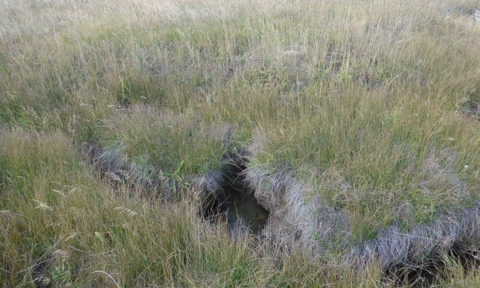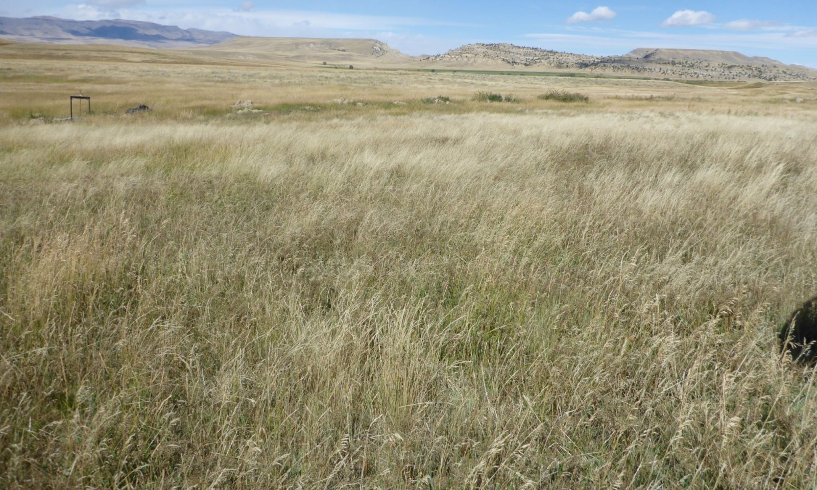
Saline Subirrigated (SS) Absaroka Upper Foothills
Scenario model
Current ecosystem state
Select a state
Management practices/drivers
Select a transition or restoration pathway
-
Transition T1A
Frequent and Severe grazing plus encroachment will convert this plant community to a Invaded State.
More details -
Transition T1B
Catastrophic events, gullying, or washouts leave a disturbed site.
More details -
Transition T3A
The weakened or lack of native community and open soil leaves a community open to invasion.
More details -
No transition or restoration pathway between the selected states has been described
Target ecosystem state
Select a state
State 1
Reference


Description
The Saline Subirrigated ecological site is a wet site that hosts a mixture of sedges and grasses, as well as a minor component of shrubs. The communities that represent the reference communities are native driven. Disturbances and the natural hydrologic processes involved in these generally riparian communities will affect which community is occurring along a landscape gradient. In communities not tied to a riparian system, the same shift in species will occur with the shift in the water table over time.
Characteristics and indicators
Alkali sacaton, Nuttall's alkaligrass, alkali bluegrass, and inland saltgrass are dominant with Nebraska sedge, beaked sedge, and baltic rush. Common shrubs in this community is greasewood, wild rose, shrubby cinquefoil, and on occasion willows. As a community is in drier stages or degrades, foxtail barley, little barley and ryegrass are common.
Resilience management
The wet nature of this community creates a fragile community that is easily altered with management pressures. The community is also resilient because of the wet nature and the significant freeze and thaw cycles common to this higher elevation soil. The salt-laden characteristic of these soils limits resiliency slightly, but the community does have the potential to recover after disturbance.
Submodel
State 2
Invaded


Description
Increased activity on the landscapes provides more opportunity for disturbances as well as an increase of non-native species seed source. Disturbances to the soil surface and exiting canopy cover provides opportunity for non-native species to establish.
The most prevelant invader on saline sites is foxtail barley, redtop bentgrass, and occasionaly Kentucky bluegrass on these subirrigated sites. There are instances where these communities cross on the landscape, and they are at-risk of further transformation. The occurrence of these communities can be a process of time or of disturbance.
Historic studies have documented the presence of non-native species such as Kentucky bluegrass and dandelions prior to the early 1950's. Another concern is the threat of large scale weed invasions. Currently, most of the mountain has retained only small or isolated patches of invasive weeds. Areas of leafy spurge, toadflax (yellow or dalmation) and thistles have been identified. Although early detection/rapid response techniques are applied for land management, limited resources make it difficult to track all current and new infestation sites. Overall, the weed infestation level is not seen as a critical concern, but the threat is growing and being monitored closely.
Characteristics and indicators
Non-native or tame species and invasive species are less of a concern on the salt-laden soils. There are, however, species that are salt-tolerant that will establish on the Saline Subirrigated ecological site, reducing or pushing native species out. The threshold that is crossed to indicate an invaded site is 5 percent composition by cover or by weight.
The dominant non-native/invader species are Kentucky bluegrass, redtop bentgrass, thistles, toadflax (Dalmatian, yellow), and swanson's pea. As new species are found, this list will be adapted to include these species.
Resilience management
Non-native and invasive species are resistant to change and resilient following disturbances.
This makes a stable community that is difficult to change without significant inputs. The salt-laden soils limit the type of treatment, access, and species adapted to help recovery of the Invaded Community.
Kentucky bluegrass, smooth brome, and other non-native species have a high resiliency once they have established in a community. The management of the native species is difficult, and is dependent on what specific species composition exists in the individual community. The removal or treatment of encroaching woody species is best tackled when they occur at a low intensity, before they may be seen as a concern.
Submodel
Description
Although to a much smaller extent than in lower elevations, there are areas that have been accessed for irrigation convenience ditches or were part of a homestead. These areas have remnants of introduced species from haylands or have been left to recover and may be in varying stages of succession. There are areas that are heavily impacted by recreational vehicles, parking, trails, roadways, or other land disturbances that have reduced or removed most native perennial vegetation and left a highly disturbed land.
The Disturbed State could be drafted as a stand-alone box within the state and transition model diagram. No matter what state a site originally is ranked in, once the site is mechanically disturbed, or suffers a catastrophic or significant natural disaster that alters the soil properties (erosional, depositional, or chemical), the site potential is altered. The most prominent shift for this site tends to be a shift in the natural hydrology that is key to this site. This can include both the loss of or enhancement to the additional moisture to the site (seepage from irrigation ditches).
Mechanical disturbances and reclamation practices using non-native species could qualify some stages of this state to be considered as a land use shift. The result is the shift in potential and response in management so that it is no longer similar to the reference community. The potential shifts are highly variable, so a dynamic state was captured to highlight the altered communities that exist on the landscape.
Characteristics and indicators
The soil disturbance and mechanical or physical removal of the vegetative canopy is the key characteristic of the Disturbed State. The initial indicators are the primary successional species that establish following a disturbance including Russian thistle, kochia, and sunflowers. These initial colonizers will then be followed by any seeded species, or other species from within the locations seed bank.
Resilience management
The Disturbed State is highly variable and in a state of flux as the successional processes occur. Continued disturbance of these communities is a potential threat; and the communities are at high risk of transitioning to the Invaded State.
Submodel
Mechanism
Frequent and Severe grazing plus encroachment will convert this plant community to an Invaded State. Grazing reduces the vigor and cover of native cover, allowing aggressive non-native species to creep into a community. Soil disturbance and increased activity (by livestock, wildlife, or human) provide a seed source for invaders to establish.
Constraints to recovery
The aggressive nature of invader species limits the ability for a community to overcome their establishment. In many cases, control or removal has not been completed successfully without complete manipulation.
Context dependence
The presence of greasewood in the community will hinder the practices that are suited for vegetation treatments. Fire and mechanical disturbances to the surface vegetation will encourage the sprouting capabilities of greasewood and could compound the situation in some instances. The moisture content of the soil, water table depth, and extent of salt load may restrict access to treat the soils or to manipulate the vegetation on some locations.
Mechanism
An abrupt or catastrophic disturbance will remove or significantly impact the native community and the soil structure, leaving a disturbed and barren site. With time, natural succession will begin the recovery process. However, the soil as well as hydrologic function has been altered in many cases, leaving a Disturbed State.
Constraints to recovery
The inability to restore hydrology or to replace soil stability in function (in the scope of significant head cuts or gullying) limits the recovery potential after significant disturbance.
Context dependence
Reclamation or restoration of the reference community is a challenge due to limitations of seed sources. Many of the species that are common in this community are established by sprig plantings only. Seedbed or site preparation is limited by the wetness of the soil, depth to water table and the soil textures. Access to these sites with equipment is difficult if not impossible for a large portion of the year.
Mechanism
Once a site has transitioned to this state, the increased bare ground and weakened plant structure leaves the community for encroachment or species creep by non-native species such as Kentucky bluegrass, creeping meadow foxtail, and redtop. Thistles, toadflax, and houndstounge are quickly becoming significant problems on areas within these weakened plant communities. Increasing bare ground and weakening plant community structure leaves the community vulnerable to invader species such as toadflax and houndstongue.
Constraints to recovery
The inability to effectively eradicate the undesirable species is the known financially limiting constraint to this site recovering.
Model keys
Briefcase
Add ecological sites and Major Land Resource Areas to your briefcase by clicking on the briefcase (![]() ) icon wherever it occurs. Drag and drop items to reorder. Cookies are used to store briefcase items between browsing sessions. Because of this, the number of items that can be added to your briefcase is limited, and briefcase items added on one device and browser cannot be accessed from another device or browser. Users who do not wish to place cookies on their devices should not use the briefcase tool. Briefcase cookies serve no other purpose than described here and are deleted whenever browsing history is cleared.
) icon wherever it occurs. Drag and drop items to reorder. Cookies are used to store briefcase items between browsing sessions. Because of this, the number of items that can be added to your briefcase is limited, and briefcase items added on one device and browser cannot be accessed from another device or browser. Users who do not wish to place cookies on their devices should not use the briefcase tool. Briefcase cookies serve no other purpose than described here and are deleted whenever browsing history is cleared.
Ecological sites
Major Land Resource Areas
The Ecosystem Dynamics Interpretive Tool is an information system framework developed by the USDA-ARS Jornada Experimental Range, USDA Natural Resources Conservation Service, and New Mexico State University.

