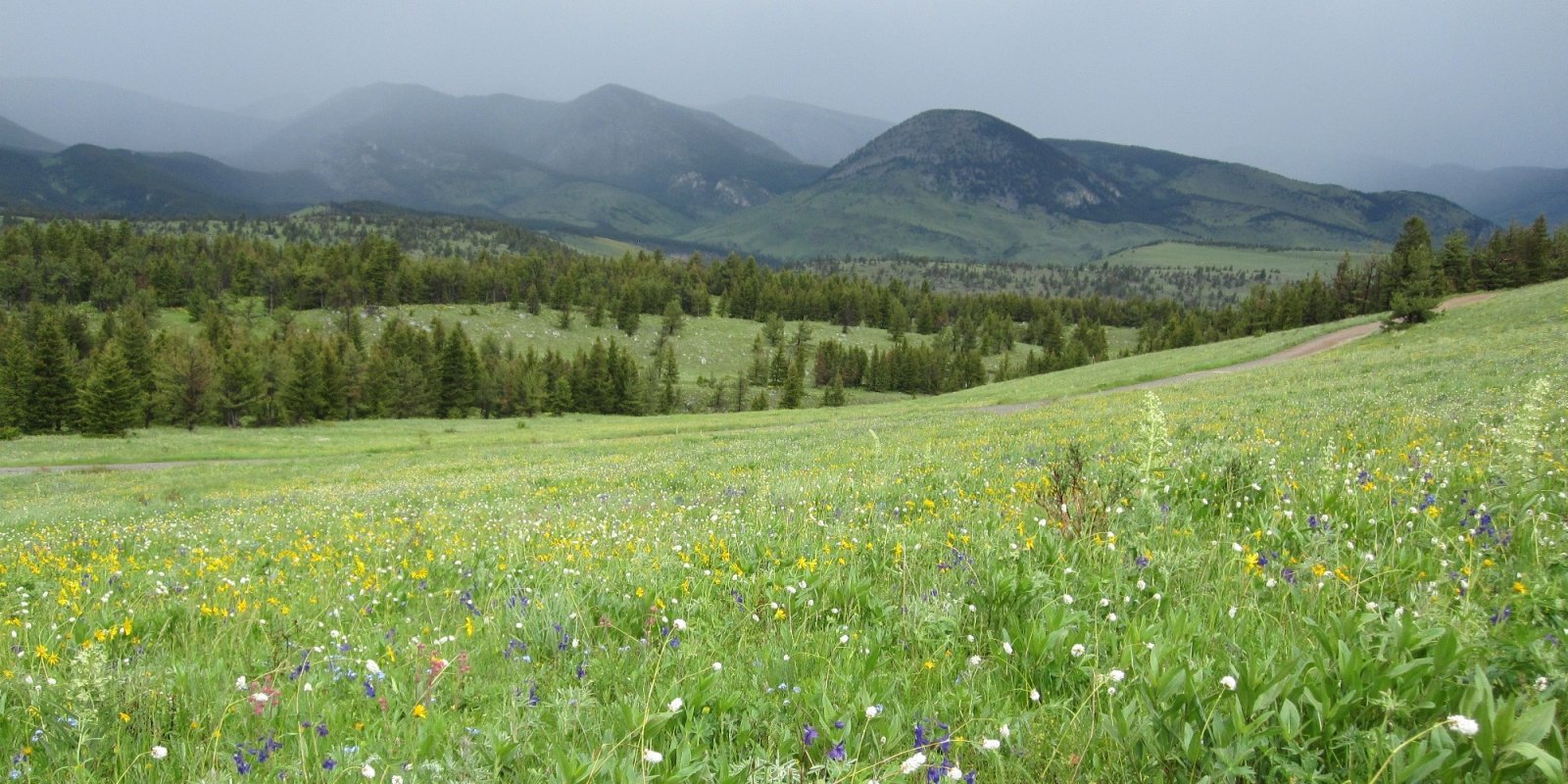
Major Land Resource Area 043B
Central Rocky Mountains
Accessed: 04/03/2026
Next steps
-
1
Select an ecological site
Select an ecological site using the list, keys, photos, briefcase, or quick search option located on this page. -
2
Explore the ecological site description
Next, learn more about the selected ecological site and its characteristic dynamics by browsing the ecological site description and exploring alternative state and transition model formats.
Ecological site list
-
i
Key Characteristics
- Site does not receive additional effective moisture¹
- Soils moderately deep to very deep (> 20” (50 cm) to bedrock (lithic or paralithic contact)
- Soil is not skeletal in the upper 20” (50 cm) of the mineral soil surface
- Site not as above
- Soil has ≥ 18% but < 35% clay in the upper 20” (50 cm) of the mineral soil surface in Bighorn Mountains
- Soils derived from granitic parent material (currently specific to Bighorn Mtns)
-
i
Key Characteristics
- Site does not receive additional effective moisture¹
- Soils moderately deep to very deep (> 20” (50 cm) to bedrock (lithic or paralithic contact)
- Soil is not skeletal in the upper 20” (50 cm) of the mineral soil surface
- Site not as above
- Soil has ≥ 18% but < 35% clay in the upper 20” (50 cm) of the mineral soil surface in Bighorn Mountains
- Soil derived from sedimentary parent material (i.e. sandstone or shale bedrock)
-
i
Key Characteristics
- Site is in the uplands.
- Site is forested
-
 ProvisionalEX043B15I954/R043BX954MTMontane Very Deep Meadow 20-24" PZ Cryic Northern Rocky Mountain Fronti
Key Characteristics
- Site is in the uplands.
- Site is not forested
- Site is in the montane zone
-
 ProvisionalEX043B15J952/R043BX952MTSubalpine Windswept Shallow Meadow 25-30" PZ Cryic Northern Rocky Mountain Fronti
Key Characteristics
- Site is in the uplands.
- Site is not forested
- Site is in the subalpine zone
-
 ProvisionalEX043B15Z955/R043BX955MTMontane Subirrigated Meadow Cryic Northern Rocky Mountain Fronti
Key Characteristics
- Site receives subirrigated water influence.
-
i
Key Characteristics
- Site does not receive additional effective moisture
- Soils are moderately deep, deep or very deep (>20" deep to root restrictive layer or bedrock)
- Site not as above
- Soil skeletal within 20" of soil surface (>35% rock fragments)
- Soil is loamy-skeletal or clayey-skeletal
- Soil not strongly or violently effervescent within 4" of soil surface
- Slope <30%
- Site is in the 15 to 19" precipitation zone and the Cryic temperature regime
-
i
Key Characteristics
- Site does not receive additional effective moisture
- Soils are moderately deep, deep or very deep (>20" deep to root restrictive layer or bedrock)
- Site not as above
- Soil skeletal within 20" of soil surface (>35% rock fragments)
- Soil is loamy-skeletal or clayey-skeletal
- Soil not strongly or violently effervescent within 4" of soil surface
- Slope ≥30%
- Site is in the 15 to 19" precipitation zone and Cryic temperature regime
-
i
Key Characteristics
- Site does not receive additional effective moisture
- Soils are moderately deep, deep or very deep (>20" deep to root restrictive layer or bedrock)
- Site not as above
- Soil skeletal within 20" of soil surface (>35% rock fragments)
- Soil is loamy-skeletal or clayey-skeletal
- Soil not strongly or violently effervescent within 4" of soil surface
- Slope <30%
- Site is in the 20 to 24" precipitation zone
-
i
Key Characteristics
- Site does not receive additional effective moisture
- Soils are moderately deep, deep or very deep (>20" deep to root restrictive layer or bedrock)
- Site not as above
- Soil skeletal within 20" of soil surface (>35% rock fragments)
- Soil is loamy-skeletal or clayey-skeletal
- Soil not strongly or violently effervescent within 4" of soil surface
- Slope ≥30%
- Site is in the 20 to 24" precipitation zone
-
i
Key Characteristics
- Site does not receive additional effective moisture¹
- Soil is non-saline, non-saline-sodic, non-sodic in the upper 20” (50 cm) of the mineral soil surface
- Soils moderately deep to very deep (> 20” (50 cm) to bedrock (lithic or paralithic contact)
- Soil is skeletal (> 35% rock fragments⁷) in the upper 20” (50 cm) of the mineral soil surface
- Soil is skeletal starting within the upper 8-20” (20-50 cm) from the mineral soil surface
- Soil has < 18% clay through the upper 20” (50 cm) of the mineral soil surface and fragments are comprised of sedimentary channers and/or flagstones
-
i
Key Characteristics
- Site does not receive additional effective moisture¹
- Soil is non-saline, non-saline-sodic, non-sodic in the upper 20” (50 cm) of the mineral soil surface
- Soils moderately deep to very deep (> 20” (50 cm) to bedrock (lithic or paralithic contact)
- Soil is not skeletal in the upper 20” (50 cm) of the mineral soil surface
- Soil has ≥ 35% clay clay throughout the upper 20” (50 cm) of the mineral soil – may have a lighter textured cap or may decrease lower in the profile
- Soil has ≥ 35% clay starting within the upper 4” (10 cm) and continues throughout the upper 20” (50 cm) of mineral soil surface; plant community dominated by Wyoming or Mountain big sagebrush²
-
i
Key Characteristics
- Site receives additional effective moisture¹ – If no, refer to Group II
- Site receives periodic overflow from adjacent slopes, but without a water table within 78” (200 cm)
- Soil is non-saline, non-saline-sodic, non-sodic; occur on floodplain steps, terraces, concave landscape positions, and positions lower in the landscape
- Soil has ≥ 35% clay in the upper 8” (20 cm) of the mineral soil surface
-
i
Key Characteristics
- Site does not receive additional effective moisture¹
- Soil is non-saline, non-saline-sodic, non-sodic in the upper 20” (50 cm) of the mineral soil surface
- Soils moderately deep to very deep (> 20” (50 cm) to bedrock (lithic or paralithic contact)
- Soil is skeletal (> 35% rock fragments⁷) in the upper 20” (50 cm) of the mineral soil surface
- Soil is skeletal starting within the upper 8-20” (20-50 cm) from the mineral soil surface
- Soil has ≥ 18% but < 60% clay through the upper 20” (50 cm) of the mineral soil surface
- Fragments typically consisting of cobbles (fragments are dominantly > 3” (76 mm) but < 10” (250 mm) in diameter); a few stones and boulders (0-5%) are present, common on landslides
-
i
Key Characteristics
- Site does not receive additional effective moisture¹
- Soil is non-saline, non-saline-sodic, non-sodic in the upper 20” (50 cm) of the mineral soil surface
- Soils moderately deep to very deep (> 20” (50 cm) to bedrock (lithic or paralithic contact)
- Soil is not skeletal in the upper 20” (50 cm) of the mineral soil surface
- Soil has ≥ 35% clay clay throughout the upper 20” (50 cm) of the mineral soil – may have a lighter textured cap or may decrease lower in the profile
- Abrupt clay increase⁶ to > 40% clay present within 4-8” (10-20 cm) of the mineral soil surface, significant surface cracking (plant community dominated by birdfoot sagebrush)
-
i
Key Characteristics
- Site does not receive additional effective moisture¹
- Soil is non-saline, non-saline-sodic, non-sodic in the upper 20” (50 cm) of the mineral soil surface
- Soils moderately deep to very deep (> 20” (50 cm) to bedrock (lithic or paralithic contact)
- Soil is skeletal (> 35% rock fragments⁷) in the upper 20” (50 cm) of the mineral soil surface
- Soil is skeletal throughout the upper 20” (50 cm) of the mineral soil surface
- Soil has < 18% clay; surface fragments and fragments in the soil profile are dominantly < 3” (76mm) in diameter, but may range in size
-
i
Key Characteristics
- Site does not receive additional effective moisture¹
- Soil is non-saline, non-saline-sodic, non-sodic in the upper 20” (50 cm) of the mineral soil surface
- Soil is very shallow (< 10” (25 cm) or shallow (< 20” (50 cm) to bedrock (lithic or paralithic contact)
- Soils very shallow, includes areas of exposed bedrock and may include pockets of deep soil, often on steep (up to 60%) slopes with very low productivity potential
- Soil with igneous or volcanic bedrock⁸ or are found on limestone parent material with a dominance of black sagebrush
-
i
Key Characteristics
- Site does not receive additional effective moisture¹
- Soil is non-saline, non-saline-sodic, non-sodic in the upper 20” (50 cm) of the mineral soil surface
- Soils moderately deep to very deep (> 20” (50 cm) to bedrock (lithic or paralithic contact)
- Soil is not skeletal in the upper 20” (50 cm) of the mineral soil surface
- Site not as above
- Soil has ≥ 18% but < 35% clay in the upper 20” (50 cm) of the mineral soil surface
- Soil is calcareous (violent effervescence³) within 20” (50 cm) of the mineral soil surface
- Soil is calcareous within the upper 8” (20 cm) of the mineral soil surface, calcium carbonate increases with depth
-
i
Key Characteristics
- Site does not receive additional effective moisture¹
- Soil is non-saline, non-saline-sodic, non-sodic in the upper 20” (50 cm) of the mineral soil surface
- Soils moderately deep to very deep (> 20” (50 cm) to bedrock (lithic or paralithic contact)
- Soil is skeletal (> 35% rock fragments⁷) in the upper 20” (50 cm) of the mineral soil surface
- Soil is skeletal throughout the upper 20” (50 cm) of the mineral soil surface
- Soil has ≥ 18% but < 60% clay; surface fragments and fragments in the soil profile are dominantly ≥ 3” (76mm) in diameter but < 10” (250 mm), but may range in size
- Violent effervescence³ starting within 4” (10 cm) from the mineral soil surface, calcium carbonate increases with depth
-
i
Key Characteristics
- Site does not receive additional effective moisture¹
- Soil is non-saline, non-saline-sodic, non-sodic in the upper 20” (50 cm) of the mineral soil surface
- Soils moderately deep to very deep (> 20” (50 cm) to bedrock (lithic or paralithic contact)
- Soil is not skeletal in the upper 20” (50 cm) of the mineral soil surface
- Site not as above
- Soil has ≥ 18% but < 35% clay in the upper 20” (50 cm) of the mineral soil surface
- Soil is non-calcareous (none to slight effervescence³) within 20” (50 cm) of the mineral soil surface
-
i
Key Characteristics
- Site does not receive additional effective moisture¹
- Soil is non-saline, non-saline-sodic, non-sodic in the upper 20” (50 cm) of the mineral soil surface
- Soils moderately deep to very deep (> 20” (50 cm) to bedrock (lithic or paralithic contact)
- Soil is not skeletal in the upper 20” (50 cm) of the mineral soil surface
- Site not as above
- Soil has ≥ 18% but < 35% clay in the upper 20” (50 cm) of the mineral soil surface
- Soil is calcareous (violent effervescence³) within 20” (50 cm) of the mineral soil surface
- Soil is calcareous starting within the upper 8-20” (20-50 cm) from the mineral soil surface
-
i
Key Characteristics
- Site receives additional effective moisture¹ – If no, refer to Group II
- Sites with a water table present for at least part of the growing season, site dominated by hydrophilic plants (ie. Wetland sedges, bulrushes, willows, tufted hairgrass, etc)²
- Site has a seasonal water table
- Soil is non-saline, non-saline-sodic, non-sodic
- Seasonal water table > 40” (100 cm) below the mineral soil surface; site regularly receives higher than normal soil moisture because of run-in or stream overflow
-
i
Key Characteristics
- Site receives additional effective moisture¹ – If no, refer to Group II
- Site receives periodic overflow from adjacent slopes, but without a water table within 78” (200 cm)
- Soil is non-saline, non-saline-sodic, non-sodic; occur on floodplain steps, terraces, concave landscape positions, and positions lower in the landscape
- Soil has < 35% clay in the upper 8” (20 cm) of the mineral soil surface
-
i
Key Characteristics
- Site receives additional effective moisture¹ – If no, refer to Group II
- Sites with a water table present for at least part of the growing season, site dominated by hydrophilic plants (ie. Wetland sedges, bulrushes, willows, tufted hairgrass, etc)²
- Site has a seasonal water table
- Soil is saline, saline-sodic, or sodic⁵ (SAR ≥ 13, or an EC ≥ 4 dS/m) in the upper 4” (10 cm)) of mineral soil; salt tolerant plants dominate site (i.e. greasewood, alkali sacaton, Nuttall’s alkaligrass, alkli bluegrass, alkali cordgrass, inland saltgrass, etc)²
- Seasonal water table > 40” (100 cm) below mineral soil surface; site regularly receives higher than normal soil moisture because of run-in or stream overflow
-
i
Key Characteristics
- Site receives additional effective moisture¹ – If no, refer to Group II
- Site receives periodic overflow from adjacent slopes, but without a water table within 78” (200 cm)
- Soil is saline, saline-sodic, or sodic⁵; site typically occurs on stream terraces along incised channels, and is dominated by greasewood² and other salt tolerant plants (i.e. Gardner’s saltbush, alkali sacaton)²
-
i
Key Characteristics
- Site receives additional effective moisture¹ – If no, refer to Group II
- Sites with a water table present for at least part of the growing season, site dominated by hydrophilic plants (ie. Wetland sedges, bulrushes, willows, tufted hairgrass, etc)²
- Site has a seasonal water table
- Soil is saline, saline-sodic, or sodic⁵ (SAR ≥ 13, or an EC ≥ 4 dS/m) in the upper 4” (10 cm)) of mineral soil; salt tolerant plants dominate site (i.e. greasewood, alkali sacaton, Nuttall’s alkaligrass, alkli bluegrass, alkali cordgrass, inland saltgrass, etc)²
- Seasonal water table is between 12-40” (30-100 cm) below the soil surface
-
i
Key Characteristics
- Site does not receive additional effective moisture¹
- Soil is saline, saline-sodic, or sodic⁵ (SAR ≥ 13, or an EC ≥ 4 dS/m) in the upper 20” (50 cm) of the mineral soil surface; site is dominated by salt tolerant plants (i.e. Gardner’s saltbush, greasewood, alkali sacaton, alkali seepweed, etc)²
- Soil is shallow to very deep (≥10” (25 cm) to bedrock (lithic or paralithic contact))
-
i
Key Characteristics
- Site does not receive additional effective moisture¹
- Soil is non-saline, non-saline-sodic, non-sodic in the upper 20” (50 cm) of the mineral soil surface
- Soils moderately deep to very deep (> 20” (50 cm) to bedrock (lithic or paralithic contact)
- Soil is not skeletal in the upper 20” (50 cm) of the mineral soil surface
- Site not as above
- Soil has < 18% clay starting within the upper 4” (10 cm) and continues throughout the upper 20” (50 cm) of mineral soil
-
i
Key Characteristics
- Site does not receive additional effective moisture¹
- Soil is saline, saline-sodic, or sodic⁵ (SAR ≥ 13, or an EC ≥ 4 dS/m) in the upper 20” (50 cm) of the mineral soil surface; site is dominated by salt tolerant plants (i.e. Gardner’s saltbush, greasewood, alkali sacaton, alkali seepweed, etc)²
- Soil is very shallow (< 10” (25 cm) to shale (lithic or paralithic contact)); productivity very low
-
i
Key Characteristics
- Site does not receive additional effective moisture¹
- Soil is non-saline, non-saline-sodic, non-sodic in the upper 20” (50 cm) of the mineral soil surface
- Soil is very shallow (< 10” (25 cm) or shallow (< 20” (50 cm) to bedrock (lithic or paralithic contact)
- Soils shallow, productivity potential is LOW
- Soil derived from sedimentary parent material (i.e. sandstone or shale bedrock)
- Soil has ≥ 35% clay
-
i
Key Characteristics
- Site does not receive additional effective moisture¹
- Soil is non-saline, non-saline-sodic, non-sodic in the upper 20” (50 cm) of the mineral soil surface
- Soil is very shallow (< 10” (25 cm) or shallow (< 20” (50 cm) to bedrock (lithic or paralithic contact)
- Soils shallow, productivity potential is LOW
- Soil derived from limestone or an igneous parent material (igneous or volcanic bedrock)⁸, with a dominance of black sagebrush
-
i
Key Characteristics
- Site does not receive additional effective moisture¹
- Soil is non-saline, non-saline-sodic, non-sodic in the upper 20” (50 cm) of the mineral soil surface
- Soil is very shallow (< 10” (25 cm) or shallow (< 20” (50 cm) to bedrock (lithic or paralithic contact)
- Soils shallow, productivity potential is LOW
- Soil derived from sedimentary parent material (i.e. sandstone or shale bedrock)
- Soil has ≥ 18% but < 35% clay
-
i
Key Characteristics
- Site does not receive additional effective moisture¹
- Soil is non-saline, non-saline-sodic, non-sodic in the upper 20” (50 cm) of the mineral soil surface
- Soil is very shallow (< 10” (25 cm) or shallow (< 20” (50 cm) to bedrock (lithic or paralithic contact)
- Soils shallow, productivity potential is LOW
- Soil derived from sedimentary parent material (i.e. sandstone or shale bedrock)
- Soil has < 18% clay
-
i
Key Characteristics
- Site does not receive additional effective moisture¹
- Soil is non-saline, non-saline-sodic, non-sodic in the upper 20” (50 cm) of the mineral soil surface
- Soils moderately deep to very deep (> 20” (50 cm) to bedrock (lithic or paralithic contact)
- Soil is skeletal (> 35% rock fragments⁷) in the upper 20” (50 cm) of the mineral soil surface
- Soil is skeletal starting within the upper 8-20” (20-50 cm) from the mineral soil surface
- Soil has ≥ 18% but < 60% clay through the upper 20” (50 cm) of the mineral soil surface
- Fragments typically consisting of stones and boulders (fragments > 10” (250 mm) in diameter), surface fragments (5-15%) increase in stones and boulders, common on Glacial outwash
-
i
Key Characteristics
- Site receives additional effective moisture¹ – If no, refer to Group II
- Sites with a water table present for at least part of the growing season, site dominated by hydrophilic plants (ie. Wetland sedges, bulrushes, willows, tufted hairgrass, etc)²
- Site has a seasonal water table
- Soil is non-saline, non-saline-sodic, non-sodic
- Seasonal water table is between 12-40” (30-100 cm) below the soil surface
-
i
Key Characteristics
- Site does not receive additional effective moisture¹
- Soil is non-saline, non-saline-sodic, non-sodic in the upper 20” (50 cm) of the mineral soil surface
- Soils moderately deep to very deep (> 20” (50 cm) to bedrock (lithic or paralithic contact)
- Soil is skeletal (> 35% rock fragments⁷) in the upper 20” (50 cm) of the mineral soil surface
- Soil is skeletal throughout the upper 20” (50 cm) of the mineral soil surface
- Soil has ≥ 18% but < 60% clay; surface fragments and fragments in the soil profile are dominantly ≥ 3” (76mm) in diameter but < 10” (250 mm), but may range in size
- None to slight effervescence³ in the upper 4” (10 cm) of the mineral soil surface
-
i
Key Characteristics
- Site does not receive additional effective moisture¹
- Soil is non-saline, non-saline-sodic, non-sodic in the upper 20” (50 cm) of the mineral soil surface
- Soil is very shallow (< 10” (25 cm) or shallow (< 20” (50 cm) to bedrock (lithic or paralithic contact)
- Soils very shallow, includes areas of exposed bedrock and may include pockets of deep soil, often on steep (up to 60%) slopes with very low productivity potential
- Soil with sedimentary bedrock, common on windswept ridges, (if productivity is high and > 35% rock fragments are present use Gravelly(Gr))
-
i
Key Characteristics
- Site receives additional effective moisture¹ – If no, refer to Group II
- Sites with a water table present for at least part of the growing season, site dominated by hydrophilic plants (ie. Wetland sedges, bulrushes, willows, tufted hairgrass, etc)²
- Site has water above soil surface part of the growing season, and a water table present within 0-12” (0-30 cm) annually
-
i
Key Characteristics
- Site does not receive additional effective moisture¹
- Soil is non-saline, non-saline-sodic, non-sodic in the upper 20” (50 cm) of the mineral soil surface
- Soils moderately deep to very deep (> 20” (50 cm) to bedrock (lithic or paralithic contact)
- Soil is skeletal (> 35% rock fragments⁷) in the upper 20” (50 cm) of the mineral soil surface
- Soil is skeletal starting within the upper 8-20” (20-50 cm) from the mineral soil surface
- Soil has < 18% clay through the upper 20” (50 cm) of the mineral soil surface and fragments are comprised of sedimentary channers and/or flagstones
-
i
Key Characteristics
- Site does not receive additional effective moisture¹
- Soil is non-saline, non-saline-sodic, non-sodic in the upper 20” (50 cm) of the mineral soil surface
- Soils moderately deep to very deep (> 20” (50 cm) to bedrock (lithic or paralithic contact)
- Soil is not skeletal in the upper 20” (50 cm) of the mineral soil surface
- Soil has ≥ 35% clay throughout the upper 20” (50 cm) of the mineral soil – may have a lighter textured cap or may decrease lower in the profile
- Soil has ≥ 35% clay starting within the upper 4” (10 cm) and continues throughout the upper 20” (50 cm) of mineral soil surface; plant community dominated by Wyoming or Mountain big sagebrush²
-
i
Key Characteristics
- Site receives additional effective moisture¹ – If no, refer to Group II
- Site receives periodic overflow from adjacent slopes, but without a water table within 78” (200 cm)
- Soil is non-saline, non-saline-sodic, non-sodic; occur on floodplain steps, terraces, concave landscape positions, and positions lower in the landscape
- Soil has ≥ 35% clay in the upper 8” (20 cm) of the mineral soil surface
-
i
Key Characteristics
- Site does not receive additional effective moisture¹
- Soil is non-saline, non-saline-sodic, non-sodic in the upper 20” (50 cm) of the mineral soil surface
- Soils moderately deep to very deep (> 20” (50 cm) to bedrock (lithic or paralithic contact)
- Soil is skeletal (> 35% rock fragments⁷) in the upper 20” (50 cm) of the mineral soil surface
- Soil is skeletal starting within the upper 8-20” (20-50 cm) from the mineral soil surface
- Soil has ≥ 18% but < 60% clay through the upper 20” (50 cm) of the mineral soil surface
- Fragments typically consisting of cobbles (fragments are dominantly > 3” (76 mm) but < 10” (250 mm) in diameter); a few stones and boulders (0-5%) are present, common on but not limited to landslides
-
i
Key Characteristics
- Site does not receive additional effective moisture¹
- Soil is non-saline, non-saline-sodic, non-sodic in the upper 20” (50 cm) of the mineral soil surface
- Soils moderately deep to very deep (> 20” (50 cm) to bedrock (lithic or paralithic contact)
- Soil is not skeletal in the upper 20” (50 cm) of the mineral soil surface
- Soil has ≥ 35% clay throughout the upper 20” (50 cm) of the mineral soil – may have a lighter textured cap or may decrease lower in the profile
- Abrupt clay increase⁶ to > 40% clay present within 4-8” (10-20 cm) of the mineral soil surface, significant surface cracking; plant community dominated by birdfoot sagebrush²
-
i
Key Characteristics
- Site does not receive additional effective moisture¹
- Soil is non-saline, non-saline-sodic, non-sodic in the upper 20” (50 cm) of the mineral soil surface
- Soils moderately deep to very deep (> 20” (50 cm) to bedrock (lithic or paralithic contact)
- Soil is skeletal (> 35% rock fragments⁷) in the upper 20” (50 cm) of the mineral soil surface
- Soil is skeletal throughout the upper 20" (50 cm) of the mineral soil surface
- Soil has < 18% clay; surface fragments and fragments in the soil profile are dominantly < 3” (76mm) in diameter, but range in size
-
i
Key Characteristics
- Site does not receive additional effective moisture¹
- Soil is non-saline, non-saline-sodic, non-sodic in the upper 20” (50 cm) of the mineral soil surface
- Soil is very shallow (< 10” (25 cm) or shallow (< 20” (50 cm) to bedrock (lithic or paralithic contact)
- Soils very shallow, includes areas of exposed bedrock and may include pockets of deep soil, often on steep (up to 60%) slopes with very low productivity potential
- Soil with igneous or volcanic bedrock⁸ or are found on limestone parent material with a dominance of Black sagebrush
-
i
Key Characteristics
- Site does not receive additional effective moisture¹
- Soil is non-saline, non-saline-sodic, non-sodic in the upper 20” (50 cm) of the mineral soil surface
- Soils moderately deep to very deep (> 20” (50 cm) to bedrock (lithic or paralithic contact)
- Soil is skeletal (> 35% rock fragments⁷) in the upper 20” (50 cm) of the mineral soil surface
- Soil is skeletal throughout the upper 20" (50 cm) of the mineral soil surface
- Soil has ≥ 18% but < 60% clay; surface fragments and fragments in the soil profile are dominantly ≥ 3” (76mm) in diameter but < 10” (250 mm), but may range in size
- Violent effervescence³ starting within 4” (10 cm) from the mineral soil surface, calcium carbonate increases with depth
-
i
Key Characteristics
- Site does not receive additional effective moisture¹
- Soil is non-saline, non-saline-sodic, non-sodic in the upper 20” (50 cm) of the mineral soil surface
- Soils moderately deep to very deep (> 20” (50 cm) to bedrock (lithic or paralithic contact)
- Soil is not skeletal in the upper 20” (50 cm) of the mineral soil surface
- Soil has <35% clay throughout the upper 20” (50 cm) of the mineral soil – may see individual horizons that are above 35% clay, but on average, the soil profile is less than 35% clays
- Soil has ≥ 18% but < 35% clay in the upper 20” (50 cm) of the mineral soil surface
- Soil is non-calcareous within 20” (50 cm) of the mineral soil surface
- Soils derived from sedimentary or a mix of parent materials
- Slope < 20%
-
i
Key Characteristics
- Site does not receive additional effective moisture¹
- Soil is non-saline, non-saline-sodic, non-sodic in the upper 20” (50 cm) of the mineral soil surface
- Soils moderately deep to very deep (> 20” (50 cm) to bedrock (lithic or paralithic contact)
- Soil is not skeletal in the upper 20” (50 cm) of the mineral soil surface
- Soil has <35% clay throughout the upper 20” (50 cm) of the mineral soil – may see individual horizons that are above 35% clay, but on average, the soil profile is less than 35% clays
- Soil has ≥ 18% but < 35% clay in the upper 20” (50 cm) of the mineral soil surface
- Soil is calcareous (violent effervescence³) within 20” (50 cm) of the mineral soil surface
- Soil is calcareous starting within the upper 8-20” (20-50 cm) from the mineral soil surface
-
i
Key Characteristics
- Site receives additional effective moisture¹ – If no, refer to Group II
- Sites with a water table present for at least part of the growing season, site dominated by hydrophilic plants (ie. Wetland sedges, bulrushes, willows, tufted hairgrass, etc)²
- Site has a seasonal water table
- Soil is non-saline, non-saline-sodic, non-sodic
- Seasonal water table > 40” (100 cm) below the mineral soil surface; site regularly receives higher than normal soil moisture because of run-in or stream overflow
-
i
Key Characteristics
- Site receives additional effective moisture¹ – If no, refer to Group II
- Site receives periodic overflow from adjacent slopes, but without a water table within 78” (200 cm)
- Soil is non-saline, non-saline-sodic, non-sodic; occur on floodplain steps, terraces, concave landscape positions, and positions lower in the landscape
- Soil has < 35% clay in the upper 8” (20 cm) of the mineral soil surface
-
i
Key Characteristics
- Site receives additional effective moisture¹ – If no, refer to Group II
- Sites with a water table present for at least part of the growing season, site dominated by hydrophilic plants (ie. Wetland sedges, bulrushes, willows, tufted hairgrass, etc)²
- Site has a seasonal water table
- Soil is saline, saline-sodic, or sodic⁵ (SAR ≥ 13, or an EC ≥ 4 dS/m) in the upper 4” (10 cm)) of mineral soil; salt tolerant plants dominate site (i.e. greasewood, alkali sacaton, Nuttall’s alkaligrass, alkli bluegrass, alkali cordgrass, inland saltgrass, etc)²
- Seasonal water table > 40” (100 cm) below mineral soil surface; site regularly receives higher than normal soil moisture because of run-in or stream overflow
-
i
Key Characteristics
- Site receives additional effective moisture¹ – If no, refer to Group II
- Sites with a water table present for at least part of the growing season, site dominated by hydrophilic plants (ie. Wetland sedges, bulrushes, willows, tufted hairgrass, etc)²
- Site has a seasonal water table
- Soil is saline, saline-sodic, or sodic⁵ (SAR ≥ 13, or an EC ≥ 4 dS/m) in the upper 4” (10 cm)) of mineral soil; salt tolerant plants dominate site (i.e. greasewood, alkali sacaton, Nuttall’s alkaligrass, alkli bluegrass, alkali cordgrass, inland saltgrass, etc)²
- Seasonal water table is between 12-40” (30-100 cm) below the soil surface
-
i
Key Characteristics
- Site does not receive additional effective moisture¹
- Soil is non-saline, non-saline-sodic, non-sodic in the upper 20” (50 cm) of the mineral soil surface
- Soils moderately deep to very deep (> 20” (50 cm) to bedrock (lithic or paralithic contact)
- Soil is not skeletal in the upper 20” (50 cm) of the mineral soil surface
- Soil has <35% clay throughout the upper 20” (50 cm) of the mineral soil – may see individual horizons that are above 35% clay, but on average, the soil profile is less than 35% clays
- Soil has < 18% clay starting within the upper 4” (10 cm) and continues throughout the upper 20” (50 cm) of mineral soil
-
i
Key Characteristics
- Site does not receive additional effective moisture¹
- Soil is non-saline, non-saline-sodic, non-sodic in the upper 20” (50 cm) of the mineral soil surface
- Soil is very shallow (< 10” (25 cm) or shallow (< 20” (50 cm) to bedrock (lithic or paralithic contact)
- Soils shallow, productivity potential is LOW
- Soil derived from sedimentary parent material (i.e. sandstone or shale bedrock)
- Soil has ≥ 35% clay
-
i
Key Characteristics
- Site does not receive additional effective moisture¹
- Soil is non-saline, non-saline-sodic, non-sodic in the upper 20” (50 cm) of the mineral soil surface
- Soil is very shallow (< 10” (25 cm) or shallow (< 20” (50 cm) to bedrock (lithic or paralithic contact)
- Soils shallow, productivity potential is LOW
- Soil derived from limestone or an igneous parent material (igneous or volcanic bedrock)⁸, with a dominance of black sagebrush
-
i
Key Characteristics
- Site does not receive additional effective moisture¹
- Soil is non-saline, non-saline-sodic, non-sodic in the upper 20” (50 cm) of the mineral soil surface
- Soil is very shallow (< 10” (25 cm) or shallow (< 20” (50 cm) to bedrock (lithic or paralithic contact)
- Soils shallow, productivity potential is LOW
- Soil derived from sedimentary parent material (i.e. sandstone or shale bedrock)
- Soil has ≥ 18% but < 35% clay
-
i
Key Characteristics
- Site does not receive additional effective moisture¹
- Soil is non-saline, non-saline-sodic, non-sodic in the upper 20” (50 cm) of the mineral soil surface
- Soil is very shallow (< 10” (25 cm) or shallow (< 20” (50 cm) to bedrock (lithic or paralithic contact)
- Soils shallow, productivity potential is LOW
- Soil derived from sedimentary parent material (i.e. sandstone or shale bedrock)
- Soil has < 18% clay
-
i
Key Characteristics
- Site does not receive additional effective moisture¹
- Soil is non-saline, non-saline-sodic, non-sodic in the upper 20” (50 cm) of the mineral soil surface
- Soils moderately deep to very deep (> 20” (50 cm) to bedrock (lithic or paralithic contact)
- Soil is not skeletal in the upper 20” (50 cm) of the mineral soil surface
- Soil has <35% clay throughout the upper 20” (50 cm) of the mineral soil – may see individual horizons that are above 35% clay, but on average, the soil profile is less than 35% clays
- Soil has ≥ 18% but < 35% clay in the upper 20” (50 cm) of the mineral soil surface
- Soil is non-calcareous within 20” (50 cm) of the mineral soil surface
- Soils derived from sedimentary or a mix of parent materials
- Slope ≥ 20%, may have indications of terrecettes
-
i
Key Characteristics
- Site does not receive additional effective moisture¹
- Soil is non-saline, non-saline-sodic, non-sodic in the upper 20” (50 cm) of the mineral soil surface
- Soils moderately deep to very deep (> 20” (50 cm) to bedrock (lithic or paralithic contact)
- Soil is skeletal (> 35% rock fragments⁷) in the upper 20” (50 cm) of the mineral soil surface
- Soil is skeletal starting within the upper 8-20” (20-50 cm) from the mineral soil surface
- Soil has ≥ 18% but < 60% clay through the upper 20” (50 cm) of the mineral soil surface
- Fragments typically consisting of stones and boulders (fragments > 10” (250 mm) in diameter), surface fragments (5-15%) increase in stones and boulders, common on but not limited to Glacial outwash
- Slope ≥ 20%
-
i
Key Characteristics
- Site does not receive additional effective moisture¹
- Soil is non-saline, non-saline-sodic, non-sodic in the upper 20” (50 cm) of the mineral soil surface
- Soils moderately deep to very deep (> 20” (50 cm) to bedrock (lithic or paralithic contact)
- Soil is skeletal (> 35% rock fragments⁷) in the upper 20” (50 cm) of the mineral soil surface
- Soil is skeletal starting within the upper 8-20” (20-50 cm) from the mineral soil surface
- Soil has ≥ 18% but < 60% clay through the upper 20” (50 cm) of the mineral soil surface
- Fragments typically consisting of stones and boulders (fragments > 10” (250 mm) in diameter), surface fragments (5-15%) increase in stones and boulders, common on but not limited to Glacial outwash
- Slope < 20%
-
i
Key Characteristics
- Site receives additional effective moisture¹ – If no, refer to Group II
- Sites with a water table present for at least part of the growing season, site dominated by hydrophilic plants (ie. Wetland sedges, bulrushes, willows, tufted hairgrass, etc)²
- Site has a seasonal water table
- Soil is non-saline, non-saline-sodic, non-sodic
- Seasonal water table is between 12-40” (30-100 cm) below the soil surface
-
i
Key Characteristics
- Site does not receive additional effective moisture¹
- Soil is non-saline, non-saline-sodic, non-sodic in the upper 20” (50 cm) of the mineral soil surface
- Soils moderately deep to very deep (> 20” (50 cm) to bedrock (lithic or paralithic contact)
- Soil is skeletal (> 35% rock fragments⁷) in the upper 20” (50 cm) of the mineral soil surface
- Soil is skeletal throughout the upper 20" (50 cm) of the mineral soil surface
- Soil has ≥ 18% but < 60% clay; surface fragments and fragments in the soil profile are dominantly ≥ 3” (76mm) in diameter but < 10” (250 mm), but may range in size
- None to strong³ effervescence in the upper 4” (10 cm) of the mineral soil surface
-
i
Key Characteristics
- Site does not receive additional effective moisture¹
- Soil is non-saline, non-saline-sodic, non-sodic in the upper 20” (50 cm) of the mineral soil surface
- Soil is very shallow (< 10” (25 cm) or shallow (< 20” (50 cm) to bedrock (lithic or paralithic contact)
- Soils very shallow, includes areas of exposed bedrock and may include pockets of deep soil, often on steep (up to 60%) slopes with very low productivity potential
- Soil with sedimentary bedrock, common on windswept ridges, (if productivity is high and > 35% rock fragments are present use Gravelly(Gr))
-
i
Key Characteristics
- Site receives additional effective moisture¹ – If no, refer to Group II
- Sites with a water table present for at least part of the growing season, site dominated by hydrophilic plants (ie. Wetland sedges, bulrushes, willows, tufted hairgrass, etc)²
- Site has water above soil surface part of the growing season, and a water table present within 0-12” (0-30 cm) annually
-
i
Key Characteristics
- Site does not receive additional effective moisture¹
- Soils moderately deep to very deep (> 20” (50 cm) to bedrock (lithic or paralithic contact)
- Soil is not skeletal in the upper 20” (50 cm) of the mineral soil surface
- Soil has ≥ 35% clay starting within the upper 4” (10 cm) from the mineral soil surface
- Soil has ≥ 35% clay throughout the upper 20” (10 cm) of mineral soil
-
i
Key Characteristics
- Site receives additional effective moisture¹ – If no, refer to Group II
- Site receives periodic overflow from adjacent slopes, but without a water table within 78” (200 cm)
- Soil has ≥ 35% clay in the upper 8” (20 cm) of the mineral soil surface
-
i
Key Characteristics
- Site does not receive additional effective moisture¹
- Soils moderately deep to very deep (> 20” (50 cm) to bedrock (lithic or paralithic contact)
- Soil is skeletal (> 35% rock fragments⁷) in the upper 20” (50 cm) of the mineral soil surface
- Soil is skeletal starting within the upper 8-20” (20-50 cm) from the mineral soil surface; Soil has ≥ 18% but < 60% clay through the upper 20” (50 cm) of the mineral soil surface
- Fragments typically consisting of cobbles (fragments are dominantly > 3” (76 mm) but < 10” (250 mm) in diameter); a few stones and boulders (0-3%) are present, common on landslides
-
i
Key Characteristics
- Site does not receive additional effective moisture¹
- Soils moderately deep to very deep (> 20” (50 cm) to bedrock (lithic or paralithic contact)
- Soil is not skeletal in the upper 20” (50 cm) of the mineral soil surface
- Soil has ≥ 35% clay starting within the upper 4” (10 cm) from the mineral soil surface
- Abrupt clay increase⁶ to > 40% clay present within 4-8” (10-20 cm) of the mineral soil surface, significant surface cracking
-
i
Key Characteristics
- Site does not receive additional effective moisture¹
- Soils moderately deep to very deep (> 20” (50 cm) to bedrock (lithic or paralithic contact)
- Soil is skeletal (> 35% rock fragments⁷) in the upper 20” (50 cm) of the mineral soil surface
- Soil is skeletal within the upper 8” (20 cm) of the mineral soil surface
- Soil has < 18% clay; surface fragments and fragments in the soil profile are dominantly < 3” (76mm) in diameter, but may range in size
-
i
Key Characteristics
- Site does not receive additional effective moisture¹
- Soils moderately deep to very deep (> 20” (50 cm) to bedrock (lithic or paralithic contact)
- Soil is not skeletal in the upper 20” (50 cm) of the mineral soil surface
- Site not as above
- Soil has ≥ 18% but < 35% clay in the upper 20” (50 cm) of the mineral soil surface in Absaroka Mountains
- Soils derived from granitic parent material (currently specific to Bighorn Mtns)
-
i
Key Characteristics
- Site does not receive additional effective moisture¹
- Soil is very shallow (< 10” (25 cm) or shallow (< 20” (50 cm) to bedrock (lithic or paralithic contact)
- Soils very shallow, includes areas of exposed bedrock and may include pockets of deep soil, often on steep (up to 55%) slopes with very low productivity potential
- Soil with igneous or volcanic bedrock
-
i
Key Characteristics
- Site does not receive additional effective moisture¹
- Soils moderately deep to very deep (> 20” (50 cm) to bedrock (lithic or paralithic contact)
- Soil is not skeletal in the upper 20” (50 cm) of the mineral soil surface
- Site not as above
- Soil has ≥ 18% but < 35% clay in the upper 20” (50 cm) of the mineral soil surface in Absaroka Mountains
- Soil derived from sedimentary parent material (i.e. sandstone or shale bedrock)
- Slope ≤ 20%
-
i
Key Characteristics
- Site receives additional effective moisture¹ – If no, refer to Group II
- Site receives periodic overflow from adjacent slopes, but without a water table within 78” (200 cm)
- Soil has < 35% clay in the upper 8” (20 cm) of the mineral soil surface
-
i
Key Characteristics
- Site does not receive additional effective moisture¹
- Soils moderately deep to very deep (> 20” (50 cm) to bedrock (lithic or paralithic contact)
- Soil is not skeletal in the upper 20” (50 cm) of the mineral soil surface
- Site not as above
- Soil has < 18% clay starting within the upper 4” (10 cm) and continues throughout the upper 20” (50 cm) of mineral soil
-
i
Key Characteristics
- Site does not receive additional effective moisture¹
- Soil is very shallow (< 10” (25 cm) or shallow (< 20” (50 cm) to bedrock (lithic or paralithic contact)
- Soils shallow, productivity potential is LOW
- Soil derived from sedimentary parent material (i.e. sandstone or shale bedrock)
-
i
Key Characteristics
- Site does not receive additional effective moisture¹
- Soil is very shallow (< 10” (25 cm) or shallow (< 20” (50 cm) to bedrock (lithic or paralithic contact)
- Soils shallow, productivity potential is LOW
- Soil derived from igneous parent material (igneous or volcanic bedrock)
-
i
Key Characteristics
- Site does not receive additional effective moisture¹
- Soils moderately deep to very deep (> 20” (50 cm) to bedrock (lithic or paralithic contact)
- Soil is not skeletal in the upper 20” (50 cm) of the mineral soil surface
- Site not as above
- Soil has ≥ 18% but < 35% clay in the upper 20” (50 cm) of the mineral soil surface in Absaroka Mountains
- Soil derived from sedimentary parent material (i.e. sandstone or shale bedrock)
- Slope > 20%, may have indications of terrecettes
-
i
Key Characteristics
- Site does not receive additional effective moisture¹
- Soils moderately deep to very deep (> 20” (50 cm) to bedrock (lithic or paralithic contact)
- Soil is skeletal (> 35% rock fragments⁷) in the upper 20” (50 cm) of the mineral soil surface
- Soil is skeletal starting within the upper 8-20” (20-50 cm) from the mineral soil surface; Soil has ≥ 18% but < 60% clay through the upper 20” (50 cm) of the mineral soil surface
- Fragments typically consisting of stones and boulders (fragments > 10” (250 mm) in diameter), surface fragments (3-15%) increase in stones and boulders, common on Glacial outwash
- Slope > 20%
-
i
Key Characteristics
- Site does not receive additional effective moisture¹
- Soils moderately deep to very deep (> 20” (50 cm) to bedrock (lithic or paralithic contact)
- Soil is skeletal (> 35% rock fragments⁷) in the upper 20” (50 cm) of the mineral soil surface
- Soil is skeletal starting within the upper 8-20” (20-50 cm) from the mineral soil surface; Soil has ≥ 18% but < 60% clay through the upper 20” (50 cm) of the mineral soil surface
- Fragments typically consisting of stones and boulders (fragments > 10” (250 mm) in diameter), surface fragments (3-15%) increase in stones and boulders, common on Glacial outwash
- Slope ≤ 20%
-
i
Key Characteristics
- Site does not receive additional effective moisture¹
- Soils moderately deep to very deep (> 20” (50 cm) to bedrock (lithic or paralithic contact)
- Soil is skeletal (> 35% rock fragments⁷) in the upper 20” (50 cm) of the mineral soil surface
- Soil is skeletal within the upper 8” (20 cm) of the mineral soil surface
- Soil has ≥ 18% but < 60% clay; surface fragments and fragments in the soil profile are dominantly ≥ 3” (76mm) in diameter but < 10” (250 mm), but may range in size
-
i
Key Characteristics
- Site does not receive additional effective moisture¹
- Soil is very shallow (< 10” (25 cm) or shallow (< 20” (50 cm) to bedrock (lithic or paralithic contact)
- Soils very shallow, includes areas of exposed bedrock and may include pockets of deep soil, often on steep (up to 55%) slopes with very low productivity potential
- Soil with sedimentary bedrock, common on windswept ridges, (if productivity is high and > 35% rock fragments are present use Gravelly (Gr))
-
i
Key Characteristics
- Site receives additional effective moisture¹ – If no, refer to Group II
- Sites with a water table present for at least part of the growing season, site dominated by hydrophilic plants
- Site has water above soil surface part of the growing season, and a water table present within 0-12” (0-30 cm) annually
-
i
Key Characteristics
- I. Biotic Groupings
- Groups
- Shallow Depth Driven
- Higher Elevations
-
i
Key Characteristics
- I. Biotic Groupings
- Groups
- Shallow Depth Driven
- Lower Elevations
-
i
Key Characteristics
- I. Biotic Groupings
- Groups
- Position Driven
- Run-in Sites
-
i
Key Characteristics
- I. Biotic Groupings
- Groups
- Position Driven
- Run-off Site
- High elevation, North Slopes
-
i
Key Characteristics
- I. Biotic Groupings
- Groups
- Position Driven
- Run-off Site
- Mid-elevations
-
i
Key Characteristics
- I. Biotic Groupings
- Groups
- Position Driven
- Run-off Site
- Low Elevations, South Slopes
-
i
Key Characteristics
- I. Biotic Groupings
- Groups
- Chemistry/Parent Material Driven
- Lime driven
-
i
Key Characteristics
- I. Biotic Groupings
- Groups
- Chemistry/Parent Material Driven
- Ash Deposits
-
i
Key Characteristics
- I. Biotic Groupings - Forestland Groups
- Shallow Depth Driven
- Higher Elevations
-
i
Key Characteristics
- I. Biotic Groupings - Forestland Groups
- Shallow Depth Driven
- Lower Elevations
-
i
Key Characteristics
- I. Biotic Groupings - Forestland Groups
- Position Driven
- Run-in Sites
- Lowlands/bottomlands
-
i
Key Characteristics
- I. Biotic Groupings - Forestland Groups
- Position Driven
- Run-in Sites
- Uplands
-
i
Key Characteristics
- I. Biotic Groupings - Forestland Groups
- Position Driven
- Run-off Site
- High elevation, North Slopes
-
i
Key Characteristics
- I. Biotic Groupings - Forestland Groups
- Position Driven
- Run-off Site
- Mid-elevations
-
i
Key Characteristics
- I. Biotic Groupings - Forestland Groups
- Position Driven
- Run-off Site
- Low Elevations, South Slopes
-
i
Key Characteristics
- I. Biotic Grouping
- Forestland Groupings
- Position Driven
- Site does not receive additional moisture from position in or near streams or waterways (run-in sites)
- Site not affected by soil chemistry
- Site affected site modifiers (texture or surface cover)
- Site has greater than 15 percent stone or boulder cover or fragmental textural family
-
i
Key Characteristics
- I. Biotic Grouping
- Forestland Groupings
- Shallow Depth Driven
- Site at High elevation and North slopes
-
i
Key Characteristics
- I. Biotic Grouping
- Forestland Groupings
- Shallow Depth Driven
- Site at Mid-elevations
-
i
Key Characteristics
- I. Biotic Grouping
- Forestland Groupings
- Shallow Depth Driven
- Site at Low elevations and South facing Mid-elevation
-
i
Key Characteristics
- I. Biotic Grouping
- Forestland Groupings
- Position Driven
- Site receives additional moisture from position in or near streams or waterways (run-in sites)
- Site located at high elevation
-
i
Key Characteristics
- I. Biotic Grouping
- Forestland Groupings
- Position Driven
- Site receives additional moisture from position in or near streams or waterways (run-in sites)
- Site located at Mid-elevations
- Site has permanent water table within 20 to 40 inches of surface
-
i
Key Characteristics
- I. Biotic Grouping
- Forestland Groupings
- Position Driven
- Site does not receive additional moisture from position in or near streams or waterways (run-in sites)
- Site not affected by soil chemistry
- Site without textural or surface modifiers
- Site dominated by Aspen
-
i
Key Characteristics
- I. Biotic Grouping
- Forestland Groupings
- Position Driven
- Site does not receive additional moisture from position in or near streams or waterways (run-in sites)
- Site not affected by soil chemistry
- Site without textural or surface modifiers
- Site located at High elevations
-
i
Key Characteristics
- I. Biotic Grouping
- Forestland Groupings
- Position Driven
- Site does not receive additional moisture from position in or near streams or waterways (run-in sites)
- Site not affected by soil chemistry
- Site without textural or surface modifiers
- Site located at Mid-elevation
-
i
Key Characteristics
- I. Biotic Grouping
- Forestland Groupings
- Position Driven
- Site does not receive additional moisture from position in or near streams or waterways (run-in sites)
- Site not affected by soil chemistry
- Site without textural or surface modifiers
- Site located at Low elevations
-
i
Key Characteristics
- I. Biotic Grouping
- Forestland Groupings
- Position Driven
- Site does not receive additional moisture from position in or near streams or waterways (run-in sites)
- Site affected by soil chemistry
- Site located at Mid-elevation
-
i
Key Characteristics
- I. Biotic Grouping
- Forestland Groupings
- Position Driven
- Site does not receive additional moisture from position in or near streams or waterways (run-in sites)
- Site affected by soil chemistry
- Site located at Low elevations
-
i
Key Characteristics
- I. Biotic Grouping
- Forestland Groupings
- Position Driven
- Site does not receive additional moisture from position in or near streams or waterways (run-in sites)
- Site not affected by soil chemistry
- Site affected site modifiers (texture or surface cover)
- Site Ashy or Medial textural class
-
i
Key Characteristics
- I. Biotic Grouping
- Forestland Groupings
- Position Driven
- Site receives additional moisture from position in or near streams or waterways (run-in sites)
- Site located at Mid-elevations
- Site has permanent water table with 20 inches of surface
-
i
Key Characteristics
- I. Biotic Groupings
- Groups
- Alpine
-
i
Key Characteristics
- I. Biotic Grouping
- Rangeland Groupings
- Position Driven
- Site receives additional moisture from position in or near streams or waterways (run-in sites)
- Site not affected by soil chemistry
- Site not located in Alpine System
- Site has a mix of native deciduous trees, shrubs, and grasses that is nearing forest levels of canopy cover
-
i
Key Characteristics
- I. Biotic Grouping
- Rangeland Groupings
- Position Driven
- Site does not receive additional moisture and is considered an upland site (run-off sites)
- Site not in Alpine System
- Site affected by soil chemistry
- Site strong or violently effervescent within 4 inches of soil surface
- Site dominated by native grasses
-
i
Key Characteristics
- I. Biotic Grouping
- Rangeland Groupings
- Position Driven
- Site does not receive additional moisture and is considered an upland site (run-off sites)
- Site not in Alpine System
- Site affected by soil chemistry
- Site strong or violently effervescent within 4 inches of soil surface
- Site dominated by sagebrush species
-
i
Key Characteristics
- I. Biotic Grouping
- Rangeland Groupings
- Position Driven
- Site does not receive additional moisture and is considered an upland site (run-off sites)
- Site not in Alpine System
- Site affected by soil chemistry
- Site affected by salt (sodic or saline sites)
- Site dominated by native grasses
-
i
Key Characteristics
- I. Biotic Grouping
- Rangeland Groupings
- Shallow Soil Depth (less than 20" deep)
- Site Dominated by native grasses
-
i
Key Characteristics
- I. Biotic Grouping
- Rangeland Groupings
- Shallow Soil Depth (less than 20" deep)
- Site Dominated by Sagebrush
-
i
Key Characteristics
- I. Biotic Grouping
- Rangeland Groupings
- Shallow Soil Depth (less than 20" deep)
- Site dominated by non-sagebrush shrubs
-
i
Key Characteristics
- I. Biotic Grouping
- Rangeland Groupings
- Position Driven
- Site receives additional moisture from position in or near streams or waterways (run-in sites)
- Site affected by soil chemistry
- Site dominated by native grasses
-
i
Key Characteristics
- I. Biotic Grouping
- Rangeland Groupings
- Position Driven
- Site receives additional moisture from position in or near streams or waterways (run-in sites)
- Site affected by soil chemistry
- Site dominated by native shrubs
-
i
Key Characteristics
- I. Biotic Grouping
- Rangeland Groupings
- Position Driven
- Site receives additional moisture from position in or near streams or waterways (run-in sites)
- Site not affected by soil chemistry
- Site not located in Alpine System
- Site dominated by native grasses
-
i
Key Characteristics
- I. Biotic Grouping
- Rangeland Groupings
- Position Driven
- Site receives additional moisture from position in or near streams or waterways (run-in sites)
- Site not affected by soil chemistry
- Site not located in Alpine System
- Site dominated by sagebrush species
-
i
Key Characteristics
- I. Biotic Grouping
- Rangeland Groupings
- Position Driven
- Site receives additional moisture from position in or near streams or waterways (run-in sites)
- Site not affected by soil chemistry
- Site not located in Alpine System
- Site dominated by non-sagebrush shrub species
-
i
Key Characteristics
- I. Biotic Grouping
- Rangeland Groupings
- Position Driven
- Site does not receive additional moisture and is considered an upland site (run-off sites)
- Site not in Alpine System
- Site not affected by soil chemistry
- Site dominated by native species
-
i
Key Characteristics
- I. Biotic Grouping
- Rangeland Groupings
- Position Driven
- Site does not receive additional moisture and is considered an upland site (run-off sites)
- Site not in Alpine System
- Site not affected by soil chemistry
- Site dominated by sagebrush species
-
i
Key Characteristics
- I. Biotic Grouping
- Rangeland Groupings
- Position Driven
- Site does not receive additional moisture and is considered an upland site (run-off sites)
- Site not in Alpine System
- Site not affected by soil chemistry
- Site dominated by non-sagebrush shrubs
-
i
Key Characteristics
- I. Biotic Grouping
- Rangeland Groupings
- Position Driven
- Site does not receive additional moisture and is considered an upland site (run-off sites)
- Site located in Alpine System
- Site not affected by soil chemistry
-
i
Key Characteristics
- I. Biotic Grouping
- Rangeland Groupings
- Position Driven
- Site does not receive additional moisture and is considered an upland site (run-off sites)
- Site located in Alpine System
- Site affected by soil chemistry
-
i
Key Characteristics
- I. Biotic Grouping
- Rangeland Groupings
- Shallow Soil Depth (less than 20" deep)
- Site located in alpine system
-
i
Key Characteristics
- I. Biotic Grouping
- Rangeland Groupings
- Position Driven
- Site receives additional moisture from position in or near streams or waterways (run-in sites)
- Site not affected by soil chemistry
- Site located in Alpine System
-
i
Key Characteristics
- Site occurs on uplands
- Soils derived from granite parent material.
- Site has slopes less than 30%.
- Site occurs in the 22+ PZ and elevations of 3500 to 7000 feet.
-
i
Key Characteristics
- Site occurs on uplands
- Soils not derived from granite soils.
- Soils are not associated with glacial moraines or glacial landforms.
- Soils are moderately deep to deep.
- Sites occur on ridgetops or mountain sides with shallow fractured bedrock.
- Elevations of 4500 to 6000 ft. They occur on ridgetops and mountainsides. Soils are shallow to fractured bed-rock. Soil textures are very cobbly loam to cobbly clay loams formed in residiuum of basalt. ...
-
i
Key Characteristics
- Site occurs on uplands
- Soils not derived from granite soils.
- Soils are not associated with glacial moraines or glacial landforms.
- Soils are shallow.
- Site occurs in 16-22 inch precipitation zone.
- Elevations of 4500 to 6000 ft. They occur on ridgetops and mountainsides. Soils are shallow to fractured bed-rock. Soil textures are very cobbly loam to cobbly clay loams formed in residiuum of basalt. ...
-
i
Key Characteristics
- Site occurs on bottomlands or riparian areas (slopes less than 5%)
- Site is not strictly associated with water courses.
- Site has less than 8" of organic layer and a water table present.
- Water at or near the surface at beginning of the growing season and greater than 40 inches at the end of the growing season. ...
- Water at or near the surface at beginning of growing season and down to 20-40 inches at the end of the growing season. ...
-
i
Key Characteristics
- Site occurs on bottomlands or riparian areas (slopes less than 5%)
- Site is not strictly associated with water courses.
- Site has less than 8" of organic layer and a water table present.
- Water at or near the surface at beginning of the growing season and greater than 40 inches at the end of the growing season. ...
- Water at or near the surface at beginning of the growing season and greater than 40 inches at the end of the growing season. ...
-
i
Key Characteristics
- Site occurs on uplands
- Soils not derived from granite soils.
- Site occurs on rolling glacial moraines, fans and fan terraces. Site occurs in 16-22 PZ and elevations of 6000 to 7300 ft. Soils are loams and can have some rocks on the surface ...
-
i
Key Characteristics
- Site occurs on bottomlands or riparian areas (slopes less than 5%)
- The site is associated with water coarses: Site occurs in 16 to over 22-inch PZ and at elevations of 6000 to 10000 ft. Soils have little development. Soils are mixed gravelly and sandy alluvium with coarse fragments. Water tables are near the surface to 12 inches. ...
-
i
Key Characteristics
- Site occurs on bottomlands or riparian areas (slopes less than 5%)
- Site is not strictly associated with water courses.
- Site has less than 8" of organic layer and a water table present.
- Site has a permanent water table between 1 and 3 ft. ...
-
i
Key Characteristics
- Site occurs on uplands
- Soils derived from granite parent material.
- Site has slopes less than 30%.
- Site occurs in 16-22 PZ and elevations of 6000 to 7500 ft. Occasional rock outcrops may occur through-out the site. Soil are deep with surface texture is sandy loam with some rock fragments
- Site occurs on uplands
- Soils derived from granite parent material.
- Site has slopes greater than 30%.
- Site occurs on southerly aspects.
- Soils are loamy or medium textured: Site occurs in 16-22 PZ and elevations of 6000 to 7500 ft. Occasional rock outcrops may occur through-out the site. Soil are deep with surface texture is sandy loam with some rock fragments ...
-
i
Key Characteristics
- Site occurs on bottomlands or riparian areas (slopes less than 5%)
- Site is not strictly associated with water courses.
- Soils on the site have an organic mat 8-40 inches.
- Organic mat present that is 8-40 inches Water at or up to 6 inches above the surface at the beginning of the growing season and down to less than 10 inches at the end of the growing season. ...
-
i
Key Characteristics
- Site occurs on uplands
- Soils not derived from granite soils.
- Soils are not associated with glacial moraines or glacial landforms.
- Soils are shallow.
- Site occurs in 16-22 inch precipitation zone.
- Site occurs in 16-22 inch PZ and elevations of 6300 to 7500 ft. The site occurs on nearly level to gently sloping outwash fans. Soils are shallow to sand and gravels that are more than 60 percent by volume. Surface in gravelly sandy loams ...
-
i
Key Characteristics
- Site occurs on uplands
- Soils not derived from granite soils.
- Soils are not associated with glacial moraines or glacial landforms.
- Soils are shallow.
- Site occurs in 22+ precipitation zone Elevations of 6300 to 7500 ft. The site occurs on nearly level to gently sloping outwash fans. Soils are shallow to sand and gravels that are more than 60 percent by volume. Surface in gravelly sandy loams ...
-
i
Key Characteristics
- Site occurs on uplands
- Soils derived from granite parent material.
- Site has slopes greater than 30%.
- Site occurs on southerly aspects.
- Soils at site are stony or gravelly.
- Site occurs in 22 inch PZ and elevations of 2800 to 5300 ft. Soils are moderately deep loams. They are derived from basalt. Coarse fragments below 10 inches ranges from 40-80 percent. ... R043BY018ID – South Slope Stony 22+ PZ PSSP6-FEID
-
i
Key Characteristics
- Site occurs on uplands
- Soils derived from granite parent material.
- Site has slopes greater than 30%.
- Site occurs on northerly aspects: Site occurs in 16-22 PZ and elevations of 5500 to 10000 ft. Soils are deep, well drained silt loams and loams.
-
i
Key Characteristics
- Site occurs on uplands
- Soils derived from granite parent material.
- Site has slopes greater than 30%.
- Site occurs on southerly aspects.
- Soils at site are stony or gravelly.
- Site occurs in 16-22 PZ and elevations of 6500 to 10000 ft. Soils are moderately deep gravelly loams ... R043BY020ID – South Slope Gravelly 16-22 PZ ARTRV/BRMA4-ELTRT
-
i
Key Characteristics
- Site occurs on uplands
- Soils not derived from granite soils.
- Soils are not associated with glacial moraines or glacial landforms.
- Soils are moderately deep to deep.
- Sites occur primarily on side slopes and benches.
- Elevations of 6800 to 10000 ft. It occurs on side slopes and benches. Soils are loams.
-
i
Key Characteristics
- Site occurs on uplands
- Soils not derived from granite soils.
- Soils are not associated with glacial moraines or glacial landforms.
- Soils are moderately deep to deep.
- Sites occur on ridgetops or mountain sides with shallow fractured bedrock.
- Site occurs at elevations of 7000 - 10000 ft. They occur on or near mountain Ridgetops and divides that are exposed to the Wind. Soils are moderately deep to deep loams ...
-
i
Key Characteristics
- Site occurs on bottomlands or riparian areas (slopes less than 5%)
- Site is not strictly associated with water courses.
- Soils on the site have an organic mat 8-40 inches.
- Soils on the site have an organic mat (peat) 10-40 inches thick. Soils are saturated to the surface yearlong ...
-
i
Key Characteristics
- Site occurs on uplands
- Soils not derived from granite soils.
- Soils are not associated with glacial moraines or glacial landforms.
- Soils are moderately deep to deep.
- Sites occur primarily on side slopes and benches.
- Site occurs at elevations of 6800 to 10000 ft. It occurs on side slopes, benches and mountain slopes. Soils are loams and sub-soils are gravelly loams. ...
-
i
Key Characteristics
- Upland site that does not receive additional moisture as above
- Soil depth moderately deep to deep (>20”) without root restricting layer that inhibits the productivity potential
- Sites with a high volume of coarse fragments in top 20” (>35% by volume)
- Site occurs in a variety of upland positions, boulders found in abundance on surface, bluebunch wheatgrass, Idaho fescue, spike fescue, bitterbrush, and big sage common, productivity high
-
i
Key Characteristics
- Upland site that does not receive additional moisture as above
- Soil depth moderately deep to deep (>20”) without root restricting layer that inhibits the productivity potential
- Sites without high volume of coarse fragments
- Soil textures are heavy, slight to severe soil cracking in dry conditions low sagebrush and green rabbitbrush common shrubs
-
i
Key Characteristics
- Upland site that does not receive additional moisture as above
- Soil depth very shallow (<10”), shallow (10-20”) OR moderately deep to deep (>20”) reacting like shallow soils due to root restrictive layer or on south and west facing slopes (LOW productivity potential)
- Soils very shallow (<10”), but may include areas of exposed bedrock and pockets of deep soil, often on steep (up to 55%) south and west facing slopes with VERY LOW productivity potential
- Bedrock igneous or volcanic, three-tip sagebrush, antelope bitterbrush, and black sage common shrubs
-
i
Key Characteristics
- Upland site that does not receive additional moisture as above
- Soil depth moderately deep to deep (>20”) without root restricting layer that inhibits the productivity potential
- Sites without high volume of coarse fragments
- Soils very fine sandy loams to clay loams, a good variety and even mix of grass species, mountain big sagebrush dominant shrub
- Soils very fine sandy loams to clay loams, a good variety and even mix of grass species, mountain big sagebrush dominant shrub
-
i
Key Characteristics
- Site in a lowland position that receives significant additional moisture from runoff of adjacent slopes or from intermittent/perennial streams or a water table (HIGH Productivity Potential)
- Site not as above
- Site receives periodic overflow from adjacent slopes, but without a water table within rooting depth of woody plants, and soil textures are loamy, serviceberry, silver sagebrush, slender wheatgrass, and basin wildrye common
-
i
Key Characteristics
- Upland site that does not receive additional moisture as above
- Soil depth very shallow (<10”), shallow (10-20”) OR moderately deep to deep (>20”) reacting like shallow soils due to root restrictive layer or on south and west facing slopes (LOW productivity potential)
- Soils shallow (10-20”), but may include moderately deep to deep gravelly or cobbly soils, soils with a root restrictive layer, and/or south and west facing slopes that react like shallow soils, productivity potential is LOW
- Soils without high amount of coarse fragments
- Medium to moderately coarse textured soils over igneous or volcanic bedrock, bitterbrush and three-tip sagebrush common
-
i
Key Characteristics
- Upland site that does not receive additional moisture as above
- Soil depth very shallow (<10”), shallow (10-20”) OR moderately deep to deep (>20”) reacting like shallow soils due to root restrictive layer or on south and west facing slopes (LOW productivity potential)
- Soils shallow (10-20”), but may include moderately deep to deep gravelly or cobbly soils, soils with a root restrictive layer, and/or south and west facing slopes that react like shallow soils, productivity potential is LOW
- Soils without high amount of coarse fragments
- Very fine sandy loam to clay loam textured soils over various bedrock types (commonly limestone, siltstone, or shale), low sagebrush intermixed with big sagebrush
-
i
Key Characteristics
- Upland site that does not receive additional moisture as above
- Soil depth moderately deep to deep (>20”) without root restricting layer that inhibits the productivity potential
- Sites without high volume of coarse fragments
- Soils very fine sandy loams to clay loams, a good variety and even mix of grass species, mountain big sagebrush dominant shrub
- Site occurs on steep north and east facing mountain slopes, mixed mountain shrub community often with aspen
-
i
Key Characteristics
- Upland site that does not receive additional moisture as above
- Soil depth moderately deep to deep (>20”) without root restricting layer that inhibits the productivity potential
- Sites with a high volume of coarse fragments in top 20” (>35% by volume)
- Site occurs on steep south and west facing mountain slopes, bluebunch wheatgrass, Idaho fescue, and spike fescue dominant grasses, mountain mahogany common shrub
-
i
Key Characteristics
- Upland site that does not receive additional moisture as above
- Soil depth very shallow (<10”), shallow (10-20”) OR moderately deep to deep (>20”) reacting like shallow soils due to root restrictive layer or on south and west facing slopes (LOW productivity potential)
- Soils shallow (10-20”), but may include moderately deep to deep gravelly or cobbly soils, soils with a root restrictive layer, and/or south and west facing slopes that react like shallow soils, productivity potential is LOW
- Coarse fragments common on surface and throughout profile (>35% by volume in top 20”), low sagebrush and bitterbrush common shrubs
-
i
Key Characteristics
- Site in a lowland position that receives significant additional moisture from runoff of adjacent slopes or from intermittent/perennial streams or a water table (HIGH Productivity Potential)
- Site not as above
- Water table within rooting depth of herbaceous species (typically above 20”) during part of the growing season, tufted hairgrass, Nebraska sedge, shrubby cinquefoil, sedges, rushes, and willow common
-
i
Key Characteristics
- Upland site that does not receive additional moisture as above
- Soil depth very shallow (<10”), shallow (10-20”) OR moderately deep to deep (>20”) reacting like shallow soils due to root restrictive layer or on south and west facing slopes (LOW productivity potential)
- Soils very shallow (<10”), but may include areas of exposed bedrock and pockets of deep soil, often on steep (up to 55%) south and west facing slopes with VERY LOW productivity potential
- Fractured bedrock of various types except igneous or volcanic, commonly on windswept ridges, bluebunch wheatgrass, Columbia needlegrass and a variety of shrub species dominate
-
i
Key Characteristics
- Site in a lowland position that receives significant additional moisture from runoff of adjacent slopes or from intermittent/perennial streams or a water table (HIGH Productivity Potential)
- Site poorly drained with water table above surface part of growing season, Nebraska sedge, northern reedgrass, tufted hairgrass, and willows common species
-
i
Key Characteristics
- Upland site that does not receive additional moisture as above
- Soil depth moderately deep to deep (>20”) without root restricting layer that inhibits the productivity potential
- Sites without high volume of coarse fragments
- Soil textures are heavy, slight to severe soil cracking in dry conditions
- Soil textures range from silty clay through finer silty and sandy clay loams, soil cracking common during dry summer months, though not severe, serviceberry common shrub with a lot of western needlegrass and rhizomatous wheatgrass
-
i
Key Characteristics
- Site in a lowland position that receives significant additional moisture from runoff of adjacent slopes or from intermittent/perennial streams or a water table (HIGH Productivity Potential)
- Sites that are not saline and/or alkaline
- Site not as above
- Site not as above
- Site similar to above with heavy textured soils (finer portions of silty clay loams to sandy clay loams and clay loams), heavy presence of rhizomatous wheatgrass
-
i
Key Characteristics
- Upland site that does not receive additional moisture as above
- Soil depth moderately deep to deep (>20”) without root restricting layer that inhibits the productivity potential
- Sites with a high volume of coarse fragments in top 20” (>35% by volume)
- Site occurs in a variety of upland positions, boulders found in abundance on surface, bluebunch wheatgrass, Idaho fescue, spike fescue, bitterbrush, and big sage common, productivity high
-
i
Key Characteristics
- Upland site that does not receive additional moisture as above
- Soil depth moderately deep to deep (>20”) without root restricting layer that inhibits the productivity potential
- Sites without high volume of coarse fragments
- Soil textures are heavy, slight to severe soil cracking in dry conditions
- Heavy clay soils with severe soil cracking in dry conditions, very sticky when wet, low sagebrush common shrub
-
i
Key Characteristics
- Upland site that does not receive additional moisture as above
- Soil depth very shallow (<10”), shallow (10-20”) OR moderately deep to deep (>20”) reacting like shallow soils due to root restrictive layer or on south and west facing slopes (LOW productivity potential)
- Soils shallow (10-20”), but may include moderately deep to deep gravelly or cobbly soils, soils with a root restrictive layer, and/or south and west facing slopes that react like shallow soils, productivity potential is LOW
- Coarse fragments common on surface and throughout profile (>35% by volume in top 20”)
- Site occurs along terrace breaks, steep slopes or along streams terraces with coarse fragments up to 3” diameter covering 50-75% of surface and making up >35% volume in top 20”, may have lime horizon below 12 inches, bluebunch wheatgrass, bitterbrush, and black sagebrush are common, productivity potential VERY LOW
-
i
Key Characteristics
- Upland site that does not receive additional moisture as above
- Soil depth very shallow (<10”), shallow (10-20”) OR moderately deep to deep (>20”) reacting like shallow soils due to root restrictive layer or on south and west facing slopes (LOW productivity potential)
- Soils very shallow (<10”), but may include areas of exposed bedrock and pockets of deep soil, often on steep (up to 55%) south and west facing slopes with VERY LOW productivity potential
- Bedrock igneous or volcanic, three-tip sagebrush, mountain mahogany, and black sage common shrubs
-
i
Key Characteristics
- Upland site that does not receive additional moisture as above
- Soil depth moderately deep to deep (>20”) without root restricting layer that inhibits the productivity potential
- Sites without high volume of coarse fragments
- Soils very fine sandy loams to clay loams, a good variety and even mix of grass species, mountain big sagebrush dominant shrub
-
i
Key Characteristics
- Site in a lowland position that receives significant additional moisture from runoff of adjacent slopes or from intermittent/perennial streams or a water table (HIGH Productivity Potential)
- Sites that are not saline and/or alkaline
- Site not as above
- Site not as above
- Site receives periodic overflow from adjacent slopes, but without a water table within rooting depth of woody plants, and soil textures are loamy, silver sagebrush, slender wheatgrass, and basin wildrye common
-
i
Key Characteristics
- Site in a lowland position that receives significant additional moisture from runoff of adjacent slopes or from intermittent/perennial streams or a water table (HIGH Productivity Potential)
- Sites that are saline and/or alkaline, dominated by salt tolerant species (inland saltgrass, alkali sacaton, alkali bluegrass, Nutall’s alkaligrass, alkali muhly)
-
i
Key Characteristics
- Upland site that does not receive additional moisture as above
- Soil depth very shallow (<10”), shallow (10-20”) OR moderately deep to deep (>20”) reacting like shallow soils due to root restrictive layer or on south and west facing slopes (LOW productivity potential)
- Soils shallow (10-20”), but may include moderately deep to deep gravelly or cobbly soils, soils with a root restrictive layer, and/or south and west facing slopes that react like shallow soils, productivity potential is LOW
- Soils without high amount of coarse fragments
- Medium to moderately coarse textured soils over igneous or volcanic bedrock, bitterbrush and three-tip sagebrush common
-
i
Key Characteristics
- Upland site that does not receive additional moisture as above
- Soil depth very shallow (<10”), shallow (10-20”) OR moderately deep to deep (>20”) reacting like shallow soils due to root restrictive layer or on south and west facing slopes (LOW productivity potential)
- Soils shallow (10-20”), but may include moderately deep to deep gravelly or cobbly soils, soils with a root restrictive layer, and/or south and west facing slopes that react like shallow soils, productivity potential is LOW
- Soils without high amount of coarse fragments
- Very fine sandy loam to clay loam textured soils over various bedrock types (commonly limestone, siltstone, or shale), low sagebrush intermixed with big sagebrush
-
i
Key Characteristics
- Upland site that does not receive additional moisture as above
- Soil depth moderately deep to deep (>20”) without root restricting layer that inhibits the productivity potential
- Sites with a high volume of coarse fragments in top 20” (>35% by volume)
- Site occurs on steep south and west facing mountain slopes, bluebunch wheatgrass, Idaho fescue, and spike fescue dominant grasses, mountain mahogany common shrub
-
i
Key Characteristics
- Upland site that does not receive additional moisture as above
- Soil depth very shallow (<10”), shallow (10-20”) OR moderately deep to deep (>20”) reacting like shallow soils due to root restrictive layer or on south and west facing slopes (LOW productivity potential)
- Soils shallow (10-20”), but may include moderately deep to deep gravelly or cobbly soils, soils with a root restrictive layer, and/or south and west facing slopes that react like shallow soils, productivity potential is LOW
- Coarse fragments common on surface and throughout profile (>35% by volume in top 20”)
- Coarse fragments are larger than 3” and often dominated by a variety of shrubs such as bitterbrush, low sage, mountain big sage, serviceberry, and green rabbitbrush
-
i
Key Characteristics
- Site in a lowland position that receives significant additional moisture from runoff of adjacent slopes or from intermittent/perennial streams or a water table (HIGH Productivity Potential)
- Sites that are not saline and/or alkaline
- Site not as above
- Water table within rooting depth of herbaceous species (typically above 20”) during part of the growing season, tufted hairgrass, shrubby cinquefoil, sedges, rushes, and willows common
-
i
Key Characteristics
- Upland site that does not receive additional moisture as above
- Soil depth very shallow (<10”), shallow (10-20”) OR moderately deep to deep (>20”) reacting like shallow soils due to root restrictive layer or on south and west facing slopes (LOW productivity potential)
- Soils very shallow (<10”), but may include areas of exposed bedrock and pockets of deep soil, often on steep (up to 55%) south and west facing slopes with VERY LOW productivity potential
- Fracture bedrock of various types except igneous or volcanic, commonly on windswept ridges, bluebunch wheatgrass and a variety of shrub species dominate
-
i
Key Characteristics
- Site in a lowland position that receives significant additional moisture from runoff of adjacent slopes or from intermittent/perennial streams or a water table (HIGH Productivity Potential)
- Sites that are not saline and/or alkaline
- Site poorly drained with water table above surface part of growing season, Nebraska sedge, water sedge, and willows common species
-
 ProvisionalR043BY304WY/R043BY304WYClayey (Cy) 15-19” Foothills and Mountains East Precipitation Zonei
Key Characteristics
- Upland site that does not receive additional moisture as above
- Soil depth moderately deep to deep (>20”) without root restricting layer that inhibits the productivity potential
- Sites without high volume of coarse fragments
- Soil textures are heavy, slight to severe soil cracking in dry conditions. Soil textures range from silty clay through finer silty and sandy clay loams, soil cracking common during dry summer months, though not severe, big sage common shrub with a lot of Columbia needlegrass, Idaho fescue and rhizomatous wheatgrasses
-
ProvisionalR043BY308WY/R043BY308WYCoarse Upland (CU) 15-19” Foothills and Mountains East Precipitation Zonei
Key Characteristics
- Upland site that does not receive additional moisture as above
- Soil depth moderately deep to deep (>20”) without root restricting layer that inhibits the productivity potential
- Sites with a high volume of coarse fragments in top 20” (>35% by volume) Site occurs in a variety of upland positions, boulders found in abundance on surface, Columbia needlegrass, Idaho fescue, spike fescue, bitterbrush, and big sage, productivity less than others in group
-
ProvisionalR043BY316WY/R043BY316WYIgneous (Ig) 15-19” Foothills and Mountains East Precipitation Zonei
Key Characteristics
- Upland site that does not receive additional moisture as above
- Soil depth very shallow (<10”), shallow (10-20”) OR moderately deep to deep (>20”) reacting like shallow soils due to root restrictive layer or on south and west facing slopes (LOW productivity potential)
- Soils very shallow (<10”), but may include areas of exposed bedrock and pockets of deep soil, often on steep (up to 55%) south and west facing slopes with VERY LOW productivity potential
- Bedrock igneous or volcanic, three-tip sagebrush, antelope bitterbrush, and black sage common shrubs
-
ProvisionalR043BY322WY/R043BY322WYLoamy (Ly) 15-19” Foothills and Mountains East Precipitation Zonei
Key Characteristics
- Upland site that does not receive additional moisture as above
- Soil depth moderately deep to deep (>20”) without root restricting layer that inhibits the productivity potential
- Sites without high volume of coarse fragments
- Site not as above
- Soils very fine sandy loams to clay loams, a good variety and even mix of grass species, mountain big sagebrush dominant shrub
-
ProvisionalR043BY330WY/R043BY330WYOverflow (Ov) 15-19” Foothills and Mountains East Precipitation Zonei
Key Characteristics
- Site in a lowland position that receives significant additional moisture from runoff of adjacent slopes or from intermittent/perennial streams or a water table (HIGH Productivity Potential)
- Site not as above
- Site receives periodic overflow from adjacent slopes, but without a water table within rooting depth of woody plants, and soil textures are loamy, serviceberry, silver sagebrush, slender wheatgrass, and basin wildrye common
-
ProvisionalR043BY350WY/R043BY350WYSandy (Sy) 15-19” Foothills and Mountains East Precipitation Zonei
Key Characteristics
- Upland site that does not receive additional moisture as above
- Soil depth moderately deep to deep (>20”) without root restricting layer that inhibits the productivity potential
- Sites without high volume of coarse fragments
- Site not as above
- Soils fine sandy loams to loamy sands, light or dark colored, Columbia needlegrass and mountain brome abundant
-
ProvisionalR043BY358WY/R043BY358WYShallow Clayey (SwCy) 15-19” Foothills and Mountains East Precipitation Zonei
Key Characteristics
- Upland site that does not receive additional moisture as above
- Soil depth very shallow (<10”), shallow (10-20”) OR moderately deep to deep (>20”) reacting like shallow soils due to root restrictive layer or on south and west facing slopes (LOW productivity potential)
- Soils shallow (10-20”), but may include moderately deep to deep gravelly or cobbly soils, soils with a root restrictive layer, and/or south and west facing slopes that react like shallow soils, productivity potential is LOW
- Silty clays or heavier textured soils over clay shale bedrock, rhizomatous wheatgrasses, Idaho fescue, bluebunch wheatgrass
-
ProvisionalR043BY360WY/R043BY360WYShallow Igneous (SwIg) 15-19” Foothills and Mountains East Precipitation Zonei
Key Characteristics
- Upland site that does not receive additional moisture as above
- Soil depth very shallow (<10”), shallow (10-20”) OR moderately deep to deep (>20”) reacting like shallow soils due to root restrictive layer or on south and west facing slopes (LOW productivity potential)
- Soils shallow (10-20”), but may include moderately deep to deep gravelly or cobbly soils, soils with a root restrictive layer, and/or south and west facing slopes that react like shallow soils, productivity potential is LOW
- Site not as above
- Site not as above
- Medium to moderately coarse textured soils over igneous or volcanic bedrock, bitterbrush, black sage and three-tip sagebrush common
-
ProvisionalR043BY362WY/R043BY362WYShallow Loamy (SwLy) 15-19” Foothills and Mountains East Precipitation Zonei
Key Characteristics
- Upland site that does not receive additional moisture as above
- Soil depth very shallow (<10”), shallow (10-20”) OR moderately deep to deep (>20”) reacting like shallow soils due to root restrictive layer or on south and west facing slopes (LOW productivity potential)
- Soils shallow (10-20”), but may include moderately deep to deep gravelly or cobbly soils, soils with a root restrictive layer, and/or south and west facing slopes that react like shallow soils, productivity potential is LOW
- Site not as above
- Site not as above
- Very fine sandy loam to clay loam textured soils over various bedrock types (commonly limestone, siltstone, or shale), black sagebrush or mountain mahogany intermixed with big sage
-
ProvisionalR043BY366WY/R043BY366WYShallow Sandy (SwSy) 15-19” Foothills and Mountains East Precipitation Zonei
Key Characteristics
- Upland site that does not receive additional moisture as above
- Soil depth very shallow (<10”), shallow (10-20”) OR moderately deep to deep (>20”) reacting like shallow soils due to root restrictive layer or on south and west facing slopes (LOW productivity potential)
- Soils shallow (10-20”), but may include moderately deep to deep gravelly or cobbly soils, soils with a root restrictive layer, and/or south and west facing slopes that react like shallow soils, productivity potential is LOW
- Site not as above
- Fine sandy loams or coarser textured soils over sandstone or sandy shale, Columbia needlegrass, Idaho fescue & bluebunch wheatgrass dominant grass species on site
-
ProvisionalR043BY374WY/R043BY374WYSubirrigated (Sb) 15-19” Foothills and Mountains East Precipitation Zonei
Key Characteristics
- Site in a lowland position that receives significant additional moisture from runoff of adjacent slopes or from intermittent/perennial streams or a water table (HIGH Productivity Potential)
- Site not as above
- Water table within rooting depth of herbaceous species (typically above 20”) during part of the growing season, tufted hairgrass, Nebraska sedge, shrubby cinquefoil, sedges, rushes, and willow common
-
ProvisionalR043BY376WY/R043BY376WYVery Shallow (VS) 15-19” Foothills and Mountains East Precipitation Zonei
Key Characteristics
- Upland site that does not receive additional moisture as above
- Soil depth very shallow (<10”), shallow (10-20”) OR moderately deep to deep (>20”) reacting like shallow soils due to root restrictive layer or on south and west facing slopes (LOW productivity potential)
- Soils very shallow (<10”), but may include areas of exposed bedrock and pockets of deep soil, often on steep (up to 55%) south and west facing slopes with VERY LOW productivity potential
- Fractured bedrock of various types except igneous or volcanic, commonly on windswept ridges, bluebunch wheatgrass, Columbia needlegrass and a variety of shrub species dominate
-
ProvisionalR043BY378WY/R043BY378WYWetland (WL) 15-19” Foothills and Mountains East Precipitation Zonei
Key Characteristics
- Site in a lowland position that receives significant additional moisture from runoff of adjacent slopes or from intermittent/perennial streams or a water table (HIGH Productivity Potential)
- Site poorly drained with water table above surface part of growing season, Nebraska sedge, northern reedgrass, tufted hairgrass, and willows common species
-
i
Key Characteristics
- Upland site that does not receive additional moisture as above
- Soil depth moderately deep to deep (>20”) without root restricting layer that inhibits the productivity potential
- Sites without high volume of coarse fragments
- Soil textures are heavy, slight to severe soil cracking in dry conditions; soil textures range from silty clay through finer silty and sandy clay loams, soil cracking common during dry summer months, though not severe, serviceberry common shrub with a lot of western needlegrass and rhizomatous wheatgrass
-
i
Key Characteristics
- Upland site that does not receive additional moisture as above
- Soil depth moderately deep to deep (>20”) without root restricting layer that inhibits the productivity potential
- Sites with a high volume of coarse fragments in top 20” (>35% by volume); site occurs in a variety of upland positions, boulders found in abundance on surface, bluebunch wheatgrass, Idaho fescue, spike fescue, bitterbrush, and big sage common, productivity high
-
i
Key Characteristics
- Upland site that does not receive additional moisture as above
- Soil depth moderately deep to deep (>20”) without root restricting layer that inhibits the productivity potential
- Sites without high volume of coarse fragments
- Site not as above
- Soils very fine sandy loams to clay loams, a good variety and even mix of grass species, big sagebrush dominant shrub
-
i
Key Characteristics
- Site in a lowland position that receives significant additional moisture from runoff of adjacent slopes or from intermittent/perennial streams or a water table (HIGH Productivity Potential)
- Site not as above
- Site has a fluctuating water table, with water within the rooting depths of herbaceous or woody species for at least part of the growing season.
- Fluctuating Water table, within rooting depth of woody species (typically greater than 3 ft during part of the growing season) well drained soils; rhizomatous wheatgrasses, green needlegrass and cottonwoods are common
-
i
Key Characteristics
- Site in a lowland position that receives significant additional moisture from runoff of adjacent slopes or from intermittent/perennial streams or a water table (HIGH Productivity Potential)
- Site not as above
- Site receives periodic overflow from adjacent slopes, but without a water table within rooting depth of woody plants, and soil textures are loamy. Silver sagebrush, and basin wildrye common
-
i
Key Characteristics
- Upland site that does not receive additional moisture as above
- Soil depth very shallow (<10”), shallow (10-20”) OR moderately deep to deep (>20”) reacting like shallow soils due to root restrictive layer or on south and west facing slopes (LOW productivity potential)
- Soils shallow (10-20”), soils with a root restrictive layer, and/or south and west facing slopes that react like shallow soils
- Soils are shallow, well drained, sandy, and loamy underlain by soft calcareous materials, with many outcrops of sedimentary bedrock. Deep pockets of soil may occur between the outcrops of bedrock
-
i
Key Characteristics
- Upland site that does not receive additional moisture as above
- Soil depth moderately deep to deep (>20”) without root restricting layer that inhibits the productivity potential
- Sites without high volume of coarse fragments
- Site not as above
- Soils ranging from sands to fine sandy loams, a good variety and even mix of grass species, big sagebrush dominant shrub
-
i
Key Characteristics
- Upland site that does not receive additional moisture as above
- Soil depth very shallow (<10”), shallow (10-20”) OR moderately deep to deep (>20”) reacting like shallow soils due to root restrictive layer or on south and west facing slopes (LOW productivity potential)
- Soils shallow (10-20”), soils with a root restrictive layer, and/or south and west facing slopes that react like shallow soils
- Site not as above
- The soils of this site include the finer portions of sandy clay loam and heavier, are moderately to slowly permeable, and overlay clay shale bedrock; rhizomatous wheatgrasses, Idaho fescue, green needlegrass and Wyoming big sagebrush are common
-
i
Key Characteristics
- Upland site that does not receive additional moisture as above
- Soil depth very shallow (<10”), shallow (10-20”) OR moderately deep to deep (>20”) reacting like shallow soils due to root restrictive layer or on south and west facing slopes (LOW productivity potential)
- Soils shallow (10-20”), soils with a root restrictive layer, and/or south and west facing slopes that react like shallow soils
- Site not as above
- Very fine sandy loam to clay loam textured soils over various bedrock types (commonly limestone, siltstone, or shale), bluebunch wheatgrass, Idaho fescue, and needle and thread common along with big sagebrush
-
i
Key Characteristics
- Upland site that does not receive additional moisture as above
- Soil depth very shallow (<10”), shallow (10-20”) OR moderately deep to deep (>20”) reacting like shallow soils due to root restrictive layer or on south and west facing slopes (LOW productivity potential)
- Soils shallow (10-20”), soils with a root restrictive layer, and/or south and west facing slopes that react like shallow soils
- Site not as above
- Soils are fine sandy loams or coarser over all bedrock types except igneous or volcanic; prairie sandreed, needleandthread, and fringed sagewort or prominent on this site
-
i
Key Characteristics
- Site in a lowland position that receives significant additional moisture from runoff of adjacent slopes or from intermittent/perennial streams or a water table (HIGH Productivity Potential)
- Site not as above
- Site has a fluctuating water table, with water within the rooting depths of herbaceous or woody species for at least part of the growing season.
- Water table within rooting depth of herbaceous species (typically above 20”) during part of the growing season, tufted hairgrass, shrubby cinquefoil, sedges, rushes, and willows common
-
i
Key Characteristics
- Upland site that does not receive additional moisture as above
- Soil depth very shallow (<10”), shallow (10-20”) OR moderately deep to deep (>20”) reacting like shallow soils due to root restrictive layer or on south and west facing slopes (LOW productivity potential)
- Soils very shallow (<10”), but may include areas of exposed bedrock and pockets of deep soil, often on steep (up to 55%) south and west facing slopes with VERY LOW productivity potential; fracture bedrock of various types, commonly on windswept ridges, bluebunch wheatgrass and a variety of shrub species dominate
-
i
Key Characteristics
- Site in a lowland position that receives significant additional moisture from runoff of adjacent slopes or from intermittent/perennial streams or a water table (HIGH Productivity Potential)
- Site poorly drained with water table above surface part of growing season, Nebraska sedge, water sedge, and willows common species
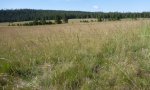
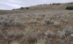

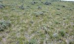
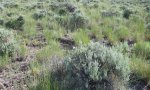
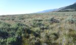
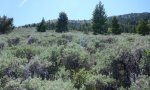
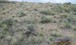
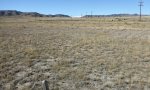
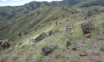
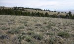
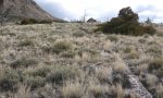
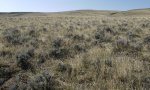
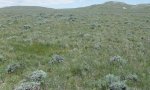
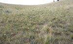
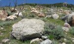
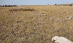
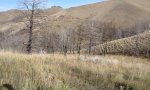
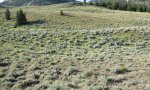
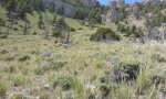
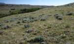
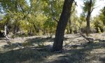
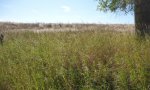
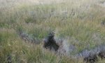
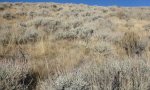
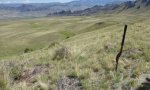
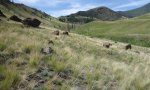
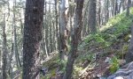
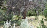
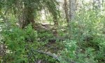
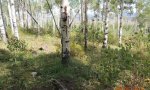
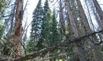

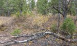
Ecological site map
Basemap
Find me
Find point
Full screen
Zoom in to display soil survey map units for an area of interest, and zoom out to display MLRAs. Select a map unit polygon to view ecological sites correlated to that map unit. View a brief description of an ecological site by clicking on its name in the map popup. Soil survey correlations may not be accurate, and ecological site classification of a location should always be verified in the field. Each selection may require the transfer of several hundred KB of data.
Ecological site keys
-
6. The dense clay site will have a lighter textured cap or “A” horizon with an abrupt clay increase, commonly the clay percent will then decrease as move lower in the profile. The abrupt increase in the upper portion of the profile with significant cracking is the key for this site. Clayey may have a lighter textured cap but typically maintains or increases in clay as move through the profile.
-
7. When calculating percent rock fragments in the profile to determine if a site is skeletal, pararock fragments (parachanners) are not considered, however, channers are. The difference between a parachanner and a channer is how “hard” the rock is. Soft flat fragments (ruptured by hand) are parachanners, while harder flat fragments are channers.
-
1. For areas that receive additional moisture through snow trapping, consider adjusting to a wetter LRU consistent with the vegetation observed for the site keyed. It is anticipated that most snow-trap sites will not have a water table.
-
2. Specific plant species listed in the key are not to be used as the only determining factor. Management or disturbance may have removed or altered the plant composition that could reflect the wrong ecological site.
-
6. The dense clay site will have a lighter textured cap or “A” horizon with an abrupt clay increase, which will then back off or become lighter as move lower in the profile. The abrupt increase in the upper portion of the profile with significant cracking is the key for this site. Clayey may have a lighter textured cap but typically maintains or increases in clay as move through the profile.
-
6 6. The dense clay site will have a lighter textured cap or “A” horizon with an abrupt clay increase, commonly the clay percent will then decrease as move lower in the profile. The abrupt increase in the upper portion of the profile with significant cracking is the key for this site. Clayey may have a lighter textured cap but typically maintains or increases in clay as move through the profile.
-
7 7. When calculating percent rock fragments in the profile to determine if a site is skeletal, pararock fragments (parachanners) are not considered, however, channers are. The difference between a parachanner and a channer is how “hard” the rock is. Soft flat fragments (ruptured by hand) are parachanners, while harder flat fragments are channers.
-
1 1. For areas that receive additional moisture through snow trapping, consider adjusting to a wetter LRU consistent with the vegetation observed for the site keyed. It is anticipated that most snow-trap sites will not have a water table.
-
2 2. Specific plant species listed in the key are not to be used as the only determining factor. Management or disturbance may have removed or altered the plant composition that could reflect the wrong ecological site.
-
3 3. Soils derived from Dolomite or similar geology may not react as “violently” as other calcareous parent materials; dolomite site may be loamy calcareous with only a strong effervescence. Soils with < 18% clays only need a CCE of 5% to be calcic or calcareous, while soils with >18% clays need a CCE of 15%.
-
5 5. Saline, saline sodic, and sodic soils have a pH of 7.9 to 9.0 and an EC (electrical conductivity) > 4 dS/m [dS/m = mmhos/cm]. Salts, including gypsum will lower the pH without affecting the EC. Soils that are sodic generally have a SAR of ≥ 13 typically have a pH of 8.8 or higher.
-
1. For areas that receive additional moisture through snow trapping, consider adjusting to a wetter LRU consistent with the vegetation observed for the site keyed. It is anticipated that most snow-trap sites will not have a water table.
-
2. Specific plant species listed in the key are not to be used as the only determining factor. Management or disturbance may have removed or altered the plant composition that could reflect the wrong ecological site.
-
3. Soils derived from Dolomite or similar geology may not react as “violently” as other calcareous parent materials; dolomite site may be loamy calcareous with only a strong effervescence. Soils with < 18% clays only need a CCE of 5% to be calcic or calcareous, while soils with >18% clays need a CCE of 15%.
-
5. Saline, saline sodic, and sodic soils have a pH of 7.9 to 9.0 and an EC (electrical conductivity) > 4 dS/m [dS/m = mmhos/cm]. Salts, including gypsum will lower the pH without affecting the EC. Soils that are sodic generally have a SAR of ≥ 13 typically have a pH of 8.8 or higher.
-
6. The dense clay site will have a lighter textured cap or “A” horizon with an abrupt clay increase, commonly the clay percent will then decrease as move lower in the profile. The abrupt increase in the upper portion of the profile with significant cracking is the key for this site. Clayey may have a lighter textured cap but typically maintains or increases in clay as move through the profile.
-
7. When calculating percent rock fragments in the profile to determine if a site is skeletal, pararock fragments (parachanners) are not considered, however, channers are. The difference between a parachanner and a channer is how “hard” the rock is. Soft flat fragments (ruptured by hand) are parachanners, while harder flat fragments are channers.
Ecological site photos
Print Options
Sections
Font
Other
Briefcase
Add ecological sites and Major Land Resource Areas to your briefcase by clicking on the briefcase (![]() ) icon wherever it occurs. Drag and drop items to reorder. Cookies are used to store briefcase items between browsing sessions. Because of this, the number of items that can be added to your briefcase is limited, and briefcase items added on one device and browser cannot be accessed from another device or browser. Users who do not wish to place cookies on their devices should not use the briefcase tool. Briefcase cookies serve no other purpose than described here and are deleted whenever browsing history is cleared.
) icon wherever it occurs. Drag and drop items to reorder. Cookies are used to store briefcase items between browsing sessions. Because of this, the number of items that can be added to your briefcase is limited, and briefcase items added on one device and browser cannot be accessed from another device or browser. Users who do not wish to place cookies on their devices should not use the briefcase tool. Briefcase cookies serve no other purpose than described here and are deleted whenever browsing history is cleared.
Ecological sites
Major Land Resource Areas
The Ecosystem Dynamics Interpretive Tool is an information system framework developed by the USDA-ARS Jornada Experimental Range, USDA Natural Resources Conservation Service, and New Mexico State University.