Natural Resources
Conservation Service
Ecological site R047XB312UT
Upland Shallow Clay (pinyon/Utah juniper)
Last updated: 2/06/2025
Accessed: 04/03/2026
General information
Provisional. A provisional ecological site description has undergone quality control and quality assurance review. It contains a working state and transition model and enough information to identify the ecological site.
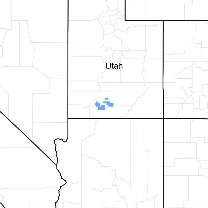
Figure 1. Mapped extent
Areas shown in blue indicate the maximum mapped extent of this ecological site. Other ecological sites likely occur within the highlighted areas. It is also possible for this ecological site to occur outside of highlighted areas if detailed soil survey has not been completed or recently updated.
MLRA notes
Major Land Resource Area (MLRA): 047X–Wasatch and Uinta Mountains
MLRA 47 occurs in Utah (86 percent), Wyoming (8 percent), Colorado (4 percent), and Idaho (2 percent). It encompasses approximately 23,825 square miles (61,740 square kilometers). The northern half of this area is in the Middle Rocky Mountains Province of the Rocky Mountain System. The southern half is in the High Plateaus of the Utah Section of the Colorado Plateaus Province of the Intermontane Plateaus. Parts of the western edge of this MLRA are in the Great Basin Section of the Basin and Range Province of the Intermontane Plateaus. The MLRA includes the Wasatch Mountains, which trend north and south, and the Uinta Mountains, which trend east and west. The steeply sloping, precipitous Wasatch Mountains have narrow crests and deep valleys. Active faulting and erosion are a dominant force in controlling the geomorphology of the area. The Uinta Mountains have a broad, gently arching, elongated shape. Structurally, they consist of a broadly folded anticline that has an erosion-resistant quartzite core. The Wasatch and Uinta Mountains have an elevation of 4,900 to about 13,500 feet (1,495 to 4,115 meters).
The mountains in this area are primarily fault blocks that have been tilted up. Alluvial fans at the base of the mountains are recharge zones for the basin fill aquifers. An ancient shoreline of historic Bonneville Lake is evident on the footslopes along the western edge of the area. Rocks exposed in the mountains are mostly Mesozoic and Paleozoic sediments, but Precambrian rocks are exposed in the Uinta Mountains. The Uinta Mountains are one of the few ranges in the United States that are oriented west to east. The southern Wasatch Mountains consist of Tertiary volcanic rocks occurring as extrusive lava and intrusive crystalline rocks.
The average precipitation is from 8 to 16 inches (203 to 406 mm) in the valleys and can range up to 73 inches (1854 mm) in the mountains. In the northern and western portions of the MLRA, peak precipitation occurs in the winter months. The southern and eastern portions have a greater incidence of high-intensity summer thunderstorms; hence, a significant amount of precipitation occurs during the summer months. The average annual temperature is 30 to 50 degrees Fahrenheit (-1 to 15 C). The freeze-free period averages 140 days and ranges from 60 to 220 days, generally decreasing in length with elevation.
The dominant soil orders in this MLRA are Aridisols, Entisols, Inceptisols, and Mollisols. The lower elevations are dominated by a frigid temperature regime, while the higher elevations experience cryic temperature regimes. Mesic temperature regimes come in on the lower elevations and south facing slopes in the southern portion of this MLRA. The soil moisture regime is typically xeric in the northern part of the MLRA, but grades to ustic in the extreme eastern and southern parts. The mineralogy is generally mixed and the soils are very shallow to very deep, generally well drained, and loamy or loamy-skeletal.
LRU notes
E47B is the Wasatch Mountains South MLRA. It occurs in the Loa, Panguitch, New Harmony area. Most of Zion, Bryce Canyon National Parks and Cedar Breaks National Monument are in this area. This area is composed of mountain ranges that run north and south.
Ecological site concept
The soils of this site formed mostly from residuum and colluvium derived mainly from shale. Rock fragments may be present on the soil surface and throughout the profile, but make up less than 35 percent of the soil volume. These soils are shallow, well-drained, and have a moderate to impermeable permeability. pH is moderately alkaline. Available water-holding capacity ranges from 3.2 to 3.6 inches of water in the upper 20 inches of soil. The soil moisture regime is mostly ustic and the soil temperature regime is frigid. Precipitation ranges from 12 to 16 inches annually.
Associated sites
| R047XB309UT |
Upland Loam (black sagebrush) |
|---|---|
| R047XB326UT |
Upland Shallow Loam (pinyon/Utah juniper) |
| R047XB333UT |
Upland Stony Loam (pinyon/Utah juniper) |
| R047XB303UT |
Upland Clay (pinyon/Utah juniper) |
Similar sites
| R047XB318UT |
Upland Shallow Hardpan (pinyon/Utah juniper) |
|---|---|
| R047XB303UT |
Upland Clay (pinyon/Utah juniper) |
Table 1. Dominant plant species
| Tree |
(1) Pinus edulis |
|---|---|
| Shrub |
(1) Artemisia nova |
| Herbaceous |
Not specified |
Physiographic features
This site occurs on mountain slopes, and is at risk of soil erosion due to steepness. Slopes range from 15 to 60 percent. Runoff class is high to very high.
Table 2. Representative physiographic features
| Landforms |
(1)
Mountain slope
|
|---|---|
| Runoff class | High to very high |
| Flooding frequency | None |
| Ponding frequency | None |
| Elevation | 6,500 – 8,500 ft |
| Slope | 15 – 60% |
| Aspect | Aspect is not a significant factor |
Climatic features
The climate is characterized by cold, snory winters and cool, moist summers. Approximately 50 percent of the moisture comes during the plant growth period from April 1 through September 30. On the average April, May, and June are the driest months and July, August, and September are the wettest months.
Table 3. Representative climatic features
| Frost-free period (characteristic range) | |
|---|---|
| Freeze-free period (characteristic range) | 70-100 days |
| Precipitation total (characteristic range) | 12-16 in |
Influencing water features
This site is not influenced by water from a wetland or stream.
Wetland description
N/A
Soil features
The soils of this site formed mostly from residuum and colluvium derived mainly from shale. Rock fragments may be present on the soil surface and throughout the profile, but make up less than 35 percent of the soil volume. These soils are shallow, well-drained, and have a moderate to impermeable permeability. pH is moderately alkaline. Available water-holding capacity ranges from 3.2 to 3.6 inches of water in the upper 20 inches of soil. The soil moisture regime is mostly ustic and the soil temperature regime is frigid. Precipitation ranges from 12 to 16 inches annually.
Modal Soil: Ruko CL - Clayey, smectitic, frigid, shallow Aridic Haplustepts
Table 4. Representative soil features
| Parent material |
(1)
Colluvium
–
shale
(2) Residuum – shale |
|---|---|
| Surface texture |
(1) Clay loam (2) Channery loam |
| Drainage class | Well drained |
| Permeability class | Moderate to very slow |
| Depth to restrictive layer | 10 – 20 in |
| Soil depth | 10 – 20 in |
| Surface fragment cover <=3" | 5% |
| Surface fragment cover >3" | 2% |
| Available water capacity (10-20in) |
3.2 – 3.6 in |
| Calcium carbonate equivalent (10-20in) |
15 – 30% |
| Electrical conductivity (10-20in) |
2 mmhos/cm |
| Sodium adsorption ratio (10-20in) |
Not specified |
| Soil reaction (1:1 water) (10-20in) |
7.9 – 8.4 |
| Subsurface fragment volume <=3" (10-20in) |
Not specified |
| Subsurface fragment volume >3" (10-20in) |
Not specified |
Ecological dynamics
As ecological condition deteriorates due to anthropogenic disturbances or the alteration of the natural disturbance regime, native perennial bunchgrasses decrease while pinyon and juniper increase. When the potential natural plant community is burned and drought conditions persist, pinyon and juniper decrease while native perennial bunchgrasses increase.
State 1: Reference State
This state represents the natural variability and dynamics of this site that occurred naturally. This state includes the dominant biotic communities that would have occurred on this ecological site prior to European Settlement. The dominant aspect of this site is Pinyon and Utah Juniper with an understory of shrubs and associated grasses. Fluctuations in species compositions and relative production may change from year to year dependent upon abnormal precipitation or other climatic factors.
The primary disturbance mechanisms for this site in reference condition include drought, insects, and infrequent fire. Because catastrophic disturbances like a crown fire or drought happen with long intervals, these communities have long periods of succession, (i.e. long periods of dense Pinyon and Juniper)—300 to 600 years in upland and foothills ecological site zones and 300 to 1,000 in semi-desert ecological site zone. Typically, fires occurred in late spring through mid-summer following several wet years that allowed the fine fuels to become more contiguous. The higher in elevation and higher precipitation area would burn more frequently as they would have more fine fuels in the understory. The timing of drought, and fire, coupled with surface disturbance can dictate whether the community can stay within the reference state or if the community transitions into another state.
When this site is at or near it's potential, pinyon pine and Utah juniper dominate the site and make up over 80 percent of the plant community. Understory production is very limited and provides marginal amounts of forage for livestock and or wildlife. It does provide good escape cover and thermal cover for deer. When the tree canopy cover exceeds 30 percent, diversity, both plant and animal drops to its lowest level.
Community Phase 1.1: Pinyon-Juniper Woodland
A well-developed understory with a canopy of younger pinyon and Utah juniper. At this stage Utah juniper may be dominant over pinyon. Pinyon trees are more susceptible to drought, insects, and disease than Utah juniper trees. In fact, it is difficult to identify methods beside fire that naturally reduce Utah juniper. After long periods of drought weaken the pinyon trees, beetle kills can become quite extensive, especially after the droughts. Drought periods can also weaken and reduce the understory. Plant establishment is mainly limited by the available moisture. Biological crusts can be highly developed and diversified in the large interspaces between trees.
When the tree canopy ranges from 15 to 30 percent, a wide variety of grasses, forbs, and shrubs will also be present in addition to the pinyon pine and Utah juniper. During this tree canopy stage, diversity of plant and animal species will reach its peak.
Community Phase Pathway 1.1A
This pathway occurs when events create a wetter climate cycle, favor pinyon and perennial bunch grass establishment. Following several favorable precipitation years and lack of surface disturbances, native perennial plants will reestablish.
Community Phase Pathway 1.1B
This pathway is very unlikely but can occur when a fire is able to move through the community. Two situations can make this occur: 1) a fire can carry in the understory after several wet years allow fine fuels to accumulate, or 2) as the woodland approaches the later stages of development where canopies become dense and crown sizes have increased, and thus community phase becomes susceptible to crown fires.
Community Phase 1.2: Mature Pinyon-Juniper Woodland
Mature pinyon and Utah juniper woodland characterized this community phase. When weather patterns favor an increase of pinyon and Utah juniper canopy with the associated understory of shrubs, grasses and forbs. Depending on the timing of precipitation, cool season grasses, like Indian ricegrass or warm season grasses like blue grama could be dominant. Interspaces supporting highly developed biological crusts are common.
Community Phase Pathway 1.2A
This pathway occurs during and after events such as drought or insect or pathogen outbreaks. Droughts and insects can kill the trees, increasing nutrient availability in the system. Due to the natural conditions of drought, grasses typically do not take up the extra nutrients in the long term. In the short term, grasses and forbs may increase for a few years until juniper and pinyon recover.
Community Phase Pathway 1.2B
This pathway is very unlikely but can occur when a fire is able to move through the community phase. Two situations can make this occur: 1) a fire can carry in the understory after several wet years allow fine fuels to accumulate, or 2) as the woodland approaches the later stages of development where canopies become dense and crown sizes have increased, and thus community phase becomes susceptible to crown fires.
Community Phase 1.3: Perennial Grassland/Shrubland with scattered PJ
The overall aspect of this community phase is grasses and shrubs with scattered pinyon and Utah juniper. The herbaceous understory has a mix of grasses and forbs. This community phase is a result of a crown fire or sufficiently large and hot ground fire that will kill many of the trees, combined with sufficient seed-banks and moisture for reestablishment of grasses and forbs. It is common that after a crown fire many patches of trees will remain unburned, because of fire’s unpredictability and broken topography. This leaves a seed bank for the burned areas. This community phase is very short lived in comparison to the other community phases in this state.
When the tree canopy ranges from 0 - 15 percent; grasses, forbs, and shrubs will produce approximately 80 to 90 percent of the total production. When the tree canopy level is reduced by fire, chaining and/or application of herbicides, forage production will be at its highest level for big game animals as well as domestic livestock.
Community Phase Pathway 1.3A
This pathway occurs when the climate favors the establishment and growth of trees. More energy is taken-up and stored in the trees as the length between fires and droughts increase. In addition, when shrubs establish on the site they can provide safe-sites for tree establishment furthering the presence of trees.
Transition T1A
This transition from the native perennial bunchgrass and shrub understory in the reference state to a state that has been invaded by naturalized species such as crested wheatgrass (blown in or seeded), cheatgrass, annual wheatgrass and other introduced or exotic plants. This transition occurs as natural and/or management actions favor an increase in non-native grasses and forbs, especially annuals. Possible events include the presence of invasive species, improper livestock grazing, extended droughts, and fire combined with an available seed source of non-native species.
State 2: Current Potential State
This state is very similar to the reference state, except that non-native grasses and/or forbs are now present in all community phases. The current potential state may include introduced (seeded) or invasive nonnative species. The invasive plants are present in sparse amounts in this state. Natural disturbance are still drought, insects, and infrequent fires still influence the community shifts. The human caused disturbance drivers (i.e. domestic livestock grazing, vegetation manipulation, and recreational activities (i.e. OHV use)) are now present. This shift in species composition could affect nutrient cycling, hydrology and soil stability. At this time there is no known way to effectively remove the non-native plants from the site once they have become established. State 2 is in jeopardy of moving to State 3 (Pinyon-Juniper Invasive State) when remaining native understory plants are stressed and invasive species have increased till they are dominant.
Community Phase 2.1: Pinyon-Juniper Woodland
A well-developed understory with a canopy of younger Pinyon and Utah juniper. At this stage Utah juniper may be dominant over Pinyon. Pinyon trees are more susceptible to drought, insects, and disease than Utah Juniper trees. In fact, it is difficult to identify methods beside fire that naturally reduce Utah juniper. After long periods of drought weaken the Pinyon trees, beetle kills can become quite extensive, especially after the droughts. Drought periods can also weaken and reduce the understory. Plant establishment is mainly limited by the available moisture. Biological crusts can be highly developed and diversified in the large interspaces between trees. Sparse invasive introduced plants species would be present in this phase.
Community Phase Pathway 2.1A
This pathway occurs when events create a wetter climate cycle, favor Pinyon and perennial bunchgrass establishment. Following several favorable precipitation years and lack of surface disturbances, native perennial bunch grasses and forbs will reestablish.
Community Phase Pathway 2.1B
This pathway is very unlikely but can occur when a fire or vegetation manipulation happens to the trees. Two situations can make this occur: 1) a fire can carry in the understory after several wet years allow fine fuels to accumulate, or 2) as the woodland approaches the later stages of development where canopies become dense and crown sizes have increased, and thus community phase becomes susceptible to crown fires. Seeding after the tree removal may be necessary to help facilitate the return of understory species. Seeding depending on the species may take this community phase into state 4 (Seeded State).
Community Phase 2.2: Mature Pinyon-Juniper Woodland
Mature pinyon and Utah juniper woodland with a well-developed understory would characterized this community phase. This phase supports a diverse understory of grasses, forbs and shrubs. Depending on the timing of precipitation, cool season grasses, like Indian ricegrass or warm season grasses like blue grama could be dominant. Interspaces supporting highly developed biological crusts are common. Sparse invasive introduced plants species would be present in this phase.
Community Phase Pathway 2.2A
This pathway occurs during and after events such as drought or beetle infestations. Droughts and insects can kill pinyon trees, increasing nutrient availability in the system. Due to the natural conditions of drought, grasses typically do not take up the extra nutrients in the long term. In the short term, grasses and forbs may increase for a few years until Juniper recover. Utah Juniper are more able to compete for these nutrients and became the dominant overstory tree over time.
Community Phase Pathway 2.2B
This pathway is very unlikely to occur naturally with fire. But, vegetation manipulation can be used to remove trees. Two situations occur naturally: 1) a fire can carry in the understory after several wet years allow fine fuels to accumulate, or 2) as the woodland approaches the later stages of development where canopies become dense and crown sizes have increased, and thus community phase becomes susceptible to crown fires. Seeding after the tree removal may be necessary to help facilitate the return of understory species. Seeding depending on the species may take this community phase into state 4 (Seeded State).
Community Phase 2.3: Perennial Grassland/Shrubland with scattered PJ
The overall aspect of this community phase is grassland with scattered pinyon and Utah juniper. The herbaceous understory has a mix of grasses and forbs. This community phase is a result of a crown fire or sufficiently large and hot ground fire that will kill many of the trees, combined with sufficient seed-banks and moisture for reestablishment of grasses and forbs. It is common that after a crown fire many patches of trees will remain unburned, because of fire’s unpredictability and broken topography. This leaves a seed bank for the burned areas. This community phase is very short lived in comparison to the other community phases in this state. Sparse invasive introduced plants species would be present in this phase.
Community Phase Pathway 2.3A
This pathway occurs when the climate favors the establishment and growth of trees. More energy is taken-up and stored in the trees as the length between fires and droughts increase. In addition, when shrubs establish on the site they can provide safe-sites for tree establishment furthering the presence of trees.
Transition T2A
When this transition to state 3 occurs the site has lost much of its expected resistance and resilience. At this point natural and management actions have decreased the understory to a point where erosion increases. Reduced influence from fire, insects, and drought could cause the tree canopy to close, effectively reducing the herbaceous understory thus facilitating the transition. Improper grazing and or increase surface disturbance combined with periods of drought can facilitate this transition because soil stability is lost and susceptibility to soil loss increases.
Transition T2B
This transition is from tree canopy reduction and re-establishment of grasses and forbs. If the community is approaching state 3 (pinyon juniper invasive state), due to a loss of understory and increase invasive plants this pathway of seeding could be preferable to doing nothing. This pathway may facilitate the recovery of the soils. The infrequent naturally occurring fires could also cause this transition. Reseeding after a fire may be the only way to successfully restore the ecological dynamics to a site. Either way this pathway involves large energy and monetary inputs by man.
State 3: Pinyon-Juniper Invasive State
This state occurs when there is an absence of natural disturbance (i.e. Insects and drought and/or fire) over long time frames. Also, management actions could have allowed trees to become very mature and have effectively closed out the understory. Invasive plants have increased in abundance. This state has the lowest resiliency and resistance of any state in this model. There may be no practicable way back to the Current Potential State (State 2), due to the large amounts of energy and monetary inputs that are needed. Seeding, with either natural disturbance and/or vegetation management to transition it to State 3 (Seeded State) may be the best long term option for this site.
Community Phase 3.1: PJ Woodland with Invasive Plants
A lack of understory with a canopy of older Pinyon and Juniper, where plant interspaces very large and connected. This community phase occurs when natural or management actions allow for the increase in Pinyon and Utah juniper and a decrease in the grass and forb understory. Invasive introduced plants species would be present in this phase and are increasing.
Community Phase Pathway 3.1A
This pathway occurs when events such as frequent fire or drought remove the trees and shrubs, and facilitate the continued establishment of cheatgrass or other invasive annuals. Cheatgrass will typically invade or increase in tree and shrub interspaces when pinyon and juniper communities are degraded. Once the cheatgrass establishes the amount and continuity of fine fuels increases. This can reduce the fire return interval and shorten the time between fires. When fire eliminates the tree, shrub, and native grass component, it completes the conversion to annual dominant community phase. Cheatgrass and other invasive annuals can persist for long periods of time. Once a fire or a drought removes the trees and shrubs, it is difficult to re-establish because, not only has the fire return interval been shortened to a time that will not allow seedling establish, the soil and other abiotic factors have been altered.
Community Phase 3.2: Invasive Annuals
This state is characterized by annual grasses like cheatgrass, annual wheatgrass dominating the understory. Also, invasive forbs like storkbill, halogeton and others may be present. This community phase has active erosion under the pinyon and Utah juniper canopy. Utah Juniper has allelopathic effects on some plant (i.e. Sandberg bluegrass, blue grama).
Community Phase Pathway 3.2A
This pathway is when there is a lack of fire and disturbance. The fire return interval lengthens. This could be done by having firebreaks or fire suppression which will allow the perennial species a chance to establish with natural processes or with vegetation manipulation.
Transition T3A
Vegetation treatment can transition it to a seeded state. Because of the soils (shallow and rocky) and the unpredictable precipitation, this pathway should be used cautiously. This pathway involves large energy and monetary inputs by man.
State 4: Seeded State
This state is a result seeding plants species. Vegetation manipulation may or may not have been done depending on disturbance history of the location. The trees were removed and adapted grasses, forbs and shrubs are established. Plants can be native or introduced depending on the desired management goals. If grazing tolerant species were established these communities can better withstand grazing and other disturbances. Due to the shallow or rocky soils and unpredictable precipitations patterns, it is difficult to establish grasses from seed, so this state may be hard to achieve and require large energy inputs.
Community Phase 4.1: Seeded Grassland/Shrubland
This community phase appears as a grassland with scattered shrubs and trees. The vegetative production is typically higher than in the current potential state, depending on grass species seeded; however the grass is still sparse due to the low water holding capacity of soils associated with pinyon and juniper.
Community Phase Pathway 4.1A
This pathway occurs when events favor the establishment of shrubs and trees, including long periods without disturbances.
Community Phase 4.2: Seeded with Pinyon and Juniper
This community phase has a dense understory of introduced grasses and forbs, but a canopy of pinyon and Utah juniper are establishing. Native perennial grasses, forbs, and shrubs may also be starting to establish. Interspaces are filled with biological crusts and herbaceous plants.
Community Phase Pathway 4.2A
This pathway occurs as trees and shrubs are removed from the community, either naturally through insect herbivory or through vegetation manipulation by man.
Transition T4A
This transition occurs when events favor the establishment and dominance of invasive annuals. Events may include an extended drought, surface disturbance such as off road vehicle use, and a shortened fire return interval, all of which can stress the native perennial bunchgrasses.
State and transition model

Figure 2. STM

Figure 3. Legend
More interactive model formats are also available.
View Interactive Models
More interactive model formats are also available.
View Interactive Models
Click on state and transition labels to scroll to the respective text
Ecosystem states
State 1 submodel, plant communities
State 1
Reference State
Community 1.1
Reference Plant Community
The general view of this site is pinyon and juniper. The composition by air-dry weight is approximately 25 percent perennial grasses, 10 percent forbs, 45 percent shrubs and 20 percent trees.
Figure 4. Annual production by plant type (representative values) or group (midpoint values)
Table 5. Annual production by plant type
| Plant type | Low (lb/acre) |
Representative value (lb/acre) |
High (lb/acre) |
|---|---|---|---|
| Shrub/Vine | 67 | 157 | 270 |
| Grass/Grasslike | 38 | 88 | 150 |
| Tree | 30 | 70 | 120 |
| Forb | 15 | 35 | 60 |
| Total | 150 | 350 | 600 |
Table 6. Canopy structure (% cover)
| Height Above Ground (ft) | Tree | Shrub/Vine | Grass/ Grasslike |
Forb |
|---|---|---|---|---|
| <0.5 | – | – | – | – |
| >0.5 <= 1 | – | – | – | 4-6% |
| >1 <= 2 | – | – | 19-21% | – |
| >2 <= 4.5 | – | 19-21% | – | – |
| >4.5 <= 13 | 29-31% | – | – | – |
| >13 <= 40 | – | – | – | – |
| >40 <= 80 | – | – | – | – |
| >80 <= 120 | – | – | – | – |
| >120 | – | – | – | – |
Additional community tables
Table 7. Community 1.1 plant community composition
| Group | Common name | Symbol | Scientific name | Annual production (lb/acre) | Foliar cover (%) | |
|---|---|---|---|---|---|---|
|
Tree
|
||||||
| 1 | Dominant Trees | 60–80 | ||||
| twoneedle pinyon | PIED | Pinus edulis | 48–60 | – | ||
| Utah juniper | JUOS | Juniperus osteosperma | 12–20 | – | ||
| Rocky Mountain juniper | JUSC2 | Juniperus scopulorum | 0 | – | ||
|
Shrub/Vine
|
||||||
| 2 | Dominant Shrubs | 120–240 | ||||
| black sagebrush | ARNO4 | Artemisia nova | 40–80 | – | ||
| antelope bitterbrush | PUTR2 | Purshia tridentata | 40–80 | – | ||
| roundleaf buffaloberry | SHRO | Shepherdia rotundifolia | 20–40 | – | ||
| alderleaf mountain mahogany | CEMO2 | Cercocarpus montanus | 20–40 | – | ||
| 3 | Sub-Dominant Shrubs | 23–104 | ||||
| Shrub (>.5m) | 2SHRUB | Shrub (>.5m) | 12–20 | – | ||
| Utah serviceberry | AMUT | Amelanchier utahensis | 0–12 | – | ||
| Bigelow sage | ARBI3 | Artemisia bigelovii | 0–12 | – | ||
| Wyoming big sagebrush | ARTRW8 | Artemisia tridentata ssp. wyomingensis | 0–12 | – | ||
| yellow rabbitbrush | CHVI8 | Chrysothamnus viscidiflorus | 0–12 | – | ||
| mormon tea | EPVI | Ephedra viridis | 0–12 | – | ||
| broom snakeweed | GUSA2 | Gutierrezia sarothrae | 0–12 | – | ||
| Mexican cliffrose | PUME | Purshia mexicana | 0–12 | – | ||
|
Grass/Grasslike
|
||||||
| 3 | Dominant Grasses | 72–120 | ||||
| Indian ricegrass | ACHY | Achnatherum hymenoides | 40–60 | – | ||
| squirreltail | ELEL5 | Elymus elymoides | 20–40 | – | ||
| western wheatgrass | PASM | Pascopyrum smithii | 12–20 | – | ||
| 1 | SUb-Dominant Grasses | 24–88 | ||||
| Grass, annual | 2GA | Grass, annual | 12–20 | – | ||
| Grass, perennial | 2GP | Grass, perennial | 12–20 | – | ||
| blue grama | BOGR2 | Bouteloua gracilis | 0–12 | – | ||
| prairie Junegrass | KOMA | Koeleria macrantha | 0–12 | – | ||
| saline wildrye | LESAS | Leymus salinus ssp. salinus | 0–12 | – | ||
| bluebunch wheatgrass | PSSP6 | Pseudoroegneria spicata | 0–12 | – | ||
|
Forb
|
||||||
| 4 | Dominant Forbs | 8–32 | ||||
| King's bird's-beak | COKI | Cordylanthus kingii | 4–16 | – | ||
| rock goldenrod | PEPU7 | Petradoria pumila | 4–16 | – | ||
| 2 | Sub-Dominant Forbs | 8–40 | ||||
| Forb, annual | 2FA | Forb, annual | 4–12 | – | ||
| Forb, perennial | 2FP | Forb, perennial | 4–12 | – | ||
| James' cryptantha | CRCI3 | Cryptantha cinerea | 0–4 | – | ||
| slender buckwheat | ERMI4 | Eriogonum microthecum | 0–4 | – | ||
| mid bladderpod | LEIN3 | Lesquerella intermedia | 0–4 | – | ||
| Pacific aster | SYCHC | Symphyotrichum chilense var. chilense | 0–4 | – | ||
Interpretations
Animal community
Fair – poor summer grazing for livestock.
Tree cover – fair forage.
Mule deer
Hydrological functions
The soils in this site are in the D hydrologic group
Recreational uses
This site has only fair aesthetic appearances
Wood products
None
Supporting information
Inventory data references
Information presented here has been derived from NRCS clipping data and other inventory data. Field observations from range trained personnel were also used.
Other references
Alexander, R. R. 1985. Major habitat types, community types, and plant communities in the Rocky Mountains. USDA- Forest Service Rocky Mountain Forest and Range Experiment Station. General technical report RM-123. 105p.
Alexander 1988. Forest vegetation on National Forests in the Rocky Mountain and Intermountain Regions: Habitat types and community types. USDA- Forest Service Rocky Mountain Forest and Range Experiment Station. General technical report RM-162. 47p.
Galatowitsch, S.M. 1990. Using the original land survey notes to reconstruct pre-settlement landscapes in the American West. Great Basin Naturalist: 50(2): 181-191. Keywords: [Western U.S., conservation, history, human impact]
Parson, R. E. 1996. A History of Rich County. Utah State Historical Society, County Commission, Rich County, Utah. Keywords: [Rich County, Utah, Historic land use, European settlements]
USDA-NRCS. 2003. National Range and Pasture Handbook. in USDA, editor, USDA-Natural Resources Conservation Service-Grazing Lands Technology Institute. Keywords: [Western US, Federal guidelines, Range pasture management]
Western Regional Climate Center, Western U.S. Climate Historical Summaries. Available at: http://www.wrcc.dri.edu/summary/Climsmut.html. Accessed 15 June 2009.
Web Soil Survey, Official Soil Series Descriptions. Available at: http://soils.usda.gov/technical/classification/osd/index.html. Accessed 15 June 2009.
Contributors
Tom Simper
Approval
Kendra Moseley, 2/06/2025
Rangeland health reference sheet
Interpreting Indicators of Rangeland Health is a qualitative assessment protocol used to determine ecosystem condition based on benchmark characteristics described in the Reference Sheet. A suite of 17 (or more) indicators are typically considered in an assessment. The ecological site(s) representative of an assessment location must be known prior to applying the protocol and must be verified based on soils and climate. Current plant community cannot be used to identify the ecological site.
| Author(s)/participant(s) | V. Keith Wadman (NRCS Retired). |
|---|---|
| Contact for lead author | shane.green@ut.usda.gov |
| Date | 12/03/2012 |
| Approved by | Kendra Moseley |
| Approval date | |
| Composition (Indicators 10 and 12) based on | Annual Production |
Indicators
-
Number and extent of rills:
Very Few. A few rills may be present on site with some increase on steeper slopes (> 10%) or on areas located below exposed bedrock, or other water shedding areas where increased runoff may occur. Rills should be < 1 inches deep, fairly short (10-12) feet) and somewhat widely spaced (8-10 feet). On steeper slopes, rills will be 12 to 15+ feet long and spaced 6 to 8 feet apart. More active rill development may be observed following major thunderstorm or spring runoff events but should heal during the next growing season. -
Presence of water flow patterns:
Few. A few sinuous flow patterns wind around perennial plants and surface rock. Evidence of flow patterns is expected to increase somewhat with slopes greater than 15%. Water flow patterns are long (15-20 feet), narrow (< 1 foot wide), and spaced widely (10-20 yards) on gentle slopes (<15%) and more closely (<10 yards) on steeper slopes (>15%). -
Number and height of erosional pedestals or terracettes:
Small pedestals may form at the base of plants that occur on the edge of water flow patterns, but should not show any exposed roots. Terracettes are fairly common, forming behind debris dams of small to medium sized litter (up to 2 inches in diameter) in water flow patterns. These debris dams may accumulate smaller litter (leaves, grass and forb stems) and sediment. -
Bare ground from Ecological Site Description or other studies (rock, litter, lichen, moss, plant canopy are not bare ground):
35–40%. (Soil surface is typically covered by up to 10% surface coarse fragments). Most bare ground is associated with water flow patterns, rills, and gullies. Poorly developed biological soil crusts that are interpreted as functioning as bare ground should be recorded as bare ground. Bare ground spaces should not be greater than 2 to 3 feet and should mostly not be connected. -
Number of gullies and erosion associated with gullies:
None on slopes < 15%. Rare on steeper slopes and on areas below exposed bedrock. There they do occur, their length often extends from the exposed bedrock to where the gully reaches a stream or other area where water and sediment accumulate. Gullies may show slightly more indication of erosion as slope increases, or as the site occurs adjacent to steep sites/watershed with concentrated flow patterns. -
Extent of wind scoured, blowouts and/or depositional areas:
None. Trees break the wind and reduce the potential for wind erosion. The sites clay loam texture as well as any coarse fragments on its surface help armor it and reduce the potential for wind erosion. -
Amount of litter movement (describe size and distance expected to travel):
Most litter resides in place with some redistribution caused by water movement. Minor litter removal may occur in flow channels with deposition occurring within 1 to 2 feet at points of obstruction. The majority of litter accumulates at the base of plants. Some grass leaves and small twigs (grass stems) may accumulate in soil depressions adjacent to plants. Woody stems are not likely to move. However, some litter movement is expected (up to 4 feet) with increases in slopes > 15% and/or increased runoff resulting from heavy thunderstorms. -
Soil surface (top few mm) resistance to erosion (stability values are averages - most sites will show a range of values):
This site should have an erosion rating of 5 or 6 under the plant canopies, and a rating of 4 to 5 in the interspaces. The average should be a 5. Vegetation cover, litter, biological soil crusts and surface rock reduce erosion. -
Soil surface structure and SOM content (include type of structure and A-horizon color and thickness):
(Ruko) Soil surface horizon is typically 0 to 4 inches deep. Texture is a clay loam, structure is typically moderate fine granular. Color is a pale brown (10YR 6/3). Texture changes to clay at a depth of 4 inches. An ochric epipedon extends 4 inches into the soil profile. Use the specific information for the soil you are assessing found in the published soil survey to supplement this description. -
Effect of community phase composition (relative proportion of different functional groups) and spatial distribution on infiltration and runoff:
Spatial distribution of well developed biological soil crusts (where present) intercept raindrops, reducing splash erosion, and provide areas of surface detention to store water allowing additional time for infiltration. Crowns of trees and accumulating litter at base of trees appear to create a micro-topography that may enhance development of water flow patterns below the drip line of the canopy. On community phases within the reference state where pinyon-juniper canopy increases, understory vegetation may be reduced causing an associated increase in runoff. -
Presence and thickness of compaction layer (usually none; describe soil profile features which may be mistaken for compaction on this site):
None. Weathered shale bedrock occurs a 19 inches. -
Functional/Structural Groups (list in order of descending dominance by above-ground annual-production or live foliar cover using symbols: >>, >, = to indicate much greater than, greater than, and equal to):
Dominant:
Trees (two-needle pinyon/Utah juniper) > = Non-Sprouting shrubs (black sagebrush, bitterbrush)> = Perennial bunchgrasses (Indian ricegrass, bottlebrush squirreltail)Sub-dominant:
Sprouting shrubs (alderleaf mountain mahogany, green rabbitbrush) > Warm season grasses (blue grama) > Forbs (slender wild buckwheat) > Biological soil crusts.Other:
Functional/structural groups may appropriately contain non-native species if their ecological function is the same as the native species in the reference state. Biological soil crust is variable in its expression where present on this site and is measured as a component of ground cover. Forbs can be expected to vary widely in their expression in the plant community based upon departures from average growing conditions.Additional:
Factors contributing to temporal variability include insects and other pathogens (mistletoe), drought, extreme precipitation events, etc. Factors contributing to spatial variability include slope, amount of rock fragments, aspect, etc. Following recent natural disturbances such as fire, drought or insects that may remove the woody vegetation, forbs and perennial grasses (herbaceous species) may become more dominate in the community. These conditions may reflect a functional community phase within the reference state. -
Amount of plant mortality and decadence (include which functional groups are expected to show mortality or decadence):
During years with average to above-average precipitation, there should be very little recent mortality or decadence apparent in trees, shrubs, or grasses. During severe (multi-year) drought up to 20% of the pinyons and junipers may die, either from drought, insect damage or pathogens such as mistletoe. There may be partial mortality on individual bunchgrasses and shrubs during drought periods, and complete mortality of individual plants during severe drought periods, particularly on the shallower and coarser soils associated with this site. Because woody stems may persist for many years, both pinyons and junipers (especially older trees) will normally have dead stems within the plant canopy. -
Average percent litter cover (%) and depth ( in):
Litter cover (including under plants) nearly all of which should be fine litter. Depth should be a 1 to 2 leaf thickness in the interspaces, up to 1/2” under shrub canopies, and up to 1” under tree canopies. Litter cover may increase to 30% on some years due to increased production of plants. -
Expected annual annual-production (this is TOTAL above-ground annual-production, not just forage annual-production):
Annual production in air-dry herbage should be approximately 300 - 400#/acre on an average year, but could range from 100 to 650#/acre during periods of prolonged drought or above average precipitation.
-
Potential invasive (including noxious) species (native and non-native). List species which BOTH characterize degraded states and have the potential to become a dominant or co-dominant species on the ecological site if their future establishment and growth is not actively controlled by management interventions. Species that become dominant for only one to several years (e.g., short-term response to drought or wildfire) are not invasive plants. Note that unlike other indicators, we are describing what is NOT expected in the reference state for the ecological site:
Few invasive species are capable of dominating this site. When invasion does occur, annual bromes such as cheatgrass, and various non-native annual forbs including alyssum and mustard species are the most likely to invade. -
Perennial plant reproductive capability:
All perennial plants should have the ability to reproduce in all years, except in extreme drought years. There are no restrictions on either seed or vegetative reproduction. Some seedling recruitment of major species should be present during average and above average growing years.
Print Options
Sections
Font
Other
The Ecosystem Dynamics Interpretive Tool is an information system framework developed by the USDA-ARS Jornada Experimental Range, USDA Natural Resources Conservation Service, and New Mexico State University.
Click on box and path labels to scroll to the respective text.