Major Land Resource Area 047X
Wasatch and Uinta Mountains
Accessed: 04/03/2026
Description
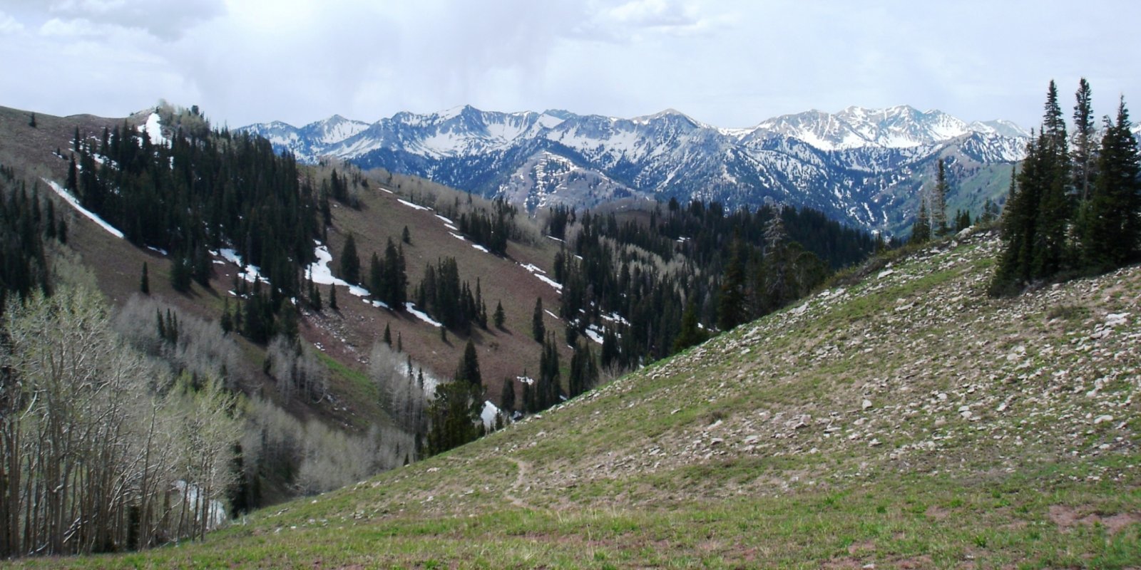
MLRA 47 occurs in Utah (86 percent), Wyoming (8 percent), Colorado (4 percent), and Idaho (2 percent). It encompasses approximately 23,825 square miles (61,740 square kilometers). The northern half of this area is in the Middle Rocky Mountains Province of the Rocky Mountain System. The southern half is in the High Plateaus of the Utah Section of the Colorado Plateaus Province of the Intermontane Plateaus. Parts of the western edge of this MLRA are in the Great Basin Section of the Basin and Range Province of the Intermontane Plateaus. The MLRA includes the Wasatch Mountains, which trend north and south, and the Unita Mountains, which trend east and west. The steeply sloping, precipitous Wasatch Mountains have narrow crests and deep valleys. Active faulting and erosion are a dominant force in controlling the geomorphology of the area. The Uinta Mountains have a broad, gently arching, elongated shape. Structurally, they consist of a broadly folded anticline that has an erosion-resistant quartzite core. The Wasatch and Uinta Mountains have an elevation of 4,900 to about 13,500 feet (1,495 to 4,115 meters). The mountains in this area are primarily fault blocks that have been tilted up. Alluvial fans at the base of the mountains are recharge zones for the basin fill aquifers. An ancient shoreline of historic Bonneville Lake is evident on the footslopes along the western edge of the area. Rocks exposed in the mountains are mostly Mesozoic and Paleozoic sediments, but Precambrian rocks are exposed in the Uinta Mountains. The Uinta Mountains are one of the few ranges in the United States that are oriented west to east. The southern Wasatch Mountains consist of Tertiary volcanic rocks occurring as extrusive lava and intrusive crystalline rocks. The average precipitation is from 8 to 16 inches (203 to 406 mm) in the valleys and can range up to 73 inches (1854 mm) in the mountains. In the northern and western portions of the MLRA, peak precipitation occurs in the winter months. The southern and eastern portions have a greater incidence of high-intensity summer thunderstorms; hence, a significant amount of precipitation occurs during the summer months. The average annual temperature is 30 to 50 degrees F (-1 to 15 C). The freeze-free period averages 140 days and ranges from 60 to 220 days, generally decreasing in length with elevation. The dominant soil orders in this MLRA are Aridisols, Entisols, Inceptisols, and Mollisols. The lower elevations are dominated by a frigid temperature regime, while the higher elevations experience cryic temperature regimes. Mesic temperature regimes come in on the lower elevations and south facing slopes in the southern portion of this MLRA. The soil moisture regime is typically xeric in the northern part of the MLRA, but grades to ustic in the extreme eastern and southern parts. The minerology is generally mixed and the soils are very shallow to very deep, generally well drained, and loamy or loamy –skeletal.
Key publications
Next steps
-
1
Select an ecological site
Select an ecological site using the list, keys, photos, briefcase, or quick search option located on this page. -
2
Explore the ecological site description
Next, learn more about the selected ecological site and its characteristic dynamics by browsing the ecological site description and exploring alternative state and transition model formats.
Ecological site list
-
i
Key Characteristics
- Site receives no extra water beyond normal precipitation.
- Less than 35" precipitation.
- 22-40" annual precipitation.
- High mountain ecological zone.
- Slope is generally under 30%.
- Restrictive layer present within 60".
- Surface soil texture not as above.
- Surface gravels less than 9% by volume.
- Slope between 5-10%, rock fragments generally larger than 3". F047XA508UT
-
i
Key Characteristics
- Site receives no extra water beyond normal precipitation.
- Less than 35" precipitation.
- 22-40" annual precipitation.
- High mountain ecological zone.
- Slope is generally over 30%.
- Restrictive layer present between 10-60".
- Surface soil texture silt loam (may have rock fragments).
- Dominant tree is Douglas fir.
-
i
Key Characteristics
- Site receives no extra water beyond normal precipitation.
- Less than 35" precipitation.
- 22-40" annual precipitation.
- High mountain ecological zone.
- Slope is generally over 30%.
- Restrictive layer not present within 60" of surface.
- Surface soil texture loam or gravelly loam.
- 15-30% by volume of rock fragments on surface (gravelly loam). F047XA531UT.
-
i
Key Characteristics
- Site receives no extra water beyond normal precipitation.
- Less than 35" precipitation.
- 22-40" annual precipitation.
- High mountain ecological zone.
- Slope is generally over 30%.
- Restrictive layer present between 10-60".
- Surface soil texture other than silt loam.
- Surface soil texture is loam with over 15% gravel by volume (i.e. gravelly loam).
- Subsurface rock larger than 3" are greater than 15% by volume.
- Surface gravel volume between 0-10%, dominant plant is Douglas fir.
-
i
Key Characteristics
- Site receives no extra water beyond normal precipitation.
- Less than 35" precipitation.
- 22-40" annual precipitation.
- High mountain ecological zone.
- Slope is generally under 30%.
- Restrictive layer present within 60".
- Surface soil texture not as above.
- Surface gravels greater than 9% by volume.
- Site not as above.
- Site generally contains rock fragments larger than 10", surface soil texture cobbly silt loam.
- Site receives no extra water beyond normal precipitation.
- Less than 35" precipitation.
- 22-40" annual precipitation.
- High mountain ecological zone.
- Slope is generally over 30%.
- Restrictive layer present between 10-60".
- Surface soil texture silt loam (may have rock fragments).
- Dominants are a mix of conifers.
-
i
Key Characteristics
- Site receives no extra water beyond normal precipitation.
- Less than 35" precipitation.
- 22-40" annual precipitation.
- High mountain ecological zone.
- Slope is generally under 30%.
- No restrictive layer within 60" of the soil surface.
- Surface soil texture sandy loam to very cobbly sandy loam with the dominant aspect of the site being trees.
-
i
Key Characteristics
- Site receives no extra water beyond normal precipitation.
- Greater than 35" annual precipitation.
- Site is capable of supporting subalpine fir and Engelmann spruce.
- Subalpine ecological zone.
- No restrictive layer within 60".
- Gravels on surface are greater than 5% by volume.
- Dominant plant is Engelmann spruce.
-
i
Key Characteristics
- Site receives no extra moisture beyond normal precipitation.
- Temperature regime is frigid or cryic and annual precipitation is 16 to 40 inches.
- Temperature regime is cryic, soil moisture regime is udic and annual precipitation is 22 to 40 inches.
- Sites are not above timberline, (8,500-10,000 feet).
- High Mountain Ecological Zone.
- Site does not have a restrictive layer in the upper 60" of soil.
- Site not as above.
- Dominant plant is Douglas fir. F047XB512UT.
-
i
Key Characteristics
- Site receives no extra water beyond normal precipitation.
- Site receives less than 25" annual precipitation, elevation is less than 9,500 feet.
- Site receives 14-25" annual precipitation, occurs at elevations between 6,000-9,500 feet.
- Mountain Ecological Zone.
- Site has no restrictive layer within 60" of soil surface.
- Slope is less than 25%.
- No rock fragments on the soil surface or in the soil profile.
- Surface soils texture is loamy with cobbles and the dominant vegetation is trees. F047XC405UT
- Site receives no extra water beyond normal precipitation.
- Site receives less than 25" annual precipitation, elevation is less than 9,500 feet.
- Site receives 14-25" annual precipitation, occurs at elevations between 6,000-9,500 feet.
- Mountain Ecological Zone.
- Site has no restrictive layer within 60" of soil surface.
- Slope is greater than 25%.
- Rock volume on the soil surface less than 1% and dominant vegetation is trees. F047XC405UT
-
i
Key Characteristics
- Site receives no extra water beyond normal precipitation.
- Site receives less than 25" annual precipitation, elevation is less than 9,500 feet.
- Site receives 14-25" annual precipitation, occurs at elevations between 6,000-9,500 feet.
- Mountain Ecological Zone.
- Site has no restrictive layer within 60" of soil surface.
- Slope is less than 25%.
- Rock fragments are present on the soil surface or in the soil profile.
- Gravel rock volume on the soil surface is greater than 15% and the dominant vegetation is aspen. R047XC458UT
-
i
Key Characteristics
- Site receives no extra water beyond normal precipitation.
- Site receives greater than 25" annual precipitation.
- Site receives 22-40" annual precipitation.
- High Mountain Ecological Zone.
- Slopes generally less than 50%
- Surface texture is loam.
- Dominant vegetation is a tree. F047XC508UT
-
i
Key Characteristics
- Site receives no extra water beyond normal precipitation.
- Site receives greater than 25" annual precipitation.
- Site receives 22-40" annual precipitation.
- High Mountain Ecological Zone.
- Slopes generally less than 50%
- Surface texture other than loam.
- Site generally contains >50% rock fragments in the top 24” of the soil profile.
- Soil does not have a mollic epipedon and coniferous trees are dominant. F047XC512UT
-
i
Key Characteristics
- Site receives no extra water beyond normal precipitation.
- Site receives greater than 25" annual precipitation.
- Site receives 22-40" annual precipitation.
- High Mountain Ecological Zone.
- Slopes generally less than 50%
- Surface texture other than loam.
- Site does not contain rock fragments on the soil surface.
- Site generally has a mixture of coniferous trees. F047XC520UT
-
i
Key Characteristics
- Site receives no extra water beyond normal precipitation.
- Site receives greater than 25" annual precipitation.
- Site receives 22-40" annual precipitation.
- High Mountain Ecological Zone.
- Slopes generally less than 50%
- Surface texture other than loam.
- Site generally contains >50% rock fragments in the top 24” of the soil profile.
- Soil has an epipedon that is generally mollic and the dominant vegetation is aspen. F047XC531UT
-
i
Key Characteristics
- Site receives no extra water beyond normal precipitation.
- Site receives greater than 25" annual precipitation.
- Site receives 22-40" annual precipitation.
- High Mountain Ecological Zone.
- Slopes greater than 50%.
- Rock fragments in the top 24” is than 50% volume and the dominant vegetation is Douglas fir. F047XC541UT.
-
i
Key Characteristics
- Site receives no extra water beyond normal precipitation.
- Site receives greater than 25" annual precipitation.
- Site receives 22-40" annual precipitation.
- High Mountain Ecological Zone.
- Slopes generally less than 50%
- Surface texture other than loam.
- Site does not contain rock fragments on the soil surface.
- Site is dominated by lodgepole pine. F047XC542UT
-
i
Key Characteristics
- Site receives extra water beyond normal precipitation through high water table and/or run-in water.
- Run-in/Interzonal Ecological Zone.
- Water table depth is 12-60" below the surface.
- Soil surface gravel volume is less than 13%.
- Site is associated with a streambank.
- Dominant tree is narrowleaf cottonwood.
- Site occurs at elevations between 4,800 to 5,100 feet.
-
 ProvisionalR047XA004UT/R047XA004UTInterzonal Cold Semi-wet Fresh Meadow (meadow sedge/tufted hairgrass)i
Key Characteristics
- Site receives extra water beyond normal precipitation through high water table and/or run-in water.
- Run-in/Interzonal Ecological Zone.
- Water table depth is 12-60" below the surface.
- Soil surface gravel volume is less than 13%.
- Site is generally located in a meadow, no defined channel present.
- Site is dominated by sedges and grasses.
-
i
Key Characteristics
- Site receives extra water beyond normal precipitation through high water table and/or run-in water.
- Run-in/Interzonal Ecological Zone.
- Water table depth is 12-60" below the surface.
- Soil surface gravel volume is less than 13%.
- Site is associated with a streambank.
- Dominant tree is narrowleaf cottonwood.
- Site occurs at elevations between 5,400 to 7,200 feet.
-
i
Key Characteristics
- Site receives extra water beyond normal precipitation through high water table and/or run-in water.
- Run-in/Interzonal Ecological Zone.
- Water table depth is 0-12" below the surface.
- Site dominated by herbaceous vegetation.
- Site dominated by sedges, soil subsurface contains rock fragments under 3" between 6-32% by volume.
-
i
Key Characteristics
- Site receives extra water beyond normal precipitation through high water table and/or run-in water.
- Run-in/Interzonal Ecological Zone.
- Water table depth is 0-12" below the surface.
- Site dominated by shrubs.
- Site dominated by willows, soil subsurface contains rock fragments smaller than 3" under 10% by volume.
-
i
Key Characteristics
- Site receives extra water beyond normal precipitation through high water table and/or run-in water.
- Run-in/Interzonal Ecological Zone.
- Water table depth is 12-60" below the surface.
- Soil surface gravel volume is greater than 15%.
- Site is dominated by basin wildrye.
-
i
Key Characteristics
- Site receives no extra water beyond normal precipitation.
- Less than 35" precipitation.
- Less than 22" precipitation.
- Less than 16" annual precipitation.
- 12-16" annual precipitation. Up to 20" on south and west slopes or soils with poor water holding capacity, site is too dry to support gambel oak.
- Upland ecological zone.
- Site does not have a restrictive layer within 60" of the soil surface.
- Gravel volume on the soil surface is less than 15%.
- Soil profile generally does not contain an argillic horizon.
- Soil profile generally contains up to 10% gravel by volume.
-
i
Key Characteristics
- Site receives no extra water beyond normal precipitation.
- Less than 35" precipitation.
- Less than 22" precipitation.
- Less than 16" annual precipitation.
- 12-16" annual precipitation. Up to 20" on south and west slopes or soils with poor water holding capacity, site is too dry to support gambel oak.
- Upland ecological zone.
- Site does not have a restrictive layer within 60" of the soil surface.
- Gravel volume on the soil surface is greater than 15%.
- Soil surface rock larger than 3" generally covers over 5% of the soil surface.
- Pre European settlement trees not present, young, even aged trees may be present.
-
i
Key Characteristics
- Site receives no extra water beyond normal precipitation.
- Less than 35" precipitation.
- Less than 22" precipitation.
- Less than 16" annual precipitation.
- 12-16" annual precipitation. Up to 20" on south and west slopes or soils with poor water holding capacity, site is too dry to support gambel oak.
- Upland ecological zone.
- Site has a restrictive layer within 60" of the soil surface.
- Restrictive layer is between 20-40".
- Soil surface rock fragment volume for rocks larger than 3" is generally less than 9%.
- Pre European settlement trees present, with older uneven aged trees.
-
i
Key Characteristics
- Site receives no extra water beyond normal precipitation.
- Less than 35" precipitation.
- Less than 22" precipitation.
- Less than 16" annual precipitation.
- 12-16" annual precipitation. Up to 20" on south and west slopes or soils with poor water holding capacity, site is too dry to support gambel oak.
- Upland ecological zone.
- Site does not have a restrictive layer within 60" of the soil surface.
- Gravel volume on the soil surface is greater than 15%.
- Soil surface rock larger than 3" is generally absent.
-
i
Key Characteristics
- Site receives no extra water beyond normal precipitation.
- Less than 35" precipitation.
- Less than 22" precipitation.
- Less than 16" annual precipitation.
- 12-16" annual precipitation. Up to 20" on south and west slopes or soils with poor water holding capacity, site is too dry to support gambel oak.
- Upland ecological zone.
- Site has a restrictive layer within 60" of the soil surface.
- Restrictive layer is between 20-40".
- Soil surface rock fragment volume for rocks larger than 3" is generally greater than 9%.
- Soils generally have a surface CaCO3 equivalent between 0-15%.
- Gravel volume on the soil surface is less than 15%.
-
i
Key Characteristics
- Site receives no extra water beyond normal precipitation.
- Less than 35" precipitation.
- Less than 22" precipitation.
- Less than 16" annual precipitation.
- 12-16" annual precipitation. Up to 20" on south and west slopes or soils with poor water holding capacity, site is too dry to support gambel oak.
- Upland ecological zone.
- Site does not have a restrictive layer within 60" of the soil surface.
- Gravel volume on the soil surface is less than 15%.
- Soil profile generally contains an argillic horizon.
-
i
Key Characteristics
- Site receives no extra water beyond normal precipitation.
- Less than 35" precipitation.
- Less than 22" precipitation.
- Less than 16" annual precipitation.
- 12-16" annual precipitation. Up to 20" on south and west slopes or soils with poor water holding capacity, site is too dry to support gambel oak.
- Upland ecological zone.
- Site does not have a restrictive layer within 60" of the soil surface.
- Gravel volume on the soil surface is less than 15%.
- Soil profile generally does not contain an argillic horizon.
- Soil profile no or less than 10% gravel content by volume.
-
i
Key Characteristics
- Site receives no extra water beyond normal precipitation.
- Less than 35" precipitation.
- Less than 22" precipitation.
- Less than 16" annual precipitation.
- 12-16" annual precipitation. Up to 20" on south and west slopes or soils with poor water holding capacity, site is too dry to support gambel oak.
- Upland ecological zone.
- Site has a restrictive layer within 60" of the soil surface.
- Restrictive layer is less than 20" from the soil surface.
- Surface soil texture loam and generally has rocks greater than 3" in the soil profile.
- Pre-European settlement juniper trees not present; younger, even aged juniper trees may be present.
- Surface CaCO3 equivalent is between 30-60%.
-
i
Key Characteristics
- Site receives no extra water beyond normal precipitation.
- Less than 35" precipitation.
- Less than 22" precipitation.
- Less than 16" annual precipitation.
- 12-16" annual precipitation. Up to 20" on south and west slopes or soils with poor water holding capacity, site is too dry to support gambel oak.
- Upland ecological zone.
- Site has a restrictive layer within 60" of the soil surface.
- Restrictive layer is less than 20" from the soil surface.
- Surface soil texture loam and generally has rocks greater than 3" in the soil profile.
- Pre-European settlement juniper trees not present; younger, even aged juniper trees may be present.
- Surface CaCO3 equivalent is between 15-30%.
-
i
Key Characteristics
- Site receives no extra water beyond normal precipitation.
- Less than 35" precipitation.
- Less than 22" precipitation.
- Less than 16" annual precipitation.
- 12-16" annual precipitation. Up to 20" on south and west slopes or soils with poor water holding capacity, site is too dry to support gambel oak.
- Upland ecological zone.
- Site has a restrictive layer within 60" of the soil surface.
- Restrictive layer is less than 20" from the soil surface.
- Surface soil texture silt loam and generally does not have rocks larger than 3" in the soil profile.
-
i
Key Characteristics
- Site receives no extra water beyond normal precipitation.
- Less than 35" precipitation.
- Less than 22" precipitation.
- Less than 16" annual precipitation.
- 12-16" annual precipitation. Up to 20" on south and west slopes or soils with poor water holding capacity, site is too dry to support gambel oak.
- Upland ecological zone.
- Site has a restrictive layer within 60" of the soil surface.
- Restrictive layer is between 20-40".
- Soil surface rock fragment volume for rocks larger than 3" is generally greater than 9%.
- Soils generally have a greater surface CaCO3 equivalent up to 40%.
-
i
Key Characteristics
- Site receives no extra water beyond normal precipitation.
- Less than 35" precipitation.
- Less than 22" precipitation.
- Less than 16" annual precipitation.
- 12-16" annual precipitation. Up to 20" on south and west slopes or soils with poor water holding capacity, site is too dry to support gambel oak.
- Upland ecological zone.
- Site has a restrictive layer within 60" of the soil surface.
- Restrictive layer is between 20-40".
- Soil surface rock fragment volume for rocks larger than 3" is generally greater than 9%.
- Soils generally have a surface CaCO3 equivalent between 0-15%.
- Gravel volume on the soil surface is greater than 15% by volume.
-
i
Key Characteristics
- Site receives no extra water beyond normal precipitation.
- Less than 35" precipitation.
- Less than 22" precipitation.
- Less than 16" annual precipitation.
- 12-16" annual precipitation. Up to 20" on south and west slopes or soils with poor water holding capacity, site is too dry to support gambel oak.
- Upland ecological zone.
- Site does not have a restrictive layer within 60" of the soil surface.
- Gravel volume on the soil surface is greater than 15%.
- Soil surface rock larger than 3" generally covers over 5% of the soil surface.
- Pre European settlement juniper trees present, older uneven aged trees.
-
i
Key Characteristics
- Site receives no extra water beyond normal precipitation.
- Less than 35" precipitation.
- Less than 22" precipitation.
- Less than 16" annual precipitation.
- 12-16" annual precipitation. Up to 20" on south and west slopes or soils with poor water holding capacity, site is too dry to support gambel oak.
- Upland ecological zone.
- Site has a restrictive layer within 60" of the soil surface.
- Restrictive layer is between 20-40".
- Soil surface rock fragment volume for rocks larger than 3" is generally less than 9%.
- Pre European settlement trees not present, younger even aged trees may be present.
-
i
Key Characteristics
- Site receives no extra water beyond normal precipitation.
- Less than 35" precipitation.
- Less than 22" precipitation.
- 16-22" annual precipitation (except some south and west slopes or soils with poor water holding capacity), adjacent areas are capable of supporting gambel oak.
- Mountain ecological zone.
- Site not as above.
- No restrictive layer within 60" of soil surface.
- Surface soil texture silty clay, clay loam, or silt loam.
- Surface soil texture silty clay or clay loam.
-
i
Key Characteristics
- Site receives no extra water beyond normal precipitation.
- Less than 35" precipitation.
- Less than 22" precipitation.
- 16-22" annual precipitation (except some south and west slopes or soils with poor water holding capacity), adjacent areas are capable of supporting gambel oak.
- Mountain ecological zone.
- Site not as above.
- No restrictive layer within 60" of soil surface.
- Surface soil texture not as above.
- Site not dominated by Douglas fir.
- Slope less than 15%.
- Subsurface rock fragments greater than 15% by volume.
- Surface soil texture cobbly loam (rocks 3-10" 15-30% by volume).
-
i
Key Characteristics
- Site receives no extra water beyond normal precipitation.
- Less than 35" precipitation.
- Less than 22" precipitation.
- 16-22" annual precipitation (except some south and west slopes or soils with poor water holding capacity), adjacent areas are capable of supporting gambel oak.
- Mountain ecological zone.
- Site not as above.
- No restrictive layer within 60" of soil surface.
- Surface soil texture not as above.
- Site dominated by Douglas fir.
-
i
Key Characteristics
- Site receives no extra water beyond normal precipitation.
- Less than 35" precipitation.
- Less than 22" precipitation.
- 16-22" annual precipitation (except some south and west slopes or soils with poor water holding capacity), adjacent areas are capable of supporting gambel oak.
- Mountain ecological zone.
- Site not as above.
- No restrictive layer within 60" of soil surface.
- Surface soil texture not as above.
- Site not dominated by Douglas fir.
- Slope greater than 15%.
- Gravels greater than 5% by volume on soil surface.
- Rock fragments larger than 3" are less than 10% by volume on soil surface.
- Surface soil texture loam, but rock fragments are over 15% by volume (i.e. gravelly loam, cobbly loam).
- Subsurface rocks larger than 3" are greater than 3% by volume.
- Dominant shrub is oak.
-
i
Key Characteristics
- Site receives no extra water beyond normal precipitation.
- Less than 35" precipitation.
- Less than 22" precipitation.
- 16-22" annual precipitation (except some south and west slopes or soils with poor water holding capacity), adjacent areas are capable of supporting gambel oak.
- Mountain ecological zone.
- Site not as above.
- No restrictive layer within 60" of soil surface.
- Surface soil texture not as above.
- Site not dominated by Douglas fir.
- Slope less than 15%.
- Subsurface rock fragments under 15% by volume.
-
i
Key Characteristics
- Site receives no extra water beyond normal precipitation.
- Less than 35" precipitation.
- Less than 22" precipitation.
- 16-22" annual precipitation (except some south and west slopes or soils with poor water holding capacity), adjacent areas are capable of supporting gambel oak.
- Mountain ecological zone.
- Site not as above.
- No restrictive layer within 60" of soil surface.
- Surface soil texture silty clay, clay loam, or silt loam.
- Surface soil texture silt loam.
- Site is in Utah. R047XA418UT
-
i
Key Characteristics
- Site receives no extra water beyond normal precipitation.
- Less than 35" precipitation.
- Less than 22" precipitation.
- 16-22" annual precipitation (except some south and west slopes or soils with poor water holding capacity), adjacent areas are capable of supporting gambel oak.
- Mountain ecological zone.
- Site not as above.
- No restrictive layer within 60" of soil surface.
- Surface soil texture not as above.
- Site not dominated by Douglas fir.
- Slope less than 15%.
- Subsurface rock fragments greater than 15% by volume.
- Surface soil texture gravelly loam (gravels up to 3" 15-30% by volume).
-
i
Key Characteristics
- Site receives no extra water beyond normal precipitation.
- Less than 35" precipitation.
- Less than 22" precipitation.
- 16-22" annual precipitation (except some south and west slopes or soils with poor water holding capacity), adjacent areas are capable of supporting gambel oak.
- Mountain ecological zone.
- Site not as above.
- No restrictive layer within 60" of soil surface.
- Surface soil texture not as above.
- Site not dominated by Douglas fir.
- Slope greater than 15%.
- Gravels less than 5% by volume on soil surface.
- Subsurface rocks larger than 3" are less than 8% by volume.
- Dominant shrub is oak.
-
i
Key Characteristics
- Site receives no extra water beyond normal precipitation.
- Less than 35" precipitation.
- Less than 22" precipitation.
- 16-22" annual precipitation (except some south and west slopes or soils with poor water holding capacity), adjacent areas are capable of supporting gambel oak.
- Mountain ecological zone.
- Site not as above.
- No restrictive layer within 60" of soil surface.
- Surface soil texture not as above.
- Site not dominated by Douglas fir.
- Slope greater than 15%.
- Gravels less than 5% by volume on soil surface.
- Subsurface rocks larger than 3" are less than 8% by volume.
- Site not dominated by oak.
- Site receives no extra water beyond normal precipitation.
- Less than 35" precipitation.
- Less than 22" precipitation.
- 16-22" annual precipitation (except some south and west slopes or soils with poor water holding capacity), adjacent areas are capable of supporting gambel oak.
- Mountain ecological zone.
- Site not as above.
- No restrictive layer within 60" of soil surface.
- Surface soil texture not as above.
- Site not dominated by Douglas fir.
- Slope greater than 15%.
- Gravels greater than 5% by volume on soil surface.
- Rock fragments larger than 3" are less than 10% by volume on soil surface.
- Surface soil texture loam, no rock fragments over 15% by volume.
-
i
Key Characteristics
- Site receives no extra water beyond normal precipitation.
- Less than 35" precipitation.
- Less than 22" precipitation.
- 16-22" annual precipitation (except some south and west slopes or soils with poor water holding capacity), adjacent areas are capable of supporting gambel oak.
- Mountain ecological zone.
- Site not as above.
- Restrictive layer present between 10-60" below soil surface.
- Restrictive layer between 20-60" below soil surface.
- Restrictive layer between 20-40" below soil surface.
- Surface soil texture fine sandy loam or sandy loam.
- If juniper trees present, they are young, post-European settlement, surface soil texture fine sandy loam.
-
i
Key Characteristics
- Site receives no extra water beyond normal precipitation.
- Less than 35" precipitation.
- Less than 22" precipitation.
- 16-22" annual precipitation (except some south and west slopes or soils with poor water holding capacity), adjacent areas are capable of supporting gambel oak.
- Mountain ecological zone.
- Site not as above.
- Restrictive layer present between 10-60" below soil surface.
- Restrictive layer between 10-20" below soil surface.
- Surface soil texture sandy loam or silt loam.
- Surface soil texture silt loam.
-
i
Key Characteristics
- Site receives no extra water beyond normal precipitation.
- Less than 35" precipitation.
- Less than 22" precipitation.
- 16-22" annual precipitation (except some south and west slopes or soils with poor water holding capacity), adjacent areas are capable of supporting gambel oak.
- Mountain ecological zone.
- Site not as above.
- Restrictive layer present between 10-60" below soil surface.
- Restrictive layer between 10-20" below soil surface.
- Surface soil texture loam or fine sandy loam.
- Surface CaCO3 equivalent between 3-40%.
- Rock fragments larger than 3" are greater than 10% by volume on the surface.
-
i
Key Characteristics
- Site receives no extra water beyond normal precipitation.
- Less than 35" precipitation.
- Less than 22" precipitation.
- 16-22" annual precipitation (except some south and west slopes or soils with poor water holding capacity), adjacent areas are capable of supporting gambel oak.
- Mountain ecological zone.
- Site not as above.
- Restrictive layer present between 10-60" below soil surface.
- Restrictive layer between 10-20" below soil surface.
- Surface soil texture loam or fine sandy loam.
- Surface CaCO3 equivalent is between 0-3%.
- Most rock fragments are larger than 3".
- Rock fragments larger than 3" are less than 30% by volume on surface, slope gentle to very steep.
- Dominant shrub is mountain big sagebrush, surface rock fragments are between 8-28% by volume.
-
i
Key Characteristics
- Site receives no extra water beyond normal precipitation.
- Less than 35" precipitation.
- Less than 22" precipitation.
- 16-22" annual precipitation (except some south and west slopes or soils with poor water holding capacity), adjacent areas are capable of supporting gambel oak.
- Mountain ecological zone.
- Site not as above.
- Restrictive layer present between 10-60" below soil surface.
- Restrictive layer between 10-20" below soil surface.
- Surface soil texture sandy loam or silt loam.
- Surface soil texture sandy loam (with 15-30% rock fragment by volume).
-
i
Key Characteristics
- Site receives no extra water beyond normal precipitation.
- Less than 35" precipitation.
- Less than 22" precipitation.
- 16-22" annual precipitation (except some south and west slopes or soils with poor water holding capacity), adjacent areas are capable of supporting gambel oak.
- Mountain ecological zone.
- Site not as above.
- Restrictive layer present between 10-60" below soil surface.
- Restrictive layer between 20-60" below soil surface.
- Restrictive layer between 40-60" below soil surface.
- Surface soil texture silty clay loam.
-
i
Key Characteristics
- Site receives no extra water beyond normal precipitation.
- Less than 35" precipitation.
- Less than 22" precipitation.
- 16-22" annual precipitation (except some south and west slopes or soils with poor water holding capacity), adjacent areas are capable of supporting gambel oak.
- Mountain ecological zone.
- Site not as above.
- No restrictive layer within 60" of soil surface.
- Surface soil texture not as above.
- Site not dominated by Douglas fir.
- Slope greater than 15%.
- Gravels greater than 5% by volume on soil surface.
- Rock fragments larger than 3" are greater than 10% by volume on soil surface.
- Site not as above.
- Site not as above.
- Dominant shrub is antelope bitterbrush.
- Site receives no extra water beyond normal precipitation.
- Less than 35" precipitation.
- Less than 22" precipitation.
- 16-22" annual precipitation (except some south and west slopes or soils with poor water holding capacity), adjacent areas are capable of supporting gambel oak.
- Mountain ecological zone.
- Site not as above.
- Restrictive layer present between 10-60" below soil surface.
- Restrictive layer between 20-60" below soil surface.
- Restrictive layer between 20-40" below soil surface.
- Surface soil texture loam.
- Dominant shrub is other than sagebrush or is a mix of shrubs.
- Dominant shrub is other than oak.
- Surface rocks larger than 3" are less than 25% by volume.
- Cobbles and stones (3-24") are between 30-60% by volume.
-
i
Key Characteristics
- Site receives no extra water beyond normal precipitation.
- Less than 35" precipitation.
- Less than 22" precipitation.
- 16-22" annual precipitation (except some south and west slopes or soils with poor water holding capacity), adjacent areas are capable of supporting gambel oak.
- Mountain ecological zone.
- Site located in area of snow accumulation on north facing slopes, dominant plant is shrubby aspen.
-
i
Key Characteristics
- Site receives no extra water beyond normal precipitation.
- Less than 35" precipitation.
- Less than 22" precipitation.
- 16-22" annual precipitation (except some south and west slopes or soils with poor water holding capacity), adjacent areas are capable of supporting gambel oak.
- Mountain ecological zone.
- Site not as above.
- Restrictive layer present between 10-60" below soil surface.
- Restrictive layer between 20-60" below soil surface.
- Restrictive layer between 20-40" below soil surface.
- Surface soil texture loam.
- Dominant shrub is other than sagebrush or is a mix of shrubs.
- Dominant shrub is other than oak.
- Surface rocks larger than 3" are less than 25% by volume.
- Cobbles (3-10") are between 15-30%.
-
i
Key Characteristics
- Site receives no extra water beyond normal precipitation.
- Less than 35" precipitation.
- Less than 22" precipitation.
- 16-22" annual precipitation (except some south and west slopes or soils with poor water holding capacity), adjacent areas are capable of supporting gambel oak.
- Mountain ecological zone.
- Site not as above.
- Restrictive layer present between 10-60" below soil surface.
- Restrictive layer between 20-60" below soil surface.
- Restrictive layer between 20-40" below soil surface.
- Surface soil texture loam.
- Dominant shrub is mountain big sagebrush.
- Surface soil texture loam, rocks in the top 24" are greater than 50% by volume.
- Site receives no extra water beyond normal precipitation.
- Less than 35" precipitation.
- Less than 22" precipitation.
- 16-22" annual precipitation (except some south and west slopes or soils with poor water holding capacity), adjacent areas are capable of supporting gambel oak.
- Mountain ecological zone.
- Site not as above.
- Restrictive layer present between 10-60" below soil surface.
- Restrictive layer between 20-60" below soil surface.
- Restrictive layer between 40-60" below soil surface.
- Surface soil texture loam.
- Rock fragment content greater than 60%.
- Dominant plant is mountain big sagebrush, organic layer usually not present.
- Site can be found on steep slopes, but generally found on gentle to moderate slopes.
-
i
Key Characteristics
- Site receives no extra water beyond normal precipitation.
- Less than 35" precipitation.
- Less than 22" precipitation.
- 16-22" annual precipitation (except some south and west slopes or soils with poor water holding capacity), adjacent areas are capable of supporting gambel oak.
- Mountain ecological zone.
- Site not as above.
- No restrictive layer within 60" of soil surface.
- Surface soil texture not as above.
- Site not dominated by Douglas fir.
- Slope greater than 15%.
- Gravels greater than 5% by volume on soil surface.
- Rock fragments larger than 3" are greater than 10% by volume on soil surface.
- Site not as above.
- Dominant shrub is oak.
- Subsurface rock fragments are greater than 60% by volume.
- Site generally occurs on slopes between 15-40%.
-
i
Key Characteristics
- Site receives no extra water beyond normal precipitation.
- Less than 35" precipitation.
- Less than 22" precipitation.
- 16-22" annual precipitation (except some south and west slopes or soils with poor water holding capacity), adjacent areas are capable of supporting gambel oak.
- Mountain ecological zone.
- Site not as above.
- Restrictive layer present between 10-60" below soil surface.
- Restrictive layer between 20-60" below soil surface.
- Restrictive layer between 20-40" below soil surface.
- Surface soil texture fine sandy loam or sandy loam.
- If juniper trees are present, they are pre-European settlement, surface soil texture sandy loam.
-
i
Key Characteristics
- Site receives no extra water beyond normal precipitation.
- Less than 35" precipitation.
- Less than 22" precipitation.
- 16-22" annual precipitation (except some south and west slopes or soils with poor water holding capacity), adjacent areas are capable of supporting gambel oak.
- Mountain ecological zone.
- Site not as above.
- Restrictive layer present between 10-60" below soil surface.
- Restrictive layer between 10-20" below soil surface.
- Surface soil texture loam or fine sandy loam.
- Surface CaCO3 equivalent is between 0-3%.
- Most rock fragments are larger than 3".
- Rock fragments larger than 3" are greater than 30% by volume on surface, site located on steep slopes (>40%).
-
i
Key Characteristics
- Site receives no extra water beyond normal precipitation.
- Less than 35" precipitation.
- Less than 22" precipitation.
- 16-22" annual precipitation (except some south and west slopes or soils with poor water holding capacity), adjacent areas are capable of supporting gambel oak.
- Mountain ecological zone.
- Site not as above.
- No restrictive layer within 60" of soil surface.
- Surface soil texture not as above.
- Site not dominated by Douglas fir.
- Slope greater than 15%.
- Gravels greater than 5% by volume on soil surface.
- Rock fragments larger than 3" are greater than 10% by volume on soil surface.
- Site not as above.
- Dominant shrub is oak.
- Subsurface rock fragments are greater than 60% by volume.
- Site generally occurs on slopes greater than 40%.
-
i
Key Characteristics
- Site receives no extra water beyond normal precipitation.
- Less than 35" precipitation.
- Less than 22" precipitation.
- 16-22" annual precipitation (except some south and west slopes or soils with poor water holding capacity), adjacent areas are capable of supporting gambel oak.
- Mountain ecological zone.
- Site not as above.
- Restrictive layer present between 10-60" below soil surface.
- Restrictive layer between 20-60" below soil surface.
- Restrictive layer between 20-40" below soil surface.
- Surface soil texture loam.
- Dominant shrub is other than sagebrush or is a mix of shrubs.
- Dominant shrub is other than oak.
- Surface rocks larger than 3" are greater than 25% by volume.
-
i
Key Characteristics
- Site receives no extra water beyond normal precipitation.
- Less than 35" precipitation.
- Less than 22" precipitation.
- 16-22" annual precipitation (except some south and west slopes or soils with poor water holding capacity), adjacent areas are capable of supporting gambel oak.
- Mountain ecological zone.
- Site not as above.
- Restrictive layer present between 10-60" below soil surface.
- Restrictive layer between 20-60" below soil surface.
- Restrictive layer between 40-60" below soil surface.
- Surface soil texture loam.
- Rock fragment content greater than 60%.
- Dominant plant is mountain big sagebrush, organic layer usually not present.
- Site located on a very steep slope.
-
i
Key Characteristics
- Site receives no extra water beyond normal precipitation.
- Less than 35" precipitation.
- Less than 22" precipitation.
- 16-22" annual precipitation (except some south and west slopes or soils with poor water holding capacity), adjacent areas are capable of supporting gambel oak.
- Mountain ecological zone.
- Site not as above.
- No restrictive layer within 60" of soil surface.
- Surface soil texture not as above.
- Site not dominated by Douglas fir.
- Slope greater than 15%.
- Gravels greater than 5% by volume on soil surface.
- Rock fragments larger than 3" are greater than 10% by volume on soil surface.
- Site located on a ridge, dominant shrub is black or low sagebrush.
-
i
Key Characteristics
- Site receives no extra water beyond normal precipitation.
- Less than 35" precipitation.
- Less than 22" precipitation.
- 16-22" annual precipitation (except some south and west slopes or soils with poor water holding capacity), adjacent areas are capable of supporting gambel oak.
- Mountain ecological zone.
- Site not as above.
- Restrictive layer present between 10-60" below soil surface.
- Restrictive layer between 10-20" below soil surface.
- Surface soil texture loam or fine sandy loam.
- Surface CaCO3 equivalent is between 0-3%.
- Most rock fragments are larger than 3".
- Rock fragments larger than 3" are greater than 30% volume on the surface, site on gentle to moderate slopes (<40%).
-
i
Key Characteristics
- Site receives no extra water beyond normal precipitation.
- Less than 35" precipitation.
- 22-40" annual precipitation.
- High mountain ecological zone.
- Slope is generally under 30%.
- Restrictive layer present within 60".
- Surface soil texture clay with rocks between 15-30% by volume.
-
-
i
Key Characteristics
- Site receives no extra water beyond normal precipitation.
- Less than 35" precipitation.
- 22-40" annual precipitation.
- High mountain ecological zone.
- Slope is generally over 30%.
- Restrictive layer not present within 60" of surface.
- Surface soil texture loam or gravelly loam.
- Less than 15% by volume of rock fragments on the surface.
- Site is in Utah. R047XA510UT.
- Site receives no extra water beyond normal precipitation.
- Less than 35" precipitation.
- 22-40" annual precipitation.
- High mountain ecological zone.
- Slope is generally over 30%.
- Restrictive layer present between 10-60".
- Surface soil texture other than silt loam.
- Surface soil texture is loam with over 15% gravel by volume (i.e. gravelly loam).
- Subsurface rock larger than 3" are between 9-14% by volume.
- Site is in Utah.
-
i
Key Characteristics
- Site receives no extra water beyond normal precipitation.
- Less than 35" precipitation.
- 22-40" annual precipitation.
- High mountain ecological zone.
- Slope is generally under 30%.
- Restrictive layer present within 60".
- Surface soil texture not as above.
- Surface gravels less than 9% by volume.
- Slope between 6 and 70%, rock fragments not present or smaller than 3".
- Site receives no extra water beyond normal precipitation.
- Less than 35" precipitation.
- 22-40" annual precipitation.
- High mountain ecological zone.
- Slope is generally under 30%.
- Restrictive layer present within 60".
- Surface soil texture not as above.
- Surface gravels greater than 9% by volume.
- Site not as above.
- Site not as above, surface soil texture loam, may or may not have rock fragments.
- Rock fragments larger than 3" are greater than 20% by volume on surface.
- Site receives no extra water beyond normal precipitation.
- Less than 35" precipitation.
- 22-40" annual precipitation.
- High mountain ecological zone.
- Slope is generally over 30%.
- Restrictive layer present between 10-60".
- Surface soil texture other than silt loam.
- Surface soil texture is fine sandy loam with over 15% gravel by volume (i.e. gravelly fine sandy loam).
-
-
i
Key Characteristics
- Site receives no extra water beyond normal precipitation.
- Less than 35" precipitation.
- 22-40" annual precipitation.
- High mountain ecological zone.
- Slope is generally under 30%.
- Restrictive layer present within 60".
- Surface soil texture not as above.
- Surface gravels greater than 9% by volume.
- Site not as above.
- Site not as above, surface soil texture loam, may or may not have rock fragments.
- Rock fragments larger than 3" are less than 20% by volume on the surface soils at least moderately deep.
- Soils are shallow (10-20")
- Site dominated by shrubs and herbaceous species.
-
i
Key Characteristics
- Site receives no extra water beyond normal precipitation.
- Less than 35" precipitation.
- 22-40" annual precipitation.
- High mountain ecological zone.
- Slope is generally under 30%.
- Restrictive layer present within 60".
- Surface soil texture not as above.
- Surface gravels greater than 9% by volume.
- Site not as above.
- Site not as above, surface soil texture loam, may or may not have rock fragments.
- Rock fragments larger than 3" are less than 20% by volume on the surface soils at least moderately deep.
- Soils are shallow (10-20")
- Site is dominated by trees.
-
i
Key Characteristics
- Site receives no extra water beyond normal precipitation.
- Less than 35" precipitation.
- 22-40" annual precipitation.
- High mountain ecological zone.
- Slope is generally under 30%.
- Restrictive layer present within 60".
- Surface soil texture not as above.
- Surface gravels greater than 9% by volume.
- Soil subsurface generally clay to clay loam with rock fragments between 1024" over 30% on surface.
-
i
Key Characteristics
- Site receives no extra water beyond normal precipitation.
- Less than 35" precipitation.
- 22-40" annual precipitation.
- High mountain ecological zone.
- Slope is generally under 30%.
- Restrictive layer present within 60".
- Surface soil texture not as above.
- Surface gravels greater than 9% by volume.
- Site not as above.
- Site not as above, surface soil texture loam, may or may not have rock fragments.
- Rock fragments larger than 3" are less than 20% by volume on the surface soils at least moderately deep.
- Soils are moderately deep (20-40").
-
i
Key Characteristics
- Site receives no extra water beyond normal precipitation.
- Less than 35" precipitation.
- 22-40" annual precipitation.
- High mountain ecological zone.
- Slope is generally under 30%.
- No restrictive layer within 60" of the soil surface.
- Surface soil textures mainly sandy loam to gravelly loam and the dominant aspect on the site is grasses and forbs.....R047XA557UT
-
i
Key Characteristics
- Site receives no extra water beyond normal precipitation.
- Less than 35" precipitation.
- 22-40" annual precipitation.
- High mountain ecological zone.
- Slope is generally over 30%.
- Restrictive layer present between 10-60".
- Surface soil texture other than silt loam.
- Surface soil texture is loam with over 15% gravel by volume (i.e. gravelly loam).
- Subsurface rock larger than 3" are greater than 15% by volume.
- Surface gravel volume between 5-20%, generally 20%, dominant plant is mountain big sagebrush.
-
i
Key Characteristics
- Site receives no extra water beyond normal precipitation.
- Less than 35" precipitation.
- 22-40" annual precipitation.
- High mountain ecological zone.
- Slope is generally under 30%.
- Restrictive layer present within 60".
- Surface soil texture not as above.
- Surface gravels greater than 9% by volume.
- Site not as above.
- Site not as above, surface soil texture loam, may or may not have rock fragments.
- Flagstones larger than 3" are greater than 20% volume on surface.
-
i
Key Characteristics
- Site receives no extra water beyond normal precipitation.
- Greater than 35" annual precipitation.
- Site is capable of supporting subalpine fir and Engelmann spruce.
- Subalpine ecological zone.
- No restrictive layer within 60".
- Gravels on surface are greater than 5% by volume.
- Site is dominated by grasses and forbs.
-
i
Key Characteristics
- Site receives no extra water beyond normal precipitation.
- Greater than 35" annual precipitation.
- Site is capable of supporting subalpine fir and Engelmann spruce.
- Subalpine ecological zone.
- Restrictive layer within 60".
- Restrictive layer between 20-60".
- Restrictive layer between 20-40".
- Site dominated by grasses and forbs.
-
i
Key Characteristics
- Site receives no extra water beyond normal precipitation.
- Greater than 35" annual precipitation.
- Site is capable of supporting subalpine fir and Engelmann spruce.
- Subalpine ecological zone.
- Restrictive layer within 60".
- Restrictive layer between 20-60".
- Restrictive layer between 40-60".
- Dominant plant is alpine Timothy.
-
i
Key Characteristics
- Site receives no extra water beyond normal precipitation.
- Greater than 35" annual precipitation.
- Site is capable of supporting subalpine fir and Engelmann spruce.
- Subalpine ecological zone.
- No restrictive layer within 60".
- Gravels on surface are less than 5% by volume.
- Surface soil texture is loam or silty clay.
- Surface soil texture is loam.
- Surface soil texture loam, dominant plant is tufted hairgrass.
-
i
Key Characteristics
- Site receives no extra water beyond normal precipitation.
- Greater than 35" annual precipitation.
- Site is capable of supporting subalpine fir and Engelmann spruce.
- Subalpine ecological zone.
- Restrictive layer within 60".
- Restrictive layer between 20-60".
- Restrictive layer between 20-40".
- Dominant plant snowfield sagebrush.
-
i
Key Characteristics
- Site receives no extra water beyond normal precipitation.
- Greater than 35" annual precipitation.
- Site is capable of supporting subalpine fir and Engelmann spruce.
- Subalpine ecological zone.
- No restrictive layer within 60".
- Gravels on surface are less than 5% by volume.
- Surface soil texture is loam or silty clay.
- Surface soil texture is silty clay.
- Surface soil texture silty clay, dominant plants are sedges.
-
-
-
-
i
Key Characteristics
- Site receives no extra moisture beyond normal precipitation.
- Temperature regime is frigid, soil moisture regime is ustic and annual precipitation is 9 to 16 inches.
- Annual precipitation is 9 to 14 inches, 5,000 to 7,000 ft elevation.
- Semidesert Ecological Zone.
- No restrictive layer present within 60" of soil surface.
- Surface soil texture loam.
- Subsurface gravels are greater than 20% by volume. R047XB210UT.
-
i
Key Characteristics
- Site receives no extra moisture beyond normal precipitation.
- Temperature regime is frigid, soil moisture regime is ustic and annual precipitation is 9 to 16 inches.
- Annual precipitation is 9 to 14 inches, 5,000 to 7,000 ft elevation.
- Semidesert Ecological Zone.
- No restrictive layer present within 60" of soil surface.
- Surface soil texture gravelly loam or sandy loam or silt loam.
- Surface soil texture sandy or gravelly loam with rock content greater than 35% in soil profile.
-
i
Key Characteristics
- Site receives no extra moisture beyond normal precipitation.
- Temperature regime is frigid, soil moisture regime is ustic and annual precipitation is 9 to 16 inches.
- Annual precipitation is 9 to 14 inches, 5,000 to 7,000 ft elevation.
- Semidesert Ecological Zone.
- No restrictive layer present within 60" of soil surface.
- Surface soil texture loam.
- Subsurface gravels are less than 20% by volume.
- Surface soil texture loam or clay loam, dominant plant is basin big sagebrush. R047XB220UT.
-
i
Key Characteristics
- Site receives no extra moisture beyond normal precipitation.
- Temperature regime is frigid, soil moisture regime is ustic and annual precipitation is 9 to 16 inches.
- Annual precipitation is 9 to 14 inches, 5,000 to 7,000 ft elevation.
- Semidesert Ecological Zone.
- No restrictive layer present within 60" of soil surface.
- Surface soil texture loam.
- Subsurface gravels are less than 20% by volume.
- Surface soil texture loam or sandy loam, dominant plant is black sagebrush. R047XB221UT.
-
i
Key Characteristics
- Site receives no extra moisture beyond normal precipitation.
- Temperature regime is frigid, soil moisture regime is ustic and annual precipitation is 9 to 16 inches.
- Annual precipitation is 9 to 14 inches, 5,000 to 7,000 ft elevation.
- Semidesert Ecological Zone.
- No restrictive layer present within 60" of soil surface.
- Surface soil texture gravelly loam or sandy loam or silt loam.
- Surface soil texture sandy or gravelly loam with rock content less than 35% in soil profile.
-
i
Key Characteristics
- Site receives no extra moisture beyond normal precipitation.
- Temperature regime is frigid, soil moisture regime is ustic and annual precipitation is 9 to 16 inches.
- Annual precipitation is 9 to 14 inches, 5,000 to 7,000 ft elevation.
- Semidesert Ecological Zone.
- Restrictive layer present within 60" of soil surface.
- Restrictive layer less than 20" below soil surface. R047XB236UT.
-
i
Key Characteristics
- Site receives no extra moisture beyond normal precipitation.
- Temperature regime is frigid, soil moisture regime is ustic and annual precipitation is 9 to 16 inches.
- Annual precipitation is 9 to 14 inches, 5,000 to 7,000 ft elevation.
- Semidesert Ecological Zone.
- No restrictive layer present within 60" of soil surface.
- Surface soil texture gravelly loam or sandy loam or silt loam.
- Surface soil texture silt loam.
- No gravels present on the soil surface. R047XB244UT.
-
i
Key Characteristics
- Site receives no extra moisture beyond normal precipitation.
- Temperature regime is frigid, soil moisture regime is ustic and annual precipitation is 9 to 16 inches.
- Annual precipitation is 9 to 14 inches, 5,000 to 7,000 ft elevation.
- Semidesert Ecological Zone.
- No restrictive layer present within 60" of soil surface.
- Surface soil texture gravelly loam or sandy loam or silt loam.
- Surface soil texture silt loam.
- Gravels present on surface, between 20-45% by volume. R047XB252UT.
-
i
Key Characteristics
- Site receives no extra moisture beyond normal precipitation.
- Temperature regime is frigid, soil moisture regime is ustic and annual precipitation is 9 to 16 inches.
- Annual precipitation is 12 to 16 inches, 6,800 to 8,500 ft elevation.
- Upland Ecological Zone.
- No restrictive layer present.
- Soil surface and subsurface is influenced by clay.
- Juniper trees present, surface rock volume variable.
- Juniper trees are pre-European settlement; rocks larger than 3" are greater than 30% by volume on soil surface. R047XB301UT.
- Site receives no extra moisture beyond normal precipitation.
- Temperature regime is frigid, soil moisture regime is ustic and annual precipitation is 9 to 16 inches.
- Annual precipitation is 12 to 16 inches, 6,800 to 8,500 ft elevation.
- Upland Ecological Zone.
- No restrictive layer present.
- Soil surface and subsurface is influenced by clay.
- Juniper trees not present, surface rocks larger than 3" are greater than 25% by volume. R047XB301UT.
-
-
i
Key Characteristics
- Site receives no extra moisture beyond normal precipitation.
- Temperature regime is frigid, soil moisture regime is ustic and annual precipitation is 9 to 16 inches.
- Annual precipitation is 12 to 16 inches, 6,800 to 8,500 ft elevation.
- Upland Ecological Zone.
- No restrictive layer present.
- Soil surface and subsurface is influenced by clay.
- Juniper trees present, surface rock volume variable.
- Juniper trees are pre-European settlement (old age class) rocks larger than 3" are not present on the surface. R047XB303UT.
-
i
Key Characteristics
- Site receives no extra moisture beyond normal precipitation.
- Temperature regime is frigid, soil moisture regime is ustic and annual precipitation is 9 to 16 inches.
- Annual precipitation is 12 to 16 inches, 6,800 to 8,500 ft elevation.
- Upland Ecological Zone.
- No restrictive layer present.
- Soil surface and subsurface not as above.
- Surface calcium carbonate equivalent up to 15%, soil effervesces with acid.
- Subsurface rocks larger than 3" are greater than 5% by volume, slopes variable.
- Juniper trees present.
- Juniper trees are pre-European settlement, older than 150 years and rock fragment in the top 24” is generally less than 50%..... R047XB304UT
-
i
Key Characteristics
- Site receives no extra moisture beyond normal precipitation.
- Temperature regime is frigid, soil moisture regime is ustic and annual precipitation is 9 to 16 inches.
- Annual precipitation is 12 to 16 inches, 6,800 to 8,500 ft elevation.
- Upland Ecological Zone.
- No restrictive layer present.
- Soil surface and subsurface not as above.
- Surface calcium carbonate equivalent is 0, soil does not strongly effervesce with acid.
- Surface rocks larger than 3" are greater than 2% by volume.
- Soil profile contains an argillic and calcic horizon (clay and calcium carbonate accumulation), surface rocks larger than 3" are up to 10%. R047XB306UT.
-
i
Key Characteristics
- Site receives no extra moisture beyond normal precipitation.
- Temperature regime is frigid, soil moisture regime is ustic and annual precipitation is 9 to 16 inches.
- Annual precipitation is 12 to 16 inches, 6,800 to 8,500 ft elevation.
- Upland Ecological Zone.
- No restrictive layer present.
- Soil surface and subsurface not as above.
- Surface calcium carbonate equivalent is 0, soil does not strongly effervesce with acid.
- Surface rocks larger than 3" are less than 2% by volume. R047XB308UT.
-
i
Key Characteristics
- Site receives no extra moisture beyond normal precipitation.
- Temperature regime is frigid, soil moisture regime is ustic and annual precipitation is 9 to 16 inches.
- Annual precipitation is 12 to 16 inches, 6,800 to 8,500 ft elevation.
- Upland Ecological Zone.
- No restrictive layer present.
- Soil surface and subsurface not as above.
- Surface calcium carbonate equivalent up to 15%, soil effervesces with acid.
- Subsurface rocks larger than 3" are less than 5% by volume, slopes between 1-15%. R047XB309UT.
-
i
Key Characteristics
- Site receives no extra moisture beyond normal precipitation.
- Temperature regime is frigid, soil moisture regime is ustic and annual precipitation is 9 to 16 inches.
- Annual precipitation is 12 to 16 inches, 6,800 to 8,500 ft elevation.
- Upland Ecological Zone.
- No restrictive layer present.
- Soil surface and subsurface not as above.
- Surface calcium carbonate equivalent up to 15%, soil effervesces with acid.
- Subsurface rocks larger than 3" are less than 5% by volume, slopes between 35-60%.
-
i
Key Characteristics
- Site receives no extra moisture beyond normal precipitation.
- Temperature regime is frigid, soil moisture regime is ustic and annual precipitation is 9 to 16 inches.
- Annual precipitation is 12 to 16 inches, 6,800 to 8,500 ft elevation.
- Upland Ecological Zone.
- Restrictive layer within 60" of soil surface.
- Restrictive layer between 10-20".
- Rock fragments not present on soil surface, surface soil texture clay loam. R047XB312UT.
-
i
Key Characteristics
- Site receives no extra moisture beyond normal precipitation.
- Temperature regime is frigid, soil moisture regime is ustic and annual precipitation is 9 to 16 inches.
- Annual precipitation is 12 to 16 inches, 6,800 to 8,500 ft elevation.
- Upland Ecological Zone.
- Restrictive layer within 60" of soil surface.
- Restrictive layer between 10-20".
- Rock fragments present on the soil surface, soil texture variable.
- Subsurface gravels greater than 25% by volume.
- Soil subsurface contains a hardpan layer (cemented by calcium carbonate).
- Juniper trees present, rocks larger than 3" may be less than or greater than 30% by volume on surface.
- Juniper trees are post-European settlement (younger than 150 years), rocks larger than 3" are greater than 30% by volume on surface. R047XB316UT.
- Site receives no extra moisture beyond normal precipitation.
- Temperature regime is frigid, soil moisture regime is ustic and annual precipitation is 9 to 16 inches.
- Annual precipitation is 12 to 16 inches, 6,800 to 8,500 ft elevation.
- Upland Ecological Zone.
- Restrictive layer within 60" of soil surface.
- Restrictive layer between 10-20".
- Rock fragments present on the soil surface, soil texture variable.
- Subsurface gravels greater than 25% by volume.
- Soil subsurface contains a hardpan layer (cemented by calcium carbonate).
- Juniper trees not present, rocks larger than 3" are greater than 30% by volume on surface. R047XB316UT.
-
i
Key Characteristics
- Site receives no extra moisture beyond normal precipitation.
- Temperature regime is frigid, soil moisture regime is ustic and annual precipitation is 9 to 16 inches.
- Annual precipitation is 12 to 16 inches, 6,800 to 8,500 ft elevation.
- Upland Ecological Zone.
- Restrictive layer within 60" of soil surface.
- Restrictive layer between 10-20".
- Rock fragments present on the soil surface, soil texture variable.
- Subsurface gravels greater than 25% by volume.
- Soil subsurface contains a hardpan layer (cemented by calcium carbonate).
- Juniper trees present, rocks larger than 3" may be less than or greater than 30% by volume on surface.
- Juniper trees are pre-European settlement (old age class) rocks larger than 3" are 3-14% by volume on surface. R047XB318UT.
-
i
Key Characteristics
- Site receives no extra moisture beyond normal precipitation.
- Temperature regime is frigid, soil moisture regime is ustic and annual precipitation is 9 to 16 inches.
- Annual precipitation is 12 to 16 inches, 6,800 to 8,500 ft elevation.
- Upland Ecological Zone.
- Restrictive layer within 60" of soil surface.
- Restrictive layer between 10-20".
- Rock fragments present on the soil surface, soil texture variable.
- Subsurface gravels less than 25% by volume.
- Utah juniper trees not present, mountain big sagebrush site, slopes between 1-35%. R047XB322UT.
-
i
Key Characteristics
- Site receives no extra moisture beyond normal precipitation.
- Temperature regime is frigid, soil moisture regime is ustic and annual precipitation is 9 to 16 inches.
- Annual precipitation is 12 to 16 inches, 6,800 to 8,500 ft elevation.
- Upland Ecological Zone.
- Restrictive layer within 60" of soil surface.
- Restrictive layer between 10-20".
- Rock fragments present on the soil surface, soil texture variable.
- Subsurface gravels less than 25% by volume.
- Utah juniper trees present on the site.
- Juniper trees are pre-European settlement (over 150 years old), slopes generally steep, up to 70%. R047XB326UT.
- Site receives no extra moisture beyond normal precipitation.
- Temperature regime is frigid, soil moisture regime is ustic and annual precipitation is 9 to 16 inches.
- Annual precipitation is 12 to 16 inches, 6,800 to 8,500 ft elevation.
- Upland Ecological Zone.
- Restrictive layer within 60" of soil surface.
- Restrictive layer between 10-20".
- Rock fragments present on the soil surface, soil texture variable.
- Subsurface gravels greater than 25% by volume.
- Soil subsurface does not contain hardpan layer, soil is shallow to bedrock. R047XB326UT.
-
i
Key Characteristics
- Site receives no extra moisture beyond normal precipitation.
- Temperature regime is frigid, soil moisture regime is ustic and annual precipitation is 9 to 16 inches.
- Annual precipitation is 12 to 16 inches, 6,800 to 8,500 ft elevation.
- Upland Ecological Zone.
- Restrictive layer within 60" of soil surface.
- Restrictive layer between 10-20".
- Rock fragments present on the soil surface, soil texture variable.
- Subsurface gravels less than 25% by volume.
- Utah juniper trees present on the site.
- Juniper trees are young, post-European settlement, slopes generally not as steep as above, up to 35%. R047XB322UT.
- Site receives no extra moisture beyond normal precipitation.
- Temperature regime is frigid, soil moisture regime is ustic and annual precipitation is 9 to 16 inches.
- Annual precipitation is 12 to 16 inches, 6,800 to 8,500 ft elevation.
- Upland Ecological Zone.
- No restrictive layer present.
- Soil surface and subsurface not as above.
- Surface calcium carbonate equivalent up to 15%, soil effervesces with acid.
- Subsurface rocks larger than 3" are greater than 5% by volume, slopes variable.
- Juniper trees present.
- Juniper trees are post-European settlement, trees young. R047XB332UT.
- Site receives no extra moisture beyond normal precipitation.
- Temperature regime is frigid, soil moisture regime is ustic and annual precipitation is 9 to 16 inches.
- Annual precipitation is 12 to 16 inches, 6,800 to 8,500 ft elevation.
- Upland Ecological Zone.
- No restrictive layer present.
- Soil surface and subsurface not as above.
- Surface calcium carbonate equivalent up to 15%, soil effervesces with acid.
- Subsurface rocks larger than 3" are greater than 5% by volume, slopes variable.
- Juniper trees not present, black sagebrush dominant. R047XB332UT.
-
i
Key Characteristics
- Site receives no extra moisture beyond normal precipitation.
- Temperature regime is frigid, soil moisture regime is ustic and annual precipitation is 9 to 16 inches.
- Annual precipitation is 12 to 16 inches, 6,800 to 8,500 ft elevation.
- Upland Ecological Zone.
- Restrictive layer within 60" of soil surface.
- Restrictive layer between 20-40". R047XB333UT.
- Site receives no extra moisture beyond normal precipitation.
- Temperature regime is frigid, soil moisture regime is ustic and annual precipitation is 9 to 16 inches.
- Annual precipitation is 12 to 16 inches, 6,800 to 8,500 ft elevation.
- Upland Ecological Zone.
- No restrictive layer present.
- Soil surface and subsurface not as above.
- Surface calcium carbonate equivalent up to 15%, soil effervesces with acid.
- Subsurface rocks larger than 3" are greater than 5% by volume, slopes variable.
- Juniper trees present.
- Juniper trees are pre-European settlement, older than 150 years old and rock fragment in the top 24" is generally greater than 50%...... R047XB333UT.
-
i
Key Characteristics
- Site receives no extra moisture beyond normal precipitation.
- Temperature regime is frigid, soil moisture regime is ustic and annual precipitation is 9 to 16 inches.
- Annual precipitation is 12 to 16 inches, 6,800 to 8,500 ft elevation.
- Upland Ecological Zone.
- No restrictive layer present.
- Soil surface and subsurface not as above.
- Surface calcium carbonate equivalent is 0, soil does not strongly effervesce with acid.
- Surface rocks larger than 3" are greater than 2% by volume.
- Soil profile generally contains only an argillic horizon (clay accumulation), higher rock volume than the above site (up to 35% for rocks larger than 3"). R047XB336UT.
-
ProvisionalR047XB345UT/R047XB345UTUpland Very Steep Shallow Loam (pinyon/Utah juniper/Douglas-fir)i
Key Characteristics
- Site receives no extra moisture beyond normal precipitation.
- Temperature regime is frigid, soil moisture regime is ustic and annual precipitation is 9 to 16 inches.
- Annual precipitation is 12 to 16 inches, 6,800 to 8,500 ft elevation.
- Upland Ecological Zone.
- Restrictive layer within 60" of soil surface.
- Restrictive layer between 10-20".
- Rock fragments present on the soil surface, soil texture variable.
- Subsurface gravels less than 25% by volume.
- Utah juniper trees present on the site.
- Juniper trees are pre European settlement (over 150 years ols), slopes generally over 50%
-
i
Key Characteristics
- Site receives no extra moisture beyond normal precipitation.
- Temperature regime is frigid or cryic and annual precipitation is 16 to 40 inches.
- Temperature regime is frigid, soil moisture regime is ustic and annual precipitation is 16 to 22 inches.
- Mountain Ecological Zone.
- No restrictive layer present in the top 60" of soil.
- Surface gravels greater than 15% by volume.
- Subsurface rocks larger than 3" are greater than 5% by volume.
- Rock fragments in the top 24” generally greater than 35% volume dominant vegetation is mountain big sagebrush
-
i
Key Characteristics
- Site receives no extra moisture beyond normal precipitation.
- Temperature regime is frigid or cryic and annual precipitation is 16 to 40 inches.
- Temperature regime is frigid, soil moisture regime is ustic and annual precipitation is 16 to 22 inches.
- Mountain Ecological Zone.
- No restrictive layer present in the top 60" of soil.
- Surface gravels greater than 15% by volume.
- Subsurface rocks larger than 3" are greater than 5% by volume.
- Rock fragments in the top 24” generally greater than 35% volume dominant vegetation is Gable Oak
-
i
Key Characteristics
- Site receives no extra moisture beyond normal precipitation.
- Temperature regime is frigid or cryic and annual precipitation is 16 to 40 inches.
- Temperature regime is frigid, soil moisture regime is ustic and annual precipitation is 16 to 22 inches.
- Mountain Ecological Zone.
- No restrictive layer present in the top 60" of soil.
- Surface gravels less than 15% by volume.
- Slopes greater than 15%.
- Rock fragments less than 15% by volume on soil surface or subsurface.
- Soil profile has a calcic horizon between 10-32". R047XB420UT.
- Site receives no extra moisture beyond normal precipitation.
- Temperature regime is frigid or cryic and annual precipitation is 16 to 40 inches.
- Temperature regime is frigid, soil moisture regime is ustic and annual precipitation is 16 to 22 inches.
- Mountain Ecological Zone.
- No restrictive layer present in the top 60" of soil.
- Surface gravels less than 15% by volume.
- Slopes less than 15%.
- Site not dominated by ponderosa pine.
- Subsurface gravel volume less than 20%.
- Site not as above.
- Surface calcium carbonate equivalent is greater than 5%.
- Dominant shrub is a mix of species, slopes between 2 and 30%. R047XB420UT.
- Site receives no extra moisture beyond normal precipitation.
- Temperature regime is frigid or cryic and annual precipitation is 16 to 40 inches.
- Temperature regime is frigid, soil moisture regime is ustic and annual precipitation is 16 to 22 inches.
- Mountain Ecological Zone.
- No restrictive layer present in the top 60" of soil.
- Surface gravels less than 15% by volume.
- Slopes less than 15%.
- Site not dominated by ponderosa pine.
- Subsurface gravel volume less than 20%.
- Site not as above.
- Surface calcium carbonate equivalent is less than 5%.
- Site may contain mountain big sagebrush, but it is codominant with other shrubs. R047XB420UT.
- Site receives no extra moisture beyond normal precipitation.
- Temperature regime is frigid or cryic and annual precipitation is 16 to 40 inches.
- Temperature regime is frigid, soil moisture regime is ustic and annual precipitation is 16 to 22 inches.
- Mountain Ecological Zone.
- Restrictive layer present within the top 60" of soil.
- Restrictive layer between 20 and 60" from soil surface.
- Restrictive layer between 20 and 40"
- Slopes are greater than 40%. R047XB420UT.
-
i
Key Characteristics
- Site receives no extra moisture beyond normal precipitation.
- Temperature regime is frigid or cryic and annual precipitation is 16 to 40 inches.
- Temperature regime is frigid, soil moisture regime is ustic and annual precipitation is 16 to 22 inches.
- Mountain Ecological Zone.
- No restrictive layer present in the top 60" of soil.
- Surface gravels less than 15% by volume.
- Slopes less than 15%.
- Site not dominated by ponderosa pine.
- Subsurface gravel volume less than 20%.
- Site not as above.
- Surface calcium carbonate equivalent is greater than 5%.
- Dominant shrub is black sagebrush, slopes less than 15%. R047XB426UT.
-
i
Key Characteristics
- Site receives no extra moisture beyond normal precipitation.
- Temperature regime is frigid or cryic and annual precipitation is 16 to 40 inches.
- Temperature regime is frigid, soil moisture regime is ustic and annual precipitation is 16 to 22 inches.
- Mountain Ecological Zone.
- No restrictive layer present in the top 60" of soil.
- Surface gravels less than 15% by volume.
- Slopes less than 15%.
- Site not dominated by ponderosa pine.
- Subsurface gravel volume greater than 20%. R047XB428UT.
- Site receives no extra moisture beyond normal precipitation.
- Temperature regime is frigid or cryic and annual precipitation is 16 to 40 inches.
- Temperature regime is frigid, soil moisture regime is ustic and annual precipitation is 16 to 22 inches.
- Mountain Ecological Zone.
- Restrictive layer present within the top 60" of soil.
- Restrictive layer between 20 and 60" from soil surface.
- Restrictive layer 40" or deeper.
- Slopes between 8-25%. R047XB428UT.
-
i
Key Characteristics
- Site receives no extra moisture beyond normal precipitation.
- Temperature regime is frigid or cryic and annual precipitation is 16 to 40 inches.
- Temperature regime is frigid, soil moisture regime is ustic and annual precipitation is 16 to 22 inches.
- Mountain Ecological Zone.
- No restrictive layer present in the top 60" of soil.
- Surface gravels greater than 15% by volume.
- Subsurface rocks larger than 3" are less than 15% by volume.
- Rock fragments larger than 3" are generally less than 15% volume dominant plant mountain big sagebrush.
- Site receives no extra moisture beyond normal precipitation.
- Temperature regime is frigid or cryic and annual precipitation is 16 to 40 inches.
- Temperature regime is frigid, soil moisture regime is ustic and annual precipitation is 16 to 22 inches.
- Mountain Ecological Zone.
- No restrictive layer present in the top 60" of soil.
- Surface gravels less than 15% by volume.
- Slopes greater than 15%.
- Rock fragments less than 15% by volume on soil surface or subsurface.
- Soil profile does not have a calcic horizon, or has calcic horizon deeper than 10".
- Site generally found on moderate slopes (up to 30%), dominant shrub is mountain big sagebrush. R047XB430UT.
- Site receives no extra moisture beyond normal precipitation.
- Temperature regime is frigid or cryic and annual precipitation is 16 to 40 inches.
- Temperature regime is frigid, soil moisture regime is ustic and annual precipitation is 16 to 22 inches.
- Mountain Ecological Zone.
- No restrictive layer present in the top 60" of soil.
- Surface gravels less than 15% by volume.
- Slopes less than 15%.
- Site not dominated by ponderosa pine.
- Subsurface gravel volume less than 20%.
- Site not as above.
- Surface calcium carbonate equivalent is less than 5%.
- Dominant shrub is mountain big sagebrush. R047XB430UT
- Site receives no extra moisture beyond normal precipitation.
- Temperature regime is frigid or cryic and annual precipitation is 16 to 40 inches.
- Temperature regime is frigid, soil moisture regime is ustic and annual precipitation is 16 to 22 inches.
- Mountain Ecological Zone.
- Restrictive layer present within the top 60" of soil.
- Restrictive layer between 20 and 60" from soil surface.
- Restrictive layer between 20 and 40"
- Slopes are less than 40%.
- Gravel volume on the soil surface is less than 15% and site generally occurs on mid mountain slopes or pediments. R047XB430UT.
-
i
Key Characteristics
- Site receives no extra moisture beyond normal precipitation.
- Temperature regime is frigid or cryic and annual precipitation is 16 to 40 inches.
- Temperature regime is frigid, soil moisture regime is ustic and annual precipitation is 16 to 22 inches.
- Mountain Ecological Zone.
- No restrictive layer present in the top 60" of soil.
- Surface gravels less than 15% by volume.
- Slopes greater than 15%.
- Rock fragments less than 15% by volume on soil surface or subsurface.
- Soil profile does not have a calcic horizon, or has calcic horizon deeper than 10".
- Site generally found on steep slopes (up to 60%), soil surface may have an organic layer of leaves and twigs, dominant shrub is oak. R047XB432UT.
- Site receives no extra moisture beyond normal precipitation.
- Temperature regime is frigid or cryic and annual precipitation is 16 to 40 inches.
- Temperature regime is frigid, soil moisture regime is ustic and annual precipitation is 16 to 22 inches.
- Mountain Ecological Zone.
- No restrictive layer present in the top 60" of soil.
- Surface gravels less than 15% by volume.
- Slopes less than 15%.
- Site not dominated by ponderosa pine.
- Subsurface gravel volume less than 20%.
- Site dominated by Gamble Oak. R047XB432UT.
-
i
Key Characteristics
- Site receives no extra moisture beyond normal precipitation.
- Temperature regime is frigid or cryic and annual precipitation is 16 to 40 inches.
- Temperature regime is frigid, soil moisture regime is ustic and annual precipitation is 16 to 22 inches.
- Mountain Ecological Zone.
- No restrictive layer present in the top 60" of soil.
- Surface gravels less than 15% by volume.
- Slopes less than 15%.
- Site dominated by ponderosa pine R047XB433UT
- Site receives no extra moisture beyond normal precipitation.
- Temperature regime is frigid or cryic and annual precipitation is 16 to 40 inches.
- Temperature regime is frigid, soil moisture regime is ustic and annual precipitation is 16 to 22 inches.
- Mountain Ecological Zone.
- Restrictive layer present within the top 60" of soil.
- Restrictive layer between 20 and 60" from soil surface.
- Restrictive layer 40" or deeper.
- Slopes between 2-5%. R047XB433UT.
-
i
Key Characteristics
- Site receives no extra moisture beyond normal precipitation.
- Temperature regime is frigid or cryic and annual precipitation is 16 to 40 inches.
- Temperature regime is frigid, soil moisture regime is ustic and annual precipitation is 16 to 22 inches.
- Mountain Ecological Zone.
- Restrictive layer present within the top 60" of soil.
- Restrictive layer between 10-20" from soil surface.
- Gravel volume on the soil surface less than 10%.
- Subsurface rock volume larger than 3" greater than 30%, slopes between 20-70%, elevation ranges from 8,300-9,400 feet. R047XB438UT.
- Site receives no extra moisture beyond normal precipitation.
- Temperature regime is frigid or cryic and annual precipitation is 16 to 40 inches.
- Temperature regime is frigid, soil moisture regime is ustic and annual precipitation is 16 to 22 inches.
- Mountain Ecological Zone.
- Restrictive layer present within the top 60" of soil.
- Restrictive layer between 10-20" from soil surface.
- Gravel volume on the soil surface 10% or greater.
- Subsurface gravel volume 5% or less. R047XB438UT.
-
i
Key Characteristics
- Site receives no extra moisture beyond normal precipitation.
- Temperature regime is frigid or cryic and annual precipitation is 16 to 40 inches.
- Temperature regime is frigid, soil moisture regime is ustic and annual precipitation is 16 to 22 inches.
- Mountain Ecological Zone.
- Restrictive layer present within the top 60" of soil.
- Restrictive layer between 10-20" from soil surface.
- Gravel volume on the soil surface 10% or greater.
- Subsurface gravel volume greater than 5%.
- Dominant plant not as above.
- Rock fragments >3" on the soil surface is >5% volume and the dominant plant is curl-leaf mountain mahogany, slopes generally moderate. R047XB440UT.
-
i
Key Characteristics
- Site receives no extra moisture beyond normal precipitation.
- Temperature regime is frigid or cryic and annual precipitation is 16 to 40 inches.
- Temperature regime is frigid, soil moisture regime is ustic and annual precipitation is 16 to 22 inches.
- Mountain Ecological Zone.
- Restrictive layer present within the top 60" of soil.
- Restrictive layer between 10-20" from soil surface.
- Gravel volume on the soil surface less than 10%.
- Subsurface rock volume larger than 3" less than 30%, slopes between 2-60%, elevation ranges from 6,800-8,500 feet. R047XB442UT.
- Site receives no extra moisture beyond normal precipitation.
- Temperature regime is frigid or cryic and annual precipitation is 16 to 40 inches.
- Temperature regime is frigid, soil moisture regime is ustic and annual precipitation is 16 to 22 inches.
- Mountain Ecological Zone.
- Restrictive layer present within the top 60" of soil.
- Restrictive layer between 10-20" from soil surface.
- Gravel volume on the soil surface 10% or greater.
- Subsurface gravel volume greater than 5%.
- Dominant plant not as above.
- Site not as above.
- Surface textures are generally very cobbly to extremely cobbly loams and dominant plant is low sagebrush (tend to be found at higher elevations). R047XB442UT.
-
i
Key Characteristics
- Site receives no extra moisture beyond normal precipitation.
- Temperature regime is frigid or cryic and annual precipitation is 16 to 40 inches.
- Temperature regime is frigid, soil moisture regime is ustic and annual precipitation is 16 to 22 inches.
- Mountain Ecological Zone.
- Restrictive layer present within the top 60" of soil.
- Restrictive layer between 10-20" from soil surface.
- Gravel volume on the soil surface 10% or greater.
- Subsurface gravel volume greater than 5%.
- Dominant plant not as above.
- Site not as above.
- Surface textures are generally very gravelly or very stony loams and dominant plant is mountain big sagebrush. R047XB446UT.
-
i
Key Characteristics
- Site receives no extra moisture beyond normal precipitation.
- Temperature regime is frigid or cryic and annual precipitation is 16 to 40 inches.
- Temperature regime is frigid, soil moisture regime is ustic and annual precipitation is 16 to 22 inches.
- Mountain Ecological Zone.
- Restrictive layer present within the top 60" of soil.
- Restrictive layer between 10-20" from soil surface.
- Gravel volume on the soil surface 10% or greater.
- Subsurface gravel volume greater than 5%.
- Dominant plant is ponderosa pine. R047XB450UT.
-
i
Key Characteristics
- Site receives no extra moisture beyond normal precipitation.
- Temperature regime is frigid or cryic and annual precipitation is 16 to 40 inches.
- Temperature regime is frigid, soil moisture regime is ustic and annual precipitation is 16 to 22 inches.
- Mountain Ecological Zone.
- No restrictive layer present in the top 60" of soil.
- Surface gravels greater than 15% by volume.
- Subsurface rocks larger than 3" are greater than 5% by volume.
- Gravel surface volume 15-25%, greater volume than site below, dominant shrub is mountain big sagebrush. R047XB462UT.
-
i
Key Characteristics
- Site receives no extra moisture beyond normal precipitation.
- Temperature regime is frigid or cryic and annual precipitation is 16 to 40 inches.
- Temperature regime is frigid, soil moisture regime is ustic and annual precipitation is 16 to 22 inches.
- Mountain Ecological Zone.
- No restrictive layer present in the top 60" of soil.
- Surface gravels greater than 15% by volume.
- Subsurface rocks larger than 3" are greater than 5% by volume.
- Rock fragments in the top 24” generally greater than 50% volume dominant shrub is Gamble Oak
- Site receives no extra moisture beyond normal precipitation.
- Temperature regime is frigid or cryic and annual precipitation is 16 to 40 inches.
- Temperature regime is frigid, soil moisture regime is ustic and annual precipitation is 16 to 22 inches.
- Mountain Ecological Zone.
- No restrictive layer present in the top 60" of soil.
- Surface gravels greater than 15% by volume.
- Subsurface rocks larger than 3" are less than 15% by volume.
- Rock fragments larger than 3" are generally greater than 15% volume dominant plant Gamble oak.
- Site receives no extra moisture beyond normal precipitation.
- Temperature regime is frigid or cryic and annual precipitation is 16 to 40 inches.
- Temperature regime is frigid, soil moisture regime is ustic and annual precipitation is 16 to 22 inches.
- Mountain Ecological Zone.
- No restrictive layer present in the top 60" of soil.
- Surface gravels less than 15% by volume.
- Slopes greater than 15%.
- Rock fragments generally greater than 15% by volume on soil surface or subsurface. R047XB463UT.
-
i
Key Characteristics
- Site receives no extra moisture beyond normal precipitation.
- Temperature regime is frigid or cryic and annual precipitation is 16 to 40 inches.
- Temperature regime is frigid, soil moisture regime is ustic and annual precipitation is 16 to 22 inches.
- Mountain Ecological Zone.
- Restrictive layer present within the top 60" of soil.
- Restrictive layer between 10-20" from soil surface.
- Gravel volume on the soil surface 10% or greater.
- Subsurface gravel volume greater than 5%.
- Dominant plant not as above.
- Rock fragments >3” on the soil surface is <5% volume and the dominant plant is curl leaf mountain mahogany, slopes generally steep. R047XB468UT.
-
i
Key Characteristics
- Site receives no extra moisture beyond normal precipitation.
- Temperature regime is frigid or cryic and annual precipitation is 16 to 40 inches.
- Temperature regime is frigid, soil moisture regime is ustic and annual precipitation is 16 to 22 inches.
- Mountain Ecological Zone.
- Restrictive layer present within the top 60" of soil.
- Restrictive layer between 20 and 60" from soil surface.
- Restrictive layer between 20 and 40"
- Slopes are less than 40%.
- Gravel volume on the soil surface is less than 15% and site occurs on hill/ridge tops with low statured vegetation. R047XB475UT.
-
i
Key Characteristics
- Site receives no extra moisture beyond normal precipitation.
- Temperature regime is frigid or cryic and annual precipitation is 16 to 40 inches.
- Temperature regime is cryic, soil moisture regime is udic and annual precipitation is 22 to 40 inches.
- Sites are not above timberline, (8,500-10,000 feet).
- High Mountain Ecological Zone.
- Site does not have a restrictive layer in the upper 60" of soil.
- Surface organic matter 4-6%, pH 6.1-7.3, generally has a mollic epipedon, dominant plant is aspen. R047XB508UT.
-
i
Key Characteristics
- Site receives no extra moisture beyond normal precipitation.
- Temperature regime is frigid or cryic and annual precipitation is 16 to 40 inches.
- Temperature regime is cryic, soil moisture regime is udic and annual precipitation is 22 to 40 inches.
- Sites are not above timberline, (8,500-10,000 feet).
- High Mountain Ecological Zone.
- Site does not have a restrictive layer in the upper 60" of soil.
- Site not as above.
- Dominant plant is Douglas fir. F047XB512UT.
-
i
Key Characteristics
- Site receives no extra moisture beyond normal precipitation.
- Temperature regime is frigid or cryic and annual precipitation is 16 to 40 inches.
- Temperature regime is cryic, soil moisture regime is udic and annual precipitation is 22 to 40 inches.
- Sites are not above timberline, (8,500-10,000 feet).
- High Mountain Ecological Zone.
- Site contains a restrictive layer in the upper 60" of soil.
- Rocks larger than 3" are less than 50% volume on soil surface. R047XB519UT
-
i
Key Characteristics
- Site receives no extra moisture beyond normal precipitation.
- Temperature regime is frigid or cryic and annual precipitation is 16 to 40 inches.
- Temperature regime is cryic, soil moisture regime is udic and annual precipitation is 22 to 40 inches.
- Sites are not above timberline, (8,500-10,000 feet).
- High Mountain Ecological Zone.
- Site contains a restrictive layer in the upper 60" of soil.
- Rocks larger than 3" are less than 50% volume on soil surface and rocks <3” are greater than 25% volume within the soils profile. R047XB532UT
-
i
Key Characteristics
- Site receives no extra moisture beyond normal precipitation.
- Temperature regime is frigid or cryic and annual precipitation is 16 to 40 inches.
- Temperature regime is cryic, soil moisture regime is udic and annual precipitation is 22 to 40 inches.
- Sites are not above timberline, (8,500-10,000 feet).
- High Mountain Ecological Zone.
- Site contains a restrictive layer in the upper 60" of soil.
- Rocks larger than 3" are greater than 50% volume on soil surface. R047XB539UT
-
i
Key Characteristics
- Site receives extra water beyond normal precipitation from runoff from adjacent slopes, from intermittent or perennial streams or from a high water table.
- Run-In Ecological Zone.
- Surface soil texture other than clay loam.
- Site other than above.
- Soil surface texture sandy loam.
- No rock fragments on the soil surface. R047XC003UT.
-
i
Key Characteristics
- Site receives extra water beyond normal precipitation from runoff from adjacent slopes, from intermittent or perennial streams or from a high water table.
- Run-In Ecological Zone.
- Surface soil texture clay loam.
- Dominant plants are narrowleaf cottonwood and coyote willow. R047XC006UT.
-
i
Key Characteristics
- Site receives extra water beyond normal precipitation from runoff from adjacent slopes, from intermittent or perennial streams or from a high water table.
- Run-In Ecological Zone.
- Surface soil texture other than clay loam.
- Site other than above.
- Soil surface texture sandy loam.
- Rock fragments on the surface (between 2-6% by volume). R047XC007UT.
-
i
Key Characteristics
- Site receives extra water beyond normal precipitation from runoff from adjacent slopes, from intermittent or perennial streams or from a high water table.
- Run-In Ecological Zone.
- Surface soil texture other than clay loam.
- Surface soil texture is loamy, site found in a meadow and will generally not have gravels in the soil profile and be more strongly influenced by water than the site above R047XC008UT
-
i
Key Characteristics
- Site receives extra water beyond normal precipitation from runoff from adjacent slopes, from intermittent or perennial streams or from a high water table.
- Run-In Ecological Zone.
- Surface soil texture other than clay loam.
- Surface soil is loamy, site NOT found in meadows with generally less water influence than the above sites is well drained and does not have gravels >3” in the soil profile. R047XC016UT
-
i
Key Characteristics
- Site receives no extra water beyond normal precipitation.
- Site receives less than 25" annual precipitation, elevation is less than 9,500 feet.
- Site receives 10-16" annual precipitation and is capable of supporting sagebrush and browse. Elevation from 6,000-8,500 feet.
- Upland Ecological Zone.
- Restrictive layer present within 60 inches.
- Restrictive layer between 20-60” from soil surface.
- Soil surface texture clay loam. R047XC302UT
-
i
Key Characteristics
- Site receives no extra water beyond normal precipitation.
- Site receives less than 25" annual precipitation, elevation is less than 9,500 feet.
- Site receives 10-16" annual precipitation and is capable of supporting sagebrush and browse. Elevation from 6,000-8,500 feet.
- Upland Ecological Zone.
- Restrictive layer present within 60 inches.
- Restrictive layer between 20-60” from soil surface.
- Soil surface texture other than above.
- Top 24” of soil profile generally has less than 50% rock fragments by volume.
- 10. Soil surface contains less than 15% rock fragments on the surface or in the profile. R047XC308UT
-
i
Key Characteristics
- Site receives no extra water beyond normal precipitation.
- Site receives less than 25" annual precipitation, elevation is less than 9,500 feet.
- Site receives 10-16" annual precipitation and is capable of supporting sagebrush and browse. Elevation from 6,000-8,500 feet.
- Upland Ecological Zone.
- No restrictive layer above 60 inches.
- Surface texture is silt loam. R047XC309UT
-
i
Key Characteristics
- Site receives no extra water beyond normal precipitation.
- Site receives less than 25" annual precipitation, elevation is less than 9,500 feet.
- Site receives 10-16" annual precipitation and is capable of supporting sagebrush and browse. Elevation from 6,000-8,500 feet.
- Upland Ecological Zone.
- No restrictive layer above 60 inches.
- Surface texture fine sandy loam, sandy loam or loam with slopes less than 40%. R047XC310UT
-
i
Key Characteristics
- Site receives no extra water beyond normal precipitation.
- Site receives less than 25" annual precipitation, elevation is less than 9,500 feet.
- Site receives 10-16" annual precipitation and is capable of supporting sagebrush and browse. Elevation from 6,000-8,500 feet.
- Upland Ecological Zone.
- No restrictive layer above 60 inches.
- Surface texture other than above.
- Top 24” of soil profile generally has less than 50% rock fragments by volume.
- Soil surface contains greater than 8% rock fragments >3”. R047XC311UT
-
i
Key Characteristics
- Site receives no extra water beyond normal precipitation.
- Site receives less than 25" annual precipitation, elevation is less than 9,500 feet.
- Site receives 10-16" annual precipitation and is capable of supporting sagebrush and browse. Elevation from 6,000-8,500 feet.
- Upland Ecological Zone.
- No restrictive layer above 60 inches.
- Surface texture other than above.
- Top 24” of soil profile generally has less than 50% rock fragments by volume.
- Soil surface contains less than 8% rock fragments >3”. R047XC312UT
-
i
Key Characteristics
- Site receives no extra water beyond normal precipitation.
- Site receives less than 25" annual precipitation, elevation is less than 9,500 feet.
- Site receives 10-16" annual precipitation and is capable of supporting sagebrush and browse. Elevation from 6,000-8,500 feet.
- Upland Ecological Zone.
- Restrictive layer present within 60 inches.
- Restrictive layer between 10-20” from soil surface.
- Soil surface contains less than 10% rock fragments >3” and trees on site are 150 years or younger (post European settlement) R047XC320UT
-
i
Key Characteristics
- Site receives no extra water beyond normal precipitation.
- Site receives less than 25" annual precipitation, elevation is less than 9,500 feet.
- Site receives 10-16" annual precipitation and is capable of supporting sagebrush and browse. Elevation from 6,000-8,500 feet.
- Upland Ecological Zone.
- Restrictive layer present within 60 inches.
- Restrictive layer between 10-20” from soil surface.
- Soil surface contains greater than 10% rock fragments >3” and majority of tees on site are 150 years or older (pre-European settlement). R047XC326UT
-
i
Key Characteristics
- Site receives no extra water beyond normal precipitation.
- Site receives less than 25" annual precipitation, elevation is less than 9,500 feet.
- Site receives 10-16" annual precipitation and is capable of supporting sagebrush and browse. Elevation from 6,000-8,500 feet.
- Upland Ecological Zone.
- No restrictive layer above 60 inches.
- Surface texture other than above.
- Top 24” of soil profile generally has greater than 50% rock fragments by volume.
- Surface texture loam with coarse modifier. R047XC332UT
-
i
Key Characteristics
- Site receives no extra water beyond normal precipitation.
- Site receives less than 25" annual precipitation, elevation is less than 9,500 feet.
- Site receives 10-16" annual precipitation and is capable of supporting sagebrush and browse. Elevation from 6,000-8,500 feet.
- Upland Ecological Zone.
- Restrictive layer present within 60 inches.
- Restrictive layer between 20-60” from soil surface.
- Soil surface texture other than above.
- Top 24” of soil profile generally has greater than 50% rock fragments by volume and trees on site are 150 years or older (pre European settlement). R047XC335UT
-
i
Key Characteristics
- Site receives no extra water beyond normal precipitation.
- Site receives less than 25" annual precipitation, elevation is less than 9,500 feet.
- Site receives 10-16" annual precipitation and is capable of supporting sagebrush and browse. Elevation from 6,000-8,500 feet.
- Upland Ecological Zone.
- No restrictive layer above 60 inches.
- Surface texture other than above.
- Top 24” of soil profile generally has greater than 50% rock fragments by volume.
- Surface texture sandy loam with coarse modifier with Bonneville/Mountain Big Sagebrush the predominant plant. R047XC336UT
-
i
Key Characteristics
- Site receives no extra water beyond normal precipitation.
- Site receives less than 25" annual precipitation, elevation is less than 9,500 feet.
- Site receives 10-16" annual precipitation and is capable of supporting sagebrush and browse. Elevation from 6,000-8,500 feet.
- Upland Ecological Zone.
- Restrictive layer present within 60 inches.
- Restrictive layer between 20-60” from soil surface.
- Soil surface texture other than above.
- 9. Top 24” of soil profile generally has greater than 50% rock fragments by volume and trees on site are 150 years or younger (post European settlement). R047XC338UT
-
i
Key Characteristics
- Site receives no extra water beyond normal precipitation.
- Site receives less than 25" annual precipitation, elevation is less than 9,500 feet.
- Site receives 10-16" annual precipitation and is capable of supporting sagebrush and browse. Elevation from 6,000-8,500 feet.
- Upland Ecological Zone.
- No restrictive layer above 60 inches.
- Surface texture other than above.
- Top 24” of soil profile generally has greater than 50% rock fragments by volume.
- Surface texture sandy loam with coarse modifier with numerous deciduous shrubs codominant with sagebrush. R047XC339UT
-
i
Key Characteristics
- Site receives no extra water beyond normal precipitation.
- Site receives less than 25" annual precipitation, elevation is less than 9,500 feet.
- Site receives 10-16" annual precipitation and is capable of supporting sagebrush and browse. Elevation from 6,000-8,500 feet.
- Upland Ecological Zone.
- No restrictive layer above 60 inches.
- Surface texture fine sandy loam with slopes greater than 40%. R047XC340UT
-
i
Key Characteristics
- Site receives no extra water beyond normal precipitation.
- Site receives less than 25" annual precipitation, elevation is less than 9,500 feet.
- Site receives 14-25" annual precipitation, occurs at elevations between 6,000-9,500 feet.
- Mountain Ecological Zone.
- Site has no restrictive layer within 60" of soil surface.
- Slope is less than 25%.
- No rock fragments on the soil surface or in the soil profile.
- Surface soil texture silty clay loam. R047XC404UT
-
i
Key Characteristics
- Site receives no extra water beyond normal precipitation.
- Site receives less than 25" annual precipitation, elevation is less than 9,500 feet.
- Site receives 14-25" annual precipitation, occurs at elevations between 6,000-9,500 feet.
- Mountain Ecological Zone.
- Site has no restrictive layer within 60" of soil surface.
- Slope is less than 25%.
- No rock fragments on the soil surface or in the soil profile.
- Surface soil texture loamy and dominant vegetation is shrubs.
- Site is in Utah. R047XC430UT
-
i
Key Characteristics
- Site receives no extra water beyond normal precipitation.
- Site receives less than 25" annual precipitation, elevation is less than 9,500 feet.
- Site receives 14-25" annual precipitation, occurs at elevations between 6,000-9,500 feet.
- Mountain Ecological Zone.
- Site has restrictive layer between 10-60" from soil surface.
- Restrictive layer between 10-40" below soil surface.
- Slopes between 3-40%.
- Surface soil texture fine sandy loam to sandy loam.
- Subsurface soil contains flag rock fragments greater than 60% volume. R047XC446UT
-
i
Key Characteristics
- Site receives no extra water beyond normal precipitation.
- Site receives less than 25" annual precipitation, elevation is less than 9,500 feet.
- Site receives 14-25" annual precipitation, occurs at elevations between 6,000-9,500 feet.
- Mountain Ecological Zone.
- Site has restrictive layer between 10-60" from soil surface.
- Restrictive layer between 10-40" below soil surface.
- Slopes between 3-40%.
- Surface soil texture fine sandy loam to sandy loam.
- Subsurface soil contains cobble rock fragments greater than 60% volume. R047XC453UT
-
i
Key Characteristics
- Site receives no extra water beyond normal precipitation.
- Site receives less than 25" annual precipitation, elevation is less than 9,500 feet.
- Site receives 14-25" annual precipitation, occurs at elevations between 6,000-9,500 feet.
- Mountain Ecological Zone.
- Site has no restrictive layer within 60" of soil surface.
- Slope is less than 25%.
- Rock fragments are present on the soil surface or in the soil profile.
- Gravel rock volume on the soil surface is greater than 15% and the dominant vegetation is bitterbrush. R047XC456UT
-
i
Key Characteristics
- Site receives no extra water beyond normal precipitation.
- Site receives less than 25" annual precipitation, elevation is less than 9,500 feet.
- Site receives 14-25" annual precipitation, occurs at elevations between 6,000-9,500 feet.
- Mountain Ecological Zone.
- Site has no restrictive layer within 60" of soil surface.
- Slope is greater than 25%.
- Rock volume on the soil surface 5-20%. R047XC460UT.
-
i
Key Characteristics
- Site receives no extra water beyond normal precipitation.
- Site receives less than 25" annual precipitation, elevation is less than 9,500 feet.
- Site receives 14-25" annual precipitation, occurs at elevations between 6,000-9,500 feet.
- Mountain Ecological Zone.
- Site has no restrictive layer within 60" of soil surface.
- Slope is less than 25%.
- Rock fragments are present on the soil surface or in the soil profile.
- Gravel rock volume on the surface is less than 15%. R047XC461UT & R047XY378CO
- Site is in Utah. R047XC461UT
- Site receives no extra water beyond normal precipitation.
- Site receives less than 25" annual precipitation, elevation is less than 9,500 feet.
- Site receives 14-25" annual precipitation, occurs at elevations between 6,000-9,500 feet.
- Mountain Ecological Zone.
- Site has no restrictive layer within 60" of soil surface.
- Slope is greater than 25%.
- Rock volume on the soil surface less than 1% and the dominant vegetation is shrubs. R047XC461UT & R047XY378CO
- Site is in Utah. R047XC461UT
-
i
Key Characteristics
- Site receives no extra water beyond normal precipitation.
- Site receives less than 25" annual precipitation, elevation is less than 9,500 feet.
- Site receives 14-25" annual precipitation, occurs at elevations between 6,000-9,500 feet.
- Mountain Ecological Zone.
- Site has no restrictive layer within 60" of soil surface.
- Slope is less than 25%.
- Rock fragments are present on the soil surface or in the soil profile.
- Gravel rock volume on the soil surface is greater than 15% and the dominant vegetation is mountain big sagebrush. R047XC462UT.
-
i
Key Characteristics
- Site receives no extra water beyond normal precipitation.
- Site receives less than 25" annual precipitation, elevation is less than 9,500 feet.
- Site receives 14-25" annual precipitation, occurs at elevations between 6,000-9,500 feet.
- Mountain Ecological Zone.
- Site has restrictive layer between 10-60" from soil surface.
- Restrictive layer between 20 and 60 inches below soil surface with a loam surface texture. R047XC472UT
-
i
Key Characteristics
- Site receives no extra water beyond normal precipitation.
- Site receives less than 25" annual precipitation, elevation is less than 9,500 feet.
- Site receives 14-25" annual precipitation, occurs at elevations between 6,000-9,500 feet.
- Mountain Ecological Zone.
- Site has restrictive layer between 10-60" from soil surface.
- Restrictive layer between 20 and 60 inches below soil surface with a stony, flaggy or cobbly surface texture. R047XC474UT.
-
i
Key Characteristics
- Site receives no extra water beyond normal precipitation.
- Site receives less than 25" annual precipitation, elevation is less than 9,500 feet.
- Site receives 14-25" annual precipitation, occurs at elevations between 6,000-9,500 feet.
- Mountain Ecological Zone.
- Site has restrictive layer between 10-60" from soil surface.
- Restrictive layer between 10-40" below soil surface.
- Slopes between 3-40%.
- Surface soil texture silt loam. R047XC475UT
-
i
Key Characteristics
- Site receives no extra water beyond normal precipitation.
- Site receives less than 25" annual precipitation, elevation is less than 9,500 feet.
- Site receives 14-25" annual precipitation, occurs at elevations between 6,000-9,500 feet.
- Mountain Ecological Zone.
- Site has restrictive layer between 10-60" from soil surface.
- Restrictive layer between 10-40" below soil surface.
- Slopes between 4 and 60% with soil depths 20-40”. R047XC476UT
-
i
Key Characteristics
- Site receives no extra water beyond normal precipitation.
- Site receives less than 25" annual precipitation, elevation is less than 9,500 feet.
- Site receives 14-25" annual precipitation, occurs at elevations between 6,000-9,500 feet.
- Mountain Ecological Zone.
- Site has restrictive layer between 10-60" from soil surface.
- Restrictive layer between 10-40" below soil surface.
- Slopes between 8 and 70%. with soil depths 10-20”. R047XC478UT
-
i
Key Characteristics
- Site receives no extra water beyond normal precipitation.
- Site receives greater than 25" annual precipitation.
- Site receives 22-40" annual precipitation.
- High Mountain Ecological Zone.
- Slopes generally less than 50%
- Surface texture is loam.
- Dominant vegetation is other than a tree. R047XC510UT
-
i
Key Characteristics
- Site receives no extra water beyond normal precipitation.
- Less than 35" precipitation.
- Less than 22" precipitation.
- 16-22" annual precipitation (except some south and west slopes or soils with poor water holding capacity), adjacent areas are capable of supporting gambel oak.
- Mountain ecological zone.
- Site not as above.
- No restrictive layer within 60" of soil surface.
- Surface soil texture silty clay, clay loam, or silt loam.
- Surface soil texture silt loam.
- Site is in Idaho. R047XY009UT
-
i
Key Characteristics
- Site receives no extra water beyond normal precipitation.
- Less than 35" precipitation.
- 22-40" annual precipitation.
- High mountain ecological zone.
- Slope is generally over 30%.
- Restrictive layer not present within 60" of surface.
- Surface soil texture loam or gravelly loam.
- Less than 15% by volume of rock fragments on the surface.
- R047XY010ID
- Site receives no extra water beyond normal precipitation.
- Less than 35" precipitation.
- 22-40" annual precipitation.
- High mountain ecological zone.
- Slope is generally over 30%.
- Restrictive layer present between 10-60".
- Surface soil texture other than silt loam.
- Surface soil texture is loam with over 15% gravel by volume (i.e. gravelly loam).
- Subsurface rock larger than 3" are between 9-14% by volume.
- Site is in Idaho.
-
i
Key Characteristics
- Site receives no extra water beyond normal precipitation.
- Site receives less than 25" annual precipitation, elevation is less than 9,500 feet.
- Site receives 14-25" annual precipitation, occurs at elevations between 6,000-9,500 feet.
- Mountain Ecological Zone.
- Site has no restrictive layer within 60" of soil surface.
- Slope is less than 25%.
- Rock fragments are present on the soil surface or in the soil profile.
- Gravel rock volume on the surface is less than 15%. R047XC461UT & R047XY378CO
- Site is in Colorado. R047XY378CO
- Site receives no extra water beyond normal precipitation.
- Site receives less than 25" annual precipitation, elevation is less than 9,500 feet.
- Site receives 14-25" annual precipitation, occurs at elevations between 6,000-9,500 feet.
- Mountain Ecological Zone.
- Site has no restrictive layer within 60" of soil surface.
- Slope is greater than 25%.
- Rock volume on the soil surface less than 1% and the dominant vegetation is shrubs. R047XC461UT & R047XY378CO
- Site is in Colorado. R047XY378UT
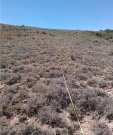
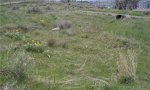
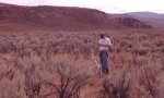
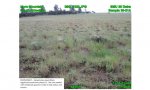
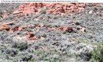
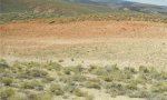
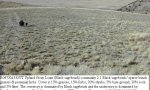
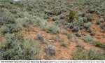
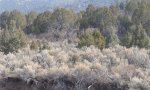
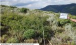
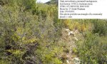
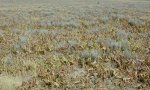
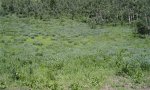
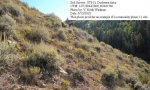
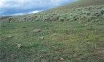
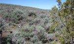
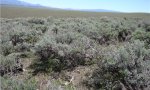
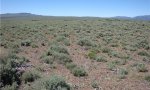
Ecological site map
Basemap
Find me
Find point
Full screen
Zoom in to display soil survey map units for an area of interest, and zoom out to display MLRAs. Select a map unit polygon to view ecological sites correlated to that map unit. View a brief description of an ecological site by clicking on its name in the map popup. Soil survey correlations may not be accurate, and ecological site classification of a location should always be verified in the field. Each selection may require the transfer of several hundred KB of data.
Ecological site keys
Ecological site photos
Print Options
Sections
Font
Other
Briefcase
Add ecological sites and Major Land Resource Areas to your briefcase by clicking on the briefcase (![]() ) icon wherever it occurs. Drag and drop items to reorder. Cookies are used to store briefcase items between browsing sessions. Because of this, the number of items that can be added to your briefcase is limited, and briefcase items added on one device and browser cannot be accessed from another device or browser. Users who do not wish to place cookies on their devices should not use the briefcase tool. Briefcase cookies serve no other purpose than described here and are deleted whenever browsing history is cleared.
) icon wherever it occurs. Drag and drop items to reorder. Cookies are used to store briefcase items between browsing sessions. Because of this, the number of items that can be added to your briefcase is limited, and briefcase items added on one device and browser cannot be accessed from another device or browser. Users who do not wish to place cookies on their devices should not use the briefcase tool. Briefcase cookies serve no other purpose than described here and are deleted whenever browsing history is cleared.
Ecological sites
Major Land Resource Areas
The Ecosystem Dynamics Interpretive Tool is an information system framework developed by the USDA-ARS Jornada Experimental Range, USDA Natural Resources Conservation Service, and New Mexico State University.