Natural Resources
Conservation Service
Ecological site R047XC461UT
Mountain Stony Loam (curl-leaf mountain mahogany)
Last updated: 2/11/2025
Accessed: 04/05/2026
General information
Provisional. A provisional ecological site description has undergone quality control and quality assurance review. It contains a working state and transition model and enough information to identify the ecological site.
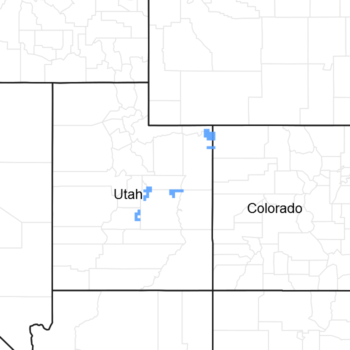
Figure 1. Mapped extent
Areas shown in blue indicate the maximum mapped extent of this ecological site. Other ecological sites likely occur within the highlighted areas. It is also possible for this ecological site to occur outside of highlighted areas if detailed soil survey has not been completed or recently updated.
MLRA notes
Major Land Resource Area (MLRA): 047X–Wasatch and Uinta Mountains
MLRA 47 occurs in Utah (86 percent), Wyoming (8 percent), Colorado (4 percent), and Idaho (2 percent). It encompasses approximately 23,825 square miles (61,740 square kilometers). The northern half of this area is in the Middle Rocky Mountains Province of the Rocky Mountain System. The southern half is in the High Plateaus of the Utah Section of the Colorado Plateaus Province of the Intermontane Plateaus. Parts of the western edge of this MLRA are in the Great Basin Section of the Basin and Range Province of the Intermontane Plateaus. The MLRA includes the Wasatch Mountains, which trend north and south, and the Uinta Mountains, which trend east and west. The steeply sloping, precipitous Wasatch Mountains have narrow crests and deep valleys. Active faulting and erosion are a dominant force in controlling the geomorphology of the area. The Uinta Mountains have a broad, gently arching, elongated shape. Structurally, they consist of a broadly folded anticline that has an erosion-resistant quartzite core. The Wasatch and Uinta Mountains have an elevation of 4,900 to about 13,500 feet (1,495 to 4,115 meters).
The mountains in this area are primarily fault blocks that have been tilted up. Alluvial fans at the base of the mountains are recharge zones for the basin fill aquifers. An ancient shoreline of historic Bonneville Lake is evident on the footslopes along the western edge of the area. Rocks exposed in the mountains are mostly Mesozoic and Paleozoic sediments, but Precambrian rocks are exposed in the Uinta Mountains. The Uinta Mountains are one of the few ranges in the United States that are oriented west to east. The southern Wasatch Mountains consist of Tertiary volcanic rocks occurring as extrusive lava and intrusive crystalline rocks.
The average precipitation is from 8 to 16 inches (203 to 406 mm) in the valleys and can range up to 73 inches (1854 mm) in the mountains. In the northern and western portions of the MLRA, peak precipitation occurs in the winter months. The southern and eastern portions have a greater incidence of high-intensity summer thunderstorms; hence, a significant amount of precipitation occurs during the summer months. The average annual temperature is 30 to 50 degrees Fahrenheit (-1 to 15 C). The freeze-free period averages 140 days and ranges from 60 to 220 days, generally decreasing in length with elevation.
The dominant soil orders in this MLRA are Aridisols, Entisols, Inceptisols, and Mollisols. The lower elevations are dominated by a frigid temperature regime, while the higher elevations experience cryic temperature regimes. Mesic temperature regimes come in on the lower elevations and south facing slopes in the southern portion of this MLRA. The soil moisture regime is typically xeric in the northern part of the MLRA, but grades to ustic in the extreme eastern and southern parts. The minerology is generally mixed and the soils are very shallow to very deep, generally well drained, and loamy or loamy-skeletal.
LRU notes
E47C is the Uinta Mountains portion of MLRA 47 that run east and west which includes the Uinta Wilderness and The Flaming Gorge National Recreation Area and towns such as Evanston, Wyoming, Hanna and Tabiona, Utah. Structurally these mountains consist of a broadly folded anticline that has an erosion resistance quartzite core. The Duchesne River and many other tributaries to the Green River run through this range, as well as the headwaters of the Bear River.
Ecological site concept
The soils on this site were formed in slope alluvium and colluvium derived from sandstone and quartzite. The soil is well drained with moderate permeability in the upper 10 inches of soil. The soil is deep with greater than 60 inches to bedrock. The soil texture at the surface is extremely boulder loam. Surface gravels are approximately one percent cover and surface rocks larger than 3 inches are not present. Subsurface gravels are 17 to 22 percent volume and rocks over 3 inches in diameter are 44 to 55 percent volume. The available water capacity is 2.0 to 2.7 and the pH is 6.6 to 7.8. The soil temperature regime is frigid and the soil moisture regime is ustic.
Associated sites
| R047XC460UT |
Mountain Stony Loam (shrub) |
|---|
Similar sites
| R047XC460UT |
Mountain Stony Loam (shrub) |
|---|
Table 1. Dominant plant species
| Tree |
Not specified |
|---|---|
| Shrub |
(1) Cercocarpus ledifolius |
| Herbaceous |
Not specified |
Physiographic features
This site can be found on mountain slopes and backslopes. The slope ranges between 15 and 50 percent. It can occur at elevations between 7,000 to 8,700 feet. Flooding and ponding do not occur on this site.
Table 2. Representative physiographic features
| Landforms |
(1)
Mountain slope
|
|---|---|
| Flooding frequency | None |
| Ponding frequency | None |
| Elevation | 2,134 – 2,652 m |
| Slope | 15 – 50% |
| Aspect | Aspect is not a significant factor |
Climatic features
The climate is characterized by cool, moist summers and cold, snowy winters. Approximately 60 percent of the moisture comes as rain from may through october. On the average, January through April are the driest months and May through October are the wettest months. The soil moisture regime is ustic and soil temperatures are in the frigid regime.
Table 3. Representative climatic features
| Frost-free period (average) | 90 days |
|---|---|
| Freeze-free period (average) | |
| Precipitation total (average) | 457 mm |
Influencing water features
This site is not influenced by water from a wetland or stream.
Wetland description
N/A
Soil features
The soils on this site were formed in slope alluvium and colluvium derived from sandstone and quartzite. The soil is well drained with moderate permeability in the upper 10 inches of soil. The soil is deep up to 60 inches to bedrock. The soil texture at the surface is extremely boulder loam. Surface gravels are approximately one percent cover and surface rocks larger than 3 inches are not present. Subsurface gravels are 17 to 22 percent volume and rocks over 3 inches in diameter are 44 to 55 percent volume. The available water capacity is 2.0 to 2.7 and the pH is 6.6 to 7.8. The soil temperature regime is frigid and the soil moisture regime is ustic.
Soils associated with this site:
Uintah Area (UT047): Bigtom (111, 72, 22, 197)
Modal Soil: Zillion Family BYX-L, 25-50%; 15-25% — loamy-skeletal, mixed Pachic Argiborolls
Table 4. Representative soil features
| Parent material |
(1)
Colluvium
–
sandstone
(2) Slope alluvium – sandstone (3) Colluvium – quartzite (4) Slope alluvium – quartzite |
|---|---|
| Surface texture |
(1) Extremely bouldery loam |
| Drainage class | Well drained |
| Permeability class | Moderate |
| Depth to restrictive layer | 102 – 152 cm |
| Soil depth | 102 – 152 cm |
| Surface fragment cover <=3" | 0 – 3% |
| Surface fragment cover >3" | 0% |
| Available water capacity (0-101.6cm) |
5.08 – 6.86 cm |
| Calcium carbonate equivalent (0-101.6cm) |
0% |
| Electrical conductivity (0-101.6cm) |
0 mmhos/cm |
| Sodium adsorption ratio (0-101.6cm) |
0 |
| Soil reaction (1:1 water) (0-101.6cm) |
6.6 – 7.8 |
| Subsurface fragment volume <=3" (Depth not specified) |
17 – 22% |
| Subsurface fragment volume >3" (Depth not specified) |
44 – 55% |
Ecological dynamics
It is impossible to determine in any quantitative detail the Historic Climax Plant Community (HCPC) for this ecological site because of the lack of direct historical documentation preceding all human influence. In some areas, the earliest reports of dominant plants include the cadastral survey conducted by the General Land Office, which began in the late 19th century for this area. However, up to the 1870s the Shoshone Indians, prevalent in northern Utah and neighboring states, grazed horses and set fires to alter the vegetation for their needs. In the 1860s, Europeans brought cattle and horses to the area, grazing large numbers of them on unfenced parcels year-long. Itinerant and local sheep flocks followed, largely replacing cattle as the browse component increased.
Below is a State and Transition Model diagram that illustrates the “phases” (common plant communities), and “states” (aggregations of those plant communities) that can occur on the site. Differences between phases and states depend primarily upon observations of a range of disturbance histories in areas where this ESD is represented. These situations include grazing gradients to water sources, fence-line contrasts, patches with differing dates of fire, herbicide treatment, tillage, etc. Reference State 1 illustrates the common plant communities that probably existed just prior to European settlement.
The major successional pathways within states, (“community pathways”) are indicated by arrows between phases. “Transitions” are indicated by arrows between states. The drivers of these changes are indicated in codes decipherable by referring to the legend at the bottom of the page and by reading the detailed narratives that follow the diagram. The transition between Reference State 1 and State 2 is considered irreversible because of the naturalization of exotic species of both flora and fauna, possible extinction of native species, and climate change. There may have also been accelerated soil erosion.
When available, monitoring data (of various types) were employed to validate more subjective inferences made in this diagram. See the complete files in the office of the State Range Conservationist for more details.
The plant communities shown in this State and Transition Model may not represent every possibility, but are probably the most prevalent and recurring plant communities. As more monitoring data are collected, some phases or states may be revised, removed, and/or new ones may be added. None of these plant communities should necessarily be thought of as “Desired Plant Communities.” According to the USDA NRCS National Range & Pasture Handbook (USDA-NRCS 2003), Desired Plant Communities (DPC’s) will be determined by the decision-makers and will meet minimum quality criteria established by the NRCS. The main purpose for including descriptions of a plant community is to capture the current knowledge at the time of this revision.
State 1 Reference State
The Reference State is a description of this ecological site just prior to Euro-American settlement but long after the arrival of Native Americans. The description of the Reference State was determined by NRCS Soil Survey Type Site Location information and familiarity with rangeland relict areas where they exist. The least modified plant community would have been dominated by a low statured curl-leaf mountain mahogany (Cercocarpus ledifolius), and a mixture of herbaceous species. Other common shrubs may have included Utah serviceberry (Amelanchier utahensis), mountain snowberry (Symphoricarpos oreophilus) and mountain big sagebrush (Artemisia tridentata ssp. vaseyana). Dominant grasses would have included bluebunch wheatgrass (Pseudoroegneria spicata), oniongrass (Melica bulbosa), and muttongrass (Poa fendleriana). Forbs would have included pacific aster (Symphyotrichum chilense var. chilense), and arrowleaf balsamroot (Balsamorhiza sagittata), among others (1.1). A more complete list of species by lifeform for the Reference State is available in accompanying tables in the “Plant Community Composition by Weight and Percentage” section of this document. These sites would have had wildfire return intervals of approximately 20 to 50 years.
Community 1.1: scattered low-statured curl-leaf mountain mahogany & associated shrubs/ rich native perennial herbaceous understory
This plant community would have been characterized by a scattering of low-statured curl-leaf mountain mahogany. Utah serviceberry, mountain snowberry would have also been present with an understory composed of a variety of forbs (pacific aster, arrowleaf balsamroot, etc.) and grasses (bluebunch wheatgrass, oniongrass, etc.).
Transition T1a: from State 1 to State 2 (Reference State to Curl-leaf Mountain Mahogany Non-native State)
The simultaneous introduction of exotic species, both plants and animals, possible extinctions of native flora and fauna, and climate change has caused State 1 to transition to State 2. Reversal of such historic changes (i.e. a return pathway) back to State 1 is not practical.
State 2 Curl-leaf Mountain Mahogany/ Introduced Non-natives State
Community 2.1 Curl-leaf Mountain Mahogany/ Introduced Non-natives State
State 2 is a description of the ecological site just following Euro-American settlement, which has been influenced by the introduction of several non-native plants and animals, possible extinctions of native species, and a different climate. The plant community will be very similar to State 1 with the exception that some introduced species are likely to be present. This plant community is considered the current potential, and is dominated by curl-leaf mountain mahogany with a scattering of Utah serviceberry, mountain snowberry and mountain big sagebrush. The native perennial herbaceous understory is still intact, but a small component of non-native species will also be present. The resiliency of this state is maintained by the root-sprouting nature of the dominant shrubs. Reductions in livestock use during the growth season will maintain the stability of the state. Alternatively, continued season-long heavy livestock grazing will reduced the stability of this state.
Community Phase 2.1: scattered low-statured curl-leaf mountain mahogany & associated shrubs/ rich native perennial herbaceous understory
This plant community is characterized by a scattering of low-statured curl-leaf mountain mahogany, Utah serviceberry, mountain snowberry and mountain big sagebrush. The native perennial understory is composed of a variety of forbs (pacific aster, arrowleaf balsamroot, etc.) and grasses (bluebunch wheatgrass, oniongrass , etc.).
Transition T2a: from State 2 to State 3 (Curl-leaf Mountain Mahogany/ Introduced Non-natives State to Tall Dense Curl-leaf Mountain Mahogany State)
Heavy continuous livestock grazing took place on these sites between the 1850s and 1950s. The effects of this heavy livestock grazing were further worsened with fire exclusion policies. A rapid increase of deer numbers in the 1950s and 1960s caused high-lining of the trees. Curl-leaf mountain mahogany began to grow taller and larger in dbh (diameter at breast height), while the herbaceous understory species were reduced greatly. Key indicators of the approach to this transition are a loss of perennial grass understory, an increase in the shrub component relative to grasses, and an increase in height and dbh of mahogany, as well as high-lining and hedging of trees. This transition is triggered by sustained heavy grazing (over time), first by livestock, and later by excessive numbers of deer.
State 3 Tall Dense Curl-leaf Mountain Mahogany State
In the absence of fire, and continued heavy impacts from livestock, deer, and elk grazing, the native grasses will markedly decrease while the shrubs, mainly curl-leaf mountain mahogany, will grow taller and more dense as reproduction becomes rarer. The resiliency of this state is maintained root-sprouting nature of the dominant shrubs. Reductions in livestock use during the growth season will maintain the stability of the state. Alternatively, continued season-long use by both domestic and wild ungulates will reduced the stability of this state.
Community Phase 3.1: abundant curl-leaf mountain mahogany/ depauperate understory
This plant community is characterized by a dramatic increase in curl-leaf mountain mahogany and substantial reduction in the perennial herbaceous component.
Transition T3a: from State 3 to State 4 (Tall Dense Curl-leaf Mountain Mahogany State to Tall Hedged Curl-leaf Mountain Mahogany State)
The region saw a marked increase in mule deer numbers during the 1940s to 1960s. As a preferred forage species for deer, curl-leaf mountain mahogany experienced heavy browsing pressure during that time. Heavy browsing combined with continued lack of fire caused these sites to transition into a near-monoculture of curl-leaf mountain mahogany. A key indicator of the approach to this transition is a loss of young, short mountain mahogany, and an increase in tall, large mountain mahogany trees. Excessive ungulate use will trigger this transition. A restoration pathway can be established by restoring fire to the ecosystem and reducing animal use on these sites.
Restoration Pathway R3a: from State 3 to State 2 (Tall Dense Curl-leaf Mountain Mahogany State to Curl-leaf Mountain Mahogany/ Introduced Non-natives State)
Brush management using prescribed fire, mechanical, or herbicidal (i.e. 2, 4-DTM) treatments, or wildfire, in combination with re-seeding efforts should be considered only on gentle to level slopes (these locations however are unusual). Curl-leaf mountain mahogany will not consistently re-sprout after these treatments, and invasive annuals and biennials are very prominent after disturbances. Re-seeding after wildfire must be done promptly or annuals and bi-annuals will takeover.
State 4 Tall Hedged Curl-leaf Mountain Mahogany State
Following a period of intense deer browsing, curl-leaf mountain mahogany will appear hedged. Without fire, mountain mahogany will grow taller and begin to form a monoculture. Introduced annuals and biennials are also quite common in the understory. In this state, the rockiness of the soil makes it self-armoring, thus reducing the effects of erosion. The steep, rocky locations of this site limit proactive management options.
Community Phase 4.1: near monoculture curl-leaf mountain mahogany/ introduced annuals & biennials
This plant community is super-dominated by curl-leaf mountain mahogany with an understory composed mainly of introduced annuals and biennials. The site will remain in this state until wildfire occurs.
State and transition model

Figure 2. STM
More interactive model formats are also available.
View Interactive Models
More interactive model formats are also available.
View Interactive Models
Click on state and transition labels to scroll to the respective text
Ecosystem states
State 1 submodel, plant communities
State 1
Reference State
Community 1.1
Reference Plant Community
The dominant aspect of the plant community is curlleaf mountainmahogany. The composition by air-dry weight is approximately 30 percent perennial grasses, 10 percent forbs, and 60 percent shrubs.
Figure 3. Annual production by plant type (representative values) or group (midpoint values)
Table 5. Annual production by plant type
| Plant type | Low (kg/hectare) |
Representative value (kg/hectare) |
High (kg/hectare) |
|---|---|---|---|
| Shrub/Vine | 841 | 1177 | 1648 |
| Grass/Grasslike | 420 | 588 | 824 |
| Forb | 140 | 196 | 275 |
| Total | 1401 | 1961 | 2747 |
Table 6. Ground cover
| Tree foliar cover | 0% |
|---|---|
| Shrub/vine/liana foliar cover | 59-61% |
| Grass/grasslike foliar cover | 19-21% |
| Forb foliar cover | 4-6% |
| Non-vascular plants | 0% |
| Biological crusts | 0% |
| Litter | 0% |
| Surface fragments >0.25" and <=3" | 0% |
| Surface fragments >3" | 0% |
| Bedrock | 0% |
| Water | 0% |
| Bare ground | 0% |
Table 7. Canopy structure (% cover)
| Height Above Ground (m) | Tree | Shrub/Vine | Grass/ Grasslike |
Forb |
|---|---|---|---|---|
| <0.15 | – | – | – | – |
| >0.15 <= 0.3 | – | – | – | 4-6% |
| >0.3 <= 0.6 | – | – | 19-21% | – |
| >0.6 <= 1.4 | – | – | – | – |
| >1.4 <= 4 | – | 59-61% | – | – |
| >4 <= 12 | – | – | – | – |
| >12 <= 24 | – | – | – | – |
| >24 <= 37 | – | – | – | – |
| >37 | – | – | – | – |
Additional community tables
Table 8. Community 1.1 plant community composition
| Group | Common name | Symbol | Scientific name | Annual production (kg/hectare) | Foliar cover (%) | |
|---|---|---|---|---|---|---|
|
Shrub/Vine
|
||||||
| 0 | Dominant Shrubs | 818–1121 | ||||
| curl-leaf mountain mahogany | CELE3 | Cercocarpus ledifolius | 504–605 | – | ||
| Utah serviceberry | AMUT | Amelanchier utahensis | 101–202 | – | ||
| mountain snowberry | SYOR2 | Symphoricarpos oreophilus | 101–202 | – | ||
| mountain big sagebrush | ARTRV | Artemisia tridentata ssp. vaseyana | 61–101 | – | ||
| chokecherry | PRVI | Prunus virginiana | 61–101 | – | ||
| 3 | Sub-Dominant Shrubs | 275–448 | ||||
| Shrub (>.5m) | 2SHRUB | Shrub (>.5m) | 61–101 | – | ||
| Martin's ceanothus | CEMA2 | Ceanothus martinii | 20–40 | – | ||
| alderleaf mountain mahogany | CEMO2 | Cercocarpus montanus | 20–40 | – | ||
| snowbrush ceanothus | CEVE | Ceanothus velutinus | 20–40 | – | ||
| yellow rabbitbrush | CHVIL4 | Chrysothamnus viscidiflorus ssp. lanceolatus | 20–40 | – | ||
| shortstem buckwheat | ERBR5 | Eriogonum brevicaule | 20–40 | – | ||
| rockspirea | HODU | Holodiscus dumosus | 20–40 | – | ||
| creeping barberry | MARE11 | Mahonia repens | 20–40 | – | ||
| Oregon boxleaf | PAMY | Paxistima myrsinites | 20–40 | – | ||
| littleleaf mock orange | PHMI4 | Philadelphus microphyllus | 20–40 | – | ||
|
Grass/Grasslike
|
||||||
| 0 | Dominant Grasses | 280–504 | ||||
| bluebunch wheatgrass | PSSP6 | Pseudoroegneria spicata | 101–202 | – | ||
| oniongrass | MEBU | Melica bulbosa | 61–101 | – | ||
| muttongrass | POFE | Poa fendleriana | 61–101 | – | ||
| Sandberg bluegrass | POSE | Poa secunda | 61–101 | – | ||
| 1 | Sub-Dominant Grasses | 168–336 | ||||
| Grass, annual | 2GA | Grass, annual | 61–101 | – | ||
| Grass, perennial | 2GP | Grass, perennial | 61–101 | – | ||
| Indian ricegrass | ACHY | Achnatherum hymenoides | 20–40 | – | ||
| Letterman's needlegrass | ACLE9 | Achnatherum lettermanii | 20–40 | – | ||
| Columbia needlegrass | ACNE9 | Achnatherum nelsonii | 20–40 | – | ||
| Geyer's sedge | CAGE2 | Carex geyeri | 20–40 | – | ||
| slender wheatgrass | ELTR7 | Elymus trachycaulus | 20–40 | – | ||
| needle and thread | HECO26 | Hesperostipa comata | 20–40 | – | ||
| prairie Junegrass | KOMA | Koeleria macrantha | 20–40 | – | ||
| basin wildrye | LECI4 | Leymus cinereus | 20–40 | – | ||
| littleseed ricegrass | PIMI | Piptatheropsis micrantha | 20–40 | – | ||
|
Forb
|
||||||
| 2 | Sub-Dominant Forbs | 168–392 | ||||
| Forb, annual | 2FA | Forb, annual | 101–202 | – | ||
| Forb, perennial | 2FP | Forb, perennial | 101–202 | – | ||
| common yarrow | ACMI2 | Achillea millefolium | 20–40 | – | ||
| nodding onion | ALCE2 | Allium cernuum | 20–40 | – | ||
| littleleaf pussytoes | ANMI3 | Antennaria microphylla | 20–40 | – | ||
| white sagebrush | ARLU | Artemisia ludoviciana | 20–40 | – | ||
| arrowleaf balsamroot | BASA3 | Balsamorhiza sagittata | 20–40 | – | ||
| Wyoming Indian paintbrush | CALI4 | Castilleja linariifolia | 20–40 | – | ||
| twolobe larkspur | DENU2 | Delphinium nuttallianum | 20–40 | – | ||
| Eaton's fleabane | EREA | Erigeron eatonii | 20–40 | – | ||
| oneflower helianthella | HEUN | Helianthella uniflora | 20–40 | – | ||
| scarlet gilia | IPAGA3 | Ipomopsis aggregata ssp. aggregata | 20–40 | – | ||
| western stoneseed | LIRU4 | Lithospermum ruderale | 20–40 | – | ||
| fernleaf biscuitroot | LODI | Lomatium dissectum | 20–40 | – | ||
| tailcup lupine | LUCAC3 | Lupinus caudatus ssp. caudatus | 20–40 | – | ||
| baby goldenrod | SONA | Solidago nana | 20–40 | – | ||
| Pacific aster | SYCHC | Symphyotrichum chilense var. chilense | 20–40 | – | ||
| foothill deathcamas | ZIPA2 | Zigadenus paniculatus | 20–40 | – | ||
Interpretations
Animal community
This site has fair to good values and provides plants that are nutritious to sheep, cattle, and horses during spring, summer and fall.
The potential is very poor for openland habitat, fair for woodland, very poor for wetland and fair for rangelands.
This site is very valuable for deer winter range. A few species of small mammals and songbirds are found on this site during part of the year.
Hydrological functions
The soil series in this site are in hydrologic group B and the hydrologic curve number is 61 when the vegetation is in good condition.
Recreational uses
This site appeals to some people with regard to aesthetics and natural beauty. It is not a good site for hunting due to the dense areas of mountain mahogany where deer and other game can find cover. It has good values for camping and picnicking from a vegetative standpoint.
Wood products
Curlleaf mountain mahogany furnishes some fence posts and stays. Firewood for fireplaces and campfires can be harvested, but the wood is difficult to cut with an axe after it is dry. Knick-knacks and other novelties as lamp stands, etc. can be made from this wood.
Supporting information
Inventory data references
Information presented here has been derived from NRCS clipping data and other inventory data. Field observations from range trained personnel were also used.
Other references
Alexander, R. R. 1985. Major habitat types, community types, and plant communities in the Rocky Mountains. USDA- Forest Service Rocky Mountain Forest and Range Experiment Station. General technical report RM-123. 105p.
Alexander 1988. Forest vegetation on National Forests in the Rocky Mountain and Intermountain Regions: Habitat types and community types. USDA- Forest Service Rocky Mountain Forest and Range Experiment Station. General technical report RM-162. 47p.
Galatowitsch, S.M. 1990. Using the original land survey notes to reconstruct pre-settlement landscapes in the American West. Great Basin Naturalist: 50(2): 181-191. Keywords: [Western U.S., conservation, history, human impact]
Parson, R. E. 1996. A History of Rich County. Utah State Historical Society, County Commission, Rich County, Utah. Keywords: [Rich County, Utah, Historic land use, European settlements]
USDA-NRCS. 2003. National Range and Pasture Handbook. in USDA, editor, USDA-Natural Resources Conservation Service-Grazing Lands Technology Institute. Keywords: [Western US, Federal guidelines, Range pasture management]
Western Regional Climate Center, Western U.S. Climate Historical Summaries. Available at: http://www.wrcc.dri.edu/summary/Climsmut.html. Accessed 15 June 2009.
Web Soil Survey, Official Soil Series Descriptions. Available at: http://soils.usda.gov/technical/classification/osd/index.html. Accessed 15 June 2009.
Contributors
Garth W. Leishman, Lars L. Rassmussen
Rangeland health reference sheet
Interpreting Indicators of Rangeland Health is a qualitative assessment protocol used to determine ecosystem condition based on benchmark characteristics described in the Reference Sheet. A suite of 17 (or more) indicators are typically considered in an assessment. The ecological site(s) representative of an assessment location must be known prior to applying the protocol and must be verified based on soils and climate. Current plant community cannot be used to identify the ecological site.
| Author(s)/participant(s) | V. Keith Wadman (NRCS Retired). |
|---|---|
| Contact for lead author | shane.green@ut.usda.gov |
| Date | 11/15/2012 |
| Approved by | Sarah Quistberg |
| Approval date | |
| Composition (Indicators 10 and 12) based on | Annual Production |
Indicators
-
Number and extent of rills:
Rare to Slight. Slight rill development may occur in exposed areas, on steeper slopes (> 20%) and/or on areas located below exposed bedrock or other water shedding areas where increased runoff may occur. Where rills are present, they should be fairly short (4-8 feet), < 1 inch deep and somewhat widely spaced (5-10 feet). Minor rill development may be observed on all slopes following major thunderstorm or spring runoff events but should heal during the next growing season. -
Presence of water flow patterns:
Slight. Some minor evidence of water flow patterns may be found winding around perennial plant bases. They show little evidence of current erosion. They are expected to be short (3-6 feet), stable, sinuous and normally not connected. There may be very minor evidence of deposition. Evidence of water flow may increase somewhat on slopes > 20%. -
Number and height of erosional pedestals or terracettes:
Perennial vegetation shows little evidence of erosional pedestalling (1 to 2% of individual plants). Plant roots are covered and most litter remains in place around plant crowns. Terracettes should be absent or, if present, stable. A slight increase in both pedestal and terracette development may occur with increasing slope. -
Bare ground from Ecological Site Description or other studies (rock, litter, lichen, moss, plant canopy are not bare ground):
Bare ground ranges from 25% - 30%. Soil surface may be covered by 45 to >70% coarse fragments. Bare ground openings should not be greater than 1 to 2 feet in diameter and should normally not be connected. -
Number of gullies and erosion associated with gullies:
None to Rare at site level. Scattered landscape level gully channels, however, are a normal component of basin/range environments. Where landscape gullies are present, they should be stable, partially vegetated on their sides and bottoms, with no evidence of head-cutting. Some slight increase in disturbance may be evident following significant weather events or when gullies convey considerable runoff from higher elevation rocky or naturally eroding areas. -
Extent of wind scoured, blowouts and/or depositional areas:
None. No evidence of wind generated soil movement is present. Wind caused blowouts and deposition are not present. -
Amount of litter movement (describe size and distance expected to travel):
Most litter resides in place with some redistribution caused by water movement. Minor litter removal may occur in flow channels with deposition occurring within 1 to 2 feet at points of obstruction. The majority of litter accumulates at the base of plants. Some grass leaves and small twigs (grass stems) may accumulate in soil depressions adjacent to plants. Woody stems are not likely to move. However, some litter movement is expected (up to 6 feet) with increases in slopes >20% and/or increased runoff resulting from heavy thunderstorms. -
Soil surface (top few mm) resistance to erosion (stability values are averages - most sites will show a range of values):
This site should have a soil stability rating of 5 or 6 under the plant canopies, and a rating of 4 to 5 in the interspaces. The average rating should be a 5. Soil surface textures are typically loams, very fine sandy loams and silt loams. -
Soil surface structure and SOM content (include type of structure and A-horizon color and thickness):
(Bigtom) Soil surface 0-7 inches. Texture is an extremely boulder loam which may have an organic mat of partially decomposed leaves and twigs 1 inch deep on the surface; color is black (5YR 3/1); and structure is moderate very fine granular. Mollic epipedon ranges to 31 inches. Use the specific information for the soil you are assessing found in the published soil survey to supplement this description. -
Effect of community phase composition (relative proportion of different functional groups) and spatial distribution on infiltration and runoff:
Perennial vegetation produces sufficient cover and spatial arrangement to intercept most raindrops and reduce raindrop splash erosion. Litter on soil surface and cryptogamic crusting, where present, also protect the soil surface from splash erosion and encourage higher infiltration. Bare spaces are expected to be small and irregular in shape and usually not connected. Vegetative structure and distribution are usually adequate to capture snow and ensure that snowmelt occurs in a controlled manner, allowing maximum time for infiltration, and reducing runoff and erosion in all but the most extreme storm events. When perennial grasses and shrubs decrease due to natural events such as long-term drought, insect damage, etc., runoff is likely to increase and infiltration be reduced. -
Presence and thickness of compaction layer (usually none; describe soil profile features which may be mistaken for compaction on this site):
None. Some soils may have natural textural variability within their profiles, including changes in clay content, these should not be mistaken for a compaction pan. -
Functional/Structural Groups (list in order of descending dominance by above-ground annual-production or live foliar cover using symbols: >>, >, = to indicate much greater than, greater than, and equal to):
Dominant:
Sprouting shrubs (curlleaf mountain mahogany, Utah serviceberry) > Non-sprouting shrub (mountain big sagebrush) = > Perennial bunchgrasses (bluebunch wheatgrass, muttongrass) > Rhizomatous Grasses (slender wheatgrass).Sub-dominant:
Perennial bunchgrasses & grasslikes (Letterman needlegrass, Geyer sedge) > Sprouting shrubs (green rabbitbrush, mountain snowberry) > Perennial forbs (arrowleaf balsamroot).Other:
A wide variety of other perennial grasses and both perennial and annual forbs can be expected to occur in the plant community.Additional:
Natural disturbance regimes include fire, drought, and insects. Assumed fire cycle of 40 to 60+ years. Functional/structural groups may appropriately contain non-native species if their ecological function is the same as the native species in the reference. Following a disturbance such as fire, drought, rodents or insects that remove woody vegetation, forbs and perennial grasses (herbaceous species) may dominate the community for a period of time. If a disturbance has not occurred for an extended period of time, woody species may continue to increase. These conditions would reflect different functional community phases within the reference state. -
Amount of plant mortality and decadence (include which functional groups are expected to show mortality or decadence):
All age classes of perennial grasses should be present under average to above average growing conditions with age class expression likely subdued during periods of extended drought. Slight decadence in the principle shrubs could occur near the end of the fire cycle or during periods of extended drought, or insect infestations. In general, a mix of age classes should be expected with some dead and decadent plants present. -
Average percent litter cover (%) and depth ( in):
Litter cover will be heavier under plants. Most litter will be herbaceous and depths of 1 to 2 inches would be considered normal. Perennial vegetation should be well distributed on the site. -
Expected annual annual-production (this is TOTAL above-ground annual-production, not just forage annual-production):
Annual production in air-dry herbage should be approximately 1700 - 1800 #/acre on an average year but could range from 1200 - 2500 #/acre during periods of prolonged drought or above average precipitation.
-
Potential invasive (including noxious) species (native and non-native). List species which BOTH characterize degraded states and have the potential to become a dominant or co-dominant species on the ecological site if their future establishment and growth is not actively controlled by management interventions. Species that become dominant for only one to several years (e.g., short-term response to drought or wildfire) are not invasive plants. Note that unlike other indicators, we are describing what is NOT expected in the reference state for the ecological site:
Cheatgrass, alyssum, mustard species, Canada thistle, black medic, Utah juniper, Gamble oak. -
Perennial plant reproductive capability:
All perennial plants should have the ability to reproduce in all years, except in extreme drought years. Green rabbitbrush sprouts vigorously following fire. There are no restrictions on either seed or vegetative reproduction. Some seedling recruitment of major species is expected to be present during average and above average growing years.
Print Options
Sections
Font
Other
The Ecosystem Dynamics Interpretive Tool is an information system framework developed by the USDA-ARS Jornada Experimental Range, USDA Natural Resources Conservation Service, and New Mexico State University.
Click on box and path labels to scroll to the respective text.