Mountain Meadow Gunnison Basin LRU
Scenario model
Current ecosystem state
Select a state
Management practices/drivers
Select a transition or restoration pathway
- Transition T1B More details
- Transition T1A More details
- Transition T1C More details
- Transition T2A More details
- Restoration pathway R3A More details
- Transition T3A More details
- Transition T3B More details
- Restoration pathway R4C More details
- Restoration pathway R4B More details
- Transition T5A More details
- Restoration pathway R5A More details
- Restoration pathway R4A More details
-
No transition or restoration pathway between the selected states has been described
Target ecosystem state
Select a state
Description
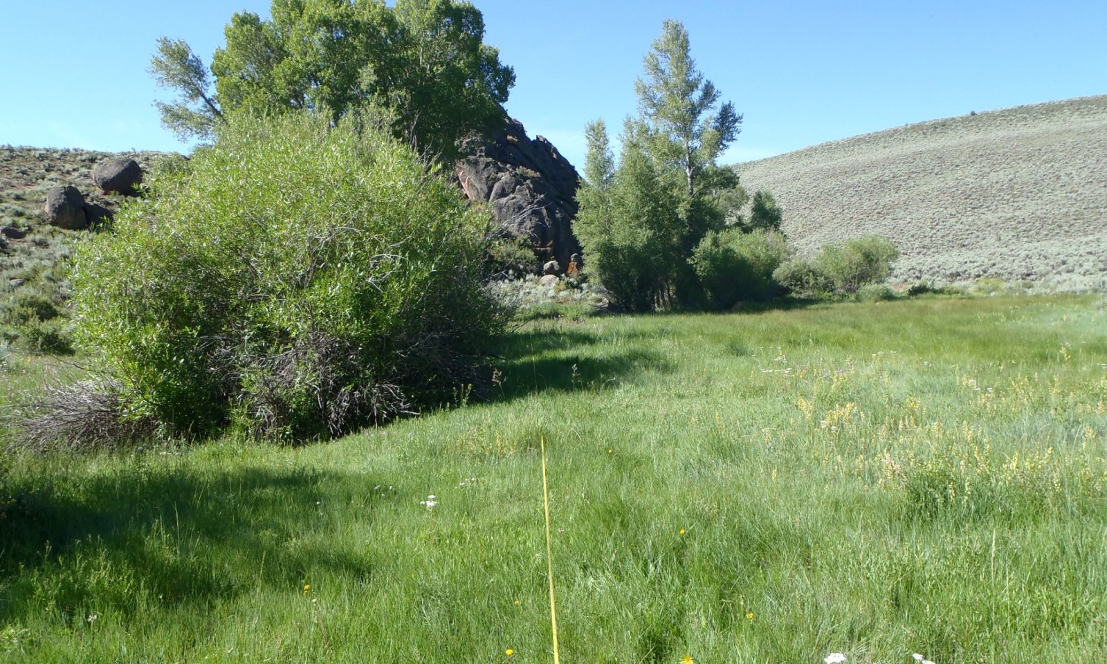
This site occurs on gently sloping valley bottoms. An persistent channel or water source is typical. The vegetation would have been a grassland (meadow) dominated by a rich mixture of native grasses and grass-likes such as Nebraska sedge and tufted hairgrass Minor amounts of forage production was due to native perennial forbs. The plant community is very productive because of the extended growing season as compared to the uplands. Early flooding at the time of peak snowmelt in the watersheds above (May-June) is the usual pattern. The reference state is stable and has properly functioning hydrology. Notable patch dynamics influence pockets of vegetation. For example, a greater dominance of grass-likes are near the water source and depression areas. Bunchgrasses, increase in prevalence further from the channel. Forbs and preferred shrubby species such as snowberry, Woods’ rose, and willows also increase. The high diversity of species in this state allows plants to adapt to periods of additional moisture or drought.
Submodel
Description
These meadows are a key part of the agricultural development of the basin. A very high percentage of these sites were homesteaded. The home base for many livestock ranches are along the rivers and streams where this ecological site occurs. This ecological site has been greatly expanded by flood irrigation and are now mostly anthropogenic grasslands of timothy (Phleum pratense), meadow foxtails (Alopecurus spp.), smooth and meadow bromes (Bromus inermus and B. riparius), Kentucky bluegrass (Poa pratensis), and in some places, orchardgrass (Dactylis glomerata). Barnes, Et. al (2009). Other common seeded species include: timothy, alsike clover, red clover, and alfalfa. These meadows have been improved by leveling, re-seeding, irrigation systems, and fertilizing. The most commonly, meadows are hayed during the summer and them pastured on the aftermath. Irrigation impacts the soil by building a organic matter and supports introduced grasses with some native sedges and rushes. Native species more tolerant of disturbance (e.g. curlycup gumweed, baltic rush, foxtail barley, and Rocky Mountain iris). Sedges, and timothy increased relative to the less grazing tolerant and palatable grasses and grass-likes such as beaked sedge and tufted hairgrass. Additionally, exotics such as common dandelion, Canada thistle, Kentucky bluegrass, and meadow fescue increased. In general, species richness declined and species equitability became more concentrated in fewer dominants. The single most important impact is whether enhanced irrigation took place to supplement the hydrologic input. In the cold temperatures of Gunnison County, haying and pasturing has been the more sustainable pattern.
Submodel
Description
This state is degraded, and the hydrology is altered. The plant community and surface debris are insufficient to slow runoff and dissipate the erosive energy of the water. During flow events, the amount of fine organic material on the surface is not sufficient to stabilize the soil, slow the flow of water, and allow for infiltration. Water from the uplands builds energy as it collects in the meadows and forms channels. The meadows cannot dissipate the energy; thus, channelization increases and head cuts form. The channel also begins to drain subterranean water, further dewatering the system in a self-perpetuating loop.
This state has two fluctuating phases. Both phases have an entrenched channel, and water has no access to the flood plain of the meadows. The plant community in the channel may be similar to that of the reference state, but the majority of the meadow supports a degraded community that produces a fraction of its original potential. The least stable fluctuating community phase is subject to excessive erosion during a flow event. No vegetation is on the sidewalls or bottom of the channel. It has a distinctly V-shaped channel that widens and deepens during each flow event. In the other fluctuating community phase, the bottom of the channel is revegetated. The vegetation is similar to that of the reference community. The water is consolidated in a smaller area. Common plants in the channel are those that are tolerant of flooding; thus, the abundance of obligate and facultative wetland species. The vegetation helps to stabilize the channel during periods of minor or moderate flooding and prevent further degradation. Commonly, the channel in this phase is U-shaped.
Kentucky bluegrass dominates as the site dries out. Shrubby cinquefoil remnants provide little protection for the herbaceous understory. American licorice and herbaceous cinquefoils are dominant forbs. Willows and other woody species are rare to nonexistent.
The state is unstable and vulnerable to excessive erosion. The biotic integrity of this plant community and watershed is nonfunctioning.
Submodel
State 4
Reclaimed


Description
The state has had man made reconstructive techniques applied to it. Some inputs may be non-intensive like building the rock walls at the start of headcuts. Other inputs may be intensive and involve time, energy, and resources to restore the level of the water table to meadow instead of the bottom of the channel. The amount of inputs needed depends on the degraded level of the specific site being restored.
Submodel
Description
This plant community is the result of long-term improper grazing use and subsequent downcutting of watercourses resulting in a lowered water table. Bare ground has allowed the invasion of noxious weeds such as Canada thistle. The site has dried out, and most plants requiring additional moisture have disappeared. Rhizomatous wheatgrass and Kentucky bluegrass are dominant grasses. Woods rose are the dominant woody plants. Willows may have disappeared although remnants may still exist.
Bare ground has increased. The soil of this state is not well protected. Degraded stream banks erode due to the lack of deep-rooted riparian plants. The watershed is nonfunctioning and usually produces excessive runoff. The biotic community is nonfunctioning due to invasive plants.
Submodel
Mechanism
Land treatments are implemented to increase forage quality and yield.
Mechanism
Changes to hydrology, extended improper grazing, extensive drought, and/or large flow event
Mechanism
Introduction of invasive species to the site, extensive drought, and/or extended improper grazing
Mechanism
Site treatments including treatment of introduced pasture grasses and native seeding. May include dirt work as water may have been spread out in the past to make the pastures larger.
Mechanism
Site treatment, native species seeding, proper grazing, and/or wetter climatic cycle. Return to the reference state can happen, if the head-cutting is caught early before it cuts a incised channel.
Mechanism
Site treatment - this may include dirt work, native seeding, rock work, proper grazing, wetter climate cycles. This transition will include intensive inputs.
Mechanism
Introduction of invasive species to the site, change in hydrology, extensive drought, and/or extended improper grazing
Mechanism
Land treatments implemented to increase forage quality and yield. May include dirt work/making ditches to spread out water, seeding introduced pasture grasses
Mechanism
Changes to hydrology, extended improper grazing, extensive drought, and/or large flow event; starting of headcuts.
Mechanism
Invasive species control, native seeding, proper grazing, and/or wetter climatic cycles, rock work or dirt work may be needed.
Mechanism
Treatment of invasive species, native seeding, changes to hydrology, extended improper grazing, extensive drought, and/or large flow event
Model keys
Briefcase
Add ecological sites and Major Land Resource Areas to your briefcase by clicking on the briefcase (![]() ) icon wherever it occurs. Drag and drop items to reorder. Cookies are used to store briefcase items between browsing sessions. Because of this, the number of items that can be added to your briefcase is limited, and briefcase items added on one device and browser cannot be accessed from another device or browser. Users who do not wish to place cookies on their devices should not use the briefcase tool. Briefcase cookies serve no other purpose than described here and are deleted whenever browsing history is cleared.
) icon wherever it occurs. Drag and drop items to reorder. Cookies are used to store briefcase items between browsing sessions. Because of this, the number of items that can be added to your briefcase is limited, and briefcase items added on one device and browser cannot be accessed from another device or browser. Users who do not wish to place cookies on their devices should not use the briefcase tool. Briefcase cookies serve no other purpose than described here and are deleted whenever browsing history is cleared.
Ecological sites
Major Land Resource Areas
The Ecosystem Dynamics Interpretive Tool is an information system framework developed by the USDA-ARS Jornada Experimental Range, USDA Natural Resources Conservation Service, and New Mexico State University.


