
Natural Resources
Conservation Service
Ecological site R051XY233CO
Mountain Loam 10-18 PZ
Last updated: 12/11/2024
Accessed: 02/15/2026
General information
Provisional. A provisional ecological site description has undergone quality control and quality assurance review. It contains a working state and transition model and enough information to identify the ecological site.
MLRA notes
Major Land Resource Area (MLRA): 051X–High Intermountain Valleys
This MLRA encompasses the San Luis Valley in south central Colorado and the Taos Plateau and Taos alluvial fans of north central New Mexico. As part of the northern portion of the Rio Grande Rift, the MLRA consists of large, alluvium filled basins washed down from adjacent mountain ranges. The Rio Grande River flows through this MLRA, continuing its long function of carrying mountain sediment down to the basin. Cenozoic volcanism is an extensive characteristic of the MLRA where large basalt flows with volcanic hills and domes are abundant. Ancient Lake Alamosa is a large feature within the MLRA.
Classification relationships
NRCS:
Major Land Resource Area 51, High Intermountain Valleys (United States Department of Agriculture, Natural Resources Conservation Service, 2006).
USFS:
331J – Northern Rio Grande Basin M331Ic > 331Ja - San Luis Valley, 331Jb - San Luis Hills and 331C - Mogotes
EPA:
22 - Arizona/New Mexico Plateau > 22a - San Luis Shrublands and Hills ; 22b -San Luis Alluvial Flats and Wetlands ; 22c - Salt Flats; 22e - Sand Dunes and Sand Sheets and 22f -Taos Plateau (Griffith, 2006).
USGS:
Southern Rocky Mountain Province
Ecological site concept
Soils are formed from colluvium and alluvium derived from igneous rock. Diagnostic horizons usually include a mollic epipedon, and argillic horizon. Soils are very deep with a taxonomic particle size class is usually fine-loamy.. Surface textures range from loam to gravelly loam. The site has a typic ustic moisture regime and a warm cryic to cool frigid temperature regime. The site occurs at the lower slopes of the mountain base, consisting of the lower colluvial apron, mountain valley fans, and terraces of drainages.
Associated sites
| R051XY281CO |
Mountain Outwash The Mountain Loam site will often grade into the Mountain Outwash site lower on the slope. The Mountain Outwash site is made up of deep alluvium on the slope. The soils are derived from alluvium from mostly metamorphic and igneous sources. The soils have a range from loam to sandy loam over skeletal layers of gravel and cobble. |
|---|---|
| R051XY317CO |
Foothill Loam The Foothill Loam site is lower in elevation and warmer in temperature. It occurs in the Pinyon-Juniper zone while the Mountain loam is in the mixed conifer zone. The Foothills Loam site occurs on what is considered the mountain-valley fan. Component landforms include: alluvial fans, fans, fan remnants, and mountain-slopes. Soils are mostly deep loam formed from alluvium from igneous and metamorphic rock. |
Similar sites
| R051XY317CO |
Foothill Loam The Foothills Loam site occurs on what is considered the mountain-valley fan. Component landforms include: alluvial fans, fans, fan remnants, and mountain-slopes. Soils are mostly deep loam formed from alluvium from igneous and metamorphic rock. |
|---|---|
| R051XY281CO |
Mountain Outwash The soils are derived from alluvium from mostly metamorphic and igneous sources. The soils have a range from loam to sandy loam over skeletal layers of gravel and cobble. |
Table 1. Dominant plant species
| Tree |
Not specified |
|---|---|
| Shrub |
(1) Artemisia tridentata |
| Herbaceous |
(1) Festuca arizonica |
Physiographic features
The site occurs at the lower slopes of the mountain base, mountain valley fans, and terraces of drainages. Elevation ranges from 8200 feet to 9500 feet. Slope ranges from 1 to 25 percent.
Table 2. Representative physiographic features
| Landforms |
(1)
Mountain slope
(2) Toe (3) Valley side (4) Fan (5) Terrace |
|---|---|
| Runoff class | Low to medium |
| Flooding frequency | None |
| Ponding frequency | None |
| Elevation | 8,200 – 9,500 ft |
| Slope | 1 – 25% |
Climatic features
The climate that typifies the High Intermountain Valley, ranges from arid to semi-arid, and is characterized by cold winters, moderate summers, and much sunshine. Average annual precipitation ranges from 7 to 10 inches along the valley floor and throughout most of the resource area. Upper elevations and southern reaches range from 11 to 18 inches. Precipitation extremes vary from 3 to 20 inches per year depending on location. The San Juan mountain range to the west and the Sangre de Cristo Mountains to the east intercept much of the precipitation causing a two-way rain shadow effect. Approximately 60 to 65 percent of the annual precipitation falls between May 1 and October 1, mostly from short duration high intensity thundershowers in July and August. Snowfall averages 34 inches annually; snow cover is light or patchy throughout much of the winter. Wind speeds average 7 miles per hour annually. High wind velocities are common in the spring.
Cold air from the encompassing mountain ranges drain into the valley and settle. This phenomena results in long cold winters and moderate summer temperatures. July is the hottest month and January is the coldest. Summer temperatures range from highs in the upper 70’s and low 80’s and occasionally reach to the mid 90o F. Summer nights are cool, with lows averaging in the mid 40’s. Temperatures of -20oF to -40oF can be expected each year and are common during some winters. Higher elevations can receive a dusting of snow as early as September 1. There is a 50% probability that the first frost in the fall will occur near September 16, and the last frost in the spring on about June 9. The average length of the growing season is 119 days and varies from 94 to 143 days. Summer humidity is low. Evaporation rates average lower than those of dry regions because of the cool climate. The site has a typic ustic moisture regime and a warm cryic to cool frigid temperature regime.
Most major plant species initiate growth between mid May and late July, but growth may extend into September. Some cool season plants begin growth earlier and complete growth by mid June.
Table 3. Representative climatic features
| Frost-free period (characteristic range) | 87-91 days |
|---|---|
| Freeze-free period (characteristic range) | 104-120 days |
| Precipitation total (characteristic range) | 14-18 in |
| Frost-free period (actual range) | 86-92 days |
| Freeze-free period (actual range) | 100-124 days |
| Precipitation total (actual range) | 14-18 in |
| Frost-free period (average) | 89 days |
| Freeze-free period (average) | 112 days |
| Precipitation total (average) | 16 in |
Figure 1. Monthly precipitation range
Figure 2. Monthly minimum temperature range
Figure 3. Monthly maximum temperature range
Figure 4. Monthly average minimum and maximum temperature
Figure 5. Annual precipitation pattern
Figure 6. Annual average temperature pattern
Climate stations used
-
(1) CRESTONE 2 SE [USC00051964], Moffat, CO
-
(2) GREAT SAND DUNES NM [USC00053541], Mosca, CO
-
(3) CERRO [USC00291630], Questa, NM
Influencing water features
This site does not have a water table.
Soil features
Soils are formed from colluvium and alluvium derived from igneous rock. Diagnostic horizons usually include a mollic epipedon, and argillic horizon. Soils are very deep with a taxonomic particle size class is usually fine-loamy.. Surface textures range from loam to gravelly loam. The site has a typic ustic moisture regime and a warm cryic to cool frigid temperature regime.
Table 4. Representative soil features
| Parent material |
(1)
Colluvium
–
igneous rock
(2) Alluvium – igneous rock |
|---|---|
| Surface texture |
(1) Loam (2) Gravelly loam |
| Family particle size |
(1) Fine-loamy |
| Drainage class | Well drained |
| Permeability class | Slow to moderate |
| Soil depth | 60 – 120 in |
| Surface fragment cover <=3" | Not specified |
| Surface fragment cover >3" | Not specified |
| Available water capacity (Depth not specified) |
5 – 7.5 in |
| Calcium carbonate equivalent (Depth not specified) |
Not specified |
| Electrical conductivity (Depth not specified) |
Not specified |
| Sodium adsorption ratio (Depth not specified) |
Not specified |
| Soil reaction (1:1 water) (Depth not specified) |
7.4 – 8.4 |
| Subsurface fragment volume <=3" (Depth not specified) |
25% |
| Subsurface fragment volume >3" (Depth not specified) |
5% |
Ecological dynamics
The Mountain Loam site is primarily a cool-season grass community with shrubs subdominant. Soils and climate tend to favor cool season grasses such as western wheatgrass, prairie junegrass, Letterman’s needlegrass, and pine needlegrass. Sandberg bluegrass, muttongrass, mountain brome, and bottlebrush squirreltail also are present. Shrubs such as big sagebrush and yellow rabbitbrush are scattered throughout. As the site grades towards more frags or coarser soil texture, needle-and-thread becomes more substantial. The site occurs in the mixed conifer zone, therefore scattered trees may be present such as Rocky Mountain juniper, ponderosa pine, and Douglas-fir. Thurber fescue may be present at the cool/moist upper end of the site.
Natural fire played an important role in the function of most high mountain valley sites, especially the sagebrush communities. Many grasses are dependent upon fire to stimulate initiation and growth. Fire also kept sagebrush stands from getting too dense, while invigorating other sprouting shrubs such as serviceberry and snowberry to form a mix. Fire helped to keep a balance between the grasses, forbs and shrubs. Plant community dynamics are improved by opening canopies and stimulating forb growth, creating a mosaic of different age classes and species composition.
Other than sagebrush, the deep-rooted shrub species that grow on the site are not easily damaged by fire. Shrubs which re-sprout (yellow rabbitbrush, serviceberry, and snowberry), are suppressed for a time allowing grasses to dominate but quickly become a larger part of the species diversity. If periodic fire does not occur, then sagebrush will slowly increase and can dominate the site.
Fire prior to 1850 was most likely frequent and of small to medium size patch burns. A change in fire regime to less frequent and higher intensity fire started, due to reduced fine-fuel loads and fire suppression from open range and fire management practices around the late 1800’s and early 1900’s. Typically, the current fire regime is expressed by few, high acreage and high intensity fires (Evers, et al, 2011). Treatment response will vary among sites due to variation in vegetation composition, density, soil properties, elevation, aspect, slope and micro-climate (McIver, et al, 2010). This site was commonly plowed and seeded to crested wheatgrass and Russian wildrye in the 1950s-60s.
State and transition model
More interactive model formats are also available.
View Interactive Models
Click on state and transition labels to scroll to the respective text
State 1 submodel, plant communities
State 2 submodel, plant communities
State 3 submodel, plant communities
State 4 submodel, plant communities
State 1
Reference
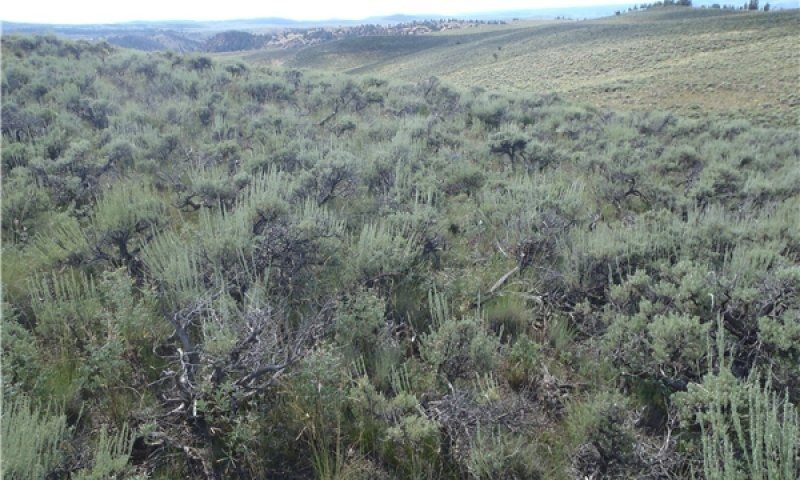
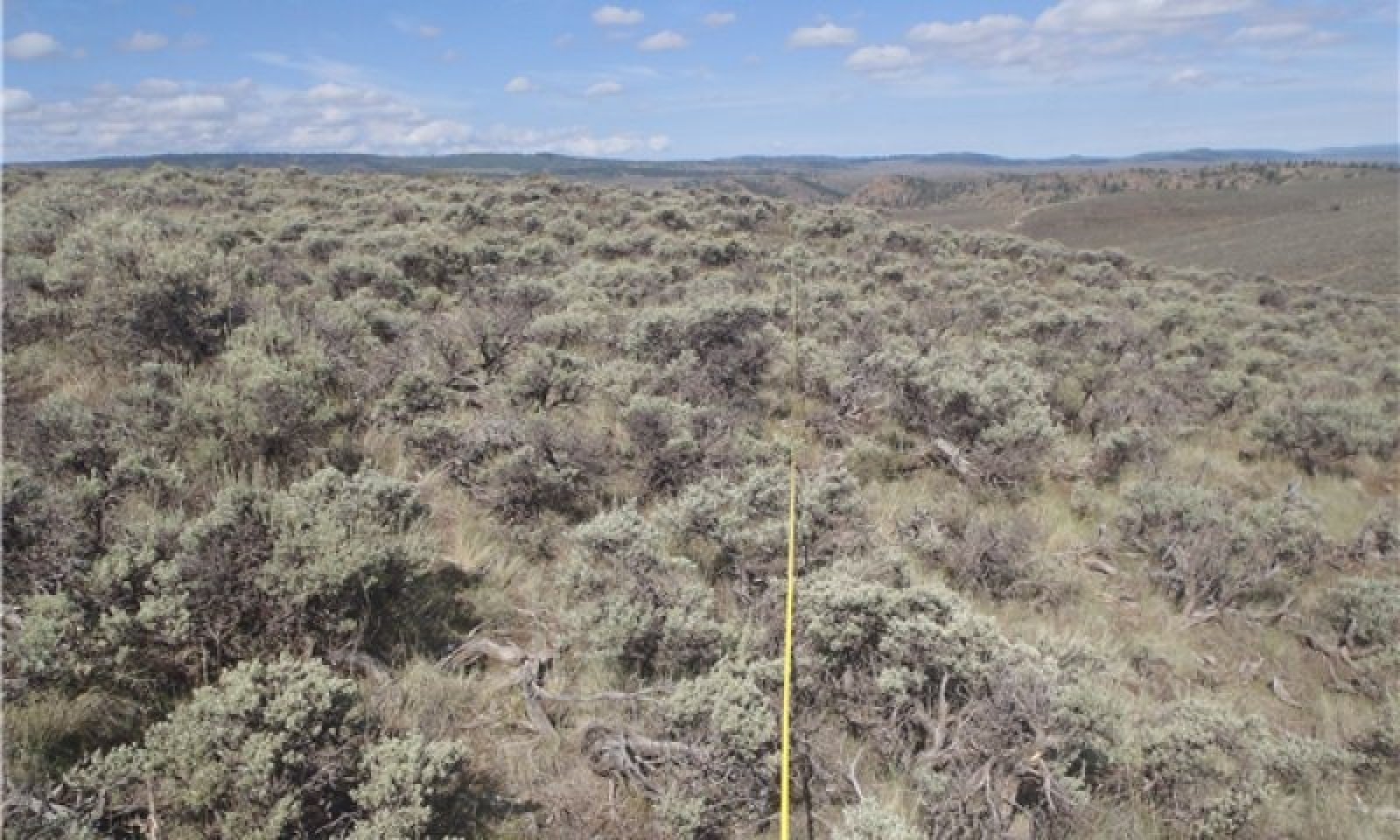
Figure 7. Reference Community 1.2: Shrub/Grass Mix
Grass is dominant with mountain big sagebrush subdominant. The site is treeless, however trees commonly are in the general vicinity. The canopy cover of mountain big sagebrush can be 15 to 40 percent within 20 years after a low-intensity fire or other disturbance, and it can be as high as 40 to 50 percent in undisturbed areas (Winward, 2004; Miller and Eddleman, 2001; Nelle et al., 2000). After a severe fire, it may be 30 years or more before mountain big sagebrush becomes dominant again (Nelle et al., 2000).
Resilience management. The major shrubs are mountain big sagebrush and yellow rabbitbrush. This reference state shows the greatest resistance to disturbance and is maintained in areas where careful grazing management has been used over a long period for the establishment of understory species and increased vigor of stressed plants. The site is subject to frequent periods of drought and fires of mixed intensity and frequency. The fire return interval (FRI) is 10 to 70 years (Howard, 1999). Sagebrush species less than 50 years old are easily killed by fire. Most forb species that re-sprout from a caudex, corm, bulb, rhizome, or rootstock recover rapidly following fire, and low-growing or mat-forming forbs such as pussytoes or buckwheat may be severely damaged and set back by fire (Miller and Eddleman, 2001).
Community 1.1
Grass and Shrub Mix
This community is grass dominant and shrub subdominant. Grasses are mostly characterized by western wheatgrass and bunchgrasses such as Letterman's needlegrass, pine needlegrass, muttongrass, squirreltail, Sandberg bluegrass, Columbia needlegrass, mountain brome, slender wheatgrass, needle-and-thread, and prairie junegrass. Shrubs such as mountain big sagebrush and yellow rabbitbrush are subdominant. The site is treeless; however, trees commonly are in the general vicinity.
Resilience management. This plant community is diverse, stable, and productive under normal precipitation. Litter is properly distributed, and a minimal amount is moved offsite. The natural plant mortality rate is low. Forbs are a dynamic component on this site; production varies greatly and is dependent on the annual precipitation. If the plant community is healthy, it has a diverse, productive herbaceous component capable of producing a seed source and a multi-aged overstory of sagebrush (Winward, 2004). Community dynamics, nutrient cycles, water cycles, and energy flow are functioning properly. The community can be maintained by properly managing grazing. This includes adequate deferment during the growing season to allow for establishment of grass and recovery of stressed plants. This community is resistant to many natural disturbances.
Dominant plant species
-
mountain big sagebrush (Artemisia tridentata ssp. vaseyana), shrub
-
western wheatgrass (Pascopyrum smithii), grass
Figure 8. Annual production by plant type (representative values) or group (midpoint values)
Table 5. Annual production by plant type
| Plant type | Low (lb/acre) |
Representative value (lb/acre) |
High (lb/acre) |
|---|---|---|---|
| Grass/Grasslike | 300 | 560 | 750 |
| Shrub/Vine | 60 | 115 | 150 |
| Forb | 40 | 75 | 100 |
| Total | 400 | 750 | 1000 |
Community 1.2
Shrub and Grass Mix

Figure 9. Shrub/Grass Community Phase
This community is dominated big sagebrush. It has more shrub cover and less understory than does the reference community. The sagebrush is often a single age stand. The abundance of Sandberg bluegrass and western wheatgrass has increased and bunchgrasses such as muttongrass has decreased. The abundance of low shrubs such as yellow rabbitbrush, spineless horsebrush, and broom snakeweed have increased.
Resilience management. Minimal understory helps to suppress low-intensity fires because of limited fuel. The increased sagebrush canopy may be due to lack of disturbance such as wildfire. Accumulating effects of degrading sagebrush habitats include higher susceptibility to erosion and sedimentation, decreased water quality, decreased forage for domestic livestock, and decreased habitat for wildlife species (McIver et al., 2010). This phase has less diversity of species as compared to community phase 1.1.
Pathway 1.1A
Community 1.1 to 1.2
Repetitive defoliation with high utilization of grasses during the growing season can reduce the fine fuel in the understory, which favors sagebrush encroachment and shortens the period to transition to community phase 1.2. Lack of fire over time can cause this transition (McIver et al., 2010). Extended periods of drought and lack of insects and pathogens can influence this pathway and create a single-aged stand of sagebrush. This transition is characterized by a loss of understory and an increase in bare ground between the shrubs and other evidence of soil erosion. Depletion of fine fuel due to inappropriate grazing has shifted the fire regime from relatively frequent, low or mixed severity fires (10 to 50 years mean fire return interval) to less frequent, high severity fires (more than 50 years mean fire return interval) (McIver et al., 2010). This pathway results in short-term loss of topsoil and reduction in water-holding capacity in the upper part of the soil due to increased runoff and erosion.
Pathway 1.2A
Community 1.2 to 1.1
Periodic, naturally occurring fires increase the resilience of the community. This transitions the site from community 1.2 (shrub dominant) to community 1.1 (grass dominant) by reducing competition and the canopy cover of less fire-tolerant species (McIver et al., 2010). Careful grazing management, especially during wet periods, coupled with fire after grasses have matured and set seed will help reduce the canopy of sagebrush and invigorate grass species. Small-scale mortality of shrubs from insects and pathogens may also move this community toward a diverse understory and increase patchiness. (Evers et al., 2011).
State 2
Degraded
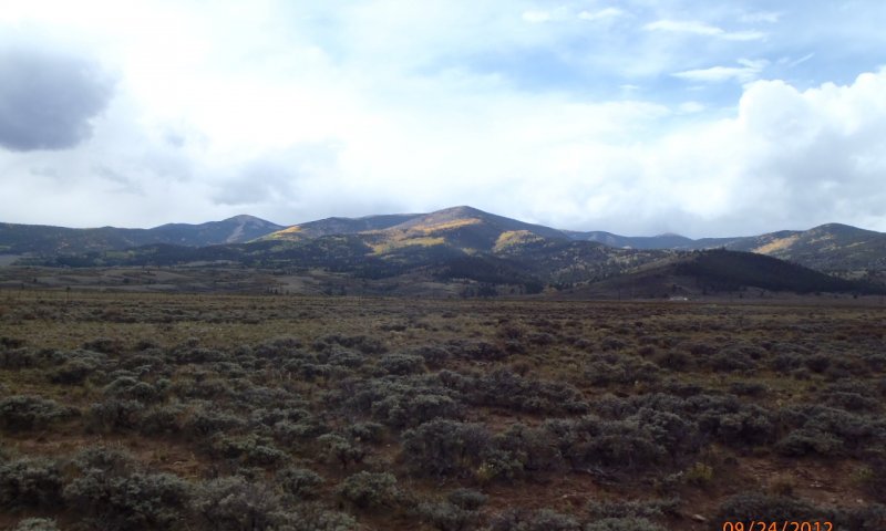
Figure 10. Degraded: Shrub Dominant
State 2 is a sagebrush-dominant community. It has more shrub cover and less understory cover as compared to state 1. State 2 has an even-structured, single-aged sagebrush stand.
Resilience management. This state has decreased resilience to disturbance as bare ground and erosion are prevalent.
Community 2.1
Shrub Dominant

Figure 11. High bare ground and soil erosion between shrubs.
Grasses such as western wheatgrass and bottlebrush squirreltail are still present. The abundance of low shrubs such as yellow rabbitbrush, spineless horsebrush and snakeweed have also increaed. Species diversity is lower and bare ground is greater causing increased erosion and less water retention.
State 3
Seeded With Introduced Species
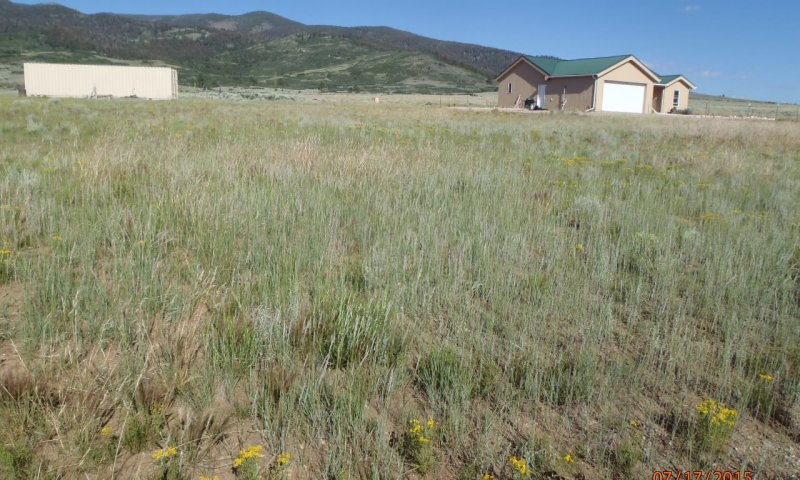
Figure 12. Site seeded to introduced species.
This state is characterized by sagebrush removal due to fire or shrub management treatments, which may include chaining, disking, and mowing. The community dynamics are similar those of the reference state. This state could persist for long periods. Sagebrush will start to re-establish when the conditions are favorable. This site historically has been seeded to perennial species such as crested wheatgrass and Russian wildrye. Due to changes in soil properties and the presence of seeded plants, this state is not likely to return to the reference state unless restoration practices are applied.
Resilience management. This state has become less resilient to drought and disease as non-native plants do not enhance native soil microbial communities.
Community 3.1
Seeded Grassland
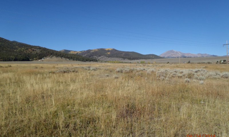
Figure 13. Seeded to introduced species with agricultural maintenance such as occasional irrigation and fertilization.
This community is characterized by introduced perennial grasses. Perennial species such as crested wheatgrass, bromegrass, and Russian wildrye have been seeded. This community is often seeded to agricultural grass species for hay crops. Sagebrush will re-establish from seed in adjacent areas or seedbanks. Small amounts of Sandberg bluegrass and western wheatgrass will slowly establish. To maintain this community some form of agricultural maintenance is needed. This could be occasional irrigation, fertilization, and shrub control. Short-term loss of topsoil and a reduction in the water-holding capacity of the upper part of the soil occur because the understory is not sufficient to prevent runoff.
Community 3.2
Shrub Dominant
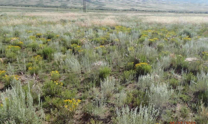
Figure 14. Over time, shrubs have become dominant in seeded area.
This community consists of seeded perennial grasses such as Russian wildrye and crested wheatgrass with shrubs established in the overstory. Shrubs such as big sagebrush and yellow rabbitbrush encroach from adjacent areas or germinate from the soil seedbank.
Resilience management. Bare ground and erosion have increased causing less resiliency to disturbance.
Pathway 3.1A
Community 3.1 to 3.2


The natural pathway over time without fire or brush control is shrub encroachment. Also, without maintenance over time, introduced species such as crested wheat will lose vigor, ecological processes will slow down, and shrubs will gain a competitive advantage.
Pathway 3.2A
Community 3.2 to 3.1


A disturbance to the shrubs coupled with agricultural maintenance of the introduced grasses will bring the site back to grass dominant. Managed grazing allowing grasses to compete will complete the process.
State 4
Seeded Mature Sagebrush
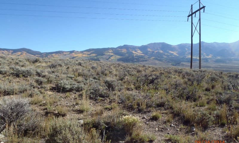
Figure 15. Old crested wheat stand gone to mature sagebrush.
State 4 consists dominantly of sagebrush. This state has more shrub cover and less understory cover.
Resilience management. This is a degraded state. The microbial community is minimal. Plant cover and diversity is minimal. Erosion has accelerated.
Community 4.1

Figure 16. Old crested wheat stand gone to mature sagebrush.
The community is an even-structured, single-aged stand. Less introduced species are in this state. The abundance of low shrubs such as yellow rabbitbrush and spineless horsebrush has increased, replacing some of the herbaceous component in the understory. This state has minimal diversity of species.
Transition T1A
State 1 to 2


Repetitive defoliation with high utilization of palatable species for extended periods during the growing season can reduce the amount of fine fuel in the understory, which favors sagebrush encroachment. Lack of fire over time can cause this transition (McIver et al., 2010). Extended periods of drought and lack of insect and pathogen activity can result in a single-aged stand of sagebrush. This transition is characterized by a decrease in the understory and an increase in the amount of bare ground between the shrubs and other evidence of soil erosion. The depletion of fine fuel due to improper grazing, shifts the fire regime from relatively frequent fires of low to mixed severity (10- to 50-year mean fire return interval) to less frequent fires of high severity (more than 50-year mean fire return interval) (McIver et al., 2010).
Transition T1B
State 1 to 3


Historically, this transition has resulted from a catastrophic wildlife but it can be induced by human activity (shrub management or prescribed burning). Introduced species are seeded. Short-term loss of topsoil and a reduction in the water-holding capacity in the upper part of the soil occurs, and the diversity of species above and the microbial community below ground have decreased.
Restoration pathway R2A
State 2 to 1


This transition is caused by fire, disease, or by human activity (shrub management or prescribed burning). Native species are seeded. Rest from grazing for seeded plant establishment is recommended.
Transition T2B
State 2 to 3


This transition is caused by human activity (shrub management or prescribed burning) or a catastrophic wildfire. Introduced species are seeded.
Restoration pathway R3A
State 3 to 1


This site may be restored to resemble the grass dominated with mountain big sagebrush community of the reference state by seeding commercial mixtures of native grasses, forbs, and shrubs. Selective removal of introduced species also may be needed. If properly managed, a semblance of the diversity and complexity of the reference state can be restored.
Transition T3A
State 3 to 4


Over time, without regular maintenance the introduced species decrease in production and density, creating areas by which shrubs can encroach and re-establish. The decrease of soil health over the years have also made it difficult for native species to re-colonize. Shrubs eventually gain a competitive advantage and increase, along with bare ground, and erosion.
Restoration pathway R4B
State 4 to 1


The site may be restored to resemble the grass/shrub mix community in the reference state by seeding commercial mixtures of native grasses, forbs, and shrubs. Selective removal of introduced species also may be needed. If properly managed, a semblance of the diversity and complexity of the reference state can be restored. This restoration pathway is intensive if attempted on a large scale.
Restoration pathway R4A
State 4 to 3


Fire and wet periods or substituted irrigation can cause the mature, single-aged shrub communities to transition to grassland if proper grazing is implemented and sufficient seed is in the seedbank to regenerate the understory species. If sufficient seed or mature plants are not available, reseeding may be needed. Shrub management practices such as prescribed burning can be used to assist in restoring state 4 to state 3.
Additional community tables
Table 6. Community 1.1 plant community composition
| Group | Common name | Symbol | Scientific name | Annual production (lb/acre) | Foliar cover (%) | |
|---|---|---|---|---|---|---|
|
Grass/Grasslike
|
||||||
| 1 | 400–600 | |||||
| western wheatgrass | PASM | Pascopyrum smithii | 100–300 | – | ||
| prairie Junegrass | KOMA | Koeleria macrantha | 50–100 | – | ||
| pine needlegrass | ACPI2 | Achnatherum pinetorum | 50–100 | – | ||
| Letterman's needlegrass | ACLE9 | Achnatherum lettermanii | 50–100 | – | ||
| muttongrass | POFE | Poa fendleriana | 50–100 | – | ||
| squirreltail | ELEL5 | Elymus elymoides | 15–35 | – | ||
| Sandberg bluegrass | POSE | Poa secunda | 15–35 | – | ||
| needle and thread | HECO26 | Hesperostipa comata | 0–25 | – | ||
| mountain brome | BRMA4 | Bromus marginatus | 0–25 | – | ||
| slender wheatgrass | ELTR7 | Elymus trachycaulus | 0–25 | – | ||
| mountain muhly | MUMO | Muhlenbergia montana | 0–25 | – | ||
| Grass, native | 2GN | Grass, native | 0–25 | – | ||
| Columbia needlegrass | ACNE9 | Achnatherum nelsonii | 0–25 | – | ||
|
Forb
|
||||||
| 2 | 40–100 | |||||
| pussytoes | ANTEN | Antennaria | 15–35 | – | ||
| Forb, native | 2FN | Forb, native | 0–35 | – | ||
| buckwheat | ERIOG | Eriogonum | 15–35 | – | ||
|
Shrub/Vine
|
||||||
| 3 | 75–150 | |||||
| mountain big sagebrush | ARTRV | Artemisia tridentata ssp. vaseyana | 30–75 | – | ||
| yellow rabbitbrush | CHVI8 | Chrysothamnus viscidiflorus | 15–35 | – | ||
| Saskatoon serviceberry | AMAL2 | Amelanchier alnifolia | 0–25 | – | ||
| snowberry | SYMPH | Symphoricarpos | 0–25 | – | ||
| spineless horsebrush | TECA2 | Tetradymia canescens | 0–25 | – | ||
| broom snakeweed | GUSA2 | Gutierrezia sarothrae | 0–25 | – | ||
| Shrub (>.5m) | 2SHRUB | Shrub (>.5m) | 0–25 | – | ||
Interpretations
Supporting information
Inventory data references
Location of Typical Example of Site:
Bench above BLM Poso Project northwest of Antonito, Conejos County.
Field Offices in Colorado where the site occurs:
Alamosa, Center, and San Luis
References
-
. 2021 (Date accessed). USDA PLANTS Database. http://plants.usda.gov.
Other references
Chapman, S.S., G.E. Griffith, J.M. Omernik, A.B. Price, J. Freeouf, and D.L. Schrupp. 2006. Ecoregions of Colorado. (2-sided color posterwith map, descriptive text, summary tables, and photographs). U.S. Geological Survey, Reston, VA. Scale 1:1,200,000.
Cleland, D.T.; Freeouf, J.A.; Keys, J.E.; Nowacki, G.J.; Carpenter, C.A.; and McNab, W.H. 2007. Ecological Subregions: Sections andSubsections for the conterminous United States. Gen. Tech. Report WO-76D [Map on CD-ROM] (A.M. Sloan, cartographer). Washington,DC: U.S. Department of Agriculture, Forest Service, presentation scale 1:3,500,000; colored.
Evers, L., R.F. Miller, M. Hemstrom, J. Merzenich, and R. Neilson. 2011. Estimating historical sage-grouse habitat abundance using state-and-transition model. Natural Resources and Environmental Issues. Volume 17, Article 16. Pages 1-13.
Goodrich, S., E.D. McArthur, and A.H. Winward. 1999. Sagebrush ecotones and average Annual Precipitation. U.S. Department of Agriculture, Forest Service Proceedings RMRS-P-11.
Howard, Janet L. 1999. Artemisia tridentata subsp. wyomingensis. In Fire Effects Information System. U.S. Department of Agriculture, Forest Service, Rocky Mountain Research Station, Fire Sciences Laboratory. Available at https://www.feis-crs.org/feis/. Accessed July 18, 2012.
Johnson, Kathleen A. 2000. Artemisia tridentata subsp. vaseyana. In Fire Effects Information System. U.S. Department of Agriculture, Forest Service, Rocky Mountain Research Station, Fire Sciences Laboratory. Available at https://www.feis-crs.org/feis/. Accessed February 28, 2012.
McIver, J. D., Brunson, M., Bunting, S. C., and others. 2010. The sagebrush steppe treatment evaluation project (SageSTEP): a test of state-and-transition theory. Gen. Tech. Rep. RMRS-GTR-237. Fort Collins, CO. USDA, Forest Service, Rocky Mountain Research Station. 16 p.
Miller, R.F., and L.L. Eddleman. 2001. Spatial and temporal changes of sage grouse habitat in the sagebrush biome. Oregon State University, Agricultural Experiment Station Technical Bulletin 151.
Nelle, P.J., K.P. Reese, and J.W. Connelly. 2000. Long-term effects of fire on sage grouse habitat. Journal of Range Management 53: 586-591.
Soil Conservation Service (SCS). August 1975. Range Site Description for Mountain Loam 10-14" P.Z. #233 USDA, Denver Colorado.
United States Department of Agriculture, Natural Resources Conservation Service. 2006. Land Resource Regions and Major Land Resource Areas of the United States, the Caribbean, and the Pacific Basin. U.S. Department of Agriculture Handbook 296.
Winward, A.H. 2004. Sagebrush of Colorado: Taxonomy, distribution, ecology, and management. Colorado Division of Wildlife. Denver, Colorado.
Contributors
C. Villa, S. Woodall, H. Garcia
Suzanne Mayne-Kinney
Approval
Kirt Walstad, 12/11/2024
Acknowledgments
Project Staff:
Suzanne Mayne-Kinney, Ecological Site Specialist, NRCS MLRA, Grand Junction SSO
Alan Stuebe, MLRA Soil Survey Leader, NRCS MLRA Alamosa SSO
Program Support:
Rachel Murph, NRCS CO State Rangeland Management Specialist, Denver
Eva Muller, Regional Director, Rocky Mountain Regional Soil Survey Office, Bozeman, MT
B.J. Shoup, CO State Soil Scientist, Denver
Eugene Backhaus, CO State Resource Conservationist, Denver
--Site Development and Testing Plan--:
Future work to validate and further refine the information in this Provisional Ecological Site Description is necessary. This will include field activities to collect low-, medium-, and high-intensity sampling, soil correlations, and analysis of that data.
Additional information and data are required to refine the Plant Production and Annual Production tables for this ecological site. The extent of MLRA 51 must be further investigated.
Field testing of the information contained in this Provisional ESD is required. As this ESD is moved to the Approved ESD level, reviews from the technical team, quality control, quality assurance, and peers will be conducted.
Rangeland health reference sheet
Interpreting Indicators of Rangeland Health is a qualitative assessment protocol used to determine ecosystem condition based on benchmark characteristics described in the Reference Sheet. A suite of 17 (or more) indicators are typically considered in an assessment. The ecological site(s) representative of an assessment location must be known prior to applying the protocol and must be verified based on soils and climate. Current plant community cannot be used to identify the ecological site.
| Author(s)/participant(s) | |
|---|---|
| Contact for lead author | |
| Date | 12/10/2024 |
| Approved by | Kirt Walstad |
| Approval date | |
| Composition (Indicators 10 and 12) based on | Annual Production |
Indicators
-
Number and extent of rills:
-
Presence of water flow patterns:
-
Number and height of erosional pedestals or terracettes:
-
Bare ground from Ecological Site Description or other studies (rock, litter, lichen, moss, plant canopy are not bare ground):
-
Number of gullies and erosion associated with gullies:
-
Extent of wind scoured, blowouts and/or depositional areas:
-
Amount of litter movement (describe size and distance expected to travel):
-
Soil surface (top few mm) resistance to erosion (stability values are averages - most sites will show a range of values):
-
Soil surface structure and SOM content (include type of structure and A-horizon color and thickness):
-
Effect of community phase composition (relative proportion of different functional groups) and spatial distribution on infiltration and runoff:
-
Presence and thickness of compaction layer (usually none; describe soil profile features which may be mistaken for compaction on this site):
-
Functional/Structural Groups (list in order of descending dominance by above-ground annual-production or live foliar cover using symbols: >>, >, = to indicate much greater than, greater than, and equal to):
Dominant:
Sub-dominant:
Other:
Additional:
-
Amount of plant mortality and decadence (include which functional groups are expected to show mortality or decadence):
-
Average percent litter cover (%) and depth ( in):
-
Expected annual annual-production (this is TOTAL above-ground annual-production, not just forage annual-production):
-
Potential invasive (including noxious) species (native and non-native). List species which BOTH characterize degraded states and have the potential to become a dominant or co-dominant species on the ecological site if their future establishment and growth is not actively controlled by management interventions. Species that become dominant for only one to several years (e.g., short-term response to drought or wildfire) are not invasive plants. Note that unlike other indicators, we are describing what is NOT expected in the reference state for the ecological site:
-
Perennial plant reproductive capability:
Print Options
Sections
Font
Other
The Ecosystem Dynamics Interpretive Tool is an information system framework developed by the USDA-ARS Jornada Experimental Range, USDA Natural Resources Conservation Service, and New Mexico State University.
Click on box and path labels to scroll to the respective text.