Mountain Outwash
Scenario model
Current ecosystem state
Select a state
Management practices/drivers
Select a transition or restoration pathway
- Transition T1A More details
- Restoration pathway R2A More details
-
No transition or restoration pathway between the selected states has been described
Target ecosystem state
Select a state
Description
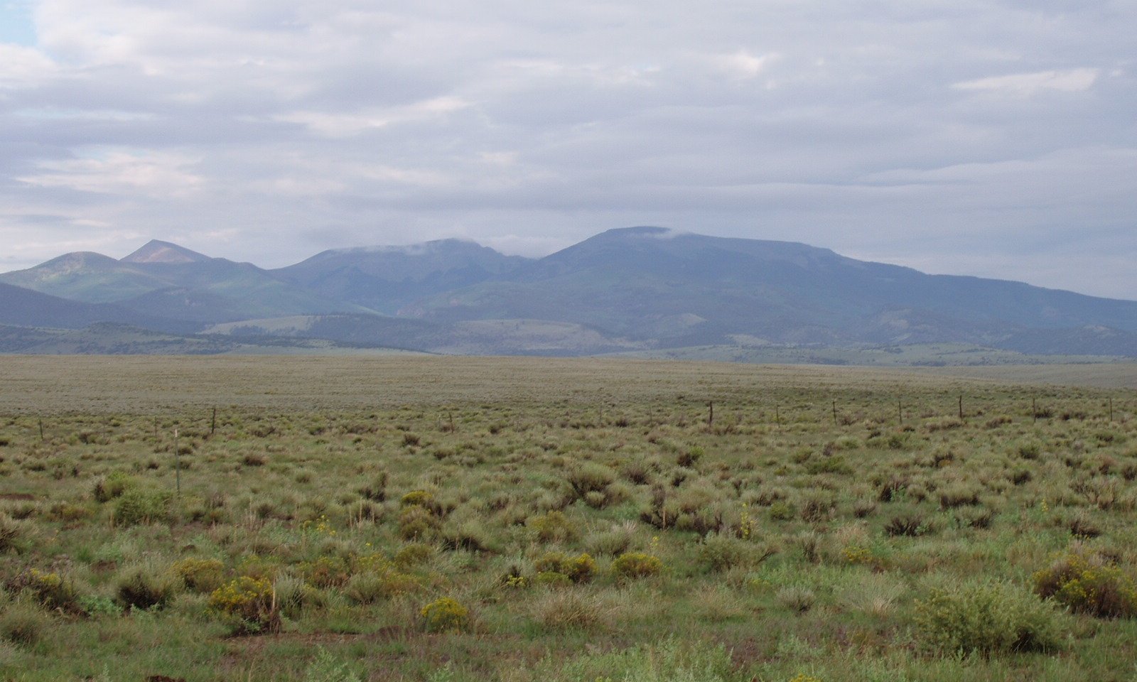
The reference state has a mix of grasses, forbs and shrubs. Bare ground is minimal and ecological services are maximized. The mix between cool and warm season grasses is about equal, allowing for continued plant growth through the late spring, summer, and into the early fall. This site also has a diverse mix of forbs and shrubs, including some cactus.
Resilience management
The reference state has a large diversity of grasses, forbs, and shrubs which provide a host of ecosystem services that maintain soil stability, biotic integrity, and hydrologic function. This state is the most capable to withstand disturbance.
Submodel
Description
This degraded state will have a predominance of bare ground, annuals, rabbitbrush species, ring muhly, and low vigor blue grama. Preferred cool season species are scarce and only exist in protected areas. Though squirreltail can hang on provide a stabilizing element in this state. This plant community develops through long-term continuous grazing. The consistent and persistent lack of adequate recovery periods between grazing occurrences has caused Greene’s rabbitbrush and/or rubber rabbitbrush to dominate.
Overall production, plant vigor, species diversity, and frequency of all native vegetation has decreased dramatically. Litter levels are low and bare ground has increased. Flow paths are evident. Soil stability, biotic integrity, and hydrologic cycles are disrupted. It will take a long time to recover from this state.
Resilience management
The degraded state has low resilience to disturbance. With low biotic diversity and cover, critical soil health features such as moisture retention, mineralization, and decomposition have decreased to a level were ecological services are negligible.
Submodel
Mechanism
The main driver leading to a threshold cross is long-term, repetitive, high utilization of plant species without recovery and opportunity for reproduction. High stocking rates increase the speed of this degradation. Essentially, preferred species get bitten repeatedly until above and below ground reserves are depleted and species die. Plants with greater defenses, such as blue grama with low meristems and weak rhizomes, and rabbitbrush with chemicals that repel taste and smell, continue to exist in in the degraded state. Bare ground increases, soil stability decreases, and the site loses its hydrologic function. Often a drought is the trigger event that causes the site to cross the threshold.
Mechanism
To restore the site to reference conditions the soil must be stabilized and built to have higher resilience. This is a long term process where cover increases, organic matter increases, aggregate stability increases, infiltration increases, and biotic diversity and production increases. As a tool in the conservation toolbox, grazing management must include monitoring and adaptive management to give plants an opportunity to re-establish and slowly begin to repair the soil. Years of favorable precipitation are helpful to speed up progress.
Model keys
Briefcase
Add ecological sites and Major Land Resource Areas to your briefcase by clicking on the briefcase (![]() ) icon wherever it occurs. Drag and drop items to reorder. Cookies are used to store briefcase items between browsing sessions. Because of this, the number of items that can be added to your briefcase is limited, and briefcase items added on one device and browser cannot be accessed from another device or browser. Users who do not wish to place cookies on their devices should not use the briefcase tool. Briefcase cookies serve no other purpose than described here and are deleted whenever browsing history is cleared.
) icon wherever it occurs. Drag and drop items to reorder. Cookies are used to store briefcase items between browsing sessions. Because of this, the number of items that can be added to your briefcase is limited, and briefcase items added on one device and browser cannot be accessed from another device or browser. Users who do not wish to place cookies on their devices should not use the briefcase tool. Briefcase cookies serve no other purpose than described here and are deleted whenever browsing history is cleared.
Ecological sites
Major Land Resource Areas
The Ecosystem Dynamics Interpretive Tool is an information system framework developed by the USDA-ARS Jornada Experimental Range, USDA Natural Resources Conservation Service, and New Mexico State University.


