Natural Resources
Conservation Service
Ecological site R062XC024SD
Shallow Loamy - South
Last updated: 7/31/2024
Accessed: 04/03/2026
General information
Provisional. A provisional ecological site description has undergone quality control and quality assurance review. It contains a working state and transition model and enough information to identify the ecological site.
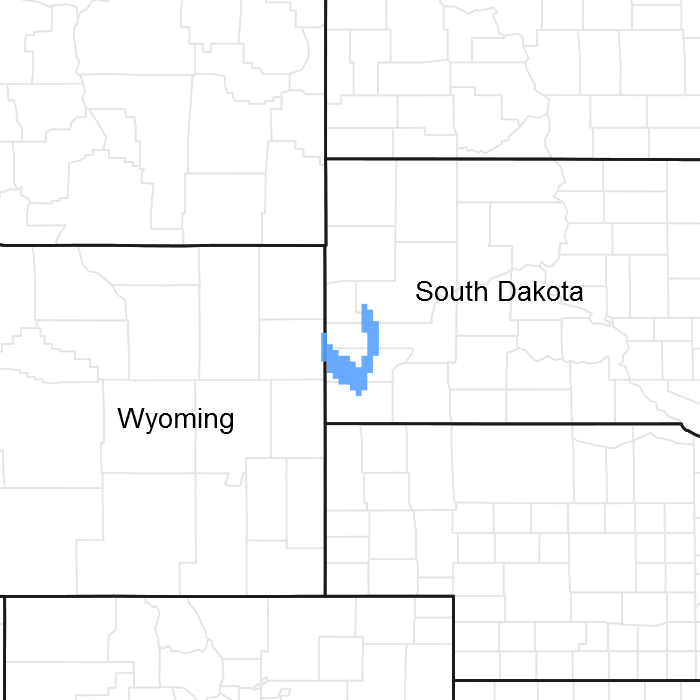
Figure 1. Mapped extent
Areas shown in blue indicate the maximum mapped extent of this ecological site. Other ecological sites likely occur within the highlighted areas. It is also possible for this ecological site to occur outside of highlighted areas if detailed soil survey has not been completed or recently updated.
MLRA notes
Major Land Resource Area (MLRA): 062X–Black Hills
The Black Hills (MLRA 62) is a unique, low lying mountain range situated in the midst of a mixed short and mid-grass prairie. It is a true Island in the Plains, as it has geophysical and biological attributes that are unlike the surrounding area. The Black Hills have strong floristic ties to four of the North American biomes: Cordilleran (Rocky Mountain) Forest, Northern Coniferous Forest, Eastern Deciduous Forest, and Grasslands.
MLRA 62 is approximately 3,040 square miles in size; 74 percent is located in South Dakota, and 26 percent is in Wyoming. The towns of Lead, Deadwood, Hill City, and Custer, South Dakota, are in this area. U.S. Highways 16 and 385 cross the MLRA. The Black Hills National Forest, Custer State Park, Mt. Rushmore National Monument, Jewel Cave National Monument, and Wind Cave National Park are located in this MLRA.
This area forms the core of the Black Hills and the Bear Lodge Mountains where the elevation ranges between 3,600 to 6,565 feet, however, Black Elk Peak (Harney Peak) rises to 7,242 feet. Slopes range from moderately sloping on some of the high plateaus to very steeply sloping along drainageways and on peaks and ridges. Narrow valleys generally are gently sloping to strongly sloping.
The Black Hills uplift is the product of the Laramide mountain-building episodes that produced most of the ranges in the Rocky Mountains. Uplift began near the end of the Cretaceous period, 65 million years ago and ended by 35 million years ago (Froiland 1999). The core of the Black Hills is a plutonic mass of granite with steeply dipping metamorphic rocks, primarily slate and schist, which directly surrounds the granite core. A plateau of Mississippian limestone surrounds the igneous and metamorphic rock core. The Madison limestone is broken around the outer edges of the uplifted area. The Permian Minnekahta limestone forms the outermost boundary of the area. Many other tilted sandstone, shale, and limestone units are exposed like a bathtub ring inside the steeply dipping Madison limestone.
The dominant soil orders in this MLRA are Alfisols (forest soils) and Mollisols (grassland soils). The soils in the area have a frigid or cryic soil temperature regime, a udic or ustic soil moisture regime, and mixed, micaceous, or smectitic mineralogy. They are shallow to very deep, generally well drained, and loamy in texture.
The Black Hills MLRA supports open to dense forest vegetation. Ponderosa pine is the dominant species across the Black Hills. White spruce grows at the higher elevations and along the major drainageways. Bur oak is found intermixed with pine in the northern and eastern fringes of the Black Hills, and Rocky Mountain juniper is most common in the southern portion of the Black Hills. Aspen is of minor extent throughout the Black Hills area. Roughleaf ricegrass, slender wheatgrass, bearded wheatgrass, poverty oatgrass, Richardson’s needlegrass, and mountain ricegrass are the most common native grasses under open forest stands. The most common native shrubs are common snowberry, bearberry, common juniper, Oregon grape, and Saskatoon serviceberry.
MLRA 62 land ownership is approximately 47 percent private and 53 percent federal. Rangeland and forestland are split almost equally between private and federal ownership (47 percent each). Minor areas of land are privately owned cropland and urban development. The forestland in this area is used mainly for timber production, recreation, and grazing.
The major resource concerns are soil erosion and surface compaction caused by logging, mining, wildfires, grazing, and urban expansion. The quality of ground and surface water is another concern, especially in the northern part of the Black Hills. The primary cause is contamination from mine waste and septic systems in areas of rural development and urban expansion (USDA-NRCS, 2006: Ag Handbook 296).
LRU notes
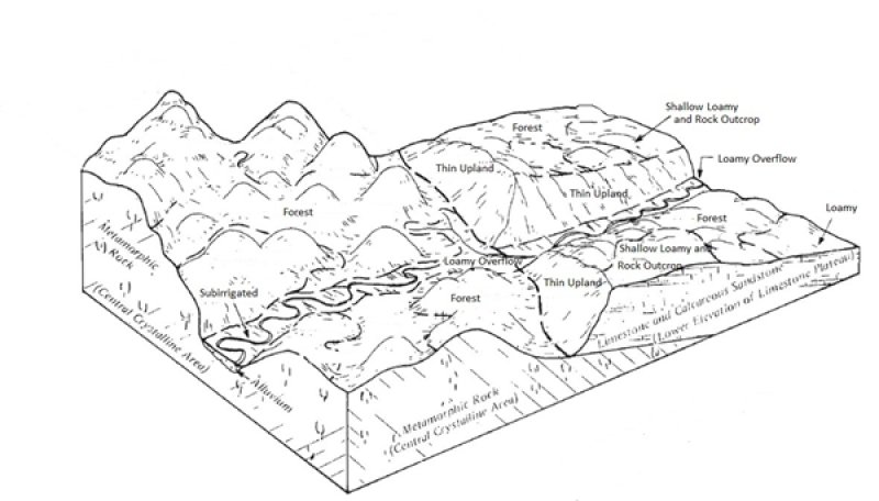
For development of ecological sites, MLRA 62 is divided into three Land Resource Units (LRU’s) or physiographic zones (A, B, C, and Y). Each LRU has a set of ecological sites that represents these zones.
The LRU is identified in the Ecological Site ID: R062XY000SD; “062X” identifies the MLRA, the next letter “Y” identifies the LRU. Note: The organization of Ecological Site ID’s will likely change in the future.
LRU-A includes the northern Black Hills and Bear Lodge Mountains (22-30” PZ); LRU-B includes the high elevation central core of the Black Hills (25-35” PZ); and LRU-C includes the southern portion of the Black Hills (17-21” PZ).
The Forest ecological sites are representative of sites in the Black Hills, Bear Lodge Mountains (MLRA-62), and the surrounding Dakota Hogback (MLRA-61). These sites are separated by elevation, soil temperature regimes, and slope.
The Low Mountain area includes all of the Black Hills, Bear Lodge Mountains, and Dakota Hogback below 6,200 feet in elevation (LRU’s A and C). The soils in this area have a frigid soil temperature regime.
The High Mountain area includes all of the Black Hills above 6,200 feet elevation (LRU-B). The soils in this area have a cryic soil temperature regime.
Classification relationships
USDA
Land Resource Region G—Western Great Plains Range and Irrigated Region:
Major Land Resource Area (MLRA) 62—Black Hills
US Environmental Protection Agency (EPA)
Level IV Ecoregions of the Conterminous United States:
Black Hills Plateau—17b
Black Hills Core Highlands—17c
USDA Forest Service
Ecological Subregions: Sections and Subsections of Conterminous United States:
Black Hills Coniferous Forest Province—M334:
Black Hills Section—334A
Black Hills Limestone Plateau-Core Highlands Subsection—M334Ab
Ecological site concept
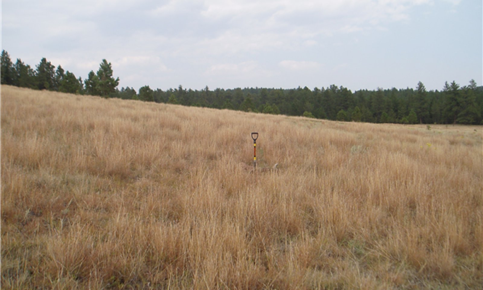
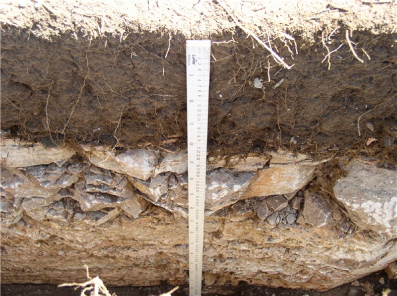
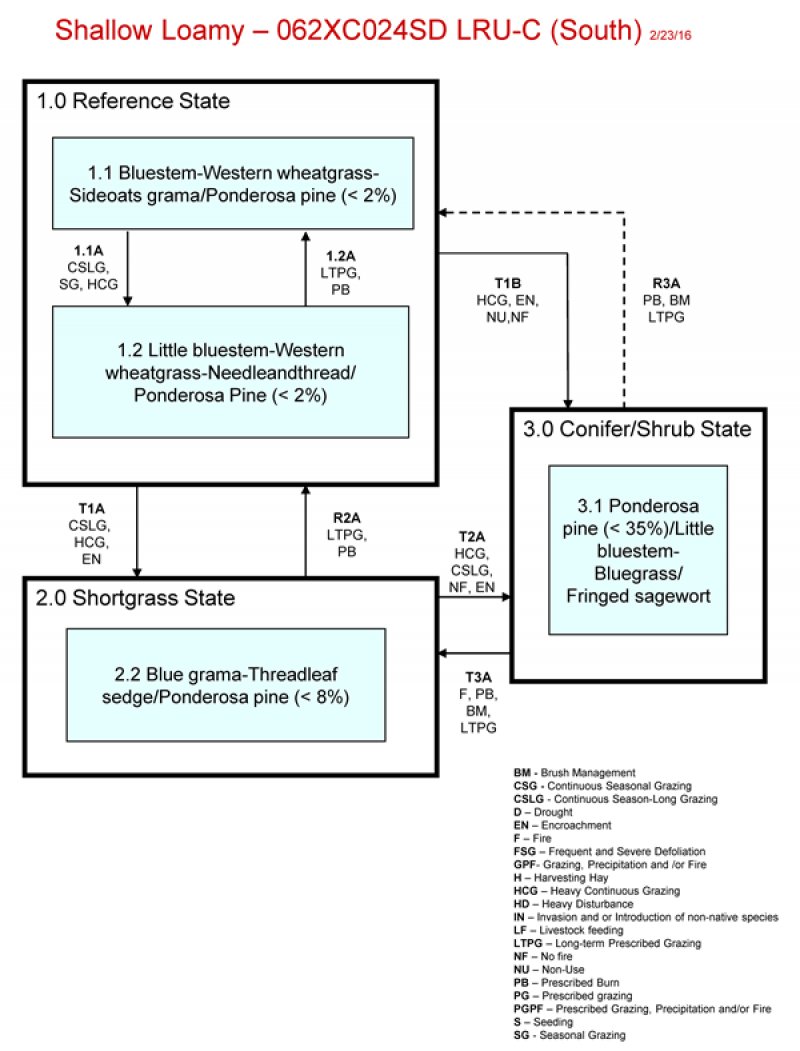
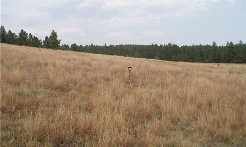
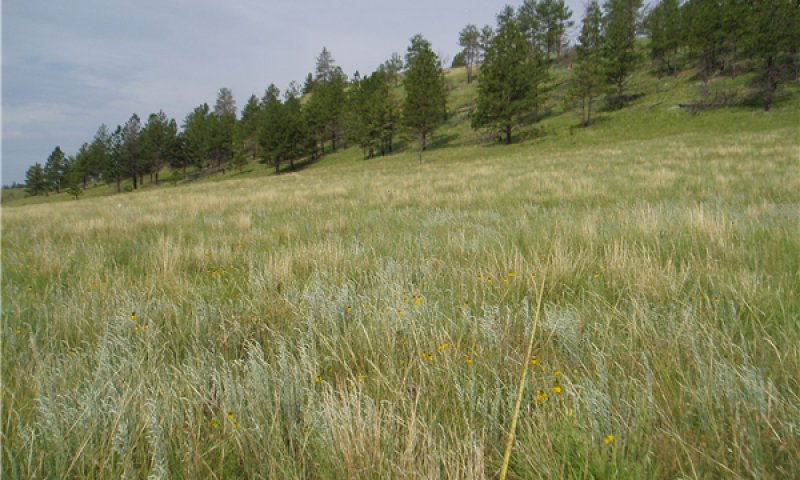
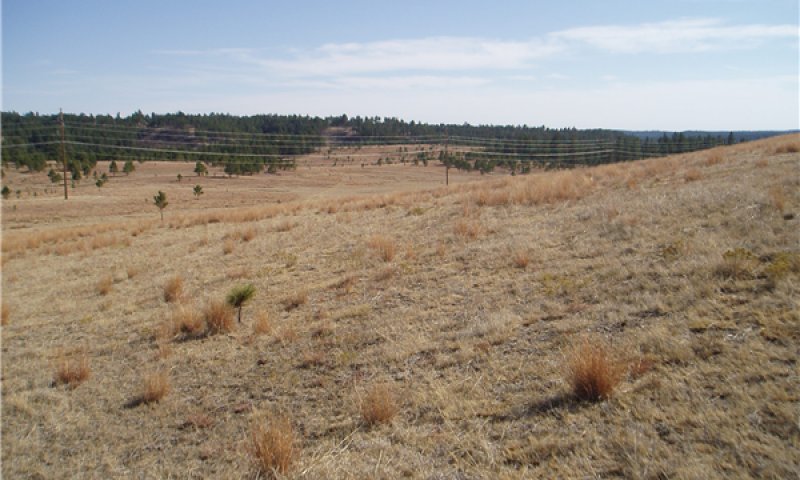
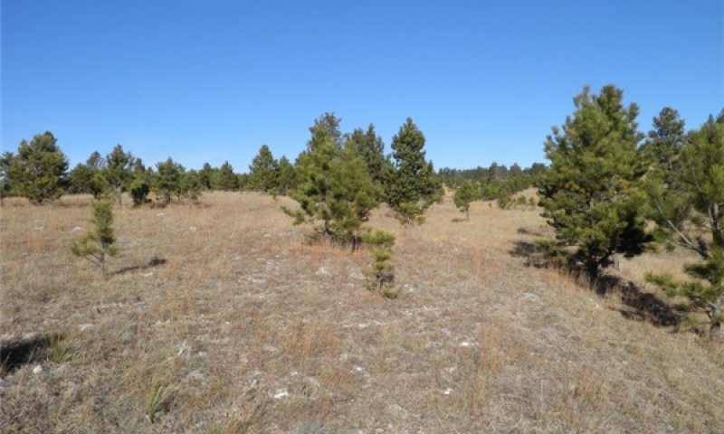
This site is located on upland landscapes in the southern portion of the Black Hills (LRU-C). Soils on this site are shallow, between 10 and 20 inches in depth, with a loamy surface layer ranging from 2 to 6 inches in depth. Most soils on this site are calcareous to the surface. The soils are well to excessively drained with a restrictive bedrock layer of sandstone or limestone, which impedes water movement and rooting depth. Slope can range from 2 to 60 percent. The site does not receive additional water from runoff or overflow. Vegetation in reference consist primarily of warm season grass species with cool season species being sub-dominant. The dominant warm season grasses include little bluestem, big bluestem, and sideoats grama. Cool season grasses include western wheatgrass and needleandthread. Forbs are common and diverse but never dominant, shrubs such as western snowberry, skunkbush sumac, prairie rose and green sagewort are often present in the plant community. Ponderosa pine can be scattered throughout the site but will not exceed 2 percent canopy cover. This site is very susceptible to pine encroachment.
Associated sites
| R062XC010SD |
Loamy - South The loamy ecological site can be adjacent to shallow loamy and often at lower positions on the landscape. |
|---|---|
| R062XY029SD |
Stony Hills Stony Hills ecological site can be adjacent to shallow loamy and often higher on the landscape. |
Similar sites
| R062XY029SD |
Stony Hills Stony Hills more big bluestem and lead plant, higher potential for ponderosa pine, higher production. |
|---|
Table 1. Dominant plant species
| Tree |
Not specified |
|---|---|
| Shrub |
Not specified |
| Herbaceous |
(1) Schizachyrium scoparium |
Click on box and path labels to scroll to the respective text.