Next steps
-
1
Select an ecological site
Select an ecological site using the list, keys, photos, briefcase, or quick search option located on this page. -
2
Explore the ecological site description
Next, learn more about the selected ecological site and its characteristic dynamics by browsing the ecological site description and exploring alternative state and transition model formats.
Ecological site list
-
i
Key Characteristics
- FOREST [Soils typically have an E horizon and translocated clays (argillic horizon). They may have an O horizon but very seldom a mollic epipedon].
- ELEVATION LESS THAN 6,200 FEET? (Low Elevation) Soils are Frigid.
- Are you in LRU A/ Northern Low Elevation Hills?
- Slope 0-15%
-
i
Key Characteristics
- FOREST [Soils typically have an E horizon and translocated clays (argillic horizon). They may have an O horizon but very seldom a mollic epipedon].
- ELEVATION LESS THAN 6,200 FEET? (Low Elevation) Soils are Frigid.
- Are you in LRU A/ Northern Low Elevation Hills?
- Slope 15+%
-
i
Key Characteristics
- FOREST [Soils typically have an E horizon and translocated clays (argillic horizon). They may have an O horizon but very seldom a mollic epipedon].
- ELEVATION GREATER THAN 6,200 FEET? LRU B (High Elevation) Soils are Cryic.
- All other.
- Slopes 0-15%
-
i
Key Characteristics
- FOREST [Soils typically have an E horizon and translocated clays (argillic horizon). They may have an O horizon but very seldom a mollic epipedon].
- ELEVATION GREATER THAN 6,200 FEET? LRU B (High Elevation) Soils are Cryic.
- Depressions/Cool Moist Slopes and Valleys, moss often present in great quantities
-
i
Key Characteristics
- FOREST [Soils typically have an E horizon and translocated clays (argillic horizon). They may have an O horizon but very seldom a mollic epipedon].
- ELEVATION GREATER THAN 6,200 FEET? LRU B (High Elevation) Soils are Cryic.
- All other.
- Slopes 15-60%
-
i
Key Characteristics
- FOREST [Soils typically have an E horizon and translocated clays (argillic horizon). They may have an O horizon but very seldom a mollic epipedon].
- ELEVATION GREATER THAN 6,200 FEET? LRU B (High Elevation) Soils are Cryic.
- All other.
- Slopes 60+%
-
i
Key Characteristics
- FOREST [Soils typically have an E horizon and translocated clays (argillic horizon). They may have an O horizon but very seldom a mollic epipedon].
- ELEVATION LESS THAN 6,200 FEET? (Low Elevation) Soils are Frigid.
- Are you in LRU C/ Southern Dry Low Elevation Hills?
- Slope 0-45+%
-
i
Key Characteristics
- FOREST [Soils typically have an E horizon and translocated clays (argillic horizon). They may have an O horizon but very seldom a mollic epipedon].
- ELEVATION LESS THAN 6,200 FEET? (Low Elevation) Soils are Frigid.
- Are you in LRU A/ Northern Low Elevation Hills?
- Cool fringe forest or pockets of increased moisture
- FOREST [Soils typically have an E horizon and translocated clays (argillic horizon). They may have an O horizon but very seldom a mollic epipedon].
- ELEVATION GREATER THAN 6,200 FEET? LRU B (High Elevation) Soils are Cryic.
- Cool fringe hardwood forest between pine dominated hills and valley loam or rangelands.
-
i
Key Characteristics
- RANGELAND (Soils usually have a mollic epipedon, lack an O horizon and do not have an E horizon. Rangelands may have conifer encroachment but are not Forest Sites).
- NORMAL LANDSCAPE POSITIONS (Upland, slopes normally linear, 1 to 6 percent except sandy/sands sites can have complex slopes, Back slope, Summit, Foot slope)
- Are soils mod. deep or deep and have many (> 35%) coarse fragments (rocks) at or near the surface and throughout the soil profile?
- No. Are soils loamy with a thick dark colored surface layer (> 16” thick) and not adjacent to a stream? Typically, in upland “U-” or “V”-shaped valleys.
- No. Clay or Silty clay (40 to 55% clay) Surface (>1.75” ribbon) with Clayey Subsoil?
- No. Loam, Silt loam, Silty, Clay loam, Sandy clay loam, or Very fine sandy loam (0.5 to 1.75” ribbon)?
- No. Sandy loam, Fine sandy loam, or Loamy very fine sand (0.25 to 0.5” ribbon)?
- Yes. Sandy - North (R062XA009SD).
-
i
Key Characteristics
- RANGELAND (Soils usually have a mollic epipedon, lack an O horizon and do not have an E horizon. Rangelands may have conifer encroachment but are not Forest Sites).
- NORMAL LANDSCAPE POSITIONS (Upland, slopes normally linear, 1 to 6 percent except sandy/sands sites can have complex slopes, Back slope, Summit, Foot slope)
- Are soils mod. deep or deep and have many (> 35%) coarse fragments (rocks) at or near the surface and throughout the soil profile?
- No. Are soils loamy with a thick dark colored surface layer (> 16” thick) and not adjacent to a stream? Typically, in upland “U-” or “V”-shaped valleys.
- No. Clay or Silty clay (40 to 55% clay) Surface (>1.75” ribbon) with Clayey Subsoil?
- No. Loam, Silt loam, Silty, Clay loam, Sandy clay loam, or Very fine sandy loam (0.5 to 1.75” ribbon)?
- Yes. Is the site an old stream terrace?
- No.
- North LRU - Loamy - North (R062XA010SD)
-
i
Key Characteristics
- RANGELAND (Soils usually have a mollic epipedon, lack an O horizon and do not have an E horizon. Rangelands may have conifer encroachment but are not Forest Sites).
- NORMAL LANDSCAPE POSITIONS (Upland, slopes normally linear, 1 to 6 percent except sandy/sands sites can have complex slopes, Back slope, Summit, Foot slope)
- Are soils mod. deep or deep and have many (> 35%) coarse fragments (rocks) at or near the surface and throughout the soil profile?
- No. Are soils loamy with a thick dark colored surface layer (> 16” thick) and not adjacent to a stream? Typically, in upland “U-” or “V”-shaped valleys.
- No. Clay or Silty clay (40 to 55% clay) Surface (>1.75” ribbon) with Clayey Subsoil?
- Yes.
- North LRU - Clayey - North (R062XA011SD)
-
i
Key Characteristics
- RANGELAND (Soils usually have a mollic epipedon, lack an O horizon and do not have an E horizon. Rangelands may have conifer encroachment but are not Forest Sites).
- RUN-OFF LANDSCAPE POSITIONS (Upland, normally convex short slopes > 6 percent, Shoulder).
- Dig hole to a depth of 20 inches minimum. Is there root restrictive layer within 10 inches of the soil surface?
- No. Is there a root restricting layer within 10-20 inches of the surface?
- Yes. Determine the soil texture.
- Clayey - Shallow Clayey - North (R062XA17SD)
-
i
Key Characteristics
- RANGELAND (Soils usually have a mollic epipedon, lack an O horizon and do not have an E horizon. Rangelands may have conifer encroachment but are not Forest Sites).
- RUN-IN LANDSCAPE POSITIONS [Valley Bottomlands, Drainageways (not depressions), Toe slopes].
- Observe the soil to a depth of 60 inches. Is there evidence of a permanent water table within 0 to 1 foot of the surface and the site is dominated by hydrophytes?
- No. Is there evidence of a permanent water table within 1 to 2 feet of the surface?
- No. Is there evidence of a permanent water table within 2 to 5 feet of the surface?
- No. Is the site adjacent to a stream or a low stream terrace that occasionally floods and is located below 6,200’ in elevation? There may also be a seasonal water table present (>5 feet of the surface).
- Yes. Dryer than lowland ES,
- North LRU - Loamy Overflow - North (R062XA020SD),
-
i
Key Characteristics
- RANGELAND (Soils usually have a mollic epipedon, lack an O horizon and do not have an E horizon. Rangelands may have conifer encroachment but are not Forest Sites).
- RUN-OFF LANDSCAPE POSITIONS (Upland, normally convex short slopes > 6 percent, Shoulder).
- Dig hole to a depth of 20 inches minimum. Is there root restrictive layer within 10 inches of the soil surface?
- No. Is there a root restricting layer within 10-20 inches of the surface?
- Yes. Determine the soil texture.
- Loamy
- North LRU - Shallow Loamy - North (R062XA024SD),
-
i
Key Characteristics
- RANGELAND (Soils usually have a mollic epipedon, lack an O horizon and do not have an E horizon. Rangelands may have conifer encroachment but are not Forest Sites).
- NORMAL LANDSCAPE POSITIONS (Upland, slopes normally linear, 1 to 6 percent except sandy/sands sites can have complex slopes, Back slope, Summit, Foot slope)
- Are soils mod. deep or deep and have many (> 35%) coarse fragments (rocks) at or near the surface and throughout the soil profile?
- Yes. Is the soil derived from flat fragmented metamorphic rock?
- Yes. Channery Loam - North (R062XA032SD).
-
i
Key Characteristics
- RANGELAND (Soils usually have a mollic epipedon, lack an O horizon and do not have an E horizon. Rangelands may have conifer encroachment but are not Forest Sites).
- RUN-IN LANDSCAPE POSITIONS [Valley Bottomlands, Drainageways (not depressions), Toe slopes].
- Observe the soil to a depth of 60 inches. Is there evidence of a permanent water table within 0 to 1 foot of the surface and the site is dominated by hydrophytes?
- No. Is there evidence of a permanent water table within 1 to 2 feet of the surface?
- No. Is there evidence of a permanent water table within 2 to 5 feet of the surface?
- No. Is the site adjacent to a stream or a low stream terrace that occasionally floods and is located below 6,200’ in elevation? There may also be a seasonal water table present (>5 feet of the surface).
- Yes, located below/wetter than loamy overflow, precip zone between 22-30 inches.
-
i
Key Characteristics
- RANGELAND (Soils usually have a mollic epipedon, lack an O horizon and do not have an E horizon. Rangelands may have conifer encroachment but are not Forest Sites).
- NORMAL LANDSCAPE POSITIONS (Upland, slopes normally linear, 1 to 6 percent except sandy/sands sites can have complex slopes, Back slope, Summit, Foot slope)
- Are soils mod. deep or deep and have many (> 35%) coarse fragments (rocks) at or near the surface and throughout the soil profile?
- No. Are soils loamy with a thick dark colored surface layer (> 16” thick) and not adjacent to a stream? Typically, in upland “U-” or “V”-shaped valleys.
- No. Clay or Silty clay (40 to 55% clay) Surface (>1.75” ribbon) with Clayey Subsoil?
- No. Loam, Silt loam, Silty, Clay loam, Sandy clay loam, or Very fine sandy loam (0.5 to 1.75” ribbon)?
- Yes. Is the site an old stream terrace?
- No.
- High Central LRU - Ly - Central (R062XB010SD),
-
i
Key Characteristics
- RANGELAND (Soils usually have a mollic epipedon, lack an O horizon and do not have an E horizon. Rangelands may have conifer encroachment but are not Forest Sites).
- RUN-OFF LANDSCAPE POSITIONS (Upland, normally convex short slopes > 6 percent, Shoulder).
- Dig hole to a depth of 20 inches minimum. Is there root restrictive layer within 10 inches of the soil surface?
- No. Is there a root restricting layer within 10-20 inches of the surface?
- Yes. Determine the soil texture.
- Loamy
- High Central LRU: SwLy - High Central (R062XB024SD),
-
i
Key Characteristics
- RANGELAND (Soils usually have a mollic epipedon, lack an O horizon and do not have an E horizon. Rangelands may have conifer encroachment but are not Forest Sites).
- RUN-IN LANDSCAPE POSITIONS [Valley Bottomlands, Drainageways (not depressions), Toe slopes].
- Observe the soil to a depth of 60 inches. Is there evidence of a permanent water table within 0 to 1 foot of the surface and the site is dominated by hydrophytes?
- No. Is there evidence of a permanent water table within 1 to 2 feet of the surface?
- No. Is there evidence of a permanent water table within 2 to 5 feet of the surface?
- No. Is the site adjacent to a stream or a low stream terrace that occasionally floods and is located below 6,200’ in elevation? There may also be a seasonal water table present (>5 feet of the surface).
- No. Is the site very stony, occasionally flood, and located at or above 6,200’ in elevation?
- Yes. Stony Overflow - Central (R062XB039SD).
-
i
Key Characteristics
- RANGELAND (Soils usually have a mollic epipedon, lack an O horizon and do not have an E horizon. Rangelands may have conifer encroachment but are not Forest Sites).
- NORMAL LANDSCAPE POSITIONS (Upland, slopes normally linear, 1 to 6 percent except sandy/sands sites can have complex slopes, Back slope, Summit, Foot slope)
- Are soils mod. deep or deep and have many (> 35%) coarse fragments (rocks) at or near the surface and throughout the soil profile?
- No. Are soils loamy with a thick dark colored surface layer (> 16” thick) and not adjacent to a stream? Typically, in upland “U-” or “V”-shaped valleys.
- No. Clay or Silty clay (40 to 55% clay) Surface (>1.75” ribbon) with Clayey Subsoil?
- No. Loam, Silt loam, Silty, Clay loam, Sandy clay loam, or Very fine sandy loam (0.5 to 1.75” ribbon)?
- Yes. Is the site an old stream terrace?
- No.
- South LRU - Ly - South (R062XC010SD).
-
i
Key Characteristics
- RANGELAND (Soils usually have a mollic epipedon, lack an O horizon and do not have an E horizon. Rangelands may have conifer encroachment but are not Forest Sites).
- NORMAL LANDSCAPE POSITIONS (Upland, slopes normally linear, 1 to 6 percent except sandy/sands sites can have complex slopes, Back slope, Summit, Foot slope)
- Are soils mod. deep or deep and have many (> 35%) coarse fragments (rocks) at or near the surface and throughout the soil profile?
- No. Are soils loamy with a thick dark colored surface layer (> 16” thick) and not adjacent to a stream? Typically, in upland “U-” or “V”-shaped valleys.
- No. Clay or Silty clay (40 to 55% clay) Surface (>1.75” ribbon) with Clayey Subsoil?
- Yes.
- South LRU - Clayey - South (R062XC011SD).
-
i
Key Characteristics
- RANGELAND (Soils usually have a mollic epipedon, lack an O horizon and do not have an E horizon. Rangelands may have conifer encroachment but are not Forest Sites).
- RUN-IN LANDSCAPE POSITIONS [Valley Bottomlands, Drainageways (not depressions), Toe slopes].
- Observe the soil to a depth of 60 inches. Is there evidence of a permanent water table within 0 to 1 foot of the surface and the site is dominated by hydrophytes?
- No. Is there evidence of a permanent water table within 1 to 2 feet of the surface?
- No. Is there evidence of a permanent water table within 2 to 5 feet of the surface?
- No. Is the site adjacent to a stream or a low stream terrace that occasionally floods and is located below 6,200’ in elevation? There may also be a seasonal water table present (>5 feet of the surface).
- Yes. Dryer than lowland ES,
- South LRU - LyOv - South (R062XC020SD).
-
i
Key Characteristics
- RANGELAND (Soils usually have a mollic epipedon, lack an O horizon and do not have an E horizon. Rangelands may have conifer encroachment but are not Forest Sites).
- RUN-OFF LANDSCAPE POSITIONS (Upland, normally convex short slopes > 6 percent, Shoulder).
- Dig hole to a depth of 20 inches minimum. Is there root restrictive layer within 10 inches of the soil surface?
- No. Is there a root restricting layer within 10-20 inches of the surface?
- Yes. Determine the soil texture.
- Loamy
- South LRU: SwLy - South (R062XC024SD)
-
i
Key Characteristics
- RANGELAND (Soils usually have a mollic epipedon, lack an O horizon and do not have an E horizon. Rangelands may have conifer encroachment but are not Forest Sites).
- RUN-IN LANDSCAPE POSITIONS [Valley Bottomlands, Drainageways (not depressions), Toe slopes].
- Observe the soil to a depth of 60 inches. Is there evidence of a permanent water table within 0 to 1 foot of the surface and the site is dominated by hydrophytes?
- No. Is there evidence of a permanent water table within 1 to 2 feet of the surface?
- No. Is there evidence of a permanent water table within 2 to 5 feet of the surface?
- No. Is the site adjacent to a stream or a low stream terrace that occasionally floods and is located below 6,200’ in elevation? There may also be a seasonal water table present (>5 feet of the surface).
- Yes, located below/wetter than loamy overflow, precip zone between 17-22 inch.
-
i
Key Characteristics
- RANGELAND (Soils usually have a mollic epipedon, lack an O horizon and do not have an E horizon. Rangelands may have conifer encroachment but are not Forest Sites).
- RUN-IN LANDSCAPE POSITIONS [Valley Bottomlands, Drainageways (not depressions), Toe slopes].
- Observe the soil to a depth of 60 inches. Is there evidence of a permanent water table within 0 to 1 foot of the surface and the site is dominated by hydrophytes?
- Yes. Wet Land (R062XY002SD).
-
i
Key Characteristics
- RANGELAND (Soils usually have a mollic epipedon, lack an O horizon and do not have an E horizon. Rangelands may have conifer encroachment but are not Forest Sites).
- RUN-IN LANDSCAPE POSITIONS [Valley Bottomlands, Drainageways (not depressions), Toe slopes].
- Observe the soil to a depth of 60 inches. Is there evidence of a permanent water table within 0 to 1 foot of the surface and the site is dominated by hydrophytes?
- No. Is there evidence of a permanent water table within 1 to 2 feet of the surface?
- No. Is there evidence of a permanent water table within 2 to 5 feet of the surface?
- Yes, 2-5ft permanent water table.
-
i
Key Characteristics
- RANGELAND (Soils usually have a mollic epipedon, lack an O horizon and do not have an E horizon. Rangelands may have conifer encroachment but are not Forest Sites).
- RUN-IN LANDSCAPE POSITIONS [Valley Bottomlands, Drainageways (not depressions), Toe slopes].
- Observe the soil to a depth of 60 inches. Is there evidence of a permanent water table within 0 to 1 foot of the surface and the site is dominated by hydrophytes?
- No. Is there evidence of a permanent water table within 1 to 2 feet of the surface?
- Yes. Wet Subirrigated (R062XY005SD).
-
-
i
Key Characteristics
- RANGELAND (Soils usually have a mollic epipedon, lack an O horizon and do not have an E horizon. Rangelands may have conifer encroachment but are not Forest Sites).
- RUN-OFF LANDSCAPE POSITIONS (Upland, normally convex short slopes > 6 percent, Shoulder).
- Dig hole to a depth of 20 inches minimum. Is there root restrictive layer within 10 inches of the soil surface?
- Yes. Very Shallow
-
i
Key Characteristics
- RANGELAND (Soils usually have a mollic epipedon, lack an O horizon and do not have an E horizon. Rangelands may have conifer encroachment but are not Forest Sites).
- NORMAL LANDSCAPE POSITIONS (Upland, slopes normally linear, 1 to 6 percent except sandy/sands sites can have complex slopes, Back slope, Summit, Foot slope)
- Are soils mod. deep or deep and have many (> 35%) coarse fragments (rocks) at or near the surface and throughout the soil profile?
- Yes. Is the soil derived from flat fragmented metamorphic rock?
- No. Stony Hills - (R062XY029SD).
-
i
Key Characteristics
- RANGELAND (Soils usually have a mollic epipedon, lack an O horizon and do not have an E horizon. Rangelands may have conifer encroachment but are not Forest Sites).
- NORMAL LANDSCAPE POSITIONS (Upland, slopes normally linear, 1 to 6 percent except sandy/sands sites can have complex slopes, Back slope, Summit, Foot slope)
- Are soils mod. deep or deep and have many (> 35%) coarse fragments (rocks) at or near the surface and throughout the soil profile?
- No. Are soils loamy with a thick dark colored surface layer (> 16” thick) and not adjacent to a stream? Typically, in upland “U-” or “V”-shaped valleys.
- Yes. Valley Loam - (R062XY043SD).
-

Ecological site map
Basemap
Find me
Find point
Full screen
Zoom in to display soil survey map units for an area of interest, and zoom out to display MLRAs. Select a map unit polygon to view ecological sites correlated to that map unit. View a brief description of an ecological site by clicking on its name in the map popup. Soil survey correlations may not be accurate, and ecological site classification of a location should always be verified in the field. Each selection may require the transfer of several hundred KB of data.
Ecological site keys
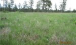
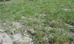
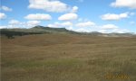
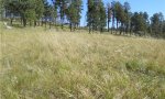
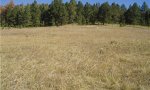
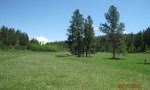
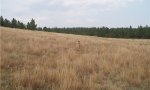
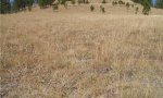
Ecological site photos
Print Options
Sections
Font
Other
Briefcase
Add ecological sites and Major Land Resource Areas to your briefcase by clicking on the briefcase (![]() ) icon wherever it occurs. Drag and drop items to reorder. Cookies are used to store briefcase items between browsing sessions. Because of this, the number of items that can be added to your briefcase is limited, and briefcase items added on one device and browser cannot be accessed from another device or browser. Users who do not wish to place cookies on their devices should not use the briefcase tool. Briefcase cookies serve no other purpose than described here and are deleted whenever browsing history is cleared.
) icon wherever it occurs. Drag and drop items to reorder. Cookies are used to store briefcase items between browsing sessions. Because of this, the number of items that can be added to your briefcase is limited, and briefcase items added on one device and browser cannot be accessed from another device or browser. Users who do not wish to place cookies on their devices should not use the briefcase tool. Briefcase cookies serve no other purpose than described here and are deleted whenever browsing history is cleared.
Ecological sites
Major Land Resource Areas
The Ecosystem Dynamics Interpretive Tool is an information system framework developed by the USDA-ARS Jornada Experimental Range, USDA Natural Resources Conservation Service, and New Mexico State University.