Natural Resources
Conservation Service
Ecological site R066XY044NE
Wet Land
Last updated: 11/18/2024
Accessed: 03/22/2026
General information
Approved. An approved ecological site description has undergone quality control and quality assurance review. It contains a working state and transition model, enough information to identify the ecological site, and full documentation for all ecosystem states contained in the state and transition model.
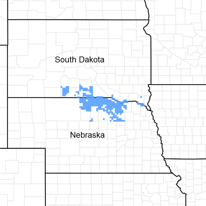
Figure 1. Mapped extent
Areas shown in blue indicate the maximum mapped extent of this ecological site. Other ecological sites likely occur within the highlighted areas. It is also possible for this ecological site to occur outside of highlighted areas if detailed soil survey has not been completed or recently updated.
MLRA notes
Major Land Resource Area (MLRA): 066X–Dakota-Nebraska Eroded Tableland
The Dakota-Nebraska Eroded Tableland (MLRA 66) occurs in north-central Nebraska (56 percent) and south-central South Dakota (44 percent). MLRA 66 is approximately 3.6 million acres and covers all or parts of 12 counties between the two states. The northern border of the MRLA bisects Tripp County, South Dakota, just south of the town of Winner. Valentine is in the northeastern corner of Cherry County, Nebraska and is located on the MLRA’s southwestern border. From there, the MLRA stretches southeast to the northwestern corner of Antelope County, Nebraska and the town of O’Neil, Nebraska in Holt County its southeastern border.
The MLRA occupies a smooth fluvial plain primarily consisting of broad intervalley areas with terraces, river breaks, and local badlands along the well-defined major drainages. The slopes range from nearly level tablelands to steep ridges and drainages. The elevation ranges from 1,970 to 2,950 feet. The Keya Paha, Elkhorn, and the Niobrara Rivers flow through the MLRA. The Niobrara is a designated National Scenic River.
Layers of shaly chalk and limestone marine sediments overlaying the Cretaceous Niobrara Formation make up the bulk of the MLRA, though the western and southwestern portions exhibit surface eolian deposits. The floors of the major drainages are underlain by deposits of alluvial sand and gravel. The dominant soil orders in this MLRA are mesic, ustic or aridic Mollisols and Entisols. Loamy and sandy are the primary soil textures in this landscape.
Twenty-seven percent of the land in this MLRA has been broken out of native prairie and farmed, while sixty-six percent of the grasslands remain intact. The remaining acres are divided between forest, urban development, and other uses. Livestock grazing, primarily by cattle, is a major industry. Corn, winter wheat, and grain sorghum are the primary commodity crops but a significant number of acres are planted to forage sorghum and alfalfa for harvest as hay. With limited irrigation available, and annual precipitation averaging from 18 inches in the west to 25 inches in the east, crop production is marginal across most of the MLRA.
The historical matrix vegetation type is mixed-grass prairie. Big bluestem, sand bluestem, prairie sandreed, little bluestem, sideoats grama, and blue grama make up the bulk of the warm-season species. Western wheatgrass, green needlegrass, and needle and thread are the dominant cool-season grasses. Large- and small-patch vegetative communities are found primarily along the riparian zones, on lowland sites, and in closed depressions. Woodlands make up about 3 percent of MLRA 66 and consist primarily of green ash, bur oak, and hackberry. Ponderosa pines can be found on steeper sites in the western portion of the landscape.
Wildlife flourishes in this combination of crop and grassland environments. In a landscape historically occupied by bison herds, white-tailed and mule deer are now the most abundant wild ungulates. Pronghorns also number among the remaining native grazers. A variety of smaller species, including coyote, raccoon, opossum, porcupines, muskrat, beaver, squirrel, prairie dogs, and mink, thrive in the region. Grassland birds, including several upland game birds, are common across the MLRA.
This landscape serves as a backdrop for a disturbance-driven ecosystem, evolving under the influences of herbivory, fire, and variable climate. Historically, these processes created a heterogeneous mosaic of plant communities and structure heights across the region. Any given site in this landscape burned every six to ten years, with most of the MLRA experiencing a six to eight year fire regime. The fires were caused by lightning strikes and were also set by Native Americans, who used fire for warfare, signaling, and to refresh the native grasses. Indigenous inhabitants understood the value of fire as a tool, and that the highly palatable growth following a fire provided excellent forage for their horses and attracted grazing game animals such as bison and elk.
Land use patterns by post-European settlers have greatly altered the historical fire regime, allowing the expansion of woody species. Fragmentation of the native grasslands by conversion to cropland, transportation corridors, and other developments has contributed to disruption of the natural fire regime of this ecosystem. The most common encroaching woody species is eastern redcedar. While eastern redcedar is native to the landscape, the historic population in MLRA 66 was limited to isolated pockets in rugged river drainageways that were protected from wildfire. Widespread plantings of windbreaks with eastern redcedar as a primary component provide a seed source for the aggressive woody plant which further facilitates woody encroachment. Encroachment of native and introduced shrubs and trees into the native grasslands degrades wildlife habit and causes significant forage loss for domestic livestock. Aggressive fire suppression policies have exacerbated this process to the point that shrub and tree encroachment is a major ecological threat to grasslands throughout most of the MLRA.
Classification relationships
►EPA◄
Level IV Ecoregions of the Conterminous United States
43—Northwestern Great Plains:
43i—Keya Paha Tablelands.
►USDA◄
Land Resource Regions and Major Land Resource Areas (USDA-NRCS, 2006)
Land Resource Region: G—Western Great Plains Range and Irrigated Region:
Major Land Resource Area (MLRA): 66 Dakota-Nebraska Eroded Tableland.
Ecological site concept
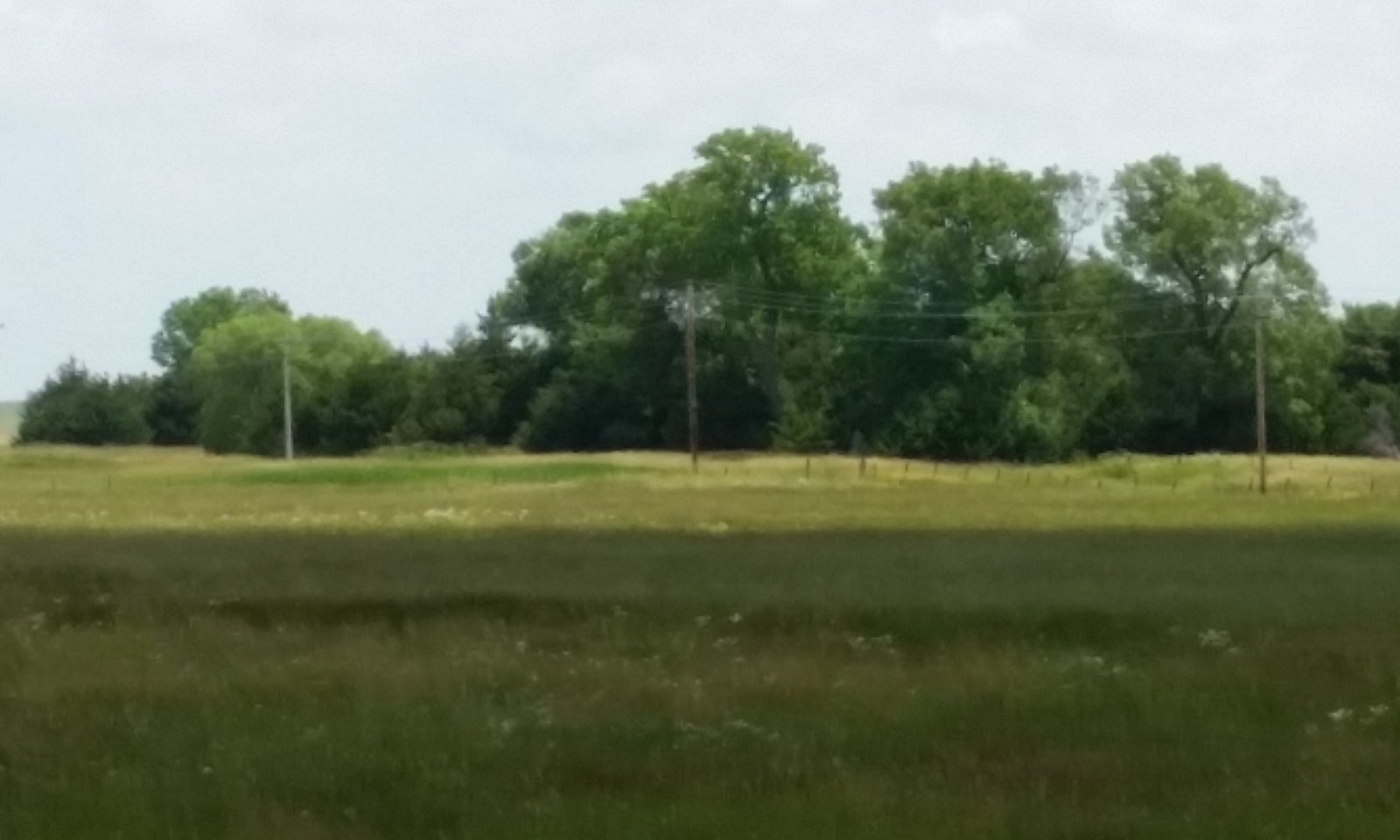
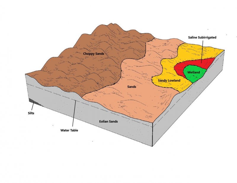
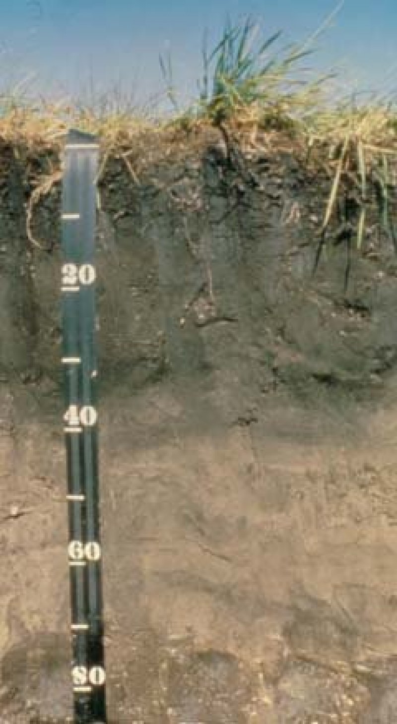
The Wet Land ecological site is a run-on site found primarily on wet swales, and in river and stream valleys on slopes of 0 to 2 percent. The site is saturated or ponded for a long duration on or near the surface during the growing season. The soils are poorly to very poorly drained, and the water table is within 20 inches of the surface.
Vegetation in the Reference Plant Community (1.1) is dominated by a mixture of warm-season tallgrasses and grass-likes. Dominant grasses and grass-likes include prairie cordgrass, northern reedgrass, and various sedges. Forbs are common and diverse. The site is susceptible to invasion of non-native, cool-season grasses.
Associated sites
| R066XY046NE |
Subirrigated The Subirrigated ecological site is often located adjacent to the Wet Land ecological site but on a slightly higher landscape position. |
|---|
Similar sites
| R066XY046NE |
Subirrigated The Subirrigated ecological site has a deeper water table, usually 20 to 36 inches, while the water table on Wetland ecological sites ranges from the surface to 20 inches. |
|---|
Table 1. Dominant plant species
| Tree |
Not specified |
|---|---|
| Shrub |
Not specified |
| Herbaceous |
(1) Spartina pectinata |

Click on box and path labels to scroll to the respective text.
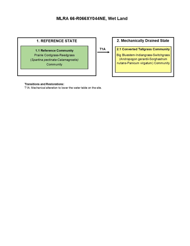
Ecosystem states
| T1A | - | Mechanical alteration to lower the water table on the site. |
|---|