Natural Resources
Conservation Service
Ecological site R066XY046NE
Subirrigated
Last updated: 11/18/2024
Accessed: 03/22/2026
General information
Approved. An approved ecological site description has undergone quality control and quality assurance review. It contains a working state and transition model, enough information to identify the ecological site, and full documentation for all ecosystem states contained in the state and transition model.
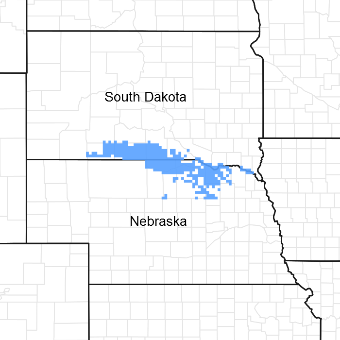
Figure 1. Mapped extent
Areas shown in blue indicate the maximum mapped extent of this ecological site. Other ecological sites likely occur within the highlighted areas. It is also possible for this ecological site to occur outside of highlighted areas if detailed soil survey has not been completed or recently updated.
MLRA notes
Major Land Resource Area (MLRA): 066X–Dakota-Nebraska Eroded Tableland
The Dakota-Nebraska Eroded Tableland (MLRA 66) occurs in north-central Nebraska (56 percent) and south-central South Dakota (44 percent). MLRA 66 is approximately 3.6 million acres and covers all or parts of twelve counties between the two states. The northern border of the MRLA bisects Tripp County, South Dakota, just south of the town of Winner. Valentine is in the northeastern corner of Cherry County, Nebraska and is located on the MLRA’s southwestern border. From there, the MLRA stretches southeast to the northwestern corner of Antelope County, Nebraska and the town of O’Neil, Nebraska in Holt County its southeastern border.
The MLRA occupies a smooth fluvial plain primarily consisting of broad intervalley areas with terraces, river breaks, and local badlands along the well-defined major drainages. The slopes range from nearly level tablelands to steep ridges and drainages. The elevation ranges from 1,970 to 2,950 feet. The Keya Paha, Elkhorn, and the Niobrara Rivers flow through the MLRA. The Niobrara is a designated National Scenic River.
Layers of shaly chalk and limestone marine sediments overlaying the Cretaceous Niobrara Formation make up the bulk of the MLRA, though the western and southwestern portions exhibit surface eolian deposits. The floors of the major drainages are underlain by deposits of alluvial sand and gravel. The dominant soil orders in this MLRA are mesic, ustic or aridic Mollisols and Entisols. Loamy and sandy are the primary soil textures in this landscape.
Twenty-seven percent of the land in this MLRA has been broken out of native prairie and farmed, while sixty-six percent of the grasslands remain intact. The remaining acres are divided between forest, urban development, and other uses. Livestock grazing, primarily by cattle, is a major industry. Corn, winter wheat, and grain sorghum are the primary commodity crops but a significant number of acres are planted to forage sorghum and alfalfa for harvest as hay. With limited irrigation available, and annual precipitation averaging from 18 inches in the west to 25 inches in the east, crop production is marginal across most of the MLRA.
The historical matrix vegetation type is mixed-grass prairie. Big bluestem, sand bluestem, prairie sandreed, little bluestem, sideoats grama, and blue grama make up the bulk of the warm-season species. Western wheatgrass, green needlegrass, and needle and thread are the dominant cool-season grasses. Large- and small-patch vegetative communities are found primarily along the riparian zones, on lowland sites, and in closed depressions. Woodlands make up about 3 percent of MLRA 66 and consist primarily of green ash, bur oak, and hackberry. Ponderosa pines can be found on steeper sites in the western portion of the landscape.
Wildlife flourishes in this combination of crop and grassland environments. In a landscape historically occupied by bison herds, white-tailed and mule deer are now the most abundant wild ungulates. Pronghorns also number among the remaining native grazers. A variety of smaller species, including coyote, raccoon, opossum, porcupines, muskrat, beaver, squirrel, prairie dogs, and mink, thrive in the region. Grassland birds, including several upland game birds, are common across the MLRA.
This landscape serves as a backdrop for a disturbance-driven ecosystem, evolving under the influences of herbivory, fire, and variable climate. Historically, these processes created a heterogeneous mosaic of plant communities and structure heights across the region. Any given site in this landscape burned every six to ten years, with most of the MLRA experiencing a six to eight year fire regime. The fires were caused by lightning strikes and were also set by Native Americans, who used fire for warfare, signaling, and to refresh the native grasses. Indigenous inhabitants understood the value of fire as a tool, and that the highly palatable growth following a fire provided excellent forage for their horses and attracted grazing game animals such as bison and elk.
Land use patterns by post-European settlers have greatly altered the historical fire regime, allowing the expansion of woody species. Fragmentation of the native grasslands by conversion to cropland, transportation corridors, and other developments has contributed to disruption of the natural fire regime of this ecosystem. The most common encroaching woody species is eastern redcedar. While eastern redcedar is native to the landscape, the historic population in MLRA 66 was limited to isolated pockets in rugged river drainageways that were protected from wildfire. Widespread plantings of windbreaks with eastern redcedar as a primary component provide a seed source for the aggressive woody plant which further facilitates woody encroachment. Encroachment of native and introduced shrubs and trees into the native grasslands degrades wildlife habit and causes significant forage loss for domestic livestock. Aggressive fire suppression policies have exacerbated this process to the point that shrub and tree encroachment is a major ecological threat to grasslands throughout most of the MLRA.
Classification relationships
►EPA◄
Level IV Ecoregions of the Conterminous United States
43—Northwestern Great Plains:
43i—Keya Paha Tablelands.
►USDA◄
Land Resource Regions and Major Land Resource Areas (USDA-NRCS, 2006)
Land Resource Region: G—Western Great Plains Range and Irrigated Region:
Major Land Resource Area (MLRA): 66 Dakota-Nebraska Eroded Tableland.
Ecological site concept
The Subirrigated ecological site occupies a run-on landscape position and is found on interdunes and along floodplains and drainage ways. The site has a seasonal high water table that ranges from twenty to thirty six inches during the growing season. The associated soils are somewhat poorly to poorly drained. Slopes are less than 3 percent. There are no visible surface salts.
Vegetation in the Reference Plant Community (1.1) is dominated by a mixture of warm-season tall- and midgrasses. Dominant grasses include big bluestem, Indiangrass, switchgrass and little bluestem. Cool-season grasses are present in lesser amounts than the warm-season grasses. Forbs are common and diverse. The site is susceptible to invasion of non-native, cool-season grasses.
Associated sites
| R066XY032NE |
Sandy 18-22" P.Z. The Sandy 18-22 PZ ecological site is often adjacent to but on a higher landscape position than the Subirrigated ecological site. |
|---|---|
| R066XY044NE |
Wet Land The Wet Land ecological site is often adjacent to but on a lower landscape position than the Subirrigated ecological site. |
| R066XY054NE |
Sandy 22-25 P.Z. The Sandy 22-25 PZ ecological site is often adjacent to but on a higher landscape position than the Subirrigated ecological site. |
| R066XY036NE |
Loamy 18-22 P.Z. The Loamy 18-22 ecological site is often adjacent to but on a higher landscape position than the Subirrigated ecological site. |
| R066XY058NE |
Loamy 22-25 P.Z. The Loamy 22-25 ecological site is often adjacent to but on a higher landscape position than the Subirrigated ecological site. |
| R066XY051NE |
Sandy Lowland The Sandy Lowland ecological site is often adjacent to but on a lower landscape position than the Subirrigated ecological site. |
Similar sites
| R066XY047NE |
Saline Subirrigated The Saline Subirrigated ecological site occurs on the same landscape position as the Subirrigated ecological site and also has a seasonal or perennial high water table. The primary difference between the two sites is the presence of visible surface salts on Saline Subirrigated ecological sites. |
|---|
Table 1. Dominant plant species
| Tree |
Not specified |
|---|---|
| Shrub |
Not specified |
| Herbaceous |
(1) Andropogon gerardii |
Physiographic features
This site occurs on level to nearly level areas of interdunes and along floodplains and drainageways that have soil water moderately close to the ground surface. Where this site occurs on interdunes, it is not subject to flooding. This site receives runoff from areas higher on the landscape.
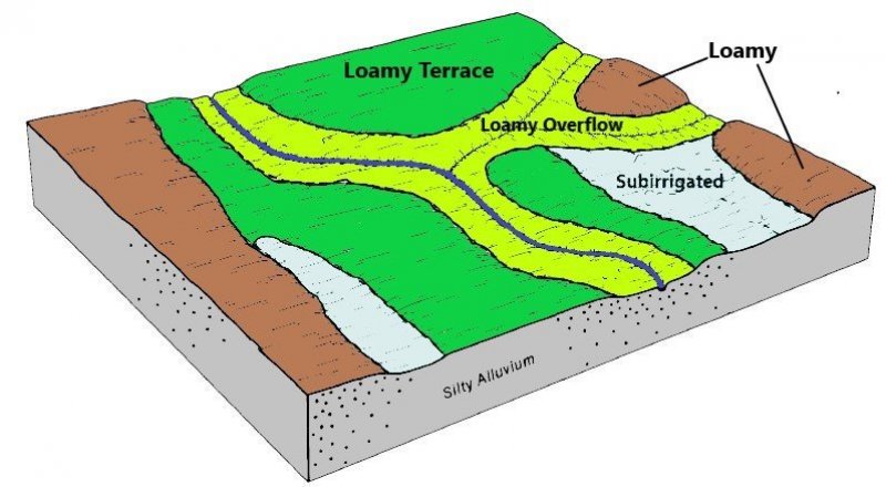
Figure 2. Block diagram for the Subirrigated site.
Table 2. Representative physiographic features
| Landforms |
(1)
Flood plain
(2) Drainageway (3) Interdune |
|---|---|
| Runoff class | Negligible to low |
| Flooding duration | Very brief (4 to 48 hours) to brief (2 to 7 days) |
| Flooding frequency | None to occasional |
| Elevation | 1,900 – 3,000 ft |
| Slope | 3% |
| Water table depth | 20 – 36 in |
| Aspect | Aspect is not a significant factor |
Climatic features
MLRA 66 is considered to have a continental climate with cold winters and hot summers, low humidity, light rainfall, and much sunshine. Extremes in temperature may also abound. The climate is the result of this MLRA’s location near the geographic center of North America. There are few natural barriers on the northern Great Plains and the winds move freely across the plains and account for rapid changes in temperature.
Annual precipitation ranges from 18 to 25 inches per year. The normal average annual temperature is about 48°F. January is the coldest month with average temperatures ranging from about 19°F (Bonesteel, SD) to about 23°F (Ainsworth, NE). July is the warmest month with temperatures averaging from about 73°F (Harrington, SD) to about 75°F (Gregory, SD). The range of normal average monthly temperatures between the coldest and warmest months is about 54°F. This large annual range attests to the continental nature of the climate this area. Hourly winds average about ten miles per hour annually, ranging from about 11 miles per hour during the spring to about nine miles per hour during the summer. Daytime winds are generally stronger than nighttime and occasional strong storms may bring brief periods of high winds with gusts to more than 50 miles per hour.
Growth of native cool-season plants begins mid to late March and continues to late June. Native warm-season plants begin growth in early May and continue to late August. Green-up of cool-season plants may occur in September and October when adequate soil moisture is present.
Table 3. Representative climatic features
| Frost-free period (characteristic range) | 112-126 days |
|---|---|
| Freeze-free period (characteristic range) | 131-147 days |
| Precipitation total (characteristic range) | 21-25 in |
| Frost-free period (actual range) | 99-128 days |
| Freeze-free period (actual range) | 123-150 days |
| Precipitation total (actual range) | 20-26 in |
| Frost-free period (average) | 117 days |
| Freeze-free period (average) | 138 days |
| Precipitation total (average) | 23 in |
Figure 3. Monthly precipitation range
Figure 4. Monthly minimum temperature range
Figure 5. Monthly maximum temperature range
Figure 6. Monthly average minimum and maximum temperature
Figure 7. Annual precipitation pattern
Figure 8. Annual average temperature pattern
Climate stations used
-
(1) MARTIN 5 E [USC00395285], Martin, SD
-
(2) HARRINGTON [USC00393574], Tuthill, SD
-
(3) KILGORE 1NE [USC00254432], Kilgore, NE
-
(4) VALENTINE MILLER FLD [USW00024032], Valentine, NE
-
(5) MISSION 14 S [USC00395638], Mission, SD
-
(6) MISSION [USC00395620], Mission, SD
-
(7) WINNER [USC00399367], Winner, SD
-
(8) SPRINGVIEW [USC00258090], Springview, NE
-
(9) AINSWORTH [USC00250050], Ainsworth, NE
-
(10) NEWPORT [USC00255925], Newport, NE
-
(11) ATKINSON 3SW [USC00250420], Atkinson, NE
-
(12) O NEILL [USC00256290], Oneill, NE
-
(13) LYNCH [USC00255040], Lynch, NE
-
(14) BUTTE [USC00251365], Butte, NE
Influencing water features
This ecological site has a combination of physical and hydrological features that provide season-long ground water within 3.5 feet of the surface, allows relatively free movement of water and air in the upper part of the soil, and are rarely or occasionally flooded.
Soil features
The soils associated with the Subirrigated ecological site are deep to very deep and poorly to somewhat poorly drained. The soils formed in eolian sand and sandy alluvium. Soil surface textures are predominantly fine sandy loam and loam but range from silty clay to fine sand. The surface layer is 3 to 10 inches thick. Slopes range from 0 to 3 percent.
Runoff as evidenced by patterns of rill, gully, or other water flow is negligible due to the low slope gradient and high intake rate of these soils. Some pedestalling of plants occurs, but it is not very evident on casual observation and occurs on less than 5 percent of the plants.
The predominant soil series correlated to this site include Elsmere, Wann, Orwet, Els, Boel, and Ord. More information can be found in the various soil survey reports. Contact the local USDA Service Center for soil survey reports that include more detail specific to your location or go to Web Soil Survey (https://websoilsurvey.sc.egov.usda.gov).
.
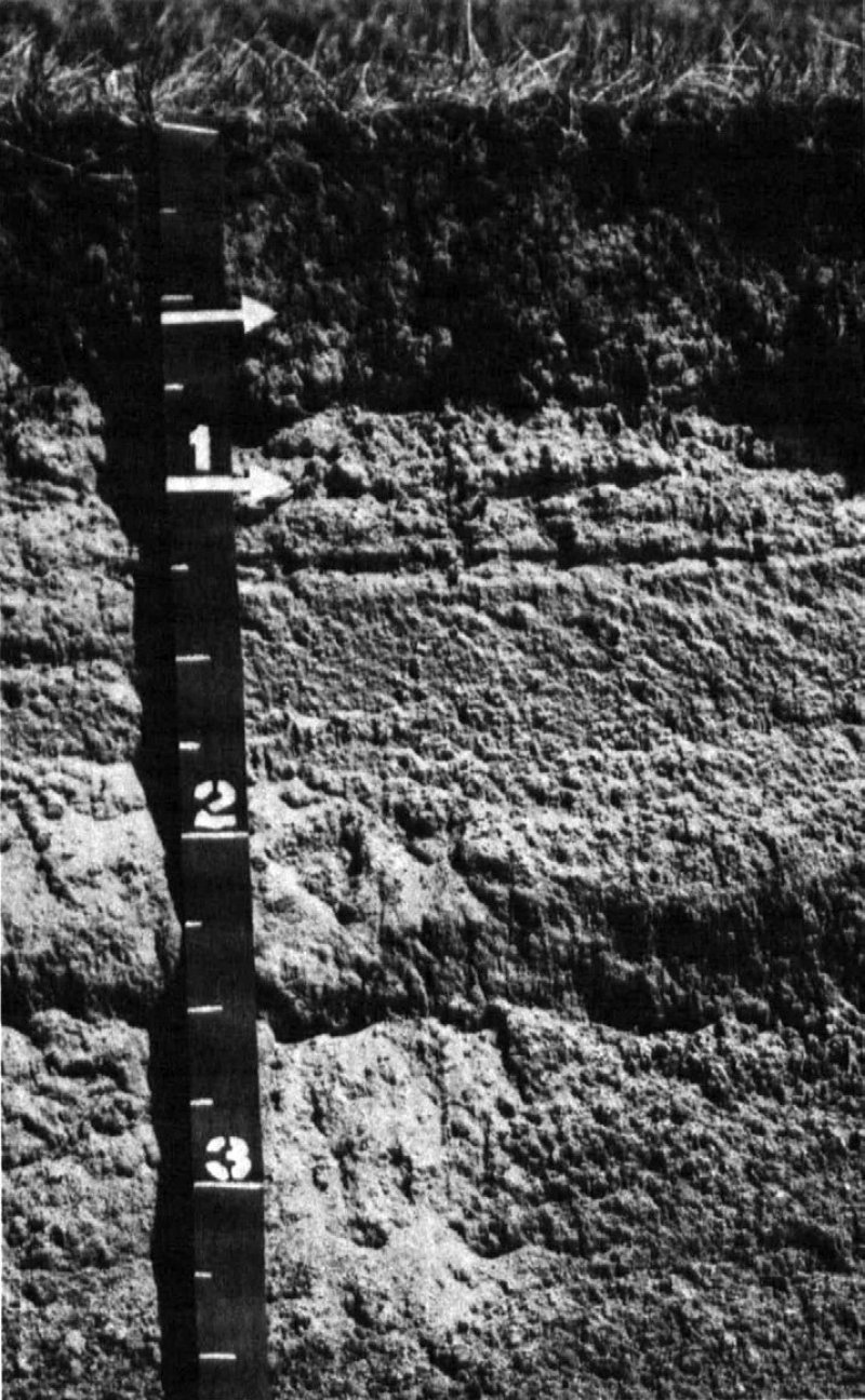
Figure 9. Platte soil series profile
Table 4. Representative soil features
| Parent material |
(1)
Alluvium
(2) Eolian sands |
|---|---|
| Surface texture |
(1) Fine sandy loam (2) Loam (3) Fine sand (4) Silt loam (5) Loamy sand (6) Loamy fine sand (7) Silty clay |
| Family particle size |
(1) Sandy (2) Coarse-loamy |
| Drainage class | Poorly drained to somewhat poorly drained |
| Permeability class | Moderately slow to rapid |
| Soil depth | 40 – 80 in |
| Surface fragment cover <=3" | 4% |
| Surface fragment cover >3" | Not specified |
| Available water capacity (0-40in) |
3 – 8.9 in |
| Calcium carbonate equivalent (0-40in) |
40% |
| Electrical conductivity (0-40in) |
2 mmhos/cm |
| Sodium adsorption ratio (0-40in) |
6 |
| Soil reaction (1:1 water) (0-40in) |
5.6 – 8.4 |
| Subsurface fragment volume <=3" (Depth not specified) |
20% |
| Subsurface fragment volume >3" (Depth not specified) |
Not specified |
Ecological dynamics
The Subirrigated site developed under Northern Great Plains climatic conditions, light to severe grazing by bison and other large herbivores, sporadic natural or human-caused wildfire, and other biotic and abiotic factors that typically influence soil and site development. This continues to be a disturbance-driven site with herbivory, fire, and variable climate being the primary disturbances. Changes occur in the plant communities due to short-term weather variations, impacts of native and exotic plant and animal species, and management actions. While the following plant community descriptions describe the typical transitions, severe disturbances, such as extended periods of well below average precipitation, can cause significant shifts in communities and species composition.
The introduction of domestic livestock by European settlers along with season-long, continuous grazing had a profound impact on the vegetation of the Subirrigated ecological site. Season-long, continuous grazing causes a repeated removal of the growing point and excessive defoliation of the leaf area of individual warm-season tallgrasses. The resulting reduction in the ability of the plants to harvest sunlight depletes root reserves, subsequently decreasing root mass. The ability of the plants to compete for nutrients is impaired, resulting in decreased vigor and eventual mortality. Species that evade negative grazing impacts through mechanisms such as a growing season adaptation (i.e., cool-season), growing points located near the soil surface, a shorter structure, or reduced palatability will increase. Repetitive haying during the same time-frame each year or without allowing adequate growing season recovery time will impact the plant community in a similar manner.
As this site deteriorates, native and introduced cool-season grasses such as redtop, Kentucky bluegrass, reed canarygrass, creeping meadow foxtail, slender wheatgrass, and smooth bromegrass will increase. Warm-season tallgrasses including Indiangrass and big bluestem will decrease in frequency and production. Light grazing and the absence of haying allows woody plant encroachment such as cottonwood into any plant community described below.
The State and Transition Model (STM) is depicted below and includes a Reference State (1), a Native/Invaded Grass State (2), and an Invaded Grass State (3). Each state represents the crossing of a major ecological threshold due to the alteration of the functional dynamic properties of the ecosystem. The primary properties observed to determine this change are soil stability, vegetative communities, and the hydrologic cycle. Each state may have one or more plant communities that fluctuate in species composition and abundance within the normal parameters of the state. Within each state, communities may degrade or recover in response to natural and man caused disturbances such as variation in the degree and timing of herbivory, presence or absence of fire, and climatic and local fluctuations in the precipitation regime. The processes that cause the movement between the states and communities are discussed in more detail in the state and community descriptions following the diagram.
Interpretations are primarily based on the Reference Plant Community (1.1). It has been determined by study of rangeland relic areas, areas protected from excessive disturbance, and areas under long-term rotational grazing regimes. Trends in plant community dynamics ranging from heavily grazed to lightly grazed areas, seasonal use pastures, and historical accounts also have been used. Other plant communities, states, transitional pathways, and thresholds have been determined through similar studies and experience.
State and transition model
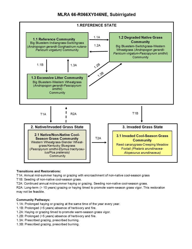
Figure 10. State and Transition Model Diagram. MLRA 66, Subirrigated Ecological Site.
More interactive model formats are also available.
View Interactive Models
More interactive model formats are also available.
View Interactive Models
Click on state and transition labels to scroll to the respective text
| T1A | - | Annual mid-summer haying or grazing with encroachment of non-native cool-season grass |
|---|---|---|
| T1B | - | Seeding of non-native cool-season grass. |
| R2A | - | Long-term (> 10 years) grazing or haying timed to promote warm-season grass vigor. |
| 2A | - | Continued annual mid-summer haying or grazing. Seeding non-native cool-season grass. |
State 1 submodel, plant communities
| 1.1A | - | Prolonged haying or grazing at same time of year every year. |
|---|---|---|
| 1.1B | - | Prolonged (>5 years) absence of herbivory and fire. |
| 1.2A | - | Haying or grazing timed to promote warm-season grass vigor. |
| 1.2B | - | Prolonged (>5 years) absence of herbivory and fire. |
| 1.3A | - | Prescribed grazing, prescribed burning. |
| 1.3B | - | Prescribed grazing, prescribed burning. |
State 2 submodel, plant communities
State 3 submodel, plant communities
State 1
Reference State
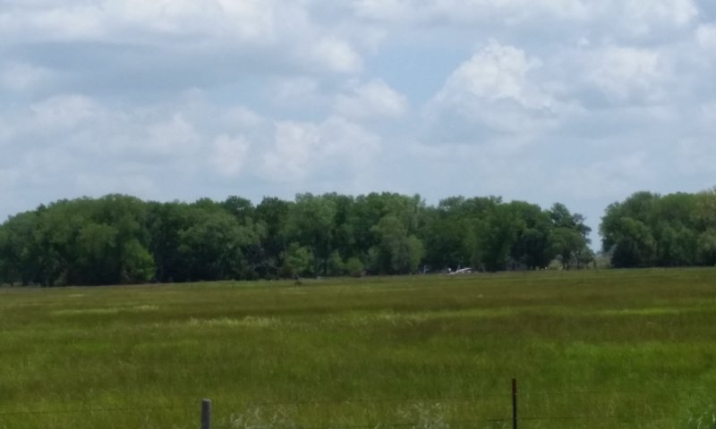
Figure 11. Reference State (1), Subirrigated Ecological Site, MLRA 66. Brown County, Nebraska.
The Reference State (1) describes the range of vegetative communities that occur on the Subirrigated ecological site where the range of natural variability under historic conditions and disturbance regimes is mostly intact. The Reference State developed under the combined influences of climatic conditions, periodic fire activity, grazing by large herbivores, and impacts from small mammals and insects. High perennial grass cover and production allows for increased soil moisture retention, vegetative production and overall soil quality. The Reference State includes four plant community phases which are the Reference Community (1.1), the At-Risk Community (1.2), and the Excessive Litter Community (1.3). The Reference Community serves as a description of the native plant community that naturally occurs on the site when the natural disturbance regimes are intact or closely mimicked by management practices. The Degraded Native Grass and At-Risk Communities result from management decisions that are unfavorable for a healthy Reference Community. The Excessive Litter Community results when herbivory and fire are eliminated from the landscape.
Dominant plant species
-
big bluestem (Andropogon gerardii), grass
-
switchgrass (Panicum virgatum), grass
-
little bluestem (Schizachyrium), grass
-
western wheatgrass (Pascopyrum smithii), grass
-
slender wheatgrass (Elymus trachycaulus), grass
-
sedge (Carex), other herbaceous
-
Sartwell's sedge (Carex sartwellii), other herbaceous
Community 1.1
Reference Community
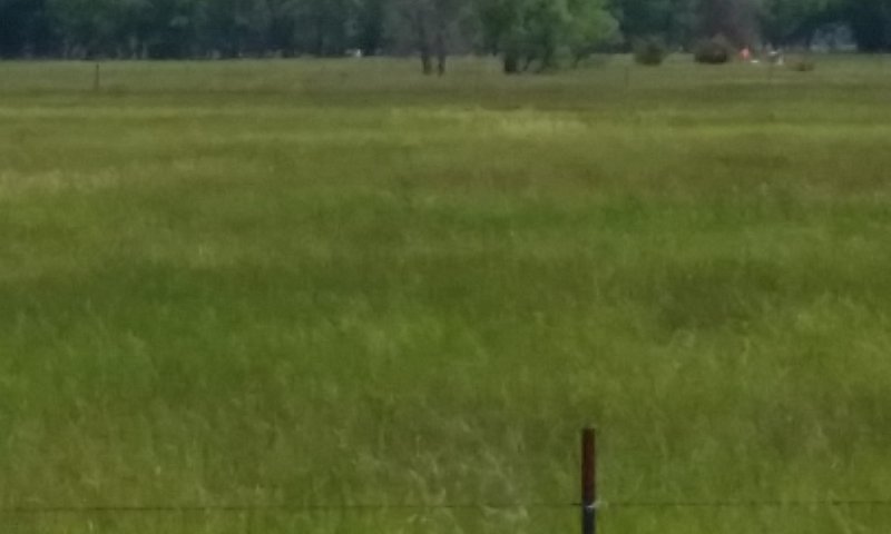
Figure 12. Reference Community (1.1), Subirrigated Ecological Site, MLRA 66. Brown County, Nebraska.
Interpretations are primarily based on the Reference or Big Bluestem-Indiangrass-Switchgrass (Andropogon gerardii-Sorghastrum nutans-Panicum virgatum) Community (1.1). This plant community serves as a description of the native plant community that occurs on the site when the natural disturbance regimes are intact or are closely mimicked by management practices. This phase is dynamic, with fluid relative abundance and spatial boundaries between the dominant structural vegetative groups. These fluctuations are primarily driven by different responses of the species to changes in precipitation timing and abundance, and to fire and grazing events. This site developed with grazing by large herbivores and is well suited for grazing by domestic livestock. The major grasses include big bluestem, Indiangrass, switchgrass, and grass-likes include sedges, rushes, and bulrushes. Grasses of secondary importance in this plant community include little bluestem, prairie cordgrass, plains bluegrass, slender wheatgrass, and western wheatgrass. The potential vegetation is 85 to 95 percent grasses and grass-like plants, 5 to 10 percent forbs, and 1 to 5 percent shrubs. Warm-season tallgrasses dominate the community. This plant community can be found on areas that are managed with prescribed grazing. It can also be found on hayland when hay is harvested at a different time during the growing season in consecutive years. Grazing or haying with adequate growing-season recovery periods allows this plant community to persist. This plant community is extremely resilient and well adapted to the Northern Great Plains climatic conditions. The plant species diversity allows for high tolerance to drought .High perennial grass cover and production increases soil moisture retention, vegetative production, and overall soil quality. This is a healthy and sustainable plant community in terms of site and soil stability, hydrologic function, and biotic integrity.
Dominant plant species
-
big bluestem (Andropogon gerardii), grass
-
Indiangrass (Sorghastrum nutans), grass
-
switchgrass (Panicum virgatum), grass
-
Sartwell's sedge (Carex sartwellii), other herbaceous
-
sedge (Carex), other herbaceous
Figure 13. Annual production by plant type (representative values) or group (midpoint values)
Table 5. Annual production by plant type
| Plant type | Low (lb/acre) |
Representative value (lb/acre) |
High (lb/acre) |
|---|---|---|---|
| Grass/Grasslike | 3280 | 4320 | 5400 |
| Forb | 220 | 360 | 550 |
| Shrub/Vine | 0 | 120 | 250 |
| Total | 3500 | 4800 | 6200 |
Figure 14. Plant community growth curve (percent production by month). NE6643, Eroded Tableland, lowland warm-season dominant.
| Jan | Feb | Mar | Apr | May | Jun | Jul | Aug | Sep | Oct | Nov | Dec |
|---|---|---|---|---|---|---|---|---|---|---|---|
| J | F | M | A | M | J | J | A | S | O | N | D |
| 0 | 0 | 3 | 7 | 15 | 25 | 25 | 17 | 6 | 2 | 0 | 0 |
Community 1.2
At-Risk Community
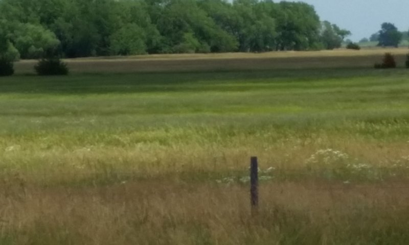
Figure 15. At-Risk Community (1.2), Subirrigated Ecological Site, MLRA 66. Brown County, Nebraska.
The At-Risk or Big Bluestem-Switchgrass-Western Wheatgrass (Andropogon gerardii-Panicum virgatum-Pascopyrum smithii) Community (1.2) develops with annual haying or moderate summer grazing followed by heavy grazing in the fall. This plant community closely resembles the Reference Community (1.1) but lacks its overall plant species diversity. Dominant grasses include big bluestem, switchgrass, little bluestem, and western wheatgrass. Other grasses include needle and thread, porcupinegrass, prairie cordgrass, slender wheatgrass, and Indiangrass. Grass-like plants have increased and non-native cool-season grasses have begun to invade the plant community. The abundance of forbs and shrubs remains constant, but species shifts have occurred. Production from warm-season tallgrasses has decreased, while cool-season grass production has increased slightly. The potential vegetation is 80 to 90 percent grasses and grasslikes, 5 to 10 percent forbs, 1 to 5 percent shrubs, and 1 to 5 percent trees. Timely haying or rotational grazing with adequate growing season recovery periods can shift this plant community to the Reference Community. Haying or grazing prior to the onset of active warm-season grass growth will reduce cool-season grass competition, improve warm-season grass vigor, and provide quality hay. Grazing after a killing frost in the fall will also help reduce cool-season grasses. This plant community is not resistant to change but is resilient. Repeated, annual mid-summer haying or continuous, summer long grazing can cause this community to cross an ecological threshold to the Native/Invaded Gras State (2).
Dominant plant species
-
sand bluestem (Andropogon hallii), grass
-
switchgrass (Panicum virgatum), grass
-
western wheatgrass (Pascopyrum smithii), grass
-
little bluestem (Schizachyrium scoparium), grass
-
sedge (Carex), other herbaceous
Figure 16. Annual production by plant type (representative values) or group (midpoint values)
Table 6. Annual production by plant type
| Plant type | Low (lb/acre) |
Representative value (lb/acre) |
High (lb/acre) |
|---|---|---|---|
| Grass/Grasslike | 2990 | 3718 | 4510 |
| Forb | 210 | 366 | 550 |
| Tree | 0 | 108 | 220 |
| Shrub/Vine | 0 | 108 | 220 |
| Total | 3200 | 4300 | 5500 |
Figure 17. Plant community growth curve (percent production by month). NE6642, Eroded Tableland, warm-season dominant, cool-season subdominant.
| Jan | Feb | Mar | Apr | May | Jun | Jul | Aug | Sep | Oct | Nov | Dec |
|---|---|---|---|---|---|---|---|---|---|---|---|
| J | F | M | A | M | J | J | A | S | O | N | D |
| 3 | 8 | 18 | 27 | 23 | 12 | 6 | 3 |
Community 1.3
The Excessive Litter Community
The Excessive Litter or Big Bluestem-Western Wheatgrass (Andropogon gerardii-Pascopyrum smithii) Community (1.3) develops when the natural disturbances of livestock grazing and fire have been removed from the land for a prolonged period of time (more than 5 years). The litter amount has clearly increased and few or no grass-likes or understory grasses are present. As the undisturbed duff layer deepens, infiltration of precipitation is interrupted and evaporation increases significantly, simulating drought-like conditions. Typically, bunchgrasses have developed dead centers and rhizomatous grasses have formed small colonies due to a lack of tiller stimulation. Plant frequency and production have decreased. Pedestalling is usually evident. As compared to the Reference Community (1.1), plant diversity has decreased and native plants tend to occur in individual colonies. The plant community has a high amount of litter covering the soil between widely dispersed mature plants. As the litter layer thickens, the health and vigor of native, warm-season tall- and midgrasses decline. Soil erosion is low and infiltration and runoff are not significantly different from the Reference Community. This plant community will change rapidly when grazing or fire is returned to the landscape.
Dominant plant species
-
big bluestem (Andropogon gerardii), grass
-
western wheatgrass (Pascopyrum smithii), grass
-
plains bluegrass (Poa arida), grass
Pathway 1.1A
Community 1.1 to 1.2
Haying or grazing that typically occurs at the same time of year every year can shift the Reference Community (1.1) to the Degraded Native Grass Community (1.2). Haying or grazing at set times during the growing season can reduce plant diversity and reduce vigor of desirable plants.
Pathway 1.1B
Community 1.1 to 1.3
Prolonged interruption (more than five years) of the natural disturbances of herbivory and fire will convert the Reference Community (1.1) to the Excessive Litter Community (1.3).
Pathway 1.2A
Community 1.2 to 1.1
Timely haying and/or rotational grazing can return the At-Risk Community (1.2) to the Reference Community (1.1). Haying or grazing prior to the onset of the rapid growth period of warm-season grasses will improve warm-season grass vigor. Early haying also reduces cool-season grass competition and provides quality hay. Grazing after a killing frost in the fall will also help reduce cool-season grasses.
Pathway 1.2B
Community 1.2 to 1.3
Prolonged interruption (more than five) of the natural disturbances of herbivory and fire will convert the At-Risk Community (1.2) to the Excessive Litter Community (1.3).
Pathway 1.3A
Community 1.3 to 1.1
Reintroduction of the natural processes of herbivory and fire will return the Excessive Litter Community (1.3) to the Reference Community (1.1).
Pathway 1.3B
Community 1.3 to 1.2
Reintroduction of the natural processes of herbivory and fire will return the Excessive Litter Community (1.3) to the At-Risk Community (1.2).
State 2
Native/Invaded Grass State
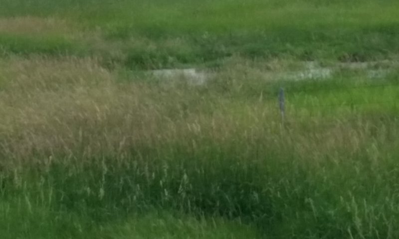
Figure 18. Native/Invaded Grass State (2), Subirrigated Ecological Site, MLRA 66. Brown County, Nebraska.
The Invaded Grass State (2) has been degraded from the Reference State (1) and much of the native warm-season grass community has been replaced by native and non-native cool-season grasses. Non-native grasses make up 15 to 30 percent of the annual production. The reduction of the warm-season tall- and midgrasses has negatively impacted energy flow and nutrient cycling. This state occurs as a result of grazing or haying during the mid-summer year after year with the invasion of non-native, cool-season grasses. The Native/Invaded Grass State includes the Native/Non-Native Cool-Season Grass Community (2.1).
Dominant plant species
-
western wheatgrass (Pascopyrum smithii), grass
-
slender wheatgrass (Elymus trachycaulus), grass
-
reed canarygrass (Phalaris arundinacea), grass
-
American licorice (Glycyrrhiza lepidota), other herbaceous
Community 2.1
Native/Non-Native Cool-Season Grass Community
The Native/Non-Native Cool-Season Grass or Western Wheatgrass-Slender Wheatgrass/Kentucky bluegrass (Pascopyrum smithii-Elymus trachycaulus/Poa pratensis) Community (2.1) develops with long-term, annual haying during mid-summer accompanied with encroachment of non-native cool-season grasses. Encroachment occurs when a viable reproductive source is available due to proximity. This community also develops on land that is heavily grazed as a winter feeding ground. Cool-season grasses dominate the plant community. Dominant grasses include western wheatgrass, slender wheatgrass, and Kentucky bluegrass. Grasses of secondary importance include reed canarygrass (native populations), foxtail barley and needle and thread. Non-native grasses such as creeping bentgrass, creeping meadow foxtail, quackgrass, smooth brome, and non-native cultivars of reed canarygrass may be encroaching on the site. Warm-season tall- and midgrasses are present in minor amounts. American licorice may become a problem in areas used as winter feeding grounds. The potential vegetation is 80 to 90 percent grasses and grasslikes, 5 to 10 percent forbs, 1 to 5 percent shrubs, and 1 to 5 percent trees. When compared to the Reference Community (1.1), native cool-season grasses have increased. Non-native cool-season grasses have encroached into the plant community and are approximately 15 percent of the composition by weight. Warm-season species such as big bluestem, switchgrass, and Indiangrass have decreased significantly and production of other warm-season grasses has also been reduced. Overall, production on the site is significantly lower than in the Reference Community. This plant community is moderately resistant to change but with annual, mid-season haying will transition to the Invaded Grass State (2).
Dominant plant species
-
western wheatgrass (Pascopyrum smithii), grass
-
slender wheatgrass (Elymus trachycaulus), grass
-
reed canarygrass (Phalaris arundinacea), grass
-
American licorice (Glycyrrhiza lepidota), other herbaceous
Figure 19. Annual production by plant type (representative values) or group (midpoint values)
Table 7. Annual production by plant type
| Plant type | Low (lb/acre) |
Representative value (lb/acre) |
High (lb/acre) |
|---|---|---|---|
| Grass/Grasslike | 2580 | 3400 | 4370 |
| Forb | 220 | 375 | 550 |
| Tree | 0 | 125 | 275 |
| Shrub/Vine | 0 | 125 | 205 |
| Total | 2800 | 4025 | 5400 |
State 3
Invaded Grass State
Figure 20. Invaded Grass State (3), Subirrigated Ecological Site, MLRA 66. Brown County, Nebraska.
In the Invaded Grass State (3) much of the native warm-season grass community has been replaced by native and non-native cool-season grasses with non-native grasses producing 30 percent or more of the annual production. Native, warm-season grasses are present at minor or trace levels or are missing from the plant community. This state may occur either as a result of continued non-native grass invasion or interseeding of non-native grasses. The Invaded Grass State includes the Invaded Cool-Season Grass Community (3.1).
Dominant plant species
-
reed canarygrass (Phalaris arundinacea), grass
-
creeping meadow foxtail (Alopecurus arundinaceus), grass
-
Kentucky bluegrass (Poa pratensis), grass
-
red clover (Trifolium pratense), other herbaceous
Community 3.1
Invaded Cool-Season Grass Community
The Invaded Cool-Season Grass or Reed Canarygrass-Creeping Meadow Foxtail (Phalaris arundinacea- Alopecurus arundinaceus) Community (2.1) occurs when a viable reproductive source is available due to proximity or when the site is seeded with reed canarygrass, creeping foxtail or other non-native, cool-season grasses. In the past reed canarygrass and creeping foxtail were often seeded to increase forage production when native grass production deteriorated. However, this seeding practice has serious repercussions on numerous wildlife species. Once these aggressive, non-native grasses become established, it becomes difficult to alter the plant community. Non-native grasses often encroach from the seeded areas into areas which have not been seeded. While this plant community has a high production potential, forage quality is sacrificed.
Dominant plant species
-
reed canarygrass (Phalaris arundinacea), grass
-
creeping meadow foxtail (Alopecurus arundinaceus), grass
-
Kentucky bluegrass (Poa pratensis), grass
-
red clover (Trifolium pratense), other herbaceous
Transition T1A
State 1 to 2
The Reference State (1) transitions to the Native/Invaded Grass State (2) with the replacement of native, warm-season, tallgrasses by native cool-season grasses and the encroachment of non-native cool-season grasses such as Kentucky bluegrass, smooth brome, creeping bentgrass, creeping meadow foxtail, quackgrass, non-native cultivars of reed canarygrass and other cool-season grasses. Restoration to the Reference State will only be feasible when adequate remnants of warm-season tallgrasses are present and when the hydrology of the site has only been minimally impacted by the change in the plant community.
Transition T1B
State 1 to 3
The transition from the Reference State (1) to the Invaded Grass State (3) occurs when non-native cool-season grasses such as creeping meadow foxtail, non-native cultivars of reed canarygrass, or other non-native grasses are seeded into native hay meadows.
Restoration pathway R2A
State 2 to 1
Long-term (more than ten years) timely haying or rotational grazing can return the Native/Invaded Grass State (2) to the Reference State (1). Haying or grazing prior to the onset of active warm-season grass growth or alternating haying with timely grazing will improve warm-season grass vigor. Early haying also reduces cool-season grass competition and provides quality hay. Grazing this plant community in mid-May to early June will suppress cool-season grasses as will grazing in the fall after a killing frost. Caution must be used on areas where Subirrigated and Wet Land complexes exist ,as concentrated spring grazing can compaction on wetter sites. The amount of time needed for this restoration will depend upon the level of non-native grass encroachment. If the replacement of native, warm-season tallgrasses by non-native, cool-season grasses is extensive this restoration may not be feasible.
Transition 2A
State 2 to 3
Th Native/Invaded Grass State (2) transitions to the Invaded Grass State (3) with continued annual mid-summer haying or continued summer grazing which causes the further increase of non-native cool-season grasses including Kentucky bluegrass, smooth brome, creeping bentgrass, creeping meadow foxtail, quackgrass, non-native cultivars of reed canarygrass and other cool-season grasses. This transition also occurs when reed canarygrass, creeping meadow foxtail, or other non-native cool-season grasses are seeded into the site. Alterations to the plant community and to hydrology make restoration unlikely.
Additional community tables
Table 8. Community 1.1 plant community composition
| Group | Common name | Symbol | Scientific name | Annual production (lb/acre) | Foliar cover (%) | |
|---|---|---|---|---|---|---|
|
Grass/Grasslike
|
||||||
| 1 | Warm-Season Tallgrass | 1680–2640 | ||||
| big bluestem | ANGE | Andropogon gerardii | 960–1920 | – | ||
| Indiangrass | SONU2 | Sorghastrum nutans | 480–960 | – | ||
| switchgrass | PAVI2 | Panicum virgatum | 240–720 | – | ||
| prairie cordgrass | SPPE | Spartina pectinata | 0–480 | – | ||
| marsh muhly | MURA | Muhlenbergia racemosa | 0–240 | – | ||
| Grass, perennial | 2GP | Grass, perennial | 0–144 | – | ||
| 2 | Warm-Season Midgrass | 480–1200 | ||||
| little bluestem | SCSC | Schizachyrium scoparium | 384–960 | – | ||
| sideoats grama | BOCU | Bouteloua curtipendula | 96–480 | – | ||
| purple lovegrass | ERSP | Eragrostis spectabilis | 0–240 | – | ||
| Grass, perennial | 2GP | Grass, perennial | 0–144 | – | ||
| 3 | Cool-Season Rhizomatous Grass | 48–240 | ||||
| western wheatgrass | PASM | Pascopyrum smithii | 48–240 | – | ||
| 4 | Cool-Season Bunchgrass | 96–480 | ||||
| Canada wildrye | ELCA4 | Elymus canadensis | 48–240 | – | ||
| needle and thread | HECOC8 | Hesperostipa comata ssp. comata | 0–240 | – | ||
| porcupinegrass | HESP11 | Hesperostipa spartea | 0–240 | – | ||
| slender wheatgrass | ELTR7 | Elymus trachycaulus | 0–240 | – | ||
| prairie wedgescale | SPOB | Sphenopholis obtusata | 0–144 | – | ||
| plains bluegrass | POAR3 | Poa arida | 0–144 | – | ||
| Grass, perennial | 2GP | Grass, perennial | 0–144 | – | ||
| foxtail barley | HOJU | Hordeum jubatum | 0–144 | – | ||
| 5 | Grass-Like | 96–480 | ||||
| sedge | CAREX | Carex | 48–336 | – | ||
| Sartwell's sedge | CASA8 | Carex sartwellii | 48–336 | – | ||
| awlfruit sedge | CAST5 | Carex stipata | 0–240 | – | ||
| upright sedge | CAST8 | Carex stricta | 0–240 | – | ||
| rush | JUNCU | Juncus | 0–240 | – | ||
| bulrush | SCHOE6 | Schoenoplectus | 0–240 | – | ||
| Grass-like (not a true grass) | 2GL | Grass-like (not a true grass) | 0–240 | – | ||
| spikerush | ELEOC | Eleocharis | 0–144 | – | ||
|
Forb
|
||||||
| 6 | Forb | 240–480 | ||||
| Forb, native | 2FN | Forb, native | 48–240 | – | ||
| American licorice | GLLE3 | Glycyrrhiza lepidota | 48–144 | – | ||
| Maximilian sunflower | HEMA2 | Helianthus maximiliani | 48–144 | – | ||
| white sagebrush | ARLU | Artemisia ludoviciana | 48–144 | – | ||
| white sagebrush | ARLU | Artemisia ludoviciana | 0–144 | – | ||
| giant goldenrod | SOGI | Solidago gigantea | 0–144 | – | ||
| Missouri goldenrod | SOMI2 | Solidago missouriensis | 0–96 | – | ||
| upright prairie coneflower | RACO3 | Ratibida columnifera | 0–96 | – | ||
| western dock | RUAQ | Rumex aquaticus | 0–96 | – | ||
| blackeyed Susan | RUHI2 | Rudbeckia hirta | 0–96 | – | ||
| false boneset | BREU | Brickellia eupatorioides | 0–96 | – | ||
| white prairie clover | DACA7 | Dalea candida | 0–96 | – | ||
| Illinois bundleflower | DEIL | Desmanthus illinoensis | 0–96 | – | ||
| autumn onion | ALST | Allium stellatum | 0–96 | – | ||
| white heath aster | SYER | Symphyotrichum ericoides | 48–96 | – | ||
| showy milkweed | ASSP | Asclepias speciosa | 48–96 | – | ||
| purple prairie clover | DAPU5 | Dalea purpurea | 48–96 | – | ||
| tall blazing star | LIAS | Liatris aspera | 48–96 | – | ||
| stiff goldenrod | OLRI | Oligoneuron rigidum | 48–96 | – | ||
| western yarrow | ACMIO | Achillea millefolium var. occidentalis | 48–96 | – | ||
| Cuman ragweed | AMPS | Ambrosia psilostachya | 48–96 | – | ||
| smooth horsetail | EQLA | Equisetum laevigatum | 0–48 | – | ||
| Virginia strawberry | FRVI | Fragaria virginiana | 0–48 | – | ||
| prairie groundsel | PAPL12 | Packera plattensis | 0–48 | – | ||
| swamp verbena | VEHA2 | Verbena hastata | 0–48 | – | ||
|
Shrub/Vine
|
||||||
| 7 | Shrub | 0–240 | ||||
| Shrub (>.5m) | 2SHRUB | Shrub (>.5m) | 0–144 | – | ||
| leadplant | AMCA6 | Amorpha canescens | 0–144 | – | ||
| rose | ROSA5 | Rosa | 0–144 | – | ||
| willow | SALIX | Salix | 0–144 | – | ||
| western snowberry | SYOC | Symphoricarpos occidentalis | 0–144 | – | ||
| western poison ivy | TORY | Toxicodendron rydbergii | 0–48 | – | ||
Table 9. Community 1.2 plant community composition
| Group | Common name | Symbol | Scientific name | Annual production (lb/acre) | Foliar cover (%) | |
|---|---|---|---|---|---|---|
|
Grass/Grasslike
|
||||||
| 1 | Warm-Season Tallgrass | 645–1505 | ||||
| switchgrass | PAVI2 | Panicum virgatum | 430–860 | – | ||
| big bluestem | ANGE | Andropogon gerardii | 215–645 | – | ||
| Indiangrass | SONU2 | Sorghastrum nutans | 0–129 | – | ||
| prairie cordgrass | SPPE | Spartina pectinata | 0–86 | – | ||
| 2 | Warm-Season MIdgrass | 215–430 | ||||
| little bluestem | SCSC | Schizachyrium scoparium | 86–430 | – | ||
| purple lovegrass | ERSP | Eragrostis spectabilis | 43–344 | – | ||
| sideoats grama | BOCU | Bouteloua curtipendula | 0–215 | – | ||
| 3 | Cool-Season Rhizomatous Grass | 215–645 | ||||
| western wheatgrass | PASM | Pascopyrum smithii | 215–645 | – | ||
| reed canarygrass | PHAR3 | Phalaris arundinacea | 0–215 | – | ||
| 4 | Cool-season Bunchgrass | 215–645 | ||||
| porcupinegrass | HESP11 | Hesperostipa spartea | 86–430 | – | ||
| needle and thread | HECOC8 | Hesperostipa comata ssp. comata | 86–430 | – | ||
| foxtail barley | HOJU | Hordeum jubatum | 43–215 | – | ||
| 6 | Grass-like | 215–645 | ||||
| Sartwell's sedge | CASA8 | Carex sartwellii | 86–430 | – | ||
| sedge | CAREX | Carex | 86–430 | – | ||
| Grass-like (not a true grass) | 2GL | Grass-like (not a true grass) | 0–430 | – | ||
| rush | JUNCU | Juncus | 43–344 | – | ||
| awlfruit sedge | CAST5 | Carex stipata | 0–301 | – | ||
| upright sedge | CAST8 | Carex stricta | 0–301 | – | ||
| spikerush | ELEOC | Eleocharis | 43–215 | – | ||
| bulrush | SCHOE6 | Schoenoplectus | 0–215 | – | ||
| 7 | Non-native Grass | 215–430 | ||||
| Kentucky bluegrass | POPR | Poa pratensis | 86–430 | – | ||
| creeping bentgrass | AGST2 | Agrostis stolonifera | 0–215 | – | ||
| smooth brome | BRIN2 | Bromus inermis | 43–215 | – | ||
| timothy | PHPR3 | Phleum pratense | 0–215 | – | ||
| reed canarygrass | PHAR3 | Phalaris arundinacea | 0–86 | – | ||
|
Forb
|
||||||
| 8 | Forb | 215–430 | ||||
| white sagebrush | ARLU | Artemisia ludoviciana | 43–215 | – | ||
| Forb, native | 2FN | Forb, native | 43–215 | – | ||
| Forb, introduced | 2FI | Forb, introduced | 43–215 | – | ||
| Cuman ragweed | AMPS | Ambrosia psilostachya | 43–172 | – | ||
| American licorice | GLLE3 | Glycyrrhiza lepidota | 43–172 | – | ||
| curly dock | RUCR | Rumex crispus | 0–129 | – | ||
| yellow salsify | TRDU | Tragopogon dubius | 43–129 | – | ||
| western yarrow | ACMIO | Achillea millefolium var. occidentalis | 43–129 | – | ||
| giant goldenrod | SOGI | Solidago gigantea | 0–129 | – | ||
| cinquefoil | POTEN | Potentilla | 43–129 | – | ||
| common dandelion | TAOF | Taraxacum officinale | 0–129 | – | ||
| white heath aster | SYER | Symphyotrichum ericoides | 43–129 | – | ||
| stiff goldenrod | OLRI | Oligoneuron rigidum | 43–129 | – | ||
| red clover | TRPR2 | Trifolium pratense | 0–86 | – | ||
| showy milkweed | ASSP | Asclepias speciosa | 43–86 | – | ||
| Missouri goldenrod | SOMI2 | Solidago missouriensis | 0–86 | – | ||
| Pennsylvania smartweed | POPE2 | Polygonum pensylvanicum | 0–86 | – | ||
| upright prairie coneflower | RACO3 | Ratibida columnifera | 0–86 | – | ||
| nodding onion | ALCE2 | Allium cernuum | 0–86 | – | ||
| smooth horsetail | EQLA | Equisetum laevigatum | 0–86 | – | ||
| white clover | TRRE3 | Trifolium repens | 0–86 | – | ||
| tall blazing star | LIAS | Liatris aspera | 43–86 | – | ||
| western dock | RUAQ | Rumex aquaticus | 0–86 | – | ||
| swamp verbena | VEHA2 | Verbena hastata | 0–86 | – | ||
| white prairie clover | DACA7 | Dalea candida | 0–43 | – | ||
| Virginia strawberry | FRVI | Fragaria virginiana | 0–43 | – | ||
| false boneset | BREU | Brickellia eupatorioides | 0–43 | – | ||
| Maximilian sunflower | HEMA2 | Helianthus maximiliani | 0–43 | – | ||
| ragwort | SENEC | Senecio | 0–43 | – | ||
| purple prairie clover | DAPU5 | Dalea purpurea | 0–43 | – | ||
|
Shrub/Vine
|
||||||
| 9 | Shrub | 0–215 | ||||
| western snowberry | SYOC | Symphoricarpos occidentalis | 0–215 | – | ||
| rose | ROSA5 | Rosa | 0–129 | – | ||
| Shrub (>.5m) | 2SHRUB | Shrub (>.5m) | 0–129 | – | ||
| western poison ivy | TORY | Toxicodendron rydbergii | 0–86 | – | ||
| willow | SALIX | Salix | 0–43 | – | ||
| leadplant | AMCA6 | Amorpha canescens | 0–43 | – | ||
|
Tree
|
||||||
| 10 | Tree | 0–215 | ||||
| cottonwood | POPUL | Populus | 0–215 | – | ||
| elm | ULMUS | Ulmus | 0–215 | – | ||
| Russian olive | ELAN | Elaeagnus angustifolia | 0–215 | – | ||
| Tree | 2TREE | Tree | 0–215 | – | ||
Table 10. Community 2.1 plant community composition
| Group | Common name | Symbol | Scientific name | Annual production (lb/acre) | Foliar cover (%) | |
|---|---|---|---|---|---|---|
|
Grass/Grasslike
|
||||||
| 1 | Warm-Season Tallgrass | 0–200 | ||||
| switchgrass | PAVI2 | Panicum virgatum | 0–200 | – | ||
| big bluestem | ANGE | Andropogon gerardii | 0–120 | – | ||
| Grass, perennial | 2GP | Grass, perennial | 0–80 | – | ||
| 2 | Warm-Season Midgrass | 0–200 | ||||
| purple lovegrass | ERSP | Eragrostis spectabilis | 0–200 | – | ||
| little bluestem | SCSC | Schizachyrium scoparium | 0–120 | – | ||
| Grass, perennial | 2GP | Grass, perennial | 0–80 | – | ||
| 3 | Cool-Season Rhizomatous Grass | 400–1000 | ||||
| western wheatgrass | PASM | Pascopyrum smithii | 400–1000 | – | ||
| reed canarygrass | PHAR3 | Phalaris arundinacea | 0–320 | – | ||
| 4 | Cool-Season Bunchgrass | 80–600 | ||||
| slender wheatgrass | ELTR7 | Elymus trachycaulus | 80–600 | – | ||
| plains bluegrass | POAR3 | Poa arida | 0–400 | – | ||
| needle and thread | HECOC8 | Hesperostipa comata ssp. comata | 0–200 | – | ||
| foxtail barley | HOJU | Hordeum jubatum | 40–200 | – | ||
| Grass, perennial | 2GP | Grass, perennial | 0–80 | – | ||
| prairie wedgescale | SPOB | Sphenopholis obtusata | 0–80 | – | ||
| 5 | Grass-like | 200–600 | ||||
| rush | JUNCU | Juncus | 80–400 | – | ||
| Grass-like (not a true grass) | 2GL | Grass-like (not a true grass) | 0–280 | – | ||
| sedge | CAREX | Carex | 40–280 | – | ||
| spikerush | ELEOC | Eleocharis | 40–280 | – | ||
| Sartwell's sedge | CASA8 | Carex sartwellii | 40–280 | – | ||
| awlfruit sedge | CAST5 | Carex stipata | 0–200 | – | ||
| upright sedge | CAST8 | Carex stricta | 0–200 | – | ||
| bulrush | SCHOE6 | Schoenoplectus | 0–200 | – | ||
| 6 | Non-Native Cool-Season Grass | 400–800 | ||||
| Kentucky bluegrass | POPR | Poa pratensis | 400–600 | – | ||
| smooth brome | BRIN2 | Bromus inermis | 100–200 | – | ||
| creeping bentgrass | AGST2 | Agrostis stolonifera | 40–200 | – | ||
| reed canarygrass | PHAR3 | Phalaris arundinacea | 0–160 | – | ||
| timothy | PHPR3 | Phleum pratense | 0–80 | – | ||
| Grass, perennial | 2GP | Grass, perennial | 0–80 | – | ||
Interpretations
Animal community
LIVESTOCK - GRAZING INTERPRETATIONS:
Grazing by domestic livestock is one of the major income-producing industries in the area. Rangeland in this area may provide year-long forage for cattle, sheep, or horses. During the dormant period, the protein levels of the forage may be lower than the minimum needed to meet livestock (primarily cattle and sheep)requirements. The following table lists suggested stocking rates for cattle under continuous season-long grazing under normal growing conditions. These are conservative estimates that should be used only as guidelines in the initial stages of the conservation planning process. Often, the current plant composition does not entirely match any particular plant community (as described in this ecological site description). Because of this, a field visit is recommended, in all cases, to document plant composition and production. More precise carrying capacity estimates should eventually be calculated using this information along with animal preference data, particularly when grazers other than cattle are involved. With consultation of the land manager, more intensive grazing management may result in improved harvest efficiencies and increased carrying capacity.
Production and Carrying Capacity*
Community 1.1, Reference Community: 4,800 lbs/acre, 1.31 AUM/acre
Community 1.2, Degraded Native Grass Community: 4,300 lbs/ac, 1.18 AUM/acre
Community 2.1, Native/Non-Native Cool-Season Grass Community: 4,000 lbs/ac, 1.10 AUM/acre
*Based upon the following conditions: continuous season-long grazing by cattle under average growing conditions, 25 percent harvest efficiency. Air dry forage requirements based on 3 percent of animal body weight, or 912 lbs/AU/month.
WILDLIFE INTERPRETATIONS:
Major Land Resource Area (MLRA) 66 lies primarily within the Mixed-grass prairie ecosystem. Though European settlers have converted about a quarter of this landscape to farmland, the majority of the prairie is still intact. This area still consists of diverse grassland habitats interspersed with varying densities of depressional wetlands and limited woody riparian corridors. These habitats historically provided critical life cycle components for the grassland birds, prairie dogs, and herds of roaming bison, elk, and pronghorn. Bobcats, wolves, and mountain lions occupied the apex predator niche. Diverse populations of small mammals and insects still provide a bountiful prey base for raptors and omnivores such as coyotes, foxes, raccoons, and opossums. In addition, a wide variety of reptiles and amphibians thrive in this landscape.
The Mixed-Grass Prairie was a disturbance-driven ecosystem with fire, herbivory, and climate functioning as the primary disturbances. Following European settlement, elimination of fire, overgrazing, and some habitat fragmentation significantly altered the appearance and functionality of the entire ecosystem. Bison and prairie dogs were historically keystone species, but free-roaming bison herds have been extirpated in this region. The loss of bison and fire as ecological drivers greatly influenced the character of the remaining native grasslands and the habitats that they provide. Fragmentation has reduced habitat quality for numerous area-sensitive species, as highlighted by the decline of the greater prairie chicken.
Historically, an ecological mosaic of the sites provided habitat for species requiring unfragmented grasslands. Most of these important habitat features and components are intact, providing upland nesting habitat for grassland birds and game birds; nesting and escape cover for waterfowl; forbs and insects for brood-rearing habitat; and a forage source for small and large herbivores.
Disruption of the natural fire regime and lack of appropriate grazing management are the greatest threats to the ecosystem dynamics today. Tree and shrub encroachment from lack of fire creates habitat that favors generalist species such as American robin and mourning dove, and provides perches for raptors, increasing the predation mortality on native bird populations. Introduced species such as smooth bromegrass, Kentucky bluegrass, nodding plumeless thistle (musk thistle), and Canada thistle further degrade the biological integrity of many areas of the prairie.
Hydrological functions
Moisture conditions are ideal for forage production on this site. Soils on this site are mostly in Hydrologic Soil Group A, but may include soils in Group B, and local areas in Group C. Although most of these soils are very permeable, water tables provide subirrigation of grasses and other vegetation. Surrounding upland areas tend to also have permeable soils and surface inflow peaks on these sites are often muted. These sites are rarely to occasionally flooded.
For the interpretive plant community, rills and gullies should not typically be present. Water flow patterns should be barely distinguishable if at all present. Pedestals are only slightly present. Litter falls in place, and signs of movement are not common. Chemical and physical crusts are rare to non-existent. Cryptogamic crusts may be present but are not significant for hydrologic considerations. Overall, this site has the appearance of being very stable and extremely productive.
Recreational uses
This site provides hunting opportunities for upland game species. The wide variety of plants which bloom from spring until fall have an aesthetic value that appeals to visitors.
Wood products
No appreciable wood products are present on the site.
Other products
Seed harvest of native plant species can provide additional income on this site.
Other information
Field Offices (Counties)
Nebraska:
Ainsworth, (Brown, Keya Paha, and Rock)
Bloomfield, (Knox,)
Spencer (Boyd)
Neligh (Antelope)
O'Neill, (Holt)
Valentine, (Cherry)
South Dakota:
Burke, (Gregory)
Martin, (Bennett and Shannon)
Winner, (Tripp)
White River, (Mellette and Todd)
Supporting information
Inventory data references
Information presented here has been derived from NRCS clipping data and other inventory data. Field observations from trained rangeland personnel were also used. Those involved in developing this site include Stanley Boltz, State Rangeland Management Specialist, NRCS South Dakota; Dana Larsen, State Rangeland Management Specialist, NRCS Nebraska; Wayne Bachman, Soil Scientist, NRCS South Dakota; Patrick Cowsert, Soil Scientist, NRCS; Roger Hammer, Soil Scientist, NRCS; Mike Hanna, Resource Conservationist, NRCS; Jerry Harding, Soil Conservationist, NRCS
Other references
High Plains Regional Climate Center, University of Nebraska.(http://www.hprcc.unl.edu/)
U.S. Department of Agriculture, Natural Resources Conservation Service. 2003. National Range and Pasture Handbook. (https://www.nrcs.usda.gov/national-range-and-pasture-handbook)
U.S. Department of Agriculture, Natural Resources Conservation Service. National Water and Climate Center. (http://www.wcc.nrcs.usda.gov/climate).
U.S. Department of Agriculture, Natural Resources Conservation Service. 2021b. National Soil Information System. (https://www.nrcs.usda.gov/resources/education-and-teaching-materials/national-soil-information-system-nasis).
U.S. Department of Agriculture, Natural Resources Conservation Service. 2021c. National soil survey handbook, title 430-VI. (http://soils.usda.gov/technical/handbook/).
Soil Survey Staff. 2021. Web soil survey. U.S. Department of Agriculture, Natural Resources Conservation Service. (https://websoilsurvey.sc.egov.usda.gov/)
USDA, NRCS. 2001. The PLANTS Database, Version 3.1 (http://plants.usda.gov). National Plant Data Center, Baton Rouge, LA USA.
USDA, NRCS, various published Soil Surveys
Contributors
Dana Larsen
Doug Whisenhunt
Nadine Bishop
Approval
Suzanne Mayne-Kinney, 11/18/2024
Acknowledgments
Many thanks to the members of the soils, local practitioners and technical teams, as well as the editor.
This Ecological Site was approved for publication in March of 2021.
Non-discrimination statement
In accordance with Federal civil rights law and U.S. Department of Agriculture (USDA) civil rights regulations and policies, the USDA, its Agencies, offices, and employees, and institutions participating in or administering USDA programs are prohibited from discriminating based on race, color, national origin, religion, sex, gender identity (including gender expression), sexual orientation, disability, age, marital status, family/parental status, income derived from a public assistance program, political beliefs, or reprisal or retaliation for prior civil rights activity, in any program or activity conducted or funded by USDA (not all bases apply to all programs). Remedies and complaint filing deadlines vary by program or incident.
Persons with disabilities who require alternative means of communication for program information (e.g., Braille, large print, audiotape, American Sign Language, etc.) should contact the responsible Agency or USDA's TARGET Center at (202) 720-2600 (voice and TTY) or contact USDA through the Federal Relay Service at (800) 877-8339. Additionally, program information may be made available in languages other than English.
To file a program discrimination complaint, complete the USDA Program Discrimination Complaint Form, AD-3027, found online at How to File a Program Discrimination Complaint and at any USDA office or write a letter addressed to USDA and provide in the letter all of the information requested in the form. To request a copy of the complaint form, call (866) 632-9992. Submit your completed form or letter to USDA by: (1) mail: U.S. Department of Agriculture, Office of the Assistant Secretary for Civil Rights, 1400 Independence Avenue, SW, Washington, D.C. 20250-9410; (2) fax: (202) 690-7442; or (3) email:
program.intake@usda.gov.
Rangeland health reference sheet
Interpreting Indicators of Rangeland Health is a qualitative assessment protocol used to determine ecosystem condition based on benchmark characteristics described in the Reference Sheet. A suite of 17 (or more) indicators are typically considered in an assessment. The ecological site(s) representative of an assessment location must be known prior to applying the protocol and must be verified based on soils and climate. Current plant community cannot be used to identify the ecological site.
| Author(s)/participant(s) | Original Author: Stan Boltz Version V participants: Emily Helms, Nadine Bishop, Jeff Nichols |
|---|---|
| Contact for lead author | jeffrey.nichols@usda.gov |
| Date | 11/18/2024 |
| Approved by | Suzanne Mayne-Kinney |
| Approval date | |
| Composition (Indicators 10 and 12) based on | Annual Production |
Indicators
-
Number and extent of rills:
None. Rills are not expected on this site. -
Presence of water flow patterns:
None. Water flow patterns are not expected on this site. -
Number and height of erosional pedestals or terracettes:
None. Pedestals and terracettes are not expected on this site. Alkali sacaton tends to have a hummocky growth form that may appear pedestalled. -
Bare ground from Ecological Site Description or other studies (rock, litter, lichen, moss, plant canopy are not bare ground):
Bare ground is typically 5 percent or less.
Bare ground is exposed mineral soil that is not covered by vegetation (basal and/or foliar canopy), standing dead vegetation, gravel/rock, and visible biological crust (e.g., lichen, mosses, algae). -
Number of gullies and erosion associated with gullies:
None. Gullies are not expected on this site. -
Extent of wind scoured, blowouts and/or depositional areas:
None. Wind-scoured areas and depositional areas are not expected on this site. -
Amount of litter movement (describe size and distance expected to travel):
Litter should fall in place. Litter movement is not expected. -
Soil surface (top few mm) resistance to erosion (stability values are averages - most sites will show a range of values):
Soil stability ratings should typically be 5 to 6, normally 6. Surface organic matter adheres to the soil surface. Soil surface fragments will typically retain structure indefinitely when dipped in distilled water. -
Soil surface structure and SOM content (include type of structure and A-horizon color and thickness):
The surface layers range from a depth of 3 to 4 inches (7.6-10.2 cm) thick. Soil color ranges from gray to dark gray (values of 4 to 5) dry and dark grayish brown, dark gray, very dark gray, dark grayish brown, to very dark grayish brown (values of 3 to 4) moist. Lute is the soil series correlated to this ecological site.
Soil surface structure is typically weak fine granular in the A-horizon and single grained in the E-horizon. These soils are slightly to strongly saline and moderately to very strongly alkaline which adversely impacts plant species composition and growth. -
Effect of community phase composition (relative proportion of different functional groups) and spatial distribution on infiltration and runoff:
The functional/structural groups provide a combination of rooting depths and structure which positively influences infiltration. Combination of shallow and deep rooted species (mid & tall rhizomatous and tufted perennial cool season grasses) with fine and coarse roots positively influences infiltration. Woody encroachment may adversely impact infiltration on this site.
The expected composition of the plant community is 75 to 85 percent grasses, 10 to 20 percent grass-likes, and 1 to 5 percent forbs. The perennial grass component is made up of warm-season, tall and mid, bunchgrasses (20-45%); warm-season, short grasses (10-25%); cool-season, rhizomatous grasses (10-20%), tall, warm-season, rhizomatous grasses (0-15%); and cool-season, bunchgrasses (2-10%). -
Presence and thickness of compaction layer (usually none; describe soil profile features which may be mistaken for compaction on this site):
None. A compaction layer should not be present. -
Functional/Structural Groups (list in order of descending dominance by above-ground annual-production or live foliar cover using symbols: >>, >, = to indicate much greater than, greater than, and equal to):
Dominant:
Phase 1.1
1. Native, perennial, C4, tall and mid bunchgrass, 560-1260 #/ac, 20-45% (1 species minimum): alkali sacaton, little bluestem, sand dropseed.
2. Native, perennial, C4, shortgrass, 280-700 #/ac, 10-25% (1 species minimum): saltgrass, blue grama, scratchgrass
Phase 1.2
1. Native, perennial, C4, shortgrass, 510-680 #/ac, 30-40% (1 species minimum): blue grama, scratchgrass, saltgrass.
2. Native, perennial, C4, tall and mid bunchgrass, 340-680 #/ac, 20-40% (1 species minimum): alkali sacaton, little bluestem, sand dropseed.
Phase 1.3
1. Native, perennial, C4, tall and mid bunchgrass, 285-570 #/ac, 15-30% (2 species minimum): alkali sacaton, little bluestem.
2. Native, perennial, C4, shortgrass, 285-570 #/ac, 15-30% (1 species minimum): blue grama, scratchgrass, saltgrass.Sub-dominant:
Phase 1.1
1. Native, perennial, C3, rhizomatous grass, 280-560 #/ac, 10-20% (1 species minimum): western wheatgrass
2. Grass-like, 140-420 #/ac, 5-15% (2 species minimum): sedge, rush, spikerush, bulrush, other grass -likes.
3. Native, perennial, C4, rhizomatous tallgrass, 140-420 #/ac, 5-15% (1 species minimum): switchgrass, alkali cordgrass.
Phase 1.2
1. Grass-likes, 85-255 #/ac, 5-15% (1 species minimum): sedge, rush, spikerush, bulrush.
Phase 1.3
1. Native, perennial, C3, bunchgrass, 285-380 #/ac, 15-20% (2 species minimum): foxtail barley, plains bluegrass, slender wheatgrass.
2. Native, perennial, C3, rhizomatous grass, 190-380 #/ac, 10-20% (1 species minimum): western wheatgrass.
3. Grass-likes, 190-380 #/ac, 10-20% (1 species minimum): sedge, rush, spikerush, bulrush.
4. Native, perennial, C4, rhizomatous, tallgrass, 95-285 #/ac, 5-15% (1species minimum): switchgrass, alkali cordgrass.Other:
Minor - Phase 1.1
1. Native, perennial, C3, bunchgrass, 56-280 #/ac, 2-10%: slender wheatgrass, plains bluegrass, foxtail barley
2. Native forbs, 0-140 #/ac, 0-5%: forbs present vary from location to location.
Minor - Phase 1.2
1. Native, perennial, C3, bunchgrass, 85-170 #/ac, 5-10%: foxtail barley, plains bluegrass, slender wheatgrass.
2. Native, perennial, C3, rhizomatous grass, 0-85 #/ac, 0-5%: western wheatgrass.
3. Native, perennial, C4, rhizomatous, tallgrass, 0-85 #/ac, 0-5%: alkali cordgrass, switchgrass.
4. Native forbs, 0-85 #/ac, 0-5%: forbs present vary from location to location.
5. Non-native C3 grass, 0-85 #/ac, 0-5%: Kentucky bluegrass.
Minor - Phase 1.3
1. Native forbs, 0-95 #/ac, 0c-5%: forbs present vary from location to location.
Trace - Phase 1.3
1. Non-native, C3 grass, 0-38 #/ac, 0-2%: Kentucky bluegrass.Additional:
The Reference Community (1.1) includes seven F/S groups. These groups are, in order of relative abundance, native, perennial, C4, tall and mid bunchgrass; native, perennial, C4, shortgrass; native, perennial, C3, rhiz. grass; grass-likes = native, perennial, C4, tall and mid rhizomatous grass; native, perennial, C3 bunchgrass; native forbs.
The Degraded Native Community (1.2) includes eight F/S groups. These groups are, in order of relative abundance, native, perennial, C4, shortgrass; native, perennial, C4, tall and mid bunchgrass; grass-likes; native, perennial, C3, bunchgrass; native, perennial, C3 rhizomatous grass = native, perennial, C4, rhiz. tallgrass = native forb = non-native, C3 grass.
The Excessive Litter Community (1.3) includes: native, perennial, C4, tall and mid bunchgrass = native, perennial, C4 shortgrass; native, perennial C3 bunchgrass; native, perennial, C3, rhiz. grass = native, perennial, C4, rhiz., tallgrass; grass-like, forb and non-native, C3 grass. -
Amount of plant mortality and decadence (include which functional groups are expected to show mortality or decadence):
Very little evidence of decadence or mortality. Bunch grasses have strong, healthy centers and shrubs have few dead stems. -
Average percent litter cover (%) and depth ( in):
Plant litter cover is evenly distributed throughout the site and is expected to be 80 to 90 percent and at a depth of approximately 0.5 to 1 inch (1.25-2.54 cm). -
Expected annual annual-production (this is TOTAL above-ground annual-production, not just forage annual-production):
Average annual production ranges from 3,500 to 6,200 pounds per acre (air dry basis). Average annual production is 4,800 pounds per acre (air dry basis) under normal precipitation and temperatures. No significant reduction is expected following wildfire. -
Potential invasive (including noxious) species (native and non-native). List species which BOTH characterize degraded states and have the potential to become a dominant or co-dominant species on the ecological site if their future establishment and growth is not actively controlled by management interventions. Species that become dominant for only one to several years (e.g., short-term response to drought or wildfire) are not invasive plants. Note that unlike other indicators, we are describing what is NOT expected in the reference state for the ecological site:
The invasive species most likely to be encountered on the site include Canada thistle, reed canarygrass, creeping foxtail, common watercress, leafy spurge, quackgrass, redtop, smooth brome, eastern redcedar, and others as they become known
.
See:
South Dakota Department of Agriculture State Noxious Weed and Pest List:
https://sdda.sd.gov/ag-services/weed-and-pest-control/weed-pest-control/sd-state-noxious-weed-declared-pest-list-and-distribution-maps/
Nebraska Invasive Species website: https://neinvasives.com/plants -
Perennial plant reproductive capability:
All perennial species exhibit high vigor relative to recent weather conditions. Perennial grasses should have vigorous rhizomes or tillers; vegetative and reproductive structures are not stunted. All perennial species should be capable of reproducing annually.
Print Options
Sections
Font
Other
The Ecosystem Dynamics Interpretive Tool is an information system framework developed by the USDA-ARS Jornada Experimental Range, USDA Natural Resources Conservation Service, and New Mexico State University.
Click on box and path labels to scroll to the respective text.
| T1A | - | Annual mid-summer haying or grazing with encroachment of non-native cool-season grass |
|---|---|---|
| T1B | - | Seeding of non-native cool-season grass. |
| R2A | - | Long-term (> 10 years) grazing or haying timed to promote warm-season grass vigor. |
| 2A | - | Continued annual mid-summer haying or grazing. Seeding non-native cool-season grass. |
State 1 submodel, plant communities
| 1.1A | - | Prolonged haying or grazing at same time of year every year. |
|---|---|---|
| 1.1B | - | Prolonged (>5 years) absence of herbivory and fire. |
| 1.2A | - | Haying or grazing timed to promote warm-season grass vigor. |
| 1.2B | - | Prolonged (>5 years) absence of herbivory and fire. |
| 1.3A | - | Prescribed grazing, prescribed burning. |
| 1.3B | - | Prescribed grazing, prescribed burning. |