Ecological dynamics
The Clayey Flats ecological site contains a mix of grasses, forbs, shrubs, and succulents. Late-seral communities are grasslands with sparsely scattered shrubs, while certain early-seral communities harbor codominant shrub communities. While warm-season plants dominate this site, cool-season grasses are quite abundant in the reference community. Within a given plant community phase, the relative abundance of cool-season plants increases in response to moisture in the spring and late fall. High temporal variation in the amount and timing of precipitation across this site strongly influences the relative cover of cool- and warm-season herbaceous species.
There are numerous variables such as elevation, latitude, hydrology, soil depth, fire frequency, grazing dynamics, and anthropogenic effects that influence plant communities. Elevation generally increases as the plateaus gently climb to the west, and proximity to greater warm-season moisture from the Gulf of Mexico increases toward the east. Thus, both factors result in an increase in the relative amount of warm-season moisture to the east. As elevation increases toward its upper extreme (about 7,500 feet) near the foot of the Rocky Mountains, cool-season plants within this site become most abundant. Therefore, blue grama and broom snakeweed are particularly abundant in the east; while western wheatgrass, fringed sage, and common sagewort increase their presence to the west.
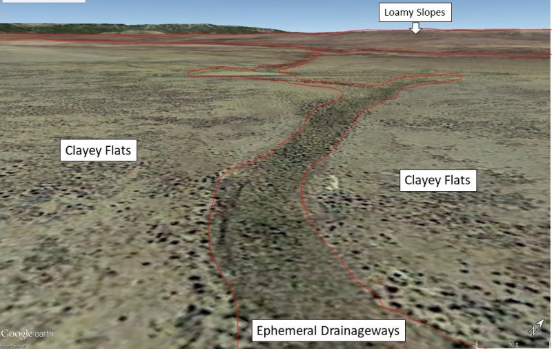
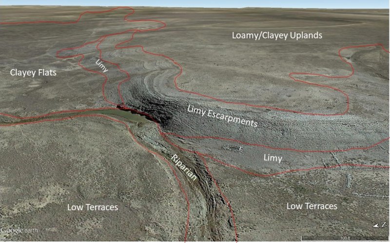
Since the Clayey Flats ecological site occurs on alluvial landforms that are bounded by other Canadian Plateaus landforms, this site does not transition into ecological sites of other LRUs at its upper and lower elevations. Rather, it is typically bounded by the Ephemeral Drainageways and Low Terraces sites at the bottom of the landform; and by the Limy, Limy Escarpments, and Clayey Uplands at the upper end of the landform.
While the Clayey Flats site occupies rather subdued geomorphic positions, even gentle undulations cause certain landform positions to receive run-on moisture from adjacent positions. While major run-on-landforms such as drainageways and playas are covered by unique ecological sites, small concavities are included within the concept of the Clayey Flats site. In these positions, we find patches with higher total production, and a greater relative abundance of western wheatgrass.
Within this site, the dominant species of short grasses are inherently drought- and grazing-tolerant (Lauenroth et al., 1994). Across the western parts of the U.S., blue grama is one of the most extensively distributed grasses and occurs in a wide variety of different ecosites ranging from grasslands to shrubland and woodland sites. This grass evolved with grazing by large herbivores and, when grazed continuously, tends to form a short sod. When allowed to grow under lower grazing pressures, the plants develop the upright physiognomy of a bunchgrass. If blue grama is eliminated from an area by extended drought (3-4 years) or disturbance such as plowing, regeneration is slow because of very slow tillering rates (Samuel, 1985), low and variable seed production, minimal seed storage in the soil (Coffin and Lauenroth, 1989) and limited seedling germination and establishment due to particular temperature and extended soil moisture requirements for successful seedling establishment (Briske and Wilson, 1978). Buffalograss, which is more abundant at warmer, lower elevations of this site, is often found occupying swale or depression positions across the landscape. Buffalograss is less drought-tolerant than blue grama but re-establishes more quickly following disturbance due to higher seed abundance and viability and more effective above-ground tillering (Peters, 2008).
Large-scale processes such as climate, fire, and grazing influence this site. During years with favorable growing seasons, the effects of grazing may be mitigated. During years of low precipitation, grazing can magnify degradation of the site (Milchunas et al., 1989). Fire is a natural disturbance regime that suppresses succulents and shrubs while stimulating grasses and forbs, however, in contrast to mid and tall grass prairie sites, fire is less important (Wright and Bailey, 1982). This is because the drier conditions produce less vegetation/fuel load, lowering the relative fire frequency. However, historically, fires that did occur were often very expansive, especially after a series of years where above average precipitation built enough litter/fine fuels. Currently, fire suppression and more extensive grazing in the region have decreased the fire frequency, and it is unlikely that these processes could occur at a natural scale (USNVC, 2017)-G144. According to (Gebow, 2001), fire effects in the same location will vary, especially with fire timing, where seasonality can either hinder or benefit plants depending on their growing stage. Precipitation events occurring before and after fire will also influence the recovery of plants. Fire promotes rhizomatous plant species, such as western wheatgrass, that can take advantage of below-ground rhizomes from which tillering is rapidly initiated.
Correlation to Current Ecological Sites:
The Clayey Flats ecological site fits many components that are currently correlated to the Clayey Upland (R070AY002NM) sites. The latter concept is too broad and does not account for the character of deeper alluvial soils which have a more specific hydrology, soil properties, and landscape character than soils on upland plateau landforms.
Clayey Upland Legacy Tables (R070AY002NM)
Annual production by plant type
Plant Type------------------Low (Lb/Acre)------RV (Lb/Acre)------High(Lb/Acre)
Grass/Grasslike---------330---------------------660---------------------1000
Shrub/Vine-----------------30-----------------------60----------------------100
Forb---------------------------10-----------------------20-----------------------40
Total---------------------------370--------------------740---------------------1140
Community 1.1 plant community composition
Common Name-------------Symbol--------Scientific Name-------Annual Production (Lb/Acre)
GRASS/GRASSLIKE
1 blue grama-----------------BOGR2---------Bouteloua gracilis--------------200–240
2 western wheatgrass---PASM-----------Pascopyrum smithii----------160–200
3 alkali sacaton-------------SPAI-------------Sporobolus airoides----------160–200
4 James' galleta------------PLJA------------Pleuraphis jamesii-------------80–120
5 vine mesquite-------------PAOB-----------Panicum obtusum-------------40–80
6 sideoats grama----------BOCU-----------Bouteloua curtipendula------8–40
7 buffalograss--------------BODA2----------Bouteloua dactyloides-------8–40
8 New Jersey muhly-----MUTO-----------Muhlenbergia torreyana-----8–40
FORB
9 ragweed--------------------AMBRO---------Ambrosia--------------------------8–24
10 Forb, perennial----------2FP---------------Forb, perennial-------------------8–24
11 Forb, annual--------------2FA---------------Forb, annual-----------------------8–24
SHRUB/VINE
12 fourwing saltbush------ATCA2----------Atriplex canescens------------16–48
13 pale desert-thorn-------LYPA-------------Lycium pallidum-----------------16–48
14 winterfat-------------------KRLA2-----------Krascheninnikovia lanata----8–24
State 1
Reference State
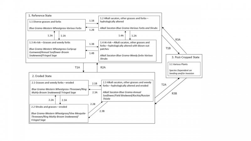
This state represents the most ecologically stable conditions in terms of resistance to erosion. Moreover, this state has the highest potential for productivity and plant diversity.
See related community phases for more information.
Community 1.1
1.1 Diverse grasses and forbs (diagnostic plant community)
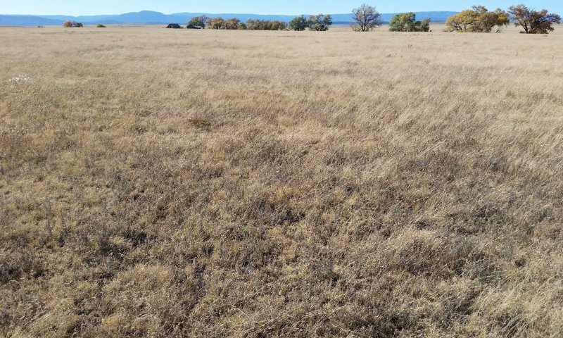
Figure 5. Community 1.1 in San Miguel County, October 2017. Grasses are both dominant and diverse, canopy cover is very high, and the soil is rich with organic matter throughout. The line of cottonwoods in the background occurs in the Riparian site.
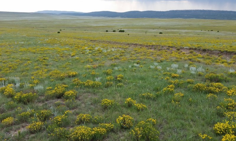
This community is dominated by grasses, but contains a number of forb species and scattered shrubs. Foliar cover is between 85 and 95 percent, and bare ground is typically less than 10 percent. Total canopy cover of warm-season grasses is above 75 percent, while cool-season grasses account for less than 10 percent. Foliar cover of forbs is often less than 5 percent, but can range as high as 15 percent. Shrub cover is less than 2 percent. Annual production averages around 1,400 pounds per acre, but can range between 1,000 and 1,800 pounds per acre, depending mostly on annual weather patterns.
This community generally occurs where season-long grazing has not been practiced in a number of years. Blue grama is the dominant species, and western wheatgrass is generally well-represented. Early-seral grasses such as sleepygrass and galleta are generally absent. Although forbs are quite secondary in total cover, they can be diverse. Shrubs such as broom snakeweed and fringed sage are present, but in small amounts. Broom snakeweed is more common at lower elevations and eastern latitudes and fringed sage is more common toward the higher/cooler end of the spatial/climatic gradient.
This plant community optimizes energy flow, hydrologic function, and nutrient cycling. The diverse root systems of various grasses take advantage of moisture from both close to the surface as well as deeper in the soil profile. High canopy cover protects the soil surface from raindrop impact; fibrous roots of grasses and good soil structure also promote infiltration of rainwater and prevent erosion. With periodic herbivory, decomposition is active, creating soil organic matter (SOM), which enhances “plant available water” needed for plant vigor. While this is the most late-seral community observed during reconnaissance, it exhibits some evidence of past degradation, and likely does not reflect pre-Colombian conditions.
Community 1.2
1.2 Alkali sacaton, other grasses and forbs—hydrologically altered
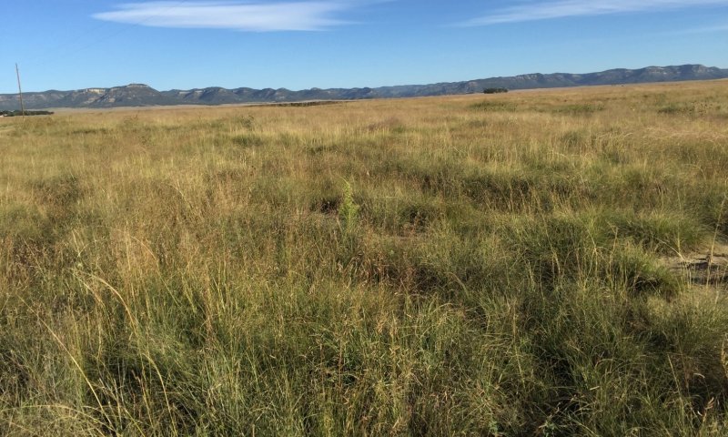
Figure 6. Community 1.2 in Colfax County, September 2017. Alkali sacaton and blue grama have similar canopy cover here, but sacaton—with its larger growth form—accounts for significantly more biomass.
This community is dominated by alkali sacaton and blue grama, but also contains a number of forbs and shrubs. Foliar cover is between 85 and 95 percent, and bare ground is typically less than 10 percent. Total canopy cover of warm-season grasses is above 80 percent, while cool-season grasses account for less than 5 percent. Foliar cover of forbs is typically below 5 percent. Shrub cover is also less than 5 percent. Annual production averages around 1,800 pounds per acre, but can range between 1,400 and 2,500 pounds per acre, depending mostly on annual weather patterns.
This community generally occurs where season-long grazing has not been practiced in a number of years. Additionally, hydrology has been altered such that a relatively high water table provides extra moisture at times. This increases plant-available water, but can also lead to increases in salinity. Alkali sacaton is the dominant species, but blue grama is abundant and often rivals the former in terms of canopy cover. Early-seral grasses such as sleepygrass and galleta are generally absent. Although forbs are quite secondary in total cover, they can be diverse. Weedy forbs such as kochia, annual sunflower, and Russian thistle are often present, but their total cover is low. Shrubs such as broom snakeweed, fringed sage, and wolfberry are present, but in small amounts. Broom snakeweed is more common at lower elevations and eastern latitudes and fringed sage is more common toward the higher/cooler end of the spatial/climatic gradient.
The upward wicking of salt-laden groundwater into the soil and subsequent evapotranspiration of this water causes salts to deposit in the soils. However, significant additions of water from above (in the form of rain and run-on) dissolve these salts and flush them through/from the soil profile. Thus, salinity is a dynamic soil property, and is not always measurable in this community phase.
This plant community optimizes energy flow, hydrologic function, and nutrient cycling. The diverse root systems of various grasses take advantage of moisture from both close to the surface as well as deeper in the soil profile. High canopy cover protects the soil surface from raindrop impact; fibrous roots of grasses and good soil structure also promote infiltration of rainwater and prevent erosion. With periodic herbivory, decomposition is active, creating soil organic matter (SOM), which enhances “plant available water” needed for plant vigor. While this is a late-seral community by today’s standards, it exhibits some evidence of past degradation, and likely does not reflect pre-Colombian conditions.
Community 1.3
3 At risk: Grasses and weedy forbs
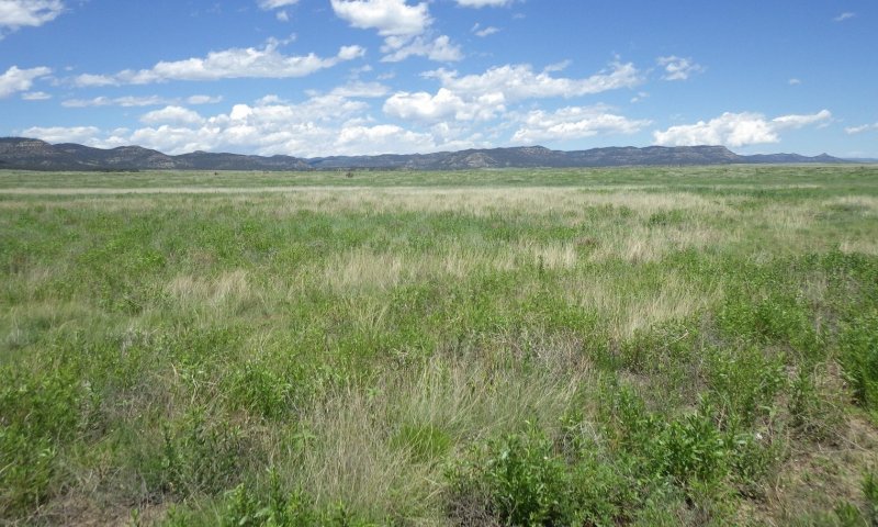
Figure 7. Community 1.3 in Colfax County, June 2015. While total foliar cover and production are relatively high and western wheatgrass is codominant, annual sunflower and curlycup gumweed rival grasses in terms of foliar cover.
This community is dominated by blue grama, but also contains significant amounts other grasses and early-seral forbs. Western wheatgrass is often quite abundant in this phase. While this community shows abundant evidence of disturbance, a significant amount of topsoil remains here. Total foliar cover averages 75 percent, and ranges from 65 to 85 percent. Bare ground ranges from 10 to 25 percent. Total canopy cover of grasses is roughly 50 percent, with warm-season species being at least modestly dominant. Foliar cover of forbs ranges from 10 to over 25 percent. Shrub cover is generally less than 5 percent. Annual production averages around 1,300 pounds per acre, but can range between 1,000 and 1,700 pounds per acre, depending mostly on annual weather patterns.
This community generally occurs where season-long grazing has been practiced long and recently enough to be reflected strongly in the plant community. Early-seral forbs such as curlycup gumweed, annual sunflower, kochia, and Russian thistle account for a significant share of total production. Bare ground is much higher than in phase 1.1, and recent wind and water erosion are often apparent. However, neither the topsoil nor the seedbank it bears have been entirely lost.
Compared to phase 1.1, several important ecosystem functions are diminished here. While roots are as diverse in terms of type and depth, total biomass and production—aboveground and below—are lower. This translates to diminished rates of nutrient cycling. Reduced production of herbaceous species translates to reduced rates of decomposition—leading in the long term to lower amounts of SOM. Where SOM has decreased in situ, or significant topsoil has been lost, soil fertility and water-holding capacity have decreased. The combination of greater bare ground and lower amounts of fibrous grass roots accelerates erosion.
Community 1.4
At risk: Alkali sacaton, other grasses and forbs—hydrologically altered with blown-out patches
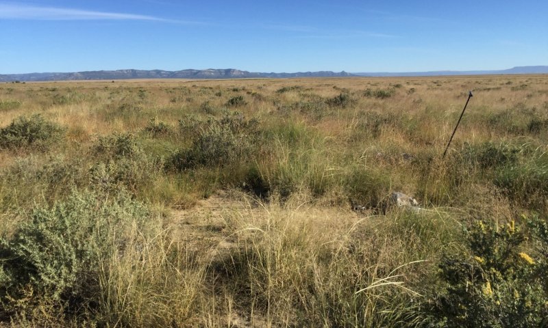
Figure 8. Community 1.4 in Colfax County, September 2017. While much of the original topsoil remains, bare spots account for a significant amount of area. These have been subsequently colonized by rather sparse stands of early seral forbs.
This community is dominated by alkali sacaton and blue grama, but also contains significant amounts shrubs and forbs. While total canopy cover is relatively high, there are large patches of bare ground that are actively eroding. Although this community shows abundant evidence of disturbance, a significant amount of topsoil remains here. Total foliar cover averages 80 percent, and ranges from 70 to 90 percent. Bare ground ranges from 5 to 25 percent. Total canopy cover of grasses is over 60 percent, with warm-season species being quite dominant. Foliar cover of shrubs ranges from 5 to over 15 percent. Forb cover is generally less than 10 percent. Annual production averages around 1,400 pounds per acre, but can range between 1,000 and 2,000 pounds per acre, depending mostly on annual weather patterns.
This community generally occurs where season-long grazing has been practiced long and recently enough to be reflected strongly in the plant community. Early-seral forbs such as kochia, Russian thistle, field bindweed, and pigweed account for a significant share of total production. Bare ground is much higher than in phase 1.2, and recent wind erosion is quite apparent. However, neither the topsoil nor the seedbank it bears have been entirely lost.
Compared to phase 1.2, several important ecosystem functions are diminished here. While roots are at least as diverse in terms of type and depth (note the increase in shrub cover), total biomass and production—aboveground and below—are lower. This translates to diminished rates of nutrient cycling. Reduced production of herbaceous species translates to reduced rates of decomposition—leading in the long term to lower amounts of SOM. Where SOM has decreased in situ, or significant topsoil has been lost, soil fertility and water-holding capacity have decreased. The combination of greater bare ground and lower amounts of fibrous grass roots accelerates erosion. Additionally, since evaporation rates are very high on patches of bare ground, salts are wicked to the surfaces of these patches when water tables and temperatures are high. This, in-turn, further reduces productivity, discourages germination, and leads to further erosion.
Pathway P1.1B
Community 1.1 to 1.2
1.1 Diverse grasses and forbs (diagnostic plant community)
1.2 Alkali sacaton, other grasses and forbs—hydrologically altered
This pathway represents a change in hydrology which elevates the water table to the point where capillary action draws groundwater into the soil profile. This leads to periods of elevated salinity. Such a change in hydrology is often human-caused, as in adding water to playas and stock tanks. However, this can also occur when natural playas fill during particularly wet periods.
Pathway P1.1A
Community 1.1 to 1.3
1.1 Diverse grasses and forbs (diagnostic plant community)
3 At risk: Grasses and weedy forbs
This pathway represents a period of heavy grazing, typically season-long, which advantages the growth and reproduction of weedy forbs and shrubs, and suppresses herbaceous species that are more palatable and/or less resilient under grazing pressure.
Pathway P1.2B
Community 1.2 to 1.1
1.2 Alkali sacaton, other grasses and forbs—hydrologically altered
1.1 Diverse grasses and forbs (diagnostic plant community)
This pathway represents a change in hydrology which causes the water table to drop such that capillary action no longer draws groundwater into the soil profile. This eliminates periods of elevated salinity and, thus, removes the competitive advantage to salt-adapted species such as alkali sacaton and fourwing saltbush.
Pathway P1.2A
Community 1.2 to 1.4
1.2 Alkali sacaton, other grasses and forbs—hydrologically altered
At risk: Alkali sacaton, other grasses and forbs—hydrologically altered with blown-out patches
This pathway represents a prolonged period of heavy grazing, typically season-long, which advantages the growth and reproduction of weedy forbs and shrubs, and suppresses herbaceous species that are more palatable and/or less resilient under grazing pressure. As this management regime persists, bare patches increase in size and number. These patches are subsequently invaded by early-seral forbs such as kochia, Russian thistle, field bindweed, and pigweed.
Pathway P1.3A
Community 1.3 to 1.1
3 At risk: Grasses and weedy forbs
1.1 Diverse grasses and forbs (diagnostic plant community)
This pathway represents prescribed grazing or rest from grazing. In either case, herbaceous plants that are palatable and/or sensitive to grazing increase in vigor and abundance, and weedy forbs are at a competitive disadvantage.
Pathway P1.3B
Community 1.3 to 1.4
3 At risk: Grasses and weedy forbs
At risk: Alkali sacaton, other grasses and forbs—hydrologically altered with blown-out patches
This pathway represents a change in hydrology which elevates the water table to the point where capillary action draws groundwater into the soil profile. This leads to periods of elevated salinity.
Pathway P1.4A
Community 1.4 to 1.2
At risk: Alkali sacaton, other grasses and forbs—hydrologically altered with blown-out patches
1.2 Alkali sacaton, other grasses and forbs—hydrologically altered
This pathway represents prescribed grazing or rest from grazing. In either case, herbaceous plants that are palatable and/or sensitive to grazing increase in vigor and abundance, and weedy forbs and certain shrubs are at a competitive disadvantage. Promoting herbivory of fourwing saltbush over that of grasses will require carefully-timed grazing.
Pathway P1.4B
Community 1.4 to 1.3
At risk: Alkali sacaton, other grasses and forbs—hydrologically altered with blown-out patches
3 At risk: Grasses and weedy forbs
This pathway represents a change in hydrology which causes the water table to drop such that capillary action no longer draws groundwater into the soil profile. This eliminates periods of elevated salinity and, thus, removes the competitive advantage to salt-adapted species such as alkali sacaton and fourwing saltbush.
State 2
Eroded State
Soils significantly eroded. See related community phases for more information.
Community 2.1
Grasses and weedy forbs—eroded
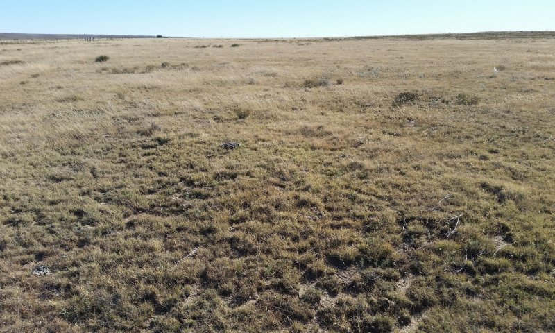
Figure 9. Community 2.1 in San Miguel County, October 2017. Note the sod-bound habit of the blue grama.
In this plant community, blue grama is the dominant grass, but its vigor and rooting depth are significantly reduced—leaving it highly vulnerable to drought stress. Early-seral grasses such as ring muhly and threeawn are well-represented, as are “weedy” forbs such as purple tansyaster and curlycup gumweed. Shrubs—namely broom snakeweed and fringed sage—may also be a significant component, but do not rival herbaceous species in terms of foliar cover. Topsoil, if present, has been severely diminished. Total foliar cover averages 75 percent, and ranges from 60 to 90 percent. Bare ground ranges from 5 to 30 percent. Total canopy cover of grasses is generally above 50 percent, with warm-season species being dominant. Foliar cover of forbs ranges from 2 to 5 percent. Shrub cover is generally less than 10 percent. Annual production averages around 850 pounds per acre, but can range between 700 and 1,200 pounds per acre, depending mostly on annual weather patterns.
This community generally occurs where season-long grazing has been practiced long enough to be reflected strongly in both the plant community and the soils. However, recent rest or prescribed grazing may have occurred—causing a shift from Community 2.2. Blue grama—often sod-bound—is the dominant plant; galleta, ring muhly, and threeawn are often well-represented, too. Early-seral forbs such as curlycup gumweed and purple tansyaster account for a measurable share of total production. Small amounts of western wheatgrass, vine mesquite, and/or alkali sacaton may be present, indicating recent rest. Bare ground is generally higher than in the reference state, and recent wind and water erosion are often apparent. Topsoil is either missing or else severely diminished in quality and thickness, and much of the seedbank has been entirely lost.
Compared to the reference state, several important ecosystem functions are diminished here. Because species diversity is lower and plant vigor is diminished, root systems are less diverse and generally shallower. This translates to diminished rates of water uptake and nutrient cycling. Reduced production of herbaceous species translates to reduced rates of decomposition—leading in the long term to lower amounts of SOM. Where SOM has decreased in situ, or significant topsoil has been lost, soil fertility and water-holding capacity have decreased. The combination of greater bare ground and lower amounts of fibrous grass roots accelerates erosion.
Community 2.2
Shrubs and grasses—eroded
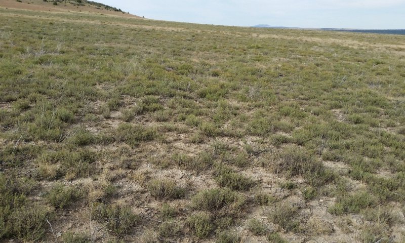
Figure 10. Community 2.2 in Mora County, October 2017. This is an extreme example of both degradation and shrub-dominance.
In this plant community, shrubs rival herbaceous plants in terms of foliar cover, and are sometimes the dominant group. Early-seral species are well-represented among grasses and forbs. Examples are threeawn, ring muhly, and purple tansyaster. Topsoil, if present, has been severely diminished. Total foliar cover averages 70 percent, and ranges from 55 to 85 percent. Bare ground ranges from 10 to 35 percent. Total canopy cover of grasses is generally below 50 percent, with warm-season species being dominant. Foliar cover of forbs ranges from 2 to 10 percent. Shrub cover ranges from 25 to 50 percent. Annual production averages around 800 pounds per acre, but can range between 600 and 1,100 pounds per acre, depending mostly on annual weather patterns.
This community generally occurs where season-long grazing has been practiced long enough to be reflected strongly in both the plant community and the soils. Broom snakeweed and fringed sage are the dominant shrubs, and blue grama—often sod-bound—is the dominant grass. Early-seral forbs such as purple tansyaster account for a measurable share of total production. Small amounts of western wheatgrass, vine mesquite, and/or alkali sacaton may be present, indicating recent rest. Bare ground is generally higher than in the reference state, and recent wind and water erosion are often apparent. Topsoil is either missing or else severely diminished in quality and thickness, and much of the seedbank has been entirely lost.
Compared to the reference state, several important ecosystem functions are diminished here. Because species diversity is lower and plant vigor is diminished, root systems are less diverse and generally shallower. The latter phenomenon appears to apply to shrubs here, as the shrink-swell action of these clay rich soils tends to break roots. Regardless, a paucity of roots, especially at depth, translates to diminished rates of water uptake and nutrient cycling. Reduced production of herbaceous species translates to reduced rates of decomposition—leading in the long term to lower amounts of SOM. Where SOM has decreased in situ, or significant topsoil has been lost, soil fertility and water-holding capacity have decreased. The combination of greater bare ground and lower amounts of fibrous grass roots accelerates erosion.
Community 2.3
Alkali sacaton, other grasses and forbs—hydrologically altered and eroded
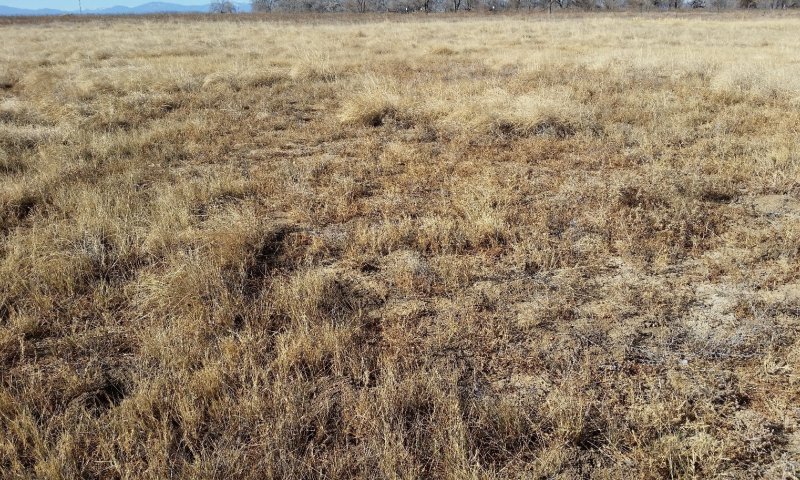
Figure 11. Community 2.3 in Colfax County, December 2017. Note the sizeable patch in the foreground that was recently bare, but has been invaded by kochia, Russian thistle, and field bindweed.
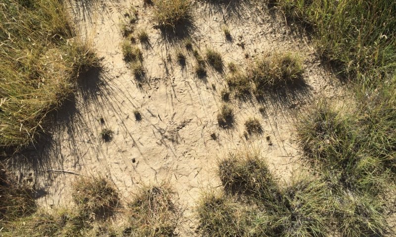
Figure 12. A patch of bare ground in Community 2.3. A thin veneer of salts has been deposited at the surface here. Such deposits discourage germination and, thus, perpetuate the very types of erosion that created them.
In this community, alkali sacaton is typically codominant with other grasses. Topsoil, if present, has been severely diminished, and there are typically large patches of bare ground. In some cases, these patches have been invaded by early-seral forbs. In others, they remain bare and develop salt crusts (usually fairly subtle) at the surface. Total foliar cover averages 70 percent, and ranges from 55 to 90 percent. Bare ground ranges from 10 to 40 percent. Total canopy cover of grasses is over 50 percent, with warm-season species being quite dominant. Foliar cover of shrubs ranges from trace to 10 percent. Forb cover also varies widely, but is generally less than 20 percent. Annual production averages around 1,250 pounds per acre, but can range between 900 and 1,600 pounds per acre, depending mostly on annual weather patterns.
This community generally occurs where season-long grazing has been practiced long and recently enough to be reflected strongly in the plant community. Early-seral forbs such as kochia, Russian thistle, field bindweed, and pigweed account for a significant share of total production. Bare ground is much higher than in the reference state, and recent wind erosion is quite apparent. Topsoil is either missing or else severely diminished in quality and thickness, and much of the seedbank has been entirely lost.
Compared to the reference state, several important ecosystem functions are diminished here. Because species diversity is lower and plant vigor is diminished, root systems are less diverse and generally shallower. This translates to diminished rates of nutrient cycling. Reduced production of herbaceous species translates to reduced rates of decomposition—leading in the long term to lower amounts of SOM. Where SOM has decreased in situ, or significant topsoil has been lost, soil fertility and water-holding capacity have decreased. The combination of greater bare ground and lower amounts of fibrous grass roots accelerates erosion. Additionally, since evaporation rates are very high on patches of bare ground, salts are wicked to the surfaces of these patches when water tables and temperatures are high. This, in-turn, further reduces productivity, discourages germination, and accelerates erosion.
Pathway P2.1A
Community 2.1 to 2.2
Grasses and weedy forbs—eroded
Shrubs and grasses—eroded
This pathway represents a prolonged period of heavy grazing, typically season-long, which advantages the growth and reproduction of shrubs and weedy forbs, while suppressing herbaceous species that are more palatable and/or less resilient under grazing pressure.
Pathway P2.1B
Community 2.1 to 2.3
Grasses and weedy forbs—eroded
Alkali sacaton, other grasses and forbs—hydrologically altered and eroded
This pathway represents a change in hydrology which elevates the water table to the point where capillary action draws groundwater into the soil profile. This leads to periods of elevated salinity.
Pathway P2.2A
Community 2.2 to 2.1
Shrubs and grasses—eroded
Grasses and weedy forbs—eroded
This pathway represents prescribed grazing or rest from grazing. In either case, herbaceous plants that are palatable and/or sensitive to grazing increase in vigor and abundance, and shrubs are at a competitive disadvantage. This pathway, which expresses itself an increase in herbaceous cover at the expense of shrubs, can also involve a late summer drought which kills broom snakeweed.
Pathway P2.2B
Community 2.2 to 2.3
Shrubs and grasses—eroded
Alkali sacaton, other grasses and forbs—hydrologically altered and eroded
This pathway represents a change in hydrology which elevates the water table to the point where capillary action draws groundwater into the soil profile. This leads to periods of elevated salinity.
Pathway P2.3A
Community 2.3 to 2.1
Alkali sacaton, other grasses and forbs—hydrologically altered and eroded
Grasses and weedy forbs—eroded
This pathway represents a change in hydrology which causes the water table to drop such that capillary action no longer draws groundwater into the soil profile. This eliminates periods of elevated salinity and, thus, removes the competitive advantage to salt-adapted species such as alkali sacaton and fourwing saltbush. Concurrently, prescribed grazing or rest from grazing allows herbaceous plants that are palatable and/or sensitive to grazing increase in vigor and abundance, while shrubs and forbs are at a competitive disadvantage.
Pathway P2.3B
Community 2.3 to 2.2
Alkali sacaton, other grasses and forbs—hydrologically altered and eroded
Shrubs and grasses—eroded
This pathway represents a change in hydrology which causes the water table to drop such that capillary action no longer draws groundwater into the soil profile. This eliminates periods of elevated salinity and, thus, removes the competitive advantage to salt-adapted species such as alkali sacaton and fourwing saltbush. Concurrent prolonged grazing pushes blue grama into a sod-bound state, and suppresses species that are more palatable or grazing-sensitive. This gives shrubs a competitive advantage.
State 3
Post-Cropped State
This state occurs where rangeland was plowed and, at some point, crop cultivation was abandoned.
Community 3.1
Various Plants
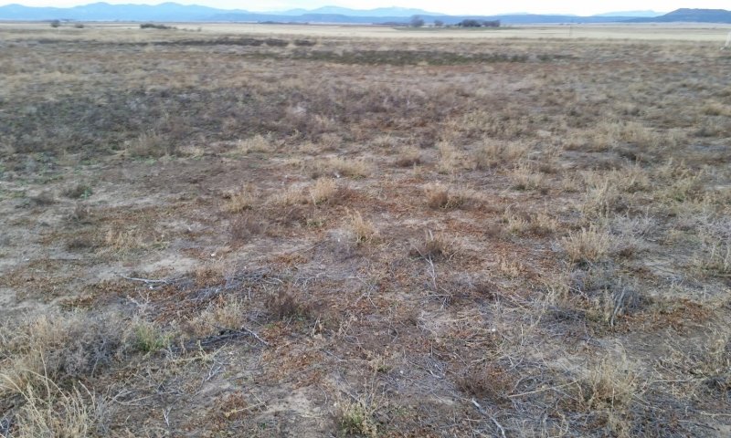
Figure 13. Community 3.1 in Colfax County, November 2017. Cropping has been abandoned at this location, leaving remnants of the alfalfa crop to compete with invading Russian thistle and field bindweed.
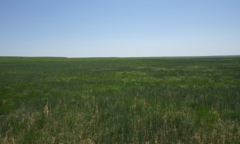
Figure 14. Community 3.1 in San Miguel County, June 2015. This field was seeded with western wheatgrass following the cessation of cropping practices. While this seeding was at least modestly successful, species richness and total production remain low.
Given a more robust dataset, this community could clearly be divided into several phases. Within community 3.1 as currently defined, species composition varies widely based on which species were seeded and which species invaded following the cessation of cropping activities. Where seeding either did not occur or was unsuccessful after crop abandonment, communities of early-seral forbs such as Russian thistle, kochia, field bindweed, pigweed, and annual sunflower exist. Where successful seeding has occurred, grass-dominated stands of low diversity exist.
Given low production and species richness, ecosystem functions are generally poor in this phase. Low root diversity and reduced plant vigor translate to diminished rates of nutrient cycling. Reduced production of herbaceous species translates to reduced rates of decomposition—leading in the long term to lower amounts of SOM. Where SOM has decreased in situ, or significant topsoil has been lost, soil fertility and water-holding capacity have decreased. The combination of greater bare ground and lower amounts of fibrous grass roots accelerates erosion. Where water tables are high enough for capillary action to draw groundwater into the soil profile, salts are wicked to the surfaces of these patches when water tables and temperatures are high. This, in-turn, further reduces productivity, discourages germination, and accelerates erosion.
Transition T1A
State 1 to 2
Slow variables: Continued encroachment by early-seral species, coupled with the loss of herbaceous plant production, leads to decreases in total canopy cover and soil organic matter. The result is an increase in the rate of wind and water erosion—leading to the loss of topsoil and an associated decrease in available water and nutrients. Trigger event: A severe drought kills already-weakened perennial grasses, resulting in a major loss in canopy cover. This die-off is followed by accelerated erosion, which further depletes soil fertility, water-holding capacity, and the seedbank. Threshold: The vigor and cover of perennial grasses is reduced to a point at which some perennial grasses die, and soil surfaces become highly susceptible to erosion.
Transition T1B
State 1 to 3
Trigger event(s): Plowing kills perennial plants. Slow variables: Once crop planting ceases, pioneer species (mostly annual forbs) establish and their abundance gradually increases. Threshold: After repeated cycles of plowing and/or applications of herbicides, the native seedbank is exhausted.
Restoration pathway R2A
State 2 to 1
An increase in the competitive advantage of various perennial grass species through physical, chemical, and biological management practices. This restoration pathway will likely require long-term, multifaceted approaches and high-energy inputs. In order to return to State 1, erosion will have to be reversed, grazing will have to be tightly-controlled, and the re-introduction of extirpated plant species may be required. Favorable weather patterns may also be necessary.
Transition T2A
State 2 to 3
Trigger event(s): Plowing kills perennial plants. Slow variables: Once crop planting ceases, pioneer species (mostly annual forbs) establish and their abundance gradually increases. Threshold: After repeated cycles and/or the applications of herbicides, the native seedbank is exhausted.
Restoration pathway R3A
State 3 to 1
The native plant community is re-established via seeding. In order for this to be successful, irrigation and/or favorable weather patterns will be required, Weed-control practices will also be necessary. Whether it is possible to transition into State 1 will depend—in part—on whether topsoil of adequate richness and thickness remains (or is restored).
Restoration pathway R3B
State 3 to 2
The native plant community is re-established via seeding. In order for this to be successful, irrigation and/or favorable weather patterns will be required. Weed-control practices will also be necessary. This restoration process occurs where topsoil is either degraded or absent.


